Lake of the Clouds, Nearly

Sunday, July 20

I never paid much attention to how the continental divide meanders through Rocky Mountain National Park. I’ve always known that it runs generally north and south through the center of the park, from Ouzel Peak to Mt. Alice in Wild Basin, to Chief’s Head Peak and McHenry’s Peak (bypassing Long’s), along the dramatic ridges and peaks in the Bear Lake region, then north to Trail Ridge Road. Then it makes a loop, turns back to the south and makes the western boundary of the park along the ‘Cloud Mountains’ of the Never Summer range. Thus it is possible to be east of the divide and west of the Colorado River at the same time.

I discover this studying the map after my attempt to reach Lake of the Clouds. Attempt, because I didn’t study the map sufficiently prior to putting boots on the trail. I made a navigational error that cost me forty five minutes and left me just short of the lake by 12:30. I probably could have made the final few hundred yards, but I try not to dally above treeline after noon, particularly when clouds are gathering. So this goes in the books as another “failed” hike. I’m getting used to this, as I seem to have one or two each year. But I can live with such failures – it was another glorious day in the park and I very much enjoyed the hike.

Lake of the Clouds is situated in a cirque cradled in the arms of Mount Cirrus and Howard Mtn. Mount Cumulus, Mount Nimbus, and Mount Stratus are lined up to the south of Howard Mtn. Lake of the Clouds is drained by Big Dutch Creek, which drops four hundred vertical feet and disappears in a tumble of boulders on the valley wall. But I begin in the wrong place.

I arrived at the Colorado River trailhead at about 8:30 and was on the trail by 8:40. The trailhead is on the west side of the park, about a half mile south of the lowest hairpin on Trail Ridge Road. The forecast was for nice weather, with the usual chance of afternoon showers. The morning was calm and nearly cloudless, as usual. The trail starts to the north and we quickly arrive at the Red Mtn Trail junction where we turn to the west and cross the Colorado River. Here it is not very wide, nor flowing swiftly, and could be easily waded. Hard to believe this trickle of water carved the Grand Canyon.

After crossing the valley, the trail turns to the south and soon crosses Opposition Creek for the first time. Here the trail gets steep, quickly climbing six hundred feet through mixed forest interrupted by the occasional spill of rocks. These treeless intervals give nice views of Kawuneeche Valley. You also see Trail Ridge Road across the valley, as far up as Fairview Curve. This means you also hear the traffic – the rumble of motorcycles and the hum of knobby tires on lifted pickup trucks.

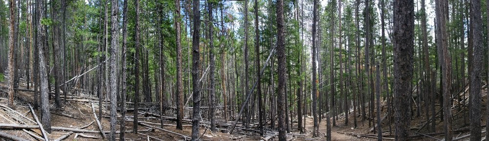
The more or less level stretch of trail was welcome after the first steep section but is quickly done. Turning north again, we are below the Grand Ditch for about a mile and a half, gaining three hundred more feet to meet it. Along the way, we’ve crossed Opposition Creek again, along with Mosquito Creek, its major tributary. The forest here is fairly pleasant, with sunlight shining brightly on the green ground cover. Part of the reason so much sun hits the ground is that a significant number of the trees have been killed by beetles. Some places very few trees are dead, but in others perhaps eighty percent have succumbed. Looking across the valley we see much the same situation.

Upon reaching the Grand Ditch, the savvy hiker will turn right and continue north. I chose to disengage the brain and make a left turn after stopping to eat some fruit and slather on the SPF. Water in the ditch flows to the north, so I went ever so slightly uphill. This is my third time to the ditch and the first it’s had water in it. My diversion lasted about forty five minutes, but I did see nice views of Red Mountain so I can’t say it was a total loss.

The Grand Ditch can be seen from Trail Ridge Road. Before I knew what it was, I often wondered what road it was. A dirt service road runs alongside the ditch where an excavator can often be seen clearing slides or doing other maintenance. It was built starting in 1890, using hand labor, burros, and wheelbarrows. By 1936 it ran fourteen miles, diverting the water from several creeks in the Never Summer Range across the continental divide at La Poudre pass and into Long Draw Reservoir for use by Fort Collins farmers.

A bit less than two miles north along the ditch we encounter Big Dutch Creek. There’s a bridge here that I was tempted to call “substantial”. It’s wide and not made of logs like most park bridges. But it’s in a state of decay. Crossing the bridge begins another climb. There are a couple of campsites along the creek, which is in earshot and drowns out the noise from Trail Ridge. Reaching spongy meadows the trail attenuates, sometimes nothing more than trampled grass. These meadows are rich with flowers this time of year – yellows and reds, blues and purples.

Although here we’re still well below treeline, we come to the end of the forest. The trail makes another steep climb and deposits the hiker at the base of a boulder field. A giant boulder field. To our right, about a mile away is Lead Mountain’s flank. From here to there, nothing but boulders. Hart Ridge is ahead, to the west about a mile and nothing but boulders. Mount Cirrus and Howard Mtn are to the left, somewhat less than a mile, boulders all the way, this time with a waterfall which disappears into the boulders.

I stopped here. Had I not made a wrong turn, I’d have been here before noon and about three miles fresher. I’m guessing a quarter mile short of the lake but still over four hundred feet below it. There’s no trail from here on out, just rock hopping. The route up to the lake is to the right of the falls. Even though it looks to be only a quarter mile, it might take me an hour. But there’s only one way to find out, so this one gets put on the to-do list for next year.

I had my picnic lunch – ham and turkey sandwich on a bagel – and drank in the view for forty minutes. On my way back to the trail I encountered another hiker. We discussed the likely best route to the lake, but he decided not to go any further. Together we found the trail and started our descent. He stopped for his lunch at the first campsite we got to; I didn’t stop until I got back to the ditch, where I refreshed my water supply from Big Dutch Creek. I took a final break and ate more fruit somewhere in Hells Hip Pocket. Two hikers on their way up passed me; the second said hello, which surprised the first who walked two feet from me but didn’t see me. Good thing I wasn’t a bear. He needs to work on his awareness.

In the first five hours of my hike I only saw six other hikers. I can’t count how many I met in the last two. These were walkers, not hikers. Few carried water, some asked me where the trail went. Near the trailhead I saw a ranger a few yards off the trail, taking pictures of flowers and making notes on a clipboard.

I returned home over Trail Ridge Road. I had the choice of Berthoud Pass and I-70 or TRR. I figured either would involve a traffic jam. In addition to the usual Sunday afternoon volume on I-70 there’s also the tunnel construction below Idaho Springs. I decided getting stuck on TRR is the way to go; at least the view is nice.

Timetable

Up Down
Trailhead 08:40 AM 04:20 PM
Red Mtn trail jct 08:50 AM 04:10 PM
Grand Ditch 10:15 AM 02:50 PM
Big Dutch Creek 11:35 AM 02:15 PM
Not quite there (10,950′) 12:35 PM 01:15 PM

Spruce Tree House

Saturday, July 13

While in Hesperus for Genae’s family reunion, I had a few free hours to attempt a hike in Mesa Verde National Park. After a nice breakfast with the family, I headed to the park. I didn’t have the means to pack a lunch, so I resigned myself to making a detour to the Subway in Cortez. When passing through Mancos, though, I spotted a grocery with a deli and saved myself some time and miles. I got a turkey club sandwich, a triple decker made out of Texas toast. I wondered how I’d open my mouth big enough to eat it.

I stopped in at the visitor center. It’s a new facility just outside the gates of the park. There, I consulted with a ranger. Mesa Verde is built more for people driving around than walking. There aren’t that many hikes in the park, and they really want you to stay on the trail. This makes a good deal of sense – the plateau is riven with canyons, and every one featuring a sheer sixty foot drop. This time of year, it’s also sunny and quite warm. There isn’t any water on the plateau and not much shade, either.

I decided the best option was the Petroglyph loop at the Spruce Tree House. This ruin is self-guided, where Cliff Palace, Balcony House, and Long House required tour tickets. There is a seven mile loop hike available, but it doesn’t feature any ruins. So the Petroglyph hike it was, at 2.4 miles.

First stop, though, was a quick tour through the Spruce Tree House. It’s a bit smaller than the the Cliff Palace, but quite striking nonetheless. A forest fire burned here last year, and was within yards of the ruins. The trees are all piñon pine and scrub oak. Even the best of the trees in the area looked half dead before the fire. Where it burned, there are a few dead trunks standing but only grass otherwise. Most of the road atop Chapin Mesa goes through the burn area.

The trail from the parking lot to the ruins goes down one side of the canyon and up to the ruins from below. The trail switches back several times and is paved with asphalt. In the morning the ruins are cool and shady. It’s only a couple hundred yards from the parking lot to the site, but lots of people were having difficulty. There’s a kiva that you can climb down into, but for the most part you are restricted to the area directly in front of the ruins and entry is forbidden.

The Petroglyph Point trail starts below the ruins and runs beneath the sheer slab of the rock formation that forms the top of the mesa. Sometimes flat rocks are stacked to make staircases, in other places steps are hewn from the living rock. The trail was not very crowded. It had rained the previous evening and it looked like only a couple dozen people had walked here since. It didn’t take long for me to pass a couple groups stopped at the various markers, reading the guide.

It was much warmer than I’m used to, and I went through water at about four times my normal route. After about a half mile, I was as secluded as I could get there. I could hear the group behind me yelling and laughing. The trail follows the bottom of the cliff along the inside of the canyon, neither climbing nor descending; a circuitous route.

A bit less than a mile along the trail are the petroglyphs. I have to admit I was a bit underwhelmed. The first time I saw petroglyphs was on a week long rafting trip down the Green River in Utah. We stopped for lunch one day and took a short hike up the canyon to see them. I remember them as being quite vivid, and on a large scale. These were subtle and small. The sign was almost bigger.

Just before arriving there, I’d been hearing voices ahead of me on the trail. I thought I had caught up to another group. Turns out they hiked out on the loop backwards to where it descends the cliff. This loop is one way, though, and they didn’t go down. I wouldn’t have gone down those steps myself. No problem going up, but not my cup of tea to go down. They hollered down at me: “Is that the petroglyph?”

Before coming up, I saw them a few yards away at the top, posing for pictures. From below, it very much had the sense of “Hold my beer and watch this!” One false move and they’re a splash of color on the rocks below.

The return part of the loop goes along the edge of the canyon, just above the trail below. There some places you can see the trail on the opposite side of the side canyon; I could hear hikers below me. Near the end of the loop, the trail crosses through the burned area just above the ruins. There I saw one giant flower; it was the only bright color in sight in any direction. Bees had found it and were going about their work. Who knows how far they have to fly each day? Not exactly a field of wildflowers.


Keplinger Lake

Sunday, July 7

Lewis W. Keplinger was a student of John Wesley Powell at Illinois State Normal University. Keplinger was a member of Powell’s expedition that first successfully climbed Long’s Peak in late August of 1868. The group first attempted the summit by starting near what is now Lake Powell. They climbed the sharp ridge that connects McHenry’s Peak with Chiefs Head and Pagoda Mtn. They found themselves cut off from their destination by “impassable chasms.” They retreated and made camp near Sandbeach Lake. The next day, Keplinger set off on his own to reconnoiter. He found a couloir winding up the south flank and managed to reach within several hundred feet of the summit before returning to camp after dark. On August 23, the group set off on Keplinger’s route at 7am. In a couple of hours they had attained his highest point where another member of the party remarked that no man could scale the point and live. By 10am, the party made the summit, led by Keplinger.

Here’s how the Foster guide describes this hike:

Bushwhacking up the length of Hunters Creek valley is a grueling exercise in backcountry slogging, but it travels through one of the most pristine and beautiful valleys in RMNP. From the Sandbeach Lake Trailhead follow the Sandbeach Lake Trail for 3.2 miles to a bridge that crosses Hunters Creek. Leave the main trail and locate a faint path that travels along the northeastern side of Hunters Creek, heading northwest into the heart of the drainage. The path dips and rises with the rolling topography, climbing steadily up the valley. The trail disintegrates, but keep hiking along the creek for 2.4 miles to a beautiful, shallow, unnamed lake at 11,180 feet. Getting to this lake involves fighting through marsh and willow-choked terrain. From the unnamed lake, bushwhack west and around the butt of a small ridge for 0.25 mile to an unnamed pond south of Keplinger Lake. Turn north and scramble through a large boulder field for 0.6 mile to Keplinger Lake.

I tried to get to Keplinger Lake last year but only achieved the unnamed lake she mentions at 11,180′. The reason I only got that far was the willow. I got to this lake about lunch time and decided the only way to proceed was to backtrack down the creek a ways, cross the creek, and avoid all the willow. I decided I didn’t have enough time or energy, so that’s as far as I went.

I put boots on the Sandbeach Lake trailhead at 6:45, forty five minutes earlier than my abortive attempt last year. This earlier departure should ensure I’m at my destination in plenty of time for lunch. The forecast for Denver was low nineties with a 40% chance for rain. The morning was clear and cool, with only a few broken clouds visible.

The hike to Hunter’s Creek is pretty basic. From the parking lot, the trail climbs quickly to the top of a ridge, then levels off somewhat. The climb to Hunters Creek is roughly 1,800′ of elevation gain in 3.2 miles. There is one vantage point that St. Vrain valley but after that no views are afforded. The trail passes mostly through mixed forest, lodgepole pine with aspen mixed in. The fun begins when leaving the main trail.

The next section of trail is about a mile and a quarter long, from the Sandbeach Lake trail to a creek that joins Hunters Creek from the north at about 10,500′ elevation. This trail is quite easy to follow, except for the occasional spot where it is interrupted by recent deadfall. I’m guessing this trail is used mostly by folks climbing Long’s using Keplinger’s route, as to continue up Hunter’s Creek you must leave it where this other stream meets the creek. From here on, there really isn’t any trail and the bushwhacking begins in earnest.

The forest thins out about this point and soon the hiker is presented with a nice view of Pagoda Mtn. The creek climbs steadily but not very steeply. I found it was often easier hiking to stay ten or twenty yards away from the creek. Before long a large snow bank becomes visible on the flank of Mt. Orton. The creek bends a bit to the right (north) and leads you into the willow Foster mentions.

Although I had been on the lookout for a suitable place to cross Hunters Creek, I crossed too late and ran into the masses of willow anyway. This was a bit demoralizing. The terrain under the willow is hard to see – a false step and you could be in a wet bog or drop a couple of feet off a rock. Finding myself in the same predicament as last year, I felt there was no real option but to power through it. I eventually made it out into clear meadow, where the creek falls down the slope in braids.

From there to the next unnamed pond (at just a shade under 11,400′) it’s an easy climb. Here, I found some cairns stacked up – the first sign of a trail for quite a way. I followed these to the west side of the pond. Turns out this was a mistake. From the west side of the pond you get dumped right back into the nasty willow. At first it wasn’t too bad, sometimes only knee deep. But it got worse, much worse. Being so close and getting stymied by the willow a second time was not an option, so I put my head down and powered through. After clearing the willow, I was deposited in a boulder field, which was easier than the willow but not by much. It took me nearly an hour to go just over a half mile. By the time I reached Keplinger I was exhausted. Time for a picnic!

I set the cameras up, the GoPro looking over the lake at the rock walls of Pagoda Mtn and the SLR the other way, with a view of Mt. Copeland to the south. It had taken me a bit longer than I’d hoped to get here, so I didn’t stay my usual hour. I ate my lunch and filled up my water bottle and headed back down at 1pm. From above, it’s clear which way to go. I crossed the outlet and walked down the east side of the valley, a fair distance above the unnamed pond below. From there, I crossed the braided stream and continued almost due south, keeping all the willow and trees to my left. After a while, I headed into the thin forest and looked for a place to cross the creek.

Anybody going up to Keplinger should take this route, as it completely avoids the willow and boulder field. Unfortunately, I didn’t make note of where I crossed. I was just so happy to have avoided all the hard parts. So, really, going this way makes the hike fairly easy. The hardest part is the section between here and the stream crossing at 10,500′. The main feature of this part is the seemingly unending maze of deadfall that needs to be navigated.

On the way up, it took me nearly four hours to get from where the Sandbeach Lake trail crosses Hunters Creek to Keplinger Lake. On the way down, the same distance cost me less than two. Obviously, a good part of this is due to the fact I was going downhill instead of uphill, but I can’t overstress the importance of avoiding the willow. I’m certain I’d have saved an hour had I made the correct navigational choices on the way up.

I took a short break when I returned to the main trail, eating another bunch of grapes and refilling my water again. Here I met two hikers coming down from Sandbeach Lake. They were the fourth and fifth people I’d seen all day. A few minutes before reaching the Meeker Park trail junction, the skies darkened somewhat and I could hear the distant rumble of thunder. Another couple ran past me, trying to get back to the trailhead before the rain. At the trail junction, graupel started to fall and I donned my poncho. The graupel quickly turned into BB sized hail. After a few minutes the hail stopped and the sun shone at my back. The storm worked its way toward Lyons, the thunder sounding closer now, even though it was past me.

I didn’t see a bear this week. Two guys I met in the morning said they had a bear in their campsite as they were cooking breakfast, which must have been a thrill. I know how thrilled I was to meet a bear thirty yards away. In fact, the only wildlife I encountered (other than squirrels and birds) was the deer I saw in Lyons. They must train their deer well – this velvet antlered buck crossed the highway using a crosswalk.

And here’s the time lapse video. I particularly like the bug walking across the camera lens.

Timetable

Up Down
Trailhead 06:45 AM 04:25 PM
Meeker Park trail jct 07:20 AM 03:50 PM
Hunters Creek 08:20 AM 02:50 PM
Stream crossing 09:05 AM 02:15 PM
Unnamed lake (11,400′) 11:25 AM 01:15 PM
Keplinger Lake 12:15 PM 01:00 PM

Cony Was the Plan

Sunday, June 30

About a week ago I decided that my next hike would be to Cony Lake. It’s an ambitious hike for me – 9.2 miles each way and about a net 3,000′ elevation gain. If I made it all the way, I’d visit four new lakes – Cony Lake and the three Hutcheson lakes, Lower, Middle, and Upper. I realized the significant probability that I’d fall short, but even if I didn’t make it all the way, I’d likely bag 3 of the 4 lakes. Or so was the plan.

To get to Cony Lake, the fun really begins at Pear Lake. On my old topo maps (1958), Pear Lake is listed as Pear Reservoir. Around the beginning of the 20th century irrigationists wanting to increase the water supply for farmers and ranchers in the area constructed reservoirs at Sandbeach, Bluebird, and Pear Lakes. These three were all returned to their natural size after the Lawn Lake dam failed in 1982.

Pear Lake is seven miles from the Finch Lake trailhead in Wild Basin. From the parking lot, the trail traverses a ridge, quickly climbing about 500′ before a switchback at the top. From there, it levels off, passing through aspen glens and skirting meadows before reaching the first Allenspark trail junction. Here the trail begins another climb of about 600′. There’s another trail junction here, with another trail to Allenspark to the left, Calypso Cascades to the right, and Finch Lake straight ahead.

Now the trail passes through part of the Ouzel fire burn. Some of the new growth is getting IMG_7401slarge, as you might expect after thirty five years. But there is still a dramatic view of all the mountains surrounding Wild Basin. Forest fires are a destructive force, no doubt about it, but a natural part of the forest’s life cycle. Here, aspen and pine are growing amidst the gray trunks of the burned trees and wildflowers blanket the ground.

The trail is still climbing here, but not nearly as steeply or relentlessly as before. After a while, another ridge is topped and the trail descends to reach Finch lake, perhaps 250 or 300′ feet below. Finch Lake is surrounded by forest and has an outlet but no obvious inlet streams. It doesn’t feature any very dramatic views, but it’s a pleasant lake.

The next section of trail, from Finch to Pear, is two miles and climbs less than 700′. The trail goes slightly downhill at first, crossing the outlet from Finch and shortly thereafter crossing Cony Creek. This section of trail doesn’t offer much in the way of views but it’s pretty nonetheless, passing through thin forest and alongside occasional meadows.

I arrived at Pear Lake in three hours, which pleased me quite a bit. I was feeling pretty good, no fatigue after 7 miles and two-thirds of the total elevation gain. It seemed to me I had a very good chance of making it all the way to Cony. This is where things started to go wrong.

It wasn’t clear to me which way to circle the lake. I started on the south side but the trail petered out and I didn’t think it was the right way. So I circled back and attacked it from the other side. But first, I thought, it was time for a break. Although I’d stopped to chat with other hikers, take sips of water, and photograph the scenery, I hadn’t sat down since I left the trailhead. It was now time for a short break – have a seat and eat some fruit.

After this short break, I continued on my way. I found an intermittent trail around the lake and up one of the inlet streams. I wasn’t sure I was on the path as indicated in Foster’s guide, but I was seeing the occasional cairn. I figured as long as I was going up, I couldn’t be too far off. After a short while, I had climbed perhaps three hundred feet and came across a small unnamed pond. Checking the map, I decided that if I continued more or less due south and crossed a small rise on the other side of the pond, I’d find myself above Lower Hutcheson Lake. But first, I should take a picture of this pond. Where I realized I had left my camera and tripod at Pear Lake where I had my break.

It only took me a few seconds to assess the situation. I could leave a thousand dollars worth of camera gear and continue, or I could abandon Cony Lake and return to fetch my gear. I figured it was unlikely anybody would wander off with my stuff if I continued, but I certainly didn’t want the camera to get rained on, which was a real possibility. So abandon Cony Lake it was. I hate when I do stupid stuff.

I probably could have made it to Lower Hutcheson Lake, but I figured it was now late enough to have lunch right here at Pear, so I set up the GoPro and tucked into my picnic. I wasn’t going to use the SLR for time lapse but after a while decided to set it up after all. The clouds were quite interesting – to the south there were two layers moving in different directions at different speeds. While the cameras were rolling, I wandered around a bit. After a while, I noticed some very low level clouds approaching from the north. These clouds very quickly arrived at Pear, skimming just a few feet above the water. Fantastic stuff! The disappointment of not hiking any farther was somewhat offset by the show the skies put on. If the video came out, I’d have a fantastic sequence.

Thunder was rumbling in the distance and with the lake fully engulfed in cloud, I decided it was time to hit the trail. It started sprinkling and before long was coming down hard enough to warrant getting the poncho out. I must have caught just the tail end of this storm as the rain stopped completely before I was back at Finch. From there on down the trail, there were numerous puddles that weren’t there on the way up. Some sections of the trail were quite muddy, but now it was noticeably wetter.

IMG_7914sThe thunder continued. It was fairly distant, not much loud cracking – mostly just rumbling and grumbling. But I was certain I risked getting rained on in a substantial way, so I kept up a pretty quick pace. Before long I was on the final stretch back to the trailhead: at the top of the ridge overlooking the entrance to Wild Basin. On the way up I noticed that there were Columbines lining both sides of the trail here. I generally don’t see them until higher elevation. I have a bunch of Columbine pictures but they’re one of my favorite flowers and I couldn’t help but stop and take another picture.

This is a pack trail and, judging by the amount of horse dung, gets quite a bit of horse traffic. So I’m always looking to avoid stepping in it. A few yards farther down the trail I stepped over something else: I thought, “That looks like bear shit. I don’t recall seeing that on the way up.” Not that I’m taking notes on the kinds of shit I see; it could have been there before and I just didn’t notice.

A few yards farther down the trail I see a bear sitting on the trail. He (she?) is maybe thirty yards away. It’s the first bear I’ve ever seen while hiking, maybe even the first bear I’ve seen in the wild, at least since I was about six and we went to Yellowstone. But here’s a bear, sitting on the trail I need to take to get to my car. I do a quick mental inventory of what food I’m carrying – just a few grapes and some potato chips. I do a quick assessment of escape routes – just the one, back up the trail. I think of the old joke about running away from bears: “I don’t need to outrun the bear, I just need to outrun you!” But I’m alone.

I am quick enough with the camera to get a nice photo or two, all the while shouting things like “Bear! Don’t bother me and I won’t bother you!” I had passed some other hikers back up the trail and expected to have company any time now, but nobody caught up to me. Perhaps they’d taken the trail to Allenspark?

IMG_7917sAfter a few nervous moments, the bear got up and headed straight down the slope, off the trail. I waited a short time before resuming the hike. The bear left the trail, but I couldn’t see him for very long and had no real idea where he was. Let’s just say my situational awareness now was at a peak. I didn’t dally long but did make an unsuccessful effort to locate the beast. For the rest of the hike I paid a fair amount of attention to what was behind me until I was back at the car.

All in all, although I was disappointed that I didn’t reach my destination due to my own stupidity, had I not made that error, I wouldn’t have witnessed the amazing cloud show and wouldn’t have seen a bear. So I can’t complain much. And not making it to Cony means I’ll just have to do this hike again. Although probably not this year.

Finally, here’s the time lapse. This is most of the GoPro footage, which suffers from variable exposure (because it’s automatic) and all the footage from the SLR. It wasn’t particularly windy, at least where the cameras were standing, so I’m not sure how to explain the motion of the SLR. So, technically, the video is not great. But I do like the content.

Timetable

There Back
Trailhead 07:00:00 AM 03:50:00 PM
Allenspark trail jct 07:35:00 AM 03:15:00 PM
Calypso trail jct 08:00:00 AM 02:55:00 PM
Finch Lake 09:00:00 AM 01:30:00 PM
Pear Lake 10:05:00 PM 12:30:00 PM

Two days, two tracks

It has been a busy week, so I’m a bit late posting this.

Saturday, June 22

I went to High Plains Raceway on Saturday with the Z Car Club of Colorado. This was my first day with the ZCCC. When running a CECA day, they prefer drivers to have their cars run through tech inspection before getting to the track. For that, they arranged for Peak Eurosport to do the inspections. If you don’t do that, they’ll still inspect you at the track before the drivers’ meeting. ZCCC has a couple tech sessions in the week prior to the event. If you miss those and want an inspection at the track, it’s an extra ten bucks.

In addition to getting the car teched before the event, I also did a little additional preparation. I’ve run out of gas at HPR twice. Well, not at HPR but between HPR and the nearest gas station (17 miles away). So I bought a 5 gallon gas can. I had to snicker a bit when I realized that this can holds half a tank of gas. Properly prepared, I should never run out of gas at the track again.

I also finally bought a lawn chair that fits in the car. All our lawn chairs are the old-fashioned kind, mesh on an aluminum frame. The sort they used to sell back in the sixties. The newer type when folded aren’t much bigger than the car’s soft top and easily fit in the boot. So, in addition to not worrying about running out of gas I could also relax in a comfy chair. Let the fun begin!

ZCCC splits drivers into four groups: A, B, C, and D. A is Expert and D is Novice. I elected to run in the B group. I can’t imagine calling myself expert at this any time soon. They had 46 cars turn out, including 21 Datsun/Nissan/Infiniti, 7 Miatas, 6 Corvetttes, 5 Porsches and a variety of others. Part of that variety was two Elises. There were a few familiar faces from CECA days and everybody made me feel right at home. A good group and I’m sure I’ll join them for another track day sometime.

The weather was fairly warm. Mostly sunny, until the end of the day when a thunder storm passed west of the track, moving south to north. On the news that night I learned that that storm dumped golf ball sized hail on the prairie. I’m glad it missed the track!

I had an unbroken string of days at HPR where I improved my best time each day. “Had”, as Saturday was the first time I wasn’t faster than my previous outing. My best lap was in the first session, two laps under 2:20. I keep working on finding a faster way around the track. I’m blaming my slower times on the hotter conditions until I learn the real reason. I’ve decided I can go quicker by taking later apexes on several of the turns. I dedicated my last session to trying this. I think I’m headed in the right direction, in spite of the hard data indicating otherwise. Next time I’ll remember to take my pyrometer so I can learn just how hot my tires are getting and collect some additional data.

I made a video of the day, this time a “Frankenlap”. I ran five sessions and mounted the camera in a different place for each. One was mounted inside the car, directed at me. I used that as the “master” shot (primarily to get the best sound) and spliced in bits from each of the other views.

Sunday, June 23

Michael and I went to Speed Raceway down in Centennial. It’s an indoor go-kart track that runs electric carts. We went with LOCO and had 15 folks turn out for the event.

They time each lap for each kart. Results are purely based on lap times, not who gets the checkered flag first. They tell drivers that if a faster driver catches up, let him pass. That may be counter to lots of peoples’ natural inclination.

We got to run three races, the first two which they characterize as “practice” and “qualifying”. They put a maximum of six cars in each group, so to get times for everybody we had three groups. Michael and I ran together the first two times. I was third, he was second each time. We both managed to improve our times each session. Michael ended up fourth overall while I was sixth.

It was a lot of fun, but I got pretty beat up by the kart. I was still hurting a bit from my day at HPR. I need to get a knee pad for my left leg. Even though I’m securely belted into my seat, my left leg takes a beating, leaving me bruised and abraded. And from experience I know I get thrown around pretty badly by the karts. The seats aren’t exactly made for me and the restraints aren’t the best racing harnesses. I ended up with a giant bruise on my back, about the size of my hand with fingers extended. As they say, “no pain, no gain!”

2013-06-23 16.57.40s

We even got a little podium ceremony. No champagne to spray, not even airline sized bottles as befitting such a colossal event!

Finally, it was good it was an indoor track, as it rained fairly hard while we were racing. It was hot out, so when we got out of the car I told Michael to leave the window cracked a bit. When we got back out, his seat was dry but mine was fairly soaked. So it goes.

Tourmaline Lake

Sunday, June 16

Tourmaline is a gemstone that comes in a wide variety of colors. More technically, tourmaline is a crystal boron silicate mineral compounded with elements such as aluminum, iron, magnesium, sodium, lithium, or potassium. Whatever that means. Was the lake given this name because tourmaline can be found there, or because of the color? I have no idea.

There are two obvious routes to reach Tourmaline Lake. In either case, you get there by visiting Odessa Lake first, meaning you can start either at Bear Lake or the Fern Lake trailhead. It is nearly a mile shorter starting from Bear Lake, but I chose to start at the Fern Lake trailhead for two reasons. First, the trail from Bear Lake descends about 500′ between Lake Helene and Odessa Lake, meaning I’d have to do an uphill stretch on the way back. I like to get most of my uphill hiking done before lunch. Second, and more importantly, I haven’t hiked from the Fern Lake trailhead since last fall’s fire.

The fire started on October 9 in rugged terrain near the Pool. It was still burning November 30 when seventy mile per hour winds pushed it to Moraine Park. Except for a small stand of trees damaged on the south side, Moraine Park looks almost untouched by the fire – the grass is regrown and although many of the shrubs along the stream were burned many of them are now sprouting green leaves. It appears to me that many of those shrubs have black bark on the trunks (stems?) so it may be that fewer of them burned than I originally surmised.

I arrived at the trailhead shortly after eight and was on the trail by 8:20. It was a pleasant sunny morning. Forecast for Denver was a high of 84, so I figured maybe ten degrees cooler at the trailhead and another few degrees at Tourmaline. The weather report suggested a fifty percent chance of rain. But at eight, there were no clouds in the sky and no wind to speak of.

IMG_7376

Burned area south of the Big Thompson

Within a couple hundred yards of the trailhead, I could see large burned areas across the river on the south side of the valley. In my mind, I always felt the section of this trail, from the trailhead to the Pool, is very similar to the lower section of the Thunder Lake trail in Wild Basin. Both run alongside the north bank of a large, boisterous stream and have very gentle gradients. On the Thunder Lake trail, you don’t get to the burn area of the Ouzel fire until well after you cross the river. On the Fern Lake trail, there is very little fire damage on the trail itself. There are a few small burned spots right along the trail before arriving at the Pool.

IMG_7381s

Looking towards Trail Ridge Road

At the Pool, the trail crosses to the south side of the Big Thompson and splits: Cub Lake to the left, Fern Lake up and to the right. Not long after that junction, the Fern Lake trail crosses Fern Creek. This crossing is a simple log bridge – two logs side by side, cut flat for a walkway, with a smaller log serving as a railing. Here the fire crossed the creek with burned trees and blackened ground on both sides of the creek. But the bridge was, strangely, untouched. From here the trail climbs steadily and zig-zags a couple of times reaching Fern Falls before finally flattening and straightening on the final approach to Fern Lake. At times the hiker is presented with a view of the terrain on the north side of the valley. That is where most of the fire burned, all the way up to the tree line.

I didn’t see any snow on the ground until reaching Fern Lake, where a snow bank covered the trail. By now the skies along the divide were no longer blue. Trying to be witty I might say the weather performed alchemy, transforming cobalt to lead. But the clouds weren’t that gray. At Fern Lake the trail crosses the outlet then passes through a boulder field before regaining the forest. From here to the Odessa Lake spur, the trail climbs steadily and provides the occasional view of Fern Lake through the trees.

The spur trail to Odessa Lake crosses the stream once again. The trail here is quite close to the stream. There is quite a bit of runoff and the trail here is wet and muddy. The trail dumps you at the northern end of the lake with a nice view of Notchtop. To get to Tourmaline Lake, circle to the west and south until reaching Tourmaline Creek. From here, there’s not much of a trail. Just follow the stream. I occasionally found a faint trail or a few cairns, but that was the exception.

The hike gets steep here. From trailhead to Tourmaline Lake the total elevation gain is 2,470′ over 5.4 miles. But the elevation gain from Odessa to Tourmaline is 560′ of that and in only about a half mile. The stream falls down the mountainside in braids and quite often underneath piles of boulders. I took my time on the steep parts, taking in the view of Joe Mills Mountain. The trail from Odessa to Bear Lake is a visible gash on the far side of the valley.

Here the clouds got productive. After one steep ascent the route flattens out a bit. This is where the graupel started falling. Neither snow nor hail, but something in between it melted fairly quickly when it hit the boulders, making them somewhat slippery. I put my windbreaker on (just shorts and Hawaiian shirt necessary until now) and the little pellets were now quite audible. After a short while the trail gets steep again for the final assault on the lake. There was some snow on the ground. I came prepared with micro spikes but never put them on. I postholed in a couple of places but the snow wasn’t much of an issue.

Tourmaline pano

Tourmaline pano

Arriving at the lake, I set up the GoPro for a timelapse before tucking in to my picnic lunch. The sky was solid formless cloud with no apparent motion. I let the camera run anyway, as you never know what you’ll get. (In this case, I got nothing. So no time lapse video for this lake. Yet.) But because of the clouds, I didn’t bother setting up the SLR for a time lapse and instead climbed up a pile of boulders in an attempt to get a nicer angle.

Tourmaline Lake

Tourmaline Lake

Seems a turkey sandwich always tastes better when I’m sitting at an alpine lake, even if it has been slightly smashed in the pack. And even if the clouds are starting to look a bit threatening. I didn’t dawdle long. I often linger for an hour or so, to make sure I take in all I can. But I didn’t like the looks of things, so I packed up and headed down the mountain. Just in time to get graupeled on again. I managed to retrace my steps, finding most of the trail fragments and cairns I saw on the way up.

On the final steep part before reaching Odessa, the precipitation changed to rain and thunder started rumbling through the valley. At first, it was just a light sprinkle but by the time I reached Odessa I decided it was more likely to get worse before it got better so I dug the poncho out of the pack. It rained steadily from there to Fern Lake, then only lightly until clearing up at Fern Falls.

Rain lashes Fern Lake

Rain lashes Fern Lake

Not long after Fern Falls, the clouds had completely disappeared.

I took a number of photos of the burned sections right along the trail, but most of them are not very interesting – or perhaps misleading. Posting a few pictures of burned trees along the trail may give the impression there’s more damage than there really is. As I said earlier, it is often just a few feet of burn where the fire crossed the trail. But I will post one more, a panorama built from three photos around a bend in the trail. Note that the trees appear undamaged; only the deadfall actually burned.

Burned section of trail

Burned section of trail

All in all, a quite enjoyable hike. I’d like to revisit the lake with better weather, perhaps next time from Bear Lake.

Timetable


There Back
Trailhead 08:20:00 AM 03:50:00 PM
The Pool 09:00:00 AM 03:05:00 PM
Fern Lake 10:10:00 AM 02:00:00 PM
Odessa Lake 11:00:00 AM 01:30:00 PM
Tourmaline Lake 12:10:00 PM 12:55:00 PM

CP Colorado

Yesterday was the 30th Annual Colorado Concours d’Elegance & Exotic Car Show, benefitting CP Colorado. Local and regional car clubs showcase about 500 rare and exotic sports cars. I’ve known about the show for a few years. The first year I owned the Lotus, the promoters were looking for a car that wasn’t in the show so they could do a television spot during channel 9’s local Sunday morning show and I volunteered for that.

Porsche Carrera GT

Porsche Carrera GT

But this is the first time I’ve entered the car into any car show of any sort. They have two kinds of entries – display only and judged. Not knowing anything about how it works, I elected to enter as a judged car. In the weeks leading up to the show, I learned that at this one the judging is done entirely on how clean the car is. That is, you won’t lose any points for having the non-original equipment. There are a lot of different car makes and models in this show, and the judges aren’t experts on all of them.

I didn’t manage to get the car detailed before the show. The extent of my preparation was a fairly thorough wash after the Braille Rally on Saturday. I have a number of black marks around the rear wheels and a big splotch of dried adhesive where the prior owner mounted his radar detector. And, of course, the car isn’t a museum piece, like so many of the other cars entered. I’m driving it all the time, and that includes four or five track days a year. So I’ve been joking that I expect to get last place. Somebody has to be last, right?

2013-06-09 10.44.23s

1937 BMW

Michael went with me. We got there a bit before 8am, entering the gates a couple cars behind a 1937 BMW. Porsche is the featured marque for this year’s show; they arrived using a different entrance, so we did a little “zipper merge” with them as we rolled onto the field. We didn’t have to go far – the Corvettes were immediately to the left of the entrance, and the Lotuses were just past them. Steve directed us to a spot between Tatiana and William. When we got onto the grass from the sidewalk, we heard the strangest noise. The car is so low, the grass is taller. The blades of grass brushed along the flat bottom of the car making a noise that sounded a lot like water coming off the tires, as if the sprinklers had run too long and had just been shut off.

After getting situated, I headed out for my first pass to check out all the cars. Because Porsche is the featured marque, it seemed like they comprised half the field. That’s a bit of an exaggeration – they probably weren’t there in any greater number than for the typical Cars and Coffee Saturday in Lafayette. Okay, so maybe they were half the field. There were several notable cars there, including a Porsche Carrera GT. And for the first time, I saw more Ford GT’s than Elises (3 to 2).

2013-06-09 11.19.10s

The Lotus area

I don’t know how many cars actually showed up. I know we were expecting a few more Lotuses. There are sixteen listed in the program but I only counted thirteen (twelve in the Lotus area and one in the Founder’s Circle). Four Elises are in the program, but we only had two. So I’m not sure if the 500 cars is a count of cars entered or the number that actually show up.

The weather was very nice. We were situated near some trees which provided welcome shade and there were a couple of picnic tables nearby. I’m still in the dark ages as far as lawn chairs go (having only the prehistoric aluminum folding chairs), so Michael and I either wandered around, used the picnic table, or sat in other people’s chairs. Clearly, I need to upgrade to a chair I can carry in the Lotus.

It was after noon before the judges showed up in our area. There’s a place on the form for “Class”. I had no idea what class I was in, so left it blank. Turns out the judging for Lotuses is broken down to Chapman era cars and post-Chapman cars. I believe Tatiana’s and mine were the only Lotuses getting judged. So my prophecy of being in last place was confirmed. Maximum score possible for my car was 250.5 and I managed 214.8. As I said above, it’s totally based on cleanliness. I was awarded full score for “operation of lights, wipers, door latches” even though I had a headlight burn out last week. And full points for “tool bag, tools, jack and tire strap” and “spare tire and wheel assembly”. The Elise has no spare tire.

Second Place!

So my last place entry managed a red ribbon for second place!

I think I’ll do this again next year, judging and all. Now that I have a “baseline” score, we’ll see how many points a good detail is worth.

Braille Rally

Today I participated in the Braille Rally for the benefit of the American Council of the Blind and Visually Impaired of Colorado. I’ve never done a rally before. The idea is you drive from point A to point B following a set of directions. The object is to get to the destination having driven the closest number of miles to the control. It doesn’t matter how long it takes you, it’s not a race. Typically, the clues can be quite tricky. But for this rally it was simply following the directions as only the driver could be looking for clues.

There where three ‘classes’ based on the navigator: Braille, large print, and sighted. The sighted navigators had to wear glasses that simulate visual impairment. I didn’t get a good car count. I was told we had about a dozen cars but there might be a late registration. They were hoping to get more people to participate, so it’s disappointing the turnout was so low. There were five LoCo members, not including Skip, who was the rally master. Two Elises, an Evora, an Esprit, and an Elan. We also had a Hyundai Veloster, a Subaru, a classic Chevy Nova and a Corvette ZR-1 as well as a couple Miatas.

We met in the parking lot of what used to be a Walgreen’s. For some reason, I was thinking it would be on the north side of Colfax, so I drove around lost for a while. I finally got my act together and found the place, to be told that everybody was watching me drive around aimlessly. We got checked in, and chatted over coffee and muffins. Drivers got souvenir bags and were assigned numbers on nice magnetic signs. By my count, half the cars were fiberglass, so the magnetic signs weren’t much help.

I never use the trip odometer on the car, so I don’t know how to reset it. Somebody showed me once, back on the Mine Tour drive, but I’ve forgotten and didn’t manage to press the magic button this morning. No problem, I’ve been using a speedometer app on my smart phone for the last several weeks. Works great, has a nice trip odometer, trip clock, altimeter, compass. And it’s a speedometer.

Rebecca was my navigator. We were in the large print class. Very nice lady, very educated and accomplished. She told me a bit about her family, where they’ve lived, and about her vision impairment. She has some permanent loss, but through the miracle of modern technology she shouldn’t lose any more.

So we hit the road. Skip sent us off one at a time, based on the light crossing Colfax. That way, nobody would be able to follow the leader, we’d all have to do our own navigating. The route was pretty simple, taking us through Golden Gate Canyon, Blackhawk and Central City, Evergreen. We missed one turn, because it wasn’t signed very well, but I had the impression everybody else missed it too. We caught up to Ross here; he figured it out before we did.

It was when we got on to 285 that things went south. The speedometer app went a bit haywire, showing a speed that was clearly wrong. It also quit counting the miles. I tried to remember what the trip odometer read when we were trying to reset it. So I wasn’t sure I had the right number, and without the right number, we wouldn’t stand a chance of winning.

The rally ended at Ferrari of Denver, one of the many sponsors of the rally. There we had a light lunch of fruit and small sandwiches. When we checked in with Skip, he gave us a trivia quiz to use in case we needed to break a tie. I think we got two or three of the fifteen questions correct. As a Lotus owner, I should have gotten another one – what does ACBC stand for. I didn’t know the A.

2013-06-08 13.15.00sAfter we ate, we had a little award ceremony. Top three finishers in each class got trophies. Ross suggested it was like t-ball – everybody gets a trophy. But in fairness, they were clearly expecting more than a dozen participants. I heard somebody say they had magnetic signs for fifty cars.

Second Place, Large Print

Second Place, Large Print

In the end, we got second place in large print. I was surprised. But it turns out several people didn’t manage to find Golden Gate Canyon and ended up nearly in Boulder, so even without a good odometer we did okay.

Tomorrow is the big CP Colorado show. It’s my first time entering the car in a show, and I put it in for judging. I’ve been joking that I’ll get last place. Somebody has to be last. I understand the judging is based almost entirely on how clean the car is. I’ve been too busy to get the car detailed. It has some black marks around the rear wheels, and there’s a big blob of adhesive on the dash where the previous owner mounted his radar detector. I washed it this afternoon, got it as clean as I’ve ever gotten it before. But it’s not a show winning car. It’ll be fun anyway.

Oh, and I decided to put the hardtop on for the show. Can’t recall the last time I had the hard top on.

Ready for the show

Ready for the show

Emerald Lake

I called Jerry last week and suggested a hike. He reminded me that Memorial Day was coming up and said we should hike to Emerald Lake. I’ve already hiked there once this year, but of course Jerry was correct: it was Memorial Day weekend.

Something like thirty years ago, Jerry and I first hiked to Emerald Lake on Memorial Day weekend. That was probably the first time I’d hiked on snow. We had a good time and repeated it the next year, and the year after that. By then it started to feel like a tradition so we kept going to Emerald Lake on Memorial Day weekend every year, unless we did it the week before or the week after. We started taking other friends along. We had a different group each year.

We lost track of how many years we went. No, that’s not true – we never kept track. We didn’t know how many times we opened the season with Emerald Lake, but it was certainly in the teens. One year I considered making t-shirts: “The Umpteenth Annual Emerald Lake Hike”. When Jerry moved to Albuquerque, I continued the hike with other friends for a while. Then, of course, we moved to Phoenix and I went years without visiting Emerald Lake.

The hike this time of year has always been a snow hike, and the lake has always been frozen over. I had never heard of microspikes before recently, so all those years it was just hiking boots without traction. I always had difficulties with two places on the trail. One just above Nymph Lake where we traverse steep snow and one at Dream Lake that’s not so steep but is along the water. I’m much more comfortable now with the microspikes.

At Emerald Lake, the ice breaks up around the edges near the outlet first. Sometimes, it’s still a few inches thick but won’t support any weight – it’s in hexagonal pieces as long and thick as your finger. If you toss a rock near the edge of the ice, a bunch of these pieces break off, tinkling a bit like wind chimes as they float. One year smaller rocks weren’t busting the ice, so Chris tried to throw a bigger one in. He lost his footing and went into the drink with the rock.

We generally had good weather. Once it was calm and cloudy, with the ceiling just above our heads when we arrived at the parking lot. When we got to Dream Lake, we couldn’t see the other end of the lake; we’d hiked into the clouds.

Saturday was a fine day, with a deep blue nearly cloudless sky. We sometimes take these blue skies for granted here in Colorado, but we really shouldn’t. You don’t see skies this blue in L.A. or Ohio, and not really that often in Phoenix. On a clear day, as you climb to higher elevations the blue just gets deeper and deeper. It’s almost purple when you look straight up when standing on the summit of a high peak. Anyway, a fine day: car thermometer read 64 at the parking lot, only the barest wisp of a cloud visible, and no wind.

As usual, there were quite a few people on the trail. Just a few yards from Bear Lake we passed a couple hikers who said they were surprised to find snow there. I had to laugh a little to myself. The mountains are at perhaps their most beautiful right now; I seldom see Longs Peak with more snow on it. Didn’t they look at the mountains as they drove to Estes Park?

We were never out of sight or earshot of other hikers. I only saw one other person wearing spikes – most were in sneakers, and most of those wore socks that didn’t cover their ankles. Most were also empty handed – not carrying food or water. But it’s a short hike, and I should applaud them getting that far, as something like 99% of visitors to the park don’t get more than a hundred yards from their cars.

At Dream Lake we scouted the route to Haiyaha. Not too many tracks along the summer route to the lake and as I was the only one with spikes we stuck with the original plan to lunch at Emerald. We took a short break for a snack before continuing.

Before long, we were at the lake and found a nice vantage point to watch the world go by. Most people tend to congregate where the trail dumps hikers at the lake’s edge; we went clockwise a short way around the lake from there, climbing the rocky slope to the shade of some trees.

Skiers in the couloirAlmost immediately, somebody saw a group of skiers near the top of one of the couloirs above the lake. I shot a couple of pictures before setting the camera up for the time lapse. Click on the picture to enlarge it; the skiers are plainly visible not far from the top.

We were there for about an hour. The skiers took their time getting down; they hiked past us as we were packing up. They told us they put boots on the trail at eight and hiked to the top of Flattop. There was another group of skiers above them, but they were taking much longer to descend.

I was hoping the skiers would show up in the time lapse. Maybe not so much the skiers themselves, as at best they’d just be specks, but the tracks they left were plainly visible to the eye. There were already a couple of bright white tracks through the dusty snow and these guys crossed them to make a couple of double helixes. But the snow is too white, the dust plainly visible to the human eye washed out on the camera image.

I shot time laps with both the GoPro and the SLR. Although it was cloudless when we hit the trail, I figured that by noon we’d likely see some clouds. Starting about the time we got to the lake the thin wisps of cloud built up, never getting very thick, but by mid afternoon filled the whole sky with overcast. This time I prefer the footage from the GoPro as the canyon is so narrow the wider angle works better. I made this video longer than the usual time lapse. It’s about two thirds of the total footage shot, so you’ll sometimes notice the same clouds twice.

Timetable

Out Back
Trailhead 10:00 AM 01:25 PM
Emerald Lake 11:35 AM 12:35 PM

Colorado Good: Four to the 4

The Colorado Grand is an annual charity tour for older cars that covers about a thousand miles in five days, attracting entrants from around the world. Lotus Colorado started doing a smaller version of this for group members. It’s not restricted to pre-1960 cars. It’s not even restricted to Lotuses. Here’s how Ross described it last month:

Many of you have been with us on our Colorado Good, where we do a bit less than the Colorado Grand; three days instead of four, about 800 miles instead of over a thousand miles; stay at good hotels instead of grand hotels and dine at good small yet really cool specialty restaurants with reasonable prices. This will be our fourth trip and will go to the Four Corners via Telluride and Pagosa Springs.

For one reason or another, we haven’t been able to join on the earlier trips. Everything worked out for this one though, so we signed up.

Saturday: Denver to Telluride

We met at The Fort restaurant near Morrison for a 9:00am departure. Actually, everybody else met closer to 8:30 but we were running a bit late and managed to show up a minute or two before everybody hit the road. We started with just the Denver area contingent and picked up folks from other locations as we went.

When I was a kid, we parked the Airstream in a trailer park called Chateau Chaparral near Nathrop, where Chalk Creek flows into the Arkansas River. They had their own suspension bridge over the Arkansas and we rode horses or dirt bikes in the national forest on the east side of the river. We made the drive there from Denver almost every week those summers. So I’ve probably been up and down that section of 285 a hundred times, maybe half as a passenger and half as a driver. So the first part of the drive was old hat for me.

Just after the junction with Colorado Hwy 9, we passed an orange Elise, the first of the Colorado Springs folks. We met the rest at Johnson’s Village, three red cars: a Corvette, a Porsche Boxster, and an Elise. After gassing up and a short break, we continued on to Gunnison for lunch at the Palisades Restaurant, meeting the final member of the group. We were now thirteen cars: 5 Elises, 2 Esprits, an Evora, an Elan, a Birkin, a Corvette, a Boxster, and a Honda S2000.

After lunch the route led us through Montrose and to Ridgway where we took another short break. We intended to stop at a gas station on the corner of US 550 and Colorado 62, but a tractor trailer rig had just run over a sign and was stopped to try and put it back up. The road was under construction a few yards up 62 and between the two traffic was getting pretty snarled up. We pulled over a couple blocks farther up.

Here we met a police officer who was a bit upset with us. He had a report that at 3:48 a red car in our group ran somebody off the road. We had been driving in a spirited way, shall we say, and running near the back of the group I saw a few aggressive passes, but didn’t see anybody get run off the road. In any event, we expected to be under scrutiny for the rest of the day.

I had been over the road between the junction of 285 and 50 a handful of times, even once in the Elise, but from Ridgway to Telluride was new to me. Climbing out of Ridgway the road sweeps in great arcs, giving us great views of the mountain range to the south. The weather was dramatic, clouds dropping veils of snow and rain. Very beautiful. I had mounted the GoPro camera while we were stopped, but the precipitation compromised the footage. Perhaps I’ll be able to salvage some short highlights.

The town of Telluride is at the end of a short spur road at the eastern end of a dead-end valley. Prominently in view climbing the steep end of the valley is a four-wheel drive road, its zig-zag filled with snow. As we arrived, a bit of a storm was descending on the village. We gathered for margaritas and conversation while thunder clapped just before the snow started to fall.

Loti in the snowTwo guys were walking down the street and saw the red Elise parked second from the end (next to the ‘Vette, but out of the picture above). “Cool! A Lotus! I want one of these!” They continued to the corner, where I heard “Another Lotus!” I really wanted to yell at them “Not two Lotuses – ten!”

Telluride, the next morningSomebody once told me the name Telluride was shortened from “To hell you ride” but this turns out to be a tall tale. It’s actually named for compounds of the element tellurium. The place was founded in 1878 as Columbia, but the post office changed the name in 1887 to avoid confusion with Columbia, California. I had guessed it must have been founded around 1880 judging by the street names. One street is Galena, which is Ulysses S. Grant’s home town.

We crossed three notable passes on Saturday.

Kenosha Pass (10,000′)

There’s not much to Kenosha Pass. In the mining days, it was called Kenosha Hill or Kenosha Summit, named for Kenosha, Wisconsin, the home of Clark Herbert, a Kenosha Pass stage driver. It crosses from the South Platte drainage into South Park and tops out at around 10,000 feet. Major Long’s party didn’t go up the canyon in 1820, deeming it too rugged. Kenosha pass was first crossed by the Bean-Sinclair party in 1830. In May of 1879 the railroad made it to the summit and US 285 follows that old route, which is in indication of it’s fairly shallow grade and lack of sharp turns.

Trout Creek Pass (9,346′)

This is the passage from Antero Junction at the west edge of South Park to the Arkansas valley. Zebulon Pike crossed the pass in 1806 when it was an ancient trail. He was correct in thinking the next drainage north was the South Platte, but mistaken when calculating that the next drainage beyond that was the Yellowstone. The Denver and South Park and Colorado Midland railroads were built over it in the 1880’s. The South Park side isn’t much, just a straight climb of a few hundred feet but the Arkansas side is a nice twisty road with excellent views of the Collegiate range: Princeton, Yale, and Harvard, all 14er’s.

Monarch Pass (11,312′ CD)

Crossing the continental divide at the southern end of the Sawatch Range, the summit affords views many consider the finest in the area. The current route was devised by Charles D. Vail and the road opened in November of 1939. The first highway department signs bore the words “Vail Pass” but unknown persons slopped the signs with black paint overnight.  On oil companies’ maps it was called Agate-Monarch Pass and before long the “Agate” was dropped.

Sunday: Telluride to Pagosa Springs

After breakfast in the hotel, we saddled up and headed to the Four Corners. There was a bit of drama at first, as one of the Elises had battery problems. That was quickly solved, though, and we were soon on the road. The drive south on 145 gives nice views of the peaks to the east before flattening out in drier climes and passing through Delores and Cortez.

Before long we were in the desert of the Four Corners monument. It’s really not much of a place, but it was recently improved. I had understood it was recently moved, but this seems not to be the case. It is, in fact, 1807 feet east of where modern surveyors would locate it, but the Supreme Court has established that the location of the monument is the legal corner of the four states. We stopped here for photos and a break before heading to Farmington for lunch.

On the way to Farmington, we were passed by a crazy Indian in a Ford pickup. Imagine coming up behind 13 sports cars and deciding they are going too slow. We weren’t in danger of being arrested for our speed, but we were moving at a pretty good clip. This guy couldn’t wait to get by us, passing whenever and wherever he felt like it, generally across the double yellow line. He finally got past our lead cars when we entered Shiprock, NM. In a school zone.

The drive from Cortez to Farmington (with our detour to the Four Corners) is a pretty dull drive. Lots of straight lines and four lane roads. Some of the rock formations are interesting, but again this is an area I’ve driven through many times. After lunch at the Three Rivers Brewery, we stayed on US 64 until the junction with US 84. This junction is a T, with 64 to the right and 84 to the left. A herd of cattle was grazing in the field at the top of the T. When we accelerated away from the stop sign, one of the Elises was loud enough to cause the cattle to stampede.

The drive from here to Pagosa is quite pretty. The landscape quickly transitions from desert to mountain pine forest and the road sweeps left and right while climbing and descending. US 64 meets US 160 at another T intersection on the east side of Pagosa Springs.

The Springs ResortWe stayed at the Springs Resort, a very nice place. After checking in, we went out for dinner then back to the resort to relax in the 23 pools along the banks of the San Juan River. The pools vary in distance from the main spring, so each is a different temperature, varying from 83 to 114 degrees. If you’re daring, you can step from the pools into the river, which we were told was 44 degrees. A few of us did, but not me!

Steaming poolsSunday’s drive crossed only one notable pass.

Lizard Head Pass (10,222′)

The pass marks the headwaters of two tributaries of the Colorado: the Delores River and the San Miguel River. A trail crossed the pass as early as 1833, a wagon road in the 1870’s, and the Rio Grande Southern Railroad in 1891. The railroad was laid to connect Silverton and Ouray. The distance between the two was 26 miles by wagon road while the rail was 217 miles and was described as “the futile, transcendently triumphant Rio Grande Southern … a masterpiece of evasion.” The railroad was bankrupt in two years.

Monday: Pagosa Springs to Denver

After breakfast we headed east along US 160, stopping for a group photo on Wolf Creek Pass before crossing to the San Luis valley.

Group photoI’ve made the drove over Wolf Creek many times. It’s not the frightening trip it used to be, back when C. W. McCall wrote a song about it:

Well, from there on down it just wasn’t real purdy: it was hairpin county and switchback city. One of ’em looked like a can full’a worms; another one looked like malaria germs. Right in the middle of the whole damn show was a real nice tunnel, now wouldn’t you know?

It’s much straighter now, and two lanes up on each side, two lanes down most of the western side. The only dicey spot is the avalanche shed on the eastern side. It often has water flowing across the road, and because it’s in the shade all the time it can get icy. But it was nice to hear the song of the engines reverberate off the walls.

Lunch was planned for Buena Vista, but we decided to eat in Salida so we split from the group. We didn’t want to retrace our route back to Denver, so rather than staying on 285 we headed up Colorado 9 from Fairplay to Breckenridge over Hoosier Pass. The weather forecast indicated it might be snowing on the high peaks of northern Colorado. I wanted to go over Loveland Pass rather than through the Eisenhower Tunnel. We encountered a small flurry on Hoosier and decided it wasn’t bad enough to dissuade us from the more interesting route.

By the time we reached A Basin it was snowing fairly heavily. The ski area is still open but there wasn’t much traffic on the pass. Luckily, it also wasn’t that cold so the snow melted as it hit the road. A snow plow was out dropping sand but we managed to pass him easily and ran into no other traffic until we reached the interstate. It looked like a few inches of snow had fallen and was blowing off the drifts along the road. But all was clear not long after the summit. I had the GoPro running for the pass, but when we stopped to take the camera off the car I saw that it was iced over. Checking the video, it began to ice up right away, near A Basin.

The remainder of the drive was down I-70, with more traffic than I expected. They are working on widening the road through the twin tunnels east of Idaho Springs. They set up a detour there with the eastbound lanes running on the south side of the river.

We crossed five notable passes, three across the Continental Divide. (Trout Creek Pass is the fifth, already described above.)

Wolf Creek Pass (10,850′ CD)

Separating the San Juan and Rio Grande drainages, Wolf Creek Pass runs 52 miles. The west side is particularly beautiful. The pass had no noticeable use before 1913, when the road was built. Before then, travelers from San Luis Valley had no choice but to take the narrow guage railroad from Alamosa over Cumbres Pass to get to Durango.

Poncha Pass (9,011′)

Poncha (Spanish for “mild”) separates the Rio Grande drainage from the Upper Arkansas. Its first notable crossing was in 1779 by Governor Juan Bautista De Anza when he was pursuing a band of terrorist Comanche. In 1853, a man in Captain John W. Gunnison’s survey party crossed the pass and called it “Gunnison Pass”. I find it a more entertaining drive than Wolf Creek. The southern side isn’t much, as the San Luis Valley is much higher than the Upper Arkansas Valley. The descent down the northern side features long sweeping curves and a pretty view of Mt. Shavano.

Hoosier Pass (11,541′ CD)

There are two passes named Hoosier. This one is the division point between the Sawatch and Front ranges. John Charles Fremont crossed it on June 22, 1844 and homesick Indiana prospectors named it about 1860. It is surrounded by dramatic peaks – a number of 14er’s including Lincoln, Bross, Cameron, Democrat, and Quandary. The pass became a road in May of 1861 when nine wagons crossed it.

Loveland Pass (11,992′ CD)

This road doesn’t get nearly as much traffic as it used to. It has been bypassed by the Eisenhower Tunnel, which was originally to be named the Straight Creek Tunnel. William A. H. Loveland was wounded in the Mexican American War, mined for gold in California, and worked futilely to put a canal across Panama for Commodore Vanderbilt. He arrived in Golden in 1859 where he used his profits from selling axes and mousetraps to build railroads. In 1879 he hired 100 men and ordered them up Clear Creek with dynamite, scoops and chuck wagons. The road was across the pass by mid-May and on June 4, fifty wagons were counted going over.