LOCO Spring Driver 2023, Part II

Saturday, May 20

The “free” breakfast at this hotel was out of the ordinary: build your own breakfast burritos. Soft corn tortillas, scrambled eggs, bacon, cheese, and green chili. Unfortunately, the corn tortilla wasn’t up to the job: any attempt to pick it up to eat it resulted in catastrophic containment failure. It was far from the best breakfast burrito I’ve had, but compared to the “free” hotel breakfasts I’ve had on my last couple of trips, it was a step up.

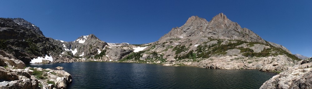
Today’s plan for the group was to spend the morning at the Colorado National Monument. We’d have our picnic lunch at the visitor center, departing at 12:30.

I had to get my brake caliper bolt taken care of. I went to the place around the corner but it was deserted. I got the phone out and searched for another place. I went there, it was also closed. The next one was an address that turned out to be smack in the middle of a mobile home park. Fourth, fifth, and sixth places all closed. All of these shops were within a couple of miles of each other. Searching for another shop was a bit like doom scrolling: closed, closed, closed.

That left me with few choices. I could go to the local Walmart or a new car dealer. I elected to try the local Buick dealer. Yes, in retrospect, I would have saved myself some time by trying to call all those places, but I thought it would be easier just to show up rather than trying to describe my issue.

I did have to describe the issue to the Buick dealer and that resulted in being put on hold while the person who answered my call talked to a service writer. I didn’t bother telling them what kind of car I was driving, just that I need this thing done pronto and that I could do it myself in ten minutes if I had the tools. They said they could help me out, so off I went.

Luckily, they weren’t busy. Naturally, they were surprised to see a Lotus. Every new car dealer service department I’ve been to has a protocol they follow: log the VIN in their system, get my name and address and mileage of the car. A guy even wanted to plug a tool into the OBDII port, but the service writer told him not to bother. When they went to take it to the shop, I was asked if it was a manual transmission. These days, nobody knows how to drive stick, so it took them another minute to get someone who could work a manual transmission to move it.

I took a seat in their lounge and waited, wondering both how long it would take and how much they’d charge me. I was a bit surprised when, half an hour later, the service writer came to the lounge to give me my keys.

I asked him, “What’s the damage?”

“No charge.”

Wow. That was better than I could have expected.

Lacking the notes for the trip, I relied on my phone to navigate me to the Colorado National Monument. There are two entrances. The group’s plan was to enter through the southern one and exit through the northern one. Naturally, my phone directed me to the northern one. I didn’t realize this until I started seeing familiar cars going the other way.

I wanted to take a couple of very short hikes. One was right after the entrance I was supposed to use and the other about midway through the drive. Due to all my running around, I didn’t have time to go all the way to the other end, do the hikes, and make it to our picnic spot in the allotted time. So I just did the second, shorter hike. It’s all good: at least I got out of the car and walked about a mile.

This short hike starts near the Coke Ovens overlook. There’s a much longer trail here as well, but I just headed to a spot right next to the Coke Ovens rock formation. It’s about half a mile from the road to the end, and descends a bit less than two hundred feet. The other trail here is the Independence Monument trail. I encountered a German couple who were on their way up. “It is much farther than you’re going, and it’s quite hot!” There is an entire network of trails around here which might be more fun in April when it’s not so hot. (Not that today was hot, but the sun was shining brightly, and it looks like there is very little shade to be found.)

After my little hike, I went back to the visitor center to find the rest of the group for our picnic. I left the picnic a few minutes early. Everybody else had been able to gas up in the morning. I needed a pit stop. Rather than leave with the group only to be abandoned at a gas station, I left early. I record my fuel consumption every time I fill up. I made my notes and was a bit surprised that this last tank yielded me 36.6 miles per gallon. When I looked up from my phone, I saw a green Europa pass by and get on the highway. But I only saw the one car, and I think he joined us midway through the day yesterday, so I thought maybe he was heading off on his own.

I fired up the car and hit the highway. We had a few miles of interstate to deal with, so I got on the highway and established a leisurely pace, five or ten miles an hour under the limit. This was a calculated risk. If I had missed seeing 20 brightly colored cars passing the gas station, I’d be getting farther and farther behind. Without directions. If the Europa was on his own, the group would catch me and all would be good.

Before long, I saw a long line of brightly colored cars in my mirror. I was back in the pack!

After our stint on the interstate, we finally would be driving on roads I’d never traveled. I love new roads. This one goes over Grand Mesa and is called the Grand Mesa Scenic Byway. Wikipedia tells me that Grand Mesa is the largest flat-topped mountain in the world.

Sometime after we left the interstate and started climbing the Mesa, I spotted Ross driving the other way. What the? How did he get ahead of us, and why was he going the other way? A few turns later, I found out why. It turns out the green Europa wasn’t off on his own, he was at the tail of a group of cars who left before Mike. They were all, except Ross, parked on the side of the road. Well, not exactly the side of the road. They were as far off the road as they could get, which wasn’t far. Everybody’s left tires were still on the road.

Chris W. had his 4-way flashers on and everybody was out of their cars. We learned that they came around a bend to find some large rocks on the road. One rock was described as the size of your head. Ross hit it, the next car managed to miss it, and Chris W. hit it. Ross couldn’t continue and took his car back to the last town while the gang set to work attempting to patch Chris’s tire. They tried a couple of plugs, but there was no way they could fix it.

Cindy lives not terribly far from here, and she has a full set of tires mounted and balanced, so she went home to get a tire so Chris could continue. The rest of us continued on our way.

Next to hitting a giant rock on the road, my brake caliper bolt and Jeff’s windshield wiper were minor inconveniences.

Before we stopped, the day had been downright toasty. This incident with the rock was at high elevation, though, and I was happy to put on my hoodie. I’d taken the top off the car before our picnic. Now we were at elevation and the clear skies were getting less clear. At 50mph with the top off, it was starting to get chilly. Then, of course, it started to rain. It wasn’t a hard rain, seldom enough to require more than the intermittent wiper setting. But I was getting wet, and that rain was cold!

At our next stop, in Hotchkiss, the three of us who had been running topless all decided it might be better to put the tops back on. It was a sound decision. Before long the rain was coming down hard. In places, it seemed like small rivers were crossing the road. I never hydroplaned, but it was wet and I was happy to be dry. Well, as dry as one can be in an Elise in the rain.

Checking into the hotel, I was standing next to Mike. He asked a question I never thought I’d hear from a Lotus driver: “Did you get enough curves?” Well, it wasn’t so much the question that was unexpected, as that after asking it, he said he did.

With our extended stop on the side of the road, we arrived at our hotel in Gunnison a bit later than expected. We got checked in and a few minutes later made our separate ways to the restaurant. Before our orders had arrived, Cindy, Chris, and their companions showed up at the restaurant, to much applause. We were all happy to see them.

Sunday, May 21

My hotel room was not the best one. I am right across the hall from the elevator. I thought that would be the worst part about it, but I am also directly above the lobby. The problem with that is, I could hear the front doors open and close whenever anybody came or went. I tried to use the fan on air conditioning unit to mask the noise, but the controls were slightly broken. Slightly, in that the temperature control knob just turned and turned but didn’t affect the output. And of the six or seven positions on the fan control knob, only “Cool High” and “Stop” were working. The fan did cover the noise of the doors downstairs, but after about twenty minutes, icicles were starting to form so I had to shut it off.

I woke up for a short while a bit after 2 am. You might think nobody would be going in and out through the lobby at that time of night, but you’d be wrong. I did manage to fall back asleep and just before I woke up, I had an odd little dream. In the dream, I was in my living room at home when a small bus crashed into the house. I asked the driver what happened and she pointed to a woman in the seat behind her. “She had a heart attack!” This is dream logic in effect. A passenger on the bus has a heart attack and causes an accident.

Over breakfast, I asked Ross how badly damaged his car is. He said the oil pan was okay and that he wasn’t losing any fluids. He thinks the exhaust was crushed, causing too much back pressure. The car ran, but only at an idle. He could drive downhill, but it was no good uphill or on the level. He managed to get it down to the safety of a parking lot at the Powderhorn ski area.

Today we were back on familiar roads. We’d head east from Gunnison and take CO 114 to Saguache. The plan for the group was to take US 285 to US 50 and ultimately picnic at the Royal Gorge. Before we left the hotel, I was undecided whether I’d stay with everybody else or head home from Salida. As the morning went on, I developed a slight headache. That was the deciding factor.

Here’s a short video made up of footage I shot over the three days. Oh, and cleaning out the car after I got home, I found my route notes. They managed to hide themselves under the passenger seat.

Here’s another video. I left this one in 360 mode, so you can pan and scroll and zoom. It’s a part of Glenwood Canyon between two of the tunnels. I’m old enough to have some memory of this canyon before it was interstate, when it was a two-lane road. The canyon is quite scenic and unlike any other canyon in the state.

Way back when, there was a movement to get the 1976 Winter Olympics to Colorado. As part of this, there was a ballot initiative asking voters if they wanted to put the interstate through the canyon. I may be misremembering, but it was defeated, and we couldn’t get the Olympic Games without the highway. Nonetheless, they started working on putting I-70 through the canyon in 1980. It was completed in 1992, and it’s a marvel of highway engineering and has been featured in at least one book published by National Geographic extolling the work. The project required 30 million pounds of structural steel, 30 million pounds of reinforcing steel, and 400,000 cubic yards of concrete weighing 1.62 billion pounds.

It’s a fantastic stretch of road, but it’s not without problems. Quite often, there are rockslides that damage the road and cause closures. These have been more common recently, due to wildfires in the area. The living trees hold the soil together, and with the trees dead or gone, any severe rains tend to cause rockslides.

LOCO Spring Drive 2023, Part 1

Every year, the club does a couple of long weekend drives, typically one in the spring and one in the fall. Years ago, we used to call them the “Colorado Good”, a play on the name of the Colorado Grand, an annual classic car charity tour.

Friday, May 19

Our rally point this morning is the Love’s gas station on the north side of Buena Vista. I figured it would take two and a half hours to get there, and I added a few minutes in case I hit the tail end of morning rush hour traffic.

Colorado weather is notoriously changeable. A common remark is, “If you don’t like the weather, wait five minutes.” Yes, I’ve heard people in other places say similar things, but Colorado is truly a “four seasons in one day” kind of place.

Today it is rainy. It’s an “upslope”, meaning it’s coming more from the east or northeast, and by going west, I would be able to get out of the rain and into the sunshine. I was thinking things would clear up at Kenosha pass, but that was optimistic. On the west side of Trout Creek pass, one usually sees a gorgeous view of Mt. Princeton and the other peaks in the Collegiate range. Today, though, the clouds hung low over the Arkansas valley and if you didn’t know there were mountains right in front of you, well, you wouldn’t know.

We met at our assembly point. On the way there from Colorado Springs, Jeff had his windshield wiper fly off his car. Will and Kat were behind him when it happened. When Will and Kat pulled into the gas station and got out of the car, they saw that Jeff’s wiper was sticking out of their front grille. What are the chances?

Our first stop was a photo opportunity at Twin Lakes. Again, normally you’d see some majestic peaks from here. The ceiling was lifting somewhat, but the tops of the mountains are still shrouded.

At Twin Lakes

From there, we went back to US 24 and headed north, over Tennessee pass.

Tennessee pass crosses the Continental Divide at an elevation of 10,424’. It climbs only 272 feet from Leadville and descends 1.826 vertical feet to Redstone. It was the first Continental Divide highway pass that was kept open all winter, starting in 1928.

Zebulon Pike came this way in 1806.

On November 24, he and three others set off from their camp near Pueblo to climb to the summit of Pike’s Peak. On the fourth day of their climb, they were in waist-deep snow but they reckoned they were still 15 or 16 miles away from the summit, still a mile above them. They turned back. They concluded the peak was the highest on the continent with an elevation of 18,541’ and that “no human being could have ascended to its pinnacle”.

After he failed to summit his peak, the expedition continued and he found himself in South Park. He crossed Trout Creek Pass and worked upstream along the Arkansas, which he had incorrectly identified as the Red. By his reckoning, the Arkansas stopped more than eighty miles to the south. To the north, he expected to find the Platte, and just past the Platte, the Yellowstone. Pike stopped near Mount Elbert, a bit short of Tennessee Pass. His men were tired and didn’t want to go any further. It was December, after all. No doubt, conditions were rough. He wasn’t lost but didn’t really know where he was.

Thirty-nine years later, John Frémont (who would later become the first Republican candidate for president) was the first to cross Tennessee pass. Ostensibly, his mission was to map the area around Bent’s Fort on the high plains of what is now southeastern Colorado. The credulous might believe he was lost, too. But his real goal was Monterey, California on behalf of Senator Thomas Hart Benton of Missouri, with a view to national expansion. California was still Mexico until it was the spoils of war the following year.

We stopped for a picnic lunch at an I-70 rest stop. I had printed our six pages of directions for the trip, including our hotel and restaurant information and Mike’s nice route description. I had the cameras in the passenger seat of the car, so I tossed the notes on top of them to sort of hide things from casual snooping.

After lunch, we headed west on I-70. Most of the gang got off the super slab to follow Cindy on a tour of some back roads. Normally, I’d be down for that but I kept on the interstate. Once I was on my own, I thought it would be a good idea to find out just where I’m headed. Somehow, I was now missing the notes. How the heck did that happen? (Odder, the notes are clearly visible in a video taken while driving on I-70. So I didn’t leave them at the rest stop.)

I wasn’t the only one who didn’t follow Cindy. Will and Kat passed me before long. They’d have stayed behind me, but I waved them by. It would have been embarrassing to miss the exit for the hotel. Just after they passed, the car acted funny for a few seconds. At first, I had a moment of panic: did I just blow a fuse? But that wasn’t the case, and all was well again very quickly. I later figured out what happened.

When we got off the highway, I ended up following Will and Kat through a fast food drive-through. They didn’t stop either but went to a different restaurant. I decided to quit stalking them and struck off for the hotel on my own. I only made one wrong turn.

I later had a chat with Cindy, who led the non-interstate tour. None of her route was in the notes, and things got complicated when she experienced a little mechanical trouble. She doesn’t know what happened, but she momentarily had neither brakes nor clutch. The clutch pedal went straight to the floor. Both systems use the same reservoir, so it’s not surprising an issue with one might cause an issue with the other. She had the rest of the gang go ahead without her. A few minutes later, both clutch and brakes were back to normal. She’s local to that area, so she managed to take a different route and rejoin the others by getting ahead of them.

For dinner, we went to an Italian restaurant called Enzo’s. I could ask Mike, who did his usual stellar job of planning and leading the group, if he chose the restaurant because of the name. If that was the case, he might deserve some grief: Enzo is Ferrari, not Lotus.

Getting off the highway, it felt like I was applying the brakes. I realized now that this is what happened when Will and Kat passed me earlier. This same thing happened on the way home from Atlanta. One of the bolts holding my right rear brake caliper in place had worked itself out. It didn’t come out completely as the parking brake cable is in the way, but it was out far enough for the caliper to occasionally be cockeyed on the disk. This happened years ago on the left side. That time, the bolt came completely out. I’m surprised this one happened again, but the caliper has other issues and I’ll be replacing it in the coming days.

In any event, the fix is an easy one. All I need to do is jack the car up, dismount the right rear wheel, get the caliper into place, and tighten the bolt. The only problem with this plan is I lack a jack and any way to remove the wheel. I got online and looked for any auto shops that would be open on a Saturday morning and found one right around the corner from the hotel. They open at 8, so I should be back on the road fairly quickly.

LoCo Fall Drive

Our last sojourn with the club was spring of last year. If I’m counting correctly, that means we missed two trips since then. So we’re due for a weekend outing. This time we’re sticking closer to home and shortening the trip to two days/one night.

Mike has now put so many of these trips together that he’s probably driven every paved mile of every state and US route west of I-25 at least twice, and certainly many miles of county road as well. His routes are well designed and documented, and thoroughly scouted. Thanks Mike!

Saturday, September 28

Our rally point was an Alta station in Woodland Park. A quick drivers meeting at 9:45 for a 10:00 departure. We left the house at 7:30 and would grab breakfast and stop at a Subway to make our picnic lunch on the way. We hit the superslab and went through the Springs. This may have been our first suboptimal decision. I think the route through Deckers is as fast, but I figured food would be easier the other way.

I’m not a big fan of Interstates to start with. But the stretch between Denver and Colorado Springs is at the top of the list of Interstates I particularly dislike. There’s been too much traffic for twenty-five years and it only gets worse. A bunch of people go too fast, and another bunch never gets out of the left lane. Now the level of difficulty has been bumped up with a twenty-one mile stretch of construction: narrow lanes, lane diversions, concrete barriers, reduced speed limits.

But today is a beautiful, clear Saturday morning in early fall and perhaps a lower than average number of inattentive drivers are out and about. The worst offenders today are the ones who you catch up to at a steady rate but speed up when you go to pass them. If that’s the worst behavior we encounter all weekend, that would be great.

We had a fast food breakfast, got our picnic lunches, and made it to the rendezvous with time to spare.

This trip is not only 2/3 of the normal duration, but about 2/3 of the normal number of cars. The Lotus contingent is a Europa, four Elises (one each of red, yellow, green and blue), and a Westfield 7. In theory, we could have had two more Elises, both orange, but the passenger count required larger vehicles so two M series BMW’s were substituted (an M4 and an X3). Also on the substitution list were two Esprits. One went down with an electrical problem a few days ago, so it is replaced by a Range Rover. The other is an X180R and is not as well-suited to these trips as the Jaguar XK-R. And, finally, a sharp, sporty Cadillac piloted by a former Elise owner.

Our first stop was the Florissant Fossil Beds National Monument. It might be natural to try to compare Dinosaur National Monument to this place, but they’re not at all the same. Florissant is six thousand acres of sub-alpine forest, while Dinosaur is high desert with deep canyons and is thirty-five times bigger. Forissant’s treasures are 34 million years old, a world dominated by mammals, while Dinosaur’s are, well, dinosaurs.

Only photo I have that shows the scale of these stumps

Thirty four million years ago, the Florissant area was prime lakeside land in a forest of giant redwood trees. Then a nearby volcano erupted and filled the place with lahar and ash, preserving the stumps of the giant trees. In addition to the giant stumps, there are layers of “paper shale” that hold fine specimens of plant and insect fossils.

The place has a smallish visitor center. There are displays that describe the geology and have examples of the fossils and interactive dioramas. There’s also the usual gift shop. Outside, there is a set of large stumps with roofs over them, and several trails that go out into the fields. We took the one mile loop and saw a number of the stumps in various conditions.

The fossil beds were notorious a century ago and people came from all around to take home pieces of the stumps. The place was comprehensively looted. As late as 1956 it was still going on. Walt Disney visited Florissant and arranged to buy one of the stumps. I understand it’s still on display at Frontierland.

After a bit more than an hour at Florissant we hit the road for Victor and Cripple Creek. These were flourishing towns in the gold rush days. In those days, most of the fortunes were made by the people who supplied and supported the miners, rather than the miners themselves. A story I find amusing is that of the guy, building his hotel in Victor, who struck gold digging the foundations.

Cripple Creek has lived on tourism and gambling for decades, but gold mining made a bit of a comeback. The road from Victor to Cripple Creek passes around the Cripple Creek and Victor Gold Mine, operated by Newmont Goldcorp. Newmont is the second largest producer of gold in the world, but this is not one of their larger operations. It is large enough, though, that I expect the mine to completely level a mountain.

We had our picnic lunches at a park in Cripple Creek. They had a festival going on, with the main drag downtown closed to traffic. A stage was a the top of the road with a live band playing sixties radio fare. Lots of the usual sorts of vendors, and a few food trucks. We’d heard that there was a car show, but we missed it. We did see another group pass through: a few Corvettes and a Ford GT.

“Acclaimed all over the world”

Our third leg of the day takes us to the Royal Gorge over a series of Teller County roads. Much of this leg was on roads I’d never been over before. There wasn’t much traffic. We weren’t going particularly fast, but it’s always nicer to pick our own pace.

At one time, the Royal Gorge was the highest suspension bridge in the world at nearly a thousand feet above the river. There are now a couple higher bridges in China. Those probably are used to get from one place to another. The Royal Gorge, though, is a bridge to nowhere. When I was a kid, you could still drive across it. Even then there wasn’t anyplace to go on the other side: you had to cross back over the bridge.

Today, of course, it’s pedestrian traffic only. I haven’t been here since I was a kid, and nothing was familiar except the bridge. A forest fire burned through the area a few years ago. It burned some of the facilities but not the bridge. So the place is mostly brand new, with a large visitor center and a number of thrill rides on the other side. We didn’t stop for very long: get some photos, walk around, take a comfort break.

From the Royal Gorge we headed west on US 50 to Salida and our lodgings for the night. We’ve been seeing a surprisingly large number of RVs so I expected to get held up in the canyon. But there are several passing lanes and the only RV we came across pulled over after two of us passed it.

Approaching Salida we ran into a construction zone that had several sections of unpaved road. We also started to smell smoke. The Decker fire is burning nearby. It’s not a particularly big fire, having burned about 1,500 acres (so far). It was started by lightning and is burning an area with lots of beetle-kill. We saw fire fighter trucks from various places; the fire is only about 5% contained but the forecast is for strong winds, so that won’t help.

We had dinner at the Boathouse Cantina. They made room for our large group near the front door. The room was dark enough to make reading the menu difficult, but we managed to decide what we wanted. Genae had the scallops while I had the tacos al pastor (pork and pineapple with jalapeno and cilantro, with a slice of lime).

Sunday, September 29

We’d spend the morning driving: over Monarch pass to Gunnison, then north through Almont, past Taylor Park Reservoir, and over the newly-paved Cottonwood pass to Buena Vista. While I enjoyed our visits to the fossil beds and the bridge, I most anticipated the drive over Cottonwood pass and it ended up being the highlight of the trip for me.

Decker fire

Genae jokingly (I think) suggested we hit the pancake house down the street. Somebody else did go there; said it’s a crowded place and you have to get there early. I wasn’t going anywhere early. Breakfast in the hotel was underwhelming. Their bagels were miniature, too small to put in the toaster. Almost everything else on offer was sugary. So I had toast.

Down to ten cars with the departure of the Cadillac, we were were a relatively easy group to wrangle. Everybody was ready to go. We left promptly at 8:30. We’ve done the drive from Salida to Gunnison a number of times. We had very little traffic this time, which is nice, but Monarch Pass is a fairly run-of-the-mill road.

Part of the fun of the trip is to see the aspen. Yesterday, I’d say the aspen looked a lot like my car: mostly green with some yellow. Today there was more yellow, so much more scenic. The western side of Monarch is grassy, with cottonwood near the water. The cottonwoods had turned, a bit more gold compared to the yellow of the aspen.

To get to Cottonwood Pass, head north out of Gunnison to the confluence of the East River and Taylor River. This confluence forms the Gunnison River. From here it’s county roads to all the way until it turns into Main Street in Buena Vista.

Taylor canyon is quite pretty. The river is still flowing nicely, and the road is often close to it. It is open range, so there are quite a few cattle guards. I’ve driven many miles through open range and rarely see cattle. Today there were some, right on the side of the road when we resumed after a short rest stop.

At Taylor Park Reservoir

Cottonwood Pass doesn’t have a storied history. No notable expeditions of exploration crossed here, no railroad conquered it. And only this year did it finally get paved. It is now the highest paved through road in the state. Only the roads to the summits of Mt. Evans and Pikes Peak are higher. The road was built in spring of 1880. Nearby Tincup Pass got a road at about the same time, but although Cottonwood is higher, it was used more than Tincup because of the gentler grade.

Cottonwood Pass has some character. Almost all the passes in Colorado on US highways have been widened and straightened to handle high traffic loads. Wolf Creek used to be so treacherous they wrote songs about it. Today it’s three or four lanes all the way over the pass. Cottonwood still has a healthy number of hairpin turns, even if it lacks precipitous drops. It’s twisty and turny: a nice Lotus road.

East side of Cottonwood Pass

The road crosses the Continental Divide Trail at the summit and the Colorado Trail a few miles down the west side. I was expecting to see another crossing on the east side as well. The CT splits: hikers can use either the Collegiate East option or Collegiate West. Each is 80 miles, and we’re passing between Mt. Yale and Mt. Princeton. It doesn’t get much more collegiate than that.

At the summit we parked next to a small SUV with writing all over the back windows: “Triple Crown AP 2017 PCT 2018 CT 2019”. Seems to me they’re running a bit late. Certainly, if they’re only this far on their way north they won’t finish.

Roadside colors

We arrived in Buena Vista about noon. We split from the group here. The itinerary called for a lunch stop here for an hour and a half or so, followed by everybody going their respective ways: the Springs folks down US 24, the Denver people down US 285. This is where we made our second suboptimal decision. We left early and went north to I-70.

This takes us through Leadville and over Fremont Pass and by the Climax mine. We stopped in Silverthorne for lunch. The electronic signs near the Dillon exit indicated “Up to 90 minutes to Denver”. That’s not bad. With no traffic it takes an hour. So thirty minutes of delays on a Sunday afternoon doesn’t sound too bad. And “up to” means it could be less, right?

Only that’s not how it turned out. It took us half an hour just to get to the tunnel. Then it was stop-and-go off and on to US 6. We’d have been much better off going 285. So it goes.

It was a really nice weekend. Big thanks to Mike for all the effort he puts in.

Colorado Good 2018 – Day 3

Monday May 21

Today will be our last day of the tour. We will separate from the group at Great Sand Dunes National Park, heading home. The rest will proceed on to Trinidad for another day of scenic byways.

Many times we’ve made the trip from Durango to Alamosa, so I’ll keep the notes short. In keeping with the motif of misinformation about bathrooms, we noted that where there used to be facilities at both the western and eastern feet of Wolf Creek Pass, there is now nothing. Also, we were expecting we’d stop at the scenic overlook on the west side, but that is temporarily closed, being used as a staging area for construction equipment.

Our route bypassed Alamosa, saving some miles. Just east of South Fork we abandoned US 285 in favor of County Road 5, a direct shot toward the park. Well, not exactly direct. At CO 17 we head north a few yards to County Road 6. These roads are no doubt sufficient for their usual purpose: low speed farm traffic. They’re a bit less than ideal for stiffly sprung sports cars. The ride wasn’t exactly quiet and comfortable. Last time I went to the Sand Dunes I was with Michael in the Chrysler. We went between CO 17 and the Dunes at well over 100mph, slowing only for the cattle guards. In the Elise, 65 was plenty fast.

The last few miles into Great Sand Dunes National Park are on CO 150. On that previous trip with Michael both sides of the road were lined with sunflowers. I’m guessing those weren’t there naturally, as they’re no longer there. It was a nice touch, adding a bit of color.

After a short stop in the visitor center, we headed to a picnic area close to the dunes. Mike found us a place with two large sets of tables and plenty of parking. We were the third car there, and right behind us a minivan arrived and started setting up at the other tables. We warned them that we’d have a big group here which seemed to scare them away. As our crew trickled in, they kept coming to the first table and just when it was about full a large family walked in and snagged the other table. No worries, as we early arrivals finished, we gave our seats to the latecomers.

Atop the first dune

The stream that usually flows off the mountain isn’t running right now. I’m not sure when it typically dries up, but I was expecting to have to wade across it to get onto the dunes. Some kids were playing with their toy construction equipment, digging holes, and we could see the sand was wet under the surface. But definitely no stream in sight.

Intrepid explorers Terry and Peter

We walked to the top of the first small dune and people watched for a while. Gordon struck off for the top of the largest dunes. I was thinking it would take a couple of hours, but he made really good progress to the point where I could no longer spot him. I learned later that he was successful. I suspect that made him the last to leave by a large margin.

Storm and sand panorama; south on the left side, northeast on the right.

While we were standing around on the sand, a rather nasty looking thunder storm was working its way toward us across the valley. We said our goodbyes and started our trek home. It looked like the group would miss the rain as there was a gap in the clouds above CO 150. But to the west it looked like we’d be running the gauntlet. Almost immediately after turning onto the country road we started getting rained on. But our timing was pretty good. A few miles down the road, the tarmac was covered with the remnants of a significant hail storm. Judging by the few tracks through the hail, it must have just finished a couple of minutes before we got there.

These thunder showers are typically pretty localized. Hailstones lined the road for less than a half mile. And we were out of the rain well before we regained CO 17. Showers were spread out across the valley, their drafts kicking up the dust before them as they scooted toward the Sangre de Cristos. We missed most of them, but it looked like we had another chance to get wet as we crossed Poncha Pass.

We missed the heaviest of the rain until just after the junction with US 50. We were in a little knot of traffic when the clouds burst. I had the wipers going as fast as they’d go, but it wasn’t much help. The windows started fogging up almost immediately. Genae worked the defrost controls, and we had the windows cracked. My left arm was getting soaked. The car in front of us gave up and pulled off the road. We continued at about 20mph. Genae got some napkins out and worked on wiping the inside of the windshield. Then it ended, almost as quickly as it began. Driving the straight lines of San Luis Valley I was complaining that I was falling asleep. This sure woke me up!

From there on home the trip was uneventful. We got back to town just in time for evening rush hour and exchanged the wide-open roads and mountain vistas for bumper-to-bumper traffic and suburban Denver.

Another great Colorado Good! A hearty “thanks” to all who participated, particularly to Mike who put it all together.

Colorado Good 2018 – Day 2

Sunday May 20

Today’s drive was from Montrose to Durango with an extended visit to Mesa Verde. The route was over Lizard Head pass and through Dolores and Cortez. As with most of the rest of this trip, it was a route we’ve taken before. It’s a beautiful route. Our only concern was the timing of potty stops. John has people in Ridgway and told us that there are bathrooms at the park there, so as we passed through town we dropped out of line and into the park. Sadly, John’s info was bad and there were no bathrooms to be found. So we were tail-end Charlie again.

We caught the group before long at a wide spot on the road just before Telluride. We weren’t going to Telluride, but making a right turn near there. This wide spot was an opportunity for a group photo. John’s next piece of info was that there were no bathrooms at the summit of Lizard Head pass, so we figured we needed to stop before then.

Obligatory group photo

At the right turn there’s a gas station, so we again dropped out of the queue. Just as we approached the summit of Lizard Head we caught up to a motor home. I was looking for a way around it when I caught a glimpse of orange in the parking lot. We weren’t expecting a stop here. It was the original target for the group photo, but as that was already taken care of we thought we’d be skipping it. Turns out John’s second piece of intel was incorrect, too. There are, in fact, bathrooms at the summit of Lizard Head pass. It was our error to doubt Mike.

The drive from Montrose to here at the summit of Lizard Head Pass is gorgeous. Mile after mile of fantastic views – snow-capped peaks and aspen groves – connected by roads that curve and swoop, rise and fall. There are many scenic drives in Colorado but this one certainly goes near the top of the list.

The Galloping Goose

Our next pit stop was in Dolores. Our chosen gas station here was next door to the an old train station that now houses the Galloping Goose Historical Society. In the 1930’s the Rio Grande Southern Railroad was facing financial difficulties. They came up with an interesting solution: the Galloping Goose. It’s a railcar operated by motor rather than steam, much lighter (and therefore reduced impact on the railroad), and has a front-end that looks like a bus. Seven of these were produced, and the one here in Dolores operates as a tourist attraction.

From Dolores we headed to Mesa Verde National Park. We weren’t sure if the restaurant in Mesa Verde was open yet, being early in the season. So we made a detour in Cortez to stop at the Subway for sandwiches. We left Dolores before the rest of the pack but still ended up at the visitor center after everyone else.

Genae, having lived a while in Durango, has visited Mesa Verde many times. I have been here a few times, last being in 2013 when I hiked to Petroglyph Point. I never really explored much of the park, having each time had a specific goal in mind. A few days prior to this trip, Genae had intended to go online and book some tour tickets. That never happened, and when we went to the ticket counter in the visitor center we found that (surprise, surprise), the day’s tours were already sold out.

Cliff House

So we were free to explore at will and see what there was to see. First task was to stop at the restaurant at the Far View area (which was, indeed, open) for beverages to go with our Subway sandwiches. We ran into Peter and Rebecca there. They said they’d never been to Wetherill Mesa before so that’s where they were headed. I’d never been there, either, so that sounded like a good place to go. Unfortunately, I immediately made a navigational error and we ended up on Chapin Mesa, which is where most people find themselves.

So we worked our way to the loop that takes us to Cliff House and Balcony House. Cliff House is closed for the season for reclamation work. There’s an overlook that gives a nice view of it, but we couldn’t visit it. And Balcony House is reachable by guided tour only, and sits in an alcove pretty much underneath the parking lot, so it’s invisible as well as unreachable. So that whole loop was disappointing.

Spruce Tree House

Next we headed to Spruce Tree House. This one is a self-guided tour, but the path to it is having some structural issues, so it’s closed as well. At least it’s visible. I was thinking the trail to Petroglyph Point takes hikers right in front of the ruins, but signs indicated we wouldn’t get a better view than where we stood, so we didn’t go any farther.

Yucca in bloom

So we got back in the car and headed to Wetherill Mesa. This turned out to be a nice little Lotus road. We encountered very little traffic, which added to the pleasure. The road is a bit on the rough side, but not terribly bad. It’s quite a drive to the end of the road where the ruins are. For future reference, count on the Long House tour taking half a day. The tour itself takes two hours, and if you drive the speed limit you can count on another forty minutes or so driving each way.

Not having tickets for the tour, our only activity was the self-guided tour of Step House. So, after spending a few hours wandering the park, we finally got to tour one of the ruins. In a way, this one is more like two ruins. One side of the alcove features the pit houses of the “Basketmakers” who occupied the place circa A.D. 600. The other side is a small multi-story pueblo built about six centuries later. It is estimated that about thirty people lived in each settlement.

Step House

Driving between the sites one can’t help but notice the frequency with which the area is subject to wildfires. The dead trees still standing in the 2002 burn area are still black. Signs along the roadside indicate other fires. Between 1989 and 2003, five fires burned over half the acreage in the park. Thunderstorms range over the area all summer long, and about 95% of fires here are started by lightning.

Overall, Mesa Verde was a bit disappointing due to our lack of proper planning (no reflection on Mike, of course, I’m talking of our own preparation) and that so many of the ruins are closed this year. That means, on the flip side, that there are still plenty of sights to see the next time we visit the place.

Durango & Silverton Narrow Gauge Railroad

Back in Durango, the group went out to dinner. We elected to go our own way and instead dined with Grace. We requested a brew pub and she recommended we go to Brew Pub and Kitchen. (Break the usual cadence when you say it, though: it’s not “Brew Pub” and “Kitchen”, it’s “Brew” “Pub and Kitchen”.) It’s right next to the narrow gauge line. While waiting for our meals a train pulled into the station. It’s quite the conversation stopper.

They have an unusual naming convention for their beers. They have “Darlene”, a Belgian ale; “Kelley”, a stout; and “Jesus”, their “righteous yarrow double IPA”. I passed on those and instead had a couple pints of “Greg”, which their menu says is “an easy drinking Kolsch to inhibit your social graces”. Naturally, Grace had to call Greg to pass on this little tidbit.

Colorado Good 2018 – Day 1

The Colorado Grand is an annual charity tour over the highways and byways of Colorado. The Colorado Good is a Lotus Colorado tour that has almost nothing in common with it. They drive 1960 and older sports cars and cars of distinction. Our cars are almost never that old, but are often distinctly colored. They attract entrants from around the world, ours come mostly from the Front Range. They get help from the State Patrol, we generally try to avoid the State Patrol. They have a storied history of charitable giving, we tell a lot of uncharitable stories.

As has been the case for the last several years, Mike was again the organizer. He did another great job, with this edition taking us through some of Colorado’s finest scenery with overnight stays in Montrose, Durango, and Trinidad, and visits to three outstanding National Parks. I think this is the club’s twelfth Colorado Good, but I may have lost count. It is the seventh that Genae and I have taken part of. This one was a big trip – a bit too big for us so we cut it short, skipping the final day. But I jump ahead. Please allow me to begin at the beginning.

Saturday May 19

As I said, most of the participants come from the Front Range. We can break the Front Range folks into two groups: those from Denver or thereabouts and those from Colorado Springs and environs. But that’s not particularly important. The drive officially begins at a Shell gas station in Johnson Village, a wide spot in the road a few miles south of Buena Vista. Typically, those of us from Denver make a token effort to gather together for the drive down US 285. Mike left us to our own devices to arrange a caravan, and those devices weren’t working. That is, we all made our own ways to the assembly point.

Had the group met at our usual jump-off spot, the parking lot at The Fort restaurant, we’d have done little more than wave hello as we passed. Our intention was to stop at the Wendy’s in Conifer for breakfast and bathroom. Genae checked their website and learned they open at 7am. Unfortunately, this turned out not to be the case and would prove to be a foreshadowing of a minor motif of the trip for us: misinformation regarding potty stops.

We were thinking we were likely ahead of many of the Denver folks and thus under the delusion that we’d be one of the first cars at the rally point. We’re typically one of the last cars to arrive. We remained true to form and found ourselves to be one of the last cars there.

Two of the cars on this trip started on the Western Slope: an Elise from Gunnison and a Europa from Dolores. John made the drive here from Gunnison but we wouldn’t be meeting Barry and Anne and their Europa until later. Nevertheless, I’ll provide the full census of cars here: we were six Elises, three Europas, an Evora, an Elan +2, an M100 Elan, a Westfield 7, a Mini, a Jaguar XKR, a Porsche Boxster, and a BMW.

In the final moments before we departed, Gordon asked me for a little mechanical assistance. I told him a little was about all I was qualified to give. All he needed to do was reattach the panel under his engine, the one you remove to change the oil. It wasn’t on quite right and it needed to be adjusted. We made the adjustment and tightened down the large bolts. All he needed to do was attach the thirteen or so small bolts and he’d be ready to go. I’m not sure how long it takes to do this, but I am sure we were all out of the gas station before he had any chance of completing the task. So we essentially pulled a “Top Gear” on Gordon, leaving him to deal with his stricken car all by himself.

I felt pretty bad about this so I assumed the position of “tail-end Charlie”. I lagged a little, checking the mirrors and hoping to see him catching up. But I knew he was quite a bit behind us. I asked Genae if we should wait at the navigation point in Saguache for him to catch up, but she said he’d be okay. I’m guessing that the Top Gear guys have plenty of time to catch up to their associates, as everybody is probably spending as much time making a film as they are actually going anywhere. We, on the other hand, don’t lollygag around, and are lucky if we can keep to within single digits above the posted speed limit. We may not see Gordon for some time.

In my reports of these drives I’ve been known to spend a lot of time describing our route. But because we’ve done quite a few of these it’s a challenge to come up with roads we haven’t been on before. That is very much the case today. So while Gordon is pedaling furiously to catch up to the group I will go off on a bit of a tangent, now having the opportunity to describe a new road.

Heading south on US 285 in the northern end of the San Luis Valley we find ourselves in the little town of Saguache. It is perhaps one of the most mispronounced place names in the state. The proper pronunciation, or at least the way the locals pronounce it, is along the lines of “sa-watch”. It’s a Ute word that refers to the range of colors that includes both green and blue. Some modern Ute speakers say it refers to green vegetation while others maintain it refers to some bluish stones. In any event, Saguache is where we leave US 285 and head north on CO 114 and begin a 67 mile stretch of road I’ve never been on before.

The literal high point of this stretch of road is Cochetopa Pass. Actually the road goes over what the sign says is North Cochetopa Pass. But no matter. “Cochetopa” is another Ute word, this one for buffalo. (And when I say “buffalo”, I of course mean bison.) This pass was the original ancient all-weather Ute and buffalo trail linking the San Luis Valley to Gunnison country. It also figured in the first penetration of the Rocky Mountains by Europeans. Governor Juan Bautista de Anza crossed it in late summer of 1779 when he was chasing a group of Comanches led by chief Cuerno Verde. I don’t know of any places in Colorado named for de Anza, but just east of the Sangre de Cristo mountains you’ll find Greenhorn Mountain. Cuerno Verde means “green horn”.

The Rio Grande River flows through the southern part of the San Luis Valley, so it would be natural to think that the streams that flow from the mountains on the northern end of the valley are Rio Grande tributaries. De Anza learned that this isn’t true. These streams, like the ones that pour off the western flanks of the Sangre de Cristo mountains above the Sand Dunes, just disappear.

We had a much easier passage to the Gunnison drainage than de Anza had 239 years ago, as the northern end of CO 114 is a nice Lotus road. Our greatest difficulty was finding places to pass the cattle trucks and lumber trucks we came upon. It was while attempting to dispatch one of these cattle trucks that I noticed a green Elise coming up behind me on the double. Gordon had caught up to us. (“How did you catch us so quickly?” I later asked. “I spent a lot of time over [redacted]. It was fun!”)

After we ate lunch at Legion Park in Gunnison we headed to Black Canyon of the Gunnison National Park. Here you’ll find some of the steepest cliffs and oldest rocks in North America. Over a period of about two million years, the Gunnison river cut a deep gorge through 1.7 billion year old gneiss and schist. The river drops an average of 96 feet per mile in the park, falling more in 48 miles than the Mississippi River does in 1500 miles.

Painted Wall – at 2,250′ it is the tallest sheer cliff in Colorado. Can you spot Gordon?

Arriving at the park’s entrance station we asked for an interagency pass as we’d be visiting three parks on the trip. The ranger, though, was all out of them. So he let us in for free. “Make sure you buy your pass at the next park you visit.” We will do exactly that.

After a brief stop in the visitor center, the group broke up. Our next group activity was dinner in Montrose and we had a few hours to spend in the park so we headed to the western end of South Rim Road. There are a number of vantage points along the road with names like Dragon Point, Pulpit Rock, and Cross Fissures View. It seemed to me to be a good idea to start at that end and work our way back, but it turns out all the parking spots are on the rim side of the road. So our retrograde path meant we’d be parallel parking facing the wrong way every time. You can’t take me anywhere.

Chasm View

This is fairly arid country, made somewhat worse by the extreme drought we find ourselves in at the moment. One of the rangers there told us that the river is flowing at only about fifty percent of it’s normal for this time of year. In spite of that, most of the shrubs along the rim are in abundant bloom and this is perhaps the prettiest time of year to visit.

Pulpit Rock and another episode of “Can you spot Gordon?”

Having stopped at almost every vista along the road we exhausted our allotted time. We made our way out of the park and into Montrose a few miles down the road. We got checked in to the hotel, then headed to dinner at a restaurant called Camp Robber. They sat us outside. It was a bit cool, with a breeze and we got sprinkled on once or twice. We didn’t know we were going to sit outside, so we weren’t prepared. I had my jacket in the car and gave it to Genae. I was pretty cold by the end of the meal.

I had a salad – Parmesan encrusted chicken on spinach, with strawberries and pineapples, tomatoes, onion, and strawberry vinaigrette dressing. The soup was hatch green chili potato soup, tasty with a bit of heat. I enjoyed the meal in spite of the chilly conditions.

LoCo Spring Drive – Day 3

June 4

For a three day vacation, there wasn’t much sleeping in. We breakfasted and checked out of the hotel and were on the road by 8am. We started off eastbound on I-80 for about twenty miles until we reached WY 130. Going south on WY 130 you cross the top of the T in a T-intersection. To continue on 130 we needed to make a left turn. Continuing straight puts you on WY 230.

We missed the turn. We were in the middle of the pack and assumed nobody else saw it as nobody slowed down or put on a turn signal. I didn’t see it until we were right on top of it, but Genae had no doubt we missed the turn for Snowy Pass. We discussed options, really wanting to turn around. I dithered, wanting to stay with the group. Before long, though, Mike found a spot where we could turn our string of cars around and after a short detour we were back on our proper way. I probably jinxed us yesterday by joking that we hadn’t made any wrong turns.

Medicine Bow Peak and the Snowy Range

The Snowy Range was the highlight of today’s drive. Mike led us to a scenic overlook that was empty, and we lined up the cars in front of the gorgeous backdrop of the Snowy Range. We lined up with the Hyundai and Subaru at the end, and very quickly a Honda Fit pulled into formation with us; an automotive photobomb. They made good by taking our group picture with Peter’s camera; he didn’t have a tripod, so with their help he got to be in the picture.

Photo courtesy Peter Monson

At the eastern foot of the pass we exited pine forest onto the high plains and through the town of Centennial. From there the road goes to Laramie, where we had a pit stop and a picnic in the park. At the gas station, one of the gals working there came out and ogled the cars. “I like that one best”, she said, pointing to the Elan +2, the oldest car in the group. “I like the old ones. I used to have Jaguar E-Type.” She was quite the enthusiast. She told us all sorts of clubs stop here; even the monster trucks came through.

From Laramie we headed south on WY 230. If you’ve been paying attention you may be wondering how we find ourselves on the road that we made a wrong turn on to on the other side of the Snowy Range. This is a fair question. You’ll have to ask somebody at the Wyoming transportation department. It appears that one can enter Colorado in two different places by driving south on WY 230.

In any event, we climb back above the grassy plains and into pine forest, and into Colorado where the route changes designation to CO 127. After a few short miles we exit the forest again and emerge in North Park where we junction with CO 125. (If you stay on CO 127 rather than making a left onto 127 you’ll cross into Wyoming and find yourself heading north on WY 230.)

I’ve lived in Colorado forty years and I’ve never been to North Park before. It was obvious to me where we were; it’s quite similar to South Park but on a smaller scale. A flat, wide, treeless, high altitude valley ringed by snow-capped mountains. We turned east on CO 14 and ascended Cameron pass. I made a point to try to identify what side roads I could, as I plan on coming here for a hike in a few weeks. But without knowing what I was looking for, a road name or route number, I could do little other than to get a sense of the terrain.

We didn’t have to go far down the Poudre canyon to start hitting traffic. We were trying to go only a few mph over the limit. The first couple of cars we caught up to kindly pulled over for us. Then we came upon a truck towing a 30’ trailer. He was oblivious; had a string of cars behind him about a mile long, was going between 10 and 20 mph under the limit, and passed at least three dozen signs advising slow traffic to use the pullouts. He led us all the way to US 287.

When we got out of the canyon, my phone chimed with a text. It was Victor, saying my car was ready. I had Genae reply, telling him I’d call him in a few minutes.

Our next (and last) rally point was the Conoco station at the corner of Wilcox and College. I immediately got on the phone with Victor. He really wanted to get the car to me so he had played around with it some more. He disconnected, cleaned, and reconnected the suspected bad sensor and it worked. I told him I’d stop by his shop after we had dinner with my brother.

I drove the rest of the way home in the Elise, but that’s the end of the next blog entry. I’m finally ready to tell the ordeal of the cam.

LoCo Spring Drive – Day 2

June 3

We wanted to get an early start today. Our first stop is the Dinosaur Quarry Visitor Center. It’s a short drive from there to the Quarry Exhibit Hall, and by 9:00 we’d have to take the shuttle bus. So we had breakfast and checked out of the hotel by 7:30.

Fossils in the quarry wall

They built a building over a “wall” of fossils; hundreds in a very small place. There are the bones of Allosaurus, Diplodocus, Stegosaurus, and several other behemoths plainly visible, free to be touched (as long as you don’t climb on the wall). The exhibit hall also includes murals and castings and signs detailing the fossils and the history of the quarry.

Quarry Exhibit Hall

The layers of the Earth are nearly vertical here. One of the layers had a faintly blue tint, which reminded me of the John Day fossil bed that I visited on my Oregon trip a few years ago. I asked about the similarity back at the visitors center but the ranger I talked to had only recently started work there and didn’t have an answer.

Swelter Shelter

We took a quick side trip about a half mile up the road to Swelter Shelter. This is a small site with enough parking for maybe half a dozen cars. Just a couple hundred feet from the road you get to see both petroglyphs and pictographs. A petroglyph is an image chipped or carved into the rock while a pictograph is something that is painted on the rock. The pictographs are somewhat more rare, as they’re more easily weathered. Unfortunately, many modern visitors have left their own marks here as well.


Extinct and large

After Dinosaur, back to Vernal then north on US 191. After a few miles the road rises steeply, navigating ten switchbacks taking us from high desert to more mountainous terrain – aspen and pine. The Simplot phosphate mine is visible in places on both sides of the highway. There are a couple of scenic overlooks but we dallied longer than expected at Dinosaur and didn’t stop to take in the views.


Extant and small

For several miles along this route we pass through a number of geological layers; we’re traveling through time. I didn’t have any idea which way we were going, from older to younger or vice-versa. For each layer we traversed there was an accompanying sign by the side of the road: “Morrison formation – where Stegosaurus roamed”. Some referenced “bizarre sharks” or fossilized sand dunes.

Passing through geologic history, we climbed and the terrain changed from high desert to mountain forests of pine and aspen. Flaming Gorge dam was next on our itinerary. US 191 makes a right turn at the junction with UT 44. We continued on 191 to the dam. Here we made notes of what we might see when we come back with the luxury of more time. They give a walking tour of the dam, where you can go deep inside and see the inner workings.

Flaming Gorge dam

On the east side of the dam there’s a road down to a boat ramp on the river. Near the top of this road is a small pullout with a nice view of the face of the dam. We asked some other members of our group if they wanted to go with us but had no takers. By the time we returned to the parking lot half a dozen others changed their minds. That’s okay, though, as there was very little parking.

We headed back down US 191 toward UT 44. Genae was keeping an eye out for a place to pull over so we could get a picture of an interesting bridge we crossed to get to the dam. It’s very much like the bridge at Roosevelt dam near Phoenix. Mike was way ahead of us, though, and had already picked out a spot for a group photo.

Which of these is not like the others?

Next we made another side trip, to Red Canyon overlook this time. There were a number of warning signs: “Steep cliffs. Guard your children!” The view was spectacular. Although we couldn’t hear the boats below us, we could see them clearly. We watched a water skier wipe out. By now it was noon and lunch wasn’t scheduled until we got to Green River. So it was decided we’d change plans and have lunch here. But no food was available; we had ours with us in a cooler (advantage of having cargo space) and a few others had stopped at a Subway in Vernal, but some didn’t have food. So a few cars went ahead of us.

After lunch we took a side trip down the Sheep Rock Geologic Loop for another group photo. We understood the loop was closed and turned around but found out later that some who didn’t have lunch went this way and the loop was open and “spectacular”. While we were stopped for this photo, I saw Ken messing around at the front of our car. He had a magnetic roundel, and temporarily made our car an honorary Lotus.

The terrain changes dramatically as we cross from Utah to Wyoming, from pine and aspen forest to high desert. Along the way we encountered some of the same signs as we saw in the morning, describing each of the geologic layers we traversed.

We stopped for fuel in Green River, WY. This was our originally scheduled lunch stop. It’s a good thing we adjusted our plan, as it was late afternoon by now.

About this time, I exchanged text messages with Victor. He confirmed that the car was ready. But shortly thereafter he called. He was sorry, but the car wouldn’t be ready until Monday at the earliest. He test drove it, but the fan never came on. Evidently the engine head coolant temperature sensor was bad and the fan wasn’t coming on. They can’t get a replacement part until Monday. I was disappointed, to say the least.

The final leg of the day was a blast eastbound on I-80 to Rawlins. We were gassed up and ready to go, so we hit the road first. It didn’t take long for the modern cars to pass us by, but we had a big enough head start that the older cars were still behind us.

After getting checked in at the hotel we had time for a brief rest before heading to dinner at Aspen House. We can be a bit picky when it comes to dining out. We wanted to go over the menu first, thinking we may head off on our own. They don’t have a menu on their website but the Yelp reviews were pretty good so we said “what the heck” and went anyway. This was a good decision. The restaurant operates in an interesting old Victorian house and the food and service were both good.

LoCo Spring Drive – Day 1

It’s time for another edition of Lotus Colorado’s “Colorado Good.” This time we’re making a loop that covers three states, with stays in Vernal, UT and Rawlings, WY and visits to Dinosaur National Monument and Flaming Gorge Reservoir.

This year the entry list included thirty people in fifteen cars, including nine Lotus. Ours, unfortunately, was not one of them as the Elise is still in the shop. We always have a variety of cars; it’s not really about the cars. But I have to admit that it felt a little off driving the Hyundai. In some subtle ways we were outsiders. Not among the group, of course. But when we drove through towns we were invisible in the Hyundai.

Friday, June 2

Mike’s directions had us rendezvousing at the rest stop in Edwards. The Denver contingent made plans to meet just outside Morrison but we headed off on our own. We’d be in a group for the better part of three days so we took advantage of having a little time on our own.

We left the house at 8:30. We weren’t rushed getting out of the house and it was plenty early. I figured we might have the better part of a half hour to loiter at the rest stop. The weather was quite pleasant – sunny and mostly clear, and calm. Another beautiful day in Colorado.

When I travel I always ask myself, “What did I forget?” I’ve been pretty good lately. I managed to not forget anything on my last several business trips. We were nearly to the assembly point when I realized I’d forgotten the SLR. So it would be cell phone pictures instead. Luckily, cell phones these days do a decent enough job to tell the story. (True, I didn’t take any pictures today, so you’ll have to judge that tomorrow and Sunday.)

As I expected, we were the first to arrive. It’s a nice little rest stop, services both eastbound and westbound traffic and sits a bit off the highway, so it’s fairly quiet. I couldn’t help but notice a “No Loitering” sign on the building. I don’t think I’ve ever seen a rest stop where loitering was specifically prohibited.

By the appointed time we had assembled most of the gang. From here until a few miles outside of Vernal it would be new roads for us. Although we were headed north, we started to the south. We skipped a few miles of interstate this way on our trip to Wolcott where we picked up CO 131 and the drive started in earnest.

I won’t bother with a navigational blow-by-blow. I will say that the highlight of the day was the twenty or so miles we spent on County Road 27 from Oak Creek to the junction with US 40. It’s quite a nice Lotus road, with a smooth surface featuring lots of twists and elevation changes. I’ll admit that it’s not as much fun in the Hyundai; low power and high center of gravity is not as good as high power and a low center of gravity. I look forward to making another pass on it someday in the fun car.

Somewhere around here Victor phoned to tell me my car would be ready tomorrow. I normally don’t care much if we have cell coverage, but I was happy we did at that moment. I’ve been a bit stressed out that I might not get the car back in time for my Austin trip next weekend. So this was a phone call I was happy to get. I reminded Victor that we were on the LoCo drive and we’d be in Ft. Collins on Sunday afternoon. We agreed I’d pick it up then. Excellent news!

We stopped for fuel in Craig, followed by a picnic in the local park. Usually we have to check the route carefully and have a plan for getting food. Will it be Subway again, or do we have multiple choice? The one advantage of not being in the Lotus is having plenty of cargo space. We had not one but two coolers with us, provisioned with ample supplies of cold cuts, cheese, condiments, beverages, and fruit. This gave us a few extra minutes of relaxation.

US 40 goes directly from Craig to Vernal. I drove that section ages ago, on my first trip to California. There’s nothing, really, to see on that road. Mike routed us through Meeker utilizing a couple of state highways. A few more miles, but less traffic and more appealing scenery. We connected back up with US 40 at the village of Dinosaur. Rather than go directly to Vernal and the hotel, we made a quick side trip to the visitor center for Dinosaur National Monument. We arrived there about 4:15.

This entrance to the park gives access to a 31 mile drive to a scenic overlook near the confluence of the Green and Yampa Rivers. It’s about forty-five minutes each way, so taking it this time was out of the question. Someday we’ll spend more time in the neighborhood; we’ll get to it sooner or later.

Our short break over, we resumed US 40 westbound to Vernal. Just after passing through the village of Dinosaur there is a large area adjacent to the road that recently burned. The highway makes a straight southern bound to this area, which was six or seven miles long and perhaps a couple hundred yards to the north. It looked to be quite recent, still smelled freshly charred. Writing this now, I looked it up and discovered that it just happened a few days ago. A 25 mile stretch of US 40 was briefly closed to fight the fire that burned 920 acres of cheat grass and brush on May 30th.

After we got settled in to the hotel we all made our way to the Vernal Brewing Company for dinner. I’m sure it’s hard to seat a table for thirty, so I try to be forgiving. We were offered a limited menu, with the choice of rib eye, salmon, or chicken. I didn’t see anybody with the chicken but did see ribs. Both Genae and I selected the rib eye. Service was good, given the circumstances, but my steak was on the cold side. In addition, it was about the thinnest rib eye I’ve seen. It seemed a bit on the tough side, but that sensation may have been enhanced by the dull cutlery. Not exactly satisfying for $75.

We were back to the hotel a bit after 9pm. It was a long day of driving. We covered more than the usual number of miles. We turned in, looking forward to more sightseeing tomorrow.

Santa Fe, Day 4

Tuesday, May 24

At dinner last night we discussed an 8:00am departure. I didn’t think anything of it at the time, but Mike’s tour guide called for an 8:30 exit. This caused a bit of confusion. We didn’t hit the road until more like 8:20 and still managed to abandon one car. Thinking we were seven cars, we were immediately split up at the first intersection. Four made it, three didn’t. We three quickly caught up.

After driving north on US 285 for a short while, we switched to a series of New Mexico state highways that make up the High Road to Taos: NM 503, NM 76, NM 75, and NM 518. The low road to Taos follows the busier routes along the rivers while the High Road goes through the hills and valleys of the southern end of the Sangre de Cristo mountains. It’s a much more circuitous route, pine-scented and cooler than river bottom desert path.

Through one small town, the road is quite narrow. Signs warn “No Center Stripe Next 1.5 Miles”. There is no center strip because the road is essentially a single lane. I’m not sure what we’d have done had we encountered oncoming traffic. A few towns later the road revealed dramatic views of what I believe is North Truchas Peak, its rocky summit still sporting a fair amount of snow. These peaks are not as dramatic as the northern Sangre de Cristos but may be the prettiest mountain views in New Mexico.

Some time before arriving at our pit stop in Taos our straggler caught up. At the pit stop we parted ways with the group. We had been over most of the roads on Mike’s route and elected to tread new ground and head east on US 64. The first section, from Taos to Angel Fire, is a nice twisty Lotus road without much weekday traffic.

The road crosses Palo Flechado Pass (“arrow-shaped trees”). A hundred years before the Louisiana Purchase, this area was the scene of some tensions between the Spanish and French over trade. In 1719 governor Valverde heard intelligence form the Spanish viceroy in Mexico City that six thousand French troops were moving up the Arkansas River. He sent a scouting party of forty-two soldiers, sixty Pueblo Indians, and a thousand horses to check the report. After battling snow, bears, and poison ivy, the group crossed the pass and made it as far as the site of current North Platte before meeting their end at the hands of the Commanche. The few stragglers that returned to Santa Fe admitted that there was no sign of six thousand Frenchmen.

Our crossing of the pass was much more comfortable; no snow, no bears, no poison ivy. At Angle Fire we enter a broad, windswept valley. There’s a Vietnam Veterans memorial here and today the road was lined with American flags for a few miles on either side. At Eagle Nest Lake the road climbs out of the valley. It’s twisty enough to have quite low speed limits; several miles of 35mph with a bit of 25mph as well. This is Cimarron Canyon State Park.

At the exit of the canyon, the land flattens to low, broad mesas and the road straightens passing through the burg of Cimarron. The road turns to the north east and runs past the NRA facility at Whittington before reaching its junction with I-25.

The remainder of our trip was on I-25 and thus deserves little discussion. We did see the remnants of our group stopped at the KFC/Taco Bell at Walsenberg. We weren’t ready for lunch yet and proceeded to Pueblo. While stopped there Genae got a Red Alert on her phone: we were about to get some very nasty weather… at home.

From the time we put wheels on I-25 until Colorado Springs we kept a steady speed a few miles an hour over the posted limit and were passed only twice. North of the Springs, driving the same speed, we were nearly the slowest car. Even travel trailers and semis passed us.

To avoid the potential of running into the weather that generated our warning we took C-470 and looped around the west side of town. This also had the benefit of missing most of the bad traffic through the center of Denver. We had no signs of bad weather until we got within a mile or so of the house. At the golf course, the fairways were covered with hail and rivers ran down the cart paths. The streets were littered with shredded leaves torn from the trees.

Michael had kindly shoveled the hail and leaves from half the driveway, clearing our path. The rain came down so hard and fast our little solar tube over the stairs leaked badly, soaking the carpet. Shredded leaves were everywhere, the raspberry bushes were transformed into denuded twigs, and the windshield of the Chrysler is cracked from top to bottom. We were quite happy to have not been caught in this in the Lotus.

2016-05-24 16.17.58sWe had a nice trip, enjoyed the company of good friends, and took pleasure in exploring a good portion of northern New Mexico.

Finally, a tip of the hat to Mike for all his effort in putting this trip together – scouting much of the route, inspecting the hotel, and ensuring that our visits to the various parks would be worthwhile.