Tuesday, May 24
At dinner last night we discussed an 8:00am departure. I didn’t think anything of it at the time, but Mike’s tour guide called for an 8:30 exit. This caused a bit of confusion. We didn’t hit the road until more like 8:20 and still managed to abandon one car. Thinking we were seven cars, we were immediately split up at the first intersection. Four made it, three didn’t. We three quickly caught up.
After driving north on US 285 for a short while, we switched to a series of New Mexico state highways that make up the High Road to Taos: NM 503, NM 76, NM 75, and NM 518. The low road to Taos follows the busier routes along the rivers while the High Road goes through the hills and valleys of the southern end of the Sangre de Cristo mountains. It’s a much more circuitous route, pine-scented and cooler than river bottom desert path.
Through one small town, the road is quite narrow. Signs warn “No Center Stripe Next 1.5 Miles”. There is no center strip because the road is essentially a single lane. I’m not sure what we’d have done had we encountered oncoming traffic. A few towns later the road revealed dramatic views of what I believe is North Truchas Peak, its rocky summit still sporting a fair amount of snow. These peaks are not as dramatic as the northern Sangre de Cristos but may be the prettiest mountain views in New Mexico.
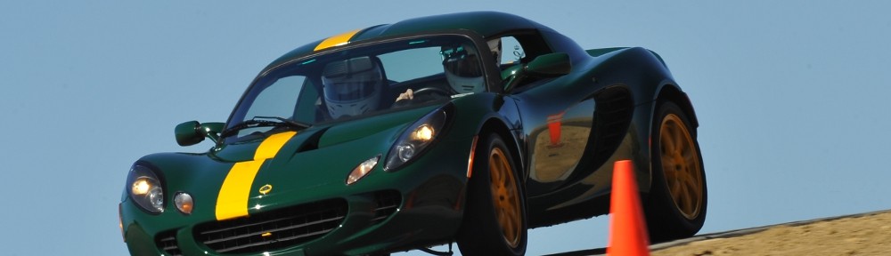
Some time before arriving at our pit stop in Taos our straggler caught up. At the pit stop we parted ways with the group. We had been over most of the roads on Mike’s route and elected to tread new ground and head east on US 64. The first section, from Taos to Angel Fire, is a nice twisty Lotus road without much weekday traffic.
The road crosses Palo Flechado Pass (“arrow-shaped trees”). A hundred years before the Louisiana Purchase, this area was the scene of some tensions between the Spanish and French over trade. In 1719 governor Valverde heard intelligence form the Spanish viceroy in Mexico City that six thousand French troops were moving up the Arkansas River. He sent a scouting party of forty-two soldiers, sixty Pueblo Indians, and a thousand horses to check the report. After battling snow, bears, and poison ivy, the group crossed the pass and made it as far as the site of current North Platte before meeting their end at the hands of the Commanche. The few stragglers that returned to Santa Fe admitted that there was no sign of six thousand Frenchmen.
Our crossing of the pass was much more comfortable; no snow, no bears, no poison ivy. At Angle Fire we enter a broad, windswept valley. There’s a Vietnam Veterans memorial here and today the road was lined with American flags for a few miles on either side. At Eagle Nest Lake the road climbs out of the valley. It’s twisty enough to have quite low speed limits; several miles of 35mph with a bit of 25mph as well. This is Cimarron Canyon State Park.
At the exit of the canyon, the land flattens to low, broad mesas and the road straightens passing through the burg of Cimarron. The road turns to the north east and runs past the NRA facility at Whittington before reaching its junction with I-25.
The remainder of our trip was on I-25 and thus deserves little discussion. We did see the remnants of our group stopped at the KFC/Taco Bell at Walsenberg. We weren’t ready for lunch yet and proceeded to Pueblo. While stopped there Genae got a Red Alert on her phone: we were about to get some very nasty weather… at home.
From the time we put wheels on I-25 until Colorado Springs we kept a steady speed a few miles an hour over the posted limit and were passed only twice. North of the Springs, driving the same speed, we were nearly the slowest car. Even travel trailers and semis passed us.
To avoid the potential of running into the weather that generated our warning we took C-470 and looped around the west side of town. This also had the benefit of missing most of the bad traffic through the center of Denver. We had no signs of bad weather until we got within a mile or so of the house. At the golf course, the fairways were covered with hail and rivers ran down the cart paths. The streets were littered with shredded leaves torn from the trees.
Michael had kindly shoveled the hail and leaves from half the driveway, clearing our path. The rain came down so hard and fast our little solar tube over the stairs leaked badly, soaking the carpet. Shredded leaves were everywhere, the raspberry bushes were transformed into denuded twigs, and the windshield of the Chrysler is cracked from top to bottom. We were quite happy to have not been caught in this in the Lotus.
 We had a nice trip, enjoyed the company of good friends, and took pleasure in exploring a good portion of northern New Mexico.
Finally, a tip of the hat to Mike for all his effort in putting this trip together – scouting much of the route, inspecting the hotel, and ensuring that our visits to the various parks would be worthwhile.