The Colorado Grand is an annual charity tour for older cars that covers about a thousand miles in five days, attracting entrants from around the world. Lotus Colorado started doing a smaller version of this for group members. It’s not restricted to pre-1960 cars. It’s not even restricted to Lotuses. Here’s how Ross described it last month:
Many of you have been with us on our Colorado Good, where we do a bit less than the Colorado Grand; three days instead of four, about 800 miles instead of over a thousand miles; stay at good hotels instead of grand hotels and dine at good small yet really cool specialty restaurants with reasonable prices. This will be our fourth trip and will go to the Four Corners via Telluride and Pagosa Springs.
For one reason or another, we haven’t been able to join on the earlier trips. Everything worked out for this one though, so we signed up.
Saturday: Denver to Telluride
We met at The Fort restaurant near Morrison for a 9:00am departure. Actually, everybody else met closer to 8:30 but we were running a bit late and managed to show up a minute or two before everybody hit the road. We started with just the Denver area contingent and picked up folks from other locations as we went.
When I was a kid, we parked the Airstream in a trailer park called Chateau Chaparral near Nathrop, where Chalk Creek flows into the Arkansas River. They had their own suspension bridge over the Arkansas and we rode horses or dirt bikes in the national forest on the east side of the river. We made the drive there from Denver almost every week those summers. So I’ve probably been up and down that section of 285 a hundred times, maybe half as a passenger and half as a driver. So the first part of the drive was old hat for me.
Just after the junction with Colorado Hwy 9, we passed an orange Elise, the first of the Colorado Springs folks. We met the rest at Johnson’s Village, three red cars: a Corvette, a Porsche Boxster, and an Elise. After gassing up and a short break, we continued on to Gunnison for lunch at the Palisades Restaurant, meeting the final member of the group. We were now thirteen cars: 5 Elises, 2 Esprits, an Evora, an Elan, a Birkin, a Corvette, a Boxster, and a Honda S2000.
After lunch the route led us through Montrose and to Ridgway where we took another short break. We intended to stop at a gas station on the corner of US 550 and Colorado 62, but a tractor trailer rig had just run over a sign and was stopped to try and put it back up. The road was under construction a few yards up 62 and between the two traffic was getting pretty snarled up. We pulled over a couple blocks farther up.
Here we met a police officer who was a bit upset with us. He had a report that at 3:48 a red car in our group ran somebody off the road. We had been driving in a spirited way, shall we say, and running near the back of the group I saw a few aggressive passes, but didn’t see anybody get run off the road. In any event, we expected to be under scrutiny for the rest of the day.
I had been over the road between the junction of 285 and 50 a handful of times, even once in the Elise, but from Ridgway to Telluride was new to me. Climbing out of Ridgway the road sweeps in great arcs, giving us great views of the mountain range to the south. The weather was dramatic, clouds dropping veils of snow and rain. Very beautiful. I had mounted the GoPro camera while we were stopped, but the precipitation compromised the footage. Perhaps I’ll be able to salvage some short highlights.
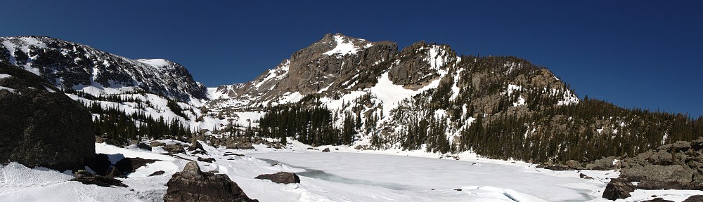
The town of Telluride is at the end of a short spur road at the eastern end of a dead-end valley. Prominently in view climbing the steep end of the valley is a four-wheel drive road, its zig-zag filled with snow. As we arrived, a bit of a storm was descending on the village. We gathered for margaritas and conversation while thunder clapped just before the snow started to fall.
 Two guys were walking down the street and saw the red Elise parked second from the end (next to the ‘Vette, but out of the picture above). “Cool! A Lotus! I want one of these!” They continued to the corner, where I heard “Another Lotus!” I really wanted to yell at them “Not two Lotuses – ten!”
 Somebody once told me the name Telluride was shortened from “To hell you ride” but this turns out to be a tall tale. It’s actually named for compounds of the element tellurium. The place was founded in 1878 as Columbia, but the post office changed the name in 1887 to avoid confusion with Columbia, California. I had guessed it must have been founded around 1880 judging by the street names. One street is Galena, which is Ulysses S. Grant’s home town.
We crossed three notable passes on Saturday.
Kenosha Pass (10,000′)
There’s not much to Kenosha Pass. In the mining days, it was called Kenosha Hill or Kenosha Summit, named for Kenosha, Wisconsin, the home of Clark Herbert, a Kenosha Pass stage driver. It crosses from the South Platte drainage into South Park and tops out at around 10,000 feet. Major Long’s party didn’t go up the canyon in 1820, deeming it too rugged. Kenosha pass was first crossed by the Bean-Sinclair party in 1830. In May of 1879 the railroad made it to the summit and US 285 follows that old route, which is in indication of it’s fairly shallow grade and lack of sharp turns.
Trout Creek Pass (9,346′)
This is the passage from Antero Junction at the west edge of South Park to the Arkansas valley. Zebulon Pike crossed the pass in 1806 when it was an ancient trail. He was correct in thinking the next drainage north was the South Platte, but mistaken when calculating that the next drainage beyond that was the Yellowstone. The Denver and South Park and Colorado Midland railroads were built over it in the 1880’s. The South Park side isn’t much, just a straight climb of a few hundred feet but the Arkansas side is a nice twisty road with excellent views of the Collegiate range: Princeton, Yale, and Harvard, all 14er’s.
Monarch Pass (11,312′ CD)
Crossing the continental divide at the southern end of the Sawatch Range, the summit affords views many consider the finest in the area. The current route was devised by Charles D. Vail and the road opened in November of 1939. The first highway department signs bore the words “Vail Pass” but unknown persons slopped the signs with black paint overnight. On oil companies’ maps it was called Agate-Monarch Pass and before long the “Agate” was dropped.
Sunday: Telluride to Pagosa Springs
After breakfast in the hotel, we saddled up and headed to the Four Corners. There was a bit of drama at first, as one of the Elises had battery problems. That was quickly solved, though, and we were soon on the road. The drive south on 145 gives nice views of the peaks to the east before flattening out in drier climes and passing through Delores and Cortez.
Before long we were in the desert of the Four Corners monument. It’s really not much of a place, but it was recently improved. I had understood it was recently moved, but this seems not to be the case. It is, in fact, 1807 feet east of where modern surveyors would locate it, but the Supreme Court has established that the location of the monument is the legal corner of the four states. We stopped here for photos and a break before heading to Farmington for lunch.
On the way to Farmington, we were passed by a crazy Indian in a Ford pickup. Imagine coming up behind 13 sports cars and deciding they are going too slow. We weren’t in danger of being arrested for our speed, but we were moving at a pretty good clip. This guy couldn’t wait to get by us, passing whenever and wherever he felt like it, generally across the double yellow line. He finally got past our lead cars when we entered Shiprock, NM. In a school zone.
The drive from Cortez to Farmington (with our detour to the Four Corners) is a pretty dull drive. Lots of straight lines and four lane roads. Some of the rock formations are interesting, but again this is an area I’ve driven through many times. After lunch at the Three Rivers Brewery, we stayed on US 64 until the junction with US 84. This junction is a T, with 64 to the right and 84 to the left. A herd of cattle was grazing in the field at the top of the T. When we accelerated away from the stop sign, one of the Elises was loud enough to cause the cattle to stampede.
The drive from here to Pagosa is quite pretty. The landscape quickly transitions from desert to mountain pine forest and the road sweeps left and right while climbing and descending. US 64 meets US 160 at another T intersection on the east side of Pagosa Springs.
 We stayed at the Springs Resort, a very nice place. After checking in, we went out for dinner then back to the resort to relax in the 23 pools along the banks of the San Juan River. The pools vary in distance from the main spring, so each is a different temperature, varying from 83 to 114 degrees. If you’re daring, you can step from the pools into the river, which we were told was 44 degrees. A few of us did, but not me!
 Sunday’s drive crossed only one notable pass.
Lizard Head Pass (10,222′)
The pass marks the headwaters of two tributaries of the Colorado: the Delores River and the San Miguel River. A trail crossed the pass as early as 1833, a wagon road in the 1870’s, and the Rio Grande Southern Railroad in 1891. The railroad was laid to connect Silverton and Ouray. The distance between the two was 26 miles by wagon road while the rail was 217 miles and was described as “the futile, transcendently triumphant Rio Grande Southern … a masterpiece of evasion.” The railroad was bankrupt in two years.
Monday: Pagosa Springs to Denver
After breakfast we headed east along US 160, stopping for a group photo on Wolf Creek Pass before crossing to the San Luis valley.
 I’ve made the drove over Wolf Creek many times. It’s not the frightening trip it used to be, back when C. W. McCall wrote a song about it:
Well, from there on down it just wasn’t real purdy: it was hairpin county and switchback city. One of ’em looked like a can full’a worms; another one looked like malaria germs. Right in the middle of the whole damn show was a real nice tunnel, now wouldn’t you know?
It’s much straighter now, and two lanes up on each side, two lanes down most of the western side. The only dicey spot is the avalanche shed on the eastern side. It often has water flowing across the road, and because it’s in the shade all the time it can get icy. But it was nice to hear the song of the engines reverberate off the walls.
Lunch was planned for Buena Vista, but we decided to eat in Salida so we split from the group. We didn’t want to retrace our route back to Denver, so rather than staying on 285 we headed up Colorado 9 from Fairplay to Breckenridge over Hoosier Pass. The weather forecast indicated it might be snowing on the high peaks of northern Colorado. I wanted to go over Loveland Pass rather than through the Eisenhower Tunnel. We encountered a small flurry on Hoosier and decided it wasn’t bad enough to dissuade us from the more interesting route.
By the time we reached A Basin it was snowing fairly heavily. The ski area is still open but there wasn’t much traffic on the pass. Luckily, it also wasn’t that cold so the snow melted as it hit the road. A snow plow was out dropping sand but we managed to pass him easily and ran into no other traffic until we reached the interstate. It looked like a few inches of snow had fallen and was blowing off the drifts along the road. But all was clear not long after the summit. I had the GoPro running for the pass, but when we stopped to take the camera off the car I saw that it was iced over. Checking the video, it began to ice up right away, near A Basin.
The remainder of the drive was down I-70, with more traffic than I expected. They are working on widening the road through the twin tunnels east of Idaho Springs. They set up a detour there with the eastbound lanes running on the south side of the river.
We crossed five notable passes, three across the Continental Divide. (Trout Creek Pass is the fifth, already described above.)
Wolf Creek Pass (10,850′ CD)
Separating the San Juan and Rio Grande drainages, Wolf Creek Pass runs 52 miles. The west side is particularly beautiful. The pass had no noticeable use before 1913, when the road was built. Before then, travelers from San Luis Valley had no choice but to take the narrow guage railroad from Alamosa over Cumbres Pass to get to Durango.
Poncha Pass (9,011′)
Poncha (Spanish for “mild”) separates the Rio Grande drainage from the Upper Arkansas. Its first notable crossing was in 1779 by Governor Juan Bautista De Anza when he was pursuing a band of terrorist Comanche. In 1853, a man in Captain John W. Gunnison’s survey party crossed the pass and called it “Gunnison Pass”. I find it a more entertaining drive than Wolf Creek. The southern side isn’t much, as the San Luis Valley is much higher than the Upper Arkansas Valley. The descent down the northern side features long sweeping curves and a pretty view of Mt. Shavano.
Hoosier Pass (11,541′ CD)
There are two passes named Hoosier. This one is the division point between the Sawatch and Front ranges. John Charles Fremont crossed it on June 22, 1844 and homesick Indiana prospectors named it about 1860. It is surrounded by dramatic peaks – a number of 14er’s including Lincoln, Bross, Cameron, Democrat, and Quandary. The pass became a road in May of 1861 when nine wagons crossed it.
Loveland Pass (11,992′ CD)
This road doesn’t get nearly as much traffic as it used to. It has been bypassed by the Eisenhower Tunnel, which was originally to be named the Straight Creek Tunnel. William A. H. Loveland was wounded in the Mexican American War, mined for gold in California, and worked futilely to put a canal across Panama for Commodore Vanderbilt. He arrived in Golden in 1859 where he used his profits from selling axes and mousetraps to build railroads. In 1879 he hired 100 men and ordered them up Clear Creek with dynamite, scoops and chuck wagons. The road was across the pass by mid-May and on June 4, fifty wagons were counted going over.
Excellent write up of our trip Dave. I would like to point out that while you are correct that there is no requirement that one’s car be either old or a Lotus, the group did include one that meets both criteria. 24 years older than the next oldest car and 40 years older than your car! We did have fun didn’t we? The photos add to the sense of the trip and now with you quite educational write up I have even learned something. Thanks Dave!
Ross