Cony Lake

Sunday, August 14

Cony Lake sits on a bench 11,512′ above sea level, surrounded by Mount Copeland, Ogalalla Peak, and Elk Tooth. It also sits on the southern boundary of RMNP. To get there, you must first get to Pear Lake, which is six or seven miles from the trailhead (depending on where you start). At Pear Lake, follow the trail by the hitchrack. This trail passes a small pond where it crosses the park boundary.

Lower and Middle Hutcheson Lakes are in Roosevelt National Forest. The faint trail leads to the lower lake before heading uphill on the northern bank of Cony Creek. The trail gets fainter and eventually disappears. Route finding from here to Upper Hutcheson can be difficult over terrain of rock benches, grassy ramps, and bands of dense willow and krummholz.

This is the fourth year in a row I’ve set off for Cony Lake. It doesn’t bother me to fall short when hiking in the Park. I’ve almost never had a bad day hiking. Each of the other times I tried Cony were memorable. The first time I had to stop at Pear Lake but got to watch clouds roll in just feet off the surface of the water. The second time I saw a bear sitting on the trail in front of me. Last year I watched an eagle catch a fish.

I started from the Allenspark trailhead rather than the Finch Lake trailhead. It saves a little distance and elevation. I wanted to drive the Chrysler because the parking lot is not Lotus friendly but it was in the shop. It was drive the Lotus or stay home, and I wasn’t about to stay home. There are two entrances to the parking lot at the trailhead. The first one features several large craters but the second is not so bad. I was able to get in and out without scraping.

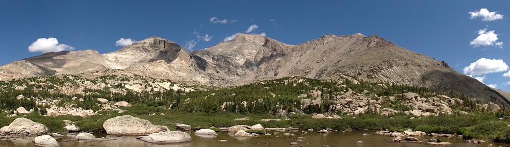
The weather was ideal. Clear, cloudless sky, a brilliant blue all morning and only a slight breeze, even above treeline.

Over the last few days I’ve spent some time visualizing the hike, mainly the approach to Upper Hutcheson. I saw myself working my way uphill without getting into the willows. I could see the ramp you descend to cross the creek right below the lake. Last year I made it as far as the inlet to Upper Hutcheson and was stymied there. I had stayed along the shore and intended to ascend alongside the creek. It’s not a good route. This time I’d start climbing almost as soon as I got on the other side of the lake, traverse the slope to above the obstructions.

Just as I saw it in my mind, I made my way up without getting stuck in the willows. I crossed the stream right at the outlet of Upper Hutcheson. This is easy to do this time of year when the water level is down somewhat. It’s probably not a good route in July. There’s a nice grassy ramp right down to the water, a few stepping stones and you’re across. I made it the rest of the way without hitting any willow. Instead, it was a lot of rock hopping. Perhaps an excessive amount of rock hopping; I was certainly tired of it by the time I was done with it.

IMG_9704route

My approximate route (drawn on a 2015 photo)

I spent an hour at the lake. I was happy with my pace all the way up. I put boots on the trail at 7:30 and dropped my pack on a rock at the lake at 12:15. It took me fifteen minutes longer going back down, but that includes a stop to refill the water bottle. I didn’t get back to the car until after six, the latest finish I can recall.

The lake is bigger than I was expecting. I sat on a giant rectangular boulder the size of a bedroom, got the GoPro running and tucked into my lunch. There were no squirrels in this boulder field, and there were no birds. A few mosquitoes buzzed me and a few flies were somehow attracted to the camera. It was quite calm, which is unusual along the divide. Some clouds were attempting to cross but were never more than incipient. They got more energetic shortly after I left Cony, some white puffs drifted over Elk Tooth, diffusing the shadows and taking the edge of the bright sunshine.

Coming down from below Upper Hutcheson I ended up in a maze of krummholz and willow. I found myself in a few of the same spots I was in last year, or the year before. I went one way, back tracked, tried another. And another, and another. Eventually I dove through a particularly nasty clump of krummholz and from then on was in the clear, but I’m disappointed I wasn’t able to retrace my steps.

I’m wearing my hiking shoes, not the boots. On the way up I hit my right ankle on a rock, tore a flap of skin. This was situated right above the shoe and when I little toe was uphill of my big toe, that flap rubbed on the shoe. About half my steps when rock hopping had my foot situated that way. By the time I was back on the trail my ankle had gone from irritating to annoyingly painful.

I was surprised at how few people I encountered. On the way up, I exchanged hellos with a group of three and a group of five. I had a brief chat with a fellow from Luxembourg. He hiked Mt. Idea a couple weeks ago, then camped in the Grand Tetons. Then it was the Badlands and a stop in Nebraska before returning to RMNP. His plan today was to lunch in Estes, then drive to the Great Sand Dunes. A pretty cool trip. I met him just below Pear a few minutes before ten.

I didn’t see another person until I was nearly back to Finch, almost six and a half hours later. I’m usually the one asking people where they’re headed, or where they’ve been. Today, though, I was the one being surveyed. After passing Finch Lake, I saw only six people. One young guy coming the other way asked “Finch or Pear?” I told him “Cony.” He hadn’t even slowed down to ask the question, but my answer stopped him in his tracks. “Way to go, buddy!” It was deja vu just after the big trail junction. A guy passing me asked “Finch or Pear?” “Cony.” “Wow”.

It’s been my habit to say something along the lines of “I felt great when I got back to the car.” That would be a fib today. I was pretty fatigued and the ankle didn’t help. It’s not the longest hike I’ve done, or the biggest climb. But I’d say it’s one of the most difficult. It’s a long hike to Pear, then miles of no trail and challenging route finding.

Timetable

Up Down
Trailhead 07:30 AM 06:10 PM
Trail Jct 08:10 AM 05:26 PM
Finch Lake 09:05 AM 04:26 PM
Pear Lake 10:05 AM 03:20 PM
Lower Hutcheson 10:40 AM 02:50 PM
Middle Hutcheson 11:00 AM 02:35 PM
Upper Hutcheson 11:25 AM 02:10 PM
Cony Lake 12:15 PM 01:10 PM

Cony Was the Plan

Sunday, June 30

About a week ago I decided that my next hike would be to Cony Lake. It’s an ambitious hike for me – 9.2 miles each way and about a net 3,000′ elevation gain. If I made it all the way, I’d visit four new lakes – Cony Lake and the three Hutcheson lakes, Lower, Middle, and Upper. I realized the significant probability that I’d fall short, but even if I didn’t make it all the way, I’d likely bag 3 of the 4 lakes. Or so was the plan.

To get to Cony Lake, the fun really begins at Pear Lake. On my old topo maps (1958), Pear Lake is listed as Pear Reservoir. Around the beginning of the 20th century irrigationists wanting to increase the water supply for farmers and ranchers in the area constructed reservoirs at Sandbeach, Bluebird, and Pear Lakes. These three were all returned to their natural size after the Lawn Lake dam failed in 1982.

Pear Lake is seven miles from the Finch Lake trailhead in Wild Basin. From the parking lot, the trail traverses a ridge, quickly climbing about 500′ before a switchback at the top. From there, it levels off, passing through aspen glens and skirting meadows before reaching the first Allenspark trail junction. Here the trail begins another climb of about 600′. There’s another trail junction here, with another trail to Allenspark to the left, Calypso Cascades to the right, and Finch Lake straight ahead.

Now the trail passes through part of the Ouzel fire burn. Some of the new growth is getting IMG_7401slarge, as you might expect after thirty five years. But there is still a dramatic view of all the mountains surrounding Wild Basin. Forest fires are a destructive force, no doubt about it, but a natural part of the forest’s life cycle. Here, aspen and pine are growing amidst the gray trunks of the burned trees and wildflowers blanket the ground.

The trail is still climbing here, but not nearly as steeply or relentlessly as before. After a while, another ridge is topped and the trail descends to reach Finch lake, perhaps 250 or 300′ feet below. Finch Lake is surrounded by forest and has an outlet but no obvious inlet streams. It doesn’t feature any very dramatic views, but it’s a pleasant lake.

The next section of trail, from Finch to Pear, is two miles and climbs less than 700′. The trail goes slightly downhill at first, crossing the outlet from Finch and shortly thereafter crossing Cony Creek. This section of trail doesn’t offer much in the way of views but it’s pretty nonetheless, passing through thin forest and alongside occasional meadows.

I arrived at Pear Lake in three hours, which pleased me quite a bit. I was feeling pretty good, no fatigue after 7 miles and two-thirds of the total elevation gain. It seemed to me I had a very good chance of making it all the way to Cony. This is where things started to go wrong.

It wasn’t clear to me which way to circle the lake. I started on the south side but the trail petered out and I didn’t think it was the right way. So I circled back and attacked it from the other side. But first, I thought, it was time for a break. Although I’d stopped to chat with other hikers, take sips of water, and photograph the scenery, I hadn’t sat down since I left the trailhead. It was now time for a short break – have a seat and eat some fruit.

After this short break, I continued on my way. I found an intermittent trail around the lake and up one of the inlet streams. I wasn’t sure I was on the path as indicated in Foster’s guide, but I was seeing the occasional cairn. I figured as long as I was going up, I couldn’t be too far off. After a short while, I had climbed perhaps three hundred feet and came across a small unnamed pond. Checking the map, I decided that if I continued more or less due south and crossed a small rise on the other side of the pond, I’d find myself above Lower Hutcheson Lake. But first, I should take a picture of this pond. Where I realized I had left my camera and tripod at Pear Lake where I had my break.

It only took me a few seconds to assess the situation. I could leave a thousand dollars worth of camera gear and continue, or I could abandon Cony Lake and return to fetch my gear. I figured it was unlikely anybody would wander off with my stuff if I continued, but I certainly didn’t want the camera to get rained on, which was a real possibility. So abandon Cony Lake it was. I hate when I do stupid stuff.

I probably could have made it to Lower Hutcheson Lake, but I figured it was now late enough to have lunch right here at Pear, so I set up the GoPro and tucked into my picnic. I wasn’t going to use the SLR for time lapse but after a while decided to set it up after all. The clouds were quite interesting – to the south there were two layers moving in different directions at different speeds. While the cameras were rolling, I wandered around a bit. After a while, I noticed some very low level clouds approaching from the north. These clouds very quickly arrived at Pear, skimming just a few feet above the water. Fantastic stuff! The disappointment of not hiking any farther was somewhat offset by the show the skies put on. If the video came out, I’d have a fantastic sequence.

Thunder was rumbling in the distance and with the lake fully engulfed in cloud, I decided it was time to hit the trail. It started sprinkling and before long was coming down hard enough to warrant getting the poncho out. I must have caught just the tail end of this storm as the rain stopped completely before I was back at Finch. From there on down the trail, there were numerous puddles that weren’t there on the way up. Some sections of the trail were quite muddy, but now it was noticeably wetter.

IMG_7914sThe thunder continued. It was fairly distant, not much loud cracking – mostly just rumbling and grumbling. But I was certain I risked getting rained on in a substantial way, so I kept up a pretty quick pace. Before long I was on the final stretch back to the trailhead: at the top of the ridge overlooking the entrance to Wild Basin. On the way up I noticed that there were Columbines lining both sides of the trail here. I generally don’t see them until higher elevation. I have a bunch of Columbine pictures but they’re one of my favorite flowers and I couldn’t help but stop and take another picture.

This is a pack trail and, judging by the amount of horse dung, gets quite a bit of horse traffic. So I’m always looking to avoid stepping in it. A few yards farther down the trail I stepped over something else: I thought, “That looks like bear shit. I don’t recall seeing that on the way up.” Not that I’m taking notes on the kinds of shit I see; it could have been there before and I just didn’t notice.

A few yards farther down the trail I see a bear sitting on the trail. He (she?) is maybe thirty yards away. It’s the first bear I’ve ever seen while hiking, maybe even the first bear I’ve seen in the wild, at least since I was about six and we went to Yellowstone. But here’s a bear, sitting on the trail I need to take to get to my car. I do a quick mental inventory of what food I’m carrying – just a few grapes and some potato chips. I do a quick assessment of escape routes – just the one, back up the trail. I think of the old joke about running away from bears: “I don’t need to outrun the bear, I just need to outrun you!” But I’m alone.

I am quick enough with the camera to get a nice photo or two, all the while shouting things like “Bear! Don’t bother me and I won’t bother you!” I had passed some other hikers back up the trail and expected to have company any time now, but nobody caught up to me. Perhaps they’d taken the trail to Allenspark?

IMG_7917sAfter a few nervous moments, the bear got up and headed straight down the slope, off the trail. I waited a short time before resuming the hike. The bear left the trail, but I couldn’t see him for very long and had no real idea where he was. Let’s just say my situational awareness now was at a peak. I didn’t dally long but did make an unsuccessful effort to locate the beast. For the rest of the hike I paid a fair amount of attention to what was behind me until I was back at the car.

All in all, although I was disappointed that I didn’t reach my destination due to my own stupidity, had I not made that error, I wouldn’t have witnessed the amazing cloud show and wouldn’t have seen a bear. So I can’t complain much. And not making it to Cony means I’ll just have to do this hike again. Although probably not this year.

Finally, here’s the time lapse. This is most of the GoPro footage, which suffers from variable exposure (because it’s automatic) and all the footage from the SLR. It wasn’t particularly windy, at least where the cameras were standing, so I’m not sure how to explain the motion of the SLR. So, technically, the video is not great. But I do like the content.

Timetable

There Back
Trailhead 07:00:00 AM 03:50:00 PM
Allenspark trail jct 07:35:00 AM 03:15:00 PM
Calypso trail jct 08:00:00 AM 02:55:00 PM
Finch Lake 09:00:00 AM 01:30:00 PM
Pear Lake 10:05:00 PM 12:30:00 PM