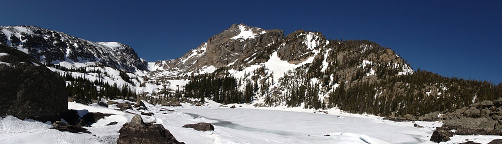
Timber Lake

I’ve been aching to hike to lakes I haven’t been to yet. It’s been a long time since I bagged a new lake. No, that’s wrong. On the contrary, it was as recent as October, and half my hikes last year were new. Is going to new places getting to be an obsession for me? “My name is Dave, and I’m an addict.”

Unfortunately, my hunger for bagging another lake is getting harder to sate. I’ve picked all the low hanging fruit and to get to new lakes I have to go farther afield. The remaining ones are farther away, with more bushwhacking, and longer drives to the trailheads. This year I’m planning an 18 mile hike and a 22 mile hike. But it’s too early to try either of those; there is still too much snow on the ground for me to attempt either. If I can’t have a new item from the menu, what haven’t I had for a while?

After giving the question some thought I decided on Timber Lake. I was there once before, thirty odd years ago with my brother. Just that one visit, half a lifetime ago, and I somehow didn’t take a camera. It’s the only lake I’ve visited only once and last visited more than six years ago. This lake will look about as new to me as one I haven’t been to.

Foster lists the hike to to Timber Lake at 5.0 miles and a 2,000 foot climb. The sign at the trailhead indicates 5.3 miles, and from the topo maps it appears closer to 2,100′. Either way, it’s a greater than average climb for a five mile hike.

It’s a west side hike, the last trailhead before the switchbacks on Trail Ridge Road. I figured if I hit the trail by nine I could be at the lake easily by noon, so I didn’t need to hit the road too early. I made a leisurely start, leaving the house a few minutes before seven. I took my time on the drive; top off and a jacket on, a bit on the cool side at 70mph, but not uncomfortable. It looked to be another beautiful day. As I went farther north, though, it became a bit overcast.

Being a west side hike, I figure two hours to reach the trailhead. I went the speed limit the whole way with the possible exception of Berthoud Pass. And as it’s a few more miles into the park than the other trailheads I didn’t get on the trail until nearly 9:30.

IMG_5035sAt the trailhead there was a notice of a detour on the trail due to a landslide, more damage from the floods of nearly two years ago. I was in this vicinity when it started raining then, traversing the ridge immediately to the north of Timber Lake, to and from the Gorge Lakes. I will never forget that one – above treeline for an eternity with lightning striking on the other side of Trail Ridge Road.

The Timber Lake trail doesn’t start climbing until you’ve gone nearly a mile through a mixed forest of pine and aspen. The trees are widely spaced and the ground is covered with grass. You can hear the cars on Trail Ridge until the trail finds the crease made by Beaver Creek and the rushing water drowns out the noise.

After crossing Beaver Creek the trail starts climbing. There are many trails that will climb 400 feet in a kilometer. (Yes, I know. Mixing my units.) For most improved trails, that’s a typical steep section; you may have one or two of these separated by level or nearly level sections. Here it’s twice that – you climb about 900 feet in the two kilometers after crossing Beaver Creek.

The detour was marked with this tape

The detour was marked with this tape

That’s when you arrive at the detour. On my way to this point I pondered what the damage would look like. I was picturing something like the landslide on Twin Sisters but I decided it wouldn’t be like that. On Twin Sisters you cross the landslide area, you don’t detour around it. On Twin Sisters a couple of switchbacks were washed away; you hike along the trail, then climb straight up the slope until you retain the trail; repeat until above the slide.

So I wasn’t surprised to see that the detour takes us straight up the slope. The footing isn’t great; I bet it’s treacherous when it’s wet. The detour goes straight up the slope gaining another 200 feet before contouring along the slope for a while. At the top there’s one spot where the soil has slipped several inches but is still somewhat held together by roots – the top of the landslide. At this point the detour falls straight down the slope a hundred and fifty feet or so and regains the trail.

Prior to the detour, the trail was pretty much free of roots and rocks making it easy to maintain a steady stride. This eased the steep climb somewhat. After the detour the trail features a more typical number of rocks and roots, slowing my pace a bit. All this time the trail has been rising along the side of the valley, a couple hundred feet above Timber Creek. About four miles in, the stream has climbed to meet the trail.

The trail rises steeply again, another two hundred feet in a series of switchbacks, before depositing us at the base of a high, dog-leg valley. The final mile and a quarter to Timber Lake only climbs another 400 feet, skirting the north side of wide open meadows. Timber Creek meanders here in places. But, to me, “meander” connotes slow. The water here is not slow.

The lake is about three times longer than it is wide, and lies more or less north-south in its valley. I arrived at the lake a few minutes before noon. On the way up, I encountered a half dozen or so hikers who were going down but saw no others going my way. I figured I’d stay about an hour and guessed that a handful of other hikers would arrive during that time. I want to maximize my personal space, so I made my way along the western shore to the north end.

The clouds looked to be more dramatic to the south over the mountains, but I didn’t want to shoot directly into the sun. I set the camera up facing the lake’s outlet and the valley beyond. A few feet above the south west shore of Timber Lake is a shallow pond. It has a nice view; I waved “hello” to a pair of hikers who were there enjoying it. By the time I packed up, three other pairs of hikers had spread out on the north east side of Timber Lake where the trail deposited them.

After eating my lunch I watched a large bird soar high above me. It was too far away to be sure, but it was a big bird so I’m guessing an Eagle. He was expending very little energy, gliding back and forth high about the ridge to my east. It amazes me that they can see their prey from such a height.

I began my hike out by continuing around the lake to the eastern shore. Circumnavigating the lake is fairly easy; no trees to speak of, and very little willow. There is some talus at the southern end, but it’s mostly covered with snow right now. The portions that weren’t snow covered were like saturates sponges. It was this way all the way around the lake. Right now, it would be misleading to identify the inlet for Timber Lake. There are a number of trickles that will remain when the snow is all gone, but until then the entire shoreline feeds the lake.

On the way down I decided I’d investigate the landslide area. You’re not supposed to continue down the trail past the detour but curiosity overcame me. By now I was thinking perhaps it would be more like where the Lawn Lake flood undercut that trail. That would certainly call for a detour. There’s a traffic cone block the trail. A short distance beyond it I arrived at the landslide area.

It wasn’t nearly as dramatic as I had envisioned. If I didn’t know it was a landslide, it might have taken me a minute to figure it out. There’s no view; it’s in the middle of forest and it’s not at all like Twin Sisters or Roaring River. Nothing has been washed away. The trees and bushes and grass is still there, but the trees are mostly uprooted, lying at odd angles. The ground didn’t wash away in the flood, it just lost cohesion and slid a short way downhill.

IMG_6364sThere is a small stream here, if you want to call it that. What channel may have existed before isn’t there any more, and the water has spread itself out – over and among and through. What might it take to make things slip some more? It’s hard to say how wide the slide is – twenty or thirty feet perhaps. But I wouldn’t want to be on it were it to let go. This one is tiny compared to the landslides that have been in the news in recent years, but think of the results if this thing let go. It’s about five hundred feet from the the top of the slide down to Timber Creek.

Managing the detour on the way out was not fun. but it was all downhill after that. Between refilling my water supply, the side trip to see the landslide, and chatting with a group from Oregon it took me a half hour longer on the way out than the way in. I was back to the car by four.

I used the app for the Fitbit on the way up. It drained my phone battery to 32% in the two and a half hours it took to reach the lake. At the lake, I put the phone on airplane mode and when I powered it up back at the car it magically was back to 39% charged. Odd. But clearly I won’t be able to use the app on any hikes longer than three hours. (I have a charger in the car, so it was 100% when I hit the trail.)

I would like to use the app another time or two to get a better sense of how well the wristband measures distance. The app, using GPS, said the hike up was 5.6 miles. That compares well to the 5.3 miles indicated on the sign plus going to the far end of the lake. It was just short of fourteen thousand steps. The wristband game me a distance of 7.1 miles on the way out. That was 14,825 steps, so using the same number of steps per mile as the ascent would put it at more like 5.95 miles.

It credited me with climbing 283 flights of stairs. Around the house, it tends to undercount stairs slightly. They count a ten foot rise as a flight, so that 283 isn’t far off. Net elevation gain to the lake would be something like 210 flights. Every trail has its ups and downs. Throw in the detour and 283 sounds reasonable.

The Fitbit says I burned about 1,800 calories on the way up, another 1,700 on the way down, and a total for the day of nearly 5,900. Typically it shows me burning about 2,600 a day.

As to my heart rate, it breaks my activity into three categories: fat burning, cardio, and peak. They determine these by calculating max heart rate as 220 minus my age. Fat burning is more than 50% of max, cardio is more than 70% of max, and peak is more than 85% of max which for me is about 140. It recorded me in the peak category for 70 minutes on the way up and 15 minutes on the way down. I was in the cardio zone 74 and 126 minutes, and fat burning 15 and 37 minutes.

Okay, enough of that.

By the time I was back to the car, the weather was starting to turn. I heard thunder rumble once just before reaching the car and the clouds over Trail Ridge looked a bit threatening. I elected to leave the top on the car for the drive home.

Traffic on Trail Ridge was sometimes painfully slow. A large herd of elk was grazing right next to the road near the lava cliffs so everybody slowed to a walk. I saw a few lightning strikes over the CCY area but only got sprinkled on. It took an hour to get from the parking lot to the eastern gates of the park.  From Estes Park to Lyons we went nearly the speed limit, and sped up again between Lyons and Boulder. Then I ran into a jam – they were carrying the torch for the Special Olympics. I caught them between Jay Road and the Diagonal. That was another ten or fifteen minutes.

All in all, not a bad way to spend the day.

Lake Helene

I’ve developed a real appreciation for Lake Helene. It only recently made it on to my radar. I had hiked from Bear Lake to Fern Lake several times before venturing the couple hundred yards off the trail. The hike is a bit on the short side for me so I’ve been doing it either in winter or late spring, most recently last Sunday.

Jerry and I hiked it last year, a bit earlier in June. We hiked over quite a bit of snow, from not much after the Flattop trail junction all the way to the lake. This time there was not as much snow in spite of the cooler and wetter May. But I get ahead of myself.

As it’s a shorter hike, I didn’t need to get up at the crack of dawn. I left the house around seven and stopped in Boulder for breakfast. I arrived at the Bear Lake parking lot at about a quarter to nine. I was surprised none of the signs suggested I park at the shuttle parking lot. It was a near thing. I snagged one of the last few parking places in time to hear the rangers “call it” – the parking lot was full.

The forecast for Denver was a pleasant but warm day with a high in the mid-90’s. I was expecting the usual brilliant blue skies, but it’s been more humid than normal so visibility wasn’t as good as normal. Perhaps we’re also getting some smoke from the forest fires in California. Other than the haze, though, it was fairly clear.

I wanted to use the Fitbit to log the hike, but the Android app was wonky again so I just pushed the button on the wristband. I’d try the app again for the return trip. I had no intention of using it both directions, as my battery life has been poor lately and I suspect the Fitbit app makes it even worse.

IMG_5030_stitch_crop_resize

Notchtop over Lake Helene

I arrived at Lake Helene a bit after ten and looked for a nice sunny spot to sit and watch the world go by. I made my way to a peninsula of talus surrounded by a sea of snow that stretched about a hundred yards in all directions. Mid-90’s in Denver and here I am, sitting in the pleasantly cool sun on a rock in the snow.

I set up the camera facing down the valley to the north and surveyed the sky. Although the mornings are often cloudless here beneath the divide, it’s typical to see clouds form by eleven or noon. You don’t need time lapse to see them move; they’re generally quite boisterous. Today, though, it was just a thin veil of high clouds with little apparent motion. That’s okay; variety is a good thing.

I spent about two hours not doing much. The snow is melting everywhere around me, just about everywhere I can see. The rocks on Notchtop are streaked dark with water. Lake Helene is brimming at its banks. The falls are too far away to hear, but there is a slight breeze whispering through the pines. Occasional gusts kicked up, painting ripples on the surface of the lake.

Being that there is no official trail to Lake Helene it doesn’t see many visitors. It’s obvious people come here; there is a faint trail and I found footprints in the snow. At this time there are probably fifty people at Emerald Lake, and on the trail there you’re never out of sight or ear-shot of other hikers. Here, I had the illusion of solitude. While I was there, a couple of hikers appeared at the outlet but they were far enough away I never heard them and between here and the Flattop trail junction I met fewer than a dozen other hikers.

According to the Fitbit app, it’s three and a quarter miles. The bracelet comes up with 3.8 miles, but it’s not using GPS. I suspect the shorter distance is more correct. Comparing the data in the two logs, I see pretty much what I’d expect. It took me fifteen minutes longer on the way up than the way back, and I was working harder, burning about 30% more calories.

Back at Bear Lake there was a steady stream of cars arriving at the parking lot. I guess most of these folks figured the signs saying the parking lot was full aren’t intended for them. Strangely, nobody waited for me to back out of my spot. The last guy to pass me waved me by. “Did you just leave that spot?” He thought he might back up and snag that spot, but he never stood a chance. Probably took me 10 minutes to get out of the parking lot. Very crowded.

On the way out of the park, the signs said all the parking lots were full and visitors should try again after 4pm. I’ve never seen any indication that all the parking lots were full before. I don’t recall seeing the shuttle parking lot more than half full. Busy day.

Emerald Lake

Sunday, May 31

The last weekend in May is my traditional jumping off point for the summer hiking season. Following tradition, I visited Emerald Lake.

As it’s a very short hike, I could enjoy a lazy morning. I left the house just after nine and had a pleasant drive in spite of the expected heavy traffic. Before I reached Boulder I realized I forgot to bring the spikes. I never had spikes until a few years ago, so I knew I’d have no problem getting to Emerald, but I’m much more comfortable hiking on snow when I have some traction. And it looks like Longs Peak has more snow now than is typical for this time of year – heck, more than is typical for any time of year – and after a very wet and cool May I was expecting to see more snow at Bear Lake than usual.

I arrived at the Bear Lake parking lot at about 10:45, late enough that I had to park near the bottom of the parking lot. There wasn’t as much snow at Bear Lake as I was expecting; clearly what’s been falling in recent weeks has been melting pretty quickly.

I recently bought a Fitbit Charge HR and this hike was the “shakedown cruise” for it. I played around with it on the Black Hills trip and for the Bolder Boulder, but the Android app crashed and I didn’t collect any useful data. I can use it with or without the phone app. If I don’t use the phone, it collects steps taken, flights of stairs climbed (1 for each 10′ gained), my heart rate, and exercise duration. Using the phone as well, I get a map of my hike. My concern is, if I use the phone, how long will the battery last?

I launched the app at 10:52, right at the car, and started walking. I followed the summer route as there wasn’t enough snow to take the winter route. According to the Fitbit, it was 1.82 miles from the car to Emerald Lake. It took me 48 minutes and I gained 818 feet of elevation.

fitbit_map

One of the reasons I wanted this particular model of Fitbit is to collect a log of my heart rate. I’ve talked to people using older ones, and you need to use a chest strap to get a log of your heart rate, or stop every now and then and query the device to get your current pulse. Here’s what my heart did on this short hike:

fitbit_heartThis was just the hike to the lake. I stopped the app there and restarted it for the return trip. Oddly, I had a higher peak heart rate going down than I did going up. I don’t expect to get similar results on my much longer and more strenuous hikes. Unfortunately, when I got back to the car I managed to plug the phone into the charger without noting how low the battery was, so I still have no idea how well it will work for an all-day hike. I’m guessing I’ll be able to use the app on the hike to where ever I’m going, and not use the app on the way out.

There were fewer hikers than I was expecting. I guess the snow had most of them turning around at Nymph Lake. I did overhear a few amusing snippets of conversation. Near Dream Lake: “Where does all the water come from? Snow melt?” Keep in mind, they hiked half the way here over snow. At Emerald Lake as I was leaving, a young couple arrived, looked around for a few seconds, took a picture to prove they’d been there, and turned around to leave. The young woman calls out to a friend, not yet to the lake, “Hardly worth the trouble, it’s not very scenic.” I have several complaints about hiking to Emerald Lake but lack of scenery isn’t one of them.

I had the SLR up and running for the time lapse by 11:52. Readers of the Black Hills posts will recall that the GoPro was a casualty of that trip, so I only had the one camera. I managed to forget to put the lens hood on it, so when it started sprinkling I stopped and packed up as the lens would get wet right away. This turned out to be a good thing, as the graupel started falling almost immediately.

I beat the squall to Dream Lake and figured I’d set up the camera to continue the time lapse. Unfortunately, I ran into some unknown technical difficulty. The timer wasn’t working. It was counting down properly: “0:02… 0:01…” but no shutter release. Very frustrating. I reset it several times to no avail and by the time I gave up, the graupel started falling here. I had planned to snack on my berries while the camera ran for a while, but so it goes.

IMG_2698sThere’s a nice open view of Glacier Gorge and the Longs Peak complex from the trail below Dream Lake, so I stopped there and ate my blackberries and raspberries. There were squalls over Longs, just as when I paused here on the way up. Very scenic. The weather didn’t follow me past Dream Lake – from my rock with a view to the car, no more precipitation.

I had a lazy drive down the mountain in an unbroken string of traffic from Estes to Lyons.

The time lapse is a bit on the short side this time, but so it goes.

Delahaye Type 145

IMG_2068sToday Jerry and I went on a tour of the Bugatti restoration shop in Berthoud. This was my third time to the shop. Of course, it’s not the shop that’s the attraction, but the cars. Today there were a handful of Bugattis there, along with a fairly modern Ferrari and a couple of Lotus. The Bugattis are always interesting, but the draw today was the Delahaye Type 145.

Emile Delahaye started building cars in Tours, France in 1894. In 1896 he entered two cars in the Paris-Marseille-Paris race, finishing 8th and averaging 12.5 miles per hour. These nineteenth century cars weren’t very powerful – one model had a 2.2 liter engine pumping out four and a half horsepower.

The state of the art had improved somewhat by 1937, when this car was built. In those days, IMG_2051sthe racing scene was dominated by government sponsored Mercedes-Benz and Auto Union. In an effort to get French auto makers to develop race cars capable of beating the Nazis, the leftist alliance Front populaire (which included, among others, the French Communist Party and Radical and Socialist Party) sponsored the ‘Prix du Million’.

The race was held at the notorious Autodrome de Montlhéry, site of Alberto Ascari’s death a dozen years before. Actually a time trial, each car was required to drive 16 laps (120 miles) and average 91 mph from a standing start. The prize was a million francs, which was a bit over $40,000 at the time but would be close to a million US dollars today.

IMG_2062sDelahaye’s answer was the Type 145, chassis 48771 specifically. The car had a 4.5 liter V-12 engine pumping out 220 horsepower. To make the engine as light as possible, the cylinder heads were made of an aluminum alloy and the block was cast in a magnesium alloy. Capable of 160mph, this car took the win driven by Rene Dreyfus.

In addition to winning that race, this car also finished 1st in 1938 Grand Prix de Cork Ireland and Grand Prix dePau, France, as well as 4th at the 1938 Mille Miglia.

This car is worth in the neighborhood of $20 million.

IMG_2065sThanks much to Victor for sharing his shop with us and to Skip for organizing the event.

LOCO Black Hills – Part 3

May 18

This morning we opted for the hotel’s breakfast. Genae tried the automatic pancake maker, I had two fruit cups. The plan today was another picnic, this time at Devil’s Tower. We’ll make a pit stop in Sundance, WY, where there’s a Subway a block from the gas station. We hit the road by nine.

We headed west on US 16 to Newcastle then north on US 85 to a place called Four Corners. Odd name because there aren’t four corners there. Odd, even, that it has a name. There are two t-junctions and the Four Corners Country Inn. We took the second T and WY 585 northwest to Sundance.

Harry Longabaugh made a name for himself here at the age of 15 by being arrested for stealing a horse. That was the only time the Sundance Kid ever got arrested. Half of us first got sandwiches while the other half pitted for fuel. While waiting for everybody to get provisioned up we saw three state troopers, the only ones we saw since Nebraska.

IMG_2030sWe had a pleasant little picnic then headed for a walk around the tower. After two pictures, the camera quit working. It’s just not my weekend with cameras. But it was a pleasant day, mostly sunny and cool. The Tower Trail is about a mile and a quarter. We took our time, stopping often to look for climbers and visiting every little spur of trail. When we finished the loop, we did the beginning portion again. The it was back to the visitor center.

Somebody said Mike wanted to line up for a group photo down at the entrance. It was a bit of a miscommunication. We exited the park and waited in the parking lot but Mike was at a much more scenic picnic area. We finally got our act together and got to the right place.

20150518_135558s

“Do Not Clean or Wash Here”

Leaving the park we took WU 24 east. This took us to a junction with US 85 just south of Belle Fourche (pronounced “Bell Foosh”). The road is a four lane divided highway, but construction had the right lane closed for quite a while. In Spearfish we made a pit stop. Overheard remarks: “They’re Lotus Elises!” and “Is there a rally going on?” There were a lot of flying insects there, but they all congregated on Cindy’s yellow Evora. She says it happens all the time; she calls the paint “Bug Yellow”. I didn’t see any bugs on my yellow stripe or wheels, clearly not “Bug Yellow”.

As is apt to happen with a chain of a dozen cars, we got split up in town after leaving the gas station. By the time we made the right turn on US 14A and headed south through Spearfish Canyon we were down to about half a dozen cars. The canyon is very scenic. Frank Lloyd Wright visited here in 1935 and was quite enamored of the place. There are many sheer cliffs and numerous wide ledges sprouting tall pines. To Wright, it evoked classical Chinese paintings.

Staying on US 14A, we exit the canyon and eventually rejoin US 85. We’re heading northbound this time, to Lead where we find US 385 and the road to Hill City and Custer. Genae and I were wondering how you pronounce “Lead”. Is it lead as in “Wild Bill Hickcok got filled full of lead in Deadwood” or lead as in “you can lead a horse to water”? It’s the second.

Lead, like Deadwood, had road construction on the main drag. Here, mercifully they kept us out of the mud by a detour through some back alleys. The trip down 385 back to Custer was a repeat of yesterday but with better weather. We thought we’d get tricky and take the truck route through Hill City and get to the head of the group, but I turned too soon and had to make a u-turn. So we were shunted to near the back of the pack.

IMG_2033s

Ambiguous sign?

As there was no group activity planned for the evening, we figured to grab a quick dinner then go back and drive the Needles Highway in a more leisurely manner. At the hotel I started one of the camera batteries charging. Then I noticed that the battery pack was a bit loose. It didn’t obviously feel loose, so I didn’t notice. I tightened it up and all is well now.

Genae wanted pizza, so we asked the hotel desk clerk for a recommendation and thus we were off to Pizza Worx. Not much in the ambiance department, but decent pizza. When we got back to the hotel to pick up the camera, we heard talk of folks wanting to get together for dinner. A large group of them decided to the Blue Bell Lodge.

IMG_2036sWe drove the Needles Highway the opposite direction from yesterday, slowly, and stopped for photos several times. It looks like the pine beetles have been at work here; quite a few trees have been cut down and the wood stacked up in piles. It’s not as bad as in some places in Colorado, hopefully the clearing they’ve done will stop the critters. We pretty much had the place to ourselves and saw very few other cars.

IMG_2038s

Eye of the Needle tunnel

It was still fairly early when we got back to Custer so we headed back into Custer State Park again searching for bison. We didn’t see any buffalo but did see much of our group parked at the Blue Bell Lodge. It would be dark before we could complete the wildlife loop so we just went a couple miles farther south and turned around. No bison but loads of white tail deer, some pronghorns, a rafter of turkeys, and even some elk.

After dinner we stopped at the Purple Pie Place but nothing struck Genae’s fancy. So when we approached the Blue Bell we decided to stop there for dessert. The gang was still there, so we joined them and ordered the apple crisp à la mode (with Blue Bell ice cream, of course).

Drove 329 miles.

May 19 – Custer to Denver

Two years ago yesterday, May 18, 2013, LOCO awoke in Telluride to snow on the cars. There wasn’t any snow on the cars when we woke up today, but it started snowing before we were downstairs for breakfast. Just about everybody got towels or washcloths from their rooms and cleared the snow from the cars. A snow brush is not generally carried as standard equipment in a Lotus.

We were on the road by 8am. Yesterday we spent most of the day near the front of the pack. Today we stayed near the back. The snow only lasted a little while – we were not only heading south, but downhill as well. Early morning the precipitation was variable but as the day wore on the rain became heavier and more steady. We considered making a stop at Lusk but stuck with the group. Our next scheduled pit stop was for Torrington.

Unfortunately, the gas station we stopped at was small. Only a couple of pumps and a single bathroom. By the time we got stopped, there were half a dozen people standing in line. Genae, not able to wait in line, found a bathroom nearby after a couple of attempts. Before she got back I had decided we’d try another place. We didn’t need gas, but I didn’t want to stand in line here, in the rain. We found another gas station down the road. Jeremy pulled in after us, and that was the last we saw of anybody from our group.

We continued southbound on US 85 a bit slower than we were going in the group. I was expecting them to catch us sooner or later, but perhaps they slowed down as well due to the rain. The wind added to the fun, a crosswind blowing strongly from the east. Oncoming trucks were brutal, throwing up huge clouds of spray. Luckily not much standing water on the road.

The group never caught us. We had lunch in Wellington and were home by 3pm.

We really enjoyed the trip – the roads, the sights, and friends. Thanks to everybody for their companionship and especially to Mike for putting it all together.

Drove 342 miles.

LOCO Black Hills – Part 2

May 17

Although the hotel provides breakfast, nothing on offer particularly appealed to us so we decided we should head to town instead. We ate at Baker’s Bakery and Café, a little place with about ten tables and the tag line “you’ll love our buns”. After bacon, eggs, hash browns and toast we went back to the hotel for our usual drivers meeting. Today we would drive the Needles Highway and the Iron Mountain Road before visiting Mount Rushmore. Then we’d head to Sturgis for lunch and return to Custer through Deadwood and Hill City. I mounted the GoPro above the left rear wheel and we hit the road.

We headed north from Custer on Sylvan Lake Rd, SD 89. For the first few miles there are numerous houses and small ranches. One has a gate with big statues: a longhorn and a bison. He has a few dozen head of each. At Sylvan Lake we reach the junction with SD 87, through here known as the Needles Highway.

The road is quite narrow – no danger of getting stuck behind an RV here. There is no center stripe most of the way, and there are a couple of primitive narrow tunnels blasted through sheer granite walls. Mike was in the lead up to this point, but pulled over for the canyon carvers. We passed Mike and the others who wanted to take their rime but didn’t go as fast as many. We let two cars pass.

The highway is named for the granite needles that punctuate the terrain. Peter Norbeck (Governor and US Senator) plotted the route on horseback and foot and construction was completed in 1922. It cost so much at the time, locals called it the Needless Highway. The road has been well maintained but not significantly upgraded. Very nearly a one lane road, there are plenty of pullouts and overlooks.

SD 87 ends at a T-junction with US 16/16A. There’s a small parking lot there, and restrooms. We stopped there for a short break, completely filling the lot. The rangers from the Custer State Park entrance station walked over the hill and took some photos. While we were stopped, I remembered to power off the GoPro to save battery. I even remembered to turn it back on when we left.

A few miles up the road I happened to look in my left hand mirror to see the suction cup mount fail and the GoPro go flying off the car. I think it survived the initial impact intact. Colin was behind me in his new Evora and he managed to dodge it. After that I didn’t see what happened. I stopped and turned around as quickly as I could and made my way back to the “scene of the crime.”

The mount was in the middle of the road, the camera nowhere to be seen. John rolled up in his Elan and helped me search. I walked up and down the side of the road a few times, along the road and down by the stream. I found the battery and the back door of the camera, both more or less intact. But no sign of the camera or housing. I was afraid somebody ran it over, possibly damaging their car, but I asked around and nobody says they hit it. After the futile search, we figured we were now on our own, well behind the group.

Rolling again, we made our way to the Iron Mountain Road. We were a bit chagrined that the road is being resurfaced. The sixteen mile stretch we were on had had the surface ground, leaving a rough road with shallow holes and loose rocks and gravel. This road, like the Needles Highway, was laid out by Peter Norbeck and is also known as the Peter Norbeck Memorial Highway. He designed it as a scenic low speed route for tourists.

Like the NIMG_2000seedles Highway, most of it is narrow and twisty. It features a few “pigtail” bridges and one lane tunnels. A pigtail bridge is much like it sounds – the road crosses a bridge then turns 270 degrees to pass under the bridge just crossed. The tunnels, again, are one lane and hewn from solid granite. Two of the tunnels are aligned with Mount Rushmore and obstructing trees removed. One of the tunnels dumps you directly onto a pigtail bridge. At the second tunnel with a Rushmore view, I was out of the car lining up a picture when Terry rolled up in his M100. We weren’t last ones on the road after all.

This narrow, twisty portion of US 16A meets SD 244 and widens to four lanes. We went left at this intersection, taking 244 to Mount Rushmore. When we arrived at the entrance station to pay our fee, the ranger asked if we were from Colorado: “I sent the rest of your group to level 6. Follow the red arrows.” Our cars occupied about a third of the level, and, as usual, had drawn admirers.

IMG_2007sWe last visited Mount Rushmore six years ago during a Clark family reunion. That time we came after dark to see the monument all lit up. This time we had daylight and scattered clouds. Lots of people visit Mount Rushmore and everybody tends to get the same picture, so I wanted to get away from the amphitheater. This turned out to be a good choice, as we weren’t allowed into the amphitheater because there was a high school graduation going on there. What a great place for a graduation ceremony.

IMG_2018sWe hiked on the Presidential Trail. Luckily, we went to the right. The trail makes a loop from the Grand View Terrace, down the hill and up a boardwalk slightly up the slope below the carvings. We didn’t know that half the trail was closed and might have been discouraged had we gone the other way instead. The weather was still pleasant and we enjoyed the short walk. And I got the same pictures as everybody else.

Next on the agenda was a drive to Sturgis via the outskirts of Rapid City. The weather held out until a bit before we arrived there, when it got windy and rainy. We weren’t too impressed by Sturgis and broke off from the group here, perhaps hunt buffalo in Custer before going back to the hotel.

We ate at Taco Johns then headed to Deadwood. It rained the whole way, and the main drag through much of Deadwood is under construction, a muddy pot-holed mess. The place has been overrun by casinos. Everything historical in Blackhawk and Central City were pretty much destroyed by the construction of casinos in the name of historical preservation. Deadwood looks to have suffered the same fate. We don’t gamble, so we didn’t stop other than to refuel.

The weather cleared about half way to Hill City, which boded well for a trip through the park. The drive from Deadwood to Hill City is pleasant if not dramatic. It had the bonus of having very little traffic. I caught up to no cars for several miles, and if I had there were ample passing zones. Unfortunately, when I did catch traffic, the passing zones evaporated.

When we stopped to pay the entry fee the ranger said, “Your car is too short!” As it so happens, the park is a free today. The ranger recommended Wildlife Loop Road. This is the third narrow road we’ve driven today. Instead of granite tunnels and pigtail bridges, it’s eighteen miles of riparian areas and grassy hills.

Genae was hoIMG_2028sping we’d see the baby bison again. She was disappointed. All we saw were a few lone males. One guy was quite close to the road. When we stopped to watch them yesterday they were making a cacophony of grunts and belch-like rumbles. This lone one was quiet.

We came across a solitary pronghorn by a cattle guard. She posed for me a little bit, crossed the road, and scratched in the gravel a couple times. Then she proceeded to piss. In retrospect, I should have taken the picture. But, frankly, I was a bit offended!

IMG_2023sThere was very little traffic. If somebody was stopped, that generally meant there was an animal in the vicinity. The biggest crowd we saw were stopped to take pictures of some donkeys . The asses didn’t appeal to us, so we skipped the photo opportunity.

Dinner was a group affair. We ate at the State Game Lodge, which made for a pleasant little drive. It’s about twelve miles from Custer, five or six miles into the park. It’s a great building, built in 1920. President Coolidge booked a two week visit but stayed for thirteen. The room we were in looked to be newer construction. I considered the Cobb salad (with hard boiled quail egg) or the bison steak but went with the buffalo burger instead.

Drove 250 miles

LOCO Black Hills – Part 1

It’s time for another long weekend road trip with Lotus Colorado. This time, Mike put together a four day excursion to the Black Hills of South Dakota. We’d drive to Custer on Saturday, visit Mount Rushmore and Sturgis on Sunday, head to Wyoming on Monday to see Devil’s Tower and return home on Tuesday.

The contact list included 22 cars and 38 people. Over a quarter were Elises – one blue, one red, two orange and two BRG. Gordon was the other green one – no stripe, silver LSS wheels, hardtop. Three Evoras, two black Exiges, two red Elans (both 1967), two M100 Elans, and a Europa round out the Lotus contingent. The others were BMW, Porsche, Saab, Volvo, and a Miata. As always, a few new faces on this trip, including a Chicago couple who rendezvoused with us in Custer.

May 16 – Denver to Custer

On past drives we’ve been pretty fortunate with the weather. We did get snowed on two years ago this weekend in Telluride and it was a bit on the warm side in Moab last year, but never anything much to complain about. But it has rained or snowed every day so far in May and the forecast doesn’t look too bright for our trip. Still, we hoped for the best.

We left the house at about 8am and fueled up. Luckily I realized I had forgotten the SLR before we got very far, so we went back home before heading to the meeting spot. We met at a gas station off exit 22 of I-76. The morning was cool and a bit breezy, with scattered, nonthreatening clouds.

Once everybody showed up we had a quick drivers meeting then hit the road, running northeast on I-76 to exit 80. There we headed northbound on Colorado SH 52 to a T-junction with CO 14 at the southern border of the Pawnee National Grassland.

After a short jog to the east, we continue north on CO 71 through the Pawnee. Here we hit a bird. I’ve hit more birds in this car than all other cars combined. On my trip to Portland last year I hit two at once. Usually it’s high on the car but this one hit the front clam and ricocheted to the windshield wiper where it got lodged in the wiper arm. For a few seconds I thought the wind might take it, but, no, it’s stuck. I turned on the wiper hoping for the best but no luck. I have no choice other than to pull over and pull it out manually.

The Pawnee Grassland gives way to a checkerboard mix of ranch and open prairie. On the south edge of Kimball we cross under I-80. Time for a pit stop. The route instructions directed us to the Kwik Stop but we followed the Miata into the station across the intersection. After fuel and potty, we lined up with the other cars at the Kwik Stop. As usual, we drew a crowd. It’s always fun to see people’s reactions – lots of smiles.

Our next stop was a picnic lunch at Scotts Bluff National Monument, a couple miles west of Gering, NE. Between Kimball and Gering is forty more miles of checkerboard. Here, more of the checker squares have checkers on them: center-pivot irrigation systems and their attendant crop circles. At Gering, the directions send us north when 71 bends slightly east, but we split up and attacked the place from several directions. We headed downtown to grab sandwiches from Subway.

We had our picnic and socialized for a while then we drove to the top of the bluff. The road to the top is 1.6 miles long. After a 180 degree sweeping turn it passes through a tunnel that curve 90 degrees the other way. It zigs and zags, passing through two more tunnels before finally dumping onto a parking lot on a wide saddle below the summit of the bluff.

Above the parking lot, a trail makes a sort of bow-tie and affords nice views. Below the bluff to the east lie the conjoined towns of Gering, Terrytown, and Scottsbluff. Immediately below the trail to the east is a nice cluster of houses – the high rent district. A national monument on one side and golf course on the other.

IMG_1963_stitch_crop_resizeThe North Platte valley is to the north. Both the Oregon Trail and Mormon Trail passed through here. When driving in comfort though these vast, rugged spaces in the west I often try to imagine what the pioneers went through. Sell your house, if you have one, and buy a wagon and team. Pile all your worldly possessions into the wagon and making twenty miles on a good day. Risking it all, venturing into the great unknown. Scotts Bluff was about a third of the way from St. Louis to the west coast, perhaps the easiest third.

IMG_1967sI’m not sure why I started doing it, but whenever I come across a survey marker I take a picture of it. That doesn’t mean I have lots of pictures of survey markers; I don’t come across them every day. The one on the top of Scotts Bluff is interesting because of what has happened to it since it was placed there in 1933. Scotts Bluff is made up of soft sandstone with a cap of hard rock. Where the hard rock is gone, the sandstone is eroding away on a human time frame. Scotts Bluff is about a foot and a half lower now than it was in 1933.

Exiting the town of Scottsbluff, Mike missed a turn. We were second in line and didn’t catch the error and everybody followed us. Mike found somebody to ask directions and while we waited, Ross passed through the formation looking like he knew exactly where we were going. We took off after him. He correctly navigated us onto US 26 eastbound. I drove several hundred miles of US 26 last summer through Oregon, Idaho, and Wyoming, but now we only followed it for a handful of miles before taking US 385 to Alliance.

For about twenty miles we’re out of the valley, away from the fields of checkers and back in prairie. Here we saw two pronghorn antelope running in our direction along the fence on the other side of the road. Our line of cars is probably a quarter mile long, and we slowed down considerably. The antelope switched direction a couple of times but were stymied by the fence.

In a field north of Alliance, a guy named Jim Reinders built an homage to Stonehenge out of old cars he’d gotten from nearby farms and dumps. Reinders noticed that the monolithic dimensions of cars from the fifties and sixties were similar to the stones at Stonehenge. They’ve painted the cars gray to make them look more like stones and they keep them from rusting away. There are some interesting cars in there – a Willy’s truck, a Gremlin, an old Plymouth like “Christine”.

IMG_1976sScattered around the property there are a number of large sculptures made out of car parts – a spawning salmon, a dinosaur, wind chimes, a Conestoga wagon. As built, Carhenge included three imported cars. These have been replaced by domestic cars and the foreigners ritually buried here, their grave marked by another junked car.

After a pass through the little gift shop, we started assembling for our departure. By now the skies were looking quite threatening. Here we had our first bit of rain, and it looked very nasty directly to the north of us. Luckily to get back on US 385 we had to jog a few miles to the west and we missed the biggest of the squalls. Along here we saw a couple of large birds in the grass along the road: a turkey and a ring neck pheasant.

Most of Nebraska looks just like what you expect Nebraska to look like – some farms, some ranches, a few feedlots. But just south of Chadron we pass through the Nebraska National Forest. I had no idea there were pine trees in Nebraska. Heck, there are hardly any trees at all. Genae found it a bit reminiscent of the area south of Flagstaff. Sadly, and perhaps obviously, this interlude was short and we were soon back to the more typical Nebraskan scenery.

After a pit stop in Chadron, we continue on 385 into South Dakota and through the Oglala National Grassland. Although the North and South Platte rivers were running high, they were within their banks. The rivers we’d been crossing lately were flooding. In addition, many low lying parts of the fields along the road had standing water.

At Oelrichs US 385 meets US 18. The two routes are conjoined until Hot Springs where 18 goes west. We continue north into Wind Cave National Park. We made another minor navigational error, missing the turn on SD 87. US 385 would take us into Custer, but we wanted the more scenic route through Custer State Park.

This is not a big park but it’s packed with things to see. It looks like parts of the place catch fire every few years so there’s an unusual mix of pine forest, recently burned areas, and open grassy hills and valleys. The hills are populated by an abundance of wildlife. In a few short miles we saw deer, antelope, and bison. A group of buffalo grazed very near the road, several cows and calves.

IMG_1990sOur accommodations for this trip were at the Bavarian Inn, a pleasant establishment on the north side of town. We got checked in, unloaded the car, and socialized over margaritas and snacks. There were no group plans for dinner, so we were all on our own. Nonetheless, almost everybody ended up in groups of four or six or eight at the Buglin’ Bull. They weren’t really prepared for so many guests and those who arrived later after us were there quite late. We were back to the hotel and in bed by 10:30.

Today’s drive: 421 miles.

ChumpCar Road America – Part 3

Race 2

Sunday morning was sunny with scattered clouds and a bit of a breeze. The forecast was to be a bit cooler than yesterday, with a better than 50% chance of rain starting after two. The possibility of rain factored into the driving sequence. Phil was game to take on the rain, so he volunteered to be last. Dennis needed go earlier because he had to start packing the trailer for our departure. The final determination was for me to be first, Dennis second, Lauren third, Phil running anchor.

We arrived at the track a bit before the 8 o’clock drivers meeting, which only took a few minutes as there was nothing much to add after yesterday. Evidently nobody did anything unique out there that needed to be called out to the general group.

Yesterday I had planned to start the lap timer on my phone and leave it in my pocket hoping I’d get some good data logged. In all the excitement of my first stint in a real race, it wasn’t on the top of my list and I forgot all about it. Being first in the car was helpful for me as there was no driver change. The day got started without any drama and I remembered to turn on the lap timer.

They have us go on the track at a quarter till so we could do a formation lap to check everybody’s transponders. There is no starting grid; it didn’t matter where I went out relative to the other cars. I was slow getting on track and I ended up “tail-end Charlie”, which was okay by me. I was so late on the track I didn’t catch the field until the lap was nearly done. Being last meant I wouldn’t be getting dive-bombed by twenty or thirty faster cars in the first lap or two.

One more lap around and then the call came through on the radio: “Green! Green! Green!”

I guess a number of the other drivers in the slower cars had the same idea as me, hanging out in the back of the pack. I was pleasantly surprised to find that I was able to pass a half dozen cars on the first green lap. A couple of them were faster cars, though, not yet warmed up. They got back around me the next lap, along with a couple cars that came out of the pits late.

On the first three green laps, cars immediately in front of me had issues in the chicane after the Carousel. The first lap an MR2 went too deep and was in the dirt. On the second lap two Miatas nearly came together. One driver gave the other a thumbs up, but I’m not sure it wasn’t ironic. The third lap was a repeat of the first but with a different car. Nothing like a little excitement to get your blood going in the morning!

Things quickly settled down and I found myself running similar speeds to a Dodge Neon painted up like a Holstein – a black and white cow. I was faster than he was in the turns but slower on the straights. I got by him on the outside on the Carousel and kept him behind me for a few laps. But every time we’d get to the end of one of the three long straights he’d be right up on me. I was disappointed when he managed to get by me. I took it as a challenge and made a real effort to put some pressure on him. I was confident I was faster than him.

It was a good dice. I forced him into a number of errors in the turns but wasn’t able to capitalize on any of them until I had a good run on him into the Carousel, where I passed him again. The next lap he went into the pits and I was looking forward to having some laps without him slowing me down. Imagine my dismay, then, to find the Holstein in front of me a lap later, after their driver change. Their second driver wasn’t up to the standards of the first and I dispatched the cow car quickly.

On the second half of my stint I was able to get a few laps where I wasn’t busy dicing or getting passed and I was able to concentrate on improving my times. I made a bit of a breakthrough on turn 1 and felt I was much faster there than yesterday. I was hoping to make a similar advance on turn 2. I managed to get it right a few times but not consistently. I was happy that fewer of the fast cars were able to catch me in the twisty bits between turn 5 and the Carousel.

Like yesterday, I managed to put together some consistent laps and managed a 3:15.8. Woo hoo!

Too quickly I was told my stint was over and it was time to pit. The driver change went better today – I managed not to forget to take off the wheel. I did bang my knee on the way out, but it went better than yesterday.

The lap timer worked flawlessly. It logged my best lap as 3:15.75 while the unofficial time displayed for us was 3:15.808. As the speedometer in the car doesn’t work, we had no idea what sorts of speeds we were attaining until now. I managed a top speed of 106 on the straight going into turn 5, and about 100 on the other two straights. I was going 80 to 85 in the Carousel.

When Dennis was on track, I took the camera and went to turn 5 to see if I could get a decent picture. I sat in the bleacher there for a few laps then tried another vantage point. I didn’t see much of the track this way, but didn’t want to be away from the pits for too long.

IMG_1939s

Dennis negotiates turn 5

Dennis had some excitement on his stint when a car ahead of him went off in the Carousel, head first into the wall and bounced back sideways across the track. This turned out to be the team next to us in the paddock – a black Maxima. Later Dennis radioed in for us to get brake fluid ready for some maintenance. We checked things out; didn’t need to add any brake fluid but the left front tire had some chunking on the outside edge. We replaced the tire and sent Lauren out on the track.

She surprised us by coming back into the pits a couple laps later. She said that after the Carousel the steering wheel wasn’t straight. She wondered at first whether she had just not put it on correctly in the pits, but then going into Canada corner she didn’t have any brakes. She managed to use the transmission to slow herself down and make the turn. Then she was feeling like the front left wheel was coming off and she limped back to the pits. We jacked up the car (when I say “we” here, I mean Dennis and Phil) and looked for a problem. I will only mangle the description of the problem, so I’ll simplify and say that it was a problem with the wheel bearing. It ended up being terminal and our day was done.

It was disappointing that Phil and Lauren didn’t get to drive, but the car and all the drivers were still in one piece and everybody had a good time, so nobody was really complaining.

IMG_1949s

Exiting turn 14

The silver linings for the day were that we didn’t get rained on at the track and we were able to pack up and be on the road headed home a couple of hours early. Frankly, we were expecting the day to be cold and wet, but although the morning was a bit on the cold side with a bit of a breeze, the day was sunny and comfortable.

I mentioned some of the folks we met while waiting to get into the track on Friday. In the paddock, we had some neighbors with a giant rig with two cars. They were from Wyoming. They consider HPR their home track, even if it is “out in the middle of nowhere.” As opposed to Gillette, WY, right? In the pits we were neighbors with a team from South Dakota who also visit HPR regularly. It’s cool to see we weren’t the only long distance warriors.

Homeward

We missed the rain at the track, but it found us as we were crossing into Illinois. The truck stop restaurant we ate at had a sign proclaiming they had been voted the healthiest menu. Don’t know who did the voting, but I wouldn’t have thought it above average for a truck stop restaurant.

We spent the night in the same Davenport hotel as before. In the same room, to be specific.

By Sunday, Phil and Dennis were tired of my stories so we listened to a bit of George Carlin and a bit of a Malcolm Gladwell book, Blink, on disc.

A wide variety of topics were discussed in the many hours in the truck. Sunday we sort of did a project post-mortem on the trip, what we should have done to be a better team.

I think it’s an interesting issue. Our mistake with Lauren’s radio in Race 1 cost us a lap. We might have made the podium had we not botched it. We also almost made an error during refueling. Dennis had nearly put the nozzle in when Phil was still attending to the car. I stood there thinking “He’s not supposed to start until Phil’s done” but took no action. Luckily, Dennis caught himself in time. But perhaps the biggest error was to not take the wheels off the car and checking everything out.

Dennis used to fly planes. With that history, it seems to me a natural that he work on some checklists for the races. Starting with, maybe, a list of possible checklists! I’m not likely to do more than one of these a year, so it would probably be good if I could practice a pit stop. To do it right would require all four drivers, and everybody would have to do each job at least once.

Afterword

On the way home Dennis asked me how I would compare this race to my club days. My immediate response was “I’ll have to conduct further research!”

I’m not sure it’s fair to compare this Road America race to a club day or an open lapping day. The big appeal of this race, for me, was the venue. I would love to drive Road America in the Elise but that’s not too likely in the foreseeable future. Driving somebody else’s car there is a fine substitute. So it might be more fair to compare this trip to the track day portion of my Portland trip.

There are more differences than similarities. The similarities are that I’m on a road trip to a new and exciting track. The biggest difference is that I’m in a different, slower, car. Instead of being alone, I’m part of a team. I’m not just bombing around the track, my laps are toward a goal and I’m running a much longer session. Although it’s a race, it’s seldom I’m ever in a position to move up or down in the standings, so in that regard is it much different than a lapping day?

I enjoyed the track immensely. I feel like I could have the track figured out pretty well with a couple dozen more laps. I never put even two wheels off and managed for the most part to avoid the nasty rumble strips in turn 5 and Canada corner.

I look forward to having the opportunity to do a similar trip in the future – a road trip to a distant track. Maybe something in California?

I had a great time, I look forward to doing another one. Thanks to Dennis for making it all possible and to Phil and Lauren for the great companionship.

And last but not least, a hearty thanks to Tina and Mike for putting us up, and putting up with us.

ChumpCar Road America – Part 2

Race 1

The day started with a drivers meeting at 8:15. It was much like the drivers meetings for all the club days or open lapping days I’ve attended. Nothing particularly stands out in my mind about it, except that they indicate slow (i.e. non-race) vehicles on track with a red cross rather than the usual white flag. These would typically be presented alongside yellow flags. The tow trucks are there because somebody went off. These are experienced corner workers; like for my track day at Portland Int’l Raceway, these guys have flagged big-boy races.

The Race started at 9. Phil is first in the car. Cars are actually sent out a few minutes before 9 so they can do a lap or two to check that the transponders are working as they pass the start/finish line. There isn’t a green flag as such – the course is green when the yellow flags are put away. We get under way pretty much on time.

Dennis has ChumpCar’s timing and scoring app installed on his phone so we can see how things are going. It gives us the number of laps run, last lap time, and fastest lap time. Phil puts down some nice laps, is pretty quickly under 3:20 per lap. By the end of his stint, he has recorded a 3:12, which turns out to be the fastest lap for the team.

There are fifty cars on in the race in four classes. We’re in class A, which is the slowest class. Our opponents in this class are mostly Miatas. We have a Miata engine in a heavier car, so we’re at a bit of a performance disadvantage, plus we’re carrying our three lap penalty. There are only a handful of Class A cars competing and we’re confident we can finish on the podium, but three laps is a lot of ground to make up.

Phil’s hour and forty minutes is over pretty quickly for us and quicker for him, I’m sure. Lauren is in the car next. Like me, she’s never driven the car before and we only practiced getting in and out of the car once. Because we’re fueling the car, our stop will last a minimum of five minutes by rule. In theory, this means we shouldn’t feel hurried. Theories are wonderful things, but the reality is that we all feel pressure to do things quickly. If you’ve never practiced something and try to do it fast, you’re likely to make mistakes.

Our mistake for Lauren was failing to do a radio check before we release her. We try to talk to her but get no response. We don’t know if she can hear us or not, but we certainly can’t hear her. That leaves us no option but to call her in by showing her the pit board. When she comes back in, we find that not only was one of the connections undone but the radio was on the wrong channel. Dennis fixes these problems, a quick check tells us everything is working, and we send her back out. This mistake essentially costs us another lap.

Judging by her lap times, she didn’t take long to settle into the car and get a rhythm. Before long she’s turning laps consistently in the 3:25 range. I’m up next, and I’m starting to get a bit anxious. I’m due in the car about 12:30, and by 12:15 hadn’t even given lunch any thought. One of Dennis’s daughters has brought a big spread of food out for us and I manage to eat a brat before I have to get in the car.

There are more right turns than left turns, and the big right turn is the Carousel. Dennis and Phil decided that we should swap the tires from left to right as the left side will be showing much more wear. The tires are directional, so I’ll be running them the wrong way. Doing this is only a problem if it rains; with the tires going the wrong direction they’ll be very bad in the wet. The weather is sunny and dry so it’s not an issue; rain isn’t in the forecast until tomorrow afternoon.

Lauren and I do the driver change while Dennis and Phil swap the wheels. The driver change is a bit quicker in spite of me not being able to see the buckles with my helmet on. It feels like forever before I’m strapped in, but the car is still in the air when I’m ready. Then it’s time for fuel and I wait patiently and compose myself. Fuel in, they release me and I head down pit lane, stop to have the timer removed from the car, and enter the track.

Almost immediately I’m swamped by faster cars. What have I gotten myself into? On my club days, we can only pass in limited places, and with a point by. On open lapping days it’s open season and I thought I was prepared for this, but it’s a bit of a shock at first. To add to the discomfort, I don’t really know where the braking and turn in points are or even which gear to be in, so I’m trying to figure all that out at the same time.

By the second or third lap Dennis is on the radio telling me I just did a three thirty something. After those hectic first few laps I start to relax a bit. The guys in the pit can’t see where I am (unless I’m on the front straight), so sometimes they’re on the radio at inconvenient times. There are places on the track where I can’t hear them, just static. When I get a message when I’m being passed by two cars in the middle of a turn I understand why Kimi Raikkonen might say “Leave me alone. I know what I’m doing!”

Several laps later, I feel like I’m getting into a groove. Dennis tells me I’m turning laps in the 3:17 range and I feel I can continue to improve. I’m starting to feel comfortable; I’m thinking that it’s all about confidence and I’m getting more confident.

I’ve driven the track many times on the computer, but that pales in comparison to the real thing. Television and video games don’t do the terrain justice, but at least I know how the track is laid out. Some turns I figure out quite quickly; they become simply a matter of practice. On other turns, I have to change my approach as I get faster and I don’t get them figured out the first day. And then there’s the Carousel. No other track I’ve been on has anything like it. It seems to go on forever. Nobody passes me in the carousel, but I make a pass there, which induced a bit of a pucker factor.

Dennis radios me that I’ve been out an hour. On lapping days, I’m usually out for a half hour at a time. Last week at HPR I did over three hours in my car, but it was a half hour at a time. This hour seemed to fly by. My stint will be over all too quickly. It is over all too quickly.

When it’s my time, I exit the track and go up the hill in pit lane. I stop for the official who puts an egg timer on the hood of the car. Then I head for our pit. I stop the car and manage to get unbuckled. I climb out of the car, forgetting to take the steering wheel off. I feel like an idiot. Although it’s a bit on the chilly side, I’m fairly drenched in sweat. But I feel great – I feel I could go another hour.

Dennis is last in the car. He quickly gets up to speed, and regularly turns 3:15 laps. When we’re not in the car, we take turns on the radio. But mostly it’s just waiting around. Dennis’s daughter’s family brought some good food – I snacked on fruit salad and drank lots of water to stay hydrated.

At the end of the day we were fourth in our class, 26th overall. Most of the cars behind us had mechanical problems.

IMG_1925s

L to R: Dennis, Lauren, me, Phil


ChumpCar Road America – Part 1

A couple years ago I started asking people if they knew of anybody who needed another driver for a race. I was asking specifically about Lemons races; I didn’t know about ChumpCar or WRL. I had no idea what would be expected of me should it happen, no idea what it would cost or how much time I’d need to devote.

I just knew I wanted to drive in a race.

One day at HPR I talked to a guy with Petty Cash Racing. He said I could drive with them for something like $1200 a race. I suspect this would have been an “arrive and drive” deal. I would be there as a client rather than as a member of the team. I didn’t want to spend that much, so I kept asking.

At last year’s Eiskhana, I chatted with Ed and mentioned I was interested in driving Lemons. He connected me with Dennis. I wanted to drive in a race last year but I just couldn’t make it work. I had ruled it out by mid-April, but had a pang when he tried to line up a Road America trip later in the year. I was delighted when he made another attempt this year.

ChumpCar

“Real Racing. Real Tracks. Real Cheap Cars.” ChumpCar operates dozens of events across the country each year. The rules make it prohibitive to have nice cars. This keeps costs down. That doesn’t make it cheap, though.

I’d put it on a par with owning a hot air balloon. I crewed on a balloon twice, ages ago. Back then, the balloons (envelope and gondola) went for about ten grand. Add a truck, maybe a small trailer. Get a bunch of folks to help out by giving rides, maybe four at a time. For the hot air balloon you need more people – somebody has to drive the recovery truck to where ever you land – but in the grand scheme they look similar to me.

For ChumpCar (and Lemons and WRL because many cars run in all three series) the car is going to be twenty or twenty five years old. Add a roll cage and fire suppression, a trailer and truck to tow it, and all the supplies and spares to keep it running (particularly tires and brakes), and even with a “real cheap car” it adds up.

The races are generally held over two days, with six or more hours of racing each day. A six hour race on Saturday and another six hours on Sunday is a Double 6. Seven each day with parc ferme rules for a 14, or twelve each day for a 24.

The Track

IMG_1872sRoad America has been hosting events since the fifties. It’s arguably the premier track in North America. Its 4.048 miles of track are draped over the terrain of Kettle Morraine near Elkhart Lake in Wisconsin. It’s a fast track, with three long straights: Road America Straight, Morraine Sweep, and Kettle Bottoms.

It is one of the few circuits in the world that is still in its original configuration. For years I watched ChampCar run there, and it was always a favorite in the various racing sims I’ve played over the years. I was quite excited about the opportunity to actually drive there.

Our event was a Double 7. For our race, we’d be using the chicane after the Carousel. Not only are there three long straights, there isn’t anything like a hairpin. That means the track is better suited to high horsepower cars. We wouldn’t be driving a high horsepower car, though.

MX-7

ChumpCar works on a points scheme with anything over 500 causing penalties. Dennis has a 1988 Mazda RX-7, which starts at 350 pts. He’s swapped a 1.6 liter Miata motor in place of the rotary. That’s another 75. Add an oil cooler and a suspension upgrade and we’re at 525 points. This resulted in a 3 lap penalty. We weren’t too happy, but some people had it much worse. There was a BMW there with a 45 lap penalty.

Being an RX-7 with an MX-5 motor, Dennis calls the car an MX-7. It weighs something like 2400 pounds and the motor puts out perhaps 115hp. It’s not going to win any drag races, but with Dunlop DZII tires she handles pretty well. They’re turning low 2:20’s at HPR. Lower horsepower than the Elise, but handles very similarly.

The team was Dennis, Phil, Lauren, and myself. Dennis is the “team owner”. It’s his car, truck, trailer, and gear. Phil is a hot shoe driver and ace mechanic. He’s only raced once before, but he’s logged quite a few track miles. Lauren and I are race rookies. Lauren has raced karts and bikes (both bicycles and motorcycles, I believe) but never cars. Although she has only tracked cars a couple of days she did attend an SCCA course. I, of course, have never raced and never taken a racing class.

With seven hours of racing each day, we’d get 1:45 each. Pit stops would be a minimum of five minutes (by rule), so we’re really get more like a hundred minutes of seat time each day. At the pit stops, we’d have to switch drivers, fuel the car, and do whatever minimal maintenance we’d need to deal with – topping off fluids, washing the windshield, checking the tires and brakes, that sort of thing. We weren’t allowed to touch or inspect the car while fueling was going.

The driver change is perhaps the most complicated part of the pit stop. The exiting driver takes the wheel off, hangs it on a hook, then loosens and unbuckles the harness. The incoming driver opens the window net, disconnects the exiting driver’s radio and helps the exiting driver out of the car. Incoming driver adds or removes seat cushions as necessary, gets in the car, and buckles up. The exiting driver connects the radio and helps the new driver tighten the straps.

Two people refuel the car. One places a pan below the car. While one person pours two jugs of fuel into the car, the other stands nearby with a fire extinguisher. Both are in full gear – suits, gloves, helmet with the visor closed. After all the fuel is in, any other necessary work can be performed.

At this point, all this is mostly theoretical to me. Lauren and I had only gotten in and out of the car one time before we actually raced, and we’d never done a pit stop.

Eastbound

Our first travel day took us from Denver to Davenport, Iowa. I’ve been fortunate that for all my road trips since we moved back to Denver, the drives to and from my destinations have been as important as any other aspect of the trip. This was not one of those trips. We were on Interstate highways pretty much the whole way. They are great roads for getting from place to place as long as you aren’t interested in what’s between the places.

Dennis, Phil, and I were in the truck. Lauren was flying in from California and would meet us there. The truck is a big diesel pickup with a smaller than expected fuel tank. Due to heavy headwinds, we were stopping every two hundred miles to refill. The long drive gave us a good chance to visit; to get to know each other better. Visiting was necessary, as there is pretty much nothing to look at through Nebraska and Iowa. About the only new thing to see on I-80 is all the windmills in Iowa.

In Davenport, we had dinner at Gramma’s Kitchen. Dennis wanted a steak and Phil wanted a beer. I’d have eaten a salad if they’d had a nice one on the menu.

Phil asked the waitress “What kinds of beer do you have?”

“All of them,” she says.

Phil says, “I’ll have an IPA.”

The waitress goes a bit blank, then says, “We have Bud, Bud Light, Coors, Coors Light, Shiner Bock, …” They have Sam Adams, but nothing like an IPA. A recurring joke on the trip was “We have all the beers!”

“Does this go on our permanent record?”

Friday was check in and registration. This takes place outside the track; we wouldn’t go through the tunnel until Saturday morning.

IMG_1860s

“Look where we are!”

Registration opened at 3, but we got there about two hours early. We parked the truck and trailer with the other early birds and wandered over to look at the track between turns 13 and 14. I wandered down to a flagging station to get a picture of the track and see there’s a gap in the fence there. I tell the guys “you can get on the track here”. “Should we walk it? We’re probably not allowed.” What the heck, we’ll just take a quick look. Once on the track we head downhill toward Canada Corner. We walked along Kettle Bottoms like tourists, wide-eyed. A maintenance guy on a little tractor went by and waved at us. Gee, he didn’t make any indication we weren’t supposed to be there so we kept going. We made it to the chicane after the Carousel before track officials arrived. Our presence here is strictly verboten: we’re in deep doo doo.

Dick, the security guy, asks us for our IDs. “You with ChumpCar?” “Yes”. “You shouldn’t be here, it’s a maintenance day, the track is closed.” By the time he finishes writing our info in his memo pad, another car comes by with a track manager. While Dick filled her in about us, a third car went by. She instructed Dick to take us back to the main gate. On the way, I ask Dick “Is this going on our permanent record?” He didn’t recognize the reference. Or Dick has no sense of humor. For a while we were sweating that we’d get a penalty from ChumpCar. We didn’t think they’d eject us from the event, but I can’t say we didn’t worry about it a little.

IMG_1862_stitch_crop_scale

Canada Corner panorama

Back at the truck, we make the acquaintance of the teams around us. The guys in front of us were from Texas. We shot the breeze with them for a while. After a couple of minutes, one asks me “Are you the guys who got in trouble for walking the track?” These guys were in the third car we saw. They had somehow talked somebody into giving them a ride around the track. On the main straight they saw somebody in bigger trouble than us – somebody else had driven their car onto the track (not their race car).

On our left was a team with a TR-7. They have it decked out in a James Bond theme. It’s number 700 instead of 007. One guy says, “Check out our license plate”. I walked to the back of the car. He pushed a button and the European style plate pops up revealing another plate behind it. I didn’t see that a little water nozzle also deployed. I got sprayed and sported a nice big wet spot on my left thigh. A few inches to the right and I’d have looked like I peed my pants.

Finally 3pm rolls around and we get registered. We take our gear – suits, helmets, shoes and socks to safety tech. On the way there, I see that I have a little tear in my suit from the sharp edge on the CG lock in the Lotus and worry that it will fail. It wasn’t that close of an inspection – just looking at the safety labels, and I pass with no problems.

A short while later they open the gates. Although we were early, we end up in the middle of the line. We drove into the paddock through the tunnel, headed up the hill and found a paddock spot. We were assigned a pit spot and assumed we had to take the same number paddock spot, but we could have parked a couple of spaces closer. We unloaded the car and took it up for inspection. They gave us a pile of sponsor stickers to put on the car and we were done.

Aside from our run-in with the “law”, there was a lot of waiting around. One of the topics of discussion was fast we might be lapping. Dennis suggested four minute laps. I was thinking we’d be faster – a 2:20 lap at HPR is over 60mph and Road America should be faster. Just how much faster was anybody’s guess. We all looked forward to finding out just how fast we would be.