May 17
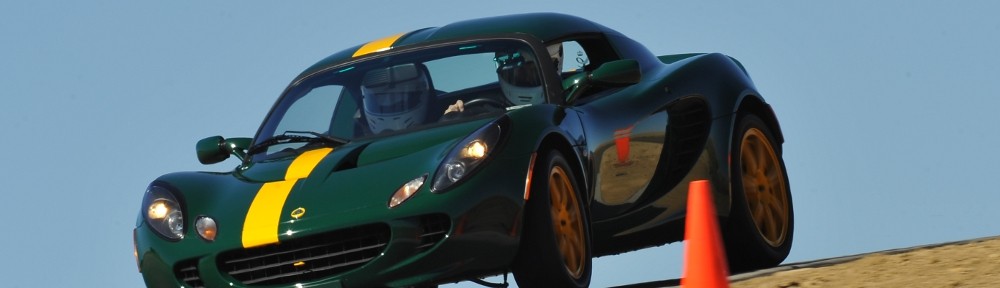
Although the hotel provides breakfast, nothing on offer particularly appealed to us so we decided we should head to town instead. We ate at Baker’s Bakery and Café, a little place with about ten tables and the tag line “you’ll love our buns”. After bacon, eggs, hash browns and toast we went back to the hotel for our usual drivers meeting. Today we would drive the Needles Highway and the Iron Mountain Road before visiting Mount Rushmore. Then we’d head to Sturgis for lunch and return to Custer through Deadwood and Hill City. I mounted the GoPro above the left rear wheel and we hit the road.
We headed north from Custer on Sylvan Lake Rd, SD 89. For the first few miles there are numerous houses and small ranches. One has a gate with big statues: a longhorn and a bison. He has a few dozen head of each. At Sylvan Lake we reach the junction with SD 87, through here known as the Needles Highway.
The road is quite narrow – no danger of getting stuck behind an RV here. There is no center stripe most of the way, and there are a couple of primitive narrow tunnels blasted through sheer granite walls. Mike was in the lead up to this point, but pulled over for the canyon carvers. We passed Mike and the others who wanted to take their rime but didn’t go as fast as many. We let two cars pass.
The highway is named for the granite needles that punctuate the terrain. Peter Norbeck (Governor and US Senator) plotted the route on horseback and foot and construction was completed in 1922. It cost so much at the time, locals called it the Needless Highway. The road has been well maintained but not significantly upgraded. Very nearly a one lane road, there are plenty of pullouts and overlooks.
SD 87 ends at a T-junction with US 16/16A. There’s a small parking lot there, and restrooms. We stopped there for a short break, completely filling the lot. The rangers from the Custer State Park entrance station walked over the hill and took some photos. While we were stopped, I remembered to power off the GoPro to save battery. I even remembered to turn it back on when we left.
A few miles up the road I happened to look in my left hand mirror to see the suction cup mount fail and the GoPro go flying off the car. I think it survived the initial impact intact. Colin was behind me in his new Evora and he managed to dodge it. After that I didn’t see what happened. I stopped and turned around as quickly as I could and made my way back to the “scene of the crime.”
The mount was in the middle of the road, the camera nowhere to be seen. John rolled up in his Elan and helped me search. I walked up and down the side of the road a few times, along the road and down by the stream. I found the battery and the back door of the camera, both more or less intact. But no sign of the camera or housing. I was afraid somebody ran it over, possibly damaging their car, but I asked around and nobody says they hit it. After the futile search, we figured we were now on our own, well behind the group.
Rolling again, we made our way to the Iron Mountain Road. We were a bit chagrined that the road is being resurfaced. The sixteen mile stretch we were on had had the surface ground, leaving a rough road with shallow holes and loose rocks and gravel. This road, like the Needles Highway, was laid out by Peter Norbeck and is also known as the Peter Norbeck Memorial Highway. He designed it as a scenic low speed route for tourists.
Like the N eedles Highway, most of it is narrow and twisty. It features a few “pigtail” bridges and one lane tunnels. A pigtail bridge is much like it sounds – the road crosses a bridge then turns 270 degrees to pass under the bridge just crossed. The tunnels, again, are one lane and hewn from solid granite. Two of the tunnels are aligned with Mount Rushmore and obstructing trees removed. One of the tunnels dumps you directly onto a pigtail bridge. At the second tunnel with a Rushmore view, I was out of the car lining up a picture when Terry rolled up in his M100. We weren’t last ones on the road after all.
This narrow, twisty portion of US 16A meets SD 244 and widens to four lanes. We went left at this intersection, taking 244 to Mount Rushmore. When we arrived at the entrance station to pay our fee, the ranger asked if we were from Colorado: “I sent the rest of your group to level 6. Follow the red arrows.” Our cars occupied about a third of the level, and, as usual, had drawn admirers.
 We last visited Mount Rushmore six years ago during a Clark family reunion. That time we came after dark to see the monument all lit up. This time we had daylight and scattered clouds. Lots of people visit Mount Rushmore and everybody tends to get the same picture, so I wanted to get away from the amphitheater. This turned out to be a good choice, as we weren’t allowed into the amphitheater because there was a high school graduation going on there. What a great place for a graduation ceremony.
 We hiked on the Presidential Trail. Luckily, we went to the right. The trail makes a loop from the Grand View Terrace, down the hill and up a boardwalk slightly up the slope below the carvings. We didn’t know that half the trail was closed and might have been discouraged had we gone the other way instead. The weather was still pleasant and we enjoyed the short walk. And I got the same pictures as everybody else.
Next on the agenda was a drive to Sturgis via the outskirts of Rapid City. The weather held out until a bit before we arrived there, when it got windy and rainy. We weren’t too impressed by Sturgis and broke off from the group here, perhaps hunt buffalo in Custer before going back to the hotel.
We ate at Taco Johns then headed to Deadwood. It rained the whole way, and the main drag through much of Deadwood is under construction, a muddy pot-holed mess. The place has been overrun by casinos. Everything historical in Blackhawk and Central City were pretty much destroyed by the construction of casinos in the name of historical preservation. Deadwood looks to have suffered the same fate. We don’t gamble, so we didn’t stop other than to refuel.
The weather cleared about half way to Hill City, which boded well for a trip through the park. The drive from Deadwood to Hill City is pleasant if not dramatic. It had the bonus of having very little traffic. I caught up to no cars for several miles, and if I had there were ample passing zones. Unfortunately, when I did catch traffic, the passing zones evaporated.
When we stopped to pay the entry fee the ranger said, “Your car is too short!” As it so happens, the park is a free today. The ranger recommended Wildlife Loop Road. This is the third narrow road we’ve driven today. Instead of granite tunnels and pigtail bridges, it’s eighteen miles of riparian areas and grassy hills.
Genae was ho ping we’d see the baby bison again. She was disappointed. All we saw were a few lone males. One guy was quite close to the road. When we stopped to watch them yesterday they were making a cacophony of grunts and belch-like rumbles. This lone one was quiet.
We came across a solitary pronghorn by a cattle guard. She posed for me a little bit, crossed the road, and scratched in the gravel a couple times. Then she proceeded to piss. In retrospect, I should have taken the picture. But, frankly, I was a bit offended!
 There was very little traffic. If somebody was stopped, that generally meant there was an animal in the vicinity. The biggest crowd we saw were stopped to take pictures of some donkeys . The asses didn’t appeal to us, so we skipped the photo opportunity.
Dinner was a group affair. We ate at the State Game Lodge, which made for a pleasant little drive. It’s about twelve miles from Custer, five or six miles into the park. It’s a great building, built in 1920. President Coolidge booked a two week visit but stayed for thirteen. The room we were in looked to be newer construction. I considered the Cobb salad (with hard boiled quail egg) or the bison steak but went with the buffalo burger instead.
Drove 250 miles