Fay Lakes

Sunday, September 6

I wanted to visit Fay Lakes last year. In October I got to the bridge over the Roaring River to find that it had been washed out in the previous year’s floods. There was a log that I could have used, but it was covered in frost. So I chickened out and went to Lawn Lake instead.

A couple weeks ago I asked the forum at ProTrails if the bridge has been replaced. It hasn’t, but one hiker said there was an easy crossing about 250 steps upstream. As it turns out, the water is low enough I was able to easily cross right where the bridge used to be. There are warning signs posted: “BRIDGE OUT – Flood Damage – River Crossing Not Recommended”. Hazards include risk of injury and drowning. Not so much in the first week of September – biggest risk is a wet foot.

Once past the Roaring River, the trail climbs to the crest of a ridge. There’s a section of forest here that fascinates me. I haven’t been anywhere else like it. The ground is covered with deadfall and dead pine needles, everything gray. I’d guess just about every place in the region has burned at least once in the last 500 years, but this one small area may have gone twice that long without.

Rewind a bit. I hit the trail a few minutes before 8. I had to park in the smaller lot at the base of the horse trail. I’m guessing I just missed the last spot in the main trailhead parking by a few minutes. Another hiker started at the same time I did. He was headed to Ypsilon Lake so we hiked together. We made good time, passing a few hikers before crossing the river and a few more just after. I neglected to get his name. He was visiting from northern Illinois. He makes a trip to RMNP every year about this time for bicycling and hiking.

We made it to Ypsilon Lake at about ten. I asked if he wanted to continue on to Fay Lakes with me, but he declined. I told him I thought we made great time; he said my pace challenged him a bit on the steeper parts. Based on how much bicycling he does, I’m not sure I challenged him all that much.

Foster says to “bushwhack northeast through dense forest” to Lower Fay Lake, but that it “is easier said than done.” Somebody has put a fair amount of effort into placing cairns along the route. Even so, it is challenging at times to follow. I lost it for a while on the way up but did manage it on the way down. The route climbs a shallow gully for a while; I regained the faint trail here and followed it to the lower lake.

Lower Fay Lake is pretty much what I expected. It’s small a small forest lake with no spectacular views. At this time of year the grass around it is dry, but is certainly quite marshy earlier in the season. The faint trail disappears entirely here; I didn’t see a single wildlife trail or cairn from here on.

Between the lower and middle lakes there is a section of dense forest that was some slow going. After that I reached the stream connecting the two lakes and followed it straight up. It got steep in one place and I had to scramble up a few rocks in one spot. I refilled my water here on the return trip.

Middle Fay Lake sits at the foot of Fairchild Mountain’s gentle southern slope. To the west, the easternmost buttress of Ypsilon Mtn thrusts itself into the sky at a jaunty angle above a grassy ramp. The summit of Fairchild is actually farther away than the summit of Ypsilon, but Ypsilon is much more dramatic.

From here, it’s a simple walk up the grassy ramp, about a quarter of a mile and two hundred feet of elevation, to reach Upper Fay Lake. I crossed the stream about half way up; the stream is so small now that it doesn’t take a long stride to do it. This puts me at the northeastern shore of the long and narrow lake. The water level in the lake is quite low, leaving a mosaic of vegetation and voids.

I found a nice picnic spot near the south eastern shore. After I ate I explored the area. There was a nice view of Fairchild and Middle Fay from the ridge behind me. To the southeast a grassy ramp rises and the map indicates that the other side is much like this one. Foster indicates a route directly back to Ypsilon this way. I considered going back that way but decided to retrace my steps.

After an hour I headed back. The walk from Upper to Middle is quite pleasant – grassy, with open views and easy walking. Most of the day is spent in the forest, with only glimpses of the peaks so I particularly enjoyed the dramatic vistas. There is no trail, but it’s easy to see where the big animals have been. Following the bent grass is like playing connect the dots with deposits of pellets.

The section between the Middle and Lower lakes is almost not so pleasant. It starts with the only part of the hike where I had to use my hands. I refilled the water bottle here, then negotiated a dense section of forest. I never had to deal with willow on this hike, but this section of forest was criss-crossed with maze of deadfall.

Approaching the Lower lake the terrain levels off and transitions to grass, and, finally, the marshy shores of the lake. This hike would be much different in July; much of my route would have been marshy or spongy. I wouldn’t call today dry, but there is little flowing or standing water and the lakes are low.

At the Lower lake I find the trail to Ypsilon. On the way out I managed to stay on the trail. There’s a stretch where the cairns are quite close together and yet sometimes challenging to follow. I both appreciate all the work that went into placing the cairns and wish they’d done more. I felt a nice little satisfaction when I got to Ypsilon Lake without losing the thread.

I took a fruit break at Ypsilon, chatted with a couple of hikers there. One saw my Fitbit; she was wearing one as well. Back at the river crossing I met a couple I had passed on the way up, not far from here. The crossing was giving her some consternation. I crossed the same way I did in the morning and he followed me. Until he couldn’t – “Your stride is just a couple inches longer than mine!”

They asked if I was the guy who hiked to Fay Lakes. They’d talked to my companion on the way up. They, David and Deborah, are from Cincinnati and spend a couple weeks in Estes Park every year. They’ve been doing it for eighteen years. They make sure to take a lot of walks in the weeks before their trip, so they’re prepared for hiking.

I was back to the car by 4:30. Traffic was horrible. Leaving Estes I wanted to get around a trailer (just because), but an SUV got in my way. If I’d have gotten around the trailer, I’d have been happier. The car holding everything up was in front of him. I’d have easily passed one slow car, but I had no chance being fourth in line. The slow guy never went the speed limit and was often twenty below it. Oblivious to the line of cars that stretched out of sight behind him, he never considered using one of the many slow-vehicle pull-outs.

LOG 35, Day 4

Monday, August 24

The printed schedule indicated an 8am start for track day, but this was incorrect. At the buffet last night, Ross made an announcement that we should be there at 7 instead. So it’s another early morning; I left the hotel before 6:30, stopped at the gas station to top off the tank, and headed south on I-25 to PPIR.

I was thinking I’d arrive just on time, thus being one of the later arrivals. To my surprise, the gate wasn’t open yet and we were queueing up in two lines. It didn’t take long to see that I was one of the earlier ones and we’d soon have people stacked up on the interstate. A few of us started directing traffic down the side road to a dirt lot. So much for the 7 o’clock start; the schedule would be shifted an hour.

After signing the track’s waiver at the gate, we stopped at another line before entering the track where we turned in our paperwork and picked up our numbers. I’ve done nearly 30 track days and this is the first one I’ve had to have a number.

I’ve only run laps at PPIR once before, with CECA. That time we were in the garages which was quite nice. Plenty of room to put our gear, out of the sun and wind. No garages today, though. After emptying the car and affixing our numbers and letters (I was A group, car 25) we went into the classroom for the drivers meeting.

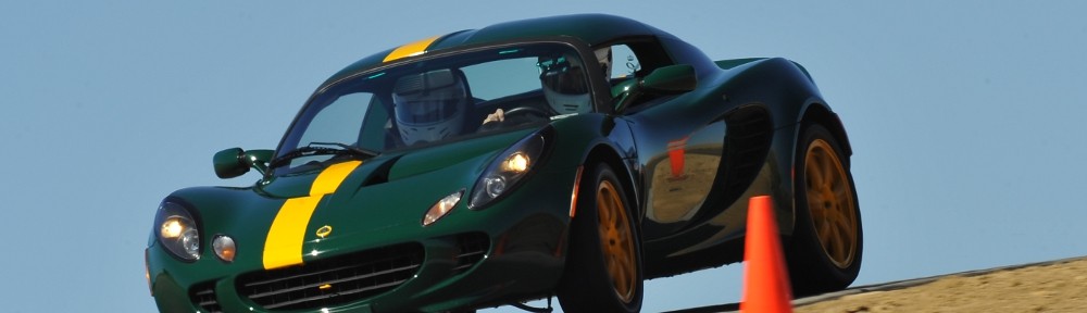
Usually they go over all the rules – which flags are in use (typically just yellow, red, and black) and tell us where we are allowed to pass. They did talk about flags but passing zones must have been discussed in yesterday’s meeting, which I missed due to being here at the autocross. No worries; I’ve been here before and know the drill. I did get some good news and some bad news. The good news was that I didn’t have to have an instructor with me, not even for the first session. The bad news, I had to keep the soft top on. So the camera got mounted on the harness bar rather than top center where I have the new adhesive mount. I later found out I wasn’t allowed to take a passenger.

I didn’t count the A group cars. There were perhaps a dozen for the first session. Greg in his formula car, a couple Esprits, a couple Evoras, a couple Exiges, me and few others. We were the first group to run, so I was in a bit of a hurry after the meeting. This is when I found out that after upgrading my phone, I needed to sign on to my RaceChrono account in order to get lap times and OBD data. Unfortunately, I was unable to remember my password, so no data acquisition today. Oh well.

This was my first track day since I started wearing the Fitbit. I was curious how much I really work in the car. But I didn’t think of turning it on until the third run, and then I forgot to turn it off for a half hour. Maybe next time I’ll do better.

Today wasn’t really a track day – it officially was a driving school. That’s why I couldn’t take a passenger – only instructors were allowed passengers. Much as our autocross was run by SCCA, the driving school was run with the aid of the Mercedes Benz club. I’ve never run with them; because we were using their insurance we weren’t allowed to go topless unless we had arm restraints. This has never been the case for me before.

IMG_1473sBecause this was a driving school, I was a bit surprised to see nobody had put cones out on the course. Usually the organizers place cones at the apex of each turn at a minimum, plus turn in and run out. I assume they got the cones out after our first session as they were there next time. In any event, I had my line figured out after a few laps.

This is not my favorite track. No, that’s not true. It’s my least favorite track. We run on about three quarters of the speedway plus the small infield section. The road course section of most ovals takes up the majority of the infield. Here at PPIR, more than half the infield is taken by parking lots, garages, and other buildings. With so little room for the road section it’s a bit rinky-dink. And, of course, I’m not going to push very hard on the speedway section – a mistake here and you’re in the wall. All other tracks I’ve been on have plenty of room if you go off – there’s nothing to hit unless you really screw up.

IMG_1475sMost of the cars in my group were faster. I passed a yellow Esprit several times, and a blue Evora. But because we were not a large group, I only had to wave by faster cars a few times. In the second session, just as I was catching the yellow Esprit, Greg caught me in his formula car. The yellow Esprit waved him by, then waved me by. By the time I completed my pass, we were well into the turn on the speedway. A few corners later I was shown the black flag. Oops, I should have waited to pass him. I think I was the only driver given the black flag all day.

Between sessions I visited with a number of people. Most track days, I know many of the people from other events – the local track rats. Today I had the opportunity to socialize with folks from all over, including a couple from Ottawa. They had flown in, so weren’t participating; he said he enjoyed running at Loudon, New Hampshire. They solve their small infield problem by running a road section outside the oval.

I only ran three sessions. I normally have an extra five gallons of gas but didn’t bring the can with me on this trip. I normally try to run as many laps as I can – get my money’s worth. But missing a session here didn’t bother me that much. I was all packed up and on the road by 3:30 and home by 5:30. I’d almost forgotten how much fun rush hour traffic can be. I’m spoiled by working at home.

I couldn’t check out the Fitbit data until after I got home. I always knew I was working hard in the car – I’m often breathing pretty hard, and your basic rule of thumb is four heartbeats per breath – but I had no real sense of how hard. The Fitbit tells me I was in peak zone for three minutes and the cardio zone for fourteen. Total that’s a bit over half the time. When I wasn’t in the cardio zone my heart rate was still above 100 much of the time. So a half hour running laps in the car is not quite as strenuous as hiking for a half hour.

LOG 35, Day 3

Sunday, August 23

Our first event of the day is the group drive to the summit of Pikes Peak. We had arranged with the city (the Pikes Peak road is operated by Colorado Springs) to be on the mountain before anybody else, so that meant another early rise. We left the hotel at 6:30 in a giant caravan to the North Pole parking lot where we lined up and waited for the Rangers to give us our passes. We pretty much filled their lot. Rangers passed out brochures – these were our tickets in. They did this instead of putting stickers on everybody’s windshield.

IMG_1463s

We passed the dozen or so folks lined up at the gate. It was pretty well known that we wouldn’t be staying within the speed limit, but we were told not to go crazy – if we overstepped we would be shut down. I later learned Clive Chapman led the charge. We were nowhere near the front of the line, but it was certainly the fastest I’ve ever made it to the top.

We got there 40 minutes before the store opened. It was cold and a bit windy and several folks really wanted to use the restrooms but we had to be patient. When they finally opened, the clerks said they weren’t warned so many people would be there; they were overwhelmed. It’s always cold and windy on top of 14ers, so the weather wasn’t unexpected. The smoke was bad again, but not too bad, and we were above it.

IMG_1465_stitch_crop_resize

I assume most people headed out on one of the three scenic drives. We did our drive to Cripple Creek yesterday because I had autocross in the afternoon. Genae isn’t at all interested in standing around in a parking lot for three or four hours so she went to the Cheyenne Mountain Zoo. I headed to PPIR.

We were on the schedule for 2pm. I’d been telling people it would be more like 3 or 3:30 but there was no general announcement. I wish I’d been able to get more people signed up the evening before. It was kind of hectic – I had forms and numbers and a notebook but no where to spread out. The wind was blowing, so everything had to be in the passenger seat of the car. At first I was able to deal with the entrants one by one but before long they were arriving two and three at a time, I eventually had everybody’s forms and had assigned a class and number.

The SCCA guys were great. We had a short meeting then set off to walk the course. Before the cars were let loose, Bill and Jon set the “slow” times in their wheelchairs. I’m pretty sure Bill has done this before – he had a more favorable final drive ratio or better charge in his batteries or both. Skip ran in his Baby 7, a one-third scale Lotus 7 go-kart. Eric and Kelly Dean not only had their Lotus but entered their Tesla as well.

I was working a corner for the first group. Second group was Elise and Exige, first group was everybody else. Nobody ever hit a cone in our sector, but we had several people DNF. The most fun was trying to get Skip to complete the course. The first time, he cut about a quarter of the course off. Each time after that I tried to point him in the right direction.

SCCA said we’d get four runs, I asked for 5 if we could be finished by six. In any event, we’d all miss the track day drivers meeting that somehow got scheduled for 5pm. We did get five runs and were done a few minutes before six so nobody would be late for the Mexican buffet that started at seven back at the hotel.

This was my second autocross. I had four different passengers on my five runs, going out solo only once. My first time was a 58 and I got better each run until the last, when I got sideways. Had I kept it straight, it would have been my fastest run. I’ll admit to being pleased that I was setting pretty good times. At my first autocross, I was about mid-pack among the rookies but only at the top end of the bottom quartile of all competitors. Today, most of our group were rookies or hadn’t done autocross often or recently.

Everybody seemed to have a good time, so I think it was a successful event. I hung around for a few extra minutes to collect the results, which Cynthia and Terry volunteered to collate.

I was back to the hotel just in time to stand in line for the Mexican buffet. After we ate, Ross made some announcements, then I got up and presented the results. People were very gracious and applauded everybody, even me when I said I’d gotten second in the Elise NA class. We all collected our trophies and sat down to watch Ross do a Tonight Show with Johnny Carson routine to chat with the evening’s guests – Clive Chapman, Arnie Johnson, and Dave Bean.

IMG_1476sUnfortunately, I missed much of what was said. Just after it got underway I realized our results didn’t include Phil. He’d been running autocross with SCCA all day, so he already had done his paperwork and gotten a number. I didn’t put him on our entry list, so I never got his results. Turns out he was second in our class, so I gave him my trophy. I felt I couldn’t take the third place trophy from the guy we announced, so Tatiana and Jeremy gave me the 2nd place autocross for the race prepped car class. There were no entrants in that class.

It’s a pretty cool trophy, even if it’s not exactly what I won. Tatiana and Jeremy did a fantastic job making these; it’s a pretty neat little memento.

LOG 35, Day 2

Saturday, August 22

The first event on the docket for Saturday was the panorama photo. We arranged a location with a view of Garden of the Gods and Pikes Peak. We first time LOG attendees were told that quite a few people want to arrive at the photo location early so they could get a prominent spot up front. So we volunteers had to arrive early; we were to direct people onto the lawn and get them lined up in good order. So I was up before six even though the photo wouldn’t actually happen until 9:30.

I didn’t count but we had something like a dozen folks directing traffic, starting in the street, winding through the parking lot, over the sidewalk, onto the lawn, then around in a large arc to get people lined up in concentric semicircles. Some had asked if we were going to try to arrange the cars by model or to abide by the “Ross Rule” – adjacent cars can’t be the same color. Attempting either of these would be futile and time consuming. Our task was simply to get them lined up.

IMG_1436sVolunteering for this task had two nice side effects. First, I got a spot in the front of the photo. Second, and perhaps more interesting, I got a good look at every car as it came in and was able to chat with many of the owners. I never did see an official car count but there were something like 130+ cars there. Of course, I’d seen the cars in the hotel parking lot but generally the owners weren’t there.

Of note, there’s a rare Autumn Gold car with Colorado plates. Only eight of that color were imported to the USA. One was totaled and another went to Norway. I wondered how we had a local car like that and I’d never seen it before but somebody told me he’s from Pagosa Springs, so he’s not really local. Another interesting and rare color was Ice White. I’d never seen one before and asked if it was a custom color. No, just rare. A couple from California have an Isotope Green Elise. It wasn’t the only IG car there, but it was the only IG car with matching fuzzy dice and beanies.

The weather couldn’t have been much better – the morning was cloudless and clear of smoke.

IMG_1429_stitch_crop_resizeOnce we got everybody situated, we just had to wait until the sun was high enough to chase the shadows of all the cars. This allowed plenty of opportunity for folks to take pictures. Some put in more than the usual amount of effort – one guy brought out a drone. We take two pictures – one with people standing by their cars, one without. Each photo is comprised of about eight shots. I ordered a copy of the one with people.

After the shoot we headed back to the hotel. The rest of the morning was a Concours. Two, really – the judged one and the people’s choice. We didn’t enter the judged one, it’s more for the classic cars anyway. And we had no chance of winning the people’s choice for two reasons – first, there were a hulluva lot of great looking cars and second, we weren’t there. Most folks would be doing the road trips after Pikes Peak. I was doing autocross, though, so now was the time to do it.

First I had to try to resolve a dilemma. I was signed up for the track day but because I was out of town all week I didn’t have a chance to get the car inspected. BOE Engineering was a sponsor and had a large presence. So I went to their trailer and asked if they’d be kind enough to take care of it. The guy I talked to said I should return at 3 and they’d take car of me.

Three drives had been mapped out – a short one, a medium one, and a long one. Because we had to be back by three, we had little choice but the short one. Which worked out fine, as that was to Cripple Creek. I’ve lived in Colorado for more than forty years but have never been there. Genae’s never been there either.

US highway 24 headed west from I-25 is always crowded. On a summer weekend, it’s your basic stop-and-go bumper-to-bumper slog.ย  It started loosening up once we passed the turnoff for Pikes Peak, tomorrow morning’s destination. Before long we were in Woodland Park. I’m pretty sure I’ve never been west of Woodland Park on US 24 before.

At Divide, we make a left turn to head south on CO 67. The road was bumpy and crowded but scenic. I say “crowded” but it wasn’t too bad. There were no long strings of cars, and we were even able to pass a few slow ones. It’s a very scenic drive. The route we took had us loop back to US 24 via Teller County Road 1. It carries less traffic and was quite pleasant.

We’d like to go back explore more of the region. The town itself is no longer interesting to us. When limited stakes gambling was first allowed, one of the big selling points was that the revenue would be means for historical preservation. I view it along the lines of the Vietnam war: “we had to destroy the village to save it”. I have no basis of comparison for Cripple Creek, but huge swaths of old buildings were removed and replaced by casinos in Black Hawk and Central City.

We stopped for a bite at Arby’s in Woodland Park and in spite of two navigational errors were back to the hotel a few minutes before three. I went over to the BOE trailer but the guy I had talked to earlier wasn’t there. The BOE guys said I should talk to the Concours Auto guy next door. He said I could show up at their shop Monday morning and get my inspection. Clearly, he wasn’t tuned in to the fact that track day was Monday. I thought I had him talked into doing one there in the parking lot but he decided not to. He said his liability insurance wouldn’t cover him if he did the inspection away from his shop. Does them doing an inspection actually imply liability? I don’t think so, but whatever.

So I went back and cornered one of the BOE guys. He and his colleagues closed up their trailer, then they abandoned him with me. I told him I’ve been throwing lean codes with the new intake. He told me a tune would run me eight hundred bucks. I think I’ll pass on that and just put the stock airbox backย  on. He also suggested I replace the bullet studs the previous owner installed and use the ones I have on the left rear. I will take that under advisement. He was very friendly and helpful.

Saturday evening was the big banquet. Genae had talked to Ann about the dress code so I planned to get all dressed up. My maximum is a sport coat and a tie. I think it’s the second time I’ve worn a tie in six or seven years.

The banquet starts at seven, with a social hour prelude. Instead of being social, I needed to get set up at a table and try to register my autocross attendees. We gave no notice we were doing this, and I didn’t even get a table until the last minute. Ross told me to share the table with the panorama photographer. He needed the whole table. The other table already there was for Bobby Unser to sign autographs. Finally the banquet staff brought me a table.

I needed to get each entrant to fill out SCCA’s weekend membership form and assign them a class and number. I had printed a bunch of numbers to be taped on the cars. I had a dozen of each digit. So I spread all this out on my table. It was funny watching people trying to figure out what I was selling. Something like 35 people had signed up for autocross but I only managed to get a dozen taken care of.

Not long after I got set up, Bobby Unser and his wife arrived and sat at the table to my left, signing autographs. He had a line of five or six people at one point, but generally there were only ever one or two people at his table. A woman approached me and said, “I understand you’re signing autographs.” I’ve either been mistaken for an 81 year old man or somebody was looking to get an autograph of somebody they know nothing about. I point to Unser and tell her, “You probably want him, but I’d be happy to give you my autograph.”

Later I made the same joke with another woman. She said, “You’re very attractive and all, but…” just as Genae walks up. “She was flirting with you.”

At seven I packed up my numbers and forms and headed to our table. Genae had the beef, I had the chicken. We’d been carrying the dinner coupons on the back of our name tags. Chicken was on yellow paper, salmon on pink, beef on red. When my name tag was showing the wrong side out, it identified me as “Chicken”. After we ate, Bobby Unser got up on stage and told stories of Pikes Peak and Indy, then answered questions. He’s a fairly entertaining fellow.

One question was, “How did the deaths of other drivers affect him?” He says he never feared death, and, as bad as it might sound, was indifferent to the deaths of his competitors. He had to be. He was injured many times; spent a lot of “sheet time” (time in the hospital). He now has difficulty walking and can’t stand for any amount of time.

Festivities wrapped up at ten to end a full day of LOG.

LOG 35, Day 1

Last weekend was LOG 35. What’s that, you say?

Lotus Ltd is the national Lotus owners club. Every year they have a national meet – the Lotus Owners Gathering, or LOG. This year is LOG 35. People come from all over the country, some driving their classic cars, others flying in. Activities include a concours d’ elegance, banquets, and scenic drives. There’s always a panoramic group picture of the cars. There may be a track day or an autocross as well.

IMG_1397s

Elite

Lotus Ltd handles various administrative tasks, but the majority of the work is done by volunteers, usually members of the local chapter that is hosting the event. This year Lotus Colorado hosted it in Colorado Springs.

These are major events. We basically took over a Marriott hotel and overflowed to another hotel nearby. We used all the hotel’s conference space – ballrooms, meeting rooms, a tent pavilion outside, and, obviously, the parking lot. We had a store on the premises. They even let us take down all the art they had in the common areas and display our own. The portrait of JW Marriott himself was about the only thing of theirs we left up.

To make one of these work, pretty much everybody in the club has to contribute. I volunteered (or was selected, it’s all a bit fuzzy) to be the autocross event chair. I think I had the easiest of the jobs. On the more difficult side you had people working with the hotel, obtaining sponsors, finding guest speakers, making trophies, making signs, running the concours, running the drivers school, and the list goes on.

As I said, I had one of the easier jobs. SCCA actually put on our event, all I had to do was liaise with them and make sure the entrants filled out the right paperwork. That said, when I took on the task I had never even attended an autocross.

I knew that an autocross is a competitive, timed event. A course is laid out on a parking lot using traffic cones. Cars run the course one at a time. Competitors are divided into classes based on size, horsepower, tires, and other factors. That was about all I knew. I fixed that by attending my first autocross back in March.

So that’s the background.

Friday, August 21

Let’s actually start Thursday evening. I flew in from Albuquerque, arriving at about seven. I didn’t have a window seat (I prefer the aisle) and the guy next to me kept the blind closed for the entire flight. I was surprised, then, to find that smoke from the wildfires in California and the Pacific northwest filled the air. Visibility was only about five miles and the sun was a dull red disk. When I got home, I pulled the dirty clothes out of the suitcase and repacked it with clean.

IMG_1417s

S1 Elise

Friday morning Michael and I mounted the track tires on the car as I was doing both the autocross and the track day. I needed to wash the car as well, but there wasn’t time for that. The track wheels were clean, though, which went a long way to making the car presentable. When I backed the car out of the driveway the tires were rubbing something awful. Somehow we’d managed to mount the left rear wheel on the front. I’ll blame Michael, but it was silly of me not to see it right away. That remedied, I ran off to the barber to get myself presentable.

We packed all our stuff in Genae’s car. We had far too much to carry in the Lotus, but the real reason to take two cars was so she wouldn’t be stranded. I left the house a few minutes before she did. I mentioned to her that I’d avoid the interstate but didn’t think to mention how much longer my route might take. I w

ent through Sedalia and Palmer Lake; a much more scenic and relaxed drive than I-25.

By the time I got to the hotel, Genae had checked us in to our room. We made two or three trips carrying stuff from the car and when that was done we registered for LOG. It’s much like registering for a conference – go from table to table, signing forms, collecting a goody bag, getting a name tag. We even got signs for the parking lot so we’d be in the same spot all weekend.

IMG_1414s

Westfield Eleven

We arranged to have people park by type of car. To get into Lotus parking you had to do the “Lotus limbo” – drive under a horizontal pole. This kept the riffraff out. The more rare classic cars were closer to the festivities, the newest and most common cars (Elises, natch) were the farthest away. Conveniently, though, the car wash we set up was in our area so I took advantage and had her bathed – she was cleaner than she’d been for two years.

Genae is a big fan of Godfathers Pizza. They make a taco pizza that’s her favorite. We’ve tried making them at home but haven’t come close. A bit of research told her there was a Godfathers on the Air Force Academy, so after the car was washed we headed that way.

Civilians and visitors have to use the north entrance. It used to be that you could just drive in, but now I’m guessing its SOP to stop every vehicle. When we pulled up we were about eighth in line. Some got waved right through, some took a bit longer. When we pulled up, the sentry asked for my ID and I gave it to him. He also said “I’m gonna have to ask you to pop the trunk.”

There’s no “popping the trunk”. I shut it off, got out, opened the boot. Nobody else had to open their trunk. “What’s a car like this cost?”

IMG_1404s

Europas

Our GPS wanted us to take Parade Loop, but a sign indicated it was closed. I asked the sentry how to get to Godfathers and he said just to stay on this road. So we did. The road took us around the north side of the campus complex, past the practice fields and to a guest parking lot. No restaurant in sight.

The next turn on the road revealed the visitor center, so we stopped in there and asked for directions. “Drive your vehicle to the guest lot. There’s a glass front building there, that’s where you’re going.” These are not the best directions: all the buildings are glass front. Genae phoned Godfathers for about the fourth time and was told they were in Arnold Hall. (This, presumably, is named for General Hap Arnold, Chief of the Army Air Forces in WW II.)

We joked that this pizza better be worth all the effort it took to get here. The restaurant is part of a small food court along with a Subway and a wings place. It’s now the last Godfathers in Colorado.

The evening was spent socializing – drinks in the hotel bar, wandering around the parking lot seeing who drove which car from where, and then dinner in the pavilion. We had our choice of turkey or roast beef followed by a choice of desserts. After dark we even had a short laser light show back in the pavilion followed by announcements of the next days activities and schedule.

IMG_1401s

Elans

Half Mtn Glacier Knob

It’s been a busy couple weeks. LOG 35 ended four days of activities yesterday with the driving school. Prior to that I was in Albuquerque on business. The day before I flew down there I hiked in the Park. Ten days, and this is my first opportunity to make a few notes and glance at the photos.

Saturday, August 15

I asked Ed if he wanted to take me to the top of the glacier knob attached to Half Mtn. This is knob #10 by his reckoning, He visited the top of all ten in one day a few years ago. This is my 4th, all with Ed’s guidance.

HalfMtnKnobMap

Our route: Up in red, down in blue

I left the house before six, picked up Ed by six thirty; we were through the Park gates before they were manned and to Bear Lake parking lot by 7:30. The lot was already three quarters full. It was another beautiful summer day in the Park – bright sunshine and a brilliant blue cloudless sky.

Ed had us off the trail and into the forest at his usual spot and visiting two officially unnamed ponds, “Zone Lake” and “Joyce’s Pond”. After crossing the main trail we had to cross Glacier Creek, which is fairly substantial here. We looked around for a few minutes before deciding to ford it. The water was cold and the rocks were slippery but it was an uneventful crossing. Once across we worked our way east to the base of a steep gully and to the bank of a small pond.

The base of the gully is a cone of talus. We took a short break at the top of the cone, where the route gets much steeper. Here we’re about two hundred feet above the valley floor and have a nice vista to the north. From here to nearly the top of the knob it’s a steep climb culminated with a scramble through a tunnel. We were on top of the knob by ten thirty.

IMG_9739s

East Glacier Knob on the left and the Mummy Range in the distance

I often say there are two kinds of hikes: those to summits and those to lakes. On summits, the views are incredible but everything is miles away. At most lakes in the Park, the scenery is dramatic, and up close. These knobs are a sort of hybrid – wide vistas but not miles from away.

IMG_9743_stitch_crop_resize

Glacier Gorge

We relaxed until noon or so before heading down the western slope. It’s a series of shelves. Navigation is generally a matter of finding the ramps from one to the next; ramps which are sometimes clogged with obstacles. After another short break at Mills Lake, we kept to the trail as far as Glacier Gorge junction, where we cut through the woods.

It was a nice hike. I’ll definitely do it again. Rather than make the steep climb, I’d take the trail to Mills Lake and go up the way we came down. I could be to the summit in half the time, trading variety for speed. But that would let me sit up there for three or four hours if I wanted.


Cony Lake, Attempt #3

Saturday, August 8

Cony Lake sits lies at the upper end of the Cony Creek drainage, south of Mount Copeland at the southern edge of the Park. Starting at the Finch Lake trailhead, it’s a 9.2 mile hike climbing over 3,000 feet. If you start at the Allenspark trailhead instead, you save a mile each way and five hundred feet of elevation.

Two years ago I made it as far as Pear Lake. I took a break there to eat some fruit. After the break I hiked up the bench to the south where I came across a pond. Here I realized I’d abandoned the camera at Pear Lake, so I had to turn around. It was just as well – clouds rolled in from the east, just feet above the lake. Last year I got as far as Upper Hutcheson Lake. I struggled through a mass of willow only to see snow covered slopes on the other side of the lake. Between my lack of spikes in mid-July and losing time in the willow, it was an easy decision to stop there.

Third time’s a charm, right? Saving eleven percent of the distance and fifteen percent of the climb will make it easier. I’m going nearly a month later in the season this time, and I have a better idea of the lay of the land. I felt good about my prospects.

We’ve been having hot, clear weather lately but Saturday’s weather forecast degraded every day all week. It would be cool with a good chance for rain. I hit the road at 5:30, planning to be on the trail by 7:00. Low clouds obscured all the peaks. Meeker, Longs, and Pagoda were mostly clear, but everything to the south was in a layer of clouds with a ceiling not far above treeline. Above that, blue skies to the west and a layer of high clouds to the east.

IMG_8642sThis was my first visit to the Allenspark trailhead. I couldn’t see the parking lot on the satellite images, so I wasn’t sure if I’d be able to park. It’s a bit over a mile up a dirt road and if I couldn’t park there I’d have to use the Finch Lake trailhead. There’s room for a dozen cars in the trees, but the entrance has a giant rut. I pondered for a second and gave it a try. It was sketchy, but I made it in without scraping bottom.

I was on schedule: on the trail promptly at seven. Another solo hiker arrived in the parking lot after me; he passed me on the trail before I’d done a mile. I asked him where he was headed. He said “Pear for sure, maybe a bit farther.” I told him I was headed to Cony. He said perhaps we’d see each other again, but he was moving at a much quicker pace than I was managing.

From the trailhead to the Finch Lake trail junction just below the Ouzel burn scar is 1.8 miles. It’s been nearly forty years since the fire. It’s no longer an area of dead sentinels and wildflowers. The new trees are getting bigger, but it’s not forest yet so the spectacular view is relatively unobscured.

There were very few other hikers. In the six miles to Pear Lake, I ran into eight or ten folks hiking out and a few more who were still at the Pear Creek campsite. I did catch up to the other hiker, Jason, between Finch and Pear. He put the afterburners on after his break and he was quickly out of sight.

A cacophony of wildflowers

A cacophony of wildflowers

Foster says, at Pear Lake “follow the unimproved but recognizable trail”. The first time I tried Cony, I went on the other side of the lake. The second, I followed the trail along the shore until it faded out, then headed up. I was thinking this was the unimproved but recognizable trail. I found out on the way back that I wasn’t even close. Anyway, I’d been here before so it was no trouble to find Lower Hutcheson Lake.

According to Foster’s map, the route is to cross Cony Creek just above the lower lake, then recross at the outlet of the middle lake. The crossing at the lower lake was easy – the stream has split into two narrower channels. Up slope a ways I found myself blocked by krummholz and willow. After squeezing through one gap I noticed my water bottle was missing. It must have fallen out right here.

But no. A thoIMG_9691srough search yielded nothing. Clearly, I lost it earlier. I made my way back down, not exactly sure how I’d come up. I think I was backtracking correctly, but did I go on this side of this clump of bushes, or that side? Shortly before I was back to where I crossed the second portion of the creek I saw Jason on the opposite hillside. I hollered at him to hold up.

I made my way over to him, told him I’d lost my water. I’d have to turn back with no water. He kindly gave me a liter of water. He was going to keep going for a while so I got out my map for us to consult. I have it marked with Foster’s route. I told him I’d look for my water bottle a little while longer before giving up. I found it almost immediately, sitting on the bank of the creek.

Following Foster’s route we found ourselves back where was when I realized I’d lost my water. It didn’t take long for us to decide to switch back to the north side of the creek. A couple minutes after crossing we found a nice trail. This dumped us on to a series of rock slabs. We were able to follow a few cairns, but that was it. From here, it’s a good idea to climb upslope a bit to avoid the krummholz and willow. Above the middle lake, Jason called it quits. He’d told his wive he’d be back at a specific time, and this was all the farther he could go.

FeatherI had no fun in the willow along the north shore of Upper Hutcheson last year, so I decided I’d stay higher up on the slope and avoid it. Foster’s route was on the south shore, but her route below was wrong and I no longer trusted it. So off I went, climbing slowly but steadily up the slope of Mount Copeland as I worked my way west. It didn’t take long to realize I still had quite a way to climb to avoid the krummholz. I paused to assessed the situation.

The north shore is a longer route than the south shore, as I’d need to go south to get to Cony. There was much less willow on the south; it looked like I could go right along the water and avoid it. If I went straight downslope where I was, it was a pretty easy route. The willow weren’t too thick there.

On the south shore, at this time of year with the water low, it looked like I could hop across the rocks right at the waters edge and avoid the bushes. It almost worked – I made it quite a distance but right at the end the rocks were too far apart, and the water had gone from a few inches deep to well over boot height. So, another short backtrack.

I finally find myself at the south western end of Upper Hutcheson Lake, just a few tenths of a mile away, at the top of a four hundred feet climb. I find myself at the base of a vast sea of willow. I either have to backtrack to go over the outcropping on my left or wade through the willow. It’s 11:30. I clearly won’t make Cony by noon. The sky is blue to the west, but some of the clouds to the east might drop some rain. I decide to abort the assault on Cony Lake and have my picnic here.

I haven’t replaced the tripod yet, but I did remember to bring the shutter timer this time. I found a nice rock to use as a base and set the camera. I faced a bit of a dilemma. To the west,ย  small clouds were coming over the divide then boiling away but the foreground not interesting. To the east the clouds were higher and slower moving and the lake is in the foreground, Too bad I only had the one camera.

It was cool and windy. I was in sunlight for the most part but had little shelter from the wind. I sat in the lee of a small boulder and ate while the camera clicked away. After a short while I realized I didn’t hear the camera shutter. Was I too far, was the wind blowing the sound away from me? No, the camera had stopped with “Err 99”. I’ve had this happen occasionally. Just turn it off and back on and it’s cleared. It ran only for a few more minutes before getting the error again.

After restarting it the second time, I started to have second thoughts as to what I should be shooting. I let it run a while longer before switching it to the west. Then, of course, those clouds seemed to be going away. Have I made a mistake? Ah, well. You never know what you’re going to get.

IMG_9684sTaking an hour break gives you a lot of time to take in the surroundings. It was windy and the nearby willows not so much rustled as hissed, at times almost loud enough to drown out the sound of falling water. I wasn’t hearing the inlet in the willows but a waterfall on the canyon wall two hundred feet up. There was quite a bit of water coming down but the talus twenty feet below the bottom of the falls was dry. From the looks of it, it’s always dry, even in max flow.

The windbreaker was beginning to feel inadequate after an hour of lounging. It was time to pack up and get moving again. My next navigational problem was getting back to the other side of the creek. I wanted to avoid the willow as much as possible. Perhaps Foster’s route here on the south side was correct after all. Being above the landscape gives a much different perspective on things than being in the landscape, looking up.

There’s a small pond below the upper lake. With water levels so low, it’s easy to skirt the southern shore to a nice crossing to a grassy slope on the other side. Easy, peasy.

It was here that I started to reflect on the day so far. I lost my water bottle and had to backtrack to retrieve it. I made a few navigational errors and I didn’t achieve my objective. Instead, I sat at the edge of a beautiful alpine lake for an hour and watched the world go by. Okay, the camera futzed out a couple of times. But all in all, there’s nothing to complain about. It’s just another beautiful day in the neighborhood.

Above Pear Lake I managed to stumble upon the trail Foster mentions. It’s quite well defined here and going is easy. I soon see Pear Lake below me – I’m well above the shore. And yet the trail refuses to descend. How can this trail not go down to the lake? I cut cross-country. About halfway from the trail to the shore I come across a nice outcropping of rocks with a view and decide it’s time to take a break.

It’s peach season. Lots of people think of Georgia when they think of peaches, but I think the best peaches are grown on the western slope of Colorado. I have one of these Palisades peaches with me. This particular example is top rate: perfectly ripe and perfectly juicy; sweet and full of flavor. I always say food tastes better at alpine lakes, but this peach would be one of the finest peaches ever, even in my kitchen.

So I’m luxuriating in this wonderful peach, enjoying the now clear and brilliant blue skies above. What could be better than this? As I’m eating the peach, I spot an eagle soaring over the lake, fishing. She circled a few times then dove. The water erupted in a big splash and momentarily she arose, the silver of a fish clearly evident in her claws. Then she made a couple of wide circles above the lake, as if to show off her kill, before heading to the trees on the other side.

Bear left for Hutcheson

Bear left for Hutcheson

Break over, I got back on the move. There’s a hitching post where the trail arrives at the lake. It’s here that you get the trail to Hutcheson Lakes. This is the trail I was just on. I walked right by it at least twice without figuring it out.

My next stop was the stream crossing at the Pear Creek campsite. I needed to replenish the water supply. Not ten steps on the other side of the creek I stumbled over a rock on the trail. I do this countless times each hike; it’s never a big deal, I never lose my balance. This time I “went over the handlebars” as Michael might say. My left foot slipped, I went down on my left knee and put my hands out to stop my fall. My left hand slipped as well and I ended up on my elbow. This resulted in an ugly abrasion on my left forearm.

It stung, and it was bloody. At least the stream was right there. I had it washed off in no time and used one of my paper towels to stanch the flow. I basically lost the skin along the bony part of the forearm – five or six inches long and a quarter inch wide. I took a couple of ibuprofen and was back under locomotion ten minutes later.

Most of the day I’d been shrugging off all the minor mishaps – I was having a great time in spite of losing my water bottle, the camera acting flaky, minor navigational issues. I’m in a beautiful place and it’s hard not to enjoy it. But the gods wanted to test my limits and had that rock grab my toe.

Chief's Head and Pagoda

Chief’s Head and Pagoda. From left to right, see the chief’s forehead, nose, and chin. Pagoda would be his pointy bra.

I was back to the car by 5:20. Turns out there are two entrances to the parking lot; the southern one lacks obstacles and I was out without any additional drama. Even though it was nice and sunny, it wasn’t hot so I headed down the road topless. Traffic wasn’t bad and it was a pleasant drive home.

Lake Nanita

Friday, July 17

This hike has been on my list for three years. I decided this spring that I would finally go there. I’ve been psyching myself up for this one for about two weeks. This would be the longest hike I’ve ever attempted – 11.1 miles each way according to Foster. I’m struggling to come up with the right words to describe my feelings. I wasn’t exactly anxious (as in filled with anxiety). Intimidated isn’t the right word either.

I hiked a portion of the North Inlet trail a few years ago when I visited Bench Lake. You go nearly seven miles up that trail to Ptarmigan Creek before heading straight up the slope. Those first seven miles are fairly mellow – you gain only about a thousand feet of elevation. The last few miles to Lakes Nokoni and Nanita are steeper, but the net climb for the eleven miles is only about 2400′.

So even though it’s quite a long hike I expected to be able to make good time. My plan was to arrive at the trailhead by seven and I guessed I could make it to Nanita in five hours. Allow an hour of lounging at the lakes and I should be back to the car by six. The drive to the trailhead is a bit over two hours (I-70 and Berthoud Pass) and the trip home another two and a half hours (over Trail Ridge Road) and it would be a very full day – leave the house before five and return at eight thirty. That was the plan, anyway.

I was out the door at 4:30. Traffic was very light and I made good time, jetting over Berthoud Pass. The sun was beginning to light the sky; the mountains to the north were still in silhouette but the wispy banners of clouds above them were lit pink and periwinkle. It was still fairly chilly and I had the heater on. The Fraser valley was blanketed with a layer of ground fog.

I made the trailhead by 6:30 and was on the trail at 6:40. It was cool enough I could have worn a light jacket but I expected to work into a lather fairly quickly. The first mile or so is more a dirt road than a trail – this provides access to a private cabin that’s on Park land. I started working the math in my head. If I manage the first three miles in an hour (a very quick pace for hiking), I would only need to average two miles an hour for the rest of the hike to maintain my schedule. I couldn’t help but recall than I failed to maintain that rate on my last three hikes.

I passed Cascade Falls in exactly an hour, and was at Big Pool in ninety minutes. I was thinking that Big Pool was five miles in, but that couldn’t be right. That would mean I was averaging well over three miles per hour. (Big Pool is 4.8 miles from the trailhead.) After two and a quarter hours I crossed Ptarmigan Creek. I was making very good time. The trail was every bit as easy as I remembered it.

My hike to Bench Lake was not the most pleasant hike. All was going well until I began my descent from the lake. I have difficulty with steep descents and this one was no exception. At my moment of greatest unease, one of my water bottles came out of its pocket and tumbled out of sight, lost. Of course it was the full bottle and not the half full one. So I had to manage my water on a warm day. Then, back on the trail, my ankle started to hurt. I thought perhaps I had an insect or spider bite. It was swollen and red, but I hadn’t twisted it. So the hike out was warm, thirsty, and somewhat painful.

But that was then.

Passing Ptarmigan Creek I was finally on new trail. From here to the Lake Nanita trail spur the trail remains fairly flat. It’s about a mile from Ptarmigan Creek to the junction. From there the trail descends a bit to cross the stream at North Inlet Falls. It is here that the (modest) climb to the lakes begins.

After about another mile the trail begins a series of widely spaced switchbacks. The slope is quite steep but the trail makes the ascent fairly painless. Up to this point, the hike has been through forest or alongside meadows and featured no views to speak of. About three quarters of a mile before Lake Nokoni, the trail traverses the top of this steep slope and the trees have thinned out considerably, opening the rich vistas of the Continental Divide to the east. Below lies the upper North Inlet valley, one of the more remote areas of the park.

It’s easy to concentrate on the majestic views to the east and overlook the profusion of wildflowers on both sides of the trail.

Ptarmigan Mountain pops into view at Nokoni Lake. The trail runs alongside a large slab of rock ten or fifteen feet high. On the other side of this rock lies Nokoni. According to the map, I figured it would be a bit farther away, but it’s right there. The lake is bigger than I expected; it’s a substantial body of water.

Lake Nanita is another 1.1 miles along. The trail crosses a saddle between Ptarmigan Mountain and point 11218. It zig-zags up the slope, mostly clear of trees, with a nice view of Nokoni below. Here I noticed it was a bit breezy. It is exposed here, and the wind gets an unobstructed run across the lake. The tree tops were swaying six or eight feet.

This is the last two hundred feet of climbing, reaching perhaps 11,050′ of elevation. Both Nanita and Nokoni are just below 10,800′. On the other side of this saddle, the trail descends alongside an open meadow and affords an unobstructed view of the western face of Ptarmigan Mountain. It is the better part of a thousand feet straight up. On the topo map you can’t make out the intervals – it’s a solid brown bar.

Unlike the other side of the saddle, where Nokoni was on full display, here you get only glimpses of Nanita. Only upon arriving at the shores of the lake do you get a good view. Foster says, “Lake Nanita is undoubtedly one of the most beautiful tarns in RMNP.” It is difficult to argue otherwise, but it must be noted that there are many lakes in the area that would easily feature on the list of “most beautiful”.

Lake Nanita, too, is a large lake. It’s bigger than Nokoni. I’m left wondering just how many lakes in the park are bigger. That would be a short list.

It took me four hours forty minutes to arrive here from the trailhead. I exceeded my expectations, and that included a ten minute break for a snack part way up the hill to Nokoni.

I plopped myself down on a rock and tucked in to my lunch. I didn’t bring the tripod, as the mount is broken, but considered making a time lapse by setting the camera on a rock. Unfortunately, the shutter timer is in the tripod’s carrying case, so that was a no go. It was a moot point anyway – the sky was absolutely cloudless. I was about 40 minutes ahead of schedule, and it’s typical that clouds don’t feature in the skies until about noon.

I sat there for an hour, enjoying my lunch and watching the world go by. A large bird (an eagle? too far away to identify) soared over the south end of the lake for a while. Fish were active within a few yards of my rock.

The sky was so clear that jets weren’t leaving contrails. A four engine jet flew over, each engine leaving a trail only for a couple of degrees of arc; the plane like the tip of a white spear. It was on a path that would take it between two of the spires of Ptarmigan Towers; it might make an interesting picture. I fumbled the lens cap when I went to take it off. I grabbed for it as it fell, missed it twice before it landed and bounced off the rock, down four feet into the lake. It was lying under four inches of water, but well out of reach. I missed the shot and lost the cap.

I did manage to find a way to clamber down and get it. It required hanging on to the branch of a bush. Had that branch broken, I’d have fallen into the water and been awarded the trifecta: cold, wet, and miserable. The retrieval was successful; a small drama.

Clouds began bubbling up at noon. I was packed up on on the trail by 12:20. After an hour of inertia, I was glad the climb up the saddle between the lakes was not so steep on this side. Once I had sight of Lake Nokoni, I knew that it was all downhill from here. Looking at the hillside above the north shore of Nokoni I could see a trail. This would be the route to Pettingell Lake on the other side of the ridge. Pettingell is the same distance from Nokoni as Nanita, and the route looks to be clear of trees so it shouldn’t be much more difficult than Nanita. It should be doable.

Back at Nokoni Lake I chatted with a group of four. They were the first people I’d seen since about 9:15. I asked if they were going to Nanita. “We were just there.” They must have been very quiet, as I never saw nor heard them, and I sat right where the trail dumps you on the shore of the lake.

I took my time over the next section of trail, where there were nice vistas to the east, taking in the view before rejoining the forest. After this it wasn’t long before I began encountering more hikers. Several folks asked me where I was staying. I was the only day-tripper out there.

I stopped just above North Inlet Falls, refilled my water bottle and ate some fruit. I stopped on the bridge to snap a photo of the falls. I never get a falls picture I like, but I’ll keep trying. At this moment it started to sprinkle. I was standing in bright sunshine but a gray cloud was immediately to the west, with blue skies beyond.

It didn’t look like it would rain hard or for long. I have a poncho, of course, but I didn’t want to mess with it for sprinkles. The cloud was small, and we were moving in opposite directions. I could manage a few drops. About a mile later it was no longer a light sprinkle, and the clouds looked distinctly bigger. Most of the oncoming hikers had donned their rain gear. At Ptarmigan Creek I put the poncho on. A minute later I was thinking it was the right choice – the rain was now mixed with graupel. Another minute later it stopped.

I took another break at Big Pool. Ate more fruit and put the poncho away. It had taken me ninety minutes to get here in the morning; even though I’d been hiking for nearly eight of the last nine hours, I felt pretty good. It was easily twenty degrees cooler in the morning, and I was fresh then, but I felt like I could match that time. I did.

I’ve never hiked so far before, but I’ve certainly done more strenuous hikes. Clearly, it’s all about the elevation gain. But I’m still a little amazed I hiked over twenty two miles in a day.

Chasm Lake

Saturday, July 11

I just about had myself talked into trying my longest hike ever – Lake Nanita. It’s over eleven miles each way and I should be able to bag three new lakes. But that will have to wait. Last Saturday we had lunch with Bob in Loveland and I managed to leave my credit card there. The place is an hour drive away, so if I was to just run up there some evening it would be a two hour trip. Instead, Genae suggested I swing by to get my credit card after a hike. That means an east side hike. Lake Nanita is on the west side.

It was about Wednesday when I decided to visit Chasm Lake. It’s much like the last two hikes – about five miles each way and about a 2400′ climb. My only question was how early I would need to arrive at the trailhead to get a parking space. Once the parking lot fills up, people start parking along the road. But that basically means parking in a ditch, so that’s out. If I was smart, I’d have a backup plan.

I left the house at six with no backup plan. I arrived at the trailhead by a quarter to eight. There were thirty or forty cars parked along the side of the road. Not good. I could have turned around as soon as I hit the parking lot but decided to go all the way to the southern end anyway. At that end of the lot I thought I found an empty spot, but there was a sign there, “No Parking” with an arrow to the right. On the fence at the end was another no parking sign, arrows pointing both ways. On the other fence, on the right side, another no parking sign, with an arrow to the left.

That sign was maybe ten feet from the end. At the other end of the fence, a giant SUV had parallel parked. Behind him there was room for four or five more cars. Why was nobody parked there? The sign clearly only prohibits parking at the end. So I arrived late and scored a parking space anyway.

I put on my boots, strapped on the fanny pack, tripod, and camera and looked for a ranger. I asked if it was okay to park there and described the signs. It was his second shift on the job and didn’t know. He found the other ranger there who said “Fred says it’s okay to park there but Bill says it’s not.” I told him I believed the sign instead of Bill and started up the mountain.

Although this was only my second trip to Chasm Lake, I’ve been on the trail here many times. From the trailhead to somewhat above treeline, there’s not much to see. Above treeline you get a nice view of Twin Sisters and the prominent landslide from the 2013 floods. Once you can see the summit of Longs, it dominates the view to the west.

For me, the view doesn’t really get interesting until you take the trail spur to Chasm Lake. Here you crest Mills Moraine and get the first good look at the giant bowl formed by Mt. Meeker, Longs Peak, and Mount Lady Washington directly ahead. The granite walls of Mt. Meeker form giant amphitheaters two thousand feet high. Below lies the valley of the Roaring Fork – Peacock Pool and Columbine Falls. (Yes, “Roaring Fork” seems to be a common name – I hiked along a different Roaring Fork last week.)

Two landslides from the September, 2013 flooding.

In September of 2013, every stream in the area flooded. Somehow, highway 7 didn’t get washed out. It was a near thing where the road crosses Cabin Creek, at Camp St. Malo. The embankment there caused debris to pile up badly. I don’t know that the Roaring Fork presented a problem near the highway, but here above treeline there were two “small” landslides that deposited alluvial fans on the high valley floor. These landslides are narrow, but something on the order of 500′ high.

My first visit to Chasm Lake was a week later in July. The trail crossed a very steep snow slope. Because Longs has gotten so much late spring snow, I figured there was a good chance of seeing snow there again. I brought my microspikes for just such an occasion, but they were not necessary. The little patch of snow today was only two feet across.

Same view as the flooded section.

On the way up, my gaze was focused on the slow above the trail. I was a bit disappointed that there weren’t many columbines there; I recalled there being many more. On the way back I was paying more attention. The slope below the trail is where the action is. This is the largest field of columbines I’ve ever seen. I paused several times through here on the hike out just to drink in all the sights.

Above Columbine Falls the terrain flattens out before dumping you at the base of a two hundred foot scramble up to the bench holding the lake.

Given the small size of the parking lot and the number of people who attempt to summit the mountain, I’m surprised at how many people are here at the lake. There were dozens of hikers on the spur trail, many more already at the lake, and a number of climbers on the various rock faces. A group of climbers were working their way up the sheer wall to my left; I could hear them calling out to each other as they worked their way up. I should have brought the telephoto lens.

When setting up the camera for the time lapse, I saw that the piece that mounts on the base of the camera is broken. That’s why the last few videos have been jerky – even a slight breeze moves the camera even though the tripod is secure. Oh well.

On the hike out I chatted with several hikers who tried to summit. One group hiked to the boulder field last night. They got there at 9:30 in total darkness and had lost the route. While setting up camp, it began to rain and hail. They got fairly wet and had a less than comfortable night. In the morning they went to the keyhole and decided it was too icy for them to go any farther. I told them I’d only summited once but made the keyhole four times. I never attempted that hike before August.

Hiking out, there was a steady stream of people on their way up. It was far too late in the day for day trippers; they all were planning a night on the mountain. I kept wondering where everybody parks. When I drove away, the answer was clear: now cars were parked alongside the road about half the way to CO 7. Folks arriving late (after 6am?) have an extra half mile (or more) added to their hikes.

I have no plans on summiting Longs Peak again, but I may hike to the keyhole again. The views from there are fantastic. Another possibility is climbing Mount Lady Washington. It’s about a thousand feet lower than Longs and not nearly as treacherous.

Watanga Lake

Friday, July 3

Last week when musing on the difficulties of bagging new lakes, I broke the challenges down into longer hikes, more bushwhacking, and more remote trailheads. This week I pulled Watanga Lake out of the Foster guide. It is reached from the Roaring Fork trailhead which is situated on Arapaho Bay, the southwestern extreme of Lake Granby. I would put it in the “remote trailhead” category. It’s not any farther than the other jumping off points on the west side of the park but it’s at the end of a ten mile dirt road. The road supports quite a bit of RV traffic and is quite smooth, but it is covered with stones. The speed limit is 25, but I probably never topped 15.

Watanga Lake is in the Indian Peaks Wilderness Area, about two tenths of a mile south of the RMNP boundary. There’s a self service permit kiosk just off US 34, at the end of the pavement. Day use is $5. About ten miles up the road, make a left turn towards the Roaring Fork campground. The trailhead is on the right.

The first couple hundred yards of trail are forested and flat. There’s a sign here announcing your entrance to the IPWA. Immediately the trail starts climbing steeply. It looks to me like a fire burned through here a few decades ago; many dead trees are standing, but there are aspen and some young pine with a smattering of mature pine. The trail is sunny, but the views of Lake Granby are still somewhat obscured.

The trail just keeps going up and up. When the trail bends to the northwest it looks to me like the trees have gone from dead by fire to dead by beetle. The ascent moderates a bit, but continues to climb. About a mile in we’ve climbed nine hundred feet and reach the first river crossing.

I would call this an unimproved trail. It is just a path, well traveled, but a path. No bars to

The first bridge is in the best condition…

divert flowing water, no rocks line the trail, nothing resembling a stair step. There are sawn log bridges, but no milled lumber anywhere. The Roaring Fork river is too wide here to be crossed with a log. Here is the only structure that could be called an improvement. In the middle of the river is a triangular log pier that supports two spans of logs. It’s a unique bridge in my experience. It was the first of what turned out to be nine water crossings, where each bridge was sketchier than the last, until the stream was small enough for me to leap across.

After this first crossing, the trail mellows out quite a bit. The next two miles only climb another seven hundred feet with the Roaring Fork river audible much of the time. Just before the confluence of Watanga Creek and the Roaring Fork there’s a trail junction. Watanga Lake is to the left. I passed a couple of hikers on the climb who were going to more distant lakes on the Roaring Fork trail.

Shortly after the trail junction, we make our sixth or seventh river crossing. We went from a double span to a long single span, two logs wide, to a single log, to a single broken log (still quite serviceable) and finally to a broken log replaced with a skinny limb. I arrived there at the same time a group of four hikers and a dog arrived on the other side.

I waited patiently and watched their crossing operation. They had a short length of white cord. They tied it onto a tree and the first guy kept it under tension to aid the crossing. I don’t think he stood a chance of making it without the cord. He was in full-cowboy attire: cowboy hat, blue jeans (with a circle worn in one back pocket), and cowboy boots, missing only the shirt with snaps. Using the cord, he crossed without incident, as did the next guy.

The third guy, wearing trail running shoes, lost his balance and went in the drink getting soaked nearly up to his knees. The last guy on the other side tied the cord to the dog’s harness and the second guy pulled the dog across. The dog looked terrified during the act and quite happy afterwards. Then they tied the cord to a tree on this side and tossed the free end to the last hiker, who then crossed without incident.

In the middle of this operation they asked if I wanted to use the cord, but I figured I wouldn’t do any better than the guy who soaked both his feet so I declined. I had decided to take boots and socks off and ford the stream as that’s what I’d need to do when returning.

The water was almost knee deep, moving quickly, and quite cold. The rocks were slippery but I had no problem making my way across. I did it a lot quicker than they did, and one of them had wet feet for the rest of his hike.

Before we parted, I asked, “How far to the lake? Two miles or so?” They said that was about right, but one of them also said they’d left the lake a half hour ago so I thought it was probably less. But they also said it felt like it took them three hours to get there from this point. I didn’t take that seriously.

A short distance past the ford the trail crosses the river again then begins to climb steeply. The last mile or so climbs another seven hundred feet. I generally don’t sit down before reaching my destination. I’ll often pause for a breather; take a sip of water or snap a photo, chat with other hikers. But I don’t sit down. This final climb took me off my feet. Part of the climb is on a hillside in full sunshine. After several switchbacks I sat in a little patch of shade and ate some fruit.

Somewhat refreshed, I pushed on, vanquished the final climb and arrived at Watanga Lake. The hike in took me three hours. This was a bit longer than I expected. Of course, there was the delay at the ford. But more annoying was that the trail was much steeper than I expected. Last week I said that the trail to Timber Lake climbed a bit more than the typical five mile hike. This trail is shorter but climbs five hundred feet more. I clearly didn’t pay any attention to that statistic when planning the hike.

Dogs were common hiking companions on this trail. Only myself and one couple lacked a canine. At the lake was a guy with three dogs. He fished, they ranged over a wide area. The dogs were small, smaller, and smallest.

The lake is scenic, but not dramatic. It’s small and shallow, with a large marshy area to the west. On my way out I ventured that way looking for another picture but there was no better view than where I sat and ate. Found a few nice flat rocks next to a handy snowbank to chill my beverage. It never ceases to amaze me how much better food tastes when enjoyed in a beautiful setting after three hours of hiking.

On the way down realized how fast the trail climbed. The guy at the lake complained about it, but I think he was complaining more about the sixty pound pack and herding the dogs. Hefting an extra sixty pounds, yeesh. That’s why I ‘m a day tripper. It took me three hours to get to the lake, but that includes probably twenty minutes watching those four guys cross the stream.

As I approached the ford, I was thinking how much more efficiently I crossed than they did. It took them quite a while and one went in the drink. But on my second crossing, I tossed one boot short and bounced into a puddle. Dang. It was standing upright, but it landed on its side. Maybe it didn’t get wet inside. Alas, it was pretty well soaked.

I sopped as much as I could with a paper towel, but it still felt pretty wet. I opened the tongue wide and set it down with as much sun shining in as I could. I took a short break and ate my cherries. Resigned to a wet foot for the remainder of the day I packed up and put the boots back on. For about thirty seconds my foot felt wet but after that it felt normal.

I made it back to the car shortly before four. No shade at the car, toasty, a bit dusty. Between the hot sun and the slow dusty drive to the highway I elected to keep the top on. I almost always return over Trail Ridge but figured the traffic there would be very bad so I drove back the way I came.

I stopped for a cold soda in Granby. There was a couple in a Polaris. Technically, they rode their Polaris; legally it’s a motorcycle and of course they get wet when it rains. Everybody was so busy asking them questions they didn’t notice me. It’s not often my car isn’t the center of attention.

Traffic moved pretty well, pretty much the speed limit all the way to Winter Park. I dispatched some slower cars going up the pass. People moved at a reasonable speed on the down side and before long we’re to I-70. The westbound traffic was horrendous. It only appeared to be stop-and-go in short blips, but it never moved fast, all the way to the bottom of Floyd Hill. And I’m sure it was that way all the way to the Eisenhower tunnel. Quite the contrast from what it was in the morning.

Fitbit app (GPS) says 4.51 miles, wristband recorded 5.97 miles with only 80 more paces on the way out. Foster says 4.8. Just a tad short of 25,000 paces for the round trip. Depending on how often the app queries the satellite, the GPS may read short on all the switchbacks. But I wouldn’t expect three tenths short, so I’ll assume the lower number is the most accurate.