Sunday, August 20
Originally, it was just going to be me and Jerry but Jerry’s brothers Chuck and Jay joined us. I wanted to hit the road fairly early, so asked if they could pick me up at eight. We were in Jay’s Chevy Colorado. It was cramped quarters. It’s not a crew cab – the back seats are hard, the backs are vertical and there is no leg room. At all. Even with the front seats all the way forward. Jay was sitting so close to the dash, he inadvertently engaged four-wheel drive on more than one occasion.
It’s temporary discomfort, though, right? We’re only going 250 miles. Google maps tells us it’s quicker to take I-25 north of Cheyenne before heading east. I’d rather take I-76 to Ft. Morgan, then through Kimball and Scottsbluff on state routes from there, hoping to avoid traffic. I think it was a good route; we indeed had no traffic but that was largely because we were ahead of the crowd.
We arrived in Alliance ready for lunch. A few blocks into town we came across Wonderful Kitchen, a Chinese place. There were two notices on the door: “Special Eclipse schedule, open until 9:30pm” and “Special Eclipse Menu”. I suspect the hours were longer than usual and the menu shorter. When we arrived, we were the only patrons and during the time we were there they only seated two other tables. I’m figuring they were expecting a bigger lunch crowd.
As to the menu, there were only six dishes available; a choice of shrimp, chicken, pork, or beef. No vegetarian options. Chopsticks were by request. Chuck has been on a vegan diet for four years. He’s not religious about it, says he enjoys a nice steak on his birthday. He ordered the chicken chow mein and the chopsticks. I had that most traditional Chinese dish: beef and potatoes. It had onions and green peppers and a dark spicy sauce.
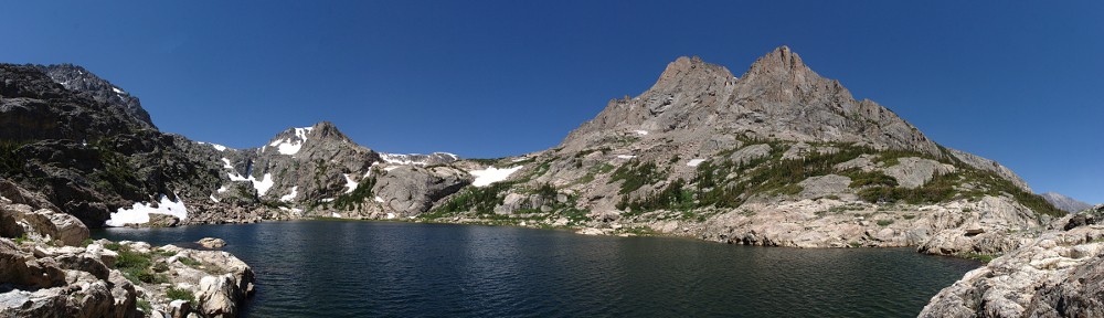
What little traffic there was in Alliance was all heading the same way we were, northeast of town. The land here is mostly center pivot irrigation: literally, crop circles. Seen from above, the land is divided into obvious squares, and most of those squares are filled edge to edge with circles, sometimes half circles. Carhenge sits at the south west corner of a square without a circle. If the land in this square was leveled off a bit and a center pivot sprinkler installed, Carhenge would still sit unmolested in the corner. It’s not terribly big.
Across the street, and a few yards north, is Jeske Lawn Sprinklers. This operation occupies a wedge of land cut out of one of these circles, a Pac-Man of corn with the Jeske buildings in Pac-Man’s mouth, with the campground as the next dot. It is Jeske who I called to get a camp site. I looked at the satellite image before calling them, but I didn’t zoom in real close. At first glance it looked like a crude, primitive campground. Looking closer now, I see that’s not true. It looks more like a collapsed building and a bunch of junk surrounded by truck tracks.
Today it’s more like an actual primitive campground. They’ve called it “Over the Hill”, which it is. It’s over the hill from Carhenge. The terrain isn’t flat and there are no hookups of any kind. No showers, no bathrooms. Just port-a-potties. Those were sited on freshly poured concrete pads. People were filling the edges of the field first. When we arrived, perhaps a quarter of the field was occupied, and people were starting to arrive at the adjacent fields to the north and east. If all this area filled up, there would be quite a crowd.
We pulled into a place close enough, but not too close, to a port-a-pottie and set up the tent and awning. Jerry and I made a trip over the hill. I was looking for a prime spot, trying to judge where the sun would be at the appointed time. I decided I wanted to be as close to the thing as I could get. After scoping the place out, we went to the souvenir stand. This was outside the small permanent building – a tent and tables. They had laid out a line, TSA fashion, that zigzagged back and forth enough times to accommodate maybe thirty people. We were the only ones. We bought t-shirts.
I asked how many people they were expecting. “Ten to twenty thousand people, is what they’re saying.” Red Rocks holds just under ten thousand. Ten thousand people here would allow everybody to sit on blankets but it would pretty well fill the place. I had a hard time imagining twice that many people here. If they were really expecting twenty thousand, they’d have ordered more port-a-potties.
A steady flow of people kept arriving at the campground. By dusk there were a bit over twice as many people there as when we arrived. It wasn’t a party crowd – there didn’t seem to be any serious drinking, anyway. People chatted loudly, kids chased each other, screaming. Nearby, somebody played their car stereo, imposing their taste on everybody. At one point, the minivan across from us had their headlights on for quite a while for no apparent reason. But overall it was a pleasant evening, good weather, few bugs.
I had hoped to take a shot at some simple astrophotography. Because there was no moon and no nearby large cities, I was hoping it would be dark enough to see the Milky Way. But by dusk we were starting to get a few clouds. And because everybody had lights on, it wasn’t as dark as I’d hoped. Also, Alliance cast a surprisingly bright light to the southwest.
We spent a lot of time chatting. Jay told us a bit about seeing an eclipse a while back. He was scuba diving around Bonaire. They didn’t even know about the eclipse until the day before. They hopped on a plane for the thirty mile flight to Curaçao and watched the total eclipse from the beach. This was 1998.
Chuck and Jay slept outside, Jerry and I in the tent. This time on “What Did I Forget?” it was my sleeping pad. Jerry had an extra blanket which he kindly loaned me. I woke up at 1:33. Somebody nearby was still chatting. I laid there a while before deciding to head to the pottie. It was occupied, and someone was waiting. So I’m second in line.
By now, most of the lights had been extinguished. Most of the clouds had vanished and I could easily pick out several constellations I forgot the names of years ago. It would be a great time to try to take a picture. If I’d planned properly, I’d have readied everything. As it was, the camera was in the bag in the cab of the truck, tripod who knows where. And, as a bonus, I’d neglected to bring a flashlight.
I was awake for an hour then slept, dreaming odd dreams, that I forgot immediately upon waking.
Monday, August 21
I awoke in a bank of fog a bit before six. Chuck and Jay were up, awoken early by a light drizzle. Water clung in small drops on the tent and awning but the ground wasn’t soaked or muddy. Yesterday I talked briefly to a local, standing in line for the latrine (but not at 2:00 am). She said that for the last week or so, the mornings had been cloudy but that it had burned off by mid-morning. So, faced with visibility of a hundred and fifty yards, I tried to remain confident.
And it did clear up considerably by eight or nine. For a time, clouds hung low to the ground all around us, but the sky above our little hill was clear and blue. After breakfast I headed over the hill to see what was happening. Not many people were there yet.
Near the top of the hill I came across a gentleman and his Speed Graphic.Versions of this  camera were produced for sixty years, and for a long time was standard equipment for press photographers. This man assembled his from parts. The image in the viewfinder is upside down and backwards. To focus, one uses a magnifying glass while underneath the black hood. His wife is a chemist, and she does the developing. He said he planned on doing a thirty second exposure.
The spot I scouted yesterday was occupied by a number of credentialed photographers; a copse of tripods. I set up nearby, leaving a small void. I got the tripod set up, had my chair and a jacket but forgot  sunscreen. I asked one of my neighbors if he’d watch my stuff and I headed back to the camp. On the way I ran into Jerry coming to meet me. I pointed out my location and continued to fetch my sunscreen.
Chuck and Jay stayed at camp. Jerry and I hung out right by Carhenge. We chatted with the folks around us and took turns wandering around in the crowd. A few people were climbing on the cars, and there was a constant circulation of people across, around, and through the field and Carhenge.
 An unusual assortment of people gravitated to the center of the structure. Some did yoga. Some laid crystals out on the ground and periodically clanged brass bowls that chimed like bells. One guy was using a pinhole box camera. A reporter took his photo and asked him a couple of questions. He took his name and home town and wrote them in his pocket sized spiral notebook. “A pinhole box you say?” People posed for pictures next to the cars. Surprisingly, I didn’t notice anybody taking selfies.
I met a woman who had come from Utah. Jerry talked to some folks from Texas. I saw license plates from Wisconsin and South Dakota. There was a guy from Washington, D.C. He told us he met other people from D.C. here. Everybody else I talked to was from Metro Denver. A couple next to us were speaking Spanish. I thought perhaps they were from a more distant place. They were from Thornton, but the guy was in Mexico City for the 1991 total eclipse.
It’s an odd collection of people, in an odd place, anticipating an odd phenomenon. Freaks and geeks. Hippies. It’s easy to let the mind wander perhaps a bit more off the beaten path. Doesn’t it look like the guy in the black t-shirt might be an alien, in the act of taking off his fake human head?
 When the moon took its first bite out of the sun a murmur rippled through the crowd. It has begun!
A guy came through the crowd handing out the paper eclipse glasses. He gave us each a pair, even though we already had our sunglass style ones. People still moved around quite a bit, but the forest of tripods the subject of more intense attention. Just seconds before totality a cloud passed in front of the sun and people with their glasses on oooh’d prematurely. The cloud quickly passed and a few seconds later the crowd oooh’d again, this time for totality.
Since the start of the eclipse, the clouds had been quite variable. It was generally clear, but clouds would come in quickly and dissipate rather than blow away. I shot several pictures partially obscured by clouds. I could only test exposures with a “full” sun so I had no clue how much I’d need to change the exposure as it progressed so I did a 2 stop bracket. My tripod isn’t too good, I had difficulty following the sun as it climbed. So it was a crap shoot.
 The sunlight was still bright, but it had an odd quality about it. Partial eclipses cause odd shadows in the leaves of trees, for example. But we had no trees here, just old cars. It was getting windy. It was good Jay and Chuck stayed at camp; they told us later that a gust nearly took away our awning. The temperature was dropping noticeably. It was about eighty when partiality started; by totality it was more like sixty.
The plan was to get a picture of the diamond ring, try a couple different exposures for the corona with the big lens. With the wide angle, I wanted to do a quick panorama. Also, I had the GoPro mounted on the arm of my chair and had started recording about ten minutes before totality. I didn’t expect much but it was easy to do.
 So the crowd gives out it’s oooh! It’s the diamond ring. I press the shutter release and … nothing. I have Err 99. The dreaded unknown error. I swap camera bodies and get a couple of corona shots. The problem is, the borrowed camera doesn’t work the same as mine, and I don’t know how to work it in the dark. I take a couple of shots and call it quits on the camera.
It really is quite a remarkable event. By the time I was done with the camera my eyes had adjusted to the darkness. All around the flat horizon it was sunset, or perhaps sunrise. The dome of the sky was filled with stars and not quite directly overhead, the sun was black and hairy! Venus was about the brightest “star” in the sky. Mercury was likely visible, but I couldn’t have pointed it out.
 And, suddenly, the lights come back on.
Wow.
I’ve been hearing a lot about how some people travel the world to see total eclipses. I’d be surprised if there weren’t people who’d do it. I didn’t go into this thinking that I’d travel the world to see more eclipses. But there’s one that will go from Texas to Maine in 2024. Jerry suggested we fly and stay in a hotel. I’m sure he was just joking, but it’s something to ponder
I can’t help but think about what one of these was like for your primitive peasant. We eagerly anticipated the event, watched the sun get eaten by the moon for an hour using high tech glasses. We have the advantage that we know exactly what’s going on. But that shepherd in sixth century Wales has no clue. He may not even notice the sun getting dim, and all at once that sun turns all black and hairy and the stars come out. And then it goes back to normal.
Take the Long Way Home
We didn’t dilly dally for long after the lights came back on. Maybe ten minutes after totality I started packing up the equipment. By the time we got back over the hill to the campsite, Chuck and Jay had everything packed up. They got an early start, what with having to take down the awning because of the wind. They weren’t alone in the camping area during the event; our neighbors had a birthday party and they shared some cake. Not only were we all packed up and ready to go, Jay made sandwiches. Time to hit the road!
It took us an hour and a half to go about five miles. Even after all the Alliance traffic merged onto the highway it took a while to get up to near the speed limit. It wasn’t helped by the many drivers who evidently weren’t interested in going anywhere near the speed limit.
Eventually we were on our way. We retraced our route through Scottsbluff and Kimball. We got stuck in another mess in Kimball. Just as we arrived, an ambulance came the other way to help a motorcyclist who was down on the ground. It didn’t look like an accident, though. Perhaps just dehydration. It took forever to get through town and when we got to I-80, the traffic on our desired route was blocked, an unmoving line of cars up the hill
We decided it was best to stick to a four lane road so we got on I-80 and headed to Cheyenne. I wasn’t too happy about going that way, but we had little choice. I couldn’t get a GPS signal, thought perhaps it was my phone so I rebooted it. But Jerry couldn’t get GPS, either. We had cell but without GPS we had no traffic data. I’d heard warnings for weeks that they expected problems with cell traffic. But that worked. I didn’t expect to have problems with GPS.
As long as we went west, traffic was okay. As soon as we hit I-25 it was a parking lot. Genae texted me that traffic was green in Colorado, but here we were, crawling along at five miles an hour, three miles from the border. By the time we crossed into Colorado we were moving again. There was another big knot between Ft. Collins and Mead.
We kept passing the same vehicles over and over. We came across a string of six rental cars, all the same model, all with magnetic signs on the doors and bumper stickers on the rear windows. It was a Russian astronomy club. I was trying to read the bumper stickers but couldn’t get a good look. I tried to take a picture of the sticker with my cell phone and I think they saw me doing it. Next time we passed them they smiled and waved. So we smiled and waved back. This happened a couple of times.
We arrived back at my place after an eight and a half hour drive. It only took us four to get up there. Eight and a half hours in the back of that truck was torture.
Yup, might have to fly to the next one.


