Mid-Ohio Trip – Autobahn Track Day

Day 6 – Thursday, May 30

Autobahn Country Club is a country club that, instead of being focused on golf or tennis, is all about performance driving. Members there have access to a race track that can be run in three configurations (North, South, Full Course), a skid pad, and a go-kart track. They can build a garage on-site for all their toys. Most such facilities are open only to members and their guests, but Autobahn sometimes hosts club track days. When I started planning this trip, I thought it would be worth a shot to ask if I could lap there on a guest pass of some sort. After a few emails and phone calls, it was all arranged.

And so, here I am, ready to see how the other half lives.

It was a leisurely morning as I didn’t need to be at the track until 9am. On Thursdays they run a later schedule that varies through the summer, based more or less on when the sun sets. So my first session wouldn’t start until 10:20am. Before that, I needed to visit their instructor. It wasn’t to get any instruction, per se, but to cover all the stuff we usually cover in the drivers meeting.

But I’m getting ahead of myself. The clock radio in my room went off at 6:10 this morning, tuned to a Spanish language station. Much of this trip I’ve been getting up at 6:10, but today I wanted to sleep in a little longer. Didn’t happen.

Went downstairs for breakfast. Same fare as the hotel in Toledo, likely because it’s the same chain. The TV was on the news as it usually is in these places. I’m never particularly interested, but the weather report did catch my attention. They said that this May is now officially the wettest May recorded in Chicago history: a bit more than 8 inches of rain. We get about 14.5 inches of precipitation all year in Denver.

At the track, after getting registered at the front gate, I went to the clubhouse to introduce myself to Ron, the fellow who arranged for me to be here. He told me a bit about the place – when they opened, how many members they have, what improvements they’re working on, and so forth. Then he took me down to meet Tony Kester, one of their instructors. I guess you could call him their resident Stig. He raced professionally for some time, participating in the American Le Mans Series as well as at least one 24 Hours of Le Mans. (A golf club has golf pros, a tennis club has tennis pros, ergo a track club has race pros.)

We covered the usual drivers meeting material – flags, passing rules, passing zones, their LED lights, entering and exiting the track – and sent me on my way. I unloaded the car in an out of the way place. (“Over there by the bleachers is probably best. Members aren’t used to people laying out a bunch of stuff” as those who don’t have garages on-site probably trailer their cars.) Then I headed on to the track.

By now I had two wristbands. One said that I’d paid, the other that I’d had my meeting with Tony. (Presumably members get different color wristbands that indicate they only need the one.) The drill is to go to the end of pit lane and stop. Race control will have you sign in (actually, he just asked me my name) and when they’re ready they’ll release you onto the track.

The first session was horrible. Although it wasn’t raining, it rained overnight and there were rivers running across the track. Not just one or two, but nearly everywhere. At the time, I think there were only three turns that were dry. I crawled around the track. Even so, I was going sideways quite a bit. Not “sideways, this is fun!” but “sideways I’m not in control!” I put four wheels off once and was sliding around quite a bit. It was not fun.

As well, I managed to pick the wrong configuration for the lap timer so I wasn’t getting any data (I had selected the North course instead of the South course). In this case, good riddance. There wasn’t any worthwhile data from this session.

Back in the clubhouse I talked to Ron again. “Have Tony show you the wet line.” Great idea. We tracked Tony down. Rewind a bit here. When Tony and I had our little drivers meeting, somebody showed up and asked him if he gave rides to a couple of guys yesterday. “Yes, both at the same time. It was really wet. I don’t think they puked, but they sure looked sick.” So Tony gets a car (an Audi RS5 Quattro, I believe) and takes me for a ride.

The first time around he’s more or less on the line you’d take in the dry. Periodically, he’s doing massive steering inputs or abrupt throttle or brakes to see how much grip there is. It’s a little unsettling. The next two times around he’s following the “wet” line, which is taking the outside of the turn rather than hitting the apex. He was giving a running commentary: “It’s good here. Still pretty slick through here. You have to avoid this puddle” and so on. The wet line works most places, but not all. Anyway, I think I get the idea and he drops me off and puts the car away. His parting shot was, “It’s easier with all-wheel drive!”

While Tony was schooling me on the wet line, a Corvette was out on the track. Well, he was out part of the time. He put it well off the track in the same location I did, but while I was able to regain the track, he needed a tow. He gave up after that, having completed two laps. His times were in the three minute range, probably about what mine were.

After my lesson from Tony, Ron came and found me. He tells me he’s signed me up to drive their BMW M2 Competition Coupe for their touring lap session. In this session we’ll be driving around behind the pace car, not above 50mph or so. No helmet required. They have a Jag I’d like to drive, but Ron tells me it’s always reserved. So the M2 works for me. During the course of the day, several people tell me that’s their favorite car of the bunch. (They have a dozen or so cars for this purpose – Audi, Lexus, BMW, the Jag.)

By now I see that I’m the only one dumb enough to waste his time at the track today. It’s just too wet. And the consensus is that the track won’t dry out, and we may actually get more rain. I’m not exactly pleased. I’ve decided that this whole thing may be a waste of my time and money. If it’s not going to get any better, I may as well leave and do something else. I was pretty down.

But I go out for another session. It’s still wet almost everywhere. I can’t follow the line I’d like to learn: the fast way around a dry track. I can’t turn in where I want, or apex where I want, or brake where I want, or even shift where I want. I’m always looking for the water. It’s drying out a little. I think. Maybe. But I manage to keep it on the track. For a long time. Technically, each run group is given a twenty minute session. But because I’m the only idiot out there, they’ll let me run until I give up. So after 35 minutes I give up. The good news is, I manage to steadily improve.

At lunch time I discover that I’ve somehow lost my credit card. It’s not my only one, so it’s just a pain in the ass and not a total disaster. No idea how I’ve lost it. I didn’t leave it at registration, and haven’t had to use it since. Where could it have gone? Anyway, after lunch is the touring lap session. Just as I’m finishing my sandwich, a gentleman comes by to give me the keys to the BMW. Well, a key fob anyway. There’s no such thing as a car key any more. Then he says, “Not to be demeaning or anything, but do you know how to put this car in park?”

Move the gear selector to “P”? This is not the correct answer. “When you pull into the parking space, leave it in drive and turn it off.” We head off to the cars for the laps. It takes me a few seconds to figure out how to get it into drive. Old dog, new tricks, I guess. It has paddle shifters but I don’t even try to figure this out.

BMW M2 Competition Coupe

Heading on to the track it’s the pace car, another BMW, me, and the Jag. We’re following the dry line even though there’s still quite a few wet spots and puddles. After a few laps it’s pretty obvious to me that we’re doing pretty good lap times. We’re not going very fast down the straights, but we’re not really slowing for the turns. I manage to dig my phone out of my pocket and get the timer running. I didn’t try to turn off any driver aids, but perhaps not all the nannies were enabled. I managed to get it somewhat sideways through the puddles a few times, as did the other BMW driver.

By the time we exit the track my soul has been a little bit crushed. Our parade laps were faster than what I managed the previous session. When I got out of the car, the other BMW driver was talking to Kyle, who was driving the pace car. “Thanks for those last two laps!” Kyle winked and said, “We never went over 50, did we?” Then I showed him my lap timer and my times from my previous session. He laughed (not in a malicious way). It is somewhat funny.

I got to talking with Kyle. He noticed my HPR hat and asked how I liked the place. He says he’s been wanting to run there but hasn’t been able to make it work yet. I told him about the facilities, that it’s a bit crude (no running water, for example) but that the track itself is great. He said he’d worked at a place like that: in the middle of nowhere and porta-potties instead of toilets. I asked him where that was. “Oregon Raceway Park”. Hey, I’ve been there!

By the time of my next session, the sun had been shining for a while, and we had a little breeze. The track was very nearly dry. I started really trying to get on it, on the dry line. There were still a few places where I couldn’t do it, where I had to adjust to avoid some water, or tiptoe through a turn to avoid spinning, but I was easily faster than before. All my laps were under two minutes, and my best was 1:53.27. Not a particularly fast lap, but maybe better than I’d have done in my first session had it been dry all day.

I had two more sessions after that. I improved my time to 1:48.05. In the clubhouse, they have a screen that is constantly updated with members times. All (or maybe just most) members run with transponders. Their times are displayed on a large monitor. I don’t have a transponder, of course, so my times weren’t included. But by now there were two members out running their spec Miatas. They were lapping in the 1:43’s. Tony asked me which Miatas they were. I described them and he said they were both very good drivers. He thought my time was pretty good given the conditions, my tires, and my lack of experience on this track.

Yours truly

In my penultimate session, I managed to kill another bird (my second on this trip). For a short while I was concerned it was stuck to my car somehow, mashed into the grill or something. Next time around the dead bird was in the middle of the track. At least is wasn’t in a place where I was going to run over it again.

In the last session I failed to improve my time. I got close, but couldn’t best it. (I’d have liked to run a few more laps, but I timed it perfectly. At the gas station down the street I pumped 9.8 gallons of gas into my 10 gallon tank.)

I finished the day with a beer in the clubhouse, packed up all my stuff, made a final search for my missing credit card, and hit the road. My first stop was the gas station a couple miles down the road. I’m glad it wasn’t any farther: I poured 9.8 gallons of gas into my 10 gallon tank.

My last session started at 6:05, so I didn’t leave the facility until about 7. On the way back to the hotel, at a stoplight a guy in the next lane told me my right headlight is out. So now I’m missing the right front turn signal and right headlight. There’s no damage from the bird strike, so I guess I’m just lucky all my lights are going dim at the same time. (Luck is when bad things happen; everything else is skill.)

Addendum: I found my credit card a couple days later, and now all the turn signals are working again. So it’s just the headlight.

Today’s miles: 72 road, 126 track Total miles: 1,729 road, 407 track

Autobahn Impressions

This is a very nice facility. This is the third track I’ve been to that is “members only”. The first was ORP, mentioned above. When I was there, it was more primitive than HPR. The other is Woody Creek, also very primitive. Nothing primitive about Autobahn.

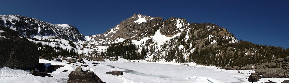
The track is more or less what I expected. We’re in Illinois, so I was expecting it to be as flat as a tabletop. It did have some subtle elevation change, just enough to catch the eye but not enough to challenge the driver. Drainage was a bit of a problem, but as alluded to earlier, this was the rainiest May recorded for the area. In addition to the rivers that ran across the track there were several places where the water percolated up through the asphalt. They really have worked hard on drainage, but what can you do in extreme conditions?

For most of the day, I had the place to myself. The aforementioned Corvette made two laps, and a couple of Miatas ran maybe a dozen laps each. When they left the track, they headed to their garages. So I never met another driver all day. I met quite a few Autobahn employees in the clubhouse, and perhaps one or two members who were there but not driving. The lack of other drivers to talk to was largely due to the track conditions.

Having the place to myself was a bit odd. It was great not having to deal with any traffic at all. Every lap was unimpeded. That’s never happened to me before and probably never will again. On the other hand, track days are very much social events. I like wandering around the paddock talking to the other drivers. Mine was the only car in the paddock. But I’m sure if the conditions had been more normal I’d have had somebody to talk to.

I’m not a man of the means required to be a member. My guest pass was a one-time thing, as a courtesy to an enthusiast passing through. If I lived in the area, I’d go back for a club day (North Woods Shelby Club runs there). I think it’s great that they open the facility up to non-members occasionally.

In spite of the rocky start, I had a great time. Everybody was friendly and made me feel at home. So I give a tip of the hat and a hearty “thank you” to Ron and the rest for hosting me.

Mid-Ohio Trip – Denver to Mansfield

Day 1 – Saturday, May 25

Before heading out I was feeling a bit of … trepidation isn’t the right word. More like low-grade anxiety. A good chunk of the center of the country has been getting hit with nasty weather the last several days. Tornadoes, some fatal, have hit Missouri, and that’s where I’m spending the night. I didn’t make hotel reservations because I didn’t know how far I’d get. My goal was Monroe City, and as it turned out I easily made it another 30 miles or so to Hannibal, right on the Mississippi River. Not that I’ve seen it yet; my motel is ten or twelve miles away. So far the weather has been good. My phone tells me no precipitation is expected in the next two hours. We’ll see.

I picked what I thought was a fairly cheap motel, at least according to Google. All I’m after is a bed and shower. When I got here, there were only four rooms left, all smoking. I’m surprised anybody still offers smoking rooms. I’m not happy, but it’s a room, and I’ve been in worse. It turned out to be on the more expensive end, about what I’d expect to pay in these parts for a Marriott property.

I can’t get internet here in the room. It never challenges me for a password. I managed to connect down in the lobby, but shortly after returning to the room I lose it. At least I managed to plan my route for tomorrow.

Today’s route was US 36 the entire way. Here in Missouri it’s four lane divided highway the whole way. Not exactly like an Interstate, as it’s not limited access. And although there were trucks, there weren’t many. Through Colorado and most of Kansas I couldn’t have asked for much better conditions. It’s not hot yet, so the clear blue skies and bright sunshine weren’t a problem. And there was almost no traffic at all. There’s an event going on at HPR, so I followed a Porsche with a giant rear wing from the gas station in Byers to the track, but after the track I didn’t see another vehicle going my direction until I got into the small towns of western Kansas.

Before reaching Kansas, I saw a fox crossing the highway in front of me. Close enough to easily identify it as a fox, but not close enough to worry about hitting it. Shortly after that, I saw a couple of pheasant standing on the shoulder of the road. At first I thought they were turkeys, but they weren’t that big, and were slender. I was a bit surprised they didn’t take off as I passed them.

Nearing the Missouri River there was quite a bit of standing water on the fields. Sometimes just large puddles, other times it was acres of field under water. I didn’t get much of a look at the Missouri and I don’t really know what it normally looks like, but it seemed it was running high. A few of the other smaller rivers I crossed, again just glimpses, looked like the trees along the banks were in the water. Tomorrow I’ll start my day with a short visit to Riverview Park here in Hannibal and get a good look at the Mississippi.

When I do my trip planning, I typically check the box to avoid highways. What I really want is “avoid Interstates”. I didn’t give it much thought, and was under the impression they were the same thing. But the other day when scouting routes for the return trip, I noticed that it was keeping me off US 36 here in Missouri. It’s not an Interstate, but it is a four lane divided highway. I’m not sure they’re consistent on this. I drove quite a few miles on US 20 through Iowa last year on my Road America trip, and that’s more Interstate-like than US 36 is here.

For tomorrow, I could easily take Interstate most of the way. But I find it so much more pleasant to take the smaller roads; I’ll gladly trade some time for the near elimination of traffic. I find it much less stressful to take the scenic route than the super-slab.

I hit another bird today. What is it about this car that causes me to hit so many birds?

Today’s miles: 660

Day 2 – Sunday, May 26

I was awakened by a peal of thunder at 4:15. I didn’t hear any tornado sirens, so that was good. But I wasn’t exactly sure I’d hear any if they were sounding. I glanced out the window and things didn’t look too bad so I went back to bed.

Breakfast wasn’t scheduled to be available until 6:30, so I loaded up the car first. It was raining pretty good. I was in the breakfast area by 6:25 and people were already eating. So I loaded up a plate with sausage gravy and biscuits, some sort of cheesy scrambled eggs, and potatoes. Then back up to the room to brush my teeth and I was on the road by 6:54.

By now the rain had slackened somewhat. But I quickly fogged up the interior of all the cockpit glass. Cracking the windows didn’t help much, and neither did the defroster. Good thing I carry a towel with me. Usually it’s in the boot, but I had anticipated just such a situation and had it in the cab with me.

I found my way to Riverview Park easily enough. It’s a dark forest early in the morning in the rain. I found a place with a view of the river (not as obvious as you might think, given the park’s name) and took a look around. It was still raining, so I didn’t hang around. Had it been nicer, I’d have explored the park a bit more. I was hoping to see some barges on the river. I did see some when I was back on the highway, crossing the bridge, but they weren’t visible from the overlook I visited.

Mississippi River, Riverview Park, Hannibal, MO

The first section of the drive was on the Interstate. My biggest issue with interstate highways is the truck traffic. There was none this morning, so I was unbothered.

My planned route had me heading north on I-172, but Navigator decided to send me farther east on I-72 instead. This turned out to be an interesting route. My first intermediate destination was Havana, IL, on the Illinois River. The route I ended up following was IL 100, along the western shore of the river from Beardstown to Havana. The river was well outside its banks through here, but it looks to me like they’re prepared for this and perhaps it’s a regular occurrence. One house on the river side of the road was built on stilts, and many of the trees along here were standing in water.

As it was, I crossed the Illinois River three times. Once on the interstate and twice on US routes. These two bridges are older, steel girder bridges. Beauty is in the eye of the beholder, so I won’t say these old bridges are more beautiful. It could be argued that the newer bridges have a simplistic beauty to them. But I find these steel girder bridges more interesting.

Writing up these notes and referring to the map, I see that I narrowly missed visiting Lotus, Illinois. I passed within a few miles of it, but it’s so small it never appeared on any signs. Had I been on the correct road I’d have had to make a short detour. I doubt it is big enough to merit a post office; from the satellite photo it looks to be a grain elevator and about six houses, about a thousand feet from the highway. Presumably, there’d have been at least a sign of some sort. Oh, well, I’ll never know.

My third intermediate navigation point was Logansport. (The second wasn’t interesting enough to get a comment.) I generally edit my route for these navigation points so that I stay on the highway rather than detouring through town. I’m glad for this one that I didn’t. Logansport sits beside the Wabash river and my route was on a side street on the south bank of the river. It, too, is running high, submerging one of the islands in the middle of the river.

The rest of the trip was fairly boring. US 24 and US 30, with a short shot on I-469. Both 24 and 30 may as well have been interstates, being four-lane divided highway, often limited access. In Ohio the speed limit was 70.

I made good time. Rather than having the motel as my destination, I had the track. Chin Motorsports does registration and tech the night before, but I figured I’d miss that, arriving after 6. But today’s event there (either NASA or PCA, I heard both) went late due to some weather and when I arrived I found myself at the end of a long line waiting to get in. So rather than just taking a picture of the sign and heading to the motel, I waited around, got registered and teched. Tech inspection amounted to me giving them my completed form and them checking that the number on the car matches the number on the form.

After checking in at the hotel, I found a gas station and a restaurant. So I’m all ready to go in the morning. It’s about a 20 minute drive to the track, and the drivers meeting is scheduled for 7:10, so I’ll try to be out the door by 6:30. That should give me time to find a spot in the paddock.

Today’s miles: 557 Total miles: 1,217

LOCO Black Hills – Part 1

It’s time for another long weekend road trip with Lotus Colorado. This time, Mike put together a four day excursion to the Black Hills of South Dakota. We’d drive to Custer on Saturday, visit Mount Rushmore and Sturgis on Sunday, head to Wyoming on Monday to see Devil’s Tower and return home on Tuesday.

The contact list included 22 cars and 38 people. Over a quarter were Elises – one blue, one red, two orange and two BRG. Gordon was the other green one – no stripe, silver LSS wheels, hardtop. Three Evoras, two black Exiges, two red Elans (both 1967), two M100 Elans, and a Europa round out the Lotus contingent. The others were BMW, Porsche, Saab, Volvo, and a Miata. As always, a few new faces on this trip, including a Chicago couple who rendezvoused with us in Custer.

May 16 – Denver to Custer

On past drives we’ve been pretty fortunate with the weather. We did get snowed on two years ago this weekend in Telluride and it was a bit on the warm side in Moab last year, but never anything much to complain about. But it has rained or snowed every day so far in May and the forecast doesn’t look too bright for our trip. Still, we hoped for the best.

We left the house at about 8am and fueled up. Luckily I realized I had forgotten the SLR before we got very far, so we went back home before heading to the meeting spot. We met at a gas station off exit 22 of I-76. The morning was cool and a bit breezy, with scattered, nonthreatening clouds.

Once everybody showed up we had a quick drivers meeting then hit the road, running northeast on I-76 to exit 80. There we headed northbound on Colorado SH 52 to a T-junction with CO 14 at the southern border of the Pawnee National Grassland.

After a short jog to the east, we continue north on CO 71 through the Pawnee. Here we hit a bird. I’ve hit more birds in this car than all other cars combined. On my trip to Portland last year I hit two at once. Usually it’s high on the car but this one hit the front clam and ricocheted to the windshield wiper where it got lodged in the wiper arm. For a few seconds I thought the wind might take it, but, no, it’s stuck. I turned on the wiper hoping for the best but no luck. I have no choice other than to pull over and pull it out manually.

The Pawnee Grassland gives way to a checkerboard mix of ranch and open prairie. On the south edge of Kimball we cross under I-80. Time for a pit stop. The route instructions directed us to the Kwik Stop but we followed the Miata into the station across the intersection. After fuel and potty, we lined up with the other cars at the Kwik Stop. As usual, we drew a crowd. It’s always fun to see people’s reactions – lots of smiles.

Our next stop was a picnic lunch at Scotts Bluff National Monument, a couple miles west of Gering, NE. Between Kimball and Gering is forty more miles of checkerboard. Here, more of the checker squares have checkers on them: center-pivot irrigation systems and their attendant crop circles. At Gering, the directions send us north when 71 bends slightly east, but we split up and attacked the place from several directions. We headed downtown to grab sandwiches from Subway.

We had our picnic and socialized for a while then we drove to the top of the bluff. The road to the top is 1.6 miles long. After a 180 degree sweeping turn it passes through a tunnel that curve 90 degrees the other way. It zigs and zags, passing through two more tunnels before finally dumping onto a parking lot on a wide saddle below the summit of the bluff.

Above the parking lot, a trail makes a sort of bow-tie and affords nice views. Below the bluff to the east lie the conjoined towns of Gering, Terrytown, and Scottsbluff. Immediately below the trail to the east is a nice cluster of houses – the high rent district. A national monument on one side and golf course on the other.

IMG_1963_stitch_crop_resizeThe North Platte valley is to the north. Both the Oregon Trail and Mormon Trail passed through here. When driving in comfort though these vast, rugged spaces in the west I often try to imagine what the pioneers went through. Sell your house, if you have one, and buy a wagon and team. Pile all your worldly possessions into the wagon and making twenty miles on a good day. Risking it all, venturing into the great unknown. Scotts Bluff was about a third of the way from St. Louis to the west coast, perhaps the easiest third.

IMG_1967sI’m not sure why I started doing it, but whenever I come across a survey marker I take a picture of it. That doesn’t mean I have lots of pictures of survey markers; I don’t come across them every day. The one on the top of Scotts Bluff is interesting because of what has happened to it since it was placed there in 1933. Scotts Bluff is made up of soft sandstone with a cap of hard rock. Where the hard rock is gone, the sandstone is eroding away on a human time frame. Scotts Bluff is about a foot and a half lower now than it was in 1933.

Exiting the town of Scottsbluff, Mike missed a turn. We were second in line and didn’t catch the error and everybody followed us. Mike found somebody to ask directions and while we waited, Ross passed through the formation looking like he knew exactly where we were going. We took off after him. He correctly navigated us onto US 26 eastbound. I drove several hundred miles of US 26 last summer through Oregon, Idaho, and Wyoming, but now we only followed it for a handful of miles before taking US 385 to Alliance.

For about twenty miles we’re out of the valley, away from the fields of checkers and back in prairie. Here we saw two pronghorn antelope running in our direction along the fence on the other side of the road. Our line of cars is probably a quarter mile long, and we slowed down considerably. The antelope switched direction a couple of times but were stymied by the fence.

In a field north of Alliance, a guy named Jim Reinders built an homage to Stonehenge out of old cars he’d gotten from nearby farms and dumps. Reinders noticed that the monolithic dimensions of cars from the fifties and sixties were similar to the stones at Stonehenge. They’ve painted the cars gray to make them look more like stones and they keep them from rusting away. There are some interesting cars in there – a Willy’s truck, a Gremlin, an old Plymouth like “Christine”.

IMG_1976sScattered around the property there are a number of large sculptures made out of car parts – a spawning salmon, a dinosaur, wind chimes, a Conestoga wagon. As built, Carhenge included three imported cars. These have been replaced by domestic cars and the foreigners ritually buried here, their grave marked by another junked car.

After a pass through the little gift shop, we started assembling for our departure. By now the skies were looking quite threatening. Here we had our first bit of rain, and it looked very nasty directly to the north of us. Luckily to get back on US 385 we had to jog a few miles to the west and we missed the biggest of the squalls. Along here we saw a couple of large birds in the grass along the road: a turkey and a ring neck pheasant.

Most of Nebraska looks just like what you expect Nebraska to look like – some farms, some ranches, a few feedlots. But just south of Chadron we pass through the Nebraska National Forest. I had no idea there were pine trees in Nebraska. Heck, there are hardly any trees at all. Genae found it a bit reminiscent of the area south of Flagstaff. Sadly, and perhaps obviously, this interlude was short and we were soon back to the more typical Nebraskan scenery.

After a pit stop in Chadron, we continue on 385 into South Dakota and through the Oglala National Grassland. Although the North and South Platte rivers were running high, they were within their banks. The rivers we’d been crossing lately were flooding. In addition, many low lying parts of the fields along the road had standing water.

At Oelrichs US 385 meets US 18. The two routes are conjoined until Hot Springs where 18 goes west. We continue north into Wind Cave National Park. We made another minor navigational error, missing the turn on SD 87. US 385 would take us into Custer, but we wanted the more scenic route through Custer State Park.

This is not a big park but it’s packed with things to see. It looks like parts of the place catch fire every few years so there’s an unusual mix of pine forest, recently burned areas, and open grassy hills and valleys. The hills are populated by an abundance of wildlife. In a few short miles we saw deer, antelope, and bison. A group of buffalo grazed very near the road, several cows and calves.

IMG_1990sOur accommodations for this trip were at the Bavarian Inn, a pleasant establishment on the north side of town. We got checked in, unloaded the car, and socialized over margaritas and snacks. There were no group plans for dinner, so we were all on our own. Nonetheless, almost everybody ended up in groups of four or six or eight at the Buglin’ Bull. They weren’t really prepared for so many guests and those who arrived later after us were there quite late. We were back to the hotel and in bed by 10:30.

Today’s drive: 421 miles.