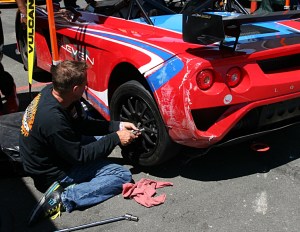
CECA at CSP

Saturday, August 20

I was the beneficiary of Scott’s misfortune. He had registered and paid for the track day with CECA at the Colorado State Patrol training facility. But his car was still in the shop. The original plan was I’d show up for a while and he could give me a ride. Instead, I ran in his place and I gave him a ride.

This was my third time here, the other two were back in 2012 and 2013. Back then the dirt road leading to the facility was heavily rutted and a challenge to navigate. We had to crawl up, often switching from one side of the road to the other to avoid bottoming out. It was a pleasant surprise to see that it has been substantially improved. It’s hardly the same road. This road will never get ruts like it used to.

There was a nice turnout. The event was limited to forty cars. I had heard that with a week to go there were only eleven entrants. I didn’t count but would guess there were twenty five or thirty cars. I could be over estimating, though. CECA allows second drivers for free, so several cars went out in more than one group. In any event, CECA is back to break-even for the season

Nissan Skyline GT-R

Nissan Skyline GT-R

It was an interesting mix of cars. There was another Elise, Mark, who’s had his pretty blue car for only a few months. A Caterham made up the rest of the Lotus contingent. There was quite a group of 1960’s cars. CECA days always have a Hertz GT 350. There was also a nice orange Mustang fastback, a green Firebird, a white Falcon (1964, maybe?), and a red Corvair that smoked like he was spraying for mosquitoes. There was a later Mustang, a race car, but pretty beat up, and a recent GT 350. A few Miatas, a few very expensive 911’s, two silver Scion FR-S’s.There must have been a Corvette, certainly, but… perhaps not.

Two cars in particular attracted my attention. I couldn’t help but notice a Nissan Skyline GT-R, right hand drive. Not a flashy car, grey inside and out, but unmistakable. It has something I’ve never seen on a coupe or sedan: a wiper for the back window.

The other was a recent Mustang. Metallic blue, with gold stripes, a GT-500 Super Snake. He just had it dyno’d – seven hundred ninety something horsepower at the flywheel. He thinks it’s capable of 180mph and says that to get it to 200mph it would cost an additional $20,000. He was running in the green group and we were never on the track together.

Mustang GT 500 Super Snake

Mustang GT 500 Super Snake

I have no data from my earlier visits. I may have had a lap timer on my old phone, but if I did the data is long gone. Laps are counter-clockwise and cover about 1.4 miles. Depending on how you count it’s either eight turns or three turns and a chicane. A lot of the guys say it’s flat, but that’s not true. There are two big humps that make some passengers nauseous. And the entry of one turn has enough downhill grade to make late braking more challenging. One thing I like about it is that there are no long straights: it’s not a horsepower track. That said, I manage to hit 100mph twice each lap (well, most laps) and average 70, which is a higher average speed than I manage at HPR.

Caterham

Caterham

The weather couldn’t have been much better. It was cool in the morning, clear and calm. It stayed clear, with the usual brilliant blue Colorado sky, but never got hot. In the morning, oversteer was a common complaint. Everybody expected it to get better as the track got some heat into it, but my car felt loose all day.

Scott seemed reluctant to take a ride. He said he didn’t want to slow me down with the additional weight of a passenger. But I like giving rides. I told him I don’t really notice much change in the car, and doubt that my times are significantly slower. We speculated that it might be two seconds a lap here. It turned out to be more like a half second. I was able to do a 1:13.6 in the second session and 1:13.4 in the fourth. Most days my times improve each session so I might have been able to do a 1:13.5 in the third. With Scott as a passenger, I managed six laps in the 1:14’s with a best of 1:14.1.

When Scott got out of the car he complained of a bit of nausea. I hope it was the humps and not my driving. I missed a lot of apexes and took some funny lines. And made my biggest mistake of the day: braking too late on the downhill section. I couldn’t get the car around the corner and put four wheels off. I wasn’t black flagged but should have self-reported. I didn’t. I had the car straight and under control, down to 25mph.

The fourth, final, session was open track – all groups could run. But a number of people had had enough by then. There weren’t many cars on the track, even with whatever green and blue drivers were out. I managed six consecutive laps without traffic. Scott took a few laps in Mark’s car; he exited the track just as I was catching him. Then Mark drove and did the same thing. I was hoping to get his car on camera for a few turns but so it goes.

After the last session I had a nice chat with Bill and Heike. Bill had an interesting proposition. “The track,” he said, “isn’t really a track. We use it like a track but it’s really an endless two-lane highway.” He’s correct, of course. It’s built like a road. It has a crown like a road, it is striped like a road. The Troopers use it as a road. Bill suggests “Stay in your lane and see how fast you can do a lap.” Next time I come here I’ll have to give it a shot.

The video is two laps plus my off. The map gauge worked this time. I have no idea why it works sometimes and not others.

Cony Lake

Sunday, August 14

Cony Lake sits on a bench 11,512′ above sea level, surrounded by Mount Copeland, Ogalalla Peak, and Elk Tooth. It also sits on the southern boundary of RMNP. To get there, you must first get to Pear Lake, which is six or seven miles from the trailhead (depending on where you start). At Pear Lake, follow the trail by the hitchrack. This trail passes a small pond where it crosses the park boundary.

Lower and Middle Hutcheson Lakes are in Roosevelt National Forest. The faint trail leads to the lower lake before heading uphill on the northern bank of Cony Creek. The trail gets fainter and eventually disappears. Route finding from here to Upper Hutcheson can be difficult over terrain of rock benches, grassy ramps, and bands of dense willow and krummholz.

This is the fourth year in a row I’ve set off for Cony Lake. It doesn’t bother me to fall short when hiking in the Park. I’ve almost never had a bad day hiking. Each of the other times I tried Cony were memorable. The first time I had to stop at Pear Lake but got to watch clouds roll in just feet off the surface of the water. The second time I saw a bear sitting on the trail in front of me. Last year I watched an eagle catch a fish.

I started from the Allenspark trailhead rather than the Finch Lake trailhead. It saves a little distance and elevation. I wanted to drive the Chrysler because the parking lot is not Lotus friendly but it was in the shop. It was drive the Lotus or stay home, and I wasn’t about to stay home. There are two entrances to the parking lot at the trailhead. The first one features several large craters but the second is not so bad. I was able to get in and out without scraping.

The weather was ideal. Clear, cloudless sky, a brilliant blue all morning and only a slight breeze, even above treeline.

Over the last few days I’ve spent some time visualizing the hike, mainly the approach to Upper Hutcheson. I saw myself working my way uphill without getting into the willows. I could see the ramp you descend to cross the creek right below the lake. Last year I made it as far as the inlet to Upper Hutcheson and was stymied there. I had stayed along the shore and intended to ascend alongside the creek. It’s not a good route. This time I’d start climbing almost as soon as I got on the other side of the lake, traverse the slope to above the obstructions.

Just as I saw it in my mind, I made my way up without getting stuck in the willows. I crossed the stream right at the outlet of Upper Hutcheson. This is easy to do this time of year when the water level is down somewhat. It’s probably not a good route in July. There’s a nice grassy ramp right down to the water, a few stepping stones and you’re across. I made it the rest of the way without hitting any willow. Instead, it was a lot of rock hopping. Perhaps an excessive amount of rock hopping; I was certainly tired of it by the time I was done with it.

IMG_9704route

My approximate route (drawn on a 2015 photo)

I spent an hour at the lake. I was happy with my pace all the way up. I put boots on the trail at 7:30 and dropped my pack on a rock at the lake at 12:15. It took me fifteen minutes longer going back down, but that includes a stop to refill the water bottle. I didn’t get back to the car until after six, the latest finish I can recall.

The lake is bigger than I was expecting. I sat on a giant rectangular boulder the size of a bedroom, got the GoPro running and tucked into my lunch. There were no squirrels in this boulder field, and there were no birds. A few mosquitoes buzzed me and a few flies were somehow attracted to the camera. It was quite calm, which is unusual along the divide. Some clouds were attempting to cross but were never more than incipient. They got more energetic shortly after I left Cony, some white puffs drifted over Elk Tooth, diffusing the shadows and taking the edge of the bright sunshine.

Coming down from below Upper Hutcheson I ended up in a maze of krummholz and willow. I found myself in a few of the same spots I was in last year, or the year before. I went one way, back tracked, tried another. And another, and another. Eventually I dove through a particularly nasty clump of krummholz and from then on was in the clear, but I’m disappointed I wasn’t able to retrace my steps.

I’m wearing my hiking shoes, not the boots. On the way up I hit my right ankle on a rock, tore a flap of skin. This was situated right above the shoe and when I little toe was uphill of my big toe, that flap rubbed on the shoe. About half my steps when rock hopping had my foot situated that way. By the time I was back on the trail my ankle had gone from irritating to annoyingly painful.

I was surprised at how few people I encountered. On the way up, I exchanged hellos with a group of three and a group of five. I had a brief chat with a fellow from Luxembourg. He hiked Mt. Idea a couple weeks ago, then camped in the Grand Tetons. Then it was the Badlands and a stop in Nebraska before returning to RMNP. His plan today was to lunch in Estes, then drive to the Great Sand Dunes. A pretty cool trip. I met him just below Pear a few minutes before ten.

I didn’t see another person until I was nearly back to Finch, almost six and a half hours later. I’m usually the one asking people where they’re headed, or where they’ve been. Today, though, I was the one being surveyed. After passing Finch Lake, I saw only six people. One young guy coming the other way asked “Finch or Pear?” I told him “Cony.” He hadn’t even slowed down to ask the question, but my answer stopped him in his tracks. “Way to go, buddy!” It was deja vu just after the big trail junction. A guy passing me asked “Finch or Pear?” “Cony.” “Wow”.

It’s been my habit to say something along the lines of “I felt great when I got back to the car.” That would be a fib today. I was pretty fatigued and the ankle didn’t help. It’s not the longest hike I’ve done, or the biggest climb. But I’d say it’s one of the most difficult. It’s a long hike to Pear, then miles of no trail and challenging route finding.

Timetable

Up Down
Trailhead 07:30 AM 06:10 PM
Trail Jct 08:10 AM 05:26 PM
Finch Lake 09:05 AM 04:26 PM
Pear Lake 10:05 AM 03:20 PM
Lower Hutcheson 10:40 AM 02:50 PM
Middle Hutcheson 11:00 AM 02:35 PM
Upper Hutcheson 11:25 AM 02:10 PM
Cony Lake 12:15 PM 01:10 PM

Laguna Seca Trip: Day 14 – Bayfield to Denver

Friday, July 22

Today was a day of waiting for pilot cars at road construction sites. I had eight, and the one on US 50 east of Gunnison had me behind at least a hundred cars.

I’ve driven Durango to Denver (or vice-versa) dozens of times. Somehow, I’ve never taken CO 149. LoCo did the road a couple of years ago, but we didn’t participate in that drive. Today I rectify that oversight. I’m driving it south to north, which is start to finish according to the mile markers.

The upper Rio Grande flows through a U-shaped valley, open and grassy, forested only on the slopes. There is a railroad as well as the highway; each runs along one side of the valley or the other. They often switch sides, crossing each other and crossing the river. At Creede, the road makes an excursion up a gully, makes a U-turn, and returns to the main valley. The forests on the southern ridge are almost completely beetle-killed. The road leaves the Rio Grande and starts climbing Spring Creek Pass. I’d been running topless all morning. When it started sprinkling here I stopped and mounted the top. For once I got the timing right – it rained heavily moments later.

With the mounting of Spring Creek Pass, the road goes into its second phase, a pair of two lane mountain passes. Many of the epic pass roads of yore have been widened and lost much of their character, including two today, Wolf Creek and Monarch. Although this route gets more traffic than I expected, it’s not likely to be widened anywhere along its length for some time. Climbing the pass, they’ve removed about sixty yards of beetle-kill on each side of the road, leaving only an occasional survivor standing sentinel.

Spring Creek Pass was in use by the old Taos trappers in the 1820’s as the shortest summer route from Taos to Gunnison country. It appears as Pass of the Rio del Norte on the R. H. Kern army map of 1851. It was also occasionally referred to as Summer Pass. It tops out at 10,858’ and crosses the Continental Divide. (This is the second of three CD crossings of the day. The aforementioned Wolf Creek and Monarch are the first and third.)

A few miles later the road crosses Slumgullion Pass, five hundred feet higher than Spring Creek Pass. It was named by pioneers from New England. Slumgullion is the multicolored refuse produced by butchering a whale. These New Englanders thought a large rock slide on the west side looked like slumgullion and thus the name. I don’t know if that slide is visible from the road; I didn’t know to look for it. Instead, I was too impressed with the result of beetle-kill removal at the summit. The entire saddle of the pass has been cleared giving an impressive view of the mountains beyond. The extensive beetle-kill is not a happy sight, but this view is a positive side-effect.

After the passes you descend to Lake City. We arrive here in a string of traffic, the result of a long wait for a pilot car where they’re repaving the road a few miles up the hill. The town clearly makes it’s living catering to those who fish and hunt. It’s very rustic. For about three blocks, I saw no cars. There must have been fifty Jeeps in a row. ATV rentals everywhere.

The third phase of CO 149 begins now: the descent through a narrow canyon carved by the quickly flowing waters of Lake Fork, a tributary of the Gunnison.

It’s a very scenic and fun drive. I was able to have long stretches where I could maintain a bubble around me – nobody in front to deal with, nobody coming up from behind. There’s no need to go particularly fast to enjoy the road. There are a number of long sweeping turns, like the carousel at Road America, easily enjoyed at sixty.

Going this way, using CO 149 and US 50 to replace the San Luis Valley, requires an additional investment in time. It doubles the time it takes to get to Salida to four hours. I will look to take this route again on a future drive to Durango, as long as I have the time to spare. You haven’t really driven a road unless you’ve gone both directions, have you?

I grabbed a quick sandwich in Gunnison and promptly got stuck in the longest line of traffic of the day. Although I had a good view of the road ahead, I couldn’t see far enough to see the flagger. I was easily behind a hundred vehicles. I probably passed thirty ascending Monarch. From here on home there was always somebody in front of me. At least I wasn’t leaving Denver – 285 coming out of town was stopped for miles.

Home again, home again, jiggety jig.

Laguna Seca Trip: Day 13 – Henderson to Bayfield, CO

Wednesday, July 20

Today is a “zero day” in Henderson with Chris. A corollary to “What happens in Vegas stays in Vegas” is “Nothing happens in Henderson.”

Thursday, July 21

In a feeble attempt to exit Vegas before it gets hot, I was out the door by 7:30.

Google wants to take me west to go east; it will suggest I make four turns or have me on a dirt road in Death Valley to save a quarter mile but will take me miles out of my way to put me on the interstate. Chris gave me a different recommendation: Boulder Highway to Nellis to Las Vegas Blvd to I-15. I take Chris’s route and for fun leave Navigator running to see how long before it reroutes me to my current path. It gave up about half way up Nellis after recommending about thirty left turns. This, perhaps, is a ploy by the Las Vegas chamber of commerce to keep me on the Interstate rather than driving through their town. Either that, or Google is still messing with me.

I’m not a particular fan of Vegas. I’ve only visited the place a few times, but it strikes me as a crummy little town. Every place I’ve seen off the Strip is run down, somewhat dilapidated, desiccated. I don’t like the weather there, and even when it’s not baking hot I find nothing appealing about it. If it weren’t for the gambling, this place wouldn’t exist, it would be just another Great Basin valley, an isolated Air Force Base.

My Vegas escape route takes me by the speedway and the location of the proposed Tesla giga-factory before depositing me on I-15. I take the interstate a few miles past St. George, Utah. In order to get Navigator to take me on my desired path, I had to give an intermediate destination. That’s St. George. So it got me off the highway and sent me left and right and left again until I was in front of the local college’s football stadium. “You’ve arrived at your destination!” Maybe I should have looked for that Starbucks instead. Actually, if I wouldn’t have wanted to top off the gas tank, I’d never have gotten off the interstate here. I get back on I-15 for a few more miles before heading east, ending the trip’s last Rule #1 violation.

This is the road to Page, Glen Canyon Dam, and Lake Powell. I’ve never seen so many boats on the road before. Boats outnumber RVs. Big boats, pulled by dueller diesel pickup trucks. Big, shiny, black pick up trucks.

I often say of Wyoming that all the interesting bits are around the edges. I’ve decided that Nevada has it worse. It has no interesting bits. Pretty much as soon as you leave Nevada the terrain gets much more interesting. Nevada, in my experience, is like a wrinkled table cloth – just one valley after another. Sameness followed by sameness, with minor variations in vegetation. Back in Utah, the wrinkles are replaced by layers. At St. George you enter red rock canyon country. We’re at the western end of the Grand Escalante Staircase (even if we’re not in that particular park). We can see different kinds and colors of rock, interesting formations. I’m happy to be leaving the Great Basin in my rear view mirror.

Not long after St. George the road takes me through Colorado City. There’s a Colorado City in Colorado but this one is bigger. It’s one of those places I’d heard of in the news over the years but never bothered to figure out where it was. It was in the news because it’s where a splinter sect of fundamentalist Mormons live. These Mormons are polygamous; believing that their god wants their leaders to marry as many fourteen year old girls as possible. In all the small towns through here, I see women in the old style garb. These dresses strike me as not far removed from the bee keeper suits women are made to wear in parts of the Middle East.

Not only are there a lot of boats on the highway, approaching Lake Powell there are lots of places to store your boat, so you don’t have to tow it up and down the highway. Lake Powell appears, side roads lead to marinas. When I see a sign for Wahweap Overlook, I stopped to look it over.

IMG_2293_stitch_crop_resize

Lake Powell from Wahweap Overlook

The next obvious stop was the Glen Canyon Dam’s visitor center, followed by a walk part way across the bridge.

Glen Canyon dam and bridge

Glen Canyon dam and bridge

Navigator’s penchant for short cuts kicks in again in Page, with the result that I drive by the lumber yard instead of any restaurants. I need to eat in Page as there’s nothing available until Kayenta, still quite a way down the road. The Maverick station has a store with a grill offering burgers and Navajo tacos. I grabbed a burger and ate it at a picnic table outside. I share the table with a young French couple. Seating was limited to two picnic tables. The other was occupied by a family. Guns were not welcome here, they were encouraged. Show your gun and a permit, get a 10% discount (not good on fuel). You can also get the discount by showing ID that says you served in the military. I wonder if that includes the military of other countries? I wonder what the French couple thought of the gun discount.

Just after Page the road passes parking lots for Antelope Canyon tours. This will have to go on the list of places to visit. We’ll certainly have to come back here and explore the place in more detail.

I’m taking AZ 98 from Page to a junction with US 160. This junction is about 30 miles from Kayenta. This is my least busy road for the day, a relaxing drive. From then on, it’s familiar roads for me – Four Corners and the oddly named Teec Nos Pos, through Cortez, past Mesa Verde, and skirting Durango. When I got to about Mancos the place looked and smelled right: I’m back in Colorado.

To top off the day, I had dinner at the Seven Rivers Restaurant at the Sky Ute Casino in Ignacio. I had the petit filet mignon, jalapeño mashed potatoes and the corn dish. Yum.

Grace and Greg kindly put me up for the night. Grace was a good sport, suffering through the modern equivalent of getting out the slide projector: going through the photos on the laptop.

Laguna Seca Trip: Day 11 – Monterey to Henderson

Tuesday, July 19

Now we enter the phase of the trip where things are a bit more free-form. So far, everything has been pretty well planned – the route is known (even if not perfectly followed), activities defined, lodging reservations made. Now, though, things are more like ideas than plans. The idea is to visit Yosemite, but it’s not well enough defined to call it a plan: drive through the park, stop at the visitors center, chat with a ranger to determine a hike for tomorrow, perhaps take in a short hike, then off to the Inyo National Forest to search for camping.

With that in mind, I want to do a little trip preparation. The internet in the motel room is nearly worthless and isn’t connecting so I figure I can go to a Starbuck’s, grab a bagel and some internet. I use the Google Navigator app on my phone: find Starbucks. It thinks about it for a few seconds and presents me with a choice: which Starbucks would I like to visit? There’s one in St. George, UT, and a couple near home in Arvada. I know I passed one within a few blocks of the motel and might guess there’d be about thirty in a five mile radius of my position. Why does Google want to send me to St. George?

No matter, I find the Starbucks. It’s in a Safeway. I grab the laptop and head inside. Get the laptop booted up and search for wi-fi. None of them seem to be Starbucks, but Safeway has an open network. Get connected to that only to find it doesn’t have internet. So no further planning for me at this point. I’ll rely on the phone app for navigation.

This goes well enough. The drive from Monterey to the approaches of Yosemite is pleasant; scenic but not particularly noteworthy. Well, except one bit: Google has me make a turn onto Road 9. This is a farm road, paved sometime in the last century and barely maintained. I’m taken through the farms of the central valley – some sort of nut orchards, corn eleven feet tall, olive orchards, various other crops. Next is a right turn on Sandy Mush Road. It’s in only slightly better shape. Why is Google sending me on these odd roads?

I arrive at Yosemite around 11. If our national parks were named for their most prominent feature, RMNP would still be RMNP. Bryce would be Hoodoo. Yosemite would be Granite Slabs. As soon as you see the first giant slab of granite that forms a cliff wall you see the entrance station.

At the gate I ask for the visitors center and am directed to Yosemite Valley, the most crowded part of the park. Here, people have parked cars at every available turn out or wide spot. I find a place to pull over and consult the park map. I see that I passed the turn off for the tunnel view, so I decide to check that out before hitting the visitor center.

I get lucky here. I imagined the parking lot to be bigger. It’s not very big, and it’s crowded. The three cars in front of me are waiting for spots and blocking ingress and egress. But they didn’t notice that a car behind them wants out, so I snag a spot before those folks. I take the opportunity to snack here; I’m starting to get hungry what with having skipped breakfast.

IMG_2260_stitch_crop_scaled

Part of the Yosemite crowd

The view here is pretty magnificent. The car normally draws a lot of attention. But here I’m mobbed by comments and questions. Nearly as many people take pictures of the car as they do of the view. I’m used to the car getting such attention. Even when there’s another Elise people like the green and yellow. But I’ve never seen anything like this. I have my snack, snap a few pictures, and am back on my way back downhill into the valley.

Yosemite Valley tunnel view

There’s a trailhead! I should stop here and take a short hike. I pull into the lot. Sort of: I can’t actually get into the lot because not only are all the spots full but there’s a long line of cars hoping to get a spot. I make about a 9 point turn to get out and note that cars are parked along the road below the parking lot, too. Clearly, I’m too optimistic. I’m going to have trouble parking anywhere in this place.

I decided to skip the visitors center and head to Tioga Pass. There are pullouts up and down all the roads in the park. I find one here with a view of the valley and park the car. I did a quick u-turn and park so that I can try to get a picture with the car in the foreground and climb a few feet up the hillside across from where I’m parked. I missed the opportunity for a quick shot. Other cars and people are arriving and they all seem to want to get a shot of the valley while standing by my car. I wait patiently and eventually get the shot.

IMG_2268sNow a tour bus pulls up. Because I’m parked where I am, he can’t get in. The ass end of his bus is blocking traffic. The driver sees me; I point to my car and to me, run across the road and hop into the car to move it down far enough for him to get parked. No key in my pocket. Where the heck is it? It’s not in the ignition, not in the seat. How the hell could I lose my car key? I need to move it downhill, so I just take it out of gear and let it roll. The bus gets parked and the driver gives me a thumbs up. I’m in a bit of panic, though. I finally find the key in the wrong pocket (I never put keys in that pocket). I make a pantomime of “cant’ find my keys” for the bus driver, then show that I found them. He laughs.

I continue up Tioga Pass, stopping at most of the pullouts. Early on, we get a view to the east and see damage from a recent forest fire. The road continues to climb and turns back to the west. Overlook after overlook is crowded. All the trailheads have full parking lots plus lines of cars on both sides of the road in both directions. Doesn’t look like I’ll be hiking today.

But, frankly, for the last few hours I’ve been considering just heading directly to Vegas. The congestion here is just an additional factor. Perhaps the deciding factor, but just one factor. I continue to take my time through the park, seeing what sights I can (and answering questions about the car at every stop). When I was looking at the map earlier, I saw there’s another visitor center at Tuolomne Meadows, so when I get there I make a quick stop. This is not the visitors center I’m looking for; it doesn’t have much to offer. And it offers me no reason not to head to Vegas. I decide to table my decision until I reach Lee Vining for a late lunch/early dinner.

Over my meal I call Chris to make sure it won’t be a problem arriving at his door two days early. This done, I call home and let Genae know the change in plans. I let Google Navigator select the quickest route to Vegas and hit the road. Now, up until now the idea was that I’d drive a somewhat longer route and see what Death Valley looks like. Yes, I’m probably insane for wanting to go through Death Valley in July in a convertible with English air conditioning (probably works great in London, cooling from 80 to 75, but it’s certainly not good for desert southwest climes). With the updated itinerary I’ll be skipping Death Valley.

The first bit of the next part of the trip is CA 120. What a fabulous road. I’ve seen a road built like this before, near Joshua Tree. The road was built using no cut-and-fill. It looks like they drove a road grader to clear the weeds, then just poured asphalt right on the ground. I didn’t see a single culvert and the only shaping of the roadbed they did was to bank the road enough to prevent any cases of negative camber. The road lies directly on the terrain, unlike most roads. If the ground falls two feet, so does the road.

This is actually quite fun. You can’t go terribly fast, but you don’t need to. It has more curves per mile than you’d expect, and it rolls up and down so much you generally can’t see more than a few hundred yards. One section descends through a gully not much wider than the road. It’s a series of S-curves a few miles long. Tightening, loosening, getting steeper then not so steep. Next comes a sign: “Dips Next 5 Miles”. This section is a straight line but the road goes through depression after depression. Again, you can’t see very far, so it’s strictly no passing. But the road goes up and down like mad. The dips come in combinations: one, then three quick ones, then a big one, then a double. Sometimes the dips are so steep you feel like you’re going straight down. None are more than perhaps thirty or forty or fifty feet deep, but they’re big enough to give you that “light stomach roller coaster” feeling, followed by some serious compression at the bottom. I was having so much fun, I laughed out loud several times. What a great Lotus road.

After this fun section, I was directed through a couple of navigation points. By now I notice that the map doesn’t show my route in a blue line. In fact, the map is empty save for the pointer that indicates my location. But it’s still telling me where to turn. Okay, I must be out of cell range. I’m sure it loaded the required info when I started and I’ll be okay. Remember, I lack an atlas.

I also use the phone as a speedometer. I notice that as I speed up or slow down, the reading doesn’t change, and the compass heading is stuck. I arrive at a T-intersection but Navigator is silent. The phone has locked up. I cycle the power and relaunch Navigator. The phone actually says “No Sim” before it says “No Service”. In any event, Navigator will be no help here.

Last gas, of course, was Lee Vining. I’d seen one sign indicating how far I’d have to drive to get gas. The signs here told me that town was to the right. I need to go southeast, and it’s south to the right, north to the left. I go south. It isn’t long before I see this is the wrong way to go. The road makes a right turn and heads directly into the sun. Yes – directly: we’re climbing a steep pass, the road still poured directly onto the terrain. I know I can get gas in about 25 miles this way, I have no idea how far I need to go the other way. The safest course is to proceed to the known gas station.

Mono Lake

Mono Lake

This is all a big adventure. The road I’m on is not quite as fun as CA 120, but it’s still a gas. It climbs steeply, twisting and turning all the time. Like the other road, the surface is good. Near the top of the pass the little canyon we’re going through is so narrow as to support only a single lane. “Yield to Oncoming Traffic.” Like the other road, it’s not heavily traveled: occasional cars but not a single truck. I’m having fun, it’s all good. Another fun Lotus road.

In the next town I gas up, get connected with Navigator, and answer more questions about the car. Navigator wants me to retrace my steps, but I see that the route through Death Valley is only 20 minutes longer from here. I’m not a big fan of repeating routes when I have so many to choose from, and as it’s only 20 minutes, what the heck? Perhaps I’m fated to go through Death Valley.

A few miles down the road, Navigator gives me a new message: Shorter route available. Do you want to take it? It can’t be the one I’ve already been on, can it? I’ve been going 20 minutes already, and turning around here would be longer, wouldn’t it? I accept the change. Of course, it wants me to make a u-turn. I cancel and reselect the Death Valley route.

Passing through the next town I can’t help but notice a bunch of runners. They’re scattered along the road side in pairs or pairs of pairs. I think the guys at the edge of town are stragglers, but after making a turn to the east I see they’re running along here, too. They’re coming my way, running on the foot-wide shoulder. There’s not much traffic, so I can almost always give them the full lane. Along the other side of the road, spaced irregularly, are vehicles deployed to assist the runners, always in pairs. I’m guessing one of the pair is the competitor, the other is providing support or assistance.

By the time I’ve gone sixty or seventy miles I’m really curious. The sun went below the mountains to the west some time ago; dusk is turning to dark. How long will I need to keep an eye out for runners in my lane? There’s a pullout ahead, so I pull off and ask the crew there. “How far are we running?” “One hundred and thirty five miles.”  This isn’t just a 135 mile run, it’s the Badwater Ultramarathon. It’s a 135 mile run out of Death Valley to the Mt. Whitney portal, which means it includes over 8,500 feet of climbing. The things people do.

The road here starts a serious descent: tight turns and steep grades. Drop offs on one side. And still there are runners. I pretty much have to crawl down the mountain to be sure I don’t run into somebody around a blind corner. By the time it’s fully dark I haven’t seen a runner in fifteen minutes, but there’s one final straggler.

The road is now clear of runners, but with the dusk and dark other critters are appearing. A coyote is ambling down the road toward me, following the center stripe. Rabbits occasionally make a dash across the road, or sit and watch me go by. It would not be fun to clobber one of these guys. Are there really as many rabbits as I’m seeing, or is my imagination getting the best of me? Now, instead of a 9:30 arrival in Vegas it’s more like 11:30. I have a couple more hours of night driving.

Shortly after Stovepipe Wells, Navigator directs me to take a left on Scotty’s Castle Road, followed by a right on Daylight Pass Road. I’m not happy that it’s taking me onto named roads. I much prefer numbered routes. After a few miles of Daylight Pass Road I enter Nevada and Navigator tells me I’m back on a numbered route, a Nevada state highway. All is well again! Except that it’s not. Now Google says to make a right turn on Airport Road. This is a dirt road. Does Google want to kill me, have me dispose of my own body in the desert? Why is it taking me this way? Should I rebel? In the dark, with no map, I follow directions. It turns out that the road is dirt only two miles, which doesn’t take long, even at 15 mph. Shortly after regaining pavement I arrive at an intersection with US 95 which will take me right to downtown Vegas.

I have survived the various tests Google as presented me: I found a Starbucks in Monterey, I overcame resetting the phone in the middle of nowhere with no service, I was not left for dead in Death Valley. And one final minor annoyance: Navigator left me at the end of Chris’s street rather than in front of his house.
Laguna Seca Trip: Day 10 – Laguna Seca

Monday, July 18

The low flying planes quit buzzing the motel soon enough, and I was finally able to sleep a troubled sleep. I tried to remain positive. This couldn’t have happened in a better place. Eight miles away are the region’s Elise experts. I topped off the gas tank then headed to the track. When I arrived at the entrance to the track, another green Elise with a wide centered yellow stripe was behind me. There’s a entrance booth that was unmanned. I pulled aside and he pulled up. “Don’t stop here. Follow me.” So I didn’t, and I did. I just met Bryan.

GBMC2167sThe check engine light hadn’t come back on, not yet at least. But the car wasn’t warming up. I didn’t think I’d be able to run if it didn’t get up to temperature and by now it should have. Just as we enter the paddock we had to stop to sign the waiver. While I was queued up behind Bryan that the temperature finally got into the operating range.

We pulled into spots right up against the pit road, just a few car lengths from the pit lane entrance. After checking in, I went back to chat with Bryan. His 2005, Lotus Racing Green, not BRG, is his track toy. Supercharged, and sporting a new device for his exhaust to mitigate the sound. He’s had some experience at this track, but only his second time in this car.

GBMC2801s

Chasing Eleanor down the Corkscrew

There was an excellent turnout. As expected, a good proportion of Lotus. Mel, who I met yesterday, brought is ’74 Elan. There was an X180R race car, “Eleanor“, the second of two type 105 race cars built to compete in the SCCA World Challenge series. There were a ton of Elises and Exiges, a 2-Eleven. In addition, there was the usual complement of Porsches, Miatas, Minis, Audis, and BMWs. What I thought was a Noble turned out to be a Rossion. There were several Mustangs. Most were new, but there was a 1973  Mustang that was a race car when new and still is. A Cobra, I believe, and not a knock-off. Even an old Volvo station wagon Lemons car.

A Golden Gate Lotus Club track day is a well-organized event. Snacks were available at check in. The drivers meeting was efficiently run, everything covered yet succinct. The photographer, Dito Milian, spoke, giving pretty much the same spiel as he did on Friday. “If you’re in the front of a line of cars, it doesn’t mean you’re holding them up. In the picture it looks like you’re winning!” We were dismissed; let the festivities begin.

GBMC3885sI’ve been carrying a second helmet the whole trip. I’d invited people to Sonoma but I didn’t really expect them to show up. I had the spare helmet on my trip two years ago and never had a guest. Carrying it is a waste of space, and I should bring something else. But today Caleb showed up so it wasn’t a waste of space after all. I like giving rides. I’ve probably had riders at nearly half my track days. But nobody was ever as excited as Caleb. He was like a kid at Christmas.

IMG_2242s

Mel and his Elan

We would have a 20 minute session each hour and a twenty minute break for lunch. Everybody got seven sessions; I drove five and a half. To start the first session, Bryan offered to lead me around for two laps. He was giving a ride to another intermediate driver; would do two laps, drop him off, and resume. I could follow the two laps.

This worked out pretty well for me, he showed me a good line. The first session was a madhouse. It seemed like there were too many cars out. It’s partly down to the rush to do three sessions an hour – they release the cars from the grid quickly, not much space between cars, so we start the session bunched up. In the drivers meeting, they announced that if you spin or go four off in the first session, or put two off with a passenger, you’ll be the Bozo. They’d actually put a Bozo sign on your car. Although I put two off with a passenger it wasn’t in the first session, so I avoided being Bozo.

IMG_2246sThat first session never really loosened up. At home, checkered flag means cool down lap, don’t use the brakes. In this trip, checkered flag is “hustle home, boys.” Keep at eighty percent of your pace, and bring it in. Today checkers were displayed at 1 and 7. In this lap. We took the checker at turn one, so had nearly a whole lap. Even at the relaxed pace, half way through the lap I was setting my best lap time for the session.

In the second session the CEL illuminated again. I had talked to Rob Dietsch earlier. He said I’d have no problems running today and no problems driving home; the only issue will be extended warm-up times. Unless, that is, the misfire code returns. I wasn’t experiencing any misfire and when Rob checked the code it was just the thermostat. [In the subsequent two weeks, no codes have been thrown and warm-up times have been normal.]

Each session got progressively better, which is the usual case. Had I given more thought to it, I might have skipped the first session and run a later one instead. Each session was better than the previous. I was starting to figure out some of the turns, working out the braking points. I was getting used to the other drivers in the session.

IMG_2249sI don’t think I passed anybody in the first session. By the third session I was really starting to get comfortable. Now I was getting stuck behind an orange Exige. I’d get close to making a run on him and I’d have to let a faster car by. Finally got up on him, got large in his mirrors, but his extra horsepower let him pull me on the straights. Not being able to get around him, I let a space open up; I could start away from him in the next session.

As odd as it was that my fastest lap in the first session would have been my in lap, had it been complete, my fastest lap in the third session was the one where I made the most mistakes. That gave me confidence. Make fewer errors, I’ll obviously get faster.

I’m sometimes surprised at how fast my modern car is compared to some classic race cars of not that long ago. The X180R is a beautiful car, sounds fantastic, it was a real pleasure to get to see it in action on the track, to run with it on the track. I was surprised I was able to catch it so easily. One of my neighbors speculated the car had a timing problem and wasn’t running properly. But it shows how automotive technology has advanced that my little 2006 street car can outrun a championship race car from 1990.

The thermostat didn’t give me much grief. The engine didn’t cool down too much between sessions, except for the lunch break. I was now faster than Bryan, so he wanted me ahead of him on the grid. Unfortunately, it took two laps to get the temperature back up. I’m fifteen seconds a lap slower without the second cam. After the two laps, I took off like a scalded cat; was able to execute a pass on the orange Exige that had flummoxed me earlier.

GBMC1132sI improved my best time in each session, until my final aborted one. I put two wheels off twice, just barely, and was a little sideways or had wobbles a number of times but felt in control the whole time. With one lapse. In my final full session I came up on a black and yellow Mustang. He waved me by, pointing me right. I passed him on the left. After the session was over I found him in the paddock and apologized. Looking at the video, I see why I did it. He was moving right as he was pointing me right. Still, I was correct to apologize.

By mid afternoon, Bryan’s exhaust gadget was discoloring his license plate. He unmounted the device for the final session and was not black flagged. He didn’t need to use it.

I ran half of what I thought was the final session, due to low fuel. Okay, I admit I was beginning to get fatigued. I didn’t have the best night’s sleep, and we had gotten a good dose of track time. I certainly won’t complain that I didn’t get my money’s worth.

GBMC2987s

Bryan follows me into the Corkscrew

At the end of the day, Caleb asked me which of the three days was my favorite. It didn’t take me long to say that today was the best of the three. There’s no doubt that a big part of it is the iconic nature of the place. I still can’t believe I got to run laps at Laguna Seca. Incredible, the stuff of fantasy. Lapping Laguna Seca in a Lotus is definitely one of the coolest things I’ve ever done.

My feelings now are quite a contrast to just 24 hours ago. I’m relieved and elated, still somewhat adrenalized, looking forward to a sound, well-earned night’s rest.

At Willows we switched gears. Now we switch directions: homeward bound.

The upgrade to Windows 10 has interfered with my video editing. Although I haven’t been able to do one yet for Sonoma, I did manage to make this two lap clip, second lap is my fast lap for the day.

Laguna Seca Trip: Day 9 – Danville to Monterey

Sunday, July 17

I wanted to find a place to hand wash the car this morning, so Rod came with me as navigator. Just exiting their neighborhood I spotted a red M100 ahead of us. Rod said, “Catch him!” He made his green light, we got stopped by a red. He was out of sight, but Rod suggested he might be going to the auto parts store. Sure enough, when we were gassing up Rod spotted him. Naturally, I had to go introduce myself. I met Mel, who would be taking his other Lotus to Laguna Seca tomorrow. What are the chances?

We found the car wash, but they weren’t washing cars because of a compressor problem. Not sure what they need a compressor for to do a hand wash, but so it goes. Back at the house, Rod helped me wash it in their driveway. I didn’t put a lot of effort into it, but managed to get about eight pounds of bugs off of it. She’s presentable now.

After lunch I packed up the car and was on the road by 2:20. Went over the San Mateo bridge and then to Half Moon Bay. Traffic crawled along slowly most of the way. South on PCH, steady stream of traffic headed northbound, nearly as much as going my way. Just south of Half Moon Bay I saw Bo’s car parked by the road. He wasn’t in it. I should have stopped. My plan was to stop a little farther along, but soon all the parking areas were filled. I ended up not stopping until I got to the hotel. Google navigation had me take an alternate route due to long delays.

At Thunderhill Bo said he might try to make it to Laguna Seca. So when I saw his car, I thought he was going to be there.

Checked in at the hotel and unpacked the car. Spent some time on the phone, then set off in search of dinner. Found the Alvorado Street Brewery and Grill. Had a pilsner and a patty melt. Started up the car to head back to the motel and got a check engine light. I checked the codes when I got back: 1302 and 0128. A 0128 indicates a bad thermostat. The phone app didn’t know what a 1302 was so, naturally, it directed me to the internet. I cleared the codes and will drive it to the track and seek professional advice.

It turns out that the next night the internet in the motel didn’t work properly. It would have saved me a lot of stress had it been this night instead. I made the mistake of reading a few pages of a Lotus Talk thread. Evidently there was a common problem, codes 1302 and 0303 (or 0302 or 0301 or 0304) that was terminal for a number of people. Limp mode, five thousand dollar repairs. Cam problems.

I shut off the laptop. If I have a terminal problem, what do I do? How do I get the car to a shop? If the repair will be expensive, I may want to have it shipped home and park it until I can afford that large of a repair. I have more stuff than I can take on an airplane. How do I get it all home? How do I get me home?

It’s going to be a long night.

Planes fly really low over my motel.

Laguna Seca Trip: Day 8 – Sonoma Raceway

Saturday, July 16

It’s an hour drive to the track from Danville. I should have left earlier; I didn’t realize how crowded it would be. I drove through the entire paddock looking for a place to park and ended up back near the entrance, closest to food. I may have gotten the very last spot. I was between two Miatas on one side, two Porsches on the other. On the other side of the Miatas is a Volcano Orange McLaren and on the other side of the Porsches is a silver one.

The place is a madhouse. Track Masters and Speed Ventures are co-organizers of the track event. Track Masters is also operating an autocross here in the parking lot so we’re quite crowded. I found the sign-in desk and submitted my paperwork, was directed to the classroom for the drivers meeting. This meeting lasted about an hour, about twice the usual length. Much emphasis was placed on the fact that there are concrete barriers in close proximity to pretty much the entire track. They called it a “professional driver’s” track: a track for drivers who’s cars are paid for by other people.

Between that and the large number of participants I was feeling less than happy.

They were running five groups: Red, Orange, Green, Purple, and Black. Four sessions, 25 minutes each, with the first Red and Orange sessions running during our meeting. I’m in Purple: Intermediate, Point-by passing. I could have run in Black, which is Advanced/High-Intermediate, Mixed Passing. Cars that don’t want to be passed without giving a point-by can put a red circle sticker on the back of the car. No sticker means pass at will. Being new to the track and on street tires I was more comfortable signing up for Purple.

I circulated the paddock area off and on all day, looking to introduce myself to any other Lotus runners. George found me. I’d been through the place once or twice without seeing his car, deep in one of the garages. He’s in an S1 Elise. After talking to him, it sounds like he has the same car as Tony from yesterday. George’s is yellow, Tony’s is green, but in all other respects the cars look identical to me. George didn’t seem to know about Tony. The only other S1 I’ve seen was at LOG. What are the chances I’d see two in two days?

IMG_2223sI found Josh and Tony parked together. Josh is running a 2-Eleven, Tony an orange Exige. I told them my story and Josh asked what size tires I’m running. It took me a minute to understand what he was really asking. He had a spare set of slicks and was offering to let me run on them. If I was more familiar with the track, I might have taken him up on the offer. Very generous.

Josh had some unwelcome excitement in the second session. After a couple of laps, Tony was behind him. Josh waved him by but in the process put two wheels off. When he came back on track he over corrected and spun, putting him in the wall. Broken left rear suspension and some fiberglass damage. I didn’t know any of this until after the session, other than seeing him parked beside the track. Our session was black flagged to get him off the track. It only took 10 minutes, but that really cuts the session short. I had two “fast” laps, but they were both heavy traffic and I was unable to get a clean lap.

IMG_2221sWhen I got off track, I headed over to see what had happened to Josh. They showed me the footage on their GoPro. Josh was assessing the damage when I took a picture. Tony says “You’re going to be in the magazine now.”

I really enjoyed the third and fourth sessions. I was getting more comfortable on the track and was able to improve my times by about three seconds each session. The fourth session was best – by now a number of cars had already left, so there was noticeably less traffic.

I chatted with a couple of other Lotus owners, whose names I’ve sadly already forgotten (I’m so bad with names). One had an ’06 Elise special edition (yellow, silver stripes). The other in an Chrome Orange S260 Exige. There was also a silver Exige there. I didn’t get to chat with him, other than to exchange hellos. As usual, all very nice, friendly folks.

IMG_2233sWhen we were all packing up I chatted a bit with the owner of the orange McLaren. He used to have an Elise. He said he wondered if it was too much. “Not too much money, too much car.”

IMG_2224sAt lunch, waiting in line for the nine dollar burger I asked the guy in front of me if his car matched his cap. “Of course,” he said. He was driving his Ferrari FF. On it’s release, it was the world’s fastest four seat car. He said he might be driving the heaviest car out there today: 4200 lbs.

Many of the guys I talked to said Sonoma was their favorite track. Of the two so far, I prefer Thunderhill. I’m a big fan of having plenty of run-off room. If I make a little mistake, like Josh made, I don’t want to pay a major penalty. Mowing the weeds is enough for me. There are a number of places on track here (turns 10 and 11 in particular) where I know I can go faster, but I’d hate to misjudge the grip level and end up in the wall. That said, my early unhappiness was forgotten. I’m happy to have come here once.

As always, I enjoyed the company of the people around me in the paddock. We had to team up to defend our territory. When we were out, somebody parked in Glen’s spot. They made an announcement on the PA for the car to be moved. The guy thought the spots were for customers of the Wine Country Motorsports store. We borrowed a couple of traffic cones to put in our spots while we were on the track.

There was an “official” photographer there. This guy did a lot of paddock shots and fewer on track. I already planned to buy two days of photos, and that wasn’t part of the budget, so buying any here was out of the question. The guy had some nice shots, though.

With the shortage of track minutes, I managed to drive back to Danville without needing to gas up. Quite a difference from yesterday, where I put 9.95 gallons into my 10 gallon tank a few miles from the track.

MJ and Rod made a nice tasty dinner for me and we spent the evening in conversation, with the failed coup attempt on the TV in the background.

Laguna Seca Trip: Day 7 – Thunderhill Raceway

Friday, July 15

Now the vacation shifts gears, so to speak.

It’s a quick 15 minutes from the motel to the track. The facility is pretty nice; they have two large canopies to park under. The one nearest race control, bathrooms, and meeting rooms was already full when I got there, so I had to park at the farther one. Late arrivals were out of luck when it came to shade. This can be quite important as the day progresses. It ended up being about 100 degrees, so shade is important to some semblance of comfort.

Checked in. All cars are required to have numbers. Evidently, that’s some sort of rule in the region, not just for this event. I could use painters tape to make a number, if I could borrow some, or I could purchase a set from them for five bucks. That’s a sticker for each side of the car and a smaller one for the windshield. I got #29.

GBMC6478sThey have an official photographer there – gotbluemilk.com. They have a trailer (“with triple air conditioning!”) full of monitors where you can view what they’ve shot. Pictures for the day are $75. For two-day events, they charge $115. Chatting with them, I discovered they would be in Laguna Seca on Monday, so I told them to bring today’s photos with them on Monday and I’d buy both days for the 2 day event price (even though it’s two one-day events, not a two-day event).

Hooked on Driving (HoD) runs four run groups. A and B had their drivers meeting together, then A went upstairs to a different room and had ground school. C and D were the advanced groups. HoD runs five twenty minute sessions. I’m used to 30 minute sessions and prefer fewer longer sessions than more shorter ones, even if it works out to be the same amount of track time. Fewer longer sessions means fewer in and out laps and more fast laps. Each group is limited to twenty five cars, which is a reasonable maximum. Twenty five cars over a three mile track means we’re generally well-spaced and had a good chance of getting a few unobstructed laps each session.

For the A and B groups, “download” sessions were held after each track session. We went over subjects such as the proper line for various turns, proper gear selection for a couple of the tricky places, and so on. The instructor in charge of the group went on track to get video of the cars in the group to illustrate the good and the not so good.

The first couple of laps of our first session were run under yellow flag with a number of instructors out leading us around. This lets us newbies get an idea of the proper line. I really enjoyed the track. It’s quite challenging with the blind crests and off-camber turns.

I make it a point to meet the other Lotus drivers at these events. Today we had two. Tony was there running his S1 Elise. He says it’s not street legal. It’s a race prepared car from the factory with roll bar, fire suppression, fuel and electrical cutoffs. It’s Lotus Racing Green. It’s left hand drive, which surprised me. Tony says it was sold in the French market. Rover engine, very similar in power to the Toyota in the Federal Elise.

Bo has an orange Elise. He’s had is about a year. Big wing, race seats, after market wheels, bigger diffuser. We were all running in the same group, so we sat together at the classroom sessions.

I don’t think all five groups were fully subscribed. At least one of the drivers in my group would normally run advanced instead, but those were full. For the most part, it was not a dissimilar group of cars to what you’re likely to see at HPR – the usual mix of Mustangs, Corvettes, Porsches, and so on. One car that stood out for me was a Ferrari race car, complete with pneumatic jacks.

IMG_2184sThe track is quite challenging. It’s out in the middle of nowhere, like HPR, so there is plenty of room if you make a mistake. If you go off, you just mow some weeds. It has a nice mix of high speed and low speed turns, off-camber turns, and blind crests. The facilities are nice as well, with air-conditioned classrooms and plenty of shade for the cars and drivers.

GBMC1197sI ran five sessions and improved my best lap each time. I was quite slow the first session; every lap in my second session was better than my best lap in the first session. If we ignore that first session, my time improved by five seconds a lap over the course of the day.

One of the great extras that HoD provided was the presence of a performance tire company. When we exited the track, we could pull into their area of the paddock and they’d get the pyrometer and pressure gauge, collect all the relevant data, and recommend changes. I struggle with setting my tire pressure; I think I got some good tips from them, it just remains to be seen if I put them to good use.

Like yesterday, it was quite hot. I don’t know what the official high temperature was for Willows. As I said, it was close to 100 degrees. This is the first time I’ve been at a track where they had a relaxed dress code. I wore my suit for the morning sessions while everyone around me was in shorts and short sleeves. I lost the suit for the afternoon and was much more comfortable. But it did feel a bit odd.

I stayed to the very end and was one of the last cars to leave the track by the time I got all packed up. I gassed up in Willows before heading south on I-5 to the Bay Area. I’m staying with friends the next two nights in Danville. It was almost exactly a two hour drive, hitting a number of interstates (I-5, 505, 680) before successfully placing me in front of my destination.

I thoroughly enjoyed the day. The track was challenging but not frustrating, HoD ran a great event, and I always enjoy socializing with people with a common passion.

Here’s my fast lap:

Laguna Seca Trip: Day 6 – Lassen to Willows, CA

Thursday, July 14

Today will be an easy day. It’s only about three hours to the motel in Willows. So I took my time getting packed up. Chatted with a fellow from Huntington Beach who used to own a Porsche Speedster. The car gets a lot of attention on the road, but very few people approached me to talk about it in the campground.

With some time to kill in the park, I decided to hike to Terrace Lake. There are actually two lakes here, almost adjacent, the other being Shadow Lake. On the map, Shadow Lake looks pretty big and the trail goes right along the shore. Should be tough to miss. I head down the trail, encountering quite a bit of snow. At times it’s a little tough finding the route. A few minutes later I arrive at a trail sign: Terrace Lake is .3 miles down the trail to the right.

I head down the trail to the right. I hike quite a long way without seeing any lakes at all. Before long I figured I’d gone a mile but I decided to carry on. I soon reach another trail junction. This one says Terrace Lake is 1.7 miles up the trail I’ve just come down. Clearly, somebody moved these lakes. You’d think somebody capable of finding more than eighty lakes in RMNP should be able to follow a trail to a couple of lakes here. How can both signs be wrong?

Shortly after turning around my mind wandered back to the question of “what if it erupts now?” This time it would take me an hour to get back to the car, but everything is in the car, so that’s good. I’m amused that I went down this line of thought once, let alone twice. The chances of this thing going off are orders of magnitude less than of me getting hit by lightning or getting in an auto accident. I never ponder those things.

There’s a large down tree that crosses the path; a section has been sawn out. The diameter of this tree trunk is four and a half or five feet. I was curious how old it was but the cut was old and rough so I couldn’t tell. Gave it a good look both times I passed it; it may have been the most interesting sight on the hike.

I arrived back at the trailhead just as a guy is starting down. He had spent the night at the same campground, but Loop A instead of Loop B. He hiked as far as Cliff Lake yesterday, said it was the best hike he’d been on. He asked me what I thought of Terrace Lake. I told him I couldn’t find it. He aborted his hike. I’m sure he’ll find it eventually, as he lives in Red Bluff, only about an hour away.

I stopped at the visitor center on my way out and bought a shirt. Still no cell service here, but another text message arrives. I’ve heard quite a few odd accents and foreign languages so far on this trip. A German family was in line in front of me. I’ve heard Spanish, French, Dutch, German, Polish, Korean, Japanese and probably a couple more.

On the road again, I turn right on CA 36. Very quickly, two motorcycles and a giant truck catch me. I’m only doing 5 over. The bikes pass me on double yellow. They pull off at a country store a few miles later so the road in front of me is clear. The big truck is getting big in the mirrors. I pull over and let him pass. It’s a big timber truck, with no cargo. He’s carrying his rear wheels rather than pulling them. Before long he’s out of sight. We hit a series of increasingly tight turns: 35mph, 30mph, 25 mph. I finally catch him but when the road straightens out, he’s pulling away again. At an intersection he pulls off to the right and waves at me as I pass, then he makes a left turn (where a fully loaded timber truck is arriving).

By now the road has fallen about a mile. The high point, at the summit parking lot, is about 8,500’. Now we’re around 3,000. No longer in subalpine forest we’re in widely dispersed scrub oak and yellow grasses. Still falling, we drop through vineyards. In the end, we fall to almond orchards and olive orchards fifty feet above sea level. We may as well have fallen all the way to hell: the sun is harsh here, and hot. And the air is hot. I’ve been cold quite a bit so far on this trip; I haven’t complained because I knew I’d remember it fondly.

I have lunch at the Applebee’s in Red Bluff. I sat at the bar. Everybody knows the bartender and waitress; they’re all locals.

It’s hotter than hell here. My phone says it’s 87, but it’s gotta be more like 100. I have 45 miles of Interstate to deal with next. I-5 is heavily traveled and carries lots of trucks. Most of the cars are left-laniacs, never getting out of the left lane. Before long we arrive at a construction zone. Right lane closed, I think it said, but there was only one sign. I’m in the right lane. I figure I’ll do a zipper merge when the lane is actually closed. Only a few of us attempt this; we pass about a half mile of cars.

Check in at the Motel 6. No carpet, no shampoo in the bathroom but no worries, I brought my own. First on the agenda is a cool shower. Need to wash off several layers of bug spray, sunscreen, and sweat. Next is laundry. Somehow I manage to forget to wash any of my shorts, but the shirts, socks, and underwear clean. Except one pair of hiking socks cleverly hiding in my hiking shoes. Dang.

This is the closest motel to the track. There are two or three more within a quarter-mile, but this is the cheapest one. I took a short walk, not much to see. There’s a State Trooper office and two restaurants that appear to be closed in addition to the other motels. When I got back I took a look at the cars in the parking lot. A couple of nice Audis, a Corvette, an old Mitsubishi with some stickers on it. I would likely see all these cars tomorrow.

I’m disappointed that I didn’t get to see Bumpass Hell. That was number one on my list. I understand they’ve been working on it quite a while, and still have a way to go before they’re finished. Comparing Lassen to Bryce or RMNP, it’s more like Bryce. It’s all about the volcano. It encompasses the volcano and a few surrounding features. The road probably couldn’t have been better sited to allow access to all the interesting features of the park. This has the effect of making many of the hikes “upside down”. Many of the trails descend from the road – you hike down when you’re fresh and it’s cool, you do all the work after you’ve walked quite a way and it’s hotter. All the Bryce hikes were upside down, too.

There are 150 miles of trail in the park, 17 of which Pacific Crest Trail. Based on the amount of hiking I log in RMNP, I’d be able to hike every mile of the Lassen trail system in two summers. I really enjoyed my short stay, and I’d still like to see Bumpass Hell.