Portland Trip: Day 1 – Denver to Boise

August 23, 2014

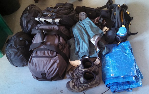
I packed the car last night. Everything went together just like in the dry run. But after I was in bed I thought of something I should bring that wasn’t on the list. Not just once but twice. Still, I managed not to think of taking a bagel out of the freezer for breakfast, but if that’s my biggest oversight I’ll be in good shape.

According to plan, I backed out of the garage promptly at 5:00am. Wanting to minimize my time on the Interstate, I got off I-25 at Ft. Collins and took US 287 to Laramie. The sun made its appearance about the same time I crossed the border into Wyoming. It was cloudy but not really overcast. The clouds were in layers, the lowest draping themselves over some of the hilltops.

I entered Laramie at about 7, looking for fuel and breakfast. I was pretty certain that if I went up the main drag I’d find somewhere to eat. There was nothing. I gassed up at the Safeway and ended up grabbing something at Wendy’s before getting on I-80. I sat at a window seat and watched people look at the car. She never fails to draw a crowd.

I’d have to say I’m pretty spoiled when it comes to scenic roads. So it should be understandable that I find the views along I-80 in Wyoming pretty boring. There’s really nothing interesting to look at until about Rock Springs where the geology changes a bit. To offset the boring scenery, or perhaps because of it, the speed limit is often 80. Typically, I’m happy going about 5 over the limit, so I ended up running most of the tank of gas at 85 or so. Instead of my expected 35mpg, I only got 28.

After fuel and restroom at mile 68, my route takes me off I-80 and onto US 30 at mile 66. Heading up US 30, there’s not a tree to be seen anywhere. The place is dense with oil production sites, all painted brown in an attempt to blend into the background. I’m amused that each has its own little solar panel. It’s a four lane highway much of the way through here. After a while, the oil production is gone, to be replaced by coal strip mines. They’re not really visible from the road, but a couple hillsides are nicely terraced, obviously reclaimed coal mines.

My next stop was in Cokeville for food. A couple miles out of town I saw a sign for a diner that looked promising. But when I came upon it, there were no cars in the parking lot. My first thought was “how good can they be if they don’t have any customers?” In retrospect that probably isn’t fair. Cokeville’s not a very big place. Instead, I grabbed a piece of pizza at the Pilot station. The pizza is from the convenience store – their restaurant is closed down. But it was actually a nice piece of pizza.

The weather had cleared up when I got on US 30, so I had some sun. But by here, the sky was filled with scattered clouds, some producing rain. I started going through these little squalls periodically. Never more than a few miles wide, they never caused me to turn the wipers on more than intermittent.

Before long, I was back on the super slab, northbound on I-15. The plan was to spend the night at Blackfoot for an early start with a quick stop at Craters of the Moon. This clearly would be suboptimal. I arrived in Blackfoot promptly at three. Way too early to bed down. So I fuelled up again, talked to three more guys about the car, and headed west on US 26.

In spite of the Snake River flowing through this valley, I find it very much like the San Luis valley. The native vegetation is much the same. It’s a bit denser here, and there is quite a bit more irrigated land than there.

I soon started seeing signs for the EBR-I Atomic Museum, a national heritage site. Miles from anywhere, I see a block shaped building a mile or so off the road. This is Experimental Breeder Reactor I. This was the first power plant in the world that produced usable electricity from atomic energy. This was Dec. 20, 1951. It was made a National Historic Landmark by LBJ in 1966.

The place was not at all what I expected, with the possible exception of the control room. Everything else was much smaller than I figured, although I can imagine the evolution from this early setup to something that would fit in a submarine. Very cool. And in spite of it being in the middle of nowhere, I was not the only visitor.

I spent about forty minutes there and when I returned to the car it was starting to rain again. By the time I got to Craters of the Moon, it was raining heavily. Perhaps I should have stopped at the visitor center anyway, but it was really coming down hard now and I had no idea how long it would last. So when a couple of bikers passed me, I let them get a bit ahead of me then matched their speed.

IMG_3815s

We had a nice little run, interrupted by some light traffic. They weren’t going that much faster than I’d have gone on my own but it was nice to pick up the pace a bit. Sometimes they went quite a bit faster than I expected, given the conditions. There was the occasional puddle of standing water. Again, the storm was fairly localized. Within twenty minutes we had gotten out from under it and the road was only damp.

This section of road around Craters of the Moon reminds me a lot of the area around Grants, New Mexico. The terrain, vegetation, and geology look quite similar to me. The lava here is blacker, perhaps, which makes me think it’s more recent.

US 20 and US 26 run the same route from Blackfoot past Craters of the Moon. Shortly after US 26 makes a right turn, the riders pulled over. I waved at them an continued. The weather had returned to the small, light squalls. I was back to my 5 mph over the limit. Traffic wasn’t heavy and slower cars were easy to pass.

Here I passed a red Honda. At least, I think it was a Honda. All identifying markings had been removed. It was red with black accents and darkly tinted windows. After I passed him, he matched my speed, following quite closely. Soon he downshifted and blazed by me at about 90, whereupon he slowed down again. I passed him a second time and he continued to follow me quite closely for quite a long time. He was being a bit of a butthead.

For the most part, both 20 and 26 were straight, flat roads. The valleys here are wide with flat bottoms. Sometimes the highway ran along the side thus twisting to and fro a bit. But long stretches were more centered in the valleys and the road has long straight stretches. Finally 26 started bending around the terrain, rising and falling. I ran into no traffic; my pleasure was uninterrupted. It was, however, short. I soon found myself at the junction with I-84.

Again the speed limit is 80, but here there is much more traffic than in Wyoming. The sky had cleared and I was feeling a bit warm for the first time today. I don’t think it was ever much over 60 all day, and often quite a bit cooler. But approaching Boise it was sunny and warm.

I pulled into the Kopper Kitchen at 7 for a Cobb salad and iced tea, found a cheap but clean motel and looking forward to a much easier day tomorrow than originally planned. I was happy to stop and see whatever sights I found along the way, which wasn’t much. With fuel and food breaks and a short museum visit, I was on the road 14 hours and covered 845 miles. Certainly more seat time than I planned, but it will allow for quite a bit of leisure tomorrow.

Much of today’s route was along segments of the Oregon Trail. I can only imagine the hardships involved in making this trek a century and a half ago. Pack up all your worldly belongings in a covered wagon, hitch up a team of oxen, and make your way through these inhospitable hundreds of miles taking a day to go as far as I go in ten or fifteen minutes.

Trip Preparation

My planned Portland trip is less than two weeks away. I first came up with this mad scheme back in January. Early on, I obsessed about it quite a bit. Now it’s getting close and I find myself back in obsession mode.

Here’s the quick rundown: spend two days driving to Maupin, OR. Take a three day trip down the Deschutes River. A track day at The Ridge Motorsports Park followed by a track day with Club Lotus Northwest at Portland International Raceway. Hike Mt. St. Helens. A third track day at Oregon Raceway Park. Hike Mt. Hood. Spend a few days in the office. One day on the road headed to either Yellowstone or the Grand Tetons. Hike there. Drive home.

That’s the plan.

Although there are some missing elements – I only know where I’m sleeping on eight of the fifteen nights – I’ve definitely moved from planning to preparation.

The car is nearly ready to go. I changed the oil today. I had the brakes flushed Friday, along with a couple minor repairs. I still need to clean the air filter.

2014-08-10 18.22.54sI have a lot of kit to take. I feel a bit like Imelda Marcos, taking driving shoes, hiking boots, old shoes for the river trip, and a pair of sneakers. I have my fanny pack for hiking and my backpack full of work stuff and the laptop. I have helmets, driving suit and gloves, and tools for the track days. Cameras, tripods, connectors, chargers. Poncho, windbreaker, sunscreen. And, of course, clothes.

It’s a small car. I’ve been concerned it might not all fit. When I do track days, I have too much gear to take a passenger. But I’ll leave the five gallon gas can at home and won’t bring a lawn chair. Not as much gear when I hike, but still a non-trivial pile of stuff. Neither of those requires me to pack ten days of clothes and my work backpack. I wonder if I need a TARDIS to fit it all.

2014-08-10 18.32.30s

This evening Genae helped do a dry run.

2014-08-10 18.31.52sAmazingly, everything fit. Note that I had the top in the drivers seat. I’ll start with the top on and when it’s nice enough to go topless, it will have to ride in the passenger seat. And I’ll need to make sure some items are handy, but I’m pleasantly surprised with the results.

And I still have ten days or so to go over the lists. I wonder what necessity I’m forgetting…


Long Beach

It took me the better part of two weeks to post about our Moab trip because as soon as we got home I had to go to Long Beach on business.

Although I spent the better part of two years working in Burbank, it has been fourteen years since I was in Long Beach for the race. On that trip we were in a motel a few miles from the track, but this trip I stayed downtown at the Marriott. The place has changed considerably in the meanwhile.

Each day for dinner, I walked from the hotel to a restaurant nearby. After eating I walked back along part of the race course. In the sidewalk in front of the convention center they’ve put some commemorative plaques, like this one:

2014-06-04 19.14.06s

Phil Hill, 1961 F1 Champ, Ferrari

The rental car this week was a Hyundai Accent, an average car in almost every way. Mine was a neutral color, sort of gray and at the same time sort of brown. The only memorable attribute of the car is the uncomfortable driving position. With the seat adjusted properly for my legs, the steering wheel was too far away.

I know I did it in the past, but today I have a hard time imagining getting around unfamiliar places without the aid of GPS. On this trip, I think Google was messing with me. It led me from the hotel to the client’s office along a different route each day, both in the morning and evening. I assume this was due to traffic. That said, it led me down a street where a train was more or less parked.

One evening I went to Burbank for dinner with a friend. Once GPS got me on I-5, I knew exactly where I was going. When I got within four miles, Google wanted to send me to Glendale. The wonders of technology.


Red Rocks Ramble

Red Rocks Ramble was the sixth edition of LoCo’s Colorado Good. This time we explored Moab. Saturday drive to Moab, Sunday a morning loop, a free afternoon followed by happy hour at the motel, Monday tour Colorado National Monument before the final blast down I-70 to home.

Saturday, May 31

We met the Denver contingent at the Fort for an 8:30 departure. We were told that photographer Mike Rodgers (Driven Imagery) would get some shots of us from an overpass at Parmalee Gulch. Turns out he went as far as the summit of Monarch Pass. I’m pretty sure I saw him shooting us in South Park, too.

RedRocksRamble01Most of the drive would follow our tracks from last spring: meet folks from Breckenridge in Fairplay, Springs folks near Buena Vista, lunch in Gunnison where we picked up our last participant. But after Ridgway we went straight instead of turning left to Telluride. This took us up the Norwood grade, through the town of Bedrock and Paradox Valley. There was absolutely no traffic all the way to the junction with US 191, a high-speed blast punctuated by occasional cattle guards.

RedRocksRamble02We weren’t so lucky on 191 all the way to Moab – lots of trucks and RVs. We arrived at the motels – we were in two motels, across the street from each other – in plenty of time to check in and get cleaned up before dinner with the group at the diner next to the motel.

One sad note for the day – Jeff broke the suspension on his Birkin near our fuel stop in Montrose and had to drop out.

Sunday, June 1

We woke to a beautiful morning and after breakfast assembled for a drive on the La Sal Loop Road. As it was hot the whole weekend, we kept the top on most of the time but we slathered on the SPF and went al fresco.

We made the run clockwise, going north from Moab and along the Colorado River through a dramatic red rock canyon. The river is calm through here, no whitewater. But the water looked very high. Quite a lot of traffic through here, as one would expect. We soon found our turn and headed south into the La Sal Mountains.

I’m sure it was a beautiful road, however many decades ago it was last paved. But it was very scenic and I think everybody enjoyed it. We pulled over for a break and a group picture. Some of the folks were wishing they’d brought a light jacket, which was a pleasant break from the heat we had the rest of the trip.

We broke into smaller groups for lunch and went off to explore on our own for the afternoon. A lot of folks headed to Arches, but we’d been there before so the choice was Dead Horse Point or Canyonlands. I suggested we do Canyonlands and hit Dead Horse Point on the way back if there’s time. There wasn’t.

Upheaval Dome

Upheaval Dome

I’d looked at the map of the park before leaving the house. I hoped maybe there’d be a short hike we could take, not much more than a mile. Upheaval Dome fit the bill, so that’s where we headed first. Round trip is a mile, characterized by the pamphlet as a “steep” 200 foot climb.

IMG_0698_stitch_smallAfter that, we pretty much stopped at every major scenic point on the road. We didn’t see anybody else from LoCo and in fact it seemed like most park visitors were foreigners. I chatted with a guy from Germany (“I see a lot of Lotuses in Germany!”), heard Chinese and Japanese, French and Spanish spoken.

IMG_0702_stitch_smallBack at the motel, we had happy hour – margaritas, snacks and conversation. Then out to Eddie McStiff’s for dinner with the group.

The day wasn’t without glitches. One of the M100’s suffered not only a nasty rock impact and broken windshield but had a mechanical problem as well. And an Elise had to make a run to Grand Junction for tires.

Monday, June 2

The first few miles of the day were a repeat of yesterday. We stopped beneath the canyon walls for a group picture. Ross’s general rule is not to put the same color cars next to each other, but that is especially true for yellow. I think Mike parked next to him just to needle him a bit. Sometime I’d like to try lining them up like a rainbow.

IMG_0717sAt our morning pit stop in Fruita I managed to catch an impromptu group shot at the Loco station. Gotta get a shot of LoCo at Loco, right?

2014-06-02 09.55.52sGassed up and refreshed, we headed into Colorado National Monument. I’ve been by here a handful of times but never stopped for a visit so it’s about time. It is a pretty interesting place. The geography is similar in many ways to Canyonlands, but smaller and more intimate. I ran the camera for this part of the drive and will post a second video if I manage to put together anything interesting.

IMG_0722_stitch_smallLunch in Grand Junction at the Kannah Creek Brewing Company for the official end of the gathering. Several of us stuck together for a few miles of twisty roads along I-70. We took County Road 45.5 into DeBeque, then side roads up and down the side of the valley to minimize our time on the super-slab.

For the run from Rifle to Frisco, we were down to four – an Evora, two Elises, and a Miata. We find the trip through Glenwood Canyon always interesting – the highway is quite the engineering marvel, even if it is just a highway. But this time, the river was running higher than either of us recall seeing it. The bike path was flooded for long stretches, and the water looked to be within a foot or two of the railroad tracks.

Once through the canyon, we put the hammer down for a high speed run over Vail pass. A Volkswagen stayed on our tail until we got to the foot of the pass. There we passed a Pantera, who made an attempt to keep up with us. After a few minutes neither he nor the VW was in our mirrors.

We had to gas up in Frisco. At the next pump was a guy filling his Harley. I was thinking he looked familiar when he said, “You were in Moab.” We had met the day before. He arrived in Frisco along an entirely different route and was headed for Trail Ridge Road next. He had ridden 1600 miles in three days, starting in Texas.

The rest of the trip was leisurely and mostly uneventful. We were held up for a few minutes while they did some blasting at the tunnel construction east of Idaho Springs. And there was construction on one of the overpasses. They ground the asphalt off but didn’t make a little ramp as normal. I hit that edge hard at about sixty and both my turn signal assemblies popped out of their mounts and flopped around until I could get pulled over. Lost one of the grommets. It’s an $8 part, but $20 for shipping.

I can’t speak for everybody, but we had a grand time.

Two Weeks in Portland

I’ve been quiet here because I’ve been a bit busy. I’m nearing the end of two weeks in Portland on business.

Rewinding to last week, but first a digression. I recently decided that it would be great fun to make the drive here from Denver if I could arrange a track day at Portland International Raceway. I reached out to the local enthusiasts, Club Lotus Northwest (CLNW) and found that they’re having a track day at PIR on August 29. I also signed up for their mailing list. When my presence was requested in the office, it turns out that I’d be in town when CLNW had one of their meetings.

So last Tuesday I found myself at the McMenamin’s Courtyard restaurant at the Kennedy School to meet with the fine folks of CLNW. Genae and I make fun of the TV shows where the substance abusers all know that there’s an AA meeting right around the corner from wherever they are. And so I travel a thousand miles to attend a Lotus club meeting. “My name is Dave and I drive a Lotus!”

The Kennedy School was an elementary school built in 1915. McMenamin’s renovated the once abandoned gem, turning it into a complex featuring a 57 room hotel, a theater, and a handful of restaurants/bars. I probably should have wandered around the place a bit to enjoy the murals. I’ll put it on my list for a return visit.

A few quick thoughts on my two weeks here:

  • Rental car for the first week was a Kia Forte. Never heard of it before. First car I’ve driven in ages that didn’t have a remote lock. A very pedestrian car completely lacking in any interesting features.
  • Week one’s hotel room was on the top floor, right next to the elevator. I was expecting it to be noisy but I was pleasantly surprised it was quiet. But each morning I was awakened to the smell of bacon – the breakfast area was directly below me and the scent went straight up the elevator shaft.
  • Going through security at DIA they directed me to a line where I didn’t need to remove my jacket, belt, or shoes, and could leave the laptop in the backpack. A first for me.
  • Returning to Denver, my flight was delayed over two hours due to wind in Denver. Only the second time I’ve had a flight delayed due to weather in Denver.
  • Second time through DIA I was again diverted, this time through the TSA pre-check line. Do they not realize I’ve been on the watch list for the last several years? I could get used to such quick screening.
  • I’m certainly spoiled by the weather in Denver. I enjoy my time here in Portland, but the weather is a bit of a downer. I may be wrong, but I think it has rained every day I’ve been here these two weeks. I’m told the sun comes out by July.
  • Week two’s car is a Dodge Avenger. How did they manage to give an exciting name to such a drab car?
  • This week’s hotel is being renovated. At least the rooms on my floor are. I’m in a newly redecorated room. Half the rooms are under construction – there are post-it notes on most doors: “Complete by Friday”, “Tile: caulk soap dish, caulk top of tile in shower”, and so on. New carpet, tile, wallpaper. But they kept the old sink and bathtub. Instead of the smell of bacon in the morning, I get the smell of paint all the time.
  • I’m a bit stuck in a rut in the restaurant category. I have dinner at another McMenamin’s place – John Barleycorn’s. This time was a pint of their Ruby and a chicken pesto sandwich.
  • Being a book junkie, I make a trip downtown to Powell’s City of Books. Three floors that take up a full city block, I can never make an exit without an armload.
  • Each time now, I eat at the Deschutes Brewery a block from Powell’s. Tonight it was smoked chicken and field greens – basically a Cobb salad with greens instead of iceberg lettuce. And a half liter of one of their cask ales. Yum.


Estes Park

Today we drove to Estes Park for lunch. Yesterday I called a couple places up there and asked if they were open and if we’d be in the way if we went up there. “Please come.” So off we went. We drove Genae’s car, not knowing what sort of road damage we’d encounter.

We gassed up and reset the trip odometer and headed west on 88th. This turns into Colorado 72 and goes up Coal Creek Canyon. This road, though, is closed at least until November. We head six miles south to Golden Gate Canyon and up to Colorado 119 north of Blackhawk. Here the traffic started getting heavy. Not many RVs, but lots of side dump trucks running in both directions.

North of Nederland we started seeing evidence of rock slides almost everywhere the road makes a rocky cut. A crew was filling a dumptruck with fallen rocks where the road makes a long cut just before Allenspark. When we passed the turn for Wild Basin, I noted that we’d been driving for two and a quarter hours. In the morning, before traffic, I could probably get to the trailhead in two hours. So a hike here has as long a drive as about any west side hike.

The most dramatic flood damage we saw was at Camp St. Malo. There’s a huge pile of debris on the west side of the road. It looked like the road had been closed here at some point.

Flood debris at Camp St. Malo

Flood debris at Camp St. Malo

The road along here must have looked more like a river. Most of this section of road is narrow because it has no shoulders. The white line marking the lane really marks the edge of the asphalt. Water ran along the edge of the road, washing away big channels of earth.

Landslide on Twin Sisters

Landslide on Twin Sisters

It’s clear that an incredible amount of water fell here. There’s a large landslide on Twin Sisters. The bathtub ring in the debris at Camp St. Malo was about eight feet above the top of the rubble. And standing there, you can see a fresh scar on Meeker as well.

After Lily lake the road descends steeply. Here the water undermined the edge of the southbound lane, causing chunks of asphalt to break off, even in the stretch that was recently repaved.

I thought we’d see if we could go far enough down Fish Creek road to go by the house on Rams Horn but it was closed above Carriage Dr. In any event, it had taken over two and a half hours to get here, and we had to be back home by four at the latest so we didn’t have much time. The plan was to grab pizza over by the Safeway then see if I could get some cheese corn at the Carmel Crisp and finally grab some beer at the brewery. So we headed straight to the restaurant – Village Pizza.

I can’t recall ever seeing fewer cars in that parking lot. The place looked closed, but the sign said open so in we went. We were the only people there. Three or four other tables were seated within minutes of us. After enjoying our pizza we headed downtown. I was pleasantly surprised. You could hardly tell the place had been flooded. Plenty of available parking near the post office.

We popped into Carmel Crisp and got some white cheddar jalapeno popcorn. They’ve been there for 38 years and I’ve probably been buying cheese corn there that long. The place really hasn’t changed in my memory, except that they sometimes put another little snapshot on their wall. They have one showing damage from the Lawn Lake flood in ’82.

I asked how long they were out of commission. They said just a short while. They had to wait for their inspection sticker but had the place cleaned up in a couple of hours. They had very little water in their shop. Some time ago their neighbors remodeled and put a wall very close to their front door. Their door is angled, and this wall sort of impedes traffic flow. They went to court over it at great expense but lost. In the end, it diverted the water enough to save them some grief.

Next, pick up some beer. We head up West Riverside Drive, not seeing much damage. Different story at Fun City, though. A fair amount of debris there. After grabbing some Stinger wild honey wheat and Estes Park Gold, we continue up Riverside. I’m happy to see that things aren’t as bad as I’d feared. We didn’t driver through Manor RV but considered it. We did drive slowly to get a good look and saw nothing out of the ordinary.

Up Marys Lake Road and back to 7. Traffic was pretty bad all day. We often saw strings of twenty and thirty cars in the other direction. On the way back was saw more sports cars, sometimes two or three together but nobody was even moving the speed limit. Side traffic often had long waits to cross or enter the highway.

It was more than 180 miles round trip, total elapsed time a tad over six hours but not much time spent in Estes. The roads were in good enough shape to take the Lotus but traffic sucked. But we did make it back in time. We had a date to see a movie, but that’s another post.

Colorado Good 5

Sorry this post is a bit late, I’ve been otherwise occupied.

Saturday, September 21

LoCo’s three day fall drive included a night in Gunnison and a night in Crested Butte. The route looked interesting, but we just have too much to do to join them. Day one, though, featured Independence Pass. I haven’t been over it in the last thirty years or so and Genae has never been over it. So we figured we’d join the group for the drive to lunch in Carbondale.

We met at a gas station near Golden and headed west on I-70. The trip up I-70 to Frisco is pretty scenic as far as interstate highways go, but not exactly a “Lotus road”. We weren’t a big group yet, missing a couple of Denver folks and not yet met with the Springs group. Even so, I was second to last in the string and lost sight of the Henrys behind me. I last saw them before Georgetown and they didn’t catch up until we exited the interstate at the junction with Colorado 91. By now we had two additional cars, both orange Elises.

Fremont Pass isn’t much twistier than I-70. On the northwest side of the highway there are a couple of large tailing ponds where there once was a mountain. And near the summit you can see another mountain being erased. At its peak, the Climax mine was the largest molybdenum mine in the world, producing three-quarters of the world’s output. It was idled in 1995 but put back into production last year, yielding over twenty million pounds per year.

We made a quick stop in Leadville before continuing on to Twin Lakes to meet the Colorado Springs contingent. There we found a patrol car parked on the side of the road with a mannequin in the drivers seat. After a short break we headed up the pass.

IMG_9908s

Rinker Peak (13,783′)

One of the objects of the drive is to see the turning of the aspen. We were a bit early, but still quite scenic.

Independence Pass tops out at 12,095′ above sea level. Twin Lakes, on the eastern end, is at 9,200′ and Aspen on the west is more like 8,000. It has a reputation for being hair-raising, and I’d say that would have been how I’d described it the first time I crossed it when I was maybe ten. At the foot of the pass, Genae said she’d compare it to Red Mountain Pass. My feeling, nostalgia isn’t what it used to be. I didn’t find it particularly thrilling. For Genae, Red Mountain is still the standard setter.

Summit Pano

I did enjoy the narrow parts on the western side. I’d forgotten all about those. There are three or four sections where the road isn’t wide enough for two way traffic. Cars on one side or the other have to wait for oncoming cars. I bet it’s loads of fun in a motor home.

We blasted through Aspen pretty much without stopping. Hit one red light, perhaps. The road snakes through town, right, left, right, left. At one turn, three or four kids had their phones out, getting us on video. Once through town, onto the superslab – not interstate, but damn close, down to Carbondale for lunch.

I didn’t plan the day very well. I considered making a side trip to Maroon Bells. It would mean going back to Aspen, which meant back over Independence to go home. Quite a long afternoon. Instead, we decided to come back to the area and spend a night or two, have a nice dinner in Aspen, take a short hike at Maroon Bells. Perhaps next spring.

So we headed up to Glenwood Springs and I-70 for the return to Denver. A lot more interstate driving than is ideal, but a pleasant day nonetheless. Glenwood Canyon is always interesting. It was recently repaired and all lanes are open both directions.

The Colorado Grand was finishing up in Vale. When we got there, we saw some transporters along the frontage road being loaded up with some of the cars. After Vail is the quick run up Vail Pass. I don’t remember what this one was like before the interstate went through. In any event, most cars make it up at 70 mph. Not exactly a Lotus road.

We stopped to fuel up in Silverthorne for the final blast back through the tunnel, and the run down to Denver. I’m curious what sort of fuel economy we were getting. It’s about 70 miles, which would normally be about two gallons. But the gauge still indicated nearly full. If I burned a gallon and a half, I’d be surprised. Which would mean something like 45 or 50 mpg. (And also means I probably only got 20 or 25 going the other way.)

I had the camera running from Twin Lakes to Aspen, but it’s bad. Within a few minutes of heading out, the lens fogged up. I’ve never had that happen before. If at first you don’t succeed, try, try again.

The Passes

Fremont Pass (11,318′) CD

Named for 1856 Republican presidential nominee John Charles Fremont although he never crossed it. Two narrow gauge railroads were built over the pass in the 1880’s, the Denver and Rio Grande and the Denver and South Park. The most dramatic scenery here is the mine. Entire mountains have been erased, with one undergoing the process.

Independence Pass (12,095′) CD

The town of Independence was named for the ghost town of Independence, founded July 4, 1879. Before that, it was known as Hunters Pass. It’s the highest paved crossing of the Divide but it’s only open in summers.

Vail Pass (10.663′) CD

This pass had no particular use prior to US 6 being put there in the 1940’s. Appropriately, it’s named for Charles D. Vail, chief engineer of the Colorado Department of Highways. Now it’s I-70, pretty much just another stretch of interstate highway.

Eisenhower Tunnel (11,158′) CD

Okay, this is cheating. The tunnel is not a pass. When the project was started it was called the Straight Creek Tunnel. This is two bores, one named for Eisenhower and the other for Edwin C. Johnson, a governor and senator who advocated for the interstate to cross Colorado.

I had a plane ride seated next to the guy who built much of the tunnel’s duct work. He was about ninety and missing a couple of fingertips. Quite an interesting character.

Spruce Tree House

Saturday, July 13

While in Hesperus for Genae’s family reunion, I had a few free hours to attempt a hike in Mesa Verde National Park. After a nice breakfast with the family, I headed to the park. I didn’t have the means to pack a lunch, so I resigned myself to making a detour to the Subway in Cortez. When passing through Mancos, though, I spotted a grocery with a deli and saved myself some time and miles. I got a turkey club sandwich, a triple decker made out of Texas toast. I wondered how I’d open my mouth big enough to eat it.

I stopped in at the visitor center. It’s a new facility just outside the gates of the park. There, I consulted with a ranger. Mesa Verde is built more for people driving around than walking. There aren’t that many hikes in the park, and they really want you to stay on the trail. This makes a good deal of sense – the plateau is riven with canyons, and every one featuring a sheer sixty foot drop. This time of year, it’s also sunny and quite warm. There isn’t any water on the plateau and not much shade, either.

I decided the best option was the Petroglyph loop at the Spruce Tree House. This ruin is self-guided, where Cliff Palace, Balcony House, and Long House required tour tickets. There is a seven mile loop hike available, but it doesn’t feature any ruins. So the Petroglyph hike it was, at 2.4 miles.

First stop, though, was a quick tour through the Spruce Tree House. It’s a bit smaller than the the Cliff Palace, but quite striking nonetheless. A forest fire burned here last year, and was within yards of the ruins. The trees are all piñon pine and scrub oak. Even the best of the trees in the area looked half dead before the fire. Where it burned, there are a few dead trunks standing but only grass otherwise. Most of the road atop Chapin Mesa goes through the burn area.

The trail from the parking lot to the ruins goes down one side of the canyon and up to the ruins from below. The trail switches back several times and is paved with asphalt. In the morning the ruins are cool and shady. It’s only a couple hundred yards from the parking lot to the site, but lots of people were having difficulty. There’s a kiva that you can climb down into, but for the most part you are restricted to the area directly in front of the ruins and entry is forbidden.

The Petroglyph Point trail starts below the ruins and runs beneath the sheer slab of the rock formation that forms the top of the mesa. Sometimes flat rocks are stacked to make staircases, in other places steps are hewn from the living rock. The trail was not very crowded. It had rained the previous evening and it looked like only a couple dozen people had walked here since. It didn’t take long for me to pass a couple groups stopped at the various markers, reading the guide.

It was much warmer than I’m used to, and I went through water at about four times my normal route. After about a half mile, I was as secluded as I could get there. I could hear the group behind me yelling and laughing. The trail follows the bottom of the cliff along the inside of the canyon, neither climbing nor descending; a circuitous route.

A bit less than a mile along the trail are the petroglyphs. I have to admit I was a bit underwhelmed. The first time I saw petroglyphs was on a week long rafting trip down the Green River in Utah. We stopped for lunch one day and took a short hike up the canyon to see them. I remember them as being quite vivid, and on a large scale. These were subtle and small. The sign was almost bigger.

Just before arriving there, I’d been hearing voices ahead of me on the trail. I thought I had caught up to another group. Turns out they hiked out on the loop backwards to where it descends the cliff. This loop is one way, though, and they didn’t go down. I wouldn’t have gone down those steps myself. No problem going up, but not my cup of tea to go down. They hollered down at me: “Is that the petroglyph?”

Before coming up, I saw them a few yards away at the top, posing for pictures. From below, it very much had the sense of “Hold my beer and watch this!” One false move and they’re a splash of color on the rocks below.

The return part of the loop goes along the edge of the canyon, just above the trail below. There some places you can see the trail on the opposite side of the side canyon; I could hear hikers below me. Near the end of the loop, the trail crosses through the burned area just above the ruins. There I saw one giant flower; it was the only bright color in sight in any direction. Bees had found it and were going about their work. Who knows how far they have to fly each day? Not exactly a field of wildflowers.


Colorado Good: Four to the 4

The Colorado Grand is an annual charity tour for older cars that covers about a thousand miles in five days, attracting entrants from around the world. Lotus Colorado started doing a smaller version of this for group members. It’s not restricted to pre-1960 cars. It’s not even restricted to Lotuses. Here’s how Ross described it last month:

Many of you have been with us on our Colorado Good, where we do a bit less than the Colorado Grand; three days instead of four, about 800 miles instead of over a thousand miles; stay at good hotels instead of grand hotels and dine at good small yet really cool specialty restaurants with reasonable prices. This will be our fourth trip and will go to the Four Corners via Telluride and Pagosa Springs.

For one reason or another, we haven’t been able to join on the earlier trips. Everything worked out for this one though, so we signed up.

Saturday: Denver to Telluride

We met at The Fort restaurant near Morrison for a 9:00am departure. Actually, everybody else met closer to 8:30 but we were running a bit late and managed to show up a minute or two before everybody hit the road. We started with just the Denver area contingent and picked up folks from other locations as we went.

When I was a kid, we parked the Airstream in a trailer park called Chateau Chaparral near Nathrop, where Chalk Creek flows into the Arkansas River. They had their own suspension bridge over the Arkansas and we rode horses or dirt bikes in the national forest on the east side of the river. We made the drive there from Denver almost every week those summers. So I’ve probably been up and down that section of 285 a hundred times, maybe half as a passenger and half as a driver. So the first part of the drive was old hat for me.

Just after the junction with Colorado Hwy 9, we passed an orange Elise, the first of the Colorado Springs folks. We met the rest at Johnson’s Village, three red cars: a Corvette, a Porsche Boxster, and an Elise. After gassing up and a short break, we continued on to Gunnison for lunch at the Palisades Restaurant, meeting the final member of the group. We were now thirteen cars: 5 Elises, 2 Esprits, an Evora, an Elan, a Birkin, a Corvette, a Boxster, and a Honda S2000.

After lunch the route led us through Montrose and to Ridgway where we took another short break. We intended to stop at a gas station on the corner of US 550 and Colorado 62, but a tractor trailer rig had just run over a sign and was stopped to try and put it back up. The road was under construction a few yards up 62 and between the two traffic was getting pretty snarled up. We pulled over a couple blocks farther up.

Here we met a police officer who was a bit upset with us. He had a report that at 3:48 a red car in our group ran somebody off the road. We had been driving in a spirited way, shall we say, and running near the back of the group I saw a few aggressive passes, but didn’t see anybody get run off the road. In any event, we expected to be under scrutiny for the rest of the day.

I had been over the road between the junction of 285 and 50 a handful of times, even once in the Elise, but from Ridgway to Telluride was new to me. Climbing out of Ridgway the road sweeps in great arcs, giving us great views of the mountain range to the south. The weather was dramatic, clouds dropping veils of snow and rain. Very beautiful. I had mounted the GoPro camera while we were stopped, but the precipitation compromised the footage. Perhaps I’ll be able to salvage some short highlights.

The town of Telluride is at the end of a short spur road at the eastern end of a dead-end valley. Prominently in view climbing the steep end of the valley is a four-wheel drive road, its zig-zag filled with snow. As we arrived, a bit of a storm was descending on the village. We gathered for margaritas and conversation while thunder clapped just before the snow started to fall.

Loti in the snowTwo guys were walking down the street and saw the red Elise parked second from the end (next to the ‘Vette, but out of the picture above). “Cool! A Lotus! I want one of these!” They continued to the corner, where I heard “Another Lotus!” I really wanted to yell at them “Not two Lotuses – ten!”

Telluride, the next morningSomebody once told me the name Telluride was shortened from “To hell you ride” but this turns out to be a tall tale. It’s actually named for compounds of the element tellurium. The place was founded in 1878 as Columbia, but the post office changed the name in 1887 to avoid confusion with Columbia, California. I had guessed it must have been founded around 1880 judging by the street names. One street is Galena, which is Ulysses S. Grant’s home town.

We crossed three notable passes on Saturday.

Kenosha Pass (10,000′)

There’s not much to Kenosha Pass. In the mining days, it was called Kenosha Hill or Kenosha Summit, named for Kenosha, Wisconsin, the home of Clark Herbert, a Kenosha Pass stage driver. It crosses from the South Platte drainage into South Park and tops out at around 10,000 feet. Major Long’s party didn’t go up the canyon in 1820, deeming it too rugged. Kenosha pass was first crossed by the Bean-Sinclair party in 1830. In May of 1879 the railroad made it to the summit and US 285 follows that old route, which is in indication of it’s fairly shallow grade and lack of sharp turns.

Trout Creek Pass (9,346′)

This is the passage from Antero Junction at the west edge of South Park to the Arkansas valley. Zebulon Pike crossed the pass in 1806 when it was an ancient trail. He was correct in thinking the next drainage north was the South Platte, but mistaken when calculating that the next drainage beyond that was the Yellowstone. The Denver and South Park and Colorado Midland railroads were built over it in the 1880’s. The South Park side isn’t much, just a straight climb of a few hundred feet but the Arkansas side is a nice twisty road with excellent views of the Collegiate range: Princeton, Yale, and Harvard, all 14er’s.

Monarch Pass (11,312′ CD)

Crossing the continental divide at the southern end of the Sawatch Range, the summit affords views many consider the finest in the area. The current route was devised by Charles D. Vail and the road opened in November of 1939. The first highway department signs bore the words “Vail Pass” but unknown persons slopped the signs with black paint overnight.  On oil companies’ maps it was called Agate-Monarch Pass and before long the “Agate” was dropped.

Sunday: Telluride to Pagosa Springs

After breakfast in the hotel, we saddled up and headed to the Four Corners. There was a bit of drama at first, as one of the Elises had battery problems. That was quickly solved, though, and we were soon on the road. The drive south on 145 gives nice views of the peaks to the east before flattening out in drier climes and passing through Delores and Cortez.

Before long we were in the desert of the Four Corners monument. It’s really not much of a place, but it was recently improved. I had understood it was recently moved, but this seems not to be the case. It is, in fact, 1807 feet east of where modern surveyors would locate it, but the Supreme Court has established that the location of the monument is the legal corner of the four states. We stopped here for photos and a break before heading to Farmington for lunch.

On the way to Farmington, we were passed by a crazy Indian in a Ford pickup. Imagine coming up behind 13 sports cars and deciding they are going too slow. We weren’t in danger of being arrested for our speed, but we were moving at a pretty good clip. This guy couldn’t wait to get by us, passing whenever and wherever he felt like it, generally across the double yellow line. He finally got past our lead cars when we entered Shiprock, NM. In a school zone.

The drive from Cortez to Farmington (with our detour to the Four Corners) is a pretty dull drive. Lots of straight lines and four lane roads. Some of the rock formations are interesting, but again this is an area I’ve driven through many times. After lunch at the Three Rivers Brewery, we stayed on US 64 until the junction with US 84. This junction is a T, with 64 to the right and 84 to the left. A herd of cattle was grazing in the field at the top of the T. When we accelerated away from the stop sign, one of the Elises was loud enough to cause the cattle to stampede.

The drive from here to Pagosa is quite pretty. The landscape quickly transitions from desert to mountain pine forest and the road sweeps left and right while climbing and descending. US 64 meets US 160 at another T intersection on the east side of Pagosa Springs.

The Springs ResortWe stayed at the Springs Resort, a very nice place. After checking in, we went out for dinner then back to the resort to relax in the 23 pools along the banks of the San Juan River. The pools vary in distance from the main spring, so each is a different temperature, varying from 83 to 114 degrees. If you’re daring, you can step from the pools into the river, which we were told was 44 degrees. A few of us did, but not me!

Steaming poolsSunday’s drive crossed only one notable pass.

Lizard Head Pass (10,222′)

The pass marks the headwaters of two tributaries of the Colorado: the Delores River and the San Miguel River. A trail crossed the pass as early as 1833, a wagon road in the 1870’s, and the Rio Grande Southern Railroad in 1891. The railroad was laid to connect Silverton and Ouray. The distance between the two was 26 miles by wagon road while the rail was 217 miles and was described as “the futile, transcendently triumphant Rio Grande Southern … a masterpiece of evasion.” The railroad was bankrupt in two years.

Monday: Pagosa Springs to Denver

After breakfast we headed east along US 160, stopping for a group photo on Wolf Creek Pass before crossing to the San Luis valley.

Group photoI’ve made the drove over Wolf Creek many times. It’s not the frightening trip it used to be, back when C. W. McCall wrote a song about it:

Well, from there on down it just wasn’t real purdy: it was hairpin county and switchback city. One of ’em looked like a can full’a worms; another one looked like malaria germs. Right in the middle of the whole damn show was a real nice tunnel, now wouldn’t you know?

It’s much straighter now, and two lanes up on each side, two lanes down most of the western side. The only dicey spot is the avalanche shed on the eastern side. It often has water flowing across the road, and because it’s in the shade all the time it can get icy. But it was nice to hear the song of the engines reverberate off the walls.

Lunch was planned for Buena Vista, but we decided to eat in Salida so we split from the group. We didn’t want to retrace our route back to Denver, so rather than staying on 285 we headed up Colorado 9 from Fairplay to Breckenridge over Hoosier Pass. The weather forecast indicated it might be snowing on the high peaks of northern Colorado. I wanted to go over Loveland Pass rather than through the Eisenhower Tunnel. We encountered a small flurry on Hoosier and decided it wasn’t bad enough to dissuade us from the more interesting route.

By the time we reached A Basin it was snowing fairly heavily. The ski area is still open but there wasn’t much traffic on the pass. Luckily, it also wasn’t that cold so the snow melted as it hit the road. A snow plow was out dropping sand but we managed to pass him easily and ran into no other traffic until we reached the interstate. It looked like a few inches of snow had fallen and was blowing off the drifts along the road. But all was clear not long after the summit. I had the GoPro running for the pass, but when we stopped to take the camera off the car I saw that it was iced over. Checking the video, it began to ice up right away, near A Basin.

The remainder of the drive was down I-70, with more traffic than I expected. They are working on widening the road through the twin tunnels east of Idaho Springs. They set up a detour there with the eastbound lanes running on the south side of the river.

We crossed five notable passes, three across the Continental Divide. (Trout Creek Pass is the fifth, already described above.)

Wolf Creek Pass (10,850′ CD)

Separating the San Juan and Rio Grande drainages, Wolf Creek Pass runs 52 miles. The west side is particularly beautiful. The pass had no noticeable use before 1913, when the road was built. Before then, travelers from San Luis Valley had no choice but to take the narrow guage railroad from Alamosa over Cumbres Pass to get to Durango.

Poncha Pass (9,011′)

Poncha (Spanish for “mild”) separates the Rio Grande drainage from the Upper Arkansas. Its first notable crossing was in 1779 by Governor Juan Bautista De Anza when he was pursuing a band of terrorist Comanche. In 1853, a man in Captain John W. Gunnison’s survey party crossed the pass and called it “Gunnison Pass”. I find it a more entertaining drive than Wolf Creek. The southern side isn’t much, as the San Luis Valley is much higher than the Upper Arkansas Valley. The descent down the northern side features long sweeping curves and a pretty view of Mt. Shavano.

Hoosier Pass (11,541′ CD)

There are two passes named Hoosier. This one is the division point between the Sawatch and Front ranges. John Charles Fremont crossed it on June 22, 1844 and homesick Indiana prospectors named it about 1860. It is surrounded by dramatic peaks – a number of 14er’s including Lincoln, Bross, Cameron, Democrat, and Quandary. The pass became a road in May of 1861 when nine wagons crossed it.

Loveland Pass (11,992′ CD)

This road doesn’t get nearly as much traffic as it used to. It has been bypassed by the Eisenhower Tunnel, which was originally to be named the Straight Creek Tunnel. William A. H. Loveland was wounded in the Mexican American War, mined for gold in California, and worked futilely to put a canal across Panama for Commodore Vanderbilt. He arrived in Golden in 1859 where he used his profits from selling axes and mousetraps to build railroads. In 1879 he hired 100 men and ordered them up Clear Creek with dynamite, scoops and chuck wagons. The road was across the pass by mid-May and on June 4, fifty wagons were counted going over.

Portland, this time

This week I spent three days in Portland, OR for the first time. That would be the 54th airport I’ve had the pleasure of visiting. Also seven weeks out of the last eight on the road.

I flew out Monday morning, booked on the 5:50am flight. I’ve flown out of DIA on Monday morning flights in the neighborhood of 80 times. I normally arrive at the gate as they start boarding or a few minutes before. This time I got there 6 minutes before departure. They close the doors at 10 minutes.

This week’s rental car was a Nissan Altima. It doesn’t have a key, just a fob. Push a button on the dash to start. But what do you do with the fob? I guess you’d pocket it once you unlock the door, but I just threw it on the passenger seat. I had to wait at the counter a few minutes for the car to be cleaned. It was either wait, or drive a minivan. So while I was waiting I leafed through a hiking guide to trails along the Columbia River. If I get to take another trip there in summer I’ll have to make sure I get out for a short hike. It also occurs to me that if I stayed an extra day I could hike to some glaciers on Mt. Hood.

When I went out to eat the first night, I learned they don’t have sales tax there. I had heard there are no self service gas stations by law, but the sales tax was a surprise to me. At the gas station, I was the only one who got out of his car and I chatted with the two attendants. They both mentioned the local slogan – “Keep Oregon Weird”.

Had dinner at McMenamins – John Barleycorn a nice little brew pub a half mile from the office. I had the chicken sandwich. The combination of the nicely toasted bun, half inch thick slices of tomato, and the “secret sauce” made it a messy, tasty eat. I had their amber, the Hammerhead. Probably should have considered their Ruby, a raspberry beer.

I flew US Airways, so I took the shortcut through Phoenix. It felt very familiar when we deplaned on the return trip when you get that blast furnace effect at the end of the jetway. Welcome to Phoenix! I had about an hour between flights, which left me thirty minutes to find some food and the right gate. We arrived at A17, and I’d leave on A18. Sweet. Except that all the restaurants in both A concourses were closed. Had to go all the way to the B concourse for a hot meal.

At Pizza Hut I grabbed a pepperoni pizza and a soda. It’s bigger than a personal pan pizza and it’s not their pan dough. The pie and the drink, over $11. Head all the way back to my gate, using six moving sidewalks each way. Are these movers for people in a hurry, or are they for people who are lazy? It can’t be both. The lazy ones make it impossible for anybody to hurry.

Back at the gate nearly half the seats are empty. The sun is streaming in nearly horizontally; anybody sitting facing the window gets it right in the face. Some opportunists have taken the seats behind pillars. Silly me, I’d have aligned the rows normal to the windows rather than perpendicular.

Ah, the glamour of business travel!