Blizzard Warning

Saturday, December 26

We drove to Phoenix for Christmas vacation. The weather was fine on our trip down, but it was a different story for the return. There was a blizzard warning for much of New Mexico – high winds and up to two feet of snow. Travel through the area was definitely not recommended. Our usual summer route takes us over Wolf Creek pass. I generally avoid Wolf Creek in the winter, as the ski area there gets more snow than any other in the state. And, looking at the forecast, Wolf Creek would be the only place in Colorado with a blizzard warning. This left us thinking the best route would be through Moab, up to I-70, over Vail pass and through the Eisenhower tunnel. The weather map had this route covered with a couple hundred miles of winter storm warning.

When the chain law is in effect, you are required to have either adequate snow tires (studded) or tire chains. We have all season radials and don’t own chains. If you get stuck on the road and obstruct travel when the chain law is in effect you face a significant fine. I found an auto parts store in Flagstaff that had chains in stock and a place for breakfast next door.

We were on the road by 5:30, in Flagstaff by 7:30. The moon was nearly full, and the pre-dawn was fairly bright. A few miles before reaching Flagstaff, a very light snow was falling from a cloudless sky. It wasn’t cloudless for long. By the time we got to Flag, it was near-blizzard conditions: cold, windy, snowing.

We didn’t dilly-dally – bought our chains, ate breakfast, fueled up, and hit the road. We headed north on US 89. There must have been other bad weather around the Grand Canyon as the electronic informational signs on the highway mentioned closed entrance roads. But a few miles north of Flagstaff, the skies cleared and the only snow in sight was already on the ground.

The wind continued to be fierce. Between Tuba City and Kayenta I started thinking I was playing some sort of hyper-realistic video game: dodge the tumbleweeds. At irregular intervals, tumbleweeds would blow onto the road. Sometimes they were coming straight at me. After a bend in the road they came diagonally across the road. Oncoming traffic increased the degree of difficulty.

In Kayenta we headed north on US 163 and into Monument Valley. It would have been nice to be able to take our time, pause here and there to enjoy the view, but every extra minute spent here added a minute after dark through the mountains on I-70. As it was, I didn’t have the good camera with us. All the pictures below were shot with a cell phone from a moving car.

2015-12-26 11.05.55s

Monument Valley

As we headed north, the snow on the ground got deeper. While we were gassing up in Blanding, a number of folks pulled up to the air station to inflate their inner tubes. There must have been a fun place near by to go snow tubing. On the highway north of Blanding, the driving got a bit treacherous. The wind whipped the snow into sheets across the road. The plows were out, scraping and spreading gravel, but they were having a hard time keeping up. After about twenty miles of this, things cleared up.

2015-12-26 13.21.57s

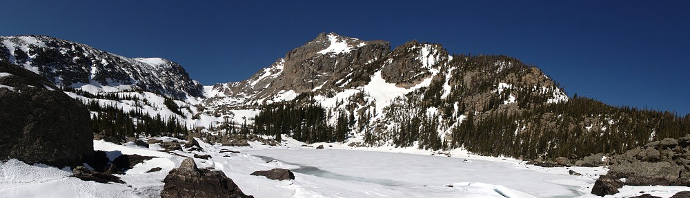
Wind whipped La Sal mountains

Although the roads were clear again, the wind was still ferocious.

We stopped in Moab for a quick lunch. From there, we took Utah 128 through the canyon alongside the Colorado River. When we were last here with LoCo it was in the neighborhood of 100 degrees. Then, the river was running quite high. Today it was closer to 10 degrees, but the river seemed still quite high; pale blue instead of the summers muddy brown.

2015-12-26 14.28.22s

We took advantage of modern technology and kept checking the weather radar. The route ahead looked clear. It looked like we wouldn’t need our chains. Better safe than sorry.

I find the cliffs to the east of Grand Junction generally not that interesting, particularly compared to the terrain to the west, the Colorado Monument. But today they were stunning. From the looks of things, the snow was blowing from the northwest as it fell. The details of the terrain stood in stark contrast – white on one side, snow-free on the other.

Rifle was our last fuel stop, and we were in full darkness soon after. The forecast winter storm evidently didn’t materialize – roads were dry and snow free. The only snow on I-70 was the last few yards of road before entering the Eisenhower tunnel. I wondered what we’d see on the other side; often the weather can be radically different on one side of the Continental Divide than the other. Exiting the tunnel, instead of bad weather, we saw the no-longer full moon peaking over the mountains to the east.

Coming down Genesee mountain we could see the lights of Denver spread out in front of us. Almost home! About a mile and a half from the junction with C-470, we were stopped in our tracks. There was an accident and all three lanes were blocked. We were stuck there for an hour.

After having the pleasure of being able to take my time getting from Point A to Point B, being able to avoid interstate highways, it was a bit of a drag making this trip in a single day. But we didn’t want to take half our holiday break getting to and from. Sometimes you just have to grin and bear it.

It was a long day, but we’re happy to be home and sleeping in our own beds.

Red Rocks Ramble

Red Rocks Ramble was the sixth edition of LoCo’s Colorado Good. This time we explored Moab. Saturday drive to Moab, Sunday a morning loop, a free afternoon followed by happy hour at the motel, Monday tour Colorado National Monument before the final blast down I-70 to home.

Saturday, May 31

We met the Denver contingent at the Fort for an 8:30 departure. We were told that photographer Mike Rodgers (Driven Imagery) would get some shots of us from an overpass at Parmalee Gulch. Turns out he went as far as the summit of Monarch Pass. I’m pretty sure I saw him shooting us in South Park, too.

RedRocksRamble01Most of the drive would follow our tracks from last spring: meet folks from Breckenridge in Fairplay, Springs folks near Buena Vista, lunch in Gunnison where we picked up our last participant. But after Ridgway we went straight instead of turning left to Telluride. This took us up the Norwood grade, through the town of Bedrock and Paradox Valley. There was absolutely no traffic all the way to the junction with US 191, a high-speed blast punctuated by occasional cattle guards.

RedRocksRamble02We weren’t so lucky on 191 all the way to Moab – lots of trucks and RVs. We arrived at the motels – we were in two motels, across the street from each other – in plenty of time to check in and get cleaned up before dinner with the group at the diner next to the motel.

One sad note for the day – Jeff broke the suspension on his Birkin near our fuel stop in Montrose and had to drop out.

Sunday, June 1

We woke to a beautiful morning and after breakfast assembled for a drive on the La Sal Loop Road. As it was hot the whole weekend, we kept the top on most of the time but we slathered on the SPF and went al fresco.

We made the run clockwise, going north from Moab and along the Colorado River through a dramatic red rock canyon. The river is calm through here, no whitewater. But the water looked very high. Quite a lot of traffic through here, as one would expect. We soon found our turn and headed south into the La Sal Mountains.

I’m sure it was a beautiful road, however many decades ago it was last paved. But it was very scenic and I think everybody enjoyed it. We pulled over for a break and a group picture. Some of the folks were wishing they’d brought a light jacket, which was a pleasant break from the heat we had the rest of the trip.

We broke into smaller groups for lunch and went off to explore on our own for the afternoon. A lot of folks headed to Arches, but we’d been there before so the choice was Dead Horse Point or Canyonlands. I suggested we do Canyonlands and hit Dead Horse Point on the way back if there’s time. There wasn’t.

Upheaval Dome

Upheaval Dome

I’d looked at the map of the park before leaving the house. I hoped maybe there’d be a short hike we could take, not much more than a mile. Upheaval Dome fit the bill, so that’s where we headed first. Round trip is a mile, characterized by the pamphlet as a “steep” 200 foot climb.

IMG_0698_stitch_smallAfter that, we pretty much stopped at every major scenic point on the road. We didn’t see anybody else from LoCo and in fact it seemed like most park visitors were foreigners. I chatted with a guy from Germany (“I see a lot of Lotuses in Germany!”), heard Chinese and Japanese, French and Spanish spoken.

IMG_0702_stitch_smallBack at the motel, we had happy hour – margaritas, snacks and conversation. Then out to Eddie McStiff’s for dinner with the group.

The day wasn’t without glitches. One of the M100’s suffered not only a nasty rock impact and broken windshield but had a mechanical problem as well. And an Elise had to make a run to Grand Junction for tires.

Monday, June 2

The first few miles of the day were a repeat of yesterday. We stopped beneath the canyon walls for a group picture. Ross’s general rule is not to put the same color cars next to each other, but that is especially true for yellow. I think Mike parked next to him just to needle him a bit. Sometime I’d like to try lining them up like a rainbow.

IMG_0717sAt our morning pit stop in Fruita I managed to catch an impromptu group shot at the Loco station. Gotta get a shot of LoCo at Loco, right?

2014-06-02 09.55.52sGassed up and refreshed, we headed into Colorado National Monument. I’ve been by here a handful of times but never stopped for a visit so it’s about time. It is a pretty interesting place. The geography is similar in many ways to Canyonlands, but smaller and more intimate. I ran the camera for this part of the drive and will post a second video if I manage to put together anything interesting.

IMG_0722_stitch_smallLunch in Grand Junction at the Kannah Creek Brewing Company for the official end of the gathering. Several of us stuck together for a few miles of twisty roads along I-70. We took County Road 45.5 into DeBeque, then side roads up and down the side of the valley to minimize our time on the super-slab.

For the run from Rifle to Frisco, we were down to four – an Evora, two Elises, and a Miata. We find the trip through Glenwood Canyon always interesting – the highway is quite the engineering marvel, even if it is just a highway. But this time, the river was running higher than either of us recall seeing it. The bike path was flooded for long stretches, and the water looked to be within a foot or two of the railroad tracks.

Once through the canyon, we put the hammer down for a high speed run over Vail pass. A Volkswagen stayed on our tail until we got to the foot of the pass. There we passed a Pantera, who made an attempt to keep up with us. After a few minutes neither he nor the VW was in our mirrors.

We had to gas up in Frisco. At the next pump was a guy filling his Harley. I was thinking he looked familiar when he said, “You were in Moab.” We had met the day before. He arrived in Frisco along an entirely different route and was headed for Trail Ridge Road next. He had ridden 1600 miles in three days, starting in Texas.

The rest of the trip was leisurely and mostly uneventful. We were held up for a few minutes while they did some blasting at the tunnel construction east of Idaho Springs. And there was construction on one of the overpasses. They ground the asphalt off but didn’t make a little ramp as normal. I hit that edge hard at about sixty and both my turn signal assemblies popped out of their mounts and flopped around until I could get pulled over. Lost one of the grommets. It’s an $8 part, but $20 for shipping.

I can’t speak for everybody, but we had a grand time.