Santa Fe, Day 1

Saturday, May 21

It’s time for another long weekend trip with LoCo. We used to call these trips The Colorado Good, a riff on The Colorado Grand. This one’s entirely in New Mexico, except for the to and from. The participant list detailed twenty cars and thirty-five people. Mike organized the whole affair and sent out a nice Tour Guide with turn-by-turn directions and snippets of history for many of the places we’d be seeing.

On the way down, the first official way point was in Johnson Village. The Denver folks would meet up with the Springs people there. The Denver contingent planned to gather at The Fort and caravan to the rendezvous. However, we elected to proceed solo and were headed up the canyon on US 285 when the rest were scheduled to start their engines. We were allowing for a potty stop; we’d have been separated from the group anyway.

Going up Kenosha Pass I was collected by a short line of traffic. When I finally got a chance to pass them, a glance in the mirror revealed a string of skittles rolling down into South Park – the other Denver cars. Mike’s notes indicated we wouldn’t be going more than five to seven miles an hour over the limit. In South Park this is fiction. The first few cars in line flew past us at a great rate of speed.

Pete stopped at the junction with US 24 and we all stopped with him. Several people got out and inspected the bottom of his car. With things well in hand, we elected to continue to the rendezvous. Moments after we left, the Colorado Springs cars arrived at the junction. We couldn’t have gotten the timing any better if we’d tried. (Later, we learned Pete’s issue was a loose diffuser.)

Approaching the summit of Trout Creek Pass a prairie dog darted out in front of me. He never had a chance; I don’t think my tires ever made contact with him, but no matter. In the hundreds of thousands of miles I’ve driven in cars and trucks before the Elise I’ve never killed any animals. I hit a deer in my Arrow but didn’t even knock her off her feet. But in the Elise I’ve now gotten four birds and a prairie dog. How does that work, exactly? When we stopped, I checked out the car. No blood, not even hair, and no damage to the car.

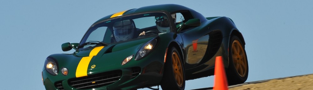
When we finally hit the road as a full group, departing Johnson Village, we were four Elises, two Exiges, two Evoras, two M100s, a Europa, a Birkin, a Focus ST, a TR-6, a Boxster, and a Miata. (In Santa Fe we added another Elise and a Z06 Corvette.)

We had a picnic lunch in Alamosa. The road through the San Luis Valley to Alamosa is one of the straightest roads I’ve ever driven on. Not exactly a Lotus road, but it gets a pass because I never get tired of looking at the Sangre de Christo mountains. We didn’t have a picnic lunch so we made a detour to Arby’s. Afterwards we refueled. Genae bought a candy bar. The cashier told her they were two for one so we decided to split one and save the other for tomorrow.

The drive from Alamosa to Antonito lacks the drama of the northern end of the valley. Ranch land instead of scrub, but centered in the wide valley and without a view. Unremarkable, except for the parallel railroad track. It’s a single line and for ten or twelve miles it’s an almost unbroken string of idle rolling stock. At the northern end it was all brand new tank cars. After the new cars it alternated stretches of hoppers, covered hoppers, and tank cars. An almost unbroken string, I say: gaps only at side roads and driveways. How many rail cars fit in ten miles? How many millions of dollars of capital equipment is that?

Leaving Antonito we finally embark on a road that is new to me. Rather than turn left to stay on US 285 in the Rio Grande valley we continue straight, the road now designated CO 17, following the Conejos River. This road takes us over La Manga (Spanish for “sleeve”) and Cumbres (“crests”) passes. The Cumbres crosses the divide of the Chama and Los Pinos rivers, both tributaries of the Rio Grande.

More than a century ago, Ernest Ingersoll described part of Cumbres Pass thus:

In the most secluded nook of the mountains we come upon Phantom Curve, with its company of isolated rocks, tall, grotesque, sunburned. They fill the eye, and in their fantastic resemblance to human shapes, seem to us crumbled images of the days when there were giants, and men of Titanic mold set up mementoes of their brawny heroes.

Much of the path parallels the Cubres-Toltec narrow gauge railroad. The road crosses the rails near the top; on the descent the rails are often visible, curling along the hillside below. The railroad turns are surprisingly tight. We didn’t see any trains running, but in Chama there were a number of sidings holding quite a few cars.

After we gassed up in Chama we were leading the group. I thought I might collect another bird when we came upon a murder of crows feasting on dead deer in middle of road. The birds were reluctant to leave their meal, not taking flight until after staring me down for a moment, making me slow down.

Our position in the lead didn’t last long. Lacking electronic counter measures we stuck to the 5-7mph rule. A few miles after the crows some faster cars passed us and we picked up the pace. The first car to pass did so just as an antelope was crossing the road ahead. There was only one; I don’t think the passing driver saw it. This section of road between US 84/US 64 junction and Tres Piedras is very nice. It features long sweeping turns on hillsides of piñon forest. There was one particularly nice view of granite mountain that resembled Half Dome.

We were near the front of the pack and our group of cars separated from the rest. We didn’t see some of the folks until well after we had checked in at hotel. This was when we learned of Jeremy’s problem: a blown oil line. He shut the motor down immediately and was fortunate to have a handy place to pull off the road. This is by far the worst mechanical issue we’ve had on any of these trips.

Happy hour was scheduled at six, which gave us time to get provisioned for tomorrow’s picnic. We made a quick run to the grocery store and picked up sandwich fixings and some fruit.

We had adult beverages and chips and dip, cheese, and shrimp; a much better spread than we were anticipating. It was a long day’s drive, and many of us were happy to move the conversation to the next room and eat at the hotel restaurant.

San Francisco

I just finished an engagement that had me in San Francisco twelve weeks since last October. It was like visiting an old friend. My first consulting job, starting at the end of 2006, was there. Then, it was something like sixty four weeks over an eighteen month span.

22nd floor, Parc 55 Hotel

22nd floor, Parc 55 Hotel

When I returned back in October, my first impression was that the place had changed quite a bit. The structure of the place hadn’t changed, all the buildings and streets were familiar, but many of the restaurants – familiar haunts – were gone, replaced by strangers. After a couple of weeks, though, that sensation went away. Lori’s Diner and the burrito place were still there, just at different addresses.

2016-01-26 07.24.29sI stayed in various Union Square hotels both times. This time I worked in the financial district and last time was City Hall. Then, we ate lunch at dozens of little places in the Tenderloin, Little Saigon, and Hayes Valley. This time the client had catered lunches every day. I only went out to eat a handful of times and gained about a pound a week during my stay.

2015-12-16 19.01.41sBefore starting that first gig San Francisco eight years ago I would say I had a fairly limited experience when it comes to food. At the end of my first day of work my colleagues and I discussed where we’d eat: Thai or Indian, they asked. I’d never had either and was out of my comfort zone. Now I’m much more open to variety. I ate at some nice Thai, Indian, Chinese, Italian, and even American restaurants. I also managed to take in some live jazz a couple of nights and went to see the Golden State Warriors beat the Dallas Mavericks.

2016-01-13 14.24.17s

California Street

Although I didn’t have to leave the office to get a good lunch, I tried to get out for a walk a couple of times a week. I did a little loop that took me through the southern end of Chinatown. From the office on Market, I went up Bush Street past Dragon’s Gate to Stockton. To the right, Stockton climbs steeply. I generally took Pine back down but sometimes strolled past the Ritz Carlton to California. Here you’re high enough to see Coit Tower to the north and one of the towers of the bay bridge to the east through the canyon of California Street.

It would have been nice to stay another week. The city is getting all dressed up for the Super Bowl. The Pro Football Hall of Fame has had exhibits on display in the airport the whole season. Although the game is something like fifty miles from downtown, this week they started hanging banners from the streetlights and placing interactive kiosks on the sidewalk of Market Street. “Enter a code, watch highlights of past games!” The kiosk in front of the office had three of the Broncos blow-out losses. No thanks, no need to watch those highlights!

2016-01-27 14.44.12sMy second or third week there I took the GoPro and tried to get some time lapse action. I got nothing worthwhile and never bothered to try again. I missed a fine opportunity this week when they spent a day and a half plastering a giant likeness of the Vince Lombardi trophy on the building across the street from my office.

I flew into SFO on eleven Mondays and a Tuesday. It was raining every one of those Monday mornings. It felt like it was about 52 degrees the whole time: day, night, sunshine, or rain.

There are homeless everywhere – more now, I think, than seven years ago. There are also quite a few street buskers. One fellow stood below our fourth floor window, day after day, and played is sitar through a little amplifier. He had a limited repertoire. We joked that somebody should go downstairs and give him twenty bucks to move a block down the street. I will admit that he was less annoying than the trumpet player we had outside City Hall. He was louder, not as good at his craft, and because it was summer at the time we had to have the windows open.

Although I never got together with any Golden Gate Lotus Club members, I did learn they’re going to have a few track days this year. One of those will be at Laguna Seca (near Monterey) on July 18. I’ve penciled that in on my calendar and we’ll see what sort of trip I can put together around it. Perhaps I can do some hiking in Yosemite along the way.

Albuquerque Gallery

Here are a few of the more interesting photos from the trip.

IMG_1705s

Inside, looking out

IMG_1762s

Yoda and Darth

IMG_1779_stitch_crop_resize

Mass ascension

IMG_1784s

Under the cow

IMG_1803s

Angry bird. There was a red one, too.

IMG_1817s

View from below

IMG_1836s

Astronaut

IMG_1852s

No passengers allowed

IMG_1856s

Flight of the bumblebees (red, blue, purple)

IMG_1866s

Mr and Mrs Penguin

IMG_1886s

Mk 17 thermonuclear weapon – the largest ever deployed by the USA

IMG_1893s

B-29 tail

IMG_1897_stitch_crop_scaled

B-29

IMG_1912s

“Amusing… Fascinating… Fun for Everyone” and “Bomb Japan”

IMG_1941s

Balloon glow

IMG_1962_stitch_crop_resize

Starting to launch

IMG_1978_stitch_crop_resize

Fill ‘er up!

IMG_2001s

Launch director in action

IMG_1996s

Colorful balloon with pendants

IMG_2009s

Old time merry-go-round

IMG_2012s

Mostly launched

IMG_2034s

World balloon

Albuquerque, Day 3

Sunday, October 11

IMG_1973s

Light it up!

I woke up at 2:30 with a head cold. Not a good start to the day. I managed to get back to sleep, but we needed to be up by 4:30 again. I really wanted to get a bit of an earlier start so we could check out of the motel and be on the road a sooner than yesterday to miss some of the traffic. As it turned out, traffic wasn’t quite as bad. We parked in the same lot again, being comfortable with routes in and out. When we pulled in, they recognized the car. “You guys park for free today!” One advantage of having a cool car.

Although it didn’t seem so, perhaps there were as many balloons today as yesterday. If so, fewer were actually launched; quite a few were static. With the first few launches it was obvious that the box wind wasn’t working. I think there were fewer spectators as well. Yesterday, we pretty much stayed in one spot. As all the balloons are assigned a grid spot, we went to a different area than yesterday to be surrounded by different balloons. After the first wave launched we slowly made our way across the field toward our exit.

We’d seen everything we needed to see by 8:30, so we headed out. Egress was much easier than either time yesterday and we were out of the congested area in minutes.

IMG_1992sFor our return route, we again wanted to avoid interstate highways. We also didn’t want to retrace our route from Friday. So today we’d head to the east side of Sandia Mountain and head to Santa Fe via NM 14. We did have to take I-40 a few miles east to get there, but that’s a small concession. NM 14 heads northeast through what I think of as typical New Mexico desert – sparse pinon pine on rolling terrain. We go through a series of small, artsy towns: Cedar Crest, Golden, Madrid, Los Cerrillos. They call this the Turquoise Trail.

The landscape flattens out; the road straightens and heads mostly north. When we approach Santa Fe, we have the choice of going directly through town or taking NM 599 around. I opted for the bypass route. From the maps it appears we’d be on the outskirts of town. Instead, we’re only technically in Santa Fe. The road is four lane divided highway with limited access – like an interstate – with no services at any of the exits. We didn’t see any signs of civilization until rejoining US 285. We stopped for fuel at one of the many small Indian casinos along the way.

US 285 (conjoined with US 84) takes us through Tesuque, Cuyamungue, Pojoaque, and Sambrillo before we get to Española. It’s a four lane divided highway, fairly heavily traveled. On one of the uphill sections we came across an old Volvo sedan from the 50’s, struggling with the incline. We waved at each other as we passed. The were headed toward Taos; we passed them again later.

In Española if you keep going straight on the main drag you find yourself on NM 68 headed to Taos. Most folks want to stay on US 285; to do that you need to make a left turn and cross the Rio Grande. This navigational error is how I first visited Taos. For today it’s the intended route and not an error. At this junction, we were about two thousand feet from where we left US 285 for Los Alamos on Friday.

Our visit to the old church in Colorado was somewhat disappointing. Jerry had visited a much older church in or near Española many years ago. We’d done some internet searching without results but were open to a side trip if we saw any promising signs. In Velarde, Jerry saw a sign he thought was familiar so we went to investigate. Our Lady of Guadalupe was built in 1817, according to the sign outside. But everything was locked up tight. I was a bit surprised, seeing as it was Sunday, but so it goes. (Are all Catholic churches in this part of the world called Our Lady of Guadalupe?)

Up to now, NM 68 has been a four lane divided highway running in straight lines. In Velarde, it narrows to two lanes and begins to run alongside the Rio Grande. It twists and turns, passing a number of small wineries and art studios. After several miles, it climbs out of the canyon and rises to the top of the plateau. The Rio Grande cuts a deep, narrow, dramatic gorge from here north for several miles. We’d get a nice look at it from above a bit later.

Once on the plateau the road straightens again for the run into Taos. It was lunch time – time to visit another brew pub. We found the Eske Brew Pub in the old town section. It’s a few yards off the main drag with an obscure address (we continued our “no GPS” policy) but well marked. The building has character: it’s in an old house. Lots of seating outside, small dining rooms inside. We sat with a view of the kitchen which is not much larger than a residential kitchen.

After our short break we continued on our way. A few blocks north, NM 68 makes a bend to the left and becomes US 64. Four miles later, we exit the somewhat verdant Taos area and return to the desert plateau. US 64 runs nearly due west here. Not far from town we arrive at the Rio Grande Gorge Bridge. I’ve been here twice before, the first time due to missing the turn in Española and once on purpose. It’s a bit of a surprise tourist destination. Vendors set up tables by the road selling jewelry, crystals, leather goods, wood carvings and other trinkets. Lots of people like to walk across the bridge. It’s evidently a hot-spot for suicides as there are a few hotline call boxes on the bridge.

IMG_2035sWest of the bridge are a number of environmentally friendly houses. These are Earthship Biotecture homes. They’re made from unusual materials and use the landscape to reduce heating and cooling requirements. The idea is that they have a zero carbon footprint, can harvest their own electricity and water, need no fuel to heat and cool, and can product a significant amount of food.

At Tres Piedras we rejoined US 285 for the trip home, now retracing our route from Friday. I won’t repeat myself and will only add that I couldn’t help but notice that there wasn’t a single flake of snow on either the Sangre de Christos or Collegiates. I don’t think I’ve ever seen these mountains like this before. Of course, it’s probably because I seldom pass by them this time of year.

I pulled into the driveway just before 8pm, sixty one hours after leaving.

Albuquerque, Day 2

Saturday, October 10

Hot air balloonists are an early rising bunch. We set our alarms for four thirty and were out the door by five. Navigation from the motel to the park couldn’t be easier: make a right turn onto 528 out of the motel and stay on it until we get to the park. It’s about seven miles.

We parked at the Medical Resort at Fiesta Park, a couple blocks south of the park. It took us an hour to get there. At the rate we were moving, it might have been another half hour to the main parking lots east of the park, through several blocks more traffic. To get to the balloon park from the car we had to find our way in the dark through the parking lot, softball fields, and the RV parking for the festival. It’s not well lit so we followed those ahead of us hoping they knew where they’re going.

We entered through gate 8. Admission is eight bucks, good for one session only. We’re planning on attending three sessions: the mass ascensions on Saturday and Sunday, and the glow on Saturday night. We figured to have eight hours to grab lunch, handle some logistics, and have time for another activity. Our plan was to to check out the National Museum of Nuclear Science at Kirtland Air Force Base.

We arrived at the field with enough time to grab some breakfast and scope out the area before things got going. Last time I was here, back in ’89, you could grab a beer at the same place you got your breakfast burrito. That’s ancient history. Now you have to go to the Dos XX pavilion to get the beer, so I passed on my 6am cerveza.

Before things get going, there’s a laser show to keep people entertained. At first it looked like everybody was going to watch from the edges. It seemed only the balloon crews were out on the field. We wandered diagonally, northwest, from where we got our breakfast and ended up a bit north of the center of the field. A long row of balloons started inflating in front of us.

IMG_1644s

Dawn patrol

Back in ’89 the Fiesta was on a dirt field. The event has grown since then and has been moved to a larger grassy field a bit north of the old location. Concessions are lined up along the east side. The big sponsor tents line the south end, and there are more tents on the north side. The field has markers laid out in a grid, letters and numbers. Each balloon is assigned a location in the grid.

It didn’t take long for the field to start filling up with people. Families with kids in strollers, people setting up lawn chairs. Many picked spots and stayed there, others moved constantly. Kids ran around with glow sticks and light sabers. Selfie sticks were everywhere – couples would find an interesting balloon and turn their backs on it to get their selfies. In the midst of all these people, crews were inflating their balloons, balloons were being launched, and later, balloons were landing.

It’s a chaos of motion and noise. Fans driven by gas motors are used to inflate the balloons, gas burners are roaring, and two or three helicopters are circulating counter-clockwise above it all. Over this racket is the buzz of the crowd – tens of thousands of people.

The launch directors wear striped shirts, like football officials. When a balloon has been inflated and is upright and ready to go, the directors clear a path with much waving of arms and blowing of whistles. Even a slight breeze will propel a balloon horizontally and there are no brakes – people have to be cleared out of the way. But the pilots apply the fuel they gain altitude pretty quickly.

IMG_1769_stitch_crop_resize

Stage coach and Spiderpig

One reason Albuquerque is a great place for a balloon festival is the “Albuquerque Box”. At low elevations, winds tend to blow from south to north. At higher elevations, winds are north to south. This allows some balloons to take off, fly several miles south, gain altitude, fly several miles north of the field, descend, fly back to the field and land. Some pilots opt to gain all their altitude at once and do only half the box. Of course, they can’t steer the balloons, so overall they tended to scatter widely.

This year there were something like 500 balloons. Not all of them participate in the mass ascension. Technically, they do. But some just inflate and remain static. Others do a short hop from one end of the park to the other. The box wind was working today, and we saw several balloons make one or two laps before landing on the field.

The first batch of balloons to launch are called the dawn patrol. These take off before dawn. Each balloon has a green light hanging from the bottom of the gondola. During inflation they’re a presence that is more felt than seen; shadows that blot out the lights on the horizon. The balloons are only visible when their burners are on, which may only be a minute or two each.

Just after the dawn patrol launches, one or two balloons take off hanging US flags from their gondolas. The national anthem is played over the PA system and we stand, caps off, hands on hearts. Nobody wants to hear me sing.

Then things get rolling in earnest. It takes a fair amount of space to set up a balloon, so they’re launched in two waves. Some spread everything out on a giant tarp. Unroll the envelope (that’s what the balloon itself is called), lay the gondola on it’s side. Use a giant fan to fill the envelope with air. When it’s full, the pilot gets in the gondola (still on its side) and hits the gas to heat it up. A few blasts and it stands itself upright. Passengers, if any, climb in. The launch director blows her whistle and makes sure nobody is in the way and off they go.

IMG_1737_stitch_crop_resize

Panorama

Sandia Mountain is east of Albuquerque, so the field is in shadow for quite some time after sunrise. Eventually the sun hits the balloons and their colors really pop. They’re often so close together, one balloon will put another in eclipse.

After all the balloons went up, we made a quick pass through the vendor area. I didn’t see any t-shirts I liked. Watched a couple minutes of chain saw carving exhibition. Nothing goes with hot air balloons quite like chainsaws. We stayed until about 10am. By then, many balloons had landed in the park. Others were scattered far to the north, west, and south. There was almost no traffic when we left; our parking lot was two-thirds empty.

Too early for lunch, we headed to the National Museum of Nuclear Science & History.

It’s at Kirtland AFB. Well, it used to be there; now it’s nearby. While the museum at Los Alamos was geared to the Manhattan Project, this one is somewhat more general. Its primary focus is on nuclear weapons and the cold war, it includes exhibits on nuclear waste transportation, atomic culture, and energy. Outside they have a large dirt area full of weapons and delivery systems: B-29, B-47, B-52, Ohio class subamarine (!), and a comprehensive collection of bombs and missiles.

IMG_1900_stitch_crop_resize

All the planes face east

After the museum we opted for a late lunch. I was looking for a good salad. I hadn’t had much luck in that search at the brew pubs we’d visited so I suggested the Council Room at the Sandia Resort and Casino, where I’ve eaten many times. It wasn’t too far out of the way as our hotel was more or less due west of there. After lunch we went back to the hotel to recharge Jerry’s phone. I transferred photos from the camera to the laptop.

We didn’t want to get stuck in a big traffic jam again so we headed back to the balloon park at five. We parked in the same lot as this morning; it was easy access and we had a quick exit. There was almost no traffic and we were there in plenty of time. We still had quite a bit of time before sunset so we went looking for a beer. There was only one place, and that had a long line. They were only letting people in as others left. We opted for soft drinks instead.

IMG_1923s

Sunset

When we attended back in the eighties, they made liberal use of a PA system. This time it must have been radio communication to the balloon pilots. They used to announce: “Everybody glow!” “Special shapes glow!” “Pulse glow!” Tonight we couldn’t hear any such announcements so everything took us by surprise. Because the balloons were neither taking off nor tethered, the balloonists couldn’t light up for very long and there are several minutes between shots. We had a nice spot near the center of the park in a fairly large void. That gave us good views all around. By sheer luck we might have been in the best spot in the park. When the balloons are glowing they’re like giant Christmas lights.

IMG_1937s

Glow!

When we thought everything was over we headed back to the car. About half way to the car the fireworks started. I’d forgotten all about that part of the show. We were in the RV park but had a fairly good view anyway. Would have been better had we stayed where we were, but so it goes. At least we’d get a jump on exiting the area. Unfortunately, we didn’t have a big enough head start. Traffic was really bad, or our parking lot was not well situated for traffic to leave, or both. It was a lesson in powers of two: at every merge point people were good enough to take turns. But we were five merge points away from the main road. It took us an hour just to get out of the lot.

Because we had a late lunch and no dinner, it was time for a snack. Jerry needed to get cash at an ATM. From our stop at the Turtle Mountain pub yesterday we knew where to find one from his bank. This was conveniently next door to the Fat Squirrel pub so we headed that way. The ATM was out of order, but the chicken quesadilla at the pub hit the spot. It was after 10 by the time we made it back to the hotel.

Albuquerque, Day 1

Every year in early October, Albuquerque holds the largest hot air balloon event in the world. It’s one of the most photographed events in the world, and it’s the only balloon event where spectators are allowed in the launch area. I attended twice, back in ’88 and ’89, with Jerry, who lived in Albuquerque for a few years. That was half a lifetime ago; it’s time to go again.

Jerry was up for a return visit: time for a road trip. I made hotel reservations a couple months ago and planned our routes. It’s a seven hour drive by interstate, plus stops, but it’s against the rules to make a Lotus road trip on the Interstate. And I’m not a big fan of going the same way all the time, so we’d have a couple of long drives. So it goes.

Friday, October 9

I picked up Jerry at 8am. He’s back in the neighborhood where we grew up. When we lived there we parked the trailer at an RV park on the Arkansas river in Nathrop for a few summers. We made that trip dozens of times. Dad always filled up the car at a gas station near Hampton and Lowell where the pumps took tokens. At Turkey Creek canyon the road went down to two lanes. It was much curvier and had a lower speed limit back then. It took us three hours to get to Nathrop. A trip to the Sand Dunes was five.

Today, it’s four hours to Alamosa. I’ve made that drive so many times it’s easy to take it for granted. But most of it is fairly spectacular. Once you get over Kenosha pass, it’s wide-open views the entire way. Many of the mountains on the west side of South Park are 14ers; they just don’t seem so big because South Park is so high. Coming down Trout Creek pass Mt. Princeton dominates the view. It and Antero and Shavano are impressive 14ers. And nine of the Sangre de Christos, from Poncha pass south, are 14ers.

It’s the tail end of aspen season. In South Park, most of the aspen have already been stripped of their gold by the wind. Along the rivers the cottonwood still had their leaves, mostly yellow with a touch of green. We seemed to go back in time as we went south. The cottonwoods became greener; the aspen regained their leaves. By the end of the day, in Albuquerque the cottonwood are only beginning to turn.

We arrived in Alamosa promptly at noon and stopped at the San Luis Valley Brewing Company for lunch. The restaurant occupies a former bank building – the old vault door is behind the bar. Pretty cool. None of their salads interested me so I opted for the Andouille Cajun Pork (sliced and served on wild rice with red & green peppers, onions and Southern au jus) and a pint of their Alamosa Amber. Their sausages are locally made – from the Gosar Ranch in Monte Vista. Good stuff.

When we were getting back in the car an old van pulled into a nearby parking spot. It was covered with bulging eyes: dozens of them, four or five inches across. Blue eyes, green eyes, eyes with long lashes.

After Alamosa we stopped briefly at Conejos, the location of Colorado’s oldest church. I was thinking there was a 16th century church in Antonito but before getting to Antonito we followed a sign (“Oldest Church in Colorado”) to Conejos. There we found the Our Lady of Guadalupe Church. It looks brand new – quite well preserved for a 16th century edifice. Except that it’s not. It was actually built in the 19th century, burned down and rebuilt in the 1920’s. So it’s a bit of misdirection to say it’s the oldest church in the state.

Back on the road, we passed through Antonito. At the south side of town is the western terminus of the narrow gauge Combres and Toltec railroad. Five or six miles later we enter New Mexico. The terrain transitions from farmland to ranch land to high desert before finally becoming a pine forest. The road is a series of straight stretches, 4 to 6 miles long joined by slight bends. In Colorado, the road is not only straight but level. Here in New Mexico it’s no longer level, cutting straight lines across the rising and falling terrain. There are no river crossings here, not even any culverts. The road is pretty much built without fills or cuts.

At Tres Piedras, US 285 junctions with US 64. Today we continue south on 285. On our return trip, we’ll be arriving here from the east on 64. So here we begin a giant loop. When we entered New Mexico we also entered Carson National Forest. All along the highway cars were parked next to the fences twenty yards off the road, their occupants in the trees collecting piñon nuts.

In Española we reach the junction with NM 30 and head south. From here to Albuquerque are new roads for me. We take NM 30 south for several miles, paralleling the Rio Grande river.  Our next navigation point is the junction with NM 502, which takes us west to Los Alamos.

Los Alamos sits on a series of mesas separated by steep, deep canyons. The road climbs from the Rio Grande valley to the top of one of these finger-like mesas and deposits us at the top, alongside the airport. Behind Los Alamos is a range of mountains. The mountains seem to be covered by a sort of stubble. This stubble is limbless, dead trees -the result of the Las Conchas fire of 2011. At the time, this was the largest fire in New Mexico history, 150,000 acres burned.

We headed to the historic district, looking for the Los Alamos Historical Museum. I didn’t have the address on our notes – it was a late addition to the itinerary. I figured it would be easy enough to find; a minor navigational exercise we’d attempt old-school, no GPS. We did see a sign for it so we knew we were close. Somehow we never saw the museum or another sign. Clearly having missed it, I pulled over and resorted to GPS. Having failed our little test, Google penalized us by sending us through the drive-through book drop of the local library to get us to our destination.

The Los Alamos Historical Museum is small, but packed with exhibits. About half are for the Manhattan Project and the rest for general history of the area. The place was fairly well packed, with most visitors in the Manhattan Project area. I’d have liked to spend more time looking at things here, but it was just too crowded.

After the museum, we go over a big bridge and NM 502 turns into NM 501. We pass through a sort of toll booth. We’re not actually entering any facility or restricted area, as far as I can tell, but I’m asked for my drivers license. “That’s all, you can go.” If this was an entrance, there was no exit. Only southbound cars were stopped.

Many of the street names in the area are a-bomb related: Bikini Atoll Rd., Trinity Drive, Oppenheimer Dr.

NM 501 ends at a T-junction with NM 4. We head west and immediately start climbing the ridge that runs north/south behind Los Alamos. This takes us along the southern border of the Bandelier National Monument. The area to our left, south, has been mostly burned. The road climbs fairly steadily, a nice Lotus road, and we soon arrive at the Valles Caldera National Preserve. It’s almost a miniature South Park – a flat, high, treeless valley surrounded by tree lined slopes. Miniature: only a few miles across and no big mountains.

Next the road turns to the south and drops the better part of 2,000 feet through red rock cliffs and red soil. Though technically we’re still in the Carson National Forest, the reality is we’re crossing from montane to desert. The road drops through the Jemez Pueblo and into San Ysidro. We gas up here for the final blast southeast on US 550 to Rio Rancho.

After checking in at the hotel we headed out in search of dinner. We ended up at the Turtle Mountain Brewing Company. The parking lot was packed and there was a wait for seats inside. We sat outside; a bit on the cool side, but not uncomfortable. Jerry had pizza, I chose a calzone.

San Diego, day 4

Monday

We hadn’t planned any activities for Monday, and with a 6pm departure we had all day to get to LAX. So we avoided the interstate where we could, and stuck to the coast.

We hit the road after a leisurely breakfast and spent some quality time in SoCal traffic. It must be soul crushing to endure this every day. Even with the cost of living so much higher there,  people seem to be able to spend a bit more on their cars. Perhaps that’s a strategy that helps deal with that traffic. We had a Tesla S behind us for quite a while, a nice Bentley passed us, two or three brand new Jags. I caught a quick glimpse of an Alfa 4C and wished I’d gotten a better look. I hadn’t seen one in the flesh before. Very pretty car.

We abandoned the interstate and exited rush hour traffic at Torrey Pines. From here to Oceanside, where Camp Pendleton forces us back onto I-5, the road varies from divided four lane to busy two lane as it rises and falls at each of a half dozen estuaries. Commuter rail runs alongside the road for long stretches as well. For the most part, there isn’t much ocean view except when descending into the estuaries where you get a good view of the beach. It was all very nice, clean, and pretty much all high-rent district.

You have to take the interstate for a while but we wanted off as quickly as possible. Our desire to avoid the interstate led us to a dead end at a beach before we finally got exited into San Clemente on El Camino Real, the Royal Road. In Dana Point, we finally get to the southern end of Highway 1, the Pacific Coast Highway. We got a kick out of the street names here – Golden Lantern, Street of the Violet Lantern, Amber Lantern, Ruby Lantern, Blue Lantern.

After Dana Point, it’s Laguna Beach, Newport Beach, Huntington Beach, Sunset Beach, Seal Beach, Long Beach. (Fun note: the spell checker doesn’t like “Laguna” and suggests “gulag”.) The farther south you are, the more unique the businesses are. For a long time, we didn’t see any chain fast food restaurants, very few Starbucks, a couple 7-11’s. Lots of little boutiques, antique shops, surf shops.

There were quite a few places where we remarked we couldn’t imagine living in. Not just because of the high-dollar nature of the place, but the houses themselves. Particularly the houses perched at the top of cliffs. It wouldn’t take an earthquake to bring one down, a big rain like we had here recently could do it. Along great stretches, the houses between the road and the beach were jammed side by side, separated by a single gated walkway. Every couple blocks there’d be a gap for beach access. Very similar to Malibu from what I recall.

We stopped in Newport Beach for lunch, at the Newport Beach Brew Co. I had a Cobb salad and a Belgian golden ale but I forget what they called it. Insane Monkey or Crazy Monkey, something like that.

I think it’s Sunset Beach where we got a nice extended stretch with a nice ocean view. The notable feature of the view today was all the container ships standing between Santa Catalina Island and Long Beach. Genae counted 23, but she probably missed a few. And I understand there are others farther from the port. I stopped to shoot a couple pictures and chatted with a guy there. He said it wasn’t as bad as it was last time, back in 2004 or so.

IMG_1726sAt Long Beach we’re back to heavy traffic and more than a few blocks from the water. The pleasant drive beside the ocean was over now; welcome to the megalapolis. There are a lot of lane closures and in places oncoming traffic was stopped for blocks. I know the way to LAX from here. We went the entire distance without navigational assistance except when we decided to find somewhere to eat lunch. I’m not sure whether to feel proud or sad that I know my way around LA as well as I do.

The rental car place was on Century, a couple blocks west of the 405. I went east to find gas. The six block detour saved twenty cents a gallon at 2.89 (much more than we’re paying here). The rental car place is not exactly a well-oiled machine. The office is a bit on the dodgy side but that’s not a big deal – quite a few of the LAX car rental offices could use an upgrade. More telling is that they basically operate out of the alley. There’s an entrance to a multi-story garage where they also do airport parking. When you pick up the car, you have to turn it around in the alley.

We had to when we picked up the car, and when returning it had to wait for somebody else to do it. The guy that recorded the car’s mileage and fuel asked if we needed a lift to the airport. When we said “Yes”, he said he’d probably take us in the car we just returned. Instead, as there was another couple as well, he took a minivan which was obviously one of their rental fleet. I’m guessing they can’t pick us up at the airport because they lack the proper licensing. So how can they legally drop us off?

As of today, by my count, I’ve flown in and out of LAX 190 times, which is the same number as Phoenix, which blows my mind. And in all those times, this trip was my first time for both terminals 4 and 5. I was pretty impressed with terminal 4 for a while. But we were out of gate 44H. There are about a dozen gates out of 44. Here you go down a flight of stairs to a door. Shuttle buses run from here to another terminal for the little CRJs. Signs you don’t see every day: “Stop for Aircraft”.

I had my sweater in one bag and my jacket in the other. The overhead bins in the CRJ are pretty small, so they took the small rollerboard and I volunteered the duffel. I didn’t know if we’d have to go to baggage claim to fetch them. If that was the case, they might as well take both. So when the pilot announced it was 13 degrees in Denver I hoped we’d have to get them from baggage claim. But no, this was valet service, so I had to wait for them at the end of the jetway.

By now it was down to 10. The jetway isn’t heated and by the time everyone is off the plane, about fifteen of us line each side. The guy across from me says I’m about two months early to be wearing a Hawaiian shirt. He says he’ll be the last one to get his bag. I disagree, it’ll be me. The bags appear two at a time. A woman closely inspects the tag on a dull gray one but a man from up the jetway gets it. A bright green bag comes soon, the woman take it. Was she really confused which bag was hers? We’re down to six of us and the guy says “Told you I was going to be last” just before his bag arrives. I get the first one with 4 people left and the other is one of the last two. Tied for last bag! I can now put my sweater and jacket on.

Icicles broke from the bottom of the car when we got in. The snow was hard, and the ice beneath it was harder and a quarter inch thick. But it was brittle from the cold and came off the windshield quite easily. There was ice on the inside of the windshield, along the darker band at the top. That never thawed on the thirty five minute drive home.

All in all, not a bad way to spend the weekend. We traded a few days of cold and snow for, well, not exactly sunny southern California weather, but mid-60’s anyway. And we had a whale of a good time.

San Diego, day 3

Sunday

We had reservations for another Hornblower cruise this morning – whale watching this time. A few weeks ago we saw a news story that said the whale migration was a bit early this year, so, not knowing any better, we were concerned the tour might be a bust. As it turns out, we saw exactly one whale.

While standing in line waiting to board, some guys in yellow jackets showed up. They were volunteers from the natural history museum. They said they have to go out on these tours at least three times a month, but some of the retired guys go much more often. They gave us short lessons on whales – baleen versus teeth, where they’re coming from and where they’re going, how we expect them to behave when we see them.

The volunteers and crew serve as lookouts, but I wonder if that was really necessary. A few miles off the coast we came across another whale tour boat and a sailboat. Word was there was a humpback in the area. Within a few minutes we saw the whale blowing and slapping her tail on the water. We don’t really know if it was a he or a she, but everybody always says “Thar she blows!” so I’ll refer to it as “she”.

IMG_1638sShe slapped her fluke on the water for quite a while, announcing to the gathering whale watchers that she was ready for her close-up. There are restrictions on how close we’re allowed to get, something like a thousand feet. That is close enough to hear her blow, but not close enough to smell her breath. Our boat stayed on her left, the other whale boat and the sailboat on her right. She’d exhale, slap her fluke a few times, then make a short dive. It was a bit hard to predict where she’d pop up next; she was moving generally westward, but along a meandering path.

IMG_1665sAfter a while, she quit slapping and started breaching. When whales are swimming in pods, the males will breach to demonstrate dominance or to attract a mate. We’re not sure why they engage in such behavior when they’re alone. We all decided she was doing this because she’s a showoff. Which suited us just fine.

She probably breached forty times. Each breach moves not only tons of whale but tons of water as well. She makes a sound a bit like a IMG_1667sgiant belly-flop, except that she’s on her back or side. This went on for quite a while, breach, breach, breach, dive; repeat a couple minutes later. It was quite a show, so not at all disappointing that we only saw one whale.

It was lunch time when we got back, so we walked over to the Fish Market Restaurant. I had the fish and chips, Alaskan cod, panko style.

IMG_1678s

Coronado Island skyline

After lunch Genae and I went to the Maritime Museum. I particularly wanted to see the HMS Surprise, having read and enjoyed all of Patrick O’Brien’s Aubrey/Maturin books. Of course, this wasn’t really the ship sailed by Captain Aubrey two hundred years ago but a replica built from the plans of the HMS Rose, a sail training tall ship on the East Coast. It was purchased by 20th Century Fox, then extensively modified to become the Surprise for the move Master and Commander: Far Side of the World.

The Museum also has the Star of India (the oldest active merchant sailing ship in the world), a Soviet Foxtrot class submarine, the USS Dolphin (the US Navy’s last diesel-electric sub), and several others.

IMG_1710s

“Stop”

We could have easily spent an additional couple hours there as they have a lot to see. We concentrated on the Star of India, the Surprise, the B-39, and the Dolphin. We took a quick look through the exhibits aboard the Berkeley, a ferryboat from San Francisco bay. It’s loaded with large, detailed models of all sorts of ships. Those models are incredible.

I found the Star of India and the Surprise fascinating but I don’t really know anything about sailing vessels. There was a docent on the Surprise talking about the materials used in the rigging, but I really had no clue what he as talking about. On the other hand, I really enjoyed getting to compare the two submarines. The B-29 is a few years newer but the Dolphin is much more modern. Obviously, it’s been upgraded since it was launched in 1968 – the electronics and the microwave oven give it away. It’s a smaller boat, but doesn’t feel nearly as cramped. The Soviet sub looks almost “steam punk” in comparison, and moving through the ship was fun. The watertight doors between compartments are round and wide; going through them is a bit like getting in and out of the Elise. Oh, and we looked through the periscopes on both subs.

When making our way to the Dolphin, we chatted briefly with crew members of the America. The America is an America’s cup boat. I’m not sure if it’s a replica of the original America’s cup winner from 1851 or if it’s a later design. This boat was just tying up at the dock, returned from whale watching. They had heard about our humpback and tried to follow it but arrived too late.

It started raining just as we left and stopped by the time we got to the car. It rained just long enough and just hard enough to soak us thoroughly. We collected the folks and made our way back to their motel where we said our goodbyes.

For dinner we went to Pizza Bella for dinner. Their menu claims they were voted “Best Pizza in the World”. I don’t know who did the voting. It was good pizza, but falls short of Beau Jo’s. As usual, I managed spread molten sauce all over the roof of my mouth, burning it badly. So it goes.

San Diego, day 2

Saturday

IMG_1477sWe didn’t have any specific plans for the day, but we had a list of possibilities. The only constraint was that our activities should have minimal walking, as my mom’s mobility is somewhat restricted.

We stopped by their motel a bit after nine and after discussing the possibilities decided to do a two-hour harbor tour in the morning and visit the Cabrillo National Monument in the afternoon.

Littoral Combat Ship

Littoral Combat Ship

The weather was on the cool side and overcast. The first part of the tour is a loop of the northern half of the harbor. We passed the boats of the San Diego Maritime Museum (the Star of India, the HMS Surprise, a Soviet submarine), the live bait barges and their attendant sea lions sunning themselves, and the submarine pens below Point Loma. A small flotilla of pleasure craft raced ahead of us, exiting the harbor. We turned around and concentrated on Naval Air Station North Island.

IMG_1538sThe USS Ronald Reagan, CVN-76, is berthed there undergoing repairs and refitting. It was in the same place last time we visited the area, ten or twelve years ago. (How long has it really been? I was still using a film camera at the time).

The tour boat went back to the dock to disembark the folks who only bought the one hour tour and load up another set of folks for the southern harbor loop. This loop took us under the San Diego

US Naval Ship Bob Hope (T-AKR-300)

US Naval Ship Bob Hope (T-AKR-300)

Coronado bridge to Naval Base San Diego. I can identify the various classes of naval ships of World War II and describe their purpose and function. But modern naval vessels are a mystery to me, slab-sided, opaque, lacking obvious armament. But we did get to see a couple of helicopter aircraft carriers, a supply ship described as the Costco of the sea, a littoral combat ship (tri-hull, angular, loaded with stealthy attributes) and the Sea Slice, an experimental ship built by Lockheed which seems to be available for purchase.

Sea Slice - experimental littoral ship

Sea Slice – experimental littoral ship

Back on shore, we made a quick visit to Tuna Harbor Park. This little park is directly south of the Midway Museum. It attracted my attention because of the giant sculpture of the kiss – that famous photo of the sailor and nurse kissing on V. E. day. It’s called “Unconditional Surrender”. Also in the park is a set of statues – Bob Hope and an audience of fifteen life-sized bronze sculptures. Pretty cool.

After this, we piled back into the car and headed to Coronado Island

The Kiss

The Kiss

for lunch. We made our way to the Brigantine Seafood restaurant, across the street from the Hotel del Coronado. I couldn’t decide which fish to eat and ended up with their Steakhouse Burger – Grass fed California beef, smoked wild boar bacon, tomatoes, chopped lettuce, blue cheese, caramelized onions, white truffle-black pepper aioli. Yes, it’s wrong to have a burger at a good seafood place, but so it goes.

Next we headed to Point Loma and the Cabrillo National Monument. Ideally, we’d be there during low tide and wander through the tidal pools searching for sea urchins and starfish. The tides weren’t right, the parking lot was full, and my mom wouldn’t have been able to make it down to the water anyway.

So we went to the visitors center, enjoyed the view of the harbor and city to the east and the

Bob Hope entertains the troops

Bob Hope entertains the troops

ocean to the west. The folks watched a short film about whales while Genae and I went to the lighthouse. There, we found a docent, or perhaps not actually a docent but someone dressed in period garb, knowledgeable in the lighthouse and its times. We had a nice little chat. His character wasn’t the lighthouse operator IMG_1611sbut a newspaperman.

I asked if he felt isolated there. “Look around you – there are lots of people!” He told us that in 1887, many folks would visit the lighthouse on Saturdays and Sundays, make a day of it. I asked if the water catchment basin provided a sufficient supply and he described the effort required to bring water from the nearest spring. Next I asked if he was a Cleveland man or Harrison man. He enjoyed the question, being in actuality not a newspaperman from 1887 but a former fifth grade history teacher.

We left the lighthouse and wandered along the paths. Past the old WW II gun emplacements, to the ocean overlooks decorated with a whale’s spine and kelp, to a nice view of the new Point Loma lighthouse. On the way back to the visitor center we stopped at a small blockhouse holding exhibits of the shore defenses – a 155mm artillery shell, a cross-section of the howitzer’s barrel showing the rifling, binoculars and telescopes used for spotting.

Old Point Loma Lighthouse

Old Point Loma Lighthouse

By now we’d managed to wear out my parents. We dropped them off at their motel and returned to ours. We’re in Old Town, so after a short rest we took a walk and looked for an interesting Mexican restaurant. We found ourselves at Café Coyote. I had enchiladas – one beef and one guacamole. I’d never heard of a guacamole enchilada before. Like the dinner in general, it was okay but nothing to write home about. That’s the thing about Mexican restaurants – it’s pretty easy to find average food but above average is fairly rare.

After dinner we walked up and down the streets of Old Town. Lots of Mexican restaurants, a few bars, a number of stores selling trinkets and souvenirs of the area. Kitschy stuff we’d never buy, but didn’t mind browsing.

San Diego, day 1

Back in December it was obvious I wouldn’t be flying USAir before my miles would expire at the end of February, so we needed to use them or lose them. We considered all the big west coast cities and picked Seattle until we realized the only flight we had enough points for was an overnighter. So we went with Plan B: San Diego. My parents like to go there so we suggested they meet us there. And we timed the weather perfectly, missing a big winter storm at home.

Friday

Up at 5:30 and out of the house a few minutes before six. Bad traffic on I-270 cost us twenty minutes, but we arrived at the gate only a few minutes behind my target time, no worries. Our first flight was DEN to PHX. There were two youth soccer teams aboard and the flight was noisy. Not because the kids were loud, but because the two chaperones in the row behind us were the loudest people on the plane.

We had a short layover before our flight to LAX. Not long enough to grab a meal, but enough to grab a snack. This was a quick flight, about an hour gate to gate. We were out at the waiting area for the rental car shuttles a few minutes after noon. We watched patiently as Hertz, Avis, Enterprise shuttles went by. Waited more – Alamo, Fox, Budget. I asked one of the drivers what color van Economy Rent-A-Car uses. Never saw one. I got the phone out and searched for Economy. Panicked a bit when the nearest one according to Google was 38 minutes away. Went to the info desk where they gave us a phone number and told us to take the parking shuttle to lot C and call for the shuttle there.

I wasn’t sure why Economy didn’t run shuttles to the airport like all the others. They’re on Century Blvd like most of the others, and they’ll drop us at the terminal when we return, so why not pick up customers there as well?

So we were running a bit later than hoped. The plan was to meet a friend at the In-N-Out in Costa Mesa at something like 1:30. By then we were getting fairly hungry: skipped breakfast, had a snack at about eleven, and it was actually 2:30 for us rather than 1:30 because of the time change.

We had told my folks it would take us a couple hours to get down to San Diego. We didn’t account for lunch, and we certainly didn’t account for southern California traffic. After lunch we followed the smart phone’s navigation instructions which put us on a toll road. Because we didn’t opt for the express pass for the rental car, we decided it best to avoid the toll road. So we turned around intending to take the 405 south but, typical for the area, that was not an option. We ended up making a u-turn in front of the In-N-Out after driving eight or ten miles.

So we finally arrived at the hotel in Old Town a bit after five. We called my folks, found our way to their motel, and from there to the Bali Hai restaurant. This is a Hawaiian themed seafood place on Shelter Island. Our table had a beautiful view of the harbor, the San Diego skyline brightly lit, mirrored in the water. I had the braised swordfish (with grilled orange, forbidden rice, and black pepper sauce). It was delicious. And all the waiters were dressed like me!

The Rental Car

The car this trip is new to me, a Chrysler 200. I found much of its operation alien. No gear selector in the console, must be on the tree. What I thought was a skinny shift lever was instead a fat windshield wiper control. I didn’t so much put it in drive as turn on the wipers and spray the washer fluid. The gear selector is a knob. As is common now, there’s a fob with no key. Keep the fob in your pocket, press the brake, push the button and the car starts. I found it unnatural to pocket the fob. I’ve driven cars for forty years and I’ve always had a key and I’ve never changed gears with a knob.

It spends quite a bit of time shifting. It’s a nine speed automatic. You’re in third by the time you hit 15 or 18, sixth at 40. This is just cruising around; I didn’t put my foot to the floor the entire four days. Quite often the shifts were pretty harsh. The brakes were good, but kind of touchy.

The back seat passengers hit their heads every time they got in the car, even when warned “watch your head!” I’m a bit too tall for the car. With the seat all the way back, the pedals were too close. This made for more fatigue on longer drives. There was no manual in the glove box and never figured out many any of the controls. Managed to mute the radio but never could turn it off. How long before I tell kids to get off my lawn?

It’s a nice car, seemingly well built (this one was brand new), and has nice lines. When I was picking everybody up once, a couple of guys said they thought it was sharp. I’m sure it would be a wonderful car for folks who only cart short people around.