Every year in early October, Albuquerque holds the largest hot air balloon event in the world. It’s one of the most photographed events in the world, and it’s the only balloon event where spectators are allowed in the launch area. I attended twice, back in ’88 and ’89, with Jerry, who lived in Albuquerque for a few years. That was half a lifetime ago; it’s time to go again.
Jerry was up for a return visit: time for a road trip. I made hotel reservations a couple months ago and planned our routes. It’s a seven hour drive by interstate, plus stops, but it’s against the rules to make a Lotus road trip on the Interstate. And I’m not a big fan of going the same way all the time, so we’d have a couple of long drives. So it goes.
Friday, October 9
I picked up Jerry at 8am. He’s back in the neighborhood where we grew up. When we lived there we parked the trailer at an RV park on the Arkansas river in Nathrop for a few summers. We made that trip dozens of times. Dad always filled up the car at a gas station near Hampton and Lowell where the pumps took tokens. At Turkey Creek canyon the road went down to two lanes. It was much curvier and had a lower speed limit back then. It took us three hours to get to Nathrop. A trip to the Sand Dunes was five.
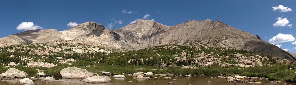
Today, it’s four hours to Alamosa. I’ve made that drive so many times it’s easy to take it for granted. But most of it is fairly spectacular. Once you get over Kenosha pass, it’s wide-open views the entire way. Many of the mountains on the west side of South Park are 14ers; they just don’t seem so big because South Park is so high. Coming down Trout Creek pass Mt. Princeton dominates the view. It and Antero and Shavano are impressive 14ers. And nine of the Sangre de Christos, from Poncha pass south, are 14ers.
It’s the tail end of aspen season. In South Park, most of the aspen have already been stripped of their gold by the wind. Along the rivers the cottonwood still had their leaves, mostly yellow with a touch of green. We seemed to go back in time as we went south. The cottonwoods became greener; the aspen regained their leaves. By the end of the day, in Albuquerque the cottonwood are only beginning to turn.
We arrived in Alamosa promptly at noon and stopped at the San Luis Valley Brewing Company for lunch. The restaurant occupies a former bank building – the old vault door is behind the bar. Pretty cool. None of their salads interested me so I opted for the Andouille Cajun Pork (sliced and served on wild rice with red & green peppers, onions and Southern au jus) and a pint of their Alamosa Amber. Their sausages are locally made – from the Gosar Ranch in Monte Vista. Good stuff.
When we were getting back in the car an old van pulled into a nearby parking spot. It was covered with bulging eyes: dozens of them, four or five inches across. Blue eyes, green eyes, eyes with long lashes.
After Alamosa we stopped briefly at Conejos, the location of Colorado’s oldest church. I was thinking there was a 16th century church in Antonito but before getting to Antonito we followed a sign (“Oldest Church in Colorado”) to Conejos. There we found the Our Lady of Guadalupe Church. It looks brand new – quite well preserved for a 16th century edifice. Except that it’s not. It was actually built in the 19th century, burned down and rebuilt in the 1920’s. So it’s a bit of misdirection to say it’s the oldest church in the state.
Back on the road, we passed through Antonito. At the south side of town is the western terminus of the narrow gauge Combres and Toltec railroad. Five or six miles later we enter New Mexico. The terrain transitions from farmland to ranch land to high desert before finally becoming a pine forest. The road is a series of straight stretches, 4 to 6 miles long joined by slight bends. In Colorado, the road is not only straight but level. Here in New Mexico it’s no longer level, cutting straight lines across the rising and falling terrain. There are no river crossings here, not even any culverts. The road is pretty much built without fills or cuts.
At Tres Piedras, US 285 junctions with US 64. Today we continue south on 285. On our return trip, we’ll be arriving here from the east on 64. So here we begin a giant loop. When we entered New Mexico we also entered Carson National Forest. All along the highway cars were parked next to the fences twenty yards off the road, their occupants in the trees collecting piñon nuts.
In Española we reach the junction with NM 30 and head south. From here to Albuquerque are new roads for me. We take NM 30 south for several miles, paralleling the Rio Grande river. Our next navigation point is the junction with NM 502, which takes us west to Los Alamos.
Los Alamos sits on a series of mesas separated by steep, deep canyons. The road climbs from the Rio Grande valley to the top of one of these finger-like mesas and deposits us at the top, alongside the airport. Behind Los Alamos is a range of mountains. The mountains seem to be covered by a sort of stubble. This stubble is limbless, dead trees -the result of the Las Conchas fire of 2011. At the time, this was the largest fire in New Mexico history, 150,000 acres burned.
We headed to the historic district, looking for the Los Alamos Historical Museum. I didn’t have the address on our notes – it was a late addition to the itinerary. I figured it would be easy enough to find; a minor navigational exercise we’d attempt old-school, no GPS. We did see a sign for it so we knew we were close. Somehow we never saw the museum or another sign. Clearly having missed it, I pulled over and resorted to GPS. Having failed our little test, Google penalized us by sending us through the drive-through book drop of the local library to get us to our destination.
The Los Alamos Historical Museum is small, but packed with exhibits. About half are for the Manhattan Project and the rest for general history of the area. The place was fairly well packed, with most visitors in the Manhattan Project area. I’d have liked to spend more time looking at things here, but it was just too crowded.
After the museum, we go over a big bridge and NM 502 turns into NM 501. We pass through a sort of toll booth. We’re not actually entering any facility or restricted area, as far as I can tell, but I’m asked for my drivers license. “That’s all, you can go.” If this was an entrance, there was no exit. Only southbound cars were stopped.
Many of the street names in the area are a-bomb related: Bikini Atoll Rd., Trinity Drive, Oppenheimer Dr.
NM 501 ends at a T-junction with NM 4. We head west and immediately start climbing the ridge that runs north/south behind Los Alamos. This takes us along the southern border of the Bandelier National Monument. The area to our left, south, has been mostly burned. The road climbs fairly steadily, a nice Lotus road, and we soon arrive at the Valles Caldera National Preserve. It’s almost a miniature South Park – a flat, high, treeless valley surrounded by tree lined slopes. Miniature: only a few miles across and no big mountains.
Next the road turns to the south and drops the better part of 2,000 feet through red rock cliffs and red soil. Though technically we’re still in the Carson National Forest, the reality is we’re crossing from montane to desert. The road drops through the Jemez Pueblo and into San Ysidro. We gas up here for the final blast southeast on US 550 to Rio Rancho.
After checking in at the hotel we headed out in search of dinner. We ended up at the Turtle Mountain Brewing Company. The parking lot was packed and there was a wait for seats inside. We sat outside; a bit on the cool side, but not uncomfortable. Jerry had pizza, I chose a calzone.