Watching the Geese

I try to take walks three or four times a week. I went through a stretch where it was never near that often, but at the same time I was hiking more often, so hopefully it evens out a bit. My walk leads me around Lake Arbor, the neighborhood body of water. During the winter, it’s home to skeins of geese and rafts of ducks.

I had to look that up. I always thought “gaggle” of geese, but that’s only what they’re called when they’re on water. In flight, they’re either a skein or a wedge. Ducks are rafts, but there are other group names as well – a team of ducks if they’re flying or a paddling of ducks when they’re on water.

Anyway, there’s generally quite a bit of activity around the lake – fields filled with grazing geese, small groups of ducks swimming in circles, birds landing and taking off, both on land and water. Last week I took the cameras with me and shot some time lapse footage. I was a bit underwhelmed. In retrospect, it wasn’t that interesting of a day to film geese. It was good practice, though, both the shooting and the editing. I posted the video, but I have no doubt I can make a better one if I give it more time.

Today would have been a better day. When I left the house, I wasn’t sure I wanted to take the usual three mile loop or cut it off shorter. The walk to the lake is mostly out of the wind, but once to the lake it was obviously quite breezy so I decided I wouldn’t bother making a lap of it. I stopped at the east end, in the trees, and watched the birds.

A gaggle was getting out of the water to graze. The ones already aground were fanning out, beaks pecking the brown grass. Geese were lined up in the water single file, paddling somewhat upwind towards the shore. One after another would hop onto the bricks lining the water’s edge and immediately put beak to lawn. In the water, the wind was pulling the line like taffy, and now the geese were flapping wings to get ashore. Before long they were flying as far as twenty feet. Now the geese still afloat were reconsidering. Two or three turned around and went to the back of the line when their turns came. Eventually the group split, three quarters or so on land, the rest moving out to deeper water. Would have made for a good time lapse sequence.

Usually on these walks I see people walking their dogs, and the usual mix of joggers and retired folks out for a stroll. Today I encountered a guy dragging his roller board suitcase behind him, with a small backpack on lying on the handle. He was barefoot with his pair of shoes dangling from around his neck. Maybe in his early twenties, baseball cap, sunglasses, a couple days of beard. I’m wearing sunglasses and have the brim of my Broncos cap pulled fairly low. I’m wearing big headphones, not the little buds. I’m listening to a BBC business podcast.

I’m wondering where he’s headed. He’s heading south east, so he’s not going to the Park-N-Ride (which is north east). It strikes me as, if not odd, at least unusual. When I pass people I generally give them a nod of hello. As I pass, he hollers out a question – “How many yards did Manning get?”

Okay, I’ll have a short chat about football. I pause the iPod and take off the cans. I give a quick recap of the game and answer his questions. Then he takes his glasses off and introduces himself. Not just first name, but first and last. Asks my name. I tell him “Dave.” “Dave what?” “Just Dave.” He says okay but sort of rolls his eyes, miffed perhaps that I didn’t give him my full name. He then launches into a bit of history. He grew up right over there (waves his arm indicating the general direction). His parents have lived there forever, he has lots of old friends here.

I wonder where this is going. Does he expect me to recognize these names? Next he tells things aren’t going well for him. He’s not close to his family, doesn’t have many friends. He recently got divorced. He just found out he has mouth cancer. Tears well up in his eyes. He hasn’t told these things to his family. “I’m probably not going to live much more than a year.” This is a bit awkward.

He pulls himself together, wishes me a good day and we resume our opposite paths.

Lake Helene

As I mentioned in an earlier post, I’ve been wanting to hike to Tourmaline Lake. It’s in a small canyon west of Odessa Lake, which can be reached from either the Fern Lake or Bear Lake trailhead. I was all set to go there via the Fern Lake route when the fire broke out and every trail north and west of Bear Lake was closed. The Fern Lake trailhead is still closed, but hikers are now allowed to get to Odessa Lake from the Bear Lake side.

Taken from Bear Lake road in Moraine Park.

Once snow is on the ground, I’m less inclined to take the longer hikes. From Bear Lake, Tourmaline Lake is about 4.5 miles. That’s about two-thirds of a mile less than from the Fern Lake trailhead but it’s probably not any easier – the highest point on the trail from Bear Lake is near Two Rivers Lake, which is higher than Tourmaline Lake. Then you descend about 600′ to Odessa before gaining those 600′ back. On the return, you get to do the up and down again.

I didn’t really know how much snow to expect. The updates for the fire said it snowed two inches one day. I figure that probably won’t obstruct the trail but there’s no trail from Odessa to Tourmaline. Also, it’s always pretty windy up there, so two inches of snow could get redistributed in drifts. And always wanting to travel light, I didn’t want to take snow shoes. So I set off toward Tourmaline Lake with the expectation that I might not actually make it there.

The day started off crisp and clear but a bit on the breezy side. I arrived at Bear Lake at about 8:30 and was thinking at first that I might not have dressed warmly enough. I was expecting a fairly warm day for this time of year and wore a couple of shirts and a windbreaker, along with gloves and a knit cap. But I figured it was still pretty early; it would probably get 20 degrees warmer by noon and the hike would get me warmed up. By 8:45 I had my boots on and was on the trail. As I said, I didn’t take snow shoes but I did put my micro spikes in the pack.

The path around Bear Lake was a sheet of ice. The first part of the trail is the same as that for Flattop Mtn. The trail goes up the side of a ridge, initially on the sunny south facing side, then crosses to the north face. Where the sun shines on it, it was covered with ice but once reaching the north face it is just packed snow. There isn’t a lot of snow on the ground yet and the trail is quite easy to follow.

Although I thought I was hiking slower than usual, I reached the Flattop/Odessa trail junction in my usual time. The trail is in forest and affords no views except for a couple of places where you can see Bierstadt Lake and points east. From here the trail bends more to the west along the foot of Flattop Mtn, climbing slowly but steadily. Two Rivers Lake and Lake Helene are off the trail to the left under the craggy north face of Flattop and the dramatic Notchtop.

After catching a glimpse of Two Rivers Lake through the trees, the trail starts to descend slightly. Here the snow was getting a bit deeper on the trail where the wind piled it up in small drifts. The trail makes a sharp turn to the north but all the footprints in the snow headed off the trail towards Lake Helene. I continued along the trail which gets a bit steeper now. Very quickly Odessa Lake came into view, partially frozen over. Also very quickly, the drifts on the trail got much deeper. I decided I can wait to reach Tourmaline Lake until next summer, but I still wanted to go a bit farther down the trail with the idea of getting a better view of the burn area. Alas, there was no end of the deep drifts in sight so I turned around and headed for Lake Helene.

I left the trail a bit before I came to everybody else’s footprints. There is a vague trail that leads to Helene’s outlet stream. Topping this small scramble of rocks I found myself at the northern end of the lake. Winter hiking is still new for me, and I’m still surprised how much lower the water level is compared to spring and summer. I could walk twenty feet or more from the grassy summer shore to the edge of the ice today. And it is solid ice, already supporting my weight.

I walked around the lake taking pictures and looking for a sunny spot on a rock, out of the wind. There aren’t any. I might have been disappointed, if it had been closer to lunch time, or if the sky wasn’t absolutely cloudless. After wandering around for about twenty minutes, I headed back toward Bear Lake.

I thought about stopping at Two Rivers Lake, but figured I’d also fail to find a sunny spot out of the wind and there was no prospect of clouds for an interesting time lapse. And I’d stopped there back in April so it’s not like I haven’t been there recently. I was a bit hungry, though, and didn’t want to wait to eat until I got back to Bear Lake. Before long I found a nice sunny becalmed rock and tucked in.

My sandwich was already a memory when the birds arrived, begging. Two little chickadees (I think; I don’t know birds) were interested in my lunch. I don’t feed the wildlife, at least not intentionally. One bird was quite brave, flitting from one spot to another, all within arm’s length. After a few minutes of this, he got even more brave and landed between my feet and found a crumb of bread I’d dropped.

On my way again, I shortly arrived at a place where the trail traverses a talus field and has a view of Joe Mills Mtn. By now some clouds were forming. I decided to set up the GoPro and grab a quick time lapse. I found myself in the shade with no place to sit down and relax so I wandered up and down the trail a bit to keep warm. There was one spot with a small break in the trees where I could see to the north – a slightly obstructed view of the fire area.

By now it was a very pleasant day; it had warmed up nicely and the winds had died down a bit. Because I was hoping for a longer hike, I was back to the car quite early. And because my little time lapse segment was quite short, I set the camera up with a view of the parking lot and let it run a few minutes.

Timetable

Out In
Trailhead 08:45 AM 01:10 PM
Flattop/Odessa jct 09:12 AM 12:44 PM
Lake Helene 10:35 AM 10:55 AM


Twin Lakes FAIL

Not far off the Campsite Shortcut trail, two small lakes lie on a small bench on the hillside. They’re called Twin Lakes presumably due to their being next to each other because they’re not twins in any other regard.

The Foster guide says to take the Campsite Shortcut trail to the Siskin campsite, then head directly uphill 400 vertical feet. I copied that page from the guide and printed out a section of the 7.5′ topo map and headed off. I didn’t bother getting an early start, as it’s a fairly short hike – something like 3.3 miles to the first lake. I decided to make it a loop and visit Ouzel Falls and Calypso Cascades on the way back.

The main trail from the Wild Basin trailhead is a busy and well maintained trail. The first section runs alongside North St. Vrain Creek. Most hikers along this section go only to Calypso Cascades or Ouzel Falls; it’s pretty common to see folks wearing flip-flops and carrying no water. Just before the main trail crosses the creek, there’s a turn off for the campsites – thus the Campsite Shortcut trail. When heading to Thunder Lake or Lion Lake, I always take this route to save some distance and get away from the crowds.

Not being a camper, I never paid much attention to these campsites. So even though I’ve been up and down this trail several times, I needed to watch for the sign to Siskin. I was a bit surprised to reach the Thunder Lake trail junction having only noticed one campsite, and that wasn’t Siskin. Clearly, I was not paying close enough attention, so I turned around and headed back. I didn’t want to go too far, so I decided to just head uphill and use the map to find my way.

Bushwhacking here isn’t that difficult. The slope wasn’t terribly steep, and there wasn’t that much deadfall to deal with. Before long, I had gained quite a bit of elevation. Being in a forest, though, I didn’t have a clear view of any landmarks. I don’t carry GPS so I wasn’t sure where I was in relation to the lakes. At one point I decided I had climbed higher than the lakes, so I zig zagged down a bit. I even thought I saw water once but was mistaken. Next I felt I’d descended too far, so I zig zagged up a bit.

By 12:15 I found myself on a pile of large boulders sitting in the sun with a nice view of the valleys to the west. I decided it was a pleasant enough place to have my lunch and watch the world go by. I set up the SLR for a time lapse ate my sandwich. It only took a few minutes for the battery to discharge completely. Clearly, I’ll need to get the battery grip for the camera if I’m going to get serious with it.

After lunch, I set off in search of the lakes again. I had decided that I was, indeed, a couple of hundred feet too high. So I zig zagged down the slope. It wasn’t long before I had gone down too far and still no sign of the lake. I headed more or less due west intending to meed the Thunder Lake trail to complete my planned loop. The forest floor here was fairly flat and walking was very easy. After a few minutes of walking through this flat area I came across a campsite. I guessed it was Siskin, but saw no signs. Clearly, I wouldn’t find Twin Lakes today. For the rest of the afternoon, U2’s I Still Haven’t Found What I’m Looking For kept bouncing around my brain.

Not long after reaching the campsite, I found a trail. I wasn’t sure whether it was the shortcut or the main trail, so I kept going west. When I found a pile of horse dung I knew I was on the main trail, as no livestock is allowed on the shortcut. Except llamas, and I doubted llama dung looked like horse dung. So I turned around. A few hundred yards down the trail I found a sign for the Siskin campsite. Had I known it wasn’t on the shortcut but on the Thunder Lake trail, I have no doubt I’d have found the lakes. I was probably just a few yards east of them at some point.

I hadn’t encountered other hikers since I left the trailhead. From Ouzel Falls back to the trailhead, the trail was much more crowded as expected. Not as crowded as a mid-summer day, but I didn’t go more than five minutes without running into somebody.

At Ouzel Falls I set up both cameras for time lapses. This was an experiment – I didn’t really know what to expect. In the end, though, none of the time lapse footage was worthwhile. The wind moved the tripod during the first SLR segment and I didn’t deal with the lighting at the falls properly.

The weather was quite nice – sunny and warm with a few clouds scattered here and there. It was a bit windy; the pines didn’t so much “whisper” as mildly roar, but on the forest floor the wind was never much of an issue.

Timetable

Trailhead 10:20 AM
Campsite Shortcut 10:50 AM
Leave trail 11:35 AM
Return to trail 01:20 PM
Ouzel Falls 01:50 PM
Calypso Cascades 02:40 PM
Trailhead 03:15 PM

Chickaree Lake

For the last week or so I’ve been looking forward to hiking to Tourmaline Lake. Unfortunately, a forest fire started near the Fern Lake trail head and there are a number of trail and road closings. Hopefully they’ll get the fire taken care of in short order but it’s hard to guess when I might be able to make that hike.

Wanting to take advantage of good weather, I scoured the maps and the Foster guide for a Plan B. I didn’t want to hike somewhere I’ve been before and I wasn’t feeling up to a very long hike. After quite a bit of deliberation I decided to hike to Chickaree Lake, an easy 2.6 miles and 480 vertical feet from the Onahu Creek trail head.

Because it was a short hike, I was able to sleep in a bit, even though the trail head is on the west side of the park. For these west side hikes, I generally take I-70 to US 40, over Berthoud Pass and through Winter Park, Fraser, and Tabernash to Granby, then east on US 34 and into the Park. On the way home it’s over Trail Ridge Road to Estes Park and US 36 through Lyons to Boulder and then home. All told, it’s probably five hours of driving depending on traffic on Trail Ridge Road. But it’s a nice loop and can be a fun drive if traffic isn’t too bad.

I hit the trail at 10am. It was not much above freezing, but calm with sunny blue skies and few clouds. The trail starts off more or less parallel to the highway for a short distance, then the highway bends west and the trail bends east. If you get an early start on these west side hikes, you often get to see moose, deer, and elk in the meadows. Today I saw none of these, but did hear a few elk bugling somewhere to the south of me.

The trail passes through lodgepole pine forest, undulating up and down a bit. The trail is often free of rocks and roots and when it gets wet it gets muddy. It was dry except for a few puddles and occasionally in the dried mud I could see the prints of elk who had used the trail. At one spot there was even a bear paw print in the dried mud. It looked like the bear was stalking the elk, but who can really tell? The prints may have been made hours apart.

Beetles have killed a large number of trees in this area. Maybe two-thirds or three-quarters of the trees are dead. In some places, the trees are quite mature, with trunks a foot or more in diameter and spaced twenty feet apart. In other places, the trunks are only four to six inches in diameter and the trees are four to six feet apart. Lodgepole pine are straight and tall with short branches, so even with closely spaced trees the forest is quite sunny.

When researching this hike, I read reports that there are (or used to be) ranger led hikes to this lake as often as twice a week. Even with small groups, if there’s that much traffic to the lake I was expecting to see traces of a trail. The Foster guide says to climb to a specific elevation then head northwest. This elevation would be before the trail crosses Onahu Creek but I didn’t see any sign of a trail to the lake.

Upon reaching the creek, I left the trail and headed northwest. I was making good time – I had expected to take about an hour to get here, but it had been only 35 minutes. According to both the map and the Foster guide, I could expect to cross a tributary of Onahu Creek before long. “Bushwhacking” is the term generally used, but because the forest is thinly vegetated it was a pretty straightforward walk. There is quite a bit of deadfall, but this section of the forest features the smaller trees so it was more stepping over than climbing over them.

After a while I was starting to doubt my pathfinding abilities. I saw no sign of a stream. Perhaps I had read the map wrong. When the trail reached that last stream, there was a sign identifying it as Onahu Creek. Maybe the sign or the map was wrong, and I had turned off too soon? I did seem to reach the creek pretty quickly. And in the forest there are no landmarks to assist in locating myself on the map. Just as I decided I’d turned off the trail too soon, I saw the lake through the trees. I had indeed walked straight to it.

Chickaree Lake lies in this thick forest on a bit of a bench. It has no inlet nor outlet stream and I was somewhat surprised at how big it is. It also has no interesting views. I went around the lake looking for a suitable place to set up the cameras and eat my lunch. I picked a spot and got the cameras up and running. As usual, I brought the GoPro for the time lapse and the SLR for everything else. I also wanted to shoot a time lapse with the SLR as I’ve been unhappy with the GoPro’s extremely wide angle and its lack of viewfinder.

After failing to get the SLR running properly for a time laps on the Sky Pond hike, I was a bit more prepared this time. I brought both batteries (fully charged) and had corrected my error with the intervalometer’s settings. Before long, I noticed that the battery indicator was reading low. A few minutes later it died completely. I swapped batteries and started it running again, keeping a closer eye on the battery indicator. The second battery also was discharging quicker than I expected. I got only 160 shots with the first battery. I didn’t want to run the second one all the way down, so I stopped it after 320.

Unfortunately, the skies weren’t cooperating with me. There was one saucer shaped cloud to the east and it never seemed to move. I made a video using both cameras as a sort of comparison, but the ripples on the lake are probably more interesting than the sky. Oh well.

After packing up my gear, I finished circumnavigating the lake. I figured I had no real chance of retracing my steps so I just headed in the correct general direction. Before long I found what looked like a trail, so I followed it. This didn’t last long – it petered out, but even if it hadn’t, I’d have left it as it was heading too much to the east and uphill. I finally did cross a trickle of water. If this was the tributary the map and guide indicate, I can only assume it’s more substantial earlier in the season.

I made it back to the trail in good order. I found the trail before I found the creek, although I could hear the creek clearly and knew I was quite close. So I returned to the trail about a tenth of a mile above where I left it. The hike back to the car was uneventful. I ran into three pairs of hikers on the way out, nobody on the way in.

For the drive home, I decided it was warm and pleasant and could do the drive topless, so off with the roof. I knew it would be cool and windy on Trail Ridge, but leave the windows up and keep the jacket handy and be ready to turn the heater on if necessary. Traffic was fairly light, being a weekday in October.

I didn’t see any smoke from the Fern Lake fire until I got to the Forest Canyon overlook. I pulled over there and hiked up the road a few hundred yards to try to get a better view.

I thought maybe a better view could be had at Many Parks curve, but the parking area there was cordoned off for use by the firefighters (although none were there at the time).

Here are a couple more views from above Upper Beaver Meadow.

Timetable

Out In
Trailhead 10:00 AM 01:10 PM
Onahu Creek 10:35 AM 12:30 PM
Chickaree Lake 10:55 AM 12:10 PM

Sky Pond

The trail to Sky Pond is fairly heavily traveled and I’ve been there at least three or four times over the years. Lately I’ve preferred to visit lakes I’ve never been to before, and I’ve come to enjoy the relative seclusion many of these hikes have provided. But I was looking at the map the other day and noticed Embryo Lake, just off the trail where Andrews Creek joins Icy Brook. So off to Sky Pond it was, thinking it may be late enough in the season to be less crowded than usual.

I had hoped to hit the trail by 8:30, but I got off to a bit of a late start. And when I arrived at the park entrance, the express pass lane was closed. It’s another free day in the park. The Bear Lake road is now paved almost all the way to Hallowell Park, but now they’ve removed the pavement from there to the park and ride.

From the Glacier Gorge trailhead, Sky Pond is 4.4 miles one way, with a 1,720 foot elevation gain. But because of my late start, and it being free day, but the time I got there Glacier Gorge parking lot was full and the Bear Lake parking lot was getting there. The trip from Bear Lake to Glacier Gorge Junction adds about a quarter mile to the trip, downhill in the morning but uphill after a long hike at the end.

To offset that, I now know where the ‘Fire trail’ is. I’ve seen it on the old maps but it’s not on the new ones, and I never looked that hard for it. Earlier this year I hiked to Frozen Lake with Ed and that’s how we returned. This cuts six tenths off the trip each way, so in the end I hiked more like 8.1 miles round trip.

The trail was quite busy today, except for the Fire trail, where I saw one other hiker in the morning and none in the afternoon. Other than that, I probably didn’t go more than three minutes without seeing or hearing another hiker.

The Fire trail is supposedly unimproved, but it’s about as unimproved as the back way down from Haiyaha – fairly well maintained. I’ve been on the main trail, to Alberta Falls then to the Mills/Loch junction, so many times it’s become a bit of a chore, a trail to push through quickly in the morning and to endure in the afternoons. So it’s a nice change to go another way, particularly as so few use it.

I made it to the Loch in less than an hour. Here is where you first get a nice view of the mountains – the higher elevations dusted with snow the last few nights. The trail winds around the Loch then goes back into the forest. Just after the turn for Andrews Glacier there is a meadow on the left affording a nice view of Powell Peak and Taylor Peak, with Timberline Falls below, glinting in the sun. It is here one makes a side trip to Embryo Lake, but I decide to save this side trip for the way back.

A few minutes further along and the trail starts to climb in earnest, leaving the forest below and the falls above. The trail is a staircase, long and winding up to the right side of Timberline Falls. At the falls you have to use your hands a bit; I caught up to a young couple here and she had some difficulty deciding how to go about it.

I really don’t like this part of the hike. I find it not so bad going up, but I don’t like the descent at all. This time of year, though, it is much less nerve wracking for me as there isn’t as much water flowing and splashing on the rocks. I didn’t have any trouble today.

Glass Lake lies just above the falls. I always used to see it called “Lake of Glass” but that usage seems to have gone away.

It is only another couple of tenths of a mile, another eighty vertical feet to Sky Pond. It has been windy every time I’ve been there, and usually there’s a rich insect life. Today it was windy but I enjoyed my lunch without interference by clouds of gnats. I sat there for half an hour without bothering to set up for a time lapse as there was not a cloud in the sky.

By the time I left, the lake was beginning to get crowded and I ran into another dozen or so hikers on the trail between Glass Lake and Sky Pond. As I said, I had no difficulty descending the falls and before long was back at the Andrews Glacier trail junction. Here, I set off to the south in search of Embryo Lake.

I quickly found a faint trail that led me to an easy crossing of Icy Brook. After skirting some deadfall and circling around a small mound I found a small meadow with a tiny pond. This must be Embryo Lake. I assume it is cleverly named – it is much too small to qualify as a lake in any regard. And based on the grass around it, I’m guessing it doesn’t get much bigger in the spring.

I was back to the Loch a few minutes after one. By now some clouds were popping up over the divide. I found a nice rock outcropping with a view and set up the cameras. As usual, I brought the GoPro. And this was my first time playing with the intervalometer for the SLR. Problem was, I hadn’t taken the time to figure out how to work it, so nothing came out. To top it off, the battery I popped in the SLR this morning indicated fully charged, but clearly it wasn’t as it died completely within minutes.

Here’s the short clip from the GoPro. Not very good – aimed too close to the sun.

Timetable

Out In
Trailhead 09:00 AM 02:35 AM
Mills/Loch jct 09:35 AM 02:00 AM
The Loch 09:55 AM 01:05 AM
Andrews jct 10:20 AM 12:30 PM
Glass Lake 10:55 AM 12:10 PM
Sky Pond 11:15 AM 11:45 AM

The side trip to Embryo Lake took only 15 minutes, and I spent a half hour shooting time lapse at the Loch on the return trip.

High Plains Raceway

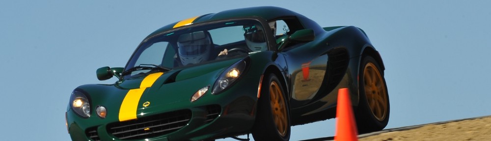
Had another track day with CECA at HPR. The first CECA event at HPR this year was the “official” LOCO track day but we had a good turnout of Lotuses today as well – if I didn’t miscount, it was seven Elises (BRG, LRG, blue, black, Storm Titanium, red, orange), an Exige (orange), an Elan, and two Caterhams. I was mildly surprised and happy to see three Ferraris out as well. Plus the usual CECA participants – a couple of Corvettes, a handful of Mustangs, some Porsches, a Viper, and so on.

I invited Scott out for a ride and he brought Nicole. They both had a ride with me and managed to get rides in other cars as well. I think they had a good time – they stayed a bit longer than their original plan. I assume that’s a good sign.

Michael was kind enough to be my support crew. We loaded the gear into his truck last night and hit the road by 6:15 this morning so I could get the slicks mounted up in time for tech inspection. On the drive to the track, we drove into a pretty sunrise, with the sun right over the highway. Once we got the slicks on, I headed to the tech inspection line and Michael crawled into the truck for a nap.

Scott rode with me for the first session. I cut it a couple of laps short because I started hearing a noise in right-hand turns. I couldn’t see anything amiss, so went back out for the second session with Nicole as a passenger. She had arranged a ride in a Viper, so I dropped her off after a few laps. The noise was still there, but not as bad, and I shortly decided I was just getting a bit of rubbing.

Third session was after lunch. Michael rode with me for that one, and about six laps in he was wanting out. This is twice now he’s been getting queasy on the track. I blamed the last time on the big bumps at the CSP track. No such excuse this time.

Michael had to leave the track early to make is evening plans, so after three sessions we put the street wheels back on. For the fourth session, I had Jason (LRG Elise) ride with me. He was driving in the blue group, so I then rode with him. It was quite interesting noting the differences in how we get around the track. For the most part, we get on the brakes and throttle at about the same spots and for most turns we follow the same line. But I’m a gear higher in almost every turn than he is. And with our fairly comparable street tires, we’re running pretty much the same lap times. My biggest take away is that I need to learn turns 4 and 10 better. He carries much more speed through both.

In the three sessions with slicks, my fast time was 2:12.64 according to the video tape. I also managed two laps in the 2:13’s and two in the 2:15’s. On street tires, I ran eight laps, six of which were less than 2:21.

Over all, it was perhaps my most enjoyable day at the track.

Here’s my fast lap:

Everett, WA

I went to Everett, Washington on business this week. Ah, the glamor of business travel. I stayed at the Holiday Inn downtown, with a gorgeous 7th floor view of I-5. The weather couldn’t have been much nicer – a bit of fog that burned off by mid-morning, then sunny cloudless days.

Tuesday I went for a fish dinner in Mukilteo. Ivar’s is right next to where the ferry to Whidbey Island docks and about a block from Mukilteo Lighthouse Park. I ordered their “World Famous” fish and chips. Couldn’t help but notice the menu said “Fresh Fish Flown in Daily”. Struck me as a little funny; the restaurant is right on the water, but their fish is shipped in. Pretty sure the fries were frozen, but it was a nice meal. From my seat I could watch the ferry load and unload. The ferry came about every half hour. It’s a double-decker. I don’t know how many cars it holds, but I counted about 120 getting on while I ate. Plus pedestrians and motorcycles.

After I ate I checked out the lighthouse and the park. I watched a couple more ferries cross paths. The sun was setting, a man was fishing with his young boy, people sat around firesย  by the water. As it got darker, a line of boats came into the boat slip. It was a pretty sunset, with a crescent moon setting as well, over the distant peaks of the Olympic peninsula.

Thursday I drove up to Bellingham to have dinner with Phil. Hadn’t seen him for a couple years, it was good to visit with him. Bellingham is something like 60 miles from Everett. Phil is in Vancouver, BC, so we met half way. I told him I’d be at the restaurant by 6:30. Left the client’s office at 5:30, brought up the navigation on the phone and saw that with traffic it would take me an hour and a half to get there. As luck would have it, Phil had to wait a while at the border crossing so we arrived at pretty much the same time. It was a pleasant drive up I-5 along the coast of the Sound with nice views all around, once I got out of traffic.

I ended up with Friday off. There was a little mix-up with scheduling – the client wanted me there all week, but then they realized they had a charity thing going on Friday and they wouldn’t be able to meet with me. I decided to see if I could walk up to get a tour of Boeing, then head to the airport and see if I could get an earlier flight. On the way, if the weather was good, maybe I’d go up to the observation deck of the space needle and get a picture of downtown Seattle with Mt. Rainier in the background.

So Friday morning I headed over to sign up for the Boeing tour. They recommend buying tickets online in advance, but it looked like they had plenty of open spots for the 10am. In the lobby, they want you to use a kiosk to buy your tickets. Two of the three were out of order, and the working one got stuck in a loop after I put my credit card in: the little hourglass icon would spin for 30 seconds, then a screen appeared asking if I was still there. Lather, rinse, repeat. Defeated by technology again, I had to resort to a human. And who knows how many times my credit card got charged.

The tour was pretty cool. They run one every half hour. A short film (out of date), then off in two groups to buses. They take you to the assembly building, the largest building in the world. Eight big doors, each the size of an NFL football field. The building is rectangular, with the short side measuring a third of a mile. They herded us down some steep steps into a service tunnel, then half that third of a mile to a service elevator that fit a busload of people at a time.

From the basement up past the first floor, mezzanine, second floor, to the third floor and onto an observation balcony over the 747 production line. The tour guide gave us the highlights – two planes a month are built, the 747-8. Six million individual parts, half of them fasteners. The stages of production – how the wings are assembled, then the fuselage, and finally to “weight on wheels”.

Next we went back down the elevator, back down the tunnel, back to the bus where we rode half the length of the building to the 787 production line. Then down more stairs, hike another 1/6 mile to another elevator and to a third floor balcony.

The 787 is assembled from components shipped in from other factories. They arrive on modified 747’s, parts as big as fuselage sections. They use special equipment to unload the planes and cart the parts to the assembly building. There, the put it all together and produce five 787’s a month and will be ramping up to ten a month soon. They’ve done something like 25 so far, mostly going to Japan (ANA and JAL).

I thought it was a pretty cool tour and I’m glad I had the chance to go. No photography allowed on the tour, of course. Not even cell phones allowed.

After that, it was south on I-5. After four days of ideal weather, things reverted to what I assume is more normal – overcast and damp. No point in making the detour to the space needle, so it was straight to SEA-TAC and the glamor of returning a rental car, going through security, and hanging out in the concourse for a couple hours. But I did get that earlier flight.

Colorado English Motoring Conclave

Today Genae and I went to the 29th annual edition of the Colorado English Motoring Conclave. It is held every year at Oak Park in Arvada. Lotus Colorado had a good turn out, as usual, with a variety of years and models. We briefly said “hi” to a few of the LOCOs before wandering around to look at all the other marques. Everybody asked me where my car was. It was parked on the street, next to another LOCO member who didn’t enter his car.

I think Genae talked me in to entering my car next year. I’m sure it won’t win any awards, but it will look nice parked with all the other Lotuses and if the weather is as good as it has been the last two years it will be a dandy way to spend a day.

Organizers expected more than 500 cars there, representing most English marques – Rolls Royce, Bentley, Lotus, Caterham, MG, Austin-Healey, Jaguar, Rover, Mini, Triumph. There was even a Hillman Minx! (There are at least two Minxes in the area; Michael and I saw a different one here last year.)

LOCO Drive – Miner’s Tour

Harv kindly organized a club drive for today. We met at the Denny’s in Boulder for breakfast and a mandatory drivers meeting. Most club drives are pretty casual – show up at the assembly point, perhaps hand out a short route description in case we get split up, then have lunch at some mountain restaurant.

This time, Harv added a little fun: four pages of detailed route notes full of interesting trivia and interspersed with questions. The team (driver/navigator) with the highest score wins a prize.

We had a nice group turn out – four Elises (BRG, LRG, black, yellow), a Caterham, a Miata, a Mercedes, and Harv led the way in his Porsche GT3. The route started up Boulder Canyon to Nederland, then down Coal Creek Canyon, up Golden Gate Canyon, down Clear Creek Canyon a bit, then over to Squaw Pass and finally to Jenny’s Restaurant in Empire for lunch and the all-important scoring of the test.

We generally like to find a scenic place to regroup along the way and also to get a group photo of all the cars. This time, all our regrouping was just beside the road so I didn’t have time for the picture. So no group photo. I did have Michael try to get a few shots from the cockpit, but those aren’t exactly ideal conditions. He got a couple of nice ones, but I need to give him a bit more instruction on how to use the camera ๐Ÿ™‚

Note: if you order the pie at Jenny’s, be sure to share! They serve giant pieces.

Edit: Here’s a picture taken by Skip:

Ptarmigan Lake

A quick glance at Google tells me there are two Ptarmigan Lakes in Colorado. This one, of course, is in RMNP. The Foster guide lists two ways to get there, one from the North Inlet trailhead and the other from Bear Lake. I hiked the North Inlet trail last September as far as Ptarmigan Creek, where I headed off-trail to Bench Lake. It was over seven miles to Bench Lake, and to proceed to Ptarmigan Lake would entail a couple more miles of bushwhacking. So I chose to start at Bear Lake, hike to the summit of Flattop Mtn, take the Tonohutu Creek trail northwest, then head off trail to the west and descend the better part of 900′ to the lake.

The trail up Fattop Mtn (12,324′) is busy and well maintained. It is the most popular route for hikers to reach the continental divide from the east side of the park. It’s about 4.4 miles from the parking lot to the sign at the trail junction at the “summit” (it’s flat on top, of course, so the generally accepted summit is the sign at a trail junction) and climbs 2,874′. Near the start of the trail, you get a nice view of Long’s Peak, then nothing but forest until reaching the Dream Lake overlook about a third of the way up. The next landmark is the Emerald Lake overlook about two-thirds of the way. From there, the trail takes you to the northern flank of Flattop, overlooking the Odessa Lake trail. It’s common to hear marmots barking their alarms as you work your way up the trail.

I’ve been on the top of Flattop several times. I’ve headed south to descend Andrew’s Glacier twice, summited Hallett once, and just sat above Tyndall Glacier for a picnic a few times. This was my first time taking the trail to the north. Not far along the trail you reach another trail junction, this one the North Inlet Trail. The Tonohutu Creek trail then proceeds along the eastern edge of the divide toward Ptarmigan Point, affording a nice view down the valley towards Odessa Lake: Ptarmigan Glacier, two unnamed pools, Lake Helene, Two Rivers Lake, and Odessa Lake are all visible below Notchtop Mountain.

The trail undulates a bit then turns almost due north near Ptarmigan Point. I headed off the trail, down the gently sloping tundra more or less in the direction of Snowdrift Peak in the distance. The mountain slopes gently at first but steadily becomes steeper and before long the lake comes into sight. I was expecting to descend a talus slope but it was almost entirely tundra. The descent is about 800 vertical feet from where I left the trail and it happens in a very short distance.

I set up the camera for the time lapse and ate my lunch. I wanted to stay for an hour, both to get a nice long video and to rest up for the steep climb back to the trail but I didn’t like the looks of the darkening clouds. After about 40 minutes I packed up, headed near the outlet for a quick panorama, then started the steep ascent.

About half way up I turned around to check out the view. I could now see Snowdrift lake to the west. I was about to take a picture, but the wind kicked up rather fiercely and nearly blew me over. It was so strong, in fact, that it made the steep climb much easier. I quit zig-zagging my way up the slope and headed in the same direction as the wind and was onto nearly level ground in no time.

Then the snow started coming down. “Coming down” isn’t exactly correct – it was coming sideways. In no time visibility to the north was very limited. Hallett Peak was just a silhouette and the peaks beyond it were totally obscured. Meanwhile, the Mummy range to the northeast was still bathed in bright sunshine. The blizzard continued for about a half hour, much to my chagrin. I was dressed in my usual hiking uniform of Hawaiian shirt and shorts (plus a windbreaker).

The weather finally broke when I started down the east side of Flattop. There I found a group of ptarmigans grazing in the tundra. (What’s the group name for ptarmigan? A pton?) They were conveniently working their way across the trail when I arrived and didn’t seem too bothered by me.

The remainder of the hike was under mostly clear, blue skies and the wind died down to a gentle breeze. Hard to believe I was experiencing such wintry conditions just a short while before.

Here’s the obligatory time lapse. It includes a short sequence filmed at Emerald Lake overlook on the way up and another from Dream Lake overlook on the way down. Yes, the weather varies that much in just a few hours on the continental divide!

Timetable

Out In
Trailhead 07:30 AM 03:20 PM
Odessa trail jct 07:55 AM 02:50 PM
Emerald Lake overlook 09:00 AM 01:30 PM
Flattop summit 10:00 AM 12:45 PM
Ptarmigan Lake 11:05 AM 11:45 AM