For the last week or so I’ve been looking forward to hiking to Tourmaline Lake. Unfortunately, a forest fire started near the Fern Lake trail head and there are a number of trail and road closings. Hopefully they’ll get the fire taken care of in short order but it’s hard to guess when I might be able to make that hike.
Wanting to take advantage of good weather, I scoured the maps and the Foster guide for a Plan B. I didn’t want to hike somewhere I’ve been before and I wasn’t feeling up to a very long hike. After quite a bit of deliberation I decided to hike to Chickaree Lake, an easy 2.6 miles and 480 vertical feet from the Onahu Creek trail head.
Because it was a short hike, I was able to sleep in a bit, even though the trail head is on the west side of the park. For these west side hikes, I generally take I-70 to US 40, over Berthoud Pass and through Winter Park, Fraser, and Tabernash to Granby, then east on US 34 and into the Park. On the way home it’s over Trail Ridge Road to Estes Park and US 36 through Lyons to Boulder and then home. All told, it’s probably five hours of driving depending on traffic on Trail Ridge Road. But it’s a nice loop and can be a fun drive if traffic isn’t too bad.
I hit the trail at 10am. It was not much above freezing, but calm with sunny blue skies and few clouds. The trail starts off more or less parallel to the highway for a short distance, then the highway bends west and the trail bends east. If you get an early start on these west side hikes, you often get to see moose, deer, and elk in the meadows. Today I saw none of these, but did hear a few elk bugling somewhere to the south of me.
The trail passes through lodgepole pine forest, undulating up and down a bit. The trail is often free of rocks and roots and when it gets wet it gets muddy. It was dry except for a few puddles and occasionally in the dried mud I could see the prints of elk who had used the trail. At one spot there was even a bear paw print in the dried mud. It looked like the bear was stalking the elk, but who can really tell? The prints may have been made hours apart.
Beetles have killed a large number of trees in this area. Maybe two-thirds or three-quarters of the trees are dead. In some places, the trees are quite mature, with trunks a foot or more in diameter and spaced twenty feet apart. In other places, the trunks are only four to six inches in diameter and the trees are four to six feet apart. Lodgepole pine are straight and tall with short branches, so even with closely spaced trees the forest is quite sunny.
When researching this hike, I read reports that there are (or used to be) ranger led hikes to this lake as often as twice a week. Even with small groups, if there’s that much traffic to the lake I was expecting to see traces of a trail. The Foster guide says to climb to a specific elevation then head northwest. This elevation would be before the trail crosses Onahu Creek but I didn’t see any sign of a trail to the lake.
Upon reaching the creek, I left the trail and headed northwest. I was making good time – I had expected to take about an hour to get here, but it had been only 35 minutes. According to both the map and the Foster guide, I could expect to cross a tributary of Onahu Creek before long. “Bushwhacking” is the term generally used, but because the forest is thinly vegetated it was a pretty straightforward walk. There is quite a bit of deadfall, but this section of the forest features the smaller trees so it was more stepping over than climbing over them.
After a while I was starting to doubt my pathfinding abilities. I saw no sign of a stream. Perhaps I had read the map wrong. When the trail reached that last stream, there was a sign identifying it as Onahu Creek. Maybe the sign or the map was wrong, and I had turned off too soon? I did seem to reach the creek pretty quickly. And in the forest there are no landmarks to assist in locating myself on the map. Just as I decided I’d turned off the trail too soon, I saw the lake through the trees. I had indeed walked straight to it.
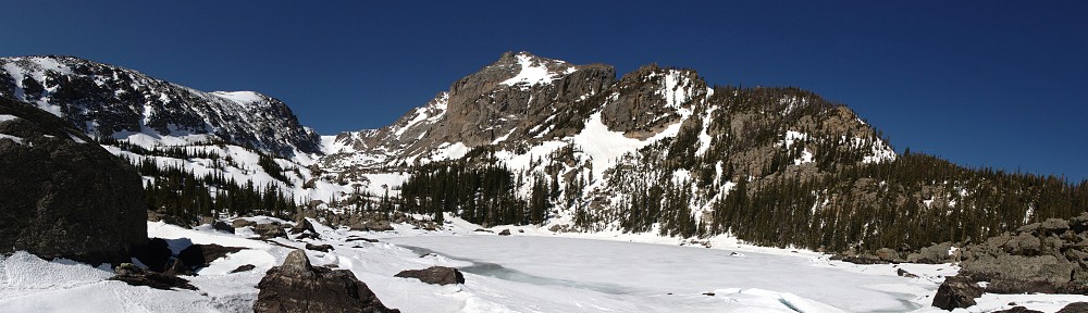
 Chickaree Lake lies in this thick forest on a bit of a bench. It has no inlet nor outlet stream and I was somewhat surprised at how big it is. It also has no interesting views. I went around the lake looking for a suitable place to set up the cameras and eat my lunch. I picked a spot and got the cameras up and running. As usual, I brought the GoPro for the time lapse and the SLR for everything else. I also wanted to shoot a time lapse with the SLR as I’ve been unhappy with the GoPro’s extremely wide angle and its lack of viewfinder.
After failing to get the SLR running properly for a time laps on the Sky Pond hike, I was a bit more prepared this time. I brought both batteries (fully charged) and had corrected my error with the intervalometer’s settings. Before long, I noticed that the battery indicator was reading low. A few minutes later it died completely. I swapped batteries and started it running again, keeping a closer eye on the battery indicator. The second battery also was discharging quicker than I expected. I got only 160 shots with the first battery. I didn’t want to run the second one all the way down, so I stopped it after 320.
Unfortunately, the skies weren’t cooperating with me. There was one saucer shaped cloud to the east and it never seemed to move. I made a video using both cameras as a sort of comparison, but the ripples on the lake are probably more interesting than the sky. Oh well.
After packing up my gear, I finished circumnavigating the lake. I figured I had no real chance of retracing my steps so I just headed in the correct general direction. Before long I found what looked like a trail, so I followed it. This didn’t last long – it petered out, but even if it hadn’t, I’d have left it as it was heading too much to the east and uphill. I finally did cross a trickle of water. If this was the tributary the map and guide indicate, I can only assume it’s more substantial earlier in the season.
I made it back to the trail in good order. I found the trail before I found the creek, although I could hear the creek clearly and knew I was quite close. So I returned to the trail about a tenth of a mile above where I left it. The hike back to the car was uneventful. I ran into three pairs of hikers on the way out, nobody on the way in.
For the drive home, I decided it was warm and pleasant and could do the drive topless, so off with the roof. I knew it would be cool and windy on Trail Ridge, but leave the windows up and keep the jacket handy and be ready to turn the heater on if necessary. Traffic was fairly light, being a weekday in October.
I didn’t see any smoke from the Fern Lake fire until I got to the Forest Canyon overlook. I pulled over there and hiked up the road a few hundred yards to try to get a better view. 
I thought maybe a better view could be had at Many Parks curve, but the parking area there was cordoned off for use by the firefighters (although none were there at the time).
Here are a couple more views from above Upper Beaver Meadow.

 Timetable
| Out | In | |
| Trailhead | 10:00 AM | 01:10 PM |
| Onahu Creek | 10:35 AM | 12:30 PM |
| Chickaree Lake | 10:55 AM | 12:10 PM |