Lake Irene

Note that I’m talking here of Lake Irene, just down the road from Poudre Lake, not Irene Lake, near the base of Sprague Glacier. I hope to write about Irene Lake before summer is over.

Last of the low-hanging fruit, perhaps?

I can’t tell you how many times I’ve driven the section of Trail Ridge Road west of the Alpine Visitor Center. But I can tell you, before today, how many times I’ve stopped at the parking lot for Lake Irene: zero.

It’s a small parking lot that will hold about a dozen cars. There are a couple of picnic tables and an improved trail of not much more than a hundred yards to small Lake Irene. There’s not much to recommend here, other than it’s easy to get to. I am fortunate to be able to make long hikes to the many beautiful lakes in the park. I probably take that for granted. But I do know that not everybody can hike like I do, and it’s good that there are some places that are more accessible. That said, it’s not ADA compliant. But it is relatively low effort.

Of course, I didn’t make the trip up here just to visit this lake. My real reason was to stop by the back country office to pick up my permit for next week’s hike. So we made a day of it, stopping in Estes for lunch then heading over Trail Ridge Road and returning to Denver via Winter Park and Berthoud Pass.

I would have liked to have taken Old Fall River Road up to the AVC, but that road isn’t open yet. And the snowbanks at the AVC are still something like ten feet deep. Lake Irene sits at about 10,600′ and there’s still snow on the ground there. Trail Ridge was so crowded we weren’t able to stop at the Rock Cut, but a brief glance at the Gorge Lakes told me they’re still well frozen.

My backpacking trip next week may be much more challenging than I was hoping. I’ll be staying at Upper Ouzel Creek. I don’t know exactly the elevation there, but it’s somewhere close to that of Lake Irene so I’m guessing there will be snow at the campsite. And my hope is to reach both Isolation Lake (11,985′) and Frigid Lake (11,824′). Frigid Lake will be, not doubt, still quite frigid.

At least it will be interesting.

Emerald Lake and Bierstadt Lake

Sunday, June 16

I think it has been four months since my last visit to the Park. That’s way too long. But it’s too early to do a nice long hike because that generally means a decent elevation gain, and from down here in the big city it looks like there’s still quite a bit of snow on the ground in the high country. So I figured I’d do a short hike to get a sense of how much snow there really is.

Lacking any good ideas, I resorted to an old standby: Emerald Lake. For nearly twenty years, I managed to drag a rotating group of friends up to Emerald on Memorial Day weekend. It’s a bit past that time now, but close enough. I was hoping to make it around the lake and gain some elevation on the west side of it for a change of pace.

I arrived at the Bear Lake parking lot a bit before nine. There were only a few empty parking spaces left. I probably should have grabbed the first one I saw, but hoping for a closer spot I found myself up at the top. There, one of the volunteers said, “Hey! We know that car!” Doc and I exchanged greetings; he wanted me to tell him about the car after I got parked. Well, Ed’s usual spot was empty, so I parked there. Before I was out of the car, another volunteer parked next to me. So I answered all of Doc’s questions and chatted with the both of them before hitting the trail.

Emerald Lake

Just before getting to Emerald I met a guy who had just skied down one of the couloirs from near the top of Flattop. Being a non-skier, this sort of thing strikes me as pretty hard-core.

At Emerald, I worked my way around the norther shore far enough to get out of the ever present crowd, but I didn’t try too hard to continue west to higher ground. Having failed to execute my original plan, it occurred to me that this hike is so short there isn’t any reason I can’t add another short hike to the day. When I recently redid my online photo gallery I noticed that I didn’t have any pictures of Lake Bierstadt. Why not make a side trip to Bierstadt and rectify that oversight?

Having arrived at the lake a few minutes before ten it was too early for lunch, so I just relaxed and took in the views. I couldn’t help but notice a bunch of debris on the ice over on the west side. There was an avalanche here back in early May. This debris is likely from that event. How else would a bunch of pieces of pine tree be on the ice in the middle of Emerald Lake?

Avalanche debris on the lake

The hike back to Bear Lake was at times painfully slow. This is what I call “conga line hiking”. There were so many people around the end of the trail at Emerald that it sounded like a high school cafeteria. On the way down, the only places I could make my way past long lines of people was on the snow: I had my micro spikes but most others were in sneakers. I would have taken the shortcut from Nymph to Bear, but I’ll only do that when nobody is watching – don’t want to let the general populace know about the shortcut. No chance of stealth today, so I took the long way.

Lake Bierstadt is named for Albert Bierstadt, a painter known for his landscapes of the American West. I saw a few of his paintings when I visited the National Gallery of Art in Washington, D.C. They’re big paintings of dramatic landscapes. So I find it a bit ironic that, in a Park with so many stunning lakes, the one with his name on it is, shall we say, not that impressive.

The hike from Bear Lake to Bierstadt Lake is about two miles. The first section is along the Flattop Mtn trail. This section of trail climbs a bit, and after the trail junction it continues to go up for a short distance. After that, it’s all flat or slightly downhill. It’s a forest hike with no views at all, except for a very short glimpse of Halleck and Flattop on a few yards of trail that goes west. The walking is very easy, with few roots or rocks to deal with. I was able to keep up what I call a “sidewalk pace”.

There were a lot fewer hikers here than at Emerald. Between Bear Lake and Bierstadt I ran into about two dozen other people. I made my way to a rock on the southwestern shore of the lake and ate my picnic lunch. I was joined in lunch by a duck who was working his way back and forth through the grasses nibbling as he went. And not far away I was somewhat surprised to hear the almost constant croaking of frogs. I know there are frogs in the park, but I’ve never seen any, and until now hadn’t heard them either.

Up to now, the weather had been quite pleasant. But to the north, some ominous clouds had formed and a chill breeze had picked up. I’d wanted to circumnavigate the lake, but with the threat of rain I packed up and headed down the trail to the Bierstadt trailhead.

Threatening clouds

So I still don’t have any pictures of the best views of Bierstadt.

The trail from the lake to the trailhead climbs something like 600′ in a mile. It switches back and forth across the mostly treeless slope on its way. I’ve made that climb a few times, but the last couple passages on this trail have been downhill only, like today. Just when I started down, I ran into a family coming up. They were only a few yards from the top. I couldn’t resist: I said, “Only another mile to go!” and waited a beat before adding “Just kidding.”

Winterlude

It has been three months since I visited RMNP. Well, I was at the back country office last week, but that doesn’t count. I didn’t actually get into the park, let alone do any hiking. I tried back in January, but that was during the government shutdown. More recently I’ve had to schedule things around work on the car, so I haven’t had much opportunity. I finally made it happen today.

I was afraid it wasn’t going to come together. Due to the recent heavy snows, I was pretty sure I wouldn’t be able to get there in the Chrysler so I’d have to find somebody to go with who was willing to drive. Luckily, Ed stepped forward and volunteered to join me for a walk in the Park.

When we arrived at the entrance station, we couldn’t help but notice that the express lane was closed. And when Ed proffered his park pass the ranger asked if his car was four wheel drive. “We really discourage continuing unless you have four wheel drive.” We pressed on, undaunted.

The road was pretty slick right away, with ice just a few yards after turning onto Bear Lake Road. We took it easy, going slower than some 4WD trucks which Ed waved by us, and made it to the parking lot without any drama.

The plan was to take Ed’s route to Lake Haiyaha. This one never gets old for me. As I’ve said before, I’m somehow unable to navigate this route on my own. I keep thinking that I should be able to find my own way, and I recognize many landmarks along the way, but I can’t mentally string it together. Eventually, though, (I keep telling myself) I’ll get it figured out.

First stream crossing.

As I’ve mentioned, the Park as gotten quite a lot of snow over recent weeks. Even though Ed has broken this route many times this season, there is little to no trace of his trail. In the depths of the forested parts, I could make out a slight depression indicating his route. But in the clearings, where the wind works full time, there’s nothing. Ed tried pointing out the signs to me on occasion – “see that slight depression there?” – it was far from obvious anybody had ever been through here.

Deep drifts

My snowshoe experience is fairly limited. I make it out only once or twice a year. So I couldn’t help but tell Ed that this was by far the deepest snow I’ve gone through. He responded that it doesn’t get much deeper. Even on snowshoes, we were often sinking knee deep. We went through a few drifts that were waist deep, and on the steeper uphill sections it was tough going. Of course, Ed was in the lead, so he was doing much more work than I was.

It was cold and windy, but that describes most winter days here beneath the Divide. At lower elevations, it was clear blue skies, but here clouds flew above the mountaintops and snow flew along the ground. It wasn’t so overcast that the sun didn’t make shadows, but it was overcast enough that the sun seemed small and distant. Surprisingly, given the amount of wind, the trees were laden with an amazing amount of snow.

In the end we didn’t make it to the lake. I needed to be back to Lyons by 3:30 or 4:00pm, and our progress was slower than usual. And, frankly, it was a fair amount of work plowing our way up the hillside. When we finally stopped, Ed guessed we had maybe another half hour at the rate we were going. Sure, I’d have liked to visited Haiyaha for a quick look at the always interesting ice there, but I’m not bothered we didn’t press on.

It was yet another beautiful day in the Park.

Mills Lake

Saturday, December 15

Chad and I hiked to Mills Lake. He drove. He didn’t want to make the trip on my summer tires in spite of my assurance that it would only be the last mile that’s dicey. We got to the Glacier Gorge parking lot around 8:30. It was about half full. In the summer, it takes me almost exactly an hour to get to the lake from the parking lot, but today it took an hour and a half.

We took the fire trail. When I came down it after visiting Ed’s igloo the tracks followed the summer trail but now it’s switched to it’s snowy winter route, up the gully. An outcropping of rock was covered with large icicles fifteen or twenty feet high.

There was a good crowd at the lake. It was pretty windy, but we stood in the lee of a small stand of pine. Even though it was out of the wind, I had a pretty nice view up the gorge. The sun is about as low in the sky as it will get as we’re just a few days from the solstice.

The view of the gorge as you near the lake is one of the most impressive views in the park. Today when we arrived there, clouds hung in giant curls from eastern flank of Thatchtop. Longs Peak  plowed the wind, leaving a wake of condensation. The wind whipped through at high speed, kicking up clouds of snow up throughout the gorge. The low sun backlit the blowing snow, showing the wind’s form; its flows and eddies.

We were there for nearly an hour. I thought we’d be doing good if we to stayed much over half an hour, but our spot was comfortably out of the wind and I managed to blather on about something or other until I sufficiently bored Chad and he suggested we make our way back to the car.

A Visit to Ed’s Igloo

Friday, November 23

Several days ago I reached out to Ed to see if he’d be interested in hiking with me today. His plans were more ambitious than mine: he said he would be going to the igloo he made the other day and spending Friday and Saturday nights there. He asked if I’d like to join him. I quickly declined, but agreed to spend the day with him. My excuse is that my sleeping bag isn’t sufficient for a November night at 10,500′ in a structure made of snow.

Earlier in the week, the forecast for the day looked pretty good. It would be mid-50’s in Denver, but windy. I don’t know why I keep mentioning the Denver forecast when I’m heading to the Park. In the summer I can count on my time in the Park being much the same as Denver, but cooler. In the winter it may as well be a different planet.

Ed wanted to meet at the Bear Lake parking lot at 7:30. That seemed a bit early for me, so I talked him into 8:00. Lately it has been taking me an hour and forty-five minutes to get to the parking lot, and when I add a few minutes to grab breakfast in Boulder and a few minutes cushion in case I run a bit late, I could leave at 6:00 to meet Ed at 8:00. As it turned out, I left promptly at 6:00 and didn’t have any traffic, so I arrived at Bear Lake at Ed’s preferred time. Which meant I had to wait.

According to the weather report, the forecast for the northern mountains was snow overnight Thursday, clearing up for most of the day, then snow again starting late afternoon or early evening. As of 7:30, the first part of that was more or less accurate. The skies were clear on my drive all the way up to the Bierstadt trailhead, just a few miles from Bear Lake. From there on, it was snowing, but not windy. Here I should mention that the Chrysler isn’t equipped for driving in snow: I have ultra-high performance summer tires on her. They’re fantastic for dry pavement, excellent in the rain, but there are few tires that are worse in the snow.

I’ll also add that the road to Bear Lake was in the worst condition I’ve ever seen. But that’s fairly meaningless, for three reasons. First, I only go to Bear Lake in the winter a few times a year. Second, I’m a fair-weather winter hiker and most times I’ve gone, I could easily take the Lotus (which is worse in the snow than the Chrysler). Third, the park service does a good job of keeping the road clear. So I made it to the parking lot without problem, but made sure to park so I didn’t have to go uphill on my way out, anticipating that conditions wouldn’t get any better.

Ed had posted a few pictures of the igloo on Facebook, but I didn’t have a great idea where it was other than the top of a little ridge with a great view. Given Ed’s range, even restricting it to within a few miles of Bear Lake, that doesn’t narrow it down much. Perhaps I should have asked him before we started, or before I agreed to go with him, but I waited until we were on our way. We stopped for a few minutes and he used his trek pole to make a diagram in the snow.

This is the fourth or fifth time I’ve followed Ed through the snow. He’s led me to Lake Haiyaha a few times and I still don’t think I could get there on his route without his guidance. I think I’m figuring it out. I think I could do it in the summer, but for some reason the terrain looks totally different to me when it’s covered with snow.

Ed leads the way

My inability to follow his route isn’t because he’s not a good guide. He is constantly pointing out terrain features. Today perhaps he was trying to show me too much. I felt it was a bit of information overload. But that may have been because I was a bit preoccupied. You see, this was a one-way trek with Ed. Because he’d be spending two nights in the igloo, I’d have to find my own way back to the car.

We spent a lot of time turning around and looking back the way we came. “Through the trees here our trail should be fairly clear. But in this clearing it will drift over. You’ll want to avoid the bottom of the gully here. Stay to the left of that log there.” That sort of thing. You see, it was snowing pretty good. The wind wasn’t as bad as it often is here so close to the Divide. But it would be hours before I came back this way.

Yours truly. This is a smile, not a grimace. Look closely: the snow is falling sideways.

Where our route crossed the trail from Lake Haiyaha to the junction with the trail to Mills Lake and the Loch, we walked back and forth along that trail so that “tourists” wouldn’t be tempted to follow our tracks. Here we discussed one of my options. I could either follow our tracks, or take the official trail. It didn’t look like the official trail was very well traveled, so I was thinking following our own tracks would be the best bet.

From here our route started getting steep. Our destination was a glacial knob at the eastern end of Otis Peak, immediately north of The Loch, and about 300′ above it. Ed knows I’m not a big fan of the steep stuff, so he gave me a bit of a pep talk. The final approach to the igloo would be quite steep. He compared it to the descent we made from the ridge on the south side of Dream Lake back in the spring. It would be that steep, but not that long, and broken into short segments.

On that final approach there was only one spot that had me bothered. It was a bit tough climbing it, as the snow seemed to want to give way under my weight. I had to be very careful to put my weight directly above the balls of my feet, which I found a bit of a challenge. At one point, I was almost crawling up the snow.

“Come stand out here on this precipice and check out the view!”

The igloo is sited atop a rock outcropping, with clear views to the east and south. Or, it would have clear views if the weather was clear. When we arrived, we could see a bit down the Bear Lake road and we had a view of Half Mountain. A cliff face of Otis was just a few yards away to the northwest, and the northern flank of Thatchtop was prominent to the south. After a quick look at the surroundings, we retreated to the shelter of the igloo for lunch.

Click on the picture to see it full-sized.

We ate and chatted for about forty-five minutes. My soda was nice and cold, but my water was colder: it was starting to freeze. This should not have surprised me, but it was a bit distressing to have to knock a plug of ice out of the mouth before I could take a sip. We set my water bottle beside Ed’s little furnace. Although it was nice and cozy inside, it wasn’t warm enough to melt the ice. Standing up, though, I found that the air was close to fifty degrees at the top, while it was more like freezing down at the level of the door.

Igloo at center; Thatchtop in background.

After lunch it was time for me to head back. When we popped out of the igloo, it was quite obvious how the conditions had changed. Visibility was just a few hundred yards. Ed kindly escorted me down the steep bits and I was soon on my way, retracing our steps from the morning. These steps, of course, were our most recent. So they had had the least amount of snow, either freshly fallen or wind-blown, obscuring them. In the trees it was quite easy to follow them. I was feeling pretty good, in spite of the degraded conditions.

Wind-sculpted pillows of snow.

The first challenging part was around a small unnamed body of water that Ed likes to call “Beautiful Lake Marv”. We had walked through an open area where the wind gets an unimpeded run. Our track was completely erased. Ed’s advice was to stay to the left and don’t go down into the gully. It took me a few minutes, but I eventually did spot our trail below me. I was able to follow it all the way down to the trail from Haiyaha.

On the way up, we didn’t just cross directly over it. After reaching it, we went along it for maybe a hundred yards, then left it. I thought I’d easily find where we gained the trail, but I had no luck. Some other hikers had come through; I followed their tracks off the trail, but they just made a short excursion to look at the stream. After a couple times up and down the trail looking for my way, I decided that the tracks along the official trail were my best bet, so off I went.

Although a bit longer, it was an easy hike out. I arrived at the trial junction in good time and ran into a few hikers. Two guys asked me how it was the way I came. I told them I didn’t go all that far. They told me they’d come up the Fire Trail and that it was pretty clear. So that’s the way I went. A few minutes later they passed me, one on skies, the other booting it. They went at a pretty good clip, the one in boots running.

By now the wind was getting pretty fierce. Even in the wooded sections, the trail was getting harder to follow. Those guys were just a few minutes ahead of me and their tracks were indistinct. Then a few minutes later another pair of hikers passed me, and shortly after that the trail was sufficiently out of the wind that it was quite obvious.

I was back to the car by 2:45. There were surprisingly few cars in the parking lot. My car was the closest to the top of the hill, and was pretty well covered by snow. By 3:00 I was on my way. I practically crawled along the road, ABS engaging quite a bit. My doors don’t lock until I reach 13mph. They didn’t lock until I passed the Glacier Gorge lot. Even going so slow, I managed to catch two other cars, who pulled over to let me by. The road was pretty treacherous, with blowing snow creating blizzard-like conditions, until about Hollowell Park. At Moraine Park, a ranger had his truck, lights flashing, blocking up-bound traffic. Clearly, they weren’t letting people go any farther. That explains why there were so few cars at Bear Lake.

So, to recap: I walked through sometimes blizzard-like conditions, up and down sometimes incredibly steep terrain, sometimes trying to follow my own vanishing tracks in the snow, then drove my car on summer tires through more blizzard conditions. Through all that, I was warm and dry. What can I say? It was another beautiful day in the neighborhood.
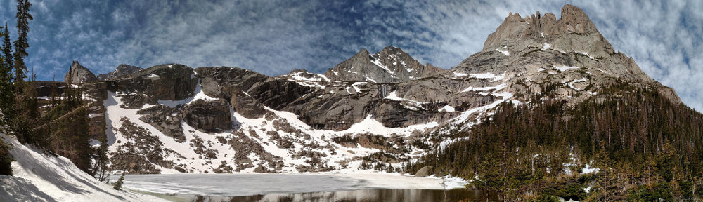
Loch Vale

Monday, October 29

Things are a bit on the slow side at work, and I have a few vacation days I haven’t used. So with the weather looking good for today, I took advantage of the opportunity and headed up to the Park for a short hike. I figured I’d try something similar to my last hike – that is, a short hike to a familiar destination but try to get a different perspective by gaining a little elevation. So I headed up to the Loch, with the intention of finding a nice rock outcropping with a view of the lake and the valley in which it sits.

I wanted to park at the Glacier Gorge parking lot, so I left a bit earlier than last time. This had the side-effect of missing the worst of rush-hour traffic going into Boulder. Between Boulder and Lyons I was treated to a beautiful sunrise, which is always a nice way to start the day.

There was relatively little traffic on US 36 and now that it’s off-season, I skipped my usual detour by the hospital and actually went through downtown Estes Park. Approaching the RMNP entrance station, I saw a few temporary signs indicating that there was a chance of fog or smoke. I thought it was odd, as the weather was fine and the skies were mostly clear. In Moraine Park their electronic sign told me that the Bear Lake parking lot was already full. I wondered how that could be, given that it was 8:30am on the last Monday of October. How can there possibly be that many people there already? If the Bear Lake lot is already full, there’s no way I’ll get a spot at Glacier Gorge.

When I arrived at Glacier Gorge parking lot there were about eight cars there. Clearly the sign in Moraine Park was in error. Two of the eight cars had just arrived moments before I did. Two guys got out of one of the cars, looked at each other, decided it was too windy and got back in their car. I told them it wouldn’t be windy on the trail, but they weren’t convinced. And, actually, I didn’t think it was very windy at all, compared to what I’ve found there in the past.

Andrews Glacier barely visible

Although I’m quite comfortable deciding what to wear and what to carry on my summer hikes, I’m not that experienced in autumn or winter. I think part of my problem is my lumbar pack. It’s sufficient for my summer day hikes but doesn’t allow me to carry what I might need on a colder weather hike. Today I wore my thermal (light or medium, I forget) underwear, hiking pants, Hawaiian shirt, hoodie, and windbreaker. I had a woolen hat and gloves, and I had my rain jacket as well. I brought my microspikes and gaiters, but ended up leaving the microspikes in the car. I figured I probably wouldn’t need them, but once I got off the trail there might be enough snow I’d want the gaiters. In the end, I didn’t use them.

The day was quite pleasant. On the trail, the wind was not an issue and I didn’t think about it until I got near my destination. There was very little snow on the ground for my entire hike, while the trail had icy stretches that became longer and more common as I gained elevation. The ice was only in the shady bits, starting about halfway up the fire trail. About half way between the Mills Lake trail junction and the Loch I encountered a hiker on his way out. He was trying for Sky Pond but turned around at Timberline Falls. All he had was microspikes and that wasn’t enough for him. He was the only person I met since the parking lot.

Shortly after arriving at the Loch I started looking for a place to start climbing. As it turns out, I started climbing too soon. But it didn’t take long to run into the talus field that’s on the south side of the lake. It runs at an angle. If I’d kept to the trail for a little longer I’d have come across it and had an easier way up.

Picnic view

In planning the hike, I had considered following this talus field all the way up to one of Ed’s glacial knobs. But I found a nice place with a view of the valley that was in the sun and out of the wind. I was perhaps two-thirds of the way up the talus. There was a bit of snow here, but I easily avoided it. I didn’t want to step on some snow only to find out that there’s nothing beneath it but a giant hole.

Interesting grain, a little burned around the edges

In the talus there’s a fair amount of dead wood. Not a lot: it’s a talus field so more or less by definition there aren’t any trees. But there are a few ribs of soil here and there and over the few hundred yards of talus I maneuvered I came across quite a few pieces of deadwood. Each one showed signs of being burned. Some were subtly discolored, just a touch of brown. Others were deeply charred. I assume all these were the result of the Bear Lake Fire of 1900. Burned bits of tree can be found throughout the area, but they’re move obvious here as no trees have grown here in the intervening century.

About two-thirds of the way to the top of the talus field I found a spot with a nice view. As a bonus, it had full sun and was not particularly windy. I fully expected that any place I found that was in the sun and wasn’t surrounded by trees obstructing the vista would be blustery, but my little spot was close to ideal. It may very well be that it wasn’t as windy as it normally is in the cooler months this close to the Divide. But it wasn’t exactly calm. The small clump of trees thirty or forty yards above me sang a bit when the heavier gusts blew by.

Interesting textures

While I let the camera run, and after my picnic, I explored the immediate neighborhood. This meant hopping from rock to rock through the talus. On my way to a spot where I could get a bit of a view of Andrews Glacier, I hopped on a rock that looked to be about three feet on a side. It was a “wobbler”. I’m often concerned that some of the smaller rocks I step on will move, but haven’t had that happen with a boulder this size. Frankly, it kind of spooked me. This one had to be three quarters of a ton or so. I had a quick mental image of it moving a large area of talus; not something I want to be in the middle of. From then on, until I got back to the trail, it seemed like every rock I stepped on moved a bit. I know it was my imagination, but it had me being very careful.

After about an hour of watching the world go by, I packed up and headed back down to the trail. Along the way I came across a large upended stump. Its color matched all the other dead wood nearby, except that it had no obvious signs of burn. What it did have was a rock that the roots had grown around. I took a few pictures of it from various angles; didn’t get one that shows it very well, but so it goes.

Rock encased in wood

Back on the trail I started encountering other hikers. One couple asked if they’d passed Sky Pond. I told them that they hadn’t, and that they weren’t likely to make it past Timberline Falls given that they lacked any kind of traction devices. The next couple I came across said they were properly equipped, and I wished them luck. They looked to be fit, but it seemed to me they wouldn’t be getting up there until fairly late in the day.

The Loch

I briefly considered taking the long way back to the car and spending a few minutes at Alberta Falls. Maybe I was feeling lazy, maybe I preferred the solitude of the fire trail, and in the end took the shortcut. As I hiked out, I shed my layers ending up in shirtsleeves. The forecast high for Denver was in the mid-70’s, while NOAA predicted a high in the mid-40’s for Loch Vale. No doubt, it was warmer than the mid-40’s where I had my picnic.

Leaving the park I saw why they had signs up warning of smoke or fog: they were doing a prescribed burn on the north side of the road, covering the whole distance between the entrance station and the Beaver Meadows visitor center. By now all the excitement seemed to be over: I saw a fair amount of smoke but no flames.

Prescribed burn

Timetable

There Back
Trailhead 08:55 AM 01:22 PM
Mills/Loch Jct 09:35 AM 12:45 PM
The Loch 10:05 AM 12:24 PM
Picnic spot 10:43 AM 11:45 AM

40° 18′ 25″ N, 109° 39′ 37″ W, or Thereabouts

Things have been a bit on the slow side at work lately. With summer hiking season winding down, I figured I could pick a day with a favorable weather forecast to take some PTO and hit the trails. The weather wonks in the Denver area have been missing their forecasts lately, predicting warmer weather than we’ve actually been getting, so this added a bit of variability. They told me Wednesday would be the warmest day for the foreseeable future so Tuesday afternoon I asked for Wednesday off.

Wednesday, October 3

I planned on a rather short hike, which meant I didn’t need to leave the house before sunrise. But a later start also meant I’d be facing morning rush hour traffic. As I work from home I almost never have to deal with traffic, so getting out in it once in a while is a good reminder as to how spoiled I am.

The Chrysler is getting old, and it sitting outside isn’t helping much. She’s getting senile. I can’t use the automatic headlights because every now and then they start flashing randomly. And the intermittent wiper often gives two or three wipes at a time. And so, when I saw the outside temperature reading at 73° on the approach to Estes I figured that was wrong, but the thermometer doesn’t yet seem to be demented. It did cool back down dramatically as I got closer to the Park.

On the way through town I spotted what I thought of as a clear-sky rainbow. I know that you don’t get rainbows without rain, but this one looked to be situated well away from any clouds. It was clear above, and the only clouds in sight were draped across the Continental Divide. Well, “socked in” more adequately describes it. Nothing above about 11,000′ was visible.

I was a bit surprised by how many people were in the park, given that it’s a weekday. The Bear Lake parking lot wasn’t yet full (but it was full when I left a bit after 1:00pm). This time of year I expect mostly locals, but there were still quite a few cars with Illinois, Minnesota, Texas, and California plates.

When I got out of the car it wasn’t particularly chilly, but it was (surprise, surprise!) fairly windy. By now I treat “windy” as the default state of things along the Divide, unless it’s mid-Summer, and sometimes even then. I wasn’t going very far, and I wasn’t exactly going to visit a lake; my intention was to spend my time surrounded by trees, so I didn’t let the wind bother me. But I didn’t put too much thought into exactly where those trees would be. My destination was the ridge that separates Dream Lake from Lake Haiyaha.

I took the shortcut from Bear Lake to Nymph Lake not so much to shorten the walk as to avoid the crowds. Rather than hustle up the Haiyaha trail, I followed the trail the few yards to the shore of Dream Lake. The clouds were impenetrable over the divide but the fierce winds that carried them east also tore them apart. To the east the skies were clear, and in the zone in between, the sun was able to play “now you see me, now you don’t” with the lakes. A few minutes patience allowed me a view of a sunny Dream Lake with clouds above.

After another quick pause to take in the views to the east, I left the trail before crossing Haiyaha’s outlet stream. There’s a bit of a trail here that gets used by the rock climbers that lasts until you reach talus. Once in the rocks I started heading uphill. It’s not too steep and there isn’t much to hinder progress – little deadfall and no rock outcroppings – and found myself at the top of the ridge in no time.

I sat up there for about an hour, letting the cameras run. I tried to stay out of the wind, but here at 10,472′ (according to GPS) it was a challenge. I found a place that wasn’t too bad. I kept an eye on the lake. For the last year or a bit more it has a distinctly glacial color to it. There was a slide a while back up the canyon and the snowmelt that passes over and through the slide has carried some sediment to the lake that gives it a turquoise color when viewed from above in sunlight. But every time the sun illuminated the lake it was over before I could capture that nice color. That just gives me an excuse to revisit this spot next summer, even though the color is already fading.

I made it back to the car pretty early so I decided to make a stop at Sprague Lake. I can’t help but notice that it hasn’t been on my list of lakes I’ve visited. Thinking about that oversight it occurs to me that I certainly haven’t been there in at least thirty years. That makes me wonder if I’ve ever actually been there. I’ve got to believe we were there as a family when I was a kid. Right? How can I have spent so much time in the Park, driven by the place hundreds of times, and never been there?

I took my time at Sprague. I let the camera run again for another half hour or so. The wind was not any less here than on the ridge above Haiyaha, particularly on the windward side. I was surprised the wind didn’t jostle my camera, as it was enough to kick up spray from the lake’s surface and unbalance the unwary pedestrian. The clouds were no longer obscuring the peaks but it wasn’t clearing up. If anything, they looked more threatening. Until you turned around and faced east, where it remained sunny.

The weather forecast turned out to be spot on. At roughly 3:30 I was mired in Boulder’s afternoon rush hour in balmy 83° sunshine.

I was hoping for better results on the time lapse. The Sprague Lake portion came out fine, with the possible exception of some spray hitting the lens. But the ridgetop sections don’t show any of the details of the clouds. The GoPro is just too wide-angle, and with the auto exposure it doesn’t handle changing light well at all. I haven’t been using the SLR since the cheap little tripod I was using broke. I guess I need to find a new tripod.

Chaos Canyon

Sunday, July 15

Lake Haiyaha sits at the entrance to Chaos Canyon. The canyon stretches roughly a mile and a half above the lake, ending at a couple of glaciers hanging below the saddle between Hallett Peak and Otis Peak. I’ve been to the lake many times but have never ventured very far up the canyon. The lake sits in a boulder field and this setting is emblematic of the terrain in the entire canyon. The few times I’ve attempted to get anywhere in the canyon ended with a nice view of the lake, but only a few hundred yards up.

On a recent hike with Ed he talked about visiting the small unnamed pond about two-thirds of the way up the canyon. He has named it “Quaint Pond” because there aren’t any bodies of water in the park having names starting with the letter Q and because he finds the pond… quaint.

I wonder about why some features in the park get named while others don’t. Quaint Pond may technically be better called Chaos Tarn but in any event it is officially unnamed. It isn’t because of its size: in the next canyon to the north, above Emerald Lake, there’s a similarly sized pond called Pool of Jade. An even smaller one in the canyon to the south, above The Loch, is called Embryo Lake. Ed suggests that many remain unnamed so people will be less inclined to visit them.

I knew from experience that I wouldn’t be able to make it to Chaos Tarn on my own, so I asked Ed if he’d take me up there. He promptly assented. We first planned on going Saturday but due to other obligations Ed wanted to switch to Sunday. I’d picked Saturday because it had a more favorable weather forecast, but the threat of rain and cooler temperatures on Sunday didn’t particularly bother me. In any event, if I wanted Ed to take me up there, Sunday was it.

We agreed I’d meet him at his place no later than six. I had a couple minor problems doing this. First, I got a few blocks from the house before realizing I forgot my phone. Then I ran into an unexpected construction detour in Boulder. So I kept Ed waiting for a few minutes. He wanted to make sure we got a parking spot at Bear Lake. We arrived by his target time of seven and found plenty of open parking spaces.

As expected, it was fairly cool. Also as expected, the skies were overcast with some of the clouds looking a bit threatening. We had a brief chat with one of the park volunteers who told us the forecast called for a band of rain starting maybe around one. That would clear but be followed by a heavier round. We were not deterred.

I didn’t check the times when we left Bear Lake and arrived at Haiyaha, but we made pretty good time. We took the shortcut from Bear to Nymph, avoiding some traffic. We were early enough that there were very few hikers between Dream and Haiyaha.

White columbine

The hike really begins here at Haiyaha. We stuck to the south side of the canyon, the north slope of the long eastern ridge of Otis Peak. Where there is soil there’s a sort of trail. Actually, there is a choice of trails. That’s because from here all the way up to the tarn we’re mostly rock hopping. It’s about a mile from the lake to the tarn and perhaps a couple hundred yards of that isn’t on the rocks. And this stuff isn’t the usual talus where you can easily step from one rock to the next. In many cases the rocks are quite large, and there are significant holes below you.

At four or five places we came across large snow fields. It didn’t occur to me to bring the microspikes, but they’d have been handy. Crossing the snow rather than the rocks would make things easier, but the edges of the snow weren’t so much snow as solid ice. It was quite treacherous around the edges. When we did cross the snow, we pretty much stuck to the edges as a slip and fall would end in a negative outcome.

Ed has been up this way a number of times. Although the destination is well-known (“We want to go just to the right of that snow field there“), there’s still quite a challenge with route finding. Along the way he’d point out sub-optimal routes: “Went up that gully once, it’s not a good way to go!”

By the time we caught sight of the pond, the clouds had closed in and obscured the peaks around us. Mist hung off the south flank of Hallett, and the divide – half a mile to the west and a thousand feet above – was totally obscured. Before we found a place to sit it had begun to rain. I was skeptical that I’d get any interesting footage for the time lapse video, but I set up the camera anyway.

Chaos Tarn -or- “Quaint Pond”

We didn’t dilly-dally. We tucked into our lunches and before long were ready to begin our trek out of the canyon. We were there only about twenty minutes. One of our concerns now was the rain making the rocks slippery. Bare rock wasn’t too bad, but when wet the lichen can make rock hopping treacherous. Lucky for us, the lichen isn’t as abundant at 11,000′ as it is at 9.000′.

The clouds followed us down the canyon. Occasionally we’d see brighter spots scooting down the opposite wall giving a bit of variety to the gray. About when we got back to Haiyaha, the ceiling had dropped below us: we were in fog. At one of the overlooks where we’d typically have a nice view of Long’s, we couldn’t see more than a hundred yards. But there it more or less stopped. When we descended toward Dream Lake, we emerged from the clouds.

Fog near Haiyaha

It had more or less stopped raining before we got back to Haiyaha, and from then on out to the parking lot we had only occasional sprinkles. It would be easy to complain about getting rained on, but, frankly, the weather was an interesting variation. In spite of the rain, there’s no denying it was still a beautiful day in the park.

Long’s Peak-less overlook

I include the time lapse in spite of its brevity, and the occasional raindrop on the lens. And an insect makes an appearance; the camera moved slightly, but I don’t think I can blame the bug! Although it wasn’t so obvious in real time, you can clearly see the ceiling coming down.

We stopped in Estes for a refreshing beer. By the time we left the brewery it was raining in earnest. Although the bit of rain we had didn’t bother me too much, I was happy that we missed the heavier rain that followed us all the way back to Lyons and home.

Loomis Lake

Saturday June 16

Loomis Lake sits in a cirque at the top of the southernmost tributary of Spruce Creek. It is surrounded on three sides by the steep cliffs of Gabletop Mountain. The official trail ends at Spruce Lake. Although there is an unofficial trail from Spruce to Loomis, it can be challenging to find.

There’s a large storm system entering the state and so we expected cooler temperatures and a good chance of rain in the afternoon. When I hit the trail, the sky was mostly cloudy and there was very little wind. The main parking area at the Fern Lake trailhead was full, so I parked at the first overflow that’s just a few yards away. While I was putting on my boots, two cars pulled out, and by the time I got back to the car mid-afternoon there were plenty of empty spaces. I wonder if it ever really got full.

The first section of the trail parallels the Big Thompson River for 1.7 miles to the Pool. It’s easy hiking and I made great time. At the Pool there’s a trail junction that has given me a little trouble in the past. Somehow I once managed to misread the sign and ended up on the trail to Cub Lake and had to backtrack.

From the Pool to Fern Falls the trail climbs about four hundred feet. The Fern Lake fire didn’t do much damage to this area. The fire did cross the trail in a few spots but you can hardly tell any more. Occasionally the trail affords views of the opposite slope where the fire was intense erasing that part of the forest, north of the Big Thompson and south of Trail Ridge Road.

When I arrived at Fern Falls I was a bit surprised by the quantity of water in the stream. I’ve been here quite a few times but don’t recall seeing this much water before. I’m thinking this must be the earliest in the season that I’ve hiked here. If all my trips were in July, August, or September, that would account for the difference in the flow.

Although it’s another seven hundred feet or so climb from Fern Falls to Fern Lake, this part of the trail always seemed easier to me than the part between the falls and the Pool. There aren’t any views along this section of trail so it’s a bit pedestrian. Going to Spruce Lake we don’t actually make it to Fern Lake. It’s an easy side trip, though, being about a hundred yards after the trail junction.

To this point, I’d only encountered six or eight other hikers. But just before the Spruce Lake trail junction I got passed by some trail runners. A group of three came by, talking as they ran. If they could still hold a conversation, I figure they need to run faster! Then a couple more passed me. And then even more. It was a veritable marathon.

Turning up the Spruce Lake trail, I left the sudden crowd. I really like the trail from Fern Lake to Spruce Lake. It has character. For long stretches, it hardly qualifies as a trail as it crosses a number of rocky sections. It’s not so rocky that the trail needs to be marked by cairns, but there are a couple of prominent blazes posted on the trees. Spruce Lake is only about a hundred feet higher than Fern Lake. Even with the trail crossing a bit of a ridge between the two lakes there’s very little elevation gain.

Although the trail remains in forest, approaching Spruce Lake you get glimpses of Castle Rock and the Gables. The outlet end of Spruce Lake is fairly marshy and has been closed to hikers for a number of years. This area is the habitat of the boreal toad. I don’t think the toad is endangered, but it may be threatened. So the park service has posted maps here indicating what’s off limits. Anybody entering the area may be fined.

The trail officially ends here at the campsites. However, there are social trails that thread along the northwest shore. The lake is popular for fishing and these trails provide access at least as far as the inlet stream. To get to Loomis Lake, we need to stay on the west side of this stream, so I don’t know if these trails continue farther around the lake.

Here’s where the challenge starts. The trail is faint near Spruce Lake. We’ll be climbing about 400′ in an eighth of a mile, so it’s pretty steep here. I gained and lost the trail a couple of times before finding it for good. After this steep climb the terrain levels out on the approach to Primrose Pond. The first time I was here was in late August, and the water level was about two feet lower. Navigation was easy – I could walk along the dry edges of the pond.

Primrose Pond

In mid-June, though, the pond is at its fullest. And, of course, the trail pretty much peters out. I found a series of cairns that led me on the north side of the pond but before long it became obvious that this was not the best way to go. I backtracked and crossed the outlet and bushwhacked along the southern shores, recrossed the stream, and found the trail again.

The trail dumps you out onto large granite slabs that have no access to the shores of Lake Loomis. The first time I visited, I was content to sit here to watch the world go by while I had my picnic. This time I wanted to get down to the water’s edge, so I crossed the outlet steam and scrambled across a section of boulders spilling from Gabletop Mountain and forming the southern shore of the lake.

I relaxed here for about an hour. This was not only a break from walking, but a break from the constant attack of mosquitoes. I’m not generally bothered by the critters and so I don’t carry mosquito repellent. Sometimes I regret that habit for a few minutes when I pause for a sip of water in dense forest. Today was different. For most of the hike I was besieged by them. I swatted at them constantly. Generally I’d smack them before they had a chance to feed on me; even so, I still managed to have bloody spots all over my arms and hands.

Loomis Lake

Sitting on my rock by the lake I couldn’t help but notice the gathering clouds. That’s not exactly correct: the clouds were ever present. But now their nature appeared to be changing; getting darker, pregnant with rain. Clearly it was getting time to hit the trail for the hike out.

I’ve said before that I often hear voices when I’m alone at these lakes. I’ve decided that they’re generally delusions. Today, though, I didn’t hear voices but breaking branches. A few moments after crossing the outlet I caught a glimpse of other hikers. It was just a glimpse, though. They weren’t close to the trail and I never saw them again.

Nearing Spruce Lake on the way down I managed to lose the trail. Usually I can manage to follow these faint trails once I find them. Today I think I lost the trail on the return farther from Spruce Lake than when I managed to find it on the way up. This time I found myself atop rock outcroppings a couple of times and had to work my way more side to side than downhill to find an easy way.

Satre famously said, “Hell is other people.” When I got back to Spruce Lake I found it inhabited by about eight people. I could hear them well before I gained the lake. They were a noisy bunch, yelling and laughing, splashing in the water. One had even brought a small boombox which could be heard clearly from quite a distance. It’s easy for me to get spoiled on my hikes. Aside from the brief non-encounter with the hikers at Loomis, I had had about three and a half hours of solitude.

It started sprinkling about when I lost the trail above Spruce Lake. It never really rained. From Spruce Lake back to about Fern Falls it alternated between no rain, a light sprinkle, and a thin drizzle. It was never heavy enough for me to bother with my rain jacket.

There are a few lakes nearby that I haven’t visited yet. Hourglass Lake, Rainbow Lake, and Irene Lake all feed Spruce Creek. A fair amount of bushwhacking looks to be involved in reaching these three from Spruce Lake, but I think if I get an early enough start they may be reachable for me on a day hike. I won’t know until I try.

Timetable

There Back
Trailhead 07:40 AM 02:37 PM
The Pool 08:11 AM 02:00 PM
Fern Falls 08:35 AM 01:30 PM
Spruce Lake trail jct 09:07 AM 12:53 PM
Spruce Lake 09:35 AM 12:27 PM
Loomis Lake 10:34 AM 11:54 AM

Black Lake

Saturday May 26

Black Lake sits at the top of Glacier Gorge. I think it is one of the most beautiful lakes in the park. Going to lakes that are farther from the trailheads has spoiled me when it comes to getting some solitude at these lakes. I figure I’ll never be at Black Lake alone, as it’s a popular destination. Even in March there were quite a few people there. I was hoping that in late May it wouldn’t be too crowded.

The drive up was uneventful. I believe US 34 is now open to traffic, but it seems US 36 is still more crowded than usual. I could be mistaken, though. Perhaps what I’m seeing is the new normal. And I think more people are taking my shortcut through Estes because of the construction there. This morning, I was actually in a short line of traffic going by the hospital.

A minor tragic note here: my car is a killer. Since I’ve owned it, I’ve hit five birds. And this morning, going by the hospital, a rabbit attempted to cross the road, darting out after the car in front of me. It didn’t make it. I hit it with a sickening little thump and in the mirror saw it tumbling, inert.

I probably should have gotten an earlier start. As it was, I didn’t arrive at the Bear Lake parking lot until about 8:00 and it was already nearly full. Alternatively, I could have parked in the park and ride as that would have saved me a little effort. The trailhead proper for Black Lake is Glacier Gorge Junction. When parking at Bear Lake, I have an extra half mile each way. It’s not the distance so much, as that it makes the last half mile of the hike uphill.

I knew I’d be hiking across quite a bit of snow before I got to the lake. The snow gets steep enough just below the lake that I won’t go there in spring without microspikes. I started seeing snow on the fire trail, in the shady spots on the north facing slopes. Snow here will probably be gone in a few days, given the high temperatures we’ve been seeing.

The snow hiking didn’t start in earnest until I reached the Glacier Gorge campsite. I stopped at the bridge there and mounted the spikes. There were still quite a few bare spots on the trail for the next third of a mile or so, but after that it was snow all the way. I ran into two groups of three hikers who were making their way down. I asked each if they made it to the lake. The both said they fell short and complained about postholing badly. This did not discourage me, and I never saw where they might have been having trouble.

It was when I got to within a couple hundred yards of the lake that I first encountered a hiker who made it. We chatted for a little bit, and as we talked two guys passed us on their way up, going at a pretty good clip. When I got up there, they were the only other people. I was thinking I’d go up above the lake a bit for my picnic, but instead I parked myself right at water’s edge. Or, I should say, at ices edge. Other than the area right around the outlet, there are only a few square yards of lake that are open water. This, too, should change rapidly in the coming days.

I brought the GoPro with me. I generally don’t bother using the app on the phone but I wanted to make sure I was framing the shot correctly. I couldn’t get the phone to talk to the camera, and as I was struggling with it a young woman came by. She was walking a lot closer to the edge of the water than I did, and a few steps from the rock I was planted on, she postholed knee deep right into the water.

“I was planning to take a swim, but not with my shoe on!”

I was incredulous. “Really, you’re going to swim?” She was serious. She worked her way along the shore to where there was open water, but I never did see her take her swim. I sat there for about twenty minutes, ate my picnic lunch, and let the camera run. When the skies over the lake cleared completely, I shut off the camera and moved to the outlet and pointed the camera north, where the only other clouds were.

By now there were a dozen people at the lake, all congregated at the outlet with the exception of the swimmer. I relaxed here for another half hour or so before packing up and heading back down.

It was a very pleasant day, with brilliant blue skies and warm enough that I never needed a jacket. Perhaps a bit too warm for May. I enjoyed the hike; the trail wasn’t too crowded and I avoided the congestion at Alberta Falls by taking the fire trail. And I had a nice little workout – my Fitbit logged more than three hours of cardio and almost a half hour in the peak zone.

Timetable

Out In
Trailhead 08:15 AM 02:45 PM
Lower fire trail jct 08:25 AM 02:30 PM
Upper fire trail jct 08:55 AM 02:00 AM
Mills Lake 09:15 AM 01:45 AM
Black Lake 11:05 AM 12:15 AM