Marigold Lake

Due east of Odessa Lake, on a small shelf two hundred feet up the north slope of Joe Mills Mountain, sits a small puddle of a lake. It has no inlet stream to fill it with snowmelt and no outlet stream to drain it. With an area of about a third of an acre, it’s not much larger than the suburban lot my house sits on.

I suspect it is rarely visited, being somewhat difficult to find. I’ve tried to reach it twice before, without success. The only reason I want to go there is to add it to the list of lakes I’ve been to. I admit that’s probably too much effort to reach a body of water not much more than a puddle that probably doesn’t even merit the designation of “lake”.

Chad told me he wanted to go on a hike so we agreed on a date and I made a plan. I decided we should circumambulate around Joe Mills Mountain as on my first attempt at Marigold. According to CalTopo, the saddle between Joe Mills Mountain and Mount Wuh was burned. Round Pond sits on that saddle. Based on what I saw on my Spruce Lake hike, I suspect the trees around the pond have survived. Why not find out? It doesn’t add any miles to the trip, but it does exchange trail miles for bushwhacking miles.

Saturday, October 22

The Park was very busy. The shuttle from the Park and Ride to Bear Lake was standing room only. We put boots on the trail at about 8:30.

It was a bit chilly. The forecast for the vicinity was “sunny and breezy, with a high of 46”. There were some thin clouds much of the day, but we could always see our shadows. In the woods, the wind is no big deal, and most of the day we’d be in the woods, so “sunny and breezy” sounds like a nice day.

An hour up the trail, we hit our departure point and headed cross-country. Our route would be to contour around Joe Mills Mountain at more or less 10,400′. From the trail to about the pond, the forest isn’t terribly dense and deadfall isn’t too bad, so the bushwhacking is a fairly pleasant stroll through the woods.

Before long, the ground in front of us started sloping down: we had reached the saddle, a bit west of it’s lowest point. We wandered around here for a short while looking for Round Pond but didn’t spot it. Frankly, it has a half-hearted search. I was more interested in getting to the burn. Missing Round Pond isn’t missing much.

The forest is denser on the north side of the mountain, and soon we’d need to traverse a fairly steep slope for a while, westbound to Marigold Lake. But first we started seeing burnt trees. Just individual trees here and there, all deadfall; burned with almost no damage to the surrounding forest. One was still standing: a hollow tree, like a chimney. After several of these we arrived at the edge of the burn scar.

I was expecting the edge to be “fuzzy”. Indistinct. Maybe a border of trees that didn’t ignite and kept their dead, red needles. But no. Green, apparently healthy trees directly adjacent to scorched earth: charred tree trunks standing like giant whiskers. The hillside won’t get shaved, but almost all those dead tree trunks will fall to the ground over the next several years.

It has been two years since the fire. Two summer growing seasons have passed. On my hike to Spruce Lake, the entire burn scar was carpeted with fireweed. Here, there were large areas where the ground is still black. I was surprised to find occasional piles of ash. I suspect they’re in dried puddles and the ash accumulated here. It’s bone dry now: disturb the frail crust and raise a bloom of ash.

On my hike to Spruce Lake, I noticed that the char on the trees is only a couple of millimeters thick, and it’s starting to flake off the dead wood. Here, I saw many interesting logs where the charred part has come off. The wood burned to different depths in random patterns, creating little topographic maps out of the tree rings.

As I said earlier, as we head west, the slope gets fairly steep for a while until we reach the bench that Marigold sits on. The forest isn’t burned here and is dense and there is much deadfall. It is a challenging route for about a third of a mile.

Chad had taken a little tumble shortly after we left the trail and his ankle was a bit tender. Now he mentioned that he was no longer enjoying the dinner he had so enjoyed last night. Then he asked me how steep I thought this slope was. And he was huffing and puffing.

We found a spot with a couple of flat rocks and a nice view and took a break. He told me later how uncomfortable he was. I had been thoughtless. Almost everyone I hike with is quite happy to go places I’m not comfortable going, so somehow I had the idea that, if I was okay going there, anyone would be okay with it. I know exactly what it’s like to find myself in terrain that makes me uncomfortable. It’s stressful. I should have gone over the route with Chad beforehand.

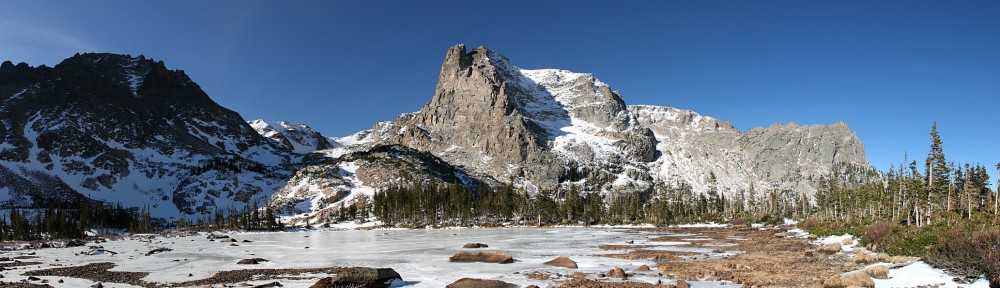
If we’ve navigated correctly, we’ll exit the steep, dense forest onto the bottom of a talus gully, right next to Marigold Lake. We came out a little bit below the lake but found it soon enough. After the dense forest, I was expecting that this pond would have no view. The view of Little Matterhorn from here is quite nice. In my plans, we were to take a nice break here, but unfortunately, there’s no place to sit. So we pressed on.

From Marigold Lake back to the trail, we’d go up a gully gaining about two hundred feet of elevation, then cross a fair amount of talus until we reached the Fern Lake trail about two-thirds of the way from Odessa Lake to the summit of the pass near Lake Helene. Although it’s a rather large talus field, the rocks are small and easy to cross and there are occasional outcroppings of grass.

Did I mention it was breezy? To now, it hadn’t been an issue. Sure, it was windy, the trees swayed quite a bit. On the forest floor, it wasn’t windy enough to disturb ashes. Crossing the talus was another matter. The wind was howling down from Ptarmigan Point unobstructed. I’d guess sustained winds were twenty miles per hour with gusts over forty or fifty. Several times, I was nearly blown over.

On the way, I came across the oddest thing. I found a solar-powered light. The kind with a stake on the end, so you can drive it into your lawn. Who would bring such a thing to the middle of a talus field? And leave it there? I packed it out. How long could it have been out here? The stickers on it were still intact. It came from WalMart.

Back on the trail, we reach the top of the pass, where the trail returns to the trees and out of the wind and it’s all downhill from here. We stopped for a break on a couple of nice, flat rocks in the sun on the lee side of a slope above what as late as August would be a small pond but is now dry ground.

Today’s beer was a repeat: Palisade Peach.

When we got back to Bear Lake, the line for the shuttle was pretty long. After the first bus loaded, it looked like there was more than a busful of people still in line in front of us. Somehow, we managed to get sardined onto the second bus. We didn’t even stop at the Glacier Gorge trailhead on the way down.

Traffic was bad all the way from the Park to my house. We were back to the car pretty much on my expected schedule, but by the time Chad dropped me off at home, it was half an hour later than expected. Traffic sucks.

In Summary

I enjoyed my day. I can finally cross Marigold off the list (or, more accurately, put it on the list). Marigold Lake had a nicer view than I expected, but I don’t think I’ll ever bother to return.

The time exploring the burned area was particularly rewarding. It won’t be like this for very long. The ash and black will soon be gone, and grass and wildflowers will soon be here. And I hope this will be the last fire in the Park for an extended period.

I’m sorry that I led Chad into a situation that he didn’t enjoy.

Round Pond

Round Pond is a small round pond that lies on the saddle between Joe Mills Mountain and Mount Wuh. According to the map, it has neither inlet nor outlet streams. I happened across it when thinking of going to the two small, unnamed ponds 350′ above and about four tenths of a mile southwest of Lake Helene.

Not far away from Round Pond is another small body of water called Marigold Lake. (This should not be confused with Marigold Pond, also in the vicinity, a few yards down the outlet stream of Two Rivers Lake.) After studying the map for a while, it seemed to me that it should be possible to visit both these lakes on the same hike.

The Foster guide has the distance to Round Pond at 2.4 miles. The distance from Round Pond to Marigold Lake looks to be about a kilometer. Assuming I make it to Marigold Lake, I’d return to Bear Lake on Foster’s route which she has at 3.9 miles. So the whole thing is about 6.9 miles and less than 900 vertical feet. Should be relatively easy, yes?

Well, perhaps not. Both lakes are quite small and in the middle of the forest. With unobstructed views of Joe Mills Mountain and Mount Wuh it would be easy to locate Round Pond, but I fully expect the forest to be dense enough to provide no views of either of those mountains. And it may be challenging to get from Round Pond to Marigold Lake by my route, having to traverse some fairly steep terrain between them.

And, who knows? If I get back to Lake Helene early enough, maybe I can get to those two unnamed ponds that caught my eye in the first place.

Saturday, July 20

I arrived at the Park & Ride at about ten minutes after eight. I’ve never seen that parking lot so full. There were only a few spots left, and the line for the shuttle wound back and forth several times. I didn’t make it to the Bear Lake parking lot until a few minutes before nine. No big deal, this hike shouldn’t take too long.

The only snow on the trail was the large drift where the trees thin out on the east side of Flattop. In the winter, when I go to either Helene or Two Rivers Lakes, this is where I always lose the trail. The wind blows all the time here in the winter, quickly erasing hikers’ tracks. But in mid-July it’s just a hundred yards or so of snow and not any sort of navigational impediment. The trail both before and after this snow is filled with the overflow of the rivulets that cross it.

Farther up the trail is another spot that gives me grief in winter. The trail crosses a talus field and in winter I’ve often resorted to going to the bottom of the hill to avoid the traverse. It’s steep enough here to give me pause, and better safe than sorry. Again, in mid-July this is not a problem, but this talus field is where I leave the trail in my quest for Round Pond.

Round Pond lies on the saddle somewhere in the center of this photo.

Immediately after stepping across Mill Creek I’m in fairly dense forest. A few minutes later an elk crashed across my path just a few yards in front of me. This was fortuitous, as it led me to a game trail. It’s not too difficult to cover ground but as I suspected, navigation is a challenge. It’s quite flat and level and no landmarks of any kind are visible. My game trail started to veer to the right when I thought I should be veering to the left, so I abandoned it and started making my own way.

On my cell phone I have a speedometer app that I use in the car. The car’s speedometer is not at all accurate, and in addition to the correct speed, it also displays (among other things) your elevation and direction of travel. It’s not a compass: to get a direction you have to be moving. This app works even when the phone is in airplane mode, so I often use it when I’m off-trail and need to make my way to a particular elevation.

Before long I figured I was in the right place and should be coming across Round Pond any minute now. But it’s really hard to judge, so I started doing a bit of a random walk across this saddle. It had been about an hour since leaving the trail and I hadn’t found it yet. I was just about to give up when I spotted a gap in the trees: there’s my lake. The trees are well back from the water, separated by, essentially, a giant sponge. Walking across it, my boots weren’t getting wet, but each footstep sank a few inches.

Round Pond

There were no rocks or fallen tree trunks to sit on, so I didn’t stay long. Not much to look at, either. Just a few Elephant Head flowers here and there. My options were to try to retrace my route and return the way I came, or to head for Marigold Lake. I knew I might have a hard time finding that lake, but given all my changes in direction to this point, I figured turning back wouldn’t be an easy proposition either. So onward it was.

After leaving Round Pond, the terrain remained flat and level, but the amount of deadfall was much increased. It was like navigating a maze. A short distance later the slope started to fall in front of me. Now the deadfall wasn’t so much a maze as a series of hurdles: almost all the trunks were lying perpendicular to the path of somebody attempting to traverse the slope. Between the steepness of the slope and all the deadfall, my progress had slowed considerably. I had to consider each foot step.

If I could keep my current elevation and contour around the mountain, I’d be a bit above the lake and it would be fairly easy to spot. The slope kept getting steeper and steeper until I was a bit out of my comfort zone. I’m okay traversing this sort of slope in the forest, but I really didn’t want to ascend or descend. And I figured there was a good chance I’d come across some large rock outcropping that would prevent me from traversing.

Sure enough, that’s what happened. I only came across one of these outcroppings, but it was enough. I couldn’t find a way over the top so I had to descend forty or fifty feet. By now I was getting a bit disheartened. This was taking much longer than I had anticipated. I still hadn’t had lunch as I hadn’t found a suitable place: a rock or log to sit on, with some sort of view and a bit of a level area to set my things. And I see I have neglected to mention the rich insect life of the forest covering Joe Mills Mountain.

Just as the steepness of the slope began to diminish, I came across a talus field. It had a number of flat rocks, sitting in the sun, with a view to the north and west. I rested here for about half an hour and had my lunch. It was now about 12:30, an hour and a half since leaving Round Pond. And I guessed that I hadn’t covered a kilometer yet, meaning I was covering less than four tenths of a mile per hour. That’s pretty slow.

Between Round Pond and my lunch spot, I caught only a few glimpses of the surrounding area. Once or twice I had partial views of Fern Lake and Odessa Lake below me, and the Fern Lake Fire scar on the slopes of Tombstone Ridge to the north. Only upon entering this little talus field did I begin to see Gabletop, Little Matterhorn, and Notchtop.

Having had my little picnic lunch, I resumed my traverse. My elevation was still a bit lower than Marigold Lake but there had been no sign of any sort of bench above me where a small lake could reside. But just a few yards after my talus field, I could spot some blue sky between the trees above me. Perhaps I was right below the lake!

I climbed a few yards but was stymied three or four times by dense vegetation. I couldn’t get through so I continued along the slope. After a short distance I could finally get onto the bench above me. But no lake was here. Dang.

To my south stretched an open expanse, mostly talus with some grassy/rocky ramps giving nice views of upper Fern Creek canyon. Heading mostly south, I soon saw the trail to Odessa Lake. It was now time for my final decision of the day. Should I go up the trail towards Lake Helene and back to Bear Lake, or down to the Fern Lake trailhead? It took me so long to get here that I didn’t have time to make my side trip up to those ponds above Helene but I headed back to Bear Lake anyway.

Upper Fern Creek Canyon

I passed the nearest point to Lake Helene at 2:30, stopped to refill my water when I crossed Mill Creek below Two Rivers Lake, and enjoyed the easy downhill slope all the way back to Bear Lake. There was no line for the bus and I was back to the Park & Ride at 4:20. This little excursion took quite a bit longer than I anticipated. The section between Round Pond and my picnic spot on the slopes of Joe Mills Mountain put me a bit outside my comfort zone but on the whole, the day wasn’t particularly strenuous.

Squirrel noshing on a mushroom cap

I can’t particularly recommend a visit to Round Pond, unless you’re looking for a navigational challenge. It would have been nice to visit Marigold Lake, but now that I’ve been in the neighborhood I think I can make it another time easily enough. Looking at aerial photos of the area, my little picnic spot was within 20 or 30 meters of it! If I’d have climbed slightly north from my spot instead of slightly south, I’m certain I’d have found it. So Marigold Lake is on the “to-do” list, but directly from the Odessa Lake trail across the open terrain of talus and grassy ramps.