Back in December I was working in San Francisco. I reached out to a few Golden Gate Lotus Club members in an attempt to get together for dinner or adult beverages. For one reason or another I was never able to visit with anybody. In the course of these emails and phone calls I learned GGLC would be having a track day at Laguna Seca in July.
I started planning almost immediately. The plans changed many times, but the central idea of the trip was lapping at Laguna Seca. In its final form, the trip would include several National Parks, three race tracks, visits to six states, and driving something like 3,500 miles.
Saturday, July 9
It’s here, it’s finally time to hit the road. I will be covering a lot of ground, literally, in the next two weeks. We start off with a big mileage day, and we start by violating Rule #1: No Interstate Highways. I’m on I-70 westbound until some miles after Green River, UT.
If you’re going to drive on the interstate, I-70 west of Denver is as good a place as any to do it. It’s quite scenic, as interstates go, what with the climb to the Eisenhower Tunnel, Vail Pass, and Glenwood Canyon. I left the house at 5:40, so it was still quite cool at high elevations. I wanted to run Glenwood Canyon topless but I waited until Avon to pull over and take the top off. It only took a few minutes for me to turn the heat on full blast. I kept thinking, as I was shivering, that this chill would be a fond memory in the heat I expected later in the trip. I didn’t complain about the cold.
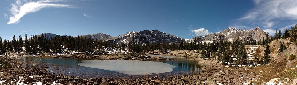
The short canyon between Debeque and Palisade is a preview of what the Colorado River does a few hundred miles down stream. Here the canyon is not deep but it has a bit of the character of the Grand Canyon and what I might see when I cross it again in a couple of weeks near Page, Arizona. This canyon section is only a few miles long and dumps us in Palisade where the almost otherworldly cliffs on the north side of the road contrast with the precise grid of the peach orchards on the south.
I gassed up in Fruita, last gas in Colorado. Most of the exits between the state line and Green River offered no services. At Green River there’s a sign that said “No services on I-70 next 106 miles.” I only had to go a short distance longer before exiting, but even on UT 24 there was nothing until Hanksville where I stopped for lunch. Utah has long stretches of desolation. Between I-70 and Hanksville I saw one small red outcropping of hoodoos, a foreshadowing of things to come.
It was now the heat of the day in the high desert – I put the top back on at my lunch break.
At Hanksville the character of the road changes from high desert to mesa and canyon. The road goes along the Fremont River; the bottom of the canyon is green and the canyon walls vary from nearly white to dun to red. There’s even a layer of green that almost matches the color of the sage brush. This is iconic old-Western landscape, the stuff John Ford movies are made of.

Petroglyphs
When planning the route, I was so focused on Bryce Canyon I didn’t notice that I’d be passing through Capitol Reef National Park and Grand Staircase-Escalante National Monument. There are no entrance stations for these parks, just drive right through. I didn’t even know I was in Grand Staircase-Escalante until I met a ranger who gave me a map after I answered questions about my car.
Capital Reef is red sandstone, carved by water. It supported the Fremont people as much as two thousand years ago. They lived in pit houses (dug into the ground, with thatch roofs) and natural rock shelters. Several petroglyphs can be viewed just a few yards from the road. The park is much bigger north-to-south than east-to-west; the road passes through only a few miles of the park and certainly gives only a brief glimpse of what’s to offer.

Chimney Rock (extreme right)
A few miles after leaving Capital Reef we arrive at the junction with UT 12. Here we turn south and enter Grand Staircase-Escalante National Monument. When I was eating lunch back in Hanksville, I overheard a couple at the next table talking about this road – they didn’t like the drop offs. A bad road for an RV might be a good road for a Lotus. The road starts off quite pleasant, running through a section of the Dixie National Forest, with scenic overlooks every few miles.

Grand Staircase-Escalante
After a while I get to the stretch of road the couple was talking about. The road goes along the spine of a narrow ridge, just a bit wider than the road itself, with steep drops off both sides. I stop here to take the top back off; it has cooled down a bit. We’ve climbed to over 9,000’ above sea level.

Lotus road!
Utah is a bit of a geological marvel. Pretty much the whole place is interesting. I always joke that Wyoming is only interesting around the edges, and that about half of Colorado is interesting. In the last few miles I’ve passed through two National Parks and a National Monument. What isn’t park or monument is Indian Nation or Bureau of Land Management land. Just about all of southern Utah is federal land in one form or another, and it contains many wonderful views.
I get to Bryce Canyon Pines by 5:30, get checked in, assemble the tent, empty the car by 6:00. Then I head into the park to scout it for tomorrow. It’s a short drive from the campground. In the visitor center, I chat with a ranger about which trails he recommends from my list.

Hiking in the hoodoos
He says I have plenty of time to do Queen’s Garden and directs me to Sunset Point (not to be confused with Sunrise Point). I have a couple of hours of sunlight left so I head down the Queen’s Garden trail. It’s a fun little trail. Queen’s Garden, it turns out, has a hoodoo that looks, in silhouette, like a famous statue of Queen Victoria. Near here the trail connects with a trail to the Navajo Loop. This was recommended by the ranger, so rather than return the way I came, I follow the Navajo Loop trail. I could have gone left or right at the junction; my choice to go left turns out to be the correct choice.
It’s 1.4 miles back to Sunset Point. The trail is very narrow in places, squeezing through the hoodoos. Before long I find myself standing at the foot of dozens of switchbacks heading up, up, up. I was back to the top and in the car by 8:15.
There are some high clouds; not sure what sort of sky we’ll have tonight. In any event, I won’t try any astrophotography.
Plan tomorrow is to hike the Fairyland Loop – 8 miles, 2300’ elevation change. That shouldn’t take more than 5 hours, I’m guessing. I’ll need to ask at the visitor center for another short hike now that I’ve already done the one that was suggested.
Back at the tent, it was quite late and I didn’t want to bother with trying to figure out the camp stove in the dark, so my first camp meal will have to wait. I did mix a batch of trail mix for the morning and had a small sample of it as a late snack. The sun doesn’t fully set until after 9:30, and with the waxing crescent moon the Milky Way was not visible. I hit the hay a bit after 10:30. One problem – I neglected to scout the bathroom situation before it got dark. They’re porta-potties, not actual bathrooms. I made a half-hearted search for one in the dark. It wasn’t until morning that I found out the map has the one nearest to me on the wrong side of the road.

The camp site