It’s a hell of a place to lose a cow. — Ebenezer Bryce, 1875
Sunday, July 10
I woke up about 6:15. I’m surprised I managed to sleep that long, being my first time sleeping on the ground in living memory. I had an apple and a protein bar for breakfast and went back to the park to hike.
I’ve been having intermittent problems with the SLR and managed to charge one battery yesterday while writing up my notes. With the freshly charged battery, the camera still refused to work. I played around with the battery pack, swapping positions of the batteries, even tried to use it without the pack. No joy. Eventually, I somehow invoked the proper magic spell for it began working again. It doesn’t exactly fill me with confidence. For much of the day, I supplemented the SLR with the cell phone.
The turnoff for the Fairyland Canyon parking lot is before you get to the entrance station. Amusingly, it is only signed for people exiting the park. So I missed the turn and had to flip a u-turn just before the entrance station.
The parking lot holds about 15 cars. I arrived a bit after 8 and was on the trail by 8:15. The trail descends through a few layers of hoodoos then makes its way around the prominence that is called Boat Mesa.
On the way down, the faces of the hoodoos in front of me are in shadow. It’s common that these hoodoos are like giant fins, long and thin. In places, some of the hoodoos seem to be glowing. In fact, the shaded face of one hoodoo is illuminated by the sunny face of the one next to it, giving it an unusual glow.

Translucent hoodoos
There are quite a few ground squirrels along the rim. I saw one family, a mother and three children, cross the path in front of me. I don’t recall seeing a group like that before. As you descend, the squirrels disappear and are replaced by lizards. One of the birds in these parts is a familiar friend from RMNP – Steller’s Jay. I also saw a small dark blue bird, but she didn’t sit still long enough for me to get a picture.
This is a dry hike. I saw no flowing or standing water. Most of the erosion is due to the freeze/thaw cycle. Water gets in the cracks and when it freezes acts as a wedge. About 200 days a year are both above and below the freezing point. The ground is limestone which is normally white. Here it is tinted different colors by various minerals.
After descending about six hundred feet we get to the bottom of Fairyland Canyon and the base of Boat Mesa. Although water doesn’t normally flow anywhere around here, it clearly does on occasion with enough force to carry a fair amount of material out of the canyon. The ground is like an un-cohesive concrete with too much gravel, seemingly held in place by gravity and friction. Flowing water undercuts it easily.
Dozens of ridges radiate away from the base of Boat Mesa and the trail works its way past a number of them. Here, the trail is visible for a fair distance both ahead and behind. The trail alternates between rising and falling, but looking at the trail from the adjacent ridge, it seems they’ve made it as level as feasible.
I can’t help but notice that, traveling the loop clockwise, I can see more of the trail behind me than I can ahead of me. In that way, it’s like real life: we know our past better than we know our future. It must be interesting taking the trail the opposite way, having a clear view of a significant portion of trail ahead.
I met three couples hiking the opposite direction. The first looked to be in a hurry; we just exchanged greetings. A few minutes later, I chatted briefly with a second couple. They said they’d left the parking lot at about the same time I did. I failed to think to ask which parking lot. The ranger suggested I start at Fairyland Canyon and go clockwise, so I was thinking it was the “normal” way. You can start there and go counter-clockwise. Or, you could start at Sunrise Point and go either clockwise or counterclockwise. You could also take advantage of the shuttle and skip the 2.5 miles of Rim Trail that connects the two parking lots.

Spur pano
I found myself at a point where there’s a spur on the ridge. A line of rocks discourages hikers from following the trail to the point, but clearly it’s often visited. This point gives a beautiful panoramic view of the curving canyon below. I could also see the trail drop steeply below, to what is perhaps the low point of the trail below Sunrise Point. At the bottom there’s a group of signs. Tower Bridge is 200 yards downhill and Sunrise Point is 1.7 miles above.

Tower Bridge (right)
I went down to a spot with a nice view the Tower Bridge and took a short break here. Munched my tail mix and meant to slather on a second coat of SPF. I got distracted by the view and made my way a quarter-mile up the trail before I remembered to apply more sunscreen.
This truly is a fantastic landscape. It’s only human nature to see things in these formations. There’s the Queen, of course. But I saw a Buddha on an altar, a fat chef with a big floppy hat, busts of forgotten ancient Roman senators. There are castles and cathedrals, too, if you care to see them.

China Wall
Near here I ran into four twenty-somethings coming down. “Are you starting or finishing?” they asked. I told them I’d started at Fairyland Canyon. They said that’s where they were headed. They wanted to get an earlier start, but one of them works in the park and had to work late yesterday; “So it goes,” they said. When I started this morning it was sunny and cool with brilliant cloudless blue skies. Now, it was sunny and on the hot side, the sun relentless and sky still cloudless. At least we had a nice breeze to take the edge off. I’m glad I got an early start.

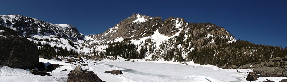
Rim view
On the section of Rim Trail between the two parking lots I ran into the couples from earlier. The first, the ones I didn’t chat with, I asked, “Didn’t we pass each other down below?” “Yeah, we remember you. We’re doing the loop, too.” When I came upon the second couple, they laughed as soon as they saw me. Some time ago they realized neither of us had asked where the other had started. They assumed I’d started where they did; I assumed they’d started where I did. The two couples were still only a few minutes apart – although not together, they managed to keep up almost identical paces.
The Rim Trail isn’t that spectacular, compared to the rest of the hike. This trail gives a few views much like many of the places you can drive to but much of the trail has a view to the west instead. Campgrounds instead of hoodoos.
I arrived back at my starting point at 12:30, having covered 8 miles and 2,309′ gross elevation change in four and a quarter hours. Net elevation change looks to be more like 900′, with a 400′ climb between the two lowest points and the usual ups and downs. I felt like I was taking my time; didn’t feel rushed to have kept that pace. I made it a point to pause often to take a good look around, enjoy the moment.
I stopped here for a rest, snacked on some more trail mix and drank plenty of water. Two liters turned out to be plenty; I’d barely had more than one, which matched the ranger’s prediction. The third couple I met down below came by when I was resting. I said “Hello again” but they didn’t seem to recognize me.
I was back in the car by 1:00. I decided to enter the park, take the road to the very end, then stop at each of the overlooks on the way back. By now, many of the views were beginning to look the same. Inspiration Point stands out, though. It is above perhaps the densest collection of hoodoos in the Park. On the west side of the road is a short stretch of area burned by recent forest fires. Research tells me this fire was in 2009.

Natural Bridge
This survey of all the scenic overlooks took me until about 3pm. About this time I decided that instead of eating my camp food, I’d grab a bite in one of the restaurants. A bit early for dinner, but I’ll have the remainder of the day’s trail mix ration for a late snack.
We had a bit of high cloud cover last night. The moon will set even later tonight, so no Milky Way (unless I decide to set an alarm in the middle of the night) but perhaps things will be marginally better without clouds. As of 5:15, still not a cloud in the sky.
I’m a bit concerned about navigation on tomorrow’s drive. Yesterday, when I wanted to see if I’d missed the junction with UT 12, I had no cell service and thus had no maps. I suspect a similar fate may befall me tomorrow, so I’ve downloaded that section of maps to the phone. We’ll see how off-line navigation works.
Took a shower just before dark, then sat watching the sky change. Listened to Dhafer Youssef while the sun set, Phillip Glass as the stars lit up. Saw a satellite pass over, even saw a shooting star. Hit the sack by 10:40. Campsites on my row faced the highway, maybe forty yards away. You’d be surprised how many motorists hit those rumble strips.
Bryce Canyon National Park is an interesting place, but it’s a bit of a one-trick pony. It’s all about the hoodoos, and although you see a few hoodoos in other places, Bryce has the fantastic concentration of them. That’s all BCNP is about and this concentration is not vast, so the park is pretty compact. From the entrance station to the southernmost overlook, the road is only 17 miles long. The Park isn’t very wide; just some of the plateau above and not far below the hoodoos. I think you could hike every mile of trail here in two or three visits. It’s not a place I would want to visit often, but I’d certainly come back here again. I’d hike Navajo trail again with pleasure. I’d like to spend some time in the other parks in the area, so passing through here again is fairly likely.


