Thursday June 13, 2024
I’ve hiked to Forest Lakes this time of year a couple of times before. I always have the ambition to make it to the upper lake, but there’s a lot of snow and I call it quits at the lower lake. This time, I told myself, I’d make it to the upper lake.
I got to the parking lot at 8:10. Less than a dozen cars were there, and one of them was headed out, his morning run done. I chatted briefly with a couple of backpackers that I passed just before we got to the Wilderness boundary. They were headed to Rogers Pass Lake and Hart Lake. “Maybe even the Divide” he said. I didn’t tell them they’d be unlikely to find anywhere without snow within a mile of any lake. I didn’t want to spoil their adventure.
The first challenge of the day was the bridge over Arapaho Creek. I’ve only been here a handful of times, but the water was much higher than I’d ever seen it. Water was flowing over six or eight feet of trail on each side of the bridge. It’s not quite ankle-deep, but the rocks are slippery and maybe not securely placed. The middle of the bridge is drenched, so you know you’ll get a quick, cold shower. I started to wonder how much higher the water might be after five hours of warm sunshine.
Not long after crossing the bridge, we get to the snow. It’s piled up in widely spaced drifts. Soon the drifts aren’t widely spaced and there is much less bare ground. The drifts are mushy around the edges but firm on top and I don’t need to use the microspikes.
I lost the trail pretty quickly, more or less as I expected. I saw an occasional old bootprint but nothing like any sign of foot traffic. I’m left to my own devices.
I eventually came to a half-broken bridge over a stream. I crossed it but immediately had second thoughts. I thought that by crossing the stream, I’d be heading to Arapaho Lakes, and I didn’t want to go that way. So after a short while, I recrossed the stream and climbed alongside it, expecting it to take me to the lower lake.
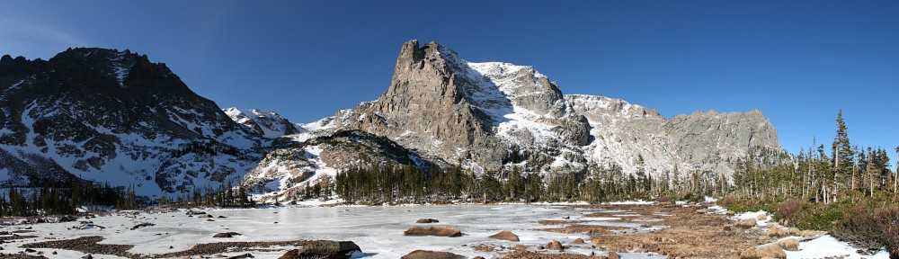
I made it to a lake, alright, but it wasn’t the lower lake. The lower lake has a mountain view and some large sun-lit rocks that make a nice place to picnic. This lake has no view to speak of and no picnic rocks. I was at the larger of the two unnamed ponds a quarter mile or so east of lower Forest Lake.
I can see why it’s unnamed. It is an unremarkable snow-fed forest lake. I stayed for about an hour. I did manage to find a picnic spot. It was quite pleasant. The weather was fine, sunny, calm. I enjoyed the route-finding, even with the navigational error. I was able to walk mostly on firm snow. I had my micro-spikes with me but didn’t use them. Traction wasn’t a problem, and I did a pretty good job of avoiding post-holing.


I was operating under the assumption that I’d get to the lower lake. Once there, I was sure I could find the tracks of all the folks who come up here. Being in the wrong place, I turn to Plan B: retrace my footsteps. Above the Arapaho Creek bridge, I hiked mostly on snow. Mostly. So it should be pretty easy, right?
Around the pond, I crossed a couple of wide marshes. Both times, scanning the far side of the marsh, I couldn’t see any of my tracks. I took what looked to be the most obvious route and got it right both times.
The sun was doing a job on my footprints, and in the shade, it wasn’t much easier. But I was able to follow my tracks for a good while. It was a more challenging task than I thought it would be. Coming across the occasional deer and elk tracks added some misdirection. Aside from crossing the stream on a different snow bridge, I was able to retrace my route with very little variation. It was a fun exercise. (It did not matter whether I could retrace my steps or not. All I needed to do to get back to the bridge was to follow the water.)
Since the couple I met just outside the boundary, I didn’t see another hiker all day until I made it back to the Arapaho Creek bridge where I passed a guy who was on his way up. Usually, I have to hike a lot farther to get that much solitude.
The pond has no name, but that won’t stop me from calling it Little Serendipity Pond. Not that the pond is little, because it’s not. It’s the level of serendipity that is little. I was happy to visit a lake I hadn’t been to before. I don’t know that I’ll ever go back, but it was an easy hike, it provides solitude, and there are far worse places to spend a pleasant day.


