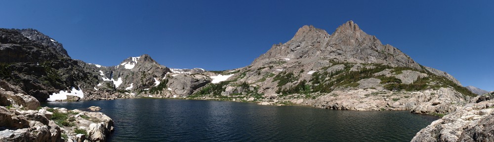
Square Top Mountain

To oversimplify the geography, Guanella Pass connects I-70 to US 285, between Georgetown to the north and Grant to the south. The road is paved the entire way, but isn’t maintained in the winter. The summit of the pass lies at 11,669′ above sea level. There are two parking lots at the summit, one that serves the Bierstadt Mountain trail and the other that takes hikers to Square Top Lakes and Square Top Mountain.

Until the last couple of years, parking was allowed beside the road if the parking lots were full. There is quite a bit of traffic over the pass, particularly during the autumn, when folks are out looking at the aspen. Not everyone who parks at these lots is there for an extended time, but if you want to be sure to get a parking spot, I recommend an early start.

Saturday, October 3

Guanella Pass Road passes three reservoirs after leaving Georgetown. By the time I put the third one, Lower Cabin Creek Reservoir, in my rearview mirror, I was second in a line of five cars. A few minutes before seven, all five of us entered the parking lot at the summit. I don’t think the fifth car in the line got a parking space.

The skies were clear to the east and clear to the west, but a band of clouds a few miles wide stretched over Mount Blue Sky. The winds are always strange along the Divide, which is just a couple of miles west of here. Winds at different altitudes often go in widely different directions. Those clouds could very well sit right there all day, or get pulled to shreds in the next hour or two.

The trail starts off going down a bit; it doesn’t regain the starting elevation until a mile in, or about two-thirds of the way to the lower Square Top Lake. I made it about this far before the sun topped Mount Bierstadt. I would have liked some sunshine to help me warm up a bit, but it didn’t take too long before I was in the shade of the clouds, which didn’t seem to move or dissipate.

It’s a bit less than two miles from the trailhead to the first trail junction. A right turn leads to the upper lake; turn left to summit Square Top or to follow the South Park Trail, which goes to the Shelf Lake Trailhead, where I was a few weeks ago. This trail must not get much traffic, as it’s fairly faint at both ends. I made it here in a bit over an hour, so I was making pretty good time: about two miles per hour.

From here to the summit is a mile and a third, climbing fifteen hundred feet. That’s more than 1,100′ per mile. I’m sure that’s not unusual for summit hikes, but it’s well out of the ordinary for trails to lakes.

About halfway from the South Park Trail to the summit, at roughly 13,000′, my pace flagged considerably. This isn’t a 14er, but it’s not far short. From here to the summit, I had to play a little mind game with myself. I admit I take a bit of pride in being able to maintain a pace where I don’t have to take breaks. I’m often slow, but tenacious. Today, here in the thin air, I told myself not to stop until I’ve taken a hundred steps. The mind game is that I don’t start counting right away, and I don’t quit as soon as I get to a hundred. After about half a dozen of these hundreds, I got to the top.

In this case, the top isn’t the summit. The top of Square Top varies between a hundred and two hundred feet wide and nearly half a mile long. When you arrive at the top of the climb, you’re still fifty feet short of the summit. This morning, there’s a bit of snow on the ground, in the hollows and between rocks. It’s only a few inches deep, but it’s almost all crust and supports my weight. If there’s a trail along here, it’s under the snow. But it’s obvious where to go, so there I went.

I had a lunch with me, including a beer. I’m not sure if this was optimistic or pessimistic planning. Optimistic because I thought I’d be able to enjoy a picnic up here, or pessimistic, thinking it would take me a lot longer to get here. It was a quarter to ten, so a bit early for lunch. And the wind was not fun. I reckon it was a steady thirty miles an hour, with occasional gusts that threatened to knock me over. I didn’t dally at the summit: I took my photos and headed back down.

On my way back the half mile from the summit to where the trail descends, I encountered two hikers. We exchanged few words, and those by yelling over the wind. I was regretting that I had neither gloves nor a warm hat and wished I had another layer. One of the other hikers was wearing shorts. Yeesh.

Once I got off the summit, I started warming up. Before I returned to the South Park Trail junction, I found a spot out of the wind and had a snack and a rest. I could have made a left turn at the next junction and gone to the upper lake for my picnic, but I decided just to head back to the car.

It took me five hours for the round trip. I generally don’t hike down any faster than I hike up, but this time, even with my snack break, the return trip was half an hour quicker. I didn’t have to “hundred” myself on the way down, that’s for sure.

I had my picnic in the car. I made sure to sit in the passenger seat, so people wouldn’t think I was about to leave. There was quite a bit of pedestrian traffic through the parking lot, and quite a few cars searching for an open parking spot, but only a few came free in the twenty minutes it took me to eat.

I expected this hike to take me longer. It’s not very far, about three and a half miles each way, but that last thousand feet of elevation gain is fairly strenuous. I enjoyed it despite the wind, but it was a reminder of why I prefer lakes to summits. The view is impressive, in that you can see mountains a hundred miles away. From here, Mount Shavano is prominent, wearing a fresh coat of snow, even though it’s 75 miles away. Pikes Peak is 55 miles distant. But from up here, everything is far away. The nearest summit is a mile away. Lakes below me that are 7 or 8 acres seem like puddles.

Yeah, I’m not a big fan of summits, but standing on this mountain, I looked at Grays and Torreys just four miles distant and told myself they should be my next summits. What makes me think I’d enjoy climbing two 14ers in one day? I guess there’s one way to find out.

LUG 2026 – Day 6

Tuesday, September 29

Chad and I shared a hotel room for LUG. Chad’s not a morning guy. My plan for the drive home was to stop at Hanging Lake for a quick hike. Hanging Lake requires a timed-entry permit, and before I left home, I bought one for 2 pm. Which meant I had to be on the road by 7. And the hotel room is in my name, so an early departure for me means Chad has to get in gear much earlier than he’d like. He seemed barely conscious when we walked out the door twenty minutes before sunrise.

By now, I’d had my share of plain bagels, and I let Chad know that I’d be stopping for food within a couple of hours. I wouldn’t be in his rearview mirror all day.

The rain made my lack of shades a moot point at the track yesterday, but I wasn’t looking forward to driving into the morning sunshine without my sunglasses. I need not have worried. It was overcast most of the time I was driving, except for about half an hour of bright sunshine near Vernal.

On the drive from home to Salt Lake City, I was shocked to see two reservoirs completely empty. Today, I passed by Strawberry Reservoir and Starvation Reservoir in Utah, and Kenney Reservoir in Colorado, all at or near full capacity. I wonder if this is because these reservoirs aren’t part of the system controlled by Denver Water. Due to the extreme drought, Denver Water has reduced flows in the Fraser River and its tributaries to keep enough water going through the Moffat Tunnel. The reduced flow of the Fraser River could very well have severe environmental impacts, because with less water, the river could freeze solid.

I stopped for fuel in Rifle, just before getting onto I-70. At the next pump, a guy got out of his pickup truck, looked at my car, looked at me, and said, “Ah, to be young and rich!” I replied, “Sorry, neither!”

I made it to the Hanging Lake parking lot a bit early. I thought I had the permit in my phone’s wallet, but it wasn’t there. I had a screenshot of it somewhere, but the ranger found my name on his list before I could find the photo. This might be the best time of the year to visit Hanging Lake. When I made the reservation, there were still quite a few permits left, and, judging by the number of spaces available in the parking lot, my Tuesday afternoon time slot wasn’t close to selling out. Bonus points for it still being good aspen viewing season.

I pulled into a parking spot next to a couple in an SUV. He was trying to get a photo of a blue jay while I was changing my shoes. (My driving shoes aren’t at all suitable for hiking.) Usually, I’m the one who wants to engage with strangers. He was drawn to the car, of course. He greeted me and asked if I tracked the car. No doubt he knew the answer before he asked it. They were visiting from Switzerland. He used to have a Radical that he drove often at Spa and at other Belgian, German, and Dutch race tracks. What are the chances that, in two days, I’d meet two people who often did track days at Spa? I met him again at the lake. He’s a trail runner. He ran it in half the time it took me.

It’s only a mile and a half from the parking lot to the lake, with about a third of that on the bike path along the Colorado River. Where the trail leaves the bike path, there are half a dozen informative signs telling the history and geology of Hanging Lake. With the highway right here, it’s noisy, but the sound of the river softens the traffic noise.

From here to the lake, the trail is fairly steep, climbing a thousand feet in a mile. After half a mile, the traffic noise is gone. The trail is very well maintained and features six bridges over Dead Horse Creek, the lake’s outlet stream. Strangely, there’s water flowing at the base of the trail and below the highest three bridges, but no water under the lower three.

I am often prone to exaggeration. I try to avoid it, or admit it when I do it. I don’t think I’m exaggerating when I say that one out of three paces on the trail is on a stone stair. The trail climbs the floor of a narrow, steep-walled canyon. For much of the hike, there are no views, except for the nearly vertical canyon walls. The lake attracts folks who don’t normally hike, and there are many benches along the way for people to rest. The final climb to the lake is up a stone stairway narrow enough to require a railing.

Just before the lake comes into view, there’s a trail junction. To the left, up the trail a short distance, is Spouting Rock Waterfall. I’d like to return here in late May or early June. Today, the flow of water is only a small fraction of what it must be in late spring. It must be spectacular when the stream is running at full flow.

Hanging Lake is small. I’ve been to dozens of bodies of water of this size that are unnamed, unworthy of notice. The surface area is only a quarter of an acre, or the same size as the lot my house sits on. Size is overrated. This place is outstanding. It is key to the ecosystem of this canyon. Birds live in the canyon walls around the lake. The water is so clear, you can see the fish.

On the hike in, at a platform near the top of the final staircase, there’s a view of the canyon. You can see how close the Grizzly Creek Fire came in 2020. This lush little lake and the wonderful spouting rock above it saved this place from the inferno. It’s a special place.

I’ve said before that I don’t have a Top Ten list of lakes, but if I did, Hanging Lake would be on it. I can’t believe I’ve lived in Colorado for more than half a century and have never been here before.

I will definitely make a point of coming back in late spring. I also think I’d like to come here in winter. The ranger told me the trail can be quite treacherous in winter, getting packed into ice by people’s footsteps. I’m willing to give it a shot with microspikes and trekking poles. The only part that seems sketchy to me is the final climb, but there’s a handrail there, so it seems doable to me.

When I got back to the bike trail along the river, there was a small herd of bighorn sheep ewes. I don’t often see bighorn sheep on my hikes. When I do, it’s always ewes, never rams. And I’ve never been this close to them before.

I was back to the car by 3:30, so just under two hours for the pleasant little diversion to Hanging Lake.

I needed a comfort break by the time I reached Georgetown. I stopped at the visitor center, where I spotted a Lamborghini. The driver was standing outside the car, talking on his phone. When I took a couple of photos, he interrupted his conversation to say to me, “Don’t post the pictures.”

I felt he was being a bit of a jerk. Two things came to my mind right away. First, unseriously, why don’t you want a photo posted? Did you steal it? Second, and really, if you don’t want people taking pictures of your car, don’t take it out of your garage. You’re out in public, and everybody carries a camera. People take pictures of my car all the time, and mine is not so exotic (or expensive) as a Lamborghini. Only a small number of people ask before they take a photo. There’s no need to ask; by now it’s pretty much expected.

A moment later, he was done talking on the phone. I showed him pictures of the three wild cars I saw at the track yesterday. He asked if the Aston Martin was my car. I pointed to my car and said, “No, that’s mine.”

My initial thought that he was being a jerk was unwarranted. It turns out that this Lamborghini isn’t yet available in the US. This car had Michigan manufacturer plates. I often see “test mules” in these parts: camouflaged cars full of test equipment. This one was not at all camouflaged, and there didn’t appear to be any equipment on board. I did a quick web search and found a bunch of photos of this car (or one just like it) in the Denver area, so it’s no secret that it exists. So, yeah, I’m posting a photo of it. I never said I wouldn’t, and I don’t think showing it to my seven subscribers will cause any problems.

I do find it hilarious that a guy driving a car that screams to the world, “Look at me!” wants to keep its existence here a secret. My car is not inconspicuous, but this thing demands your attention. In the words of Elmer Fudd, “Shhh! Be qwiet!”

Thus ends my trip to LUG. I experienced despair and elation; I drove my car in the wet on the track, and I topped the week off with a short hike to a lake long on beauty. Sure, if I hadn’t had car problems, I’d have had a better time, but things could have been much worse.

The next LOG (Lotus Owners Gathering) will be in Dayton, Ohio. I think I might consider thinking about going.

A Different Shelf Lake

I’ve often joked that it’s hard to name lakes. On the East Inlet Trail in Rocky Mountain National Park, you can visit five lakes: Lone Pine Lake, Lake Verna, Spirit Lake, Fourth Lake, and Fifth Lake. It was too hard to name those last two, so they punted. But it’s more than that. Although this is the only Lake Verna in the US, there are 31 Spirit Lakes, a dozen Lone Pine Lakes, a slew of Fourth Lakes, eleven Fifth Lakes (and a Lake Fifth).

In Rocky Mountain National Park alone, there’s a Lake Irene and an Irene Lake. There’s also a Solitude Lake and a Lake Solitude. I’ve hiked to Crater Lake in Indian Peaks Wilderness and Crater Lakes in James Peak Wilderness. Don’t get me started on Bear Lake: there are seven in Colorado and nearly two hundred nationwide.

As to Shelf Lake, there are two in Colorado and eleven total. I’ve been to the Shelf Lake in Rocky Mountain National Park a couple of times. The Shelf Lake that’s the destination for my next hike is in Clear Creek County, on a shelf 900 feet below the summit of Decatur Mountain.

Saturday, September 11

The trailhead is on Upper Geneva Road, off the north side of Guanella Pass. It’s about three and a half miles up a dirt road. The road starts off pretty good, but steadily gets rougher. It doesn’t require 4-wheel-drive, but ground clearance is a must. The parking lot holds a bit more than a dozen vehicles, and there’s room for another dozen in an adjacent overflow area. I arrived at 8:45 and got one of the last spots.

The hike is only three and a half miles, but with the trailhead at 10,000′ and the lake at 12,000′, the air is a bit thin the whole time, and about a third of it is above treeline.

About a mile into the hike is the first steep climb, and this is rewarded with a clear view of the valley below. Along the trail, there is the occasional aspen grove. Today, most of them are still green, or just getting a tinge of yellow. There was only one grove that was fully gold.

The trail leaves the forest and crosses the main stream, revealing the high, broad valley between Decatur and Square Top. Much like the other high valleys in the vicinity, this one is a sea of willow. The trail cuts a few long, narrow paths through the willow, at times nearly head-high. In these sections, the trail is not much more than shoulder-wide, and you hear oncoming hikers before you see them.

After the willow, the trail reaches the base of the shelf that contains the lake for the final steep lift to the lake.

The hike to Shelf Lake isn’t a “conga line” hike, but the only destination for people who parked at the trailhead is this lake, so counting the cars at the trailhead should give you a good idea of how many people you’ll encounter. I stayed at the lake for about an hour, and there were never fewer than half a dozen people there. Just about everybody I came across had either a dog or a fishing pole, and many had both.

Unfortunately, I managed to forget to bring the Insta360, so no timelapse video for this one. So it goes.

It’s a pleasant hike, not too strenuous, not too long. The weather was nice, and it was an enjoyable way to spend the day. I probably won’t return to Shelf Lake, given my compulsion to always hike to lakes I haven’t visited before, but I hope to return to the vicinity again and get a more distant view of it.

During my map study in preparation for this hike, it seemed to me that I might consider hiking over the pass between Square Top and Argentine Peak to reach Murray Reservoir and Silver Dollar Lake. It’s at 13,000′, but that’s only 3,000′ higher than the trailhead. In the final climb to Shelf Lake, I paused several times to look at this ridge. The lower, shallower part of the climb is mostly a matter of navigating the willow. The upper, steeper part is grassy ramps. It looks pretty straightforward. Obviously, it requires two cars, so I can’t do it solo.

An alternative would be to start from the parking lot at the summit of the Guanella Pass. A trail from there goes to the summit of Square Top and crosses the crest of this ridge. This point-to-point hike would be a bit less than seven miles, with about 2,000′ of elevation gain.

Timber Lake

Monday, August 31

For this week’s hike, I managed to overcome my compulsion to visit a lake I’ve never been to before and returned to Timber Lake.

Timber Lake, with a surface area of about seven acres, sits in the morning’s shadow of Mt. Ida at a little over 11,000′ elevation. I was last here back in 2015. I gave a pretty good description of the trail then, so won’t repeat it.

The trail is your basic forest trail. Signs along the trail say the lake is 4.4 miles from the trailhead, but Caltopo maps reckons it at 5 miles. There aren’t any outstanding views on the way to the lake. My wife would probably describe it as “just another trail to just another lake.”

There is one outstanding feature of this trail, though. That’s the landslide area. The landslide happened during the 2013 floods. Locals will recall that just about every road into the mountains between I-70 and the Wyoming border was washed out. At the same time, there was a massive landslide on Twin Sisters.

When I hiked here in 2015, the landslide area was closed off – signs and orange tape directing hikers to detour above the slide. Now, there’s just a warning sign on each side of the slide area. The detour is still obvious on the west side of the slide, but I didn’t spot it on the east side. Judging from the state of the trail (not grown over at all, and with fresh boot prints), I’d guess very few people take the detour. The warning signs urge caution whether you cross the slide area or detour above it.

The slide area isn’t as big as I thought it was when I was here before. I counted 135 paces between the two signs, and only about two-thirds of that distance is the slide itself. The slide on Twin Sisters is an order of magnitude larger.

Erosion isn’t a topic I discuss very often with other folks. I suspect most people think of it as how rivers and streams wear away mountains. That’s true to a point, but it takes the normal flow of water (and wind) a very long time to effect change. That sort of erosion is ubiquitous, inexorable, and slow. Floods, like those in this area in 2013, or those like the failure of the Lawn Lake dam, or the slide in Chaos Canyon that turned the water of Lake Haiyaha turquoise, make the big changes. A flood can move a 50-ton boulder downstream a mile, or shift a mountainside. It is these catastrophic events that change the landscape.

My brother-in-law gave me a little emergency kit ages ago. I’ve carried it with me on day hikes and backpacking trips ever since. I’ve never used it until today. It fits in an Altoids tin. One might ask how much you can get in such a small package. My question is how Greg managed to fit everything into the tin. (It includes bandages, antibiotic ointment, matches, a razor blade, a compass, a length of cord, one of those Mylar thermal blankets, and a bunch more.)

I met a couple of hikers at the landslide area. One had slipped and bloodied a finger. He asked if I had a Band-Aid. As a matter of fact, I do! I dug to the bottom of my pack, retrieved the Altoids tin, and opened it. Naturally, the Band-Aids were at the bottom, so I had to take everything out to get to them. And, naturally, I was unable to repack the tin. It was like the tin was Dr. Who’s TARDIS – bigger inside than outside – until I tried to refill it. Evidently, Greg found the only way to pack this real-life 3-D Tetris game.

It took me a bit less than three hours to reach the lake. The weather was cool – I wore my jacket nearly all day – and the forecast was for rain starting mid-afternoon. In the end, it never did rain, and it warmed up enough in the afternoon for me to finally pack my jacket.

The two hikers I met in the landslide never did make it to the lake. I met another pair of hikers before I reached the lake. They asked if I’d seen any moose. They said they encountered a cow and calf on their hike in. I had seen the tracks, but not the animals that made them. I saw no big game all day.

One other hiker did arrive at the lake while I was there, and the only other hikers I ran into were on their way to check out the landslide area. I didn’t realize it was well enough known to be an attraction on its own.

A few yards Southwest of Timber Lake are two unnamed ponds, which I’m calling North Timber Pond and South Timber Pond. They’re scenic in their own right, and if you’ve made the effort to visit Timber Lake, they’re worth the extra few minutes. I suspect they don’t see very many visitors, as I didn’t spot any social trails leading to them.

On the hike out, I made a stop at one of the campsites on the trail. There are four. From closest to the trailhead to closest to the lake, they are Timber Creek, Jackstraw, Rockslide, and Snowbird. I checked out Rockslide. It’s a very nice camp. It’s only about a ten-minute hike to the lake, and ten or twelve minutes the other way there’s a privy (close to Jackstraw campsite). If I were ever to want to camp in the area, I’d stay here.

Timber Lake is worth a visit. It’s not a difficult hike, it affords some solitude, and the landslide area may be of interest.

LocationTime
Trailhead8:54 am
Timber Creek campsite10:36 am
Jackstraw campsite11:15 am
Rockslide campsite11:30 am
Snowbird campsite11:35 am
Timber Lake11:41 am

Blue Lake-ish

Often, when I mention to people that I’ve visited more than 150 named lakes in Colorado, I’ll get asked which is my favorite. It’s both an easy and a difficult question. I don’t have a “Top Ten” list. Today I could give you a list of ten fantastic lakes to visit, but if you ask me tomorrow, you’ll probably get a slightly different list, depending on my mood.

That said, there’s one place that I keep returning to: Glacier Gorge. It’s the valley that runs north/south immediately west of Longs Peak, anchored by Mills Lake at its northern end. Within Glacier Gorge, there are eight named lakes: Mills, Jewel, Black, Blue, Green, Frozen, Shelf, and Solitude. I’ve been to all of them multiple times. I could probably name a few lakes that are more dramatic or scenic or awesome than any of these eight.

But the southern end of Glacier Gorge keeps drawing me back for more visits. Black Lake is the launching pad. Climb the trail for four hundred feet beside the inlet stream on the east shore of the lake to be surrounded by greatness. Storm Peak, Longs Peak, Pagoda Mountain, Chiefs Head Peak, Spearhead, McHenrys Peak, Arrowhead, and Thatchtop rise around you, chiseled near-vertical slabs of granite.

It is not the most visited place in the Park, but Mills Lake and Black Lake are relatively easy to get to, so they see a lot of traffic. Taking the Fire Trail shortcut, Black Lake is four miles from the trailhead. The Fire Trail isn’t on maps distributed by the Park, and both ends of it are obscured so as to limit traffic, but it does get a fair amount of use by experienced and knowledgeable hikers.

I haven’t visited Glacier Gorge yet this year, so it was time for a trip.

The trailhead is on Bear Lake Road, so a timed entry pass is required. They go up for sale at 7:00 pm the night before. They release more than a hundred passes each day. And, no matter how early I arrive, I park at the Park-N-Ride and take the shuttle bus to the trailhead.

August 18, 2026

I decided to go back to Blue Lake. Having been there before, I didn’t bother taking a map with me. I know where it is, and although there’s no trail (that I know of), it’s not a difficult navigational problem. (He said with confidence!)

I put boots on the trail a couple of minutes after eight and arrived at Black Lake a few minutes after ten. The climb up the inlet, although fairly steep, doesn’t take long. It flattens out as you get to the top, and I got off the trail pretty quickly. Up here, it’s islands of granite slabs separated by seas of willow and krummholz. Regular readers know my dislike of willow and krummholz.

It’s just a matter of finding a route that maximizes travel over granite and avoiding the willow. This is often easier said than done. Forty minutes after leaving Black Lake, I found myself standing over a small pond that’s not on the map. I reckoned that Blue Lake was that way a short distance and surveyed my surroundings for an easy route.

Then I decided I’d just stop here and enjoy my surroundings. It’s easy to get caught up in goals: my goal was Blue Lake. But I’ve been there before. I’d never been to this little puddle; it has fundamentally the same view as Blue Lake, and the chances that anybody else will come here today are close to zero. Why not have my picnic here? So I did.

It turns out I was just 650′ more or less due west of Blue Lake. This little puddle is snow-fed and has no inlet or outlet. The water today was about a foot and a half below the high-water mark. I found some fairly fresh elk tracks, but didn’t spot any big game.

From here, if one had a decent pair of binoculars or a camera with a telephoto lens, it’s possible to spot hikers on Longs Peak making their way up the Trough, or hardcore climbers working up one of the sheer faces of Spearhead. Lacking any serious optical aids, I shot a couple of photos of these areas on the phone using maximum magnification, but no humans appear in these photos.

I sat there for about an hour watching the world go by. The weather to the north looked to be turning nasty – rain showers were moving over the Mummy range. Even at 11,000′, my view to the west is blocked by the high peaks, and you don’t get much advance notice of storms rolling in. I figured chances were good I’d get rained on soon, so I packed up and headed down. In the end, the weather remained nice. I returned to the trailhead by a quarter to three.

Just another beautiful day in the Park.

Stone Lake and Upper Lake

In north-central Indian Peaks Wilderness, in a high mountain valley bounded by Hiamovi Mountain, Cooper Peak, and the improbably named Ooh La La!, lie two lakes: Stone Lake and Upper Lake. I’m mildly amused by the name of the latter. My brain glitches a bit; it wants to add a word. Upper what lake? I’ve recently been to Upper Storm Lake, and I’ve visited Upper Crater Lake. Upper Storm Lake is above Storm Lake, and Upper Crater Lake is above two other Crater Lakes. Shouldn’t this one follow the pattern and be “Upper Stone Lake”?

I put this hike on my “possibles” list some time ago, but waffled back and forth between thinking it was a day hike and a backpacking trip. It’s only about 6.2 miles to Upper Lake, and I often make longer day hikes. But this one had me doubting myself. Typically, my destination lake is the high point of the hike. For this one, the trail passes over a saddle from one drainage to another. The trail climbs to 11,200′, then descends 700′ before a gentle climb to the lakes. By the time the hiker reaches the high point of the hike on the way back to the trailhead, this works out to nearly 4,000′ of total elevation gain in about 8 miles. So it’s a steep one.

Friday, August 7

The Watanga Lake trailhead (I’ve also seen it listed as the Roaring Fork trailhead) is at Arapaho Bay in Lake Granby. It’s about ten miles from US 34, and nine miles of that is dirt road. But the road is very well maintained, has no ruts, and isn’t a washboard road. I’ve driven the Lotus on it a couple of times before. The parking lot has room for maybe two dozen vehicles. On this August weekday morning, there were only four cars there when I arrived at 7:30 am.

Within a few minutes of hitting the trail, we are on the first steep section of the hike, climbing five hundred feet in a bit more than a third of a mile. In contrast, the next thousand feet of elevation gain takes nearly two miles, to the junction with the Roaring Fork trail. (I may be using the incorrect names; I’m assuming we’re on the Watanga Lake trail until that junction. And note that there seem to be many trails called the “Roaring Fork Trail”.) To this point, the trail was alongside Arapaho Creek.

At the trail junction, we make a right turn. After a few minutes, we reach the second steep lift of the hike, gaining another five hundred feet in four-tenths of a mile. The map shows a stream not far from the trail and crossing it at least once. This summer has been quite dry. From the junction until nearly as far as Stone Lake, there isn’t any water. I had plenty of water to get me to the lakes, but I always like to keep track of my water sources.

At the top of the climb, still more than a mile and a half from Stone Lake, the trail passes through a large meadow with expansive views to the south and east, and the dramatic peaks in the heart of Indian Peaks Wilderness are on glorious display. Well, that was mostly true today. The sky was cloudless, but not the deep blue I’m accustomed to when hiking above 11,000′. Today, everything is hazy due to distant wildfires.

After taking in the views from the meadow, the trail descends into Hell Canyon. Here, we come to the third steep section. On the way to Stone Lake, we’re going down this steep bit. We’ll have to go back up it on the return to the trailhead. The footing here is sometimes less than ideal. Trek poles definitely help. Again, we see a five hundred foot elevation change in about four-tenths of a mile.

From the trailhead to the meadow at the top of the hike, the trail moves through moderately dense forest. In Hell Canyon, the forest thins out considerably. In late morning, the sun felt pretty good, but on the return trip, in the heat of early afternoon, the sun was oppressive. I didn’t see any clouds until nearly 3 pm.

There isn’t much traffic on this trail. I met an older couple at the trail junction, and a group of eight backpackers passed me in the meadow. I met two more backpackers about a mile short of Stone Lake. I didn’t see anybody else until I returned to the trailhead. Because there’s not much traffic, the trail becomes less obvious. It’s never difficult to follow, but in the places where it goes through grassy fields, I imagine it would only take a few weeks without hikers for the trail to disappear.

Both Stone Lake and Upper Lake are gorgeous. They are not situated above treeline in a stark cirque, nor in forest with trees lining the shore. There is forest, but it’s sparse and set back from the grassy shore. Hiamovi Tower stands majestically above Upper Lake. There are many small ponds scattered about.

The trail from Stone Lake to Upper Lake isn’t obvious, but that doesn’t matter. I followed the wrong trail and ended up at a campsite. I just headed cross-country toward Upper Lake and was there in a few minutes. The campsite I stumbled upon was the only one I saw, but no doubt there are a few others that are just as nice.

I’ll come back here for a backpacking trip someday. There are two named lakes a short distance down Stone Lake’s outlet. These shouldn’t be too difficult to reach. I’d also like to head north from Upper Lake (toward the saddle just above the beer can in my “Today’s beer” photo) to visit an unnamed lake in the extreme southern part of Rocky Mountain National Park. I’d guess that lake gets very few visitors.

SegmentDistanceElev ChangeTimeSpeed
Trailhead to Watanga Jct2.5 mi608’/mi1:411.5 mph
Watanga Jct to Stone Lake3.2 mi254’/mi12:391.2 mph
Stone Lake to Upper Lake0.4 mi245’/mi0:201.2 mph
Trailhead to Upper Lake6.1 mi399’/mi14:401.3 mph
  1. Net elevation change, not gross ↩︎

Pawnee Lake

Pawnee Lake sits a stone’s throw west of the Continental Divide, in the heart of Indian Peaks Wilderness, surrounded by Blackfoot, Paiute Peak, Mount Toll, Pawnee Peak, and Shoshoni Peak. It can be reached from trailheads at Brainard Lake, east of the Divide. Taking that seven-mile route involves a 2000′ climb to Pawnee Pass, followed by a sketchy 1700′ descent to the lake, making for a total of 3700′ of climbing for the round trip.

Not being a big fan of sketchy steep descents and going uphill both ways to school, I chose to get there from the Monarch Lake trailhead. It’s eight miles and climbs about 2500′. The only negative to this option for me is the extra hour’s drive each way.

Friday, July 17

The hike to Pawnee Lake shares much of the route to Crater Lake. Instead of hiking the last mile to Crater Lake, make a left turn on the Pawnee Pass trail and hike about 1.7 miles to Pawnee Lake. On my trip to Crater Lake, I wasn’t sure about my park pass. I later learned that if you have an annual pass or lifetime pass, just leave it visible on the dash of your car.

The trail to Crater Lake gets a fair amount of traffic. Crater Lake is gorgeous, and there are a few nice falls and cascades along the trail. If the hike to Crater Lake was shorter, I think there’d be many more visitors. I encountered quite a few backpackers hiking out from a night or two at Crater Lake, but I didn’t meet anybody who had been to Pawnee Lake.

Shortly after passing the Buchanan Pass trail, I met a couple of moose. Some hikers I’d passed a few minutes before warned me they were up ahead. Still, I came up on them abruptly. As I came around a corner, one was on the trail about fifteen feet in front of me. I was expecting to see him, but he wasn’t expecting to see me. He took a couple of steps toward me before he left the trail. I took a few more steps before I saw the second guy. He, too, was startled, and his first steps were in my direction. Moose have a reputation for being unpredictable, but in my dozens of encounters with them, this is the first time I thought I might have to put a tree between us.

After hiking 6.3 miles of trail that’s shared with Crater Lake, there’s a final trail junction. Go to the left and hike a further 1.7 miles to Pawnee Lake, climbing about 800′. The trail affords some nice views of steep and jagged terrain of Cherokee, Lone Eagle Peak, and Mount George.

Not long after diverging from the Crater Lake trail, I met two women backpacking out. They had come over the Divide from Long Lake. I asked them about the descent from Pawnee Pass. They both shook their heads. They didn’t like it. I’m sure it’s easier with a day pack than a full backpack, but their few words supported my decision to avoid crossing the pass.

I sat by the lake for nearly an hour, and for half of that, it rained lightly, just enough to warrant the rain jacket. Before I left the lake, the clouds were breaking up, and I could see my shadow more often than not. By mid-afternoon, a quick, cool shower would have been welcomed.

On my hike out, at one of the falls that has a nice pool, I ran into four backpackers from Minnesota. They had just cooled off with a dip in the pool and suggested I do the same. They were doing a big loop: Brainard Lake north to Buchanan Pass trail, then on to Pawnee Lake and Pawnee Pass and back to Brainard Lake. The research they’d done recommended this counter-clockwise route rather than clockwise, as it’s better to go up the west side of Pawnee Pass than to go down it. More confirmation that I made the correct choice.

One other hiker I encountered deserves mention. We had a rather long conversation. He had a bit of an accent, but just a bit. Parting, I asked if he was Australian. He laughed and said I was one of the few who noticed. I said I wasn’t sure, as I can’t really discern the difference between Aussie and Kiwi accents. He told me he’s been in the US for more than a decade and spent some time in Britain. Then he gave me a perfect demonstration of the differences between Aussie, Kiwi, and South African accents.

I have no time-lapse video today. Even if I hadn’t forgotten the camera at home, the weather would have made for a boring video.

Timetable

SegmentDistanceElev ChangeTimeSpeed
Trailhead to Crater Lake Trail1.6 mi16’/mi0:303.2 mph
Crater Lake Trail to Buchanan Pass Jct1.7 mi245’/mi0:472.2 mph
Buchanan Pass Jct to Pawnee Pass Jct3.0 mi417’/mi2:181.3 mph
Pawnee Pass Jct to Pawnee Lake1.7 mi482’/mi1:101.5 mph
Trailhead to Pawnee Lake8.0 mi315’/mi4:451.7 mph

Summer Reruns

Way back when, all the new TV shows would be broadcast in the fall, and when summer rolled around, nothing new was ever on – it was all reruns. In the world of television, summer reruns aren’t a thing anymore. My compulsion to hike to lakes I’ve not been to before is as strong as ever, but sometimes convenience is a stronger factor.

June 10 – Forest Lakes – Picnic with Bullwinkle

For years, my traditional first hike of the year was Emerald Lake in Rocky Mountain National Park. Familiarity breeds contempt, and while I don’t feel contempt for Emerald Lake, the appeal has lessened somewhat. The last handful of years, I’ve been starting my hiking season with a trip to Forest Lakes in James Peak Wilderness. The lower Forest Lake, specifically.

I wasn’t going to write anything about this trip. It’s a rather run-of-the-mill forest hike with no grand vistas (or vistas of any kind, really), and the views from the shores of the lakes are not exactly spectacular. I keep doing this hike in late May or early June because, due to the snow, it’s a different hike every time. But, generally not noteworthy.

This year, we had a very dry winter with the mountain snowpack much reduced from normal. And I was doing this hike a week or two later than normal. Still, I was surprised that I didn’t encounter any snow at all on the trail. That made it easy to find a spot for my picnic. I found a nice slab of rock near the outlet. Because the area around the outlet is fairly marshy, I was on a bit of a peninsula.

I was there about 45 minutes and had had enough. I’d have been happy to sit there for an extended time, but it was a bit breezy, so when I finished my lunch, I packed up to leave. That’s when Bullwinkle showed up. He looked at me, and we acknowledged each other’s existence, me on my rock, him standing a few feet from the dry ground I wanted to make my exit over. So I waited.

He munched on the grass and flowers. He scratched himself. He ate some more. He scratched some more. Occasionally, he’d give me a look. Then he’d go back to eating. I watched him eat his salad for 45 minutes, by which time he was far enough from my path of egress that I was willing to go around him. Moose are unpredictable. And moose eat constantly. I don’t think I’ve seen a moose that wasn’t eating.

June 21 – Neva Lakes – Thieving Marmot

For Father’s Day, I was invited to go take a hike. No, not with my loving family. Just me. I’m okay with that.

I decided to venture to Neva Lakes. I was there a couple of years ago, late in the season, in October. It’s a fun hike, with a nice stretch of it off-trail through a valley of winding streams, ponds, and thinly scattered trees. The lakes lie a bit below 12,000′, beneath the Continental Divide in Indian Peaks Wilderness. Being that it’s still June, even though the snowpack is less than normal, I figured I’d encounter some snow.

I reckon I made it to within about a quarter mile of the lower lake before I stopped. I faced a steep climb over snow, into a stiff breeze. I knew the lake would be icebound and the wind would only be worse, not better. It wouldn’t be a very comfortable picnic spot, so I stopped where I was: a small, unnamed pond in a bowl that was somewhat protected from the wind with a nice view of the mountainside below Lake Dorothy.

At one point, I was eating my sandwich and set my beer on a rock. Then I spotted a marmot. I wasn’t sure he had seen me, despite my wearing my red jacket. He clambered down some rocks to a patch of snow. He crossed that, then started coming straight in my direction. I shifted my weight from foot to foot, which caused him to panic a bit and run for cover. He has certainly seen me now.

A few seconds later, he was over his shyness and back on a path straight toward me. Usually, marmots are quite shy. They’re not like the ground squirrels that have no manners and aren’t above digging through an unwatched pack. Generally, if I get within 20 feet of a marmot, it’ll go for cover.

This one, though, was on a mission. I just didn’t know what it was. Here’s where I made a small, incorrect decision: I had my phone out to take pictures of the little guy. I should have been recording a video.

His mission was to steal my beer. I had no idea marmots liked beer, or would even have any concept of how to make off with a can of beer should they come across one. I stood there, dumbly, as he snuck up on my beer. At first, I thought he was just curious and wanted to sniff it. Before I knew it, he clamped his teeth on the top rim of the can, picked it up, turned around and started away. He gave me a bit of side-eye, and I think he may have thought he was invisible. I hollered at him and took a couple of steps toward him before he dropped it, spilling about a third of what was left in the can.

He didn’t run off very far after that. Perhaps he was hoping I had a second beer and was more willing to share it. He sat on a rock, splooting, trying to look cute or something, unbothered by my harangue about low-down, beer-theiving, no-good rodents.

Caribou Lake

I first put eyes on Caribou Lake three years ago, when I hiked to Lake Dorothy. Approaching Lake Dorothy, the Continental Divide is just a few yards from the trail junction for Arapaho Pass/Caribou Pass. Caribou Lake sits eight hundred feet below the divide. When I saw the trail to Caribou that day, it left an impression on me. It looked like a real slog.

The hike to Caribou Lake is uphill both ways. From the trailhead to the summit of Arapaho Pass is about two thousand feet. From the summit of the pass to the lake is eight hundred, but you do it in about a mile and a half. I’ve had this hike on the to-do list since that Lake Dorothy hike, but it never bubbled to the top because that eight-hundred-foot climb intimidated me.

Well, it finally bubbled to the top of the list.

Thursday, September 11

I arrived at the trailhead at 7:30. It was a bit less than half full. The weather was nice; it was a few degrees warmer than I expected for mid-September. No wind to speak of and only a few scattered high clouds.

My Lake Dorothy post describes the trail, so I won’t repeat myself. There are a couple of places early on the trail where you can see across the valley to where the outlet of Diamond Lake falls, but this late in the season, the water is quite low and the falls are silent.

I’d guess that more than half the hikers at this trailhead go to Diamond Lake, and with so few cars there, I expected to encounter very few people. From the footprints at the water crossings, I knew I was following two hikers and a dog, and I caught them a bit after the Fourth of July Mine when they were taking a break. A few minutes later, a solo hiker was coming down. He said he’d hiked to Caribou Pass. I ran into him at about 9:00, so he must have gotten an early start.

At the summit of Arapaho Pass, on the Continental Divide, it was as windy as I expected. I had to take my cap off lest it be blown away. The trail down is in very good shape. It’s almost entirely on a steep grassy slope – no scree, no talus. It’s not as steep as I expected, and the footing is generally good with only a short stretch of slippy stuff. It only took me half an hour to get from the top to the lake.

I really like Caribou Lake. It’s surrounded almost entirely by high, rugged mountain peaks. The forest it’s in is sparse, and its shores are grassy, providing wide-open views. The water, like most lakes along the Divide, is crystal clear. While eating my picnic lunch, sitting on a rock thirty yards upslope from the water, I could see fish swimming.

I arrived at the lake less than three hours after leaving the car. It was a little early for lunch, but I ate anyway. I ate about half my food, with the idea of having second lunch at the mine on the way back.

When I got to the lake, I thought I heard voices. I often think I hear voices, but that tends to happen to me in places I don’t expect to find other people. In this case, I did hear voices. I never spotted the other people, but I think they were climbing fairly high up a scree pile. At one point, I heard rockfall. It lasted several seconds, perhaps starting with a single rock but ending more like scree. The voices seemed to come from the same direction, but I never did spot anybody in that direction.

I didn’t circumnavigate the lake, but I did explore the north shore. I spotted several vintages of moose poo, and there were moose tracks on the lake bed near the outlet. I didn’t spot any moose, but they’re regular visitors here.

I stayed there for about an hour. I didn’t spend much time thinking about the hike back up the mountain, but I couldn’t help but notice it’s on the only grassy slope that goes all the way to the top. The trail looks to be perfectly laid out. The prospect of the hike out literally hangs over your head the whole time you’re there. But I had a plan.

I had a plan, but did I have the discipline? The plan was to never look up. I paused several times to take in the view below me, but I didn’t want to look up and see how much farther I had to go. I kept my vision on the ten or fifteen yards of trail between the toes of my boots and the brim of my cap. My discipline held, for the most part. On the hike down, I made a mental note that a rock outcrop the trail passes is quite close to the top. The first time I looked up, I was much closer to the outcrop than I expected.

It took me fifty minutes to make the climb, so a pretty good pace given the terrain. At the top, it was noticeably windier than it was a couple of hours ago. I took that peek at the outcrop after I heard the peal of thunder in the distance. Storm clouds were building. It looked quite dark indeed on the west side of Caribou Pass. I hoped it wouldn’t start raining until I was at the top.

At the top, I was greeted not only by the increased wind but also by the sight of storm clouds wrapped around Mount Jasper. I had barely gotten a couple of hundred yards down the trail, far enough below the pass that the wind wasn’t so bad, when it started to precipitate. It started, as it often does, with graupel. That was quickly replaced by a steady, cold rain. I began to wonder if the weather would cooperate with my plans for second lunch at the mine. There looked to be some blue sky to the west of this squall, so I remained confident.

The storm did pass soon enough. As it headed east, it continued to grow, dousing the valley below pretty good, but I was back in bright sunshine before getting back to the mine. I ran into a couple there, who told me they’d been watching a moose for the last half hour. They asked me how far up the trail the waterfall is. There is no waterfall up the trail from here. I mentioned the one before the Diamond Lake junction, across the valley, and said that with so little water running, it wasn’t obvious. “Ah, yes, that’s probably the waterfall we’re thinking of.” They wandered off, and I ate, and I never did spot the moose.

A bit later, I came across a backpacker. He said he hadn’t decided yet whether he’d camp at Lake Dorothy or the lower Neva Lake. I asked if he’d been to Dorothy before; it’s pretty desolate. He’d been there before, and he agreed. I think it would make for an incredibly windy night.

When I reached the Wilderness boundary, I met three young women sitting on a large boulder, lounging and chatting. They asked what there was to see on this trail. “Is there anything within twenty minutes?” No, nothing on this trail within twenty minutes. I didn’t have the heart to tell them I’d been hiking for seven hours. The boundary is only about a quarter of a mile from the parking lot.

I highly recommend Caribou Lake. It’s less than a ten-mile round trip, and the climb back up to the pass wasn’t the slog I envisioned. The lake is quite scenic, and there are some very nice campsites there. I will almost certainly make a return visit. Next time, I’ll make the short side-trip to a small, unnamed pond a quarter mile to the west.

It occurs to me that it might be a pleasant backpacking trip to hike in from Fourth of July trailhead, camp at the lake, and hike out to Monarch Lake.

Return to Pitkin Lake

I hiked to Pitkin Lake two summers ago. About halfway to the lake, it started raining. After a while, I gave up and turned around. Then it cleared up, and I turned around again. I got to the lake, but didn’t even have time to sit down and relax because I needed to get to the trailhead at a specific time for my ride home.

It deserves another visit.

July 1, 2025

Last time, I had Michael drop me off at the trailhead. This time, I parked in town and took the shuttle. I’ve done that for a few of these Vail hikes, and the parking was always free. No longer: now you have to pay for parking. Naturally, when I got to the trailhead, there was plenty of parking. Should have scouted parking at the trailhead before parking in town.

It was a beautiful day, nary a cloud in the cobalt sky until after noon. The temperature was perfect, the wind was calm. Couldn’t ask for a nicer morning.

The hike is steep, and my pace was slow. It took me three and a half hours to get there, taking only a five-minute plum break. One nice side-effect of a rather steep hike is that Pitkin Creek features some spectacular falls.

When I arrived at the lake, there were four other hikers there; two pairs. I found a nice spot where I could neither see them nor be seen and tucked into my picnic lunch. About halfway through my sandwich, I spotted a mountain goat on the other side of the lake, working her way toward me. Given the topography, I figured there was a good chance she’d want to go right past my picnic spot.

I couldn’t see much of the shore to my right, but these goats love standing on rocks, and she popped up on the rocks about eighty yards away and looked me in the eye. A minute or two later, she looked at me from atop a rock thirty yards away. Yup, she knows I’m here and she’s coming this way anyway.

I was right on the water on a small peninsula, with an eight-foot wall of rock to my left. To the right, I can climb a steepish rocky/grassy slope to the top. So I go up there and a minute later, here she is, ten yards away. I told her to leave me alone and to keep moving. She was standing on the neck of my little peninsula, so I was stuck between her and the water. It would not have been funny for her to push me into the lake.

After I waved at her and shooed her, she kept on her way. I went back down to the water to finish my lunch.

A short while later, I swallowed the last bite of my candy bar disguised as a protein bar and stood up. I startled her. She had come back and stood over me, almost breathing down my neck while I finished my lunch. I had no idea she was there.

Just as I started back, a group of hikers arrived. Three people and a dog. I pointed out the goat and suggested they keep an eye on her as she wasn’t shy. I also said there were quite a few marmots around. She said, “Yeah, I’ve been hearing them, but I haven’t seen any. I had to put the dog on the leash because he was in heaven!” I didn’t point out the obvious that her dog being off the leash was probably why she never saw a marmot.

Over the course of the day, I encountered eighteen other hikers with four dogs. All were off-leash.

On the hike out, when I crossed Pitkin Creek below one of the impressive falls, it started to rain. I little sprinkle doesn’t bother me, but the clouds to the north were looking threatening. Walking through a meadow, I could see the broad leaves of the ground cover shudder when hit by a raindrop. Just here and there at first, but the drops are big. Before I cleared the meadow and got back in the trees, it wasn’t a sprinkle but a shower, raindrops making all the leaves dance. I donned the raincoat. This is pretty much where I got rained on the first time. At least the gods were kind enough to let me relax at the lake for an hour!

A few minutes after putting on the raincoat, the thunder began to rumble. I didn’t see the flash of lightning all day; it was probably in the neighboring valleys. The thunder wasn’t the crack-so-loud-you-jump sort, but the deep, rolling rumble. After each peal, graupel would fall for a minute or two. A few minutes later, another long, slow rumble and another minute of graupel.

At times, it seemed like I was just a few yards from the edge of the storm. For more than a few minutes, I was hiking in a moderate shower in full sunlight. I was being teased. It rained for about an hour and a half. Just before it quit, it threw in a final thunderclap so loud and close it made me jump.

The rest of the afternoon was beautiful.