Upper Storm Lake

Jasper Creek drains the valley east of the Continental Divide, bounded by Mount Jasper on the north and Skyscraper Peak on the south. In this valley are found Jasper Lake, Devil’s Thumb Lake, Storm Lake, and Upper Storm Lake, as well as half a dozen or so unnamed lakes and ponds. Upper Storm Lake sits at 11,946′ above sea level, about a furlong from the Divide, and is the only named lake here that I haven’t visited yet. No, I won’t make you look that up: it’s an eighth of a mile.

Chad and I hiked to Storm Lake a couple of years ago, when I managed to lose one of my GoPro cameras. Before that trip, I thought it might be possible to reach the upper lake on a day hike, but once I got a good look at the terrain, I decided I’d need to spend a night camping at Jasper Lake in order to have a chance.

Sunday, July 26

As is usual, I struggled with how early we needed to get to the trailhead. There is limited parking at the trailhead. On weekends, this isn’t a big problem as they run a shuttle bus from Nederland High School to the Hessie trailhead. Since we won’t be back at the trailhead until Monday, the shuttle isn’t an option for us.

So it was a bad sign when we rolled up to the high school at seven to see the parking lot nearly full and a sign saying parking at both Hessie and Fourth of July trailheads is full. I told the volunteer we have a backcountry pass, and he got on the radio to a colleague. We were in luck: they had saved one parking spot at Hessie. Does that mean our timing was perfect?

It’s about five miles from the trailhead to Jasper Lake, but we were parked another quarter mile down the road. We arrived at our campsite just after eleven, so I was pretty slow. Carrying the backpack really slows me down. There are seven campsites at the lake. We camped on the west side, so I don’t know if any of the sites on the other side were occupied. One on the west had a tent on it when we got there, but it was gone by evening.

After setting up camp and eating lunch, we set forth for Upper Storm Lake. The climb up Jasper Creek is spectacular. You pass a series of cascades and falls surrounded by an abundance of wildflowers. We’re not above treeline yet, but the views are open. The trail peters out now and then, but navigation is fairly obvious until you get very close to Storm Lake and encounter some willow and krumholz.

Standing near the outlet of Storm Lake, the view of the terrain ahead is a bit discouraging. The north shore looks to be impassable due to a surplus of willow, and the south shore has a large rock outcropping we would have to go above. It looked like we’d have to climb a couple hundred feet to find a clear path.

Once above the south shore, things didn’t look much better. We’re standing in front of a large bowl. The two obvious routes are to head northwest and descend to the bottom of the bowl, and from there climb to Upper Storm Lake’s eastern shore. Alternatively, we could circle the bowl, heading west and curving north, climbing slightly the whole way. Neither looked particularly appealing. The lower route would mean dealing with vast fields of willow, while the upper meant crossing quite a bit of talus. We were hoping to find some grassy ramps to cross, but these were in short supply. We opted for the upper route.

Gordon led the way. He’s a faster hiker than me, and he has a knack for finding the easy path. Initially, he found some game trails to follow, but these disappeared fairly quickly. Our route, in the end, was about a mile long, with most of that being talus. It took us about two hours to reach Upper Storm Lake.

It started raining fifteen or twenty minutes before we reached the upper lake. Gordon put his raincoat on first. I was hoping he had the magic raincoat – the one that, as soon as you put it on, makes the rain stop. His coat was not magic. My coat did the trick last week, but I must have used all the magic, as today the rain continued. Oh well.

Any lake at or above 12,000′ is going to be stark. Upper Storm Lake is no exception. Dark, rain-laden clouds are coming over the Divide from the west, but the rain that falls is blowing in from the east. At the Divide, I’m accustomed to seeing layers of clouds that move in different directions. Now, the clouds all move in one direction, but the raindrops are going the wrong way. How does this work? The clouds aren’t very far above us; it didn’t seem possible for this to be happening. Just another of the wonders of weather along the Continental Divide.

We didn’t linger very long. The clouds grew more threatening every minute. Two things in particular were on my mind. First, the possibility of lightning. Above treeline, there’s nowhere to hide. Second, the rocks tend to get slippery when wet, and we had to cross the better part of a mile of talus. I mentioned the second to Gordon, but neither of us wanted to mention lightning for fear of tempting the godz. I never did see any lightning, but we did hear one peal of thunder.

The route down is typically easier to find than the route up. I often find an easier route. After surveying the options, we chose to return the way we came. Better the devil you know – the big patches of willow didn’t look any better from here. Gordon did a great job of route finding, minimizing the talus and maximizing the few grassy ramps. His balance amazes me; never a false step, never had to use his hands. I, on the other hand, managed to slip on wet rocks twice, landing unceremoniously on my ass. No harm, no foul.

I made it back to camp a bit after five. I didn’t see anybody else at the lake, which surprised me. I was expecting all the campsites to be taken, but it very much looked like we were the only campers here.

The skies never did clear up. We had light rain off and on all night.

Monday, July 27

In the morning, I spent some time investigating the shoreline of Lake Jasper. It’s a reservoir, and with the drought conditions we’re having, the lake is at perhaps its lowest level, maybe twelve feet below its full capacity. It’s hard for me to judge when the water level went down. Some of this liminal space between the current shoreline and the usual one is dried and cracked, while in other areas it’s still muddy. Some plants are just starting to grow here, perhaps not more than a week old. Moose tracks are all over the place.

Years ago, I seldom saw moose. When I did see them, it was only on the western slope. Now, east or west of the Divide, I see moose on almost every hike. While exploring, I heard a distant splash. It took me a few minutes to spot him. He was swimming across the lake about a hundred yards away. When he got to the opposite shore, he shook himself like a dog, then began to frolic: jumping back and forth, splashing in the water. He was too far away to get a decent picture. We ran into him later, on the trail when we were hiking out.

It took me a bit longer to hike out than it did to get in. You’d think I’d have an easier time going downhill, but that’s seldom the case for me. Today I struggled. I think my age is catching up to me. I do just fine on day hikes, but the 35lb backpack kicks my ass. I have a permit for next month, but I’m wondering whether I’ll cancel it or not.

Despite my growing reluctance to carry a heavy backpack, the poor weather, and the difficult hike from Storm Lake to Upper Storm Lake, I had a good time. My irrational desire to always “bag” new lakes compels me to visit places that may not be worth the trip. I can’t recommend that hikers go to Upper Storm Lake, as “the juice isn’t worth the squeeze”, but I gained a warm sense of accomplishment by going there.

Pawnee Lake

Pawnee Lake sits a stone’s throw west of the Continental Divide, in the heart of Indian Peaks Wilderness, surrounded by Blackfoot, Paiute Peak, Mount Toll, Pawnee Peak, and Shoshoni Peak. It can be reached from trailheads at Brainard Lake, east of the Divide. Taking that seven-mile route involves a 2000′ climb to Pawnee Pass, followed by a sketchy 1700′ descent to the lake, making for a total of 3700′ of climbing for the round trip.

Not being a big fan of sketchy steep descents and going uphill both ways to school, I chose to get there from the Monarch Lake trailhead. It’s eight miles and climbs about 2500′. The only negative to this option for me is the extra hour’s drive each way.

Friday, July 17

The hike to Pawnee Lake shares much of the route to Crater Lake. Instead of hiking the last mile to Crater Lake, make a left turn on the Pawnee Pass trail and hike about 1.7 miles to Pawnee Lake. On my trip to Crater Lake, I wasn’t sure about my park pass. I later learned that if you have an annual pass or lifetime pass, just leave it visible on the dash of your car.

The trail to Crater Lake gets a fair amount of traffic. Crater Lake is gorgeous, and there are a few nice falls and cascades along the trail. If the hike to Crater Lake was shorter, I think there’d be many more visitors. I encountered quite a few backpackers hiking out from a night or two at Crater Lake, but I didn’t meet anybody who had been to Pawnee Lake.

Shortly after passing the Buchanan Pass trail, I met a couple of moose. Some hikers I’d passed a few minutes before warned me they were up ahead. Still, I came up on them abruptly. As I came around a corner, one was on the trail about fifteen feet in front of me. I was expecting to see him, but he wasn’t expecting to see me. He took a couple of steps toward me before he left the trail. I took a few more steps before I saw the second guy. He, too, was startled, and his first steps were in my direction. Moose have a reputation for being unpredictable, but in my dozens of encounters with them, this is the first time I thought I might have to put a tree between us.

After hiking 6.3 miles of trail that’s shared with Crater Lake, there’s a final trail junction. Go to the left and hike a further 1.7 miles to Pawnee Lake, climbing about 800′. The trail affords some nice views of steep and jagged terrain of Cherokee, Lone Eagle Peak, and Mount George.

Not long after diverging from the Crater Lake trail, I met two women backpacking out. They had come over the Divide from Long Lake. I asked them about the descent from Pawnee Pass. They both shook their heads. They didn’t like it. I’m sure it’s easier with a day pack than a full backpack, but their few words supported my decision to avoid crossing the pass.

I sat by the lake for nearly an hour, and for half of that, it rained lightly, just enough to warrant the rain jacket. Before I left the lake, the clouds were breaking up, and I could see my shadow more often than not. By mid-afternoon, a quick, cool shower would have been welcomed.

On my hike out, at one of the falls that has a nice pool, I ran into four backpackers from Minnesota. They had just cooled off with a dip in the pool and suggested I do the same. They were doing a big loop: Brainard Lake north to Buchanan Pass trail, then on to Pawnee Lake and Pawnee Pass and back to Brainard Lake. The research they’d done recommended this counter-clockwise route rather than clockwise, as it’s better to go up the west side of Pawnee Pass than to go down it. More confirmation that I made the correct choice.

One other hiker I encountered deserves mention. We had a rather long conversation. He had a bit of an accent, but just a bit. Parting, I asked if he was Australian. He laughed and said I was one of the few who noticed. I said I wasn’t sure, as I can’t really discern the difference between Aussie and Kiwi accents. He told me he’s been in the US for more than a decade and spent some time in Britain. Then he gave me a perfect demonstration of the differences between Aussie, Kiwi, and South African accents.

I have no time-lapse video today. Even if I hadn’t forgotten it at home, the weather would have made for a boring video.

Timetable

SegmentDistanceElev ChangeTimeSpeed
Trailhead to Crater Lake Trail1.6 mi16โ€™/mi0:303.2 mph
Crater Lake Trail to Buchanan Pass Jct1.7 mi245โ€™/mi0:472.2 mph
Buchanan Pass Jct to Pawnee Pass Jct3.0 mi417โ€™/mi2:181.3 mph
Pawnee Pass Jct to Pawnee Lake1.7 mi482โ€™/mi1:101.5 mph
Trailhead to Pawnee Lake8.0 mi315โ€™/mi4:451.7 mph

Summer Reruns

Way back when, all the new TV shows would be broadcast in the fall, and when summer rolled around, nothing new was ever on – it was all reruns. In the world of television, summer reruns aren’t a thing anymore. My compulsion to hike to lakes I’ve not been to before is as strong as ever, but sometimes convenience is a stronger factor.

June 10 – Forest Lakes – Picnic with Bullwinkle

For years, my traditional first hike of the year was Emerald Lake in Rocky Mountain National Park. Familiarity breeds contempt, and while I don’t feel contempt for Emerald Lake, the appeal has lessened somewhat. The last handful of years, I’ve been starting my hiking season with a trip to Forest Lakes in James Peak Wilderness. The lower Forest Lake, specifically.

I wasn’t going to write anything about this trip. It’s a rather run-of-the-mill forest hike with no grand vistas (or vistas of any kind, really), and the views from the shores of the lakes are not exactly spectacular. I keep doing this hike in late May or early June because, due to the snow, it’s a different hike every time. But, generally not noteworthy.

This year, we had a very dry winter with the mountain snowpack much reduced from normal. And I was doing this hike a week or two later than normal. Still, I was surprised that I didn’t encounter any snow at all on the trail. That made it easy to find a spot for my picnic. I found a nice slab of rock near the outlet. Because the area around the outlet is fairly marshy, I was on a bit of a peninsula.

I was there about 45 minutes and had had enough. I’d have been happy to sit there for an extended time, but it was a bit breezy, so when I finished my lunch, I packed up to leave. That’s when Bullwinkle showed up. He looked at me, and we acknowledged each other’s existence, me on my rock, him standing a few feet from the dry ground I wanted to make my exit over. So I waited.

He munched on the grass and flowers. He scratched himself. He ate some more. He scratched some more. Occasionally, he’d give me a look. Then he’d go back to eating. I watched him eat his salad for 45 minutes, by which time he was far enough from my path of egress that I was willing to go around him. Moose are unpredictable. And moose eat constantly. I don’t think I’ve seen a moose that wasn’t eating.

June 21 – Neva Lakes – Thieving Marmot

For Father’s Day, I was invited to go take a hike. No, not with my loving family. Just me. I’m okay with that.

I decided to venture to Neva Lakes. I was there a couple of years ago, late in the season, in October. It’s a fun hike, with a nice stretch of it off-trail through a valley of winding streams, ponds, and thinly scattered trees. The lakes lie a bit below 12,000′, beneath the Continental Divide in Indian Peaks Wilderness. Being that it’s still June, even though the snowpack is less than normal, I figured I’d encounter some snow.

I reckon I made it to within about a quarter mile of the lower lake before I stopped. I faced a steep climb over snow, into a stiff breeze. I knew the lake would be icebound and the wind would only be worse, not better. It wouldn’t be a very comfortable picnic spot, so I stopped where I was: a small, unnamed pond in a bowl that was somewhat protected from the wind with a nice view of the mountainside below Lake Dorothy.

At one point, I was eating my sandwich and set my beer on a rock. Then I spotted a marmot. I wasn’t sure he had seen me, despite my wearing my red jacket. He clambered down some rocks to a patch of snow. He crossed that, then started coming straight in my direction. I shifted my weight from foot to foot, which caused him to panic a bit and run for cover. He has certainly seen me now.

A few seconds later, he was over his shyness and back on a path straight toward me. Usually, marmots are quite shy. They’re not like the ground squirrels that have no manners and aren’t above digging through an unwatched pack. Generally, if I get within 20 feet of a marmot, it’ll go for cover.

This one, though, was on a mission. I just didn’t know what it was. Here’s where I made a small, incorrect decision: I had my phone out to take pictures of the little guy. I should have been recording a video.

His mission was to steal my beer. I had no idea marmots liked beer, or would even have any concept of how to make off with a can of beer should they come across one. I stood there, dumbly, as he snuck up on my beer. At first, I thought he was just curious and wanted to sniff it. Before I knew it, he clamped his teeth on the top rim of the can, picked it up, turned around and started away. He gave me a bit of side-eye, and I think he may have thought he was invisible. I hollered at him and took a couple of steps toward him before he dropped it, spilling about a third of what was left in the can.

He didn’t run off very far after that. Perhaps he was hoping I had a second beer and was more willing to share it. He sat on a rock, splooting, trying to look cute or something, unbothered by my harangue about low-down, beer-theiving, no-good rodents.

Caribou Lake

I first put eyes on Caribou Lake three years ago, when I hiked to Lake Dorothy. Approaching Lake Dorothy, the Continental Divide is just a few yards from the trail junction for Arapaho Pass/Caribou Pass. Caribou Lake sits eight hundred feet below the divide. When I saw the trail to Caribou that day, it left an impression on me. It looked like a real slog.

The hike to Caribou Lake is uphill both ways. From the trailhead to the summit of Arapaho Pass is about two thousand feet. From the summit of the pass to the lake is eight hundred, but you do it in about a mile and a half. I’ve had this hike on the to-do list since that Lake Dorothy hike, but it never bubbled to the top because that eight-hundred-foot climb intimidated me.

Well, it finally bubbled to the top of the list.

Thursday, September 11

I arrived at the trailhead at 7:30. It was a bit less than half full. The weather was nice; it was a few degrees warmer than I expected for mid-September. No wind to speak of and only a few scattered high clouds.

My Lake Dorothy post describes the trail, so I won’t repeat myself. There are a couple of places early on the trail where you can see across the valley to where the outlet of Diamond Lake falls, but this late in the season, the water is quite low and the falls are silent.

I’d guess that more than half the hikers at this trailhead go to Diamond Lake, and with so few cars there, I expected to encounter very few people. From the footprints at the water crossings, I knew I was following two hikers and a dog, and I caught them a bit after the Fourth of July Mine when they were taking a break. A few minutes later, a solo hiker was coming down. He said he’d hiked to Caribou Pass. I ran into him at about 9:00, so he must have gotten an early start.

At the summit of Arapaho Pass, on the Continental Divide, it was as windy as I expected. I had to take my cap off lest it be blown away. The trail down is in very good shape. It’s almost entirely on a steep grassy slope – no scree, no talus. It’s not as steep as I expected, and the footing is generally good with only a short stretch of slippy stuff. It only took me half an hour to get from the top to the lake.

I really like Caribou Lake. It’s surrounded almost entirely by high, rugged mountain peaks. The forest it’s in is sparse, and its shores are grassy, providing wide-open views. The water, like most lakes along the Divide, is crystal clear. While eating my picnic lunch, sitting on a rock thirty yards upslope from the water, I could see fish swimming.

I arrived at the lake less than three hours after leaving the car. It was a little early for lunch, but I ate anyway. I ate about half my food, with the idea of having second lunch at the mine on the way back.

When I got to the lake, I thought I heard voices. I often think I hear voices, but that tends to happen to me in places I don’t expect to find other people. In this case, I did hear voices. I never spotted the other people, but I think they were climbing fairly high up a scree pile. At one point, I heard rockfall. It lasted several seconds, perhaps starting with a single rock but ending more like scree. The voices seemed to come from the same direction, but I never did spot anybody in that direction.

I didn’t circumnavigate the lake, but I did explore the north shore. I spotted several vintages of moose poo, and there were moose tracks on the lake bed near the outlet. I didn’t spot any moose, but they’re regular visitors here.

I stayed there for about an hour. I didn’t spend much time thinking about the hike back up the mountain, but I couldn’t help but notice it’s on the only grassy slope that goes all the way to the top. The trail looks to be perfectly laid out. The prospect of the hike out literally hangs over your head the whole time you’re there. But I had a plan.

I had a plan, but did I have the discipline? The plan was to never look up. I paused several times to take in the view below me, but I didn’t want to look up and see how much farther I had to go. I kept my vision on the ten or fifteen yards of trail between the toes of my boots and the brim of my cap. My discipline held, for the most part. On the hike down, I made a mental note that a rock outcrop the trail passes is quite close to the top. The first time I looked up, I was much closer to the outcrop than I expected.

It took me fifty minutes to make the climb, so a pretty good pace given the terrain. At the top, it was noticeably windier than it was a couple of hours ago. I took that peek at the outcrop after I heard the peal of thunder in the distance. Storm clouds were building. It looked quite dark indeed on the west side of Caribou Pass. I hoped it wouldn’t start raining until I was at the top.

At the top, I was greeted not only by the increased wind but also by the sight of storm clouds wrapped around Mount Jasper. I had barely gotten a couple of hundred yards down the trail, far enough below the pass that the wind wasn’t so bad, when it started to precipitate. It started, as it often does, with graupel. That was quickly replaced by a steady, cold rain. I began to wonder if the weather would cooperate with my plans for second lunch at the mine. There looked to be some blue sky to the west of this squall, so I remained confident.

The storm did pass soon enough. As it headed east, it continued to grow, dousing the valley below pretty good, but I was back in bright sunshine before getting back to the mine. I ran into a couple there, who told me they’d been watching a moose for the last half hour. They asked me how far up the trail the waterfall is. There is no waterfall up the trail from here. I mentioned the one before the Diamond Lake junction, across the valley, and said that with so little water running, it wasn’t obvious. “Ah, yes, that’s probably the waterfall we’re thinking of.” They wandered off, and I ate, and I never did spot the moose.

A bit later, I came across a backpacker. He said he hadn’t decided yet whether he’d camp at Lake Dorothy or the lower Neva Lake. I asked if he’d been to Dorothy before; it’s pretty desolate. He’d been there before, and he agreed. I think it would make for an incredibly windy night.

When I reached the Wilderness boundary, I met three young women sitting on a large boulder, lounging and chatting. They asked what there was to see on this trail. “Is there anything within twenty minutes?” No, nothing on this trail within twenty minutes. I didn’t have the heart to tell them I’d been hiking for seven hours. The boundary is only about a quarter of a mile from the parking lot.

I highly recommend Caribou Lake. It’s less than a ten-mile round trip, and the climb back up to the pass wasn’t the slog I envisioned. The lake is quite scenic, and there are some very nice campsites there. I will almost certainly make a return visit. Next time, I’ll make the short side-trip to a small, unnamed pond a quarter mile to the west.

It occurs to me that it might be a pleasant backpacking trip to hike in from Fourth of July trailhead, camp at the lake, and hike out to Monarch Lake.

Storm Lake

In Indian Peaks Wilderness, in the high valley above Jasper Lake, there is a series of snow-fed lakes and ponds. The highest one, at 11,946′ is Upper Storm Lake. Below that are a few small, unnamed ponds. The lowest body of water in this valley is Storm Lake, 11,426′. I’ve been looking at the map of this area for more than a year. My inner voice tells me I should try to visit Upper Storm Lake. I sometimes have to tell my inner voice to be quiet. My heart, lungs, and legs know better. But there isn’t any reason I can’t get to Storm Lake.

So I asked Chad if he’d like to join me. He may be regretting that he said, “Yes!”

The weather forecast was not favorable. An upslope storm was approaching and Denver was expected to be rainy and cold. The forecasters weren’t sure whether the weather would get bad by mid-morning or mid-afternoon. The National Weather Service said this for Jasper Lake:

Snow showers likely, mainly after 3pm. Some thunder is also possible. Increasing clouds, with a high near 44. Breezy, with an east southeast wind 9 to 14 mph increasing to 17 to 22 mph in the afternoon. Winds could gust as high as 33 mph. Chance of precipitation is 60%. Little or no snow accumulation expected.

Saturday, September 21

Jasper Lake is reached from the Hessie trailhead. Being a weekend, even with the rather threatening forecast, all the parking was taken and we had to use the shuttle bus from Nederland High School.

It was a beautiful autumn morning, calm with cloudless skies. Not as chilly as I expected. When we got back to the car at the end of the day, we agreed that we couldn’t have asked for better weather. Clouds were widely scattered and thin, until nearly two o’clock. There was only a slight breeze at Storm Lake, which is as good as it gets at treeline beneath the Divide. On the drive out we had only a few sprinkles until we got closer to Denver.

It took us two and a half hours to reach Jasper Lake. The trail isn’t my favorite. Jasper Lake is a reservoir, and the trail mostly follows the road they made when they built the dam.

There’s no official trail above Jasper, but I was expecting to be able to follow a social trail or a game trail. There are stretches where a trail is obvious, but much of the time it’s subtle. That said, the navigation is simple: stay on the south side of the stream. There are a couple of small willow patches to negotiate near the top, but nothing bad.

It’s a bit steep, but the views are worth the effort. The stream is waterfall followed by cascade followed by waterfall. I’d like to come back in July when the stream is running high. I’m sure it’s spectacular.

Storm Lake is nice. The shore has a mixture of boulders, willow, and krummholz. I made a minor exploration of the outlet area. The stream looks much smaller here than on the falls below. The outlet area is rocky rather than marshy. So I was surprised to see that the lake has two outlets. The smaller one joins the main one a couple of hundred feet away.

On our way back down, we stopped on the banks of Jasper Lake for a short break. I took off my hoodie and stowed the GoPro in the pack. At least, that was the plan. When I got home, the camera wasn’t in the pack. It wasn’t in the car, either. I’d have sworn I put the camera in the pack and Chad says he remembers me rearranging it. So, I donated a camera. I hope somebody finds it and can make use of it. I’m bummed.

So, needless to say, there’s no video for this hike.

I thought Chad was doing okay. We paused now and then to take in a view, or sip water, or have a quick chat with other hikers. But, as is my usual practice, we didn’t sit down for a break. It wasn’t until after our break at Jasper on the way down that I realized how much he was struggling. We took another break a bit later, after which he took the lead on the trail. I finally understood how much I’d been pushing him. At one point he made a joke about calling the rescue team. At least I think he was joking. We took his car, and when we got off the trail he asked me to drive. I killed Chad. Sorry, man. At least we didn’t get snowed on.

Upper Storm Lake is about a mile past Storm Lake, and another five hundred feet up. It’s beyond my day-hike range, but there is plenty of camping at Jasper Lake and I wouldn’t mind returning to the area to have a go at getting there.

Skyscraper Reservoir

Starting a bit more than a century ago, a number of alpine lakes in what is now Rocky Mountain National Park and Indian Peaks Wilderness had their capacity enlarged by building dams. With the failure of the Lawn Lake dam in 1982, the reservoirs in the Park have all been removed and the lakes returned to their previous state. Natural processes are quite slow at high altitude, and most of these lakes have a noticeable “bathtub ring” where one can see the difference between the natural level of the lake and the higher level when it was dammed.

In Indian Peaks, though, some of these reservoirs and dams still exist, and at least one I’ve been to, Jasper Lake, is still operating.

Skyscraper Reservoir is of a more recent vintage than those decommissioned reservoirs in the Park. Those were constructed between the 1890s and 1920s. Skyscraper Reservoir wasn’t built until the 1940s.

Everett Long, the second-generation owner of Long’s Gardens in Boulder, decided that he needed a better water source to keep his seed and garden business going and growing. He was an avid mountaineer (he climbed Longs Peak 93 times!) with intimate knowledge of the area that is now the Park and the IPW.

Long knew the drainages and many lakes of the high country well. He had graduated from CU in 1934 and had studied water law. Today, land use policies and water law are highly complex, but back in Ev’s day, it was still possible for an individual (or small company) to find a mountain lake that was suitable for a dam, build it, and access the stored water. So that’s what he set out to do.

Everett and his wife Anne were newlyweds and honeymooned at a cabin in the Fourth of July area. They spent their days hiking the high country, ultimately settling on what was then called Upper Woodland Lake as the right place. In 1940, preparations were made to transform Upper Woodland Lake into Skyscraper Reservoir. Plans for the dam were submitted to the Colorado State Engineer that summer and approved in September 1940.

That same fall, equipment was hauled to the lake so that work could begin the next year. The following summer, Upper Woodland Lake was drained and excavation for the damโ€™s foundation was completed. In 1942, construction of the dam began, but work had to be put on hold for the next three years while Long served as a civilian flight instructor during WWII. After the war, work on the reservoir resumed. While horses were used early in the project to transport equipment, dynamite, and concrete, they soon purchased a 1947 Dodge Power Wagon and an M29 Weasel (a tracked vehicle developed during the war for use on snow and difficult terrain) that served until the project was completed.

Today, a road and bridges still survive a bit further than the spur trail to Lost Lake, there was never a proper road built the last few miles to the dam. The Dodge could deal with the rudimentary roads as far as they went, but it was necessary to use the truckโ€™s winch to pull itself up the final three miles to the construction site.

The working season above 11,000 feet is short, so it took five more summers to complete construction. Finally, in 1951, the water level was raised 15 ft. and the reservoir was filled to capacity. In 1967, Skyscraper Reservoir was sold to the City of Boulder.

Tuesday, August 27

I arrived at the trailhead at about 7:30 and was able to park very close to the shuttle bus stop. Usually, I have to park a fair distance down the road.

I’m not a big fan of the trail from the trailhead to the spur trail to Lost Lake. It’s mostly a four-wheel-drive road, wide, with a gentle grade. But there are a lot of large, loose rocks and the footing doesn’t allow for a quick pace.

There are two trails that parallel Jasper Creek, one on each side. I took the one on the west. As you near the Woodland Lake junction, the trail gets a bit thready. I’ve now done two round trips along this section, so four times through, and don’t think I’ve gone exactly the same way twice.

About a quarter mile above the Woodland Creek junction, the trail crosses a stream. The bridge here is broken. People have piled a bunch of branches across it. Last year I came this way but the water was running over all of it so I turned around and went to Lost Lake. Today, the water was low enough that crossing wasn’t a problem. None of the trail is very steep, but the the first mile after the junction, with the broken bridge in the middle, is the steepest.

The peaks at the head of the valley are relatively gently sloped: there are no towering crags, no steep rock faces. Woodland Lake is your basic forest lake. The hike through the forest is pleasant, but dramatic scenery is not on offer here. But the dam is of interest. Most of the small alpine reservoirs in the area were remediated in the wake of the Lawn Lake flood.

As is typical at the Divide, the wind was on the unpleasant side. I certainly didn’t want to sit near the dam. I watched the wind on the water for a few minutes then set off for the opposite side of the lake, in the lee of the slope.

It’s not clear to me if this lake is still used as a reservoir. The dam still stands. That is, there is no sign of any attempted removal of the structure. But the water level is right about at the base of the dam, so the lake today is about its original size. Based on my two visits to the broken bridge, I’d say the water flow was normal seasonal flow – that is, uncontrolled. On the other hand, there isn’t much growth in the bathtub ring compared to reservoirs that were reclaimed in the 80s. Some grasses, but no shrubs or tree saplings.

SegmentDistanceElev ChangeTimeSpeed
Trailhead to Devil’s Thumb Bypass1.3 mi342’/mi0:332.4 mph
Devil’s Thumb Bypass to Devil’s Thumb0.5 mi400’/mi0:122.3 mph
Devil’s Thumb to Woodland Lake Jct1.0 mi130’/mi0:252.3 mph
Woodland Lake Jct to Skyscraper Reservoir2.4 mi562’/mi1:411.4 mph
Trailhead to Skyscraper Reservoir5.2 mi430’/mi2:511.8 mph

Gourd Lake

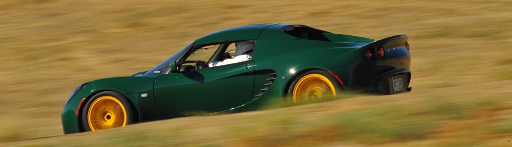
I’ve been making an effort to select hikes that I can get to in the fun car. If I take the SUV, I leave Genae without a vehicle. Last week I took the SUV to the trailhead at Monarch Lake and thought it wouldn’t be a problem to drive the Lotus. It had rained the night before my hike and the road wasn’t muddy at all and, as I reported, only the last mile gave me any caution. If I went pretty slow, I thought I’d be okay. So for this week’s hike, I returned to the trailhead at Monarch Lake.

Thursday, August 15

The difference this time was that the road wasn’t dry. It certainly had rained overnight. I must have been mistaken that it had rained the night before my last hike. From US 34 to the trailhead, it’s 9.6 miles. The first couple of tenths are paved, and only the last 0.8 miles had any loose stones. The speed limit is 25, and I stuck to that (or less) until I got to the last stretch, where I crawled along at about 10 mph.

When I got out of the car, I couldn’t help but see (I’m exaggerating here) about a hundred pounds of mud on the car. Last week, you couldn’t even tell I’d taken the SUV on a dirt road. I joke about how seldom I wash the Lotus. Well, I’d be washing it real soon!

The way to Gourd Lake begins on the same trail I took last week to Mirror Lake and Crater Lake, until the junction with the Buchanan Pass trail. Here we make a left turn rather than a right turn. The trail, parallelling Buchanan Creek, is rather run-of-the-mill, affording neither open views nor interesting falls or cascades.

After hiking 2.2 miles up the Buchanan Pass trail we come to the junction with the spur trail that takes us to the lake. The trail climbs a steep slope to reach Gourd Lake, which is situated on a small shelf. Looking at the map, I was not looking forward to this bit. My hikes up the steep trails in Eagles Nest Wilderness had me anticipating that I might be quite slow on this final push to the lake.

I was worried over nothing. The trail is nicely graded and uses a series of about a dozen switchbacks. It is a persistent climb, but is never steep. I had allowed two hours to hoist my sorry ass up the side of the valley, but even with a short break to enjoy a fresh Palisade peach it was more like an hour and a half.

The trail climbs a south facing slope and I was looking forward to views of the dramatic territory along the Continental Divide. The forest here isn’t terribly dense, and on a slope like this I figured there might be several places with a clear, unobstructed view. Glimpses are afforded, but any panoramic look at the terrain was slightly veiled.

Arriving on the shelf holding the lake, we first come to a small pond that is Not Gourd Lake. On my map, the trail skirts to the left here. I kept on the vague path that goes to the right, going around the bent “neck” of the gourd, taking me to the eastern shore.

The weather had been nice so far. Once the early clouds burned off, the skies overhead were their usual brilliant blue. But once I sat down for my picnic, some rather threatening clouds appeared. A slight breeze picked up and it did start to sprinkle but never enough that I felt I needed to put on my jacket. The change in weather did encourage me to cut my stay at the lake a bit short. The weather godz were just messing with me, though, as it cleared up about half an hour after I started hiking back to the car. So it goes.

I don’t have any video or timelapse for this trip. I plugged the GoPro in to charge it. I would swear it was charging, but when I arrived at the lake and tried to turn it on, the battery was dead, dead, dead. Oh well.

The trailhead area is quite busy, even though the parking lot wasn’t full in the morning nor in the afternoon. Quite a few people take the loop around Monarch Lake. Beyond Monarch Lake, most of the hiker/backpacker traffic heads towards Crater Lake or Pawnee Pass. After I made my left turn onto the Buchanan Pass trail, I only came across six other hikers.

Just over a ridge to the north of Gourd Lake is Island Lake. It’s a bit out of my range for a day trip, but certainly looks like it would be a fun side trip for a backpacker. I keep a list of places I may want to hike to. Funny, the list never seems to get any shorter.

Timetable

SegmentDistanceElev ChangeTimeSpeed
Trailhead to Crater Lake Trail1.6 mi16’/mi0:342.8 mph
Crater Lake Trail to Buchanan Pass Jct1.7 mi245โ€™/mi0:442.3 mph
Buchanan Pass Jct to Gourd Lake Trail2.2 mi350’/mi1:022.1 mph
Gourd Lake Jct to Gourd Lake2.5 mi500’/mi1:321.6 mph
Trailhead to Gourd Lake8.0 mi308’/mi3:522.1 mph

Mirror Lake and Crater Lake

I’ve never been responsible for naming any geographical features, but I’ll grant that it can sometimes be quite difficult. Two obvious issues come to mind. First, naming places after people. Times change, and attitudes change (thankfully). We’ve seen some prominent places renamed in recent years: Mount McKinley is now Mount Denali and Mount Evans is now Mount Blue Sky.

If we try to avoid naming things after people, we run into the issue of duplicates. I wondered earlier how many Columbine Lakes there might be in Colorado. The USGS database lists six. I don’t know how to find out which name has the most lakes. Crater Lake might be in the running, with 11 entries in the USGS database for Colorado. One entry in that list is for the Crater Lakes I visited in James Peak Wilderness, which is actually three lakes.

The Crater Lake in Indian Peaks Wilderness has been on my list of possible hikes for a year. On my hike to Columbine Lake, I met a couple of hikers who said it was one of the prettiest lakes they’d ever been to. That piqued my interest.

August 6, 2024

Crater Lake is reached from the Monarch Lake trailhead. Monarch Lake is nine and a half miles east of US 34 on County Road 6. It’s not asphalt, but the first seven or eight may as well be. There is a little bit of loose gravel, but the surface is almost like a paved road. There are campgrounds up here, and there’s a lot of RV traffic, so the road is quite well maintained. The final mile or so is good enough that I would consider driving the fun car next time.

The trailhead is a two-and-a-half-hour drive from home. I set my alarm for five and was able to put boots on the trail by 7:45. I still haven’t figured out how to use my pass for these non-Park hikes, and I didn’t see the kiosk on the way in, so I risked a fine. I left my Senior Pass on the dash and hoped that would mollify the powers that be.

After passing the three-quarter-mile-long Monarch Lake, the trail from the Wilderness boundary to the junction with Buchanan Pass is a rather run-of-the-mill forest hike. Long stretches are nearly level and free of rocks and roots, allowing for a quick pace. The trail junction with Buchanan Pass is not quite halfway to the destination, and I covered it in less than an hour and a half. It was starting to look like maybe I could reach the lake in less than four hours.

Now the trail heads up a valley that runs nearly three miles in a straight line to the southeast. The head of the canyon is deep in the heart of the Indian Peaks, surrounded by Cherokee, Iroquois, Apache, Shoshone, Hopi, and Navajo. None are 14ers, and only a couple are 13ers, but in combination, they’re an impressive group of peaks, all vertical lines and jagged profiles.

Most of the elevation gain of the hike is on this stretch. The effort of the climb is well rewarded with some nice cascades and waterfalls. There are a number of campsites at the lake, and the trail is well-traveled by backpackers. If I were to be carrying 35 or 40 pounds, I’d enjoy stopping for breaks at these falls. But I pushed on.

When I reached a series of switchbacks that climbed a fairly steep slope, I couldn’t help but think that if this trail was in the Eagles Nest Wilderness, they’d have just made it go straight up. At the top of these switchbacks is Mirror Lake, with an amazing view. I paused here for a few minutes to get some photos, then pushed on to Crater. A quick quarter mile later and you’re there.

Lone Eagle Peak dominates the view at both lakes.

I’ve been asked many times what my favorite lake is. I don’t really have one. I don’t have a Top 10, either. But if I did have a Top 10, I think I’d have to put Crater Lake on it.

Camping is allowed by permit, using designated spots. I saw signs with sites numbered as high as 11 but didn’t see signs for 11 sites. I think this would be an excellent place to spend a couple of nights. With two nights here, I’d consider a visit to Pawnee Lake a couple of miles away. And if I was adventurous, I’d take a stab at bushwhacking to Triangle Lake.

On the way back, I ran into a couple of guys who had lost the trail. I didn’t see them – they spotted me. There’s a place where the trail goes over solid rock for perhaps eighty yards. There are nice cairns at each end and one in the middle. They didn’t know to go from cairn to cairn and instead went into the bush.

Not long after that, two young men caught and passed me. They were traveling very light, t-shirts and shorts, and some water. Storm clouds were forming to the north, moving to the east. Perhaps it would miss us, but it didn’t look good. As they passed me, they asked if I thought we’d get rained on. “Probably”. They told me they had intended to get to the top of Pawnee Pass, but the weather prospects turned them around. They said maybe they’d started too late. I asked when they started. “12:30”. I told them I like to be off the top by noon.

A few minutes after they passed me, it started to sprinkle. Over the next few minutes, it increased a bit, and the skies were darkening. I stopped and put on my rain jacket. A minute later, there was one bright zap with its crash less than two seconds behind. That was close, less than half a mile! And that was it. It stopped raining. I have little doubt that by putting on my jacket I single-handedly stopped the rain. Ha!

There was more traffic on the trail than I expected, with a relatively high percentage being backpackers. I talked to people that had started their hike at Brainard Lake and I talked to folks who were headed there. That’s quite the climb with a heavy pack. Pawnee Pass tops out at about 12,500′.

I stopped at one of the nice falls for a break. I refilled my water and had my second peach. Yum!

When I was nearly back to Monarch Lake, I made a slight navigation error at a trail junction. I should have stayed to the right, but the sign said Monarch Lake trailhead was to the left, so I went that way. That took me the long way around Monarch Lake. I realized this pretty quickly and could have turned around, but I thought I might as well see a different view of the place. Unfortunately, the trail on the south shore doesn’t go along the shore: it’s up the slope a ways. You don’t get down to the water until you get to the western end of the lake. So it goes.

It’s a strenuous hike, but it has a nice payoff. It took me about four hours each way, and it’s a bit of a drive from Denver. Highly recommended.

Timetable

SegmentDistanceElev ChangeTimeSpeed
Trailhead to Crater Lake Trail1.6 mi16’/mi0:283.4 mph
Crater Lake Trail to Buchanan Pass Jct1.7 mi245’/mi0:541.9 mph
Buchanan Pass Jct to Pawnee Pass Jct3.0 mi417’/mi2:081.4 mph
Pawnee Pass Jct to Mirror Lake0.7 mi381’/mi0:281.5 mph
Mirror Lake to Crater Lake0.3 mi100’/mi0:131.2 mph
Trailhead to Crater Lake7.3 mi274’/mi4:111.7 mph

Columbine Lake

Eleven miles up a dirt road off US 40 near Tabernash is the Junco Lake Trailhead. The name confuses me. The only Junco Lake I can find in Colorado is the one in Wild Basin in RMNP. That Junco Lake is twelve miles to the north on the other side of the Continental Divide. You can’t get there from here.

Where you can get from here is Columbine Lake. There is likely more than one Columbine Lake in Colorado. This one lies 11,047′ above sea level in the morning shadow of the northern flank of Mount Neva in the Indian Peaks Wilderness. This is my third view of Mount Neva, having visited Lake Dorothy and the Neva Lakes.

I very nearly decided to hike to Caribou Lake via Arapaho Pass. It would have been about as strenuous as my two recent hikes near Vail. I thought I’d take a break, though, from the steep ones and do an easy one. Protrails.com has been offline for a while now, so I think it’s dead. I don’t think I like Alltrails as much. Alltrails lists Columbine Lake as 3.4 miles each way. CalTopo maps shows it as 3.23 miles.

Tuesday, July 23

Because it’s a shorter hike, I didn’t need to hit the road before dawn. It’s a tad over two hours to get to the trailhead. The trailhead is in the national forest and there’s a use fee. Their website says I can use my lifetime pass. Unfortunately, the kiosk had no way for me to use my pass so I paid the five bucks.

I arrived at the trailhead a few minutes after nine. There was plenty of parking available. I had a quick chat with a couple of guys who were putting on their backpacks. They were headed to Caribou Lake over Caribou Pass. I can imagine how much fun hefting forty pounds up that trail. I think if I was camping at Caribou Lake, I’d take the long way from Monarch Lake instead of the bonus 800′ of elevation (each way!).

Anywho, I put boots on the trail at 9:16. The first section of trail, up to the Indian Peaks Boundary sign is an old 4×4 road, full of loose, round rocks but easy hiking. Somehow I missed it on the way up, not spotting it until nearly back to the car, there’s a derelict cabin a few yards off the trail.

From the boundary to the junction with the spur trail to the lake, the trail skirts a large grassy meadow. The open meadows mean open views, and before long we get a nice look at Mount Neva. Half a mile after entering the Wilderness, there’s a trail junction. The main trail continues to the left, eventually topping Caribou Pass. To reach Columbine Lake, take the trail to the right.

The final mile and a half of trail is the most scenic. Unfortunately, today the air is full of smoke from wildfires in Canada and the Pacific Northwest, a thousand or more miles away. All too far away to give the air a smokey smell, but enough to make what should be brilliant blue to something between gray and a pale brown.

Columbine Lake gets a fair amount of visitors, and there are social trails that circumnavigate it. I went around it counter-clockwise. Doing this, you get dumped back onto the trail to the lake a fair distance below the actual lake. Had I intended to go around the lake clockwise, I probably wouldn’t have found the little trail. In any event, the lake is surrounded by grassy meadows filled with wildflowers.

The one flower I didn’t see all day: columbines! I don’t know how many lakes in Colorado are called Columbine Lake (and, certainly, there is more than one) but I’m guessing this is the only one where you won’t see any columbines.

Overall, an easy and enjoyable hike.

Timetable

SEgmentLengthElev GainTimeSpeed
Trailhead to IPW boundary1.4 mi268’/mi0:332.5 mph
IPW boundary to trail jct0.5 mi260’/mi0:171.8 mph
Trail jct to Columbine Lake1.4 mi332’/mi0:541.5 mph
Trailhead to Columbine Lake3.3 mi300’/mi1:441.9 mph

Neva Lakes

Saturday, October 6

Two lakes sit due south of Mount Neva, a few yards east of the Continental Divide, at nearly 12,000′ above sea level. I’ve been wanting to hike there for a few weeks but couldn’t fit it into the schedule. It’s getting late enough in the season that if I don’t do it now, I won’t do it this year.

I talked Chad into going with me. The last time I took him off trail, we traversed a steep forested hillside that made him quite uncomfortable. And early in that hike, he tweaked his ankle a bit. He didn’t have a great time.

So I was pleasantly surprised he agreed to go on a hike I described as sunny but cold, with winds that might drive us from the lakes within minutes, and to get there, we’d have two hours off the trail over a route that ProTrails describes as marshy with a steep wall at the end.

We left my place at seven. I figured the trailhead wouldn’t be as busy as it is in August. It was a calculated risk, and I had no Plan B. Generally I reach the high school before the rangers are staffing their station. Today we arrived just as the ranger put out the “FULL” sign for the Fourth of July trailhead.

He told us that there may still be parking available there. The ranger up at the trailhead was now on her way down with a count of available parking. We were directed to park next to an orange cone in the school parking lot, first in line for any empty spots. We waited maybe fifteen minutes before being told to head on up. Next in line behind us was a big Audi sedan. It’s a rough road with lots of holes and exposed rocks. Three or four cars later was a BMW sedan. That those guys got those cars up there indicates you can drive damn near anything up there if you’re so inclined.

Before shutting off the car, I checked the temperature: 28 degrees F.

To reach the lakes, we headed up the Arapaho Pass trail to the derelict mine and the junction with the trail that climbs the flank of South Arapaho Peak. It’s a two-mile hike from the trailhead, rising about 1100′ at a fairly constant grade. It took us an hour. From the trail junction, we’d descend a couple hundred feet to the floor of the valley. Chad was glad to be done with the relentless trail.

We’re pretty much right at treeline when we leave the trail. The trees are in clumps, fairly easy to skirt. Any flat spaces between the trees and along the stream are normally boggy and marshy, but this late in the season, everything is dry. Well, almost everything. We do come across a few bogs, but it’ll never be any drier than it is today. We followed a number of game trails that appeared and faded out at the edge of a dry marsh or a small talus field. Regardless, navigation is as easy as it gets with these expansive views.

For about a mile above our stream crossing, we gain only about three hundred feet. It’s a pleasant, leisurely stroll. The sun is shining brightly in a deep cobalt sky with a gentle breeze. It has snowed here, lightly, a couple of times over the last several days. A thin dusting of snow clings to the high, steep, shady, northern mountainside. Where we’re walking, there are occasional spots of snow in the shade of a bush or rock. One pool we passed had a very thin sheet of ice on it. It was nearly invisible. I gently pushed on it. Not hard enough to crack it, but I did make some water rise through a few silver dollar-sized holes at the other end of the ice. Pretty cool.

Being off-trail, I expected not to see any other hikers. Just before we came to ProTrails’ “steep wall” below the lakes, we spotted three hikers with a dog working their way up the valley, still on the other side of the stream. They passed us pretty quickly, they were moving at a pretty good clip. We had a brief chat as to the best route. This was their first trip to these lakes, too. I said we were going to try to make use of any grassy ramps a bit to the left of the lakes to avoid the steep talus. This would take us to the upper lake first, putting us on its southeastern shore.

We arrived at the upper lake pretty much on schedule. We found a nice spot for our picnic not too close to the other hikers, whose dog ran over to greet us when we appeared. We had a nice view of Mount Neva. There was still not a cloud in the sky, and the winds were about as calm as one can expect beneath the Divide. I brought beers. I had a blood orange blonde, Chad had the lager.

After the other group left, Chad spotted a couple of hikers descending a ravine from the ridgeline between Mount Neva and Mount Jasper. There’s a route from Arapaho Pass that summits Neva and comes down here. Not long after those two guys, wearing shorts and lightweight shoes, disappeared down the outlet of the lake we saw two more hikers mid-descent. Too steep for me, I think.

The upper lake looks to already have drained two feet below its high-water mark, judging from the bathtub ring. The outlet is high and dry. A few yards below the lake, following the dry outlet we came to running water: the upper lake is draining from here. It’s a pretty strong flow. I’d guess it’s eight or ten feet of elevation below the surface of the lake. This drain is surrounded by tufts of grass. The water flows gently to a small pond that then drains into the lower lake. The lower lake is still full.

Leaving the lower lake at its outlet, we were at the top of a large, steep talus field. The grassy ramps we came up on are quite a ways to our right. We worked our way down diagonally, crossing more talus than is to my liking.

Navigation back across the valley and up to the trail is, again, dead simple. The trail we’re heading toward is a plainly visible slash across the mountain ahead of us. Again, we gained and lost social trails. A few times, I saw the footprints of the hikers with the lightweight footwear.

After crossing the stream, we needed to climb about two hundred feet to gain the trail. Getting near the end, I found a faint game trail. We followed it for a short while, but I decided I wanted to climb faster and took a more direct route. We stopped for a short break when we got to the trail. I figured we were between the mine and the junction. We discussed whether we wanted to head up to the mine or not. We decided not.

This was a good choice. It turns out we were above the mine and didn’t need to make a side trip to get there. Had we made the side trip, we’d have gone the wrong way.

When I was here before, I wanted to get a picture of the vertical mine shaft. There was no barrier around it. I’m smart enough to go nowhere near the slippery-looking edge, but I could imagine coming across it in the dark or in bad weather. Today I have my GoPro on a stick. Perhaps I could get a video looking down into the black hole.

It was not to be. They have somehow managed to fill the hole with dirt and rocks. I imagine they must have had to somehow put a plug in it and cover the plug with dirt. This was a pretty deep shaft and filling it up is out of the question. This trail gets quite a bit of traffic. I’m surprised they didn’t plug the shaft before now.

It was a great hike. We couldn’t have had better weather. The views were fantastic