Pawnee Lake

Pawnee Lake sits a stone’s throw west of the Continental Divide, in the heart of Indian Peaks Wilderness, surrounded by Blackfoot, Paiute Peak, Mount Toll, Pawnee Peak, and Shoshoni Peak. It can be reached from trailheads at Brainard Lake, east of the Divide. Taking that seven-mile route involves a 2000′ climb to Pawnee Pass, followed by a sketchy 1700′ descent to the lake, making for a total of 3700′ of climbing for the round trip.

Not being a big fan of sketchy steep descents and going uphill both ways to school, I chose to get there from the Monarch Lake trailhead. It’s eight miles and climbs about 2500′. The only negative to this option for me is the extra hour’s drive each way.

Friday, July 17

The hike to Pawnee Lake shares much of the route to Crater Lake. Instead of hiking the last mile to Crater Lake, make a left turn on the Pawnee Pass trail and hike about 1.7 miles to Pawnee Lake. On my trip to Crater Lake, I wasn’t sure about my park pass. I later learned that if you have an annual pass or lifetime pass, just leave it visible on the dash of your car.

The trail to Crater Lake gets a fair amount of traffic. Crater Lake is gorgeous, and there are a few nice falls and cascades along the trail. If the hike to Crater Lake was shorter, I think there’d be many more visitors. I encountered quite a few backpackers hiking out from a night or two at Crater Lake, but I didn’t meet anybody who had been to Pawnee Lake.

Shortly after passing the Buchanan Pass trail, I met a couple of moose. Some hikers I’d passed a few minutes before warned me they were up ahead. Still, I came up on them abruptly. As I came around a corner, one was on the trail about fifteen feet in front of me. I was expecting to see him, but he wasn’t expecting to see me. He took a couple of steps toward me before he left the trail. I took a few more steps before I saw the second guy. He, too, was startled, and his first steps were in my direction. Moose have a reputation for being unpredictable, but in my dozens of encounters with them, this is the first time I thought I might have to put a tree between us.

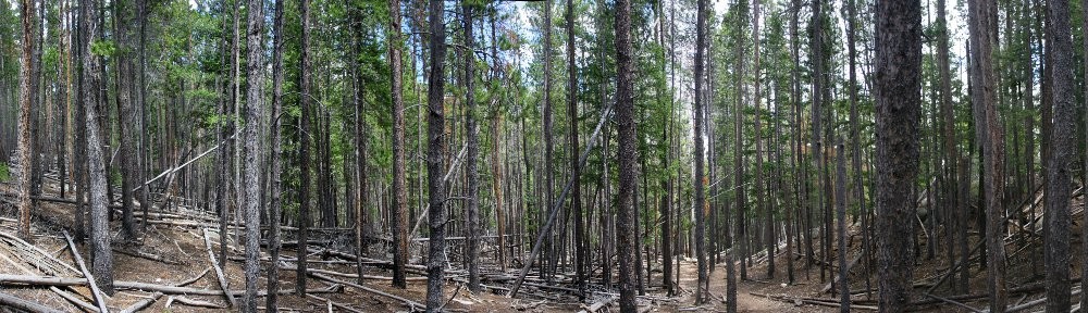
After hiking 6.3 miles of trail that’s shared with Crater Lake, there’s a final trail junction. Go to the left and hike a further 1.7 miles to Pawnee Lake, climbing about 800′. The trail affords some nice views of steep and jagged terrain of Cherokee, Lone Eagle Peak, and Mount George.

Not long after diverging from the Crater Lake trail, I met two women backpacking out. They had come over the Divide from Long Lake. I asked them about the descent from Pawnee Pass. They both shook their heads. They didn’t like it. I’m sure it’s easier with a day pack than a full backpack, but their few words supported my decision to avoid crossing the pass.

I sat by the lake for nearly an hour, and for half of that, it rained lightly, just enough to warrant the rain jacket. Before I left the lake, the clouds were breaking up, and I could see my shadow more often than not. By mid-afternoon, a quick, cool shower would have been welcomed.

On my hike out, at one of the falls that has a nice pool, I ran into four backpackers from Minnesota. They had just cooled off with a dip in the pool and suggested I do the same. They were doing a big loop: Brainard Lake north to Buchanan Pass trail, then on to Pawnee Lake and Pawnee Pass and back to Brainard Lake. The research they’d done recommended this counter-clockwise route rather than clockwise, as it’s better to go up the west side of Pawnee Pass than to go down it. More confirmation that I made the correct choice.

One other hiker I encountered deserves mention. We had a rather long conversation. He had a bit of an accent, but just a bit. Parting, I asked if he was Australian. He laughed and said I was one of the few who noticed. I said I wasn’t sure, as I can’t really discern the difference between Aussie and Kiwi accents. He told me he’s been in the US for more than a decade and spent some time in Britain. Then he gave me a perfect demonstration of the differences between Aussie, Kiwi, and South African accents.

I have no time-lapse video today. Even if I hadn’t forgotten it at home, the weather would have made for a boring video.

Timetable

SegmentDistanceElev ChangeTimeSpeed
Trailhead to Crater Lake Trail1.6 mi16โ€™/mi0:303.2 mph
Crater Lake Trail to Buchanan Pass Jct1.7 mi245โ€™/mi0:472.2 mph
Buchanan Pass Jct to Pawnee Pass Jct3.0 mi417โ€™/mi2:181.3 mph
Pawnee Pass Jct to Pawnee Lake1.7 mi482โ€™/mi1:101.5 mph
Trailhead to Pawnee Lake8.0 mi315โ€™/mi4:451.7 mph

Gourd Lake

I’ve been making an effort to select hikes that I can get to in the fun car. If I take the SUV, I leave Genae without a vehicle. Last week I took the SUV to the trailhead at Monarch Lake and thought it wouldn’t be a problem to drive the Lotus. It had rained the night before my hike and the road wasn’t muddy at all and, as I reported, only the last mile gave me any caution. If I went pretty slow, I thought I’d be okay. So for this week’s hike, I returned to the trailhead at Monarch Lake.

Thursday, August 15

The difference this time was that the road wasn’t dry. It certainly had rained overnight. I must have been mistaken that it had rained the night before my last hike. From US 34 to the trailhead, it’s 9.6 miles. The first couple of tenths are paved, and only the last 0.8 miles had any loose stones. The speed limit is 25, and I stuck to that (or less) until I got to the last stretch, where I crawled along at about 10 mph.

When I got out of the car, I couldn’t help but see (I’m exaggerating here) about a hundred pounds of mud on the car. Last week, you couldn’t even tell I’d taken the SUV on a dirt road. I joke about how seldom I wash the Lotus. Well, I’d be washing it real soon!

The way to Gourd Lake begins on the same trail I took last week to Mirror Lake and Crater Lake, until the junction with the Buchanan Pass trail. Here we make a left turn rather than a right turn. The trail, parallelling Buchanan Creek, is rather run-of-the-mill, affording neither open views nor interesting falls or cascades.

After hiking 2.2 miles up the Buchanan Pass trail we come to the junction with the spur trail that takes us to the lake. The trail climbs a steep slope to reach Gourd Lake, which is situated on a small shelf. Looking at the map, I was not looking forward to this bit. My hikes up the steep trails in Eagles Nest Wilderness had me anticipating that I might be quite slow on this final push to the lake.

I was worried over nothing. The trail is nicely graded and uses a series of about a dozen switchbacks. It is a persistent climb, but is never steep. I had allowed two hours to hoist my sorry ass up the side of the valley, but even with a short break to enjoy a fresh Palisade peach it was more like an hour and a half.

The trail climbs a south facing slope and I was looking forward to views of the dramatic territory along the Continental Divide. The forest here isn’t terribly dense, and on a slope like this I figured there might be several places with a clear, unobstructed view. Glimpses are afforded, but any panoramic look at the terrain was slightly veiled.

Arriving on the shelf holding the lake, we first come to a small pond that is Not Gourd Lake. On my map, the trail skirts to the left here. I kept on the vague path that goes to the right, going around the bent “neck” of the gourd, taking me to the eastern shore.

The weather had been nice so far. Once the early clouds burned off, the skies overhead were their usual brilliant blue. But once I sat down for my picnic, some rather threatening clouds appeared. A slight breeze picked up and it did start to sprinkle but never enough that I felt I needed to put on my jacket. The change in weather did encourage me to cut my stay at the lake a bit short. The weather godz were just messing with me, though, as it cleared up about half an hour after I started hiking back to the car. So it goes.

I don’t have any video or timelapse for this trip. I plugged the GoPro in to charge it. I would swear it was charging, but when I arrived at the lake and tried to turn it on, the battery was dead, dead, dead. Oh well.

The trailhead area is quite busy, even though the parking lot wasn’t full in the morning nor in the afternoon. Quite a few people take the loop around Monarch Lake. Beyond Monarch Lake, most of the hiker/backpacker traffic heads towards Crater Lake or Pawnee Pass. After I made my left turn onto the Buchanan Pass trail, I only came across six other hikers.

Just over a ridge to the north of Gourd Lake is Island Lake. It’s a bit out of my range for a day trip, but certainly looks like it would be a fun side trip for a backpacker. I keep a list of places I may want to hike to. Funny, the list never seems to get any shorter.

Timetable

SegmentDistanceElev ChangeTimeSpeed
Trailhead to Crater Lake Trail1.6 mi16’/mi0:342.8 mph
Crater Lake Trail to Buchanan Pass Jct1.7 mi245โ€™/mi0:442.3 mph
Buchanan Pass Jct to Gourd Lake Trail2.2 mi350’/mi1:022.1 mph
Gourd Lake Jct to Gourd Lake2.5 mi500’/mi1:321.6 mph
Trailhead to Gourd Lake8.0 mi308’/mi3:522.1 mph

Mirror Lake and Crater Lake

I’ve never been responsible for naming any geographical features, but I’ll grant that it can sometimes be quite difficult. Two obvious issues come to mind. First, naming places after people. Times change, and attitudes change (thankfully). We’ve seen some prominent places renamed in recent years: Mount McKinley is now Mount Denali and Mount Evans is now Mount Blue Sky.

If we try to avoid naming things after people, we run into the issue of duplicates. I wondered earlier how many Columbine Lakes there might be in Colorado. The USGS database lists six. I don’t know how to find out which name has the most lakes. Crater Lake might be in the running, with 11 entries in the USGS database for Colorado. One entry in that list is for the Crater Lakes I visited in James Peak Wilderness, which is actually three lakes.

The Crater Lake in Indian Peaks Wilderness has been on my list of possible hikes for a year. On my hike to Columbine Lake, I met a couple of hikers who said it was one of the prettiest lakes they’d ever been to. That piqued my interest.

August 6, 2024

Crater Lake is reached from the Monarch Lake trailhead. Monarch Lake is nine and a half miles east of US 34 on County Road 6. It’s not asphalt, but the first seven or eight may as well be. There is a little bit of loose gravel, but the surface is almost like a paved road. There are campgrounds up here, and there’s a lot of RV traffic, so the road is quite well maintained. The final mile or so is good enough that I would consider driving the fun car next time.

The trailhead is a two-and-a-half-hour drive from home. I set my alarm for five and was able to put boots on the trail by 7:45. I still haven’t figured out how to use my pass for these non-Park hikes, and I didn’t see the kiosk on the way in, so I risked a fine. I left my Senior Pass on the dash and hoped that would mollify the powers that be.

After passing the three-quarter-mile-long Monarch Lake, the trail from the Wilderness boundary to the junction with Buchanan Pass is a rather run-of-the-mill forest hike. Long stretches are nearly level and free of rocks and roots, allowing for a quick pace. The trail junction with Buchanan Pass is not quite halfway to the destination, and I covered it in less than an hour and a half. It was starting to look like maybe I could reach the lake in less than four hours.

Now the trail heads up a valley that runs nearly three miles in a straight line to the southeast. The head of the canyon is deep in the heart of the Indian Peaks, surrounded by Cherokee, Iroquois, Apache, Shoshone, Hopi, and Navajo. None are 14ers, and only a couple are 13ers, but in combination, they’re an impressive group of peaks, all vertical lines and jagged profiles.

Most of the elevation gain of the hike is on this stretch. The effort of the climb is well rewarded with some nice cascades and waterfalls. There are a number of campsites at the lake, and the trail is well-traveled by backpackers. If I were to be carrying 35 or 40 pounds, I’d enjoy stopping for breaks at these falls. But I pushed on.

When I reached a series of switchbacks that climbed a fairly steep slope, I couldn’t help but think that if this trail was in the Eagles Nest Wilderness, they’d have just made it go straight up. At the top of these switchbacks is Mirror Lake, with an amazing view. I paused here for a few minutes to get some photos, then pushed on to Crater. A quick quarter mile later and you’re there.

Lone Eagle Peak dominates the view at both lakes.

I’ve been asked many times what my favorite lake is. I don’t really have one. I don’t have a Top 10, either. But if I did have a Top 10, I think I’d have to put Crater Lake on it.

Camping is allowed by permit, using designated spots. I saw signs with sites numbered as high as 11 but didn’t see signs for 11 sites. I think this would be an excellent place to spend a couple of nights. With two nights here, I’d consider a visit to Pawnee Lake a couple of miles away. And if I was adventurous, I’d take a stab at bushwhacking to Triangle Lake.

On the way back, I ran into a couple of guys who had lost the trail. I didn’t see them – they spotted me. There’s a place where the trail goes over solid rock for perhaps eighty yards. There are nice cairns at each end and one in the middle. They didn’t know to go from cairn to cairn and instead went into the bush.

Not long after that, two young men caught and passed me. They were traveling very light, t-shirts and shorts, and some water. Storm clouds were forming to the north, moving to the east. Perhaps it would miss us, but it didn’t look good. As they passed me, they asked if I thought we’d get rained on. “Probably”. They told me they had intended to get to the top of Pawnee Pass, but the weather prospects turned them around. They said maybe they’d started too late. I asked when they started. “12:30”. I told them I like to be off the top by noon.

A few minutes after they passed me, it started to sprinkle. Over the next few minutes, it increased a bit, and the skies were darkening. I stopped and put on my rain jacket. A minute later, there was one bright zap with its crash less than two seconds behind. That was close, less than half a mile! And that was it. It stopped raining. I have little doubt that by putting on my jacket I single-handedly stopped the rain. Ha!

There was more traffic on the trail than I expected, with a relatively high percentage being backpackers. I talked to people that had started their hike at Brainard Lake and I talked to folks who were headed there. That’s quite the climb with a heavy pack. Pawnee Pass tops out at about 12,500′.

I stopped at one of the nice falls for a break. I refilled my water and had my second peach. Yum!

When I was nearly back to Monarch Lake, I made a slight navigation error at a trail junction. I should have stayed to the right, but the sign said Monarch Lake trailhead was to the left, so I went that way. That took me the long way around Monarch Lake. I realized this pretty quickly and could have turned around, but I thought I might as well see a different view of the place. Unfortunately, the trail on the south shore doesn’t go along the shore: it’s up the slope a ways. You don’t get down to the water until you get to the western end of the lake. So it goes.

It’s a strenuous hike, but it has a nice payoff. It took me about four hours each way, and it’s a bit of a drive from Denver. Highly recommended.

Timetable

SegmentDistanceElev ChangeTimeSpeed
Trailhead to Crater Lake Trail1.6 mi16’/mi0:283.4 mph
Crater Lake Trail to Buchanan Pass Jct1.7 mi245’/mi0:541.9 mph
Buchanan Pass Jct to Pawnee Pass Jct3.0 mi417’/mi2:081.4 mph
Pawnee Pass Jct to Mirror Lake0.7 mi381’/mi0:281.5 mph
Mirror Lake to Crater Lake0.3 mi100’/mi0:131.2 mph
Trailhead to Crater Lake7.3 mi274’/mi4:111.7 mph