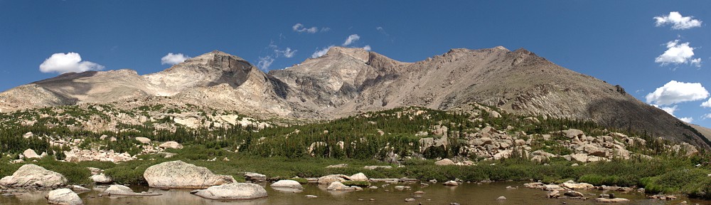
To oversimplify the geography, Guanella Pass connects I-70 to US 285, between Georgetown to the north and Grant to the south. The road is paved the entire way, but isn’t maintained in the winter. The summit of the pass lies at 11,669′ above sea level. There are two parking lots at the summit, one that serves the Bierstadt Mountain trail and the other that takes hikers to Square Top Lakes and Square Top Mountain.
Until the last couple of years, parking was allowed beside the road if the parking lots were full. There is quite a bit of traffic over the pass, particularly during the autumn, when folks are out looking at the aspen. Not everyone who parks at these lots is there for an extended time, but if you want to be sure to get a parking spot, I recommend an early start.
Saturday, October 3
Guanella Pass Road passes three reservoirs after leaving Georgetown. By the time I put the third one, Lower Cabin Creek Reservoir, in my rearview mirror, I was second in a line of five cars. A few minutes before seven, all five of us entered the parking lot at the summit. I don’t think the fifth car in the line got a parking space.
The skies were clear to the east and clear to the west, but a band of clouds a few miles wide stretched over Mount Blue Sky. The winds are always strange along the Divide, which is just a couple of miles west of here. Winds at different altitudes often go in widely different directions. Those clouds could very well sit right there all day, or get pulled to shreds in the next hour or two.
The trail starts off going down a bit; it doesn’t regain the starting elevation until a mile in, or about two-thirds of the way to the lower Square Top Lake. I made it about this far before the sun topped Mount Bierstadt. I would have liked some sunshine to help me warm up a bit, but it didn’t take too long before I was in the shade of the clouds, which didn’t seem to move or dissipate.
It’s a bit less than two miles from the trailhead to the first trail junction. A right turn leads to the upper lake; turn left to summit Square Top or to follow the South Park Trail, which goes to the Shelf Lake Trailhead, where I was a few weeks ago. This trail must not get much traffic, as it’s fairly faint at both ends. I made it here in a bit over an hour, so I was making pretty good time: about two miles per hour.
From here to the summit is a mile and a third, climbing fifteen hundred feet. That’s more than 1,100′ per mile. I’m sure that’s not unusual for summit hikes, but it’s well out of the ordinary for trails to lakes.
About halfway from the South Park Trail to the summit, at roughly 13,000′, my pace flagged considerably. This isn’t a 14er, but it’s not far short. From here to the summit, I had to play a little mind game with myself. I admit I take a bit of pride in being able to maintain a pace where I don’t have to take breaks. I’m often slow, but tenacious. Today, here in the thin air, I told myself not to stop until I’ve taken a hundred steps. The mind game is that I don’t start counting right away, and I don’t quit as soon as I get to a hundred. After about half a dozen of these hundreds, I got to the top.
In this case, the top isn’t the summit. The top of Square Top varies between a hundred and two hundred feet wide and nearly half a mile long. When you arrive at the top of the climb, you’re still fifty feet short of the summit. This morning, there’s a bit of snow on the ground, in the hollows and between rocks. It’s only a few inches deep, but it’s almost all crust and supports my weight. If there’s a trail along here, it’s under the snow. But it’s obvious where to go, so there I went.
I had a lunch with me, including a beer. I’m not sure if this was optimistic or pessimistic planning. Optimistic because I thought I’d be able to enjoy a picnic up here, or pessimistic, thinking it would take me a lot longer to get here. It was a quarter to ten, so a bit early for lunch. And the wind was not fun. I reckon it was a steady thirty miles an hour, with occasional gusts that threatened to knock me over. I didn’t dally at the summit: I took my photos and headed back down.
On my way back the half mile from the summit to where the trail descends, I encountered two hikers. We exchanged few words, and those by yelling over the wind. I was regretting that I had neither gloves nor a warm hat and wished I had another layer. One of the other hikers was wearing shorts. Yeesh.
Once I got off the summit, I started warming up. Before I returned to the South Park Trail junction, I found a spot out of the wind and had a snack and a rest. I could have made a left turn at the next junction and gone to the upper lake for my picnic, but I decided just to head back to the car.
It took me five hours for the round trip. I generally don’t hike down any faster than I hike up, but this time, even with my snack break, the return trip was half an hour quicker. I didn’t have to “hundred” myself on the way down, that’s for sure.
I had my picnic in the car. I made sure to sit in the passenger seat, so people wouldn’t think I was about to leave. There was quite a bit of pedestrian traffic through the parking lot, and quite a few cars searching for an open parking spot, but only a few came free in the twenty minutes it took me to eat.
I expected this hike to take me longer. It’s not very far, about three and a half miles each way, but that last thousand feet of elevation gain is fairly strenuous. I enjoyed it despite the wind, but it was a reminder of why I prefer lakes to summits. The view is impressive, in that you can see mountains a hundred miles away. From here, Mount Shavano is prominent, wearing a fresh coat of snow, even though it’s 75 miles away. Pikes Peak is 55 miles distant. But from up here, everything is far away. The nearest summit is a mile away. Lakes below me that are 7 or 8 acres seem like puddles.
Yeah, I’m not a big fan of summits, but standing on this mountain, I looked at Grays and Torreys just four miles distant and told myself they should be my next summits. What makes me think I’d enjoy climbing two 14ers in one day? I guess there’s one way to find out.


