Stone Lake and Upper Lake

In north-central Indian Peaks Wilderness, in a high mountain valley bounded by Hiamovi Mountain, Cooper Peak, and the improbably named Ooh La La!, lie two lakes: Stone Lake and Upper Lake. I’m mildly amused by the name of the latter. My brain glitches a bit; it wants to add a word. Upper what lake? I’ve recently been to Upper Storm Lake, and I’ve visited Upper Crater Lake. Upper Storm Lake is above Storm Lake, and Upper Crater Lake is above two other Crater Lakes. Shouldn’t this one follow the pattern and be “Upper Stone Lake”?

I put this hike on my “possibles” list some time ago, but waffled back and forth between thinking it was a day hike and a backpacking trip. It’s only about 6.2 miles to Upper Lake, and I often make longer day hikes. But this one had me doubting myself. Typically, my destination lake is the high point of the hike. For this one, the trail passes over a saddle from one drainage to another. The trail climbs to 11,200′, then descends 700′ before a gentle climb to the lakes. By the time the hiker reaches the high point of the hike on the way back to the trailhead, this works out to nearly 4,000′ of total elevation gain in about 8 miles. So it’s a steep one.

Friday, August 7

The Watanga Lake trailhead (I’ve also seen it listed as the Roaring Fork trailhead) is at Arapaho Bay in Lake Granby. It’s about ten miles from US 34, and nine miles of that is dirt road. But the road is very well maintained, has no ruts, and isn’t a washboard road. I’ve driven the Lotus on it a couple of times before. The parking lot has room for maybe two dozen vehicles. On this August weekday morning, there were only four cars there when I arrived at 7:30 am.

Within a few minutes of hitting the trail, we are on the first steep section of the hike, climbing five hundred feet in a bit more than a third of a mile. In contrast, the next thousand feet of elevation gain takes nearly two miles, to the junction with the Roaring Fork trail. (I may be using the incorrect names; I’m assuming we’re on the Watanga Lake trail until that junction. And note that there seem to be many trails called the “Roaring Fork Trail”.) To this point, the trail was alongside Arapaho Creek.

At the trail junction, we make a right turn. After a few minutes, we reach the second steep lift of the hike, gaining another five hundred feet in four-tenths of a mile. The map shows a stream not far from the trail and crossing it at least once. This summer has been quite dry. From the junction until nearly as far as Stone Lake, there isn’t any water. I had plenty of water to get me to the lakes, but I always like to keep track of my water sources.

At the top of the climb, still more than a mile and a half from Stone Lake, the trail passes through a large meadow with expansive views to the south and east, and the dramatic peaks in the heart of Indian Peaks Wilderness are on glorious display. Well, that was mostly true today. The sky was cloudless, but not the deep blue I’m accustomed to when hiking above 11,000′. Today, everything is hazy due to distant wildfires.

After taking in the views from the meadow, the trail descends into Hell Canyon. Here, we come to the third steep section. On the way to Stone Lake, we’re going down this steep bit. We’ll have to go back up it on the return to the trailhead. The footing here is sometimes less than ideal. Trek poles definitely help. Again, we see a five hundred foot elevation change in about four-tenths of a mile.

From the trailhead to the meadow at the top of the hike, the trail moves through moderately dense forest. In Hell Canyon, the forest thins out considerably. In late morning, the sun felt pretty good, but on the return trip, in the heat of early afternoon, the sun was oppressive. I didn’t see any clouds until nearly 3 pm.

There isn’t much traffic on this trail. I met an older couple at the trail junction, and a group of eight backpackers passed me in the meadow. I met two more backpackers about a mile short of Stone Lake. I didn’t see anybody else until I returned to the trailhead. Because there’s not much traffic, the trail becomes less obvious. It’s never difficult to follow, but in the places where it goes through grassy fields, I imagine it would only take a few weeks without hikers for the trail to disappear.

Both Stone Lake and Upper Lake are gorgeous. They are not situated above treeline in a stark cirque, nor in forest with trees lining the shore. There is forest, but it’s sparse and set back from the grassy shore. Hiamovi Tower stands majestically above Upper Lake. There are many small ponds scattered about.

The trail from Stone Lake to Upper Lake isn’t obvious, but that doesn’t matter. I followed the wrong trail and ended up at a campsite. I just headed cross-country toward Upper Lake and was there in a few minutes. The campsite I stumbled upon was the only one I saw, but no doubt there are a few others that are just as nice.

I’ll come back here for a backpacking trip someday. There are two named lakes a short distance down Stone Lake’s outlet. These shouldn’t be too difficult to reach. I’d also like to head north from Upper Lake (toward the saddle just above the beer can in my “Today’s beer” photo) to visit an unnamed lake in the extreme southern part of Rocky Mountain National Park. I’d guess that lake gets very few visitors.

SegmentDistanceElev ChangeTimeSpeed
Trailhead to Watanga Jct2.5 mi608’/mi1:411.5 mph
Watanga Jct to Stone Lake3.2 mi254’/mi12:391.2 mph
Stone Lake to Upper Lake0.4 mi245’/mi0:201.2 mph
Trailhead to Upper Lake6.1 mi399’/mi14:401.3 mph
  1. Net elevation change, not gross โ†ฉ๏ธŽ

Pawnee Lake

Pawnee Lake sits a stone’s throw west of the Continental Divide, in the heart of Indian Peaks Wilderness, surrounded by Blackfoot, Paiute Peak, Mount Toll, Pawnee Peak, and Shoshoni Peak. It can be reached from trailheads at Brainard Lake, east of the Divide. Taking that seven-mile route involves a 2000′ climb to Pawnee Pass, followed by a sketchy 1700′ descent to the lake, making for a total of 3700′ of climbing for the round trip.

Not being a big fan of sketchy steep descents and going uphill both ways to school, I chose to get there from the Monarch Lake trailhead. It’s eight miles and climbs about 2500′. The only negative to this option for me is the extra hour’s drive each way.

Friday, July 17

The hike to Pawnee Lake shares much of the route to Crater Lake. Instead of hiking the last mile to Crater Lake, make a left turn on the Pawnee Pass trail and hike about 1.7 miles to Pawnee Lake. On my trip to Crater Lake, I wasn’t sure about my park pass. I later learned that if you have an annual pass or lifetime pass, just leave it visible on the dash of your car.

The trail to Crater Lake gets a fair amount of traffic. Crater Lake is gorgeous, and there are a few nice falls and cascades along the trail. If the hike to Crater Lake was shorter, I think there’d be many more visitors. I encountered quite a few backpackers hiking out from a night or two at Crater Lake, but I didn’t meet anybody who had been to Pawnee Lake.

Shortly after passing the Buchanan Pass trail, I met a couple of moose. Some hikers I’d passed a few minutes before warned me they were up ahead. Still, I came up on them abruptly. As I came around a corner, one was on the trail about fifteen feet in front of me. I was expecting to see him, but he wasn’t expecting to see me. He took a couple of steps toward me before he left the trail. I took a few more steps before I saw the second guy. He, too, was startled, and his first steps were in my direction. Moose have a reputation for being unpredictable, but in my dozens of encounters with them, this is the first time I thought I might have to put a tree between us.

After hiking 6.3 miles of trail that’s shared with Crater Lake, there’s a final trail junction. Go to the left and hike a further 1.7 miles to Pawnee Lake, climbing about 800′. The trail affords some nice views of steep and jagged terrain of Cherokee, Lone Eagle Peak, and Mount George.

Not long after diverging from the Crater Lake trail, I met two women backpacking out. They had come over the Divide from Long Lake. I asked them about the descent from Pawnee Pass. They both shook their heads. They didn’t like it. I’m sure it’s easier with a day pack than a full backpack, but their few words supported my decision to avoid crossing the pass.

I sat by the lake for nearly an hour, and for half of that, it rained lightly, just enough to warrant the rain jacket. Before I left the lake, the clouds were breaking up, and I could see my shadow more often than not. By mid-afternoon, a quick, cool shower would have been welcomed.

On my hike out, at one of the falls that has a nice pool, I ran into four backpackers from Minnesota. They had just cooled off with a dip in the pool and suggested I do the same. They were doing a big loop: Brainard Lake north to Buchanan Pass trail, then on to Pawnee Lake and Pawnee Pass and back to Brainard Lake. The research they’d done recommended this counter-clockwise route rather than clockwise, as it’s better to go up the west side of Pawnee Pass than to go down it. More confirmation that I made the correct choice.

One other hiker I encountered deserves mention. We had a rather long conversation. He had a bit of an accent, but just a bit. Parting, I asked if he was Australian. He laughed and said I was one of the few who noticed. I said I wasn’t sure, as I can’t really discern the difference between Aussie and Kiwi accents. He told me he’s been in the US for more than a decade and spent some time in Britain. Then he gave me a perfect demonstration of the differences between Aussie, Kiwi, and South African accents.

I have no time-lapse video today. Even if I hadn’t forgotten it at home, the weather would have made for a boring video.

Timetable

SegmentDistanceElev ChangeTimeSpeed
Trailhead to Crater Lake Trail1.6 mi16โ€™/mi0:303.2 mph
Crater Lake Trail to Buchanan Pass Jct1.7 mi245โ€™/mi0:472.2 mph
Buchanan Pass Jct to Pawnee Pass Jct3.0 mi417โ€™/mi2:181.3 mph
Pawnee Pass Jct to Pawnee Lake1.7 mi482โ€™/mi1:101.5 mph
Trailhead to Pawnee Lake8.0 mi315โ€™/mi4:451.7 mph

Skyscraper Reservoir

Starting a bit more than a century ago, a number of alpine lakes in what is now Rocky Mountain National Park and Indian Peaks Wilderness had their capacity enlarged by building dams. With the failure of the Lawn Lake dam in 1982, the reservoirs in the Park have all been removed and the lakes returned to their previous state. Natural processes are quite slow at high altitude, and most of these lakes have a noticeable “bathtub ring” where one can see the difference between the natural level of the lake and the higher level when it was dammed.

In Indian Peaks, though, some of these reservoirs and dams still exist, and at least one I’ve been to, Jasper Lake, is still operating.

Skyscraper Reservoir is of a more recent vintage than those decommissioned reservoirs in the Park. Those were constructed between the 1890s and 1920s. Skyscraper Reservoir wasn’t built until the 1940s.

Everett Long, the second-generation owner of Long’s Gardens in Boulder, decided that he needed a better water source to keep his seed and garden business going and growing. He was an avid mountaineer (he climbed Longs Peak 93 times!) with intimate knowledge of the area that is now the Park and the IPW.

Long knew the drainages and many lakes of the high country well. He had graduated from CU in 1934 and had studied water law. Today, land use policies and water law are highly complex, but back in Ev’s day, it was still possible for an individual (or small company) to find a mountain lake that was suitable for a dam, build it, and access the stored water. So that’s what he set out to do.

Everett and his wife Anne were newlyweds and honeymooned at a cabin in the Fourth of July area. They spent their days hiking the high country, ultimately settling on what was then called Upper Woodland Lake as the right place. In 1940, preparations were made to transform Upper Woodland Lake into Skyscraper Reservoir. Plans for the dam were submitted to the Colorado State Engineer that summer and approved in September 1940.

That same fall, equipment was hauled to the lake so that work could begin the next year. The following summer, Upper Woodland Lake was drained and excavation for the damโ€™s foundation was completed. In 1942, construction of the dam began, but work had to be put on hold for the next three years while Long served as a civilian flight instructor during WWII. After the war, work on the reservoir resumed. While horses were used early in the project to transport equipment, dynamite, and concrete, they soon purchased a 1947 Dodge Power Wagon and an M29 Weasel (a tracked vehicle developed during the war for use on snow and difficult terrain) that served until the project was completed.

Today, a road and bridges still survive a bit further than the spur trail to Lost Lake, there was never a proper road built the last few miles to the dam. The Dodge could deal with the rudimentary roads as far as they went, but it was necessary to use the truckโ€™s winch to pull itself up the final three miles to the construction site.

The working season above 11,000 feet is short, so it took five more summers to complete construction. Finally, in 1951, the water level was raised 15 ft. and the reservoir was filled to capacity. In 1967, Skyscraper Reservoir was sold to the City of Boulder.

Tuesday, August 27

I arrived at the trailhead at about 7:30 and was able to park very close to the shuttle bus stop. Usually, I have to park a fair distance down the road.

I’m not a big fan of the trail from the trailhead to the spur trail to Lost Lake. It’s mostly a four-wheel-drive road, wide, with a gentle grade. But there are a lot of large, loose rocks and the footing doesn’t allow for a quick pace.

There are two trails that parallel Jasper Creek, one on each side. I took the one on the west. As you near the Woodland Lake junction, the trail gets a bit thready. I’ve now done two round trips along this section, so four times through, and don’t think I’ve gone exactly the same way twice.

About a quarter mile above the Woodland Creek junction, the trail crosses a stream. The bridge here is broken. People have piled a bunch of branches across it. Last year I came this way but the water was running over all of it so I turned around and went to Lost Lake. Today, the water was low enough that crossing wasn’t a problem. None of the trail is very steep, but the the first mile after the junction, with the broken bridge in the middle, is the steepest.

The peaks at the head of the valley are relatively gently sloped: there are no towering crags, no steep rock faces. Woodland Lake is your basic forest lake. The hike through the forest is pleasant, but dramatic scenery is not on offer here. But the dam is of interest. Most of the small alpine reservoirs in the area were remediated in the wake of the Lawn Lake flood.

As is typical at the Divide, the wind was on the unpleasant side. I certainly didn’t want to sit near the dam. I watched the wind on the water for a few minutes then set off for the opposite side of the lake, in the lee of the slope.

It’s not clear to me if this lake is still used as a reservoir. The dam still stands. That is, there is no sign of any attempted removal of the structure. But the water level is right about at the base of the dam, so the lake today is about its original size. Based on my two visits to the broken bridge, I’d say the water flow was normal seasonal flow – that is, uncontrolled. On the other hand, there isn’t much growth in the bathtub ring compared to reservoirs that were reclaimed in the 80s. Some grasses, but no shrubs or tree saplings.

SegmentDistanceElev ChangeTimeSpeed
Trailhead to Devil’s Thumb Bypass1.3 mi342’/mi0:332.4 mph
Devil’s Thumb Bypass to Devil’s Thumb0.5 mi400’/mi0:122.3 mph
Devil’s Thumb to Woodland Lake Jct1.0 mi130’/mi0:252.3 mph
Woodland Lake Jct to Skyscraper Reservoir2.4 mi562’/mi1:411.4 mph
Trailhead to Skyscraper Reservoir5.2 mi430’/mi2:511.8 mph

Gourd Lake

I’ve been making an effort to select hikes that I can get to in the fun car. If I take the SUV, I leave Genae without a vehicle. Last week I took the SUV to the trailhead at Monarch Lake and thought it wouldn’t be a problem to drive the Lotus. It had rained the night before my hike and the road wasn’t muddy at all and, as I reported, only the last mile gave me any caution. If I went pretty slow, I thought I’d be okay. So for this week’s hike, I returned to the trailhead at Monarch Lake.

Thursday, August 15

The difference this time was that the road wasn’t dry. It certainly had rained overnight. I must have been mistaken that it had rained the night before my last hike. From US 34 to the trailhead, it’s 9.6 miles. The first couple of tenths are paved, and only the last 0.8 miles had any loose stones. The speed limit is 25, and I stuck to that (or less) until I got to the last stretch, where I crawled along at about 10 mph.

When I got out of the car, I couldn’t help but see (I’m exaggerating here) about a hundred pounds of mud on the car. Last week, you couldn’t even tell I’d taken the SUV on a dirt road. I joke about how seldom I wash the Lotus. Well, I’d be washing it real soon!

The way to Gourd Lake begins on the same trail I took last week to Mirror Lake and Crater Lake, until the junction with the Buchanan Pass trail. Here we make a left turn rather than a right turn. The trail, parallelling Buchanan Creek, is rather run-of-the-mill, affording neither open views nor interesting falls or cascades.

After hiking 2.2 miles up the Buchanan Pass trail we come to the junction with the spur trail that takes us to the lake. The trail climbs a steep slope to reach Gourd Lake, which is situated on a small shelf. Looking at the map, I was not looking forward to this bit. My hikes up the steep trails in Eagles Nest Wilderness had me anticipating that I might be quite slow on this final push to the lake.

I was worried over nothing. The trail is nicely graded and uses a series of about a dozen switchbacks. It is a persistent climb, but is never steep. I had allowed two hours to hoist my sorry ass up the side of the valley, but even with a short break to enjoy a fresh Palisade peach it was more like an hour and a half.

The trail climbs a south facing slope and I was looking forward to views of the dramatic territory along the Continental Divide. The forest here isn’t terribly dense, and on a slope like this I figured there might be several places with a clear, unobstructed view. Glimpses are afforded, but any panoramic look at the terrain was slightly veiled.

Arriving on the shelf holding the lake, we first come to a small pond that is Not Gourd Lake. On my map, the trail skirts to the left here. I kept on the vague path that goes to the right, going around the bent “neck” of the gourd, taking me to the eastern shore.

The weather had been nice so far. Once the early clouds burned off, the skies overhead were their usual brilliant blue. But once I sat down for my picnic, some rather threatening clouds appeared. A slight breeze picked up and it did start to sprinkle but never enough that I felt I needed to put on my jacket. The change in weather did encourage me to cut my stay at the lake a bit short. The weather godz were just messing with me, though, as it cleared up about half an hour after I started hiking back to the car. So it goes.

I don’t have any video or timelapse for this trip. I plugged the GoPro in to charge it. I would swear it was charging, but when I arrived at the lake and tried to turn it on, the battery was dead, dead, dead. Oh well.

The trailhead area is quite busy, even though the parking lot wasn’t full in the morning nor in the afternoon. Quite a few people take the loop around Monarch Lake. Beyond Monarch Lake, most of the hiker/backpacker traffic heads towards Crater Lake or Pawnee Pass. After I made my left turn onto the Buchanan Pass trail, I only came across six other hikers.

Just over a ridge to the north of Gourd Lake is Island Lake. It’s a bit out of my range for a day trip, but certainly looks like it would be a fun side trip for a backpacker. I keep a list of places I may want to hike to. Funny, the list never seems to get any shorter.

Timetable

SegmentDistanceElev ChangeTimeSpeed
Trailhead to Crater Lake Trail1.6 mi16’/mi0:342.8 mph
Crater Lake Trail to Buchanan Pass Jct1.7 mi245โ€™/mi0:442.3 mph
Buchanan Pass Jct to Gourd Lake Trail2.2 mi350’/mi1:022.1 mph
Gourd Lake Jct to Gourd Lake2.5 mi500’/mi1:321.6 mph
Trailhead to Gourd Lake8.0 mi308’/mi3:522.1 mph

Gore Lake

I only started hiking in Eagles Nest Wilderness last year, so I’m not really that familiar with the terrain. If I get some of the details of the geography or the boundaries incorrect, I apologize.

Eagles Nest Wilderness was established in 1976. The mountains in the wilderness are the southern peaks of the Gore Range. The Gore Range goes roughly from Tenmile Peak in the south to Rabbit Ears Pass in the north. In various places in this 1400 square mile area are Gore Creek, Gore Lake, Gore Pass, and Gore Canyon.

Gore Creek runs through Vail and joins the Eagle River about five miles below the town. Gore Creek is fed by the outlet streams from other lakes I’ve recently hiked to: Pitkin, Booth, and Deluge. As, for example, Pitkin Creek originates from Pitkin Lake, one might expect Gore Creek to originate from Gore Lake. This is not correct. Gore Creek begins at an unnamed lake about two and a half miles south of Gore Lake as the crow flies.

Why so many places named “Gore”? I have found three possibilities.

Some say that the name for Gore Pass originated from its wedge shape. (A gore is a triangular piece, say, of cloth or land. On an Interstate highway, the triangle between the traffic lanes and the on-ramp or off-ramp is the gore point.) Once the pass got its name, it spread to the other geographical features.

Other folks, including Henry Gannett (a member of the Hayden Survey of 1871, which came nowhere near this area) claimed the name honored George Gore, a Denver gunsmith.

Those possibilities are boring. The third origin story is that all these places are named for Sir St. George Gore. There are quite a few tall tales about the man. He was from Sligo, Ireland, and was a big fan of hunting. He arrived in St. Louis in 1853 and in the following few years hired Jim Bridger as a guide. Due to Gore’s “peculiar disposition”, Bridger charged him thirty dollars a day to put up with him. One of the tall tales is that Gore was the real discoverer of gold in the Rockies, but he kept quiet about it because he didn’t want to spoil the hunting.

Gore’s hunting expedition, which lasted nearly three years and is believed to have cost half a million dollars (about twenty million in 2024 dollars) is said to have included forty men, one hundred and twelve horses, twelve yoke of oxen, fourteen hunting dogs, six wagons, and twenty-one carts full of champagne. The exact number of animals killed by Gore is unknown, but he claimed to have killed 105 bears, 1,600 deer and elk, and 2,000 buffalo. At the end of the expedition, he had agreed to sell his equipage to the American Fur Company in St. Louis but a last-minute dispute over the price put Gore in a bad mood and he burned it all. Oh, and the expedition never visited the mountain range that bears his name.

The hike to Gore Lake is similar to the other hikes I’ve mentioned: Pitkin, Booth, and Deluge. Gore Creek flows through a valley that has a series of hanging valleys above it. To reach any of these lakes, you have to climb out of the lower valley, up steep slopes to reach the hanging valleys, and then proceed up the valley before another steep rise to whichever lake is the goal. For Pitkin, Booth, and Deluge, the hike starts with the climb out of the valley but to reach Gore Lake, we have to hike up the lower valley a few miles to reach Gore Lake’s hanging valley.

Tuesday, July 30

Having learned on my Deluge Lake hike that there’s no shortage of parking at the trailhead, I could dispense with the shuttle bus and start the hike as early as I wanted. This hike is a bit longer than the others (AllTrails says 6.0 miles each way; Caltopo maps has it at 5.8), so I had some concerns as to how long this little walk would take me. I averaged only a bit more than a mile an hour on the other hikes. But because the elevation gain isn’t quite so great, I was hoping I’d be able to maintain a somewhat brisker pace. I reckoned that I should be able to reach the lake in about four hours.

In preparation, I mentally broke the hike down into two sections. The first section is the hike up the valley to the junction with the spur trail that goes to the lake. The second section is the spur trail, which begins with the climb up to the hanging valley. After the initial steep climb, the trail mellows quite a bit before reaching the final ascent to the lake.

The first four miles of the hike are quite pleasant. The elevation gain isn’t remarkable, and while the trail isn’t often close to the creek, it passes through a varied, not-very-dense forest. Sometimes aspen, sometimes pine, with occasional breaks in the tree cover revealing the valley walls. There are a couple of short stretches where it looks like a forest fire burned through here maybe a decade or more ago.

When I reached the spur trail that leads to Gore Lake, I came across something I’ve never encountered on a hike before: a gravesite.

Here we get to the crux of the hike: climbing up to the hanging valley, six hundred feet up in about a kilometer.

I tried to keep my mind off the steepness by doing some math. I estimated how many steps it would be to the lake. Number of miles times the number of feet in a mile, divided by my stride length. Take one percent of that and start counting. The number of steps I came up with was wrong, but it doesn’t matter. If I wanted to know how many steps, I could look at my FitBit. But I did count out my incorrect 1% twelve times before I quit, and by then I was nearly done with the climb.

The rest of the hike to the lake is quite nice. There’s a final lift of four hundred feet, but it’s not as steep as the climb out of the lower valley. The trail offers plenty of open views of the surrounding peaks.

Gore Lake is quite scenic. It’s not a stark lake surrounded by talus and tundra, it’s a bit below treeline and has a smattering of trees. It also seems to be a regular hangout for a herd of mountain goats. I chatted with a couple of folks who hike here regularly. They said they see the goats every time they’re here. They seem quite habituated to people and even use the trails along the lakeshore.

Of the four hikes I’ve done from trailheads in Vail, I enjoyed this one the most. It’s longer than the others but isn’t quite as strenuous. The noise from the highway fades more quickly, and I think this is the prettiest of the four lakes. It’s definitely worth a visit, if you’re up to the task.

SegmentDistanceElev ChangeTimeSpeed
Trailhead to ENW boundary0.4 mi786’/mi0:141.8 mph
ENW boundary to spur trail3.7 mi307’/mi2:001.8 mph
Spur trail to Lake1.7 mi702’/mi1:381.1 mph
Trailhead to Lake5.8 mi460’/mi3:521.5 mph

Columbine Lake

Eleven miles up a dirt road off US 40 near Tabernash is the Junco Lake Trailhead. The name confuses me. The only Junco Lake I can find in Colorado is the one in Wild Basin in RMNP. That Junco Lake is twelve miles to the north on the other side of the Continental Divide. You can’t get there from here.

Where you can get from here is Columbine Lake. There is likely more than one Columbine Lake in Colorado. This one lies 11,047′ above sea level in the morning shadow of the northern flank of Mount Neva in the Indian Peaks Wilderness. This is my third view of Mount Neva, having visited Lake Dorothy and the Neva Lakes.

I very nearly decided to hike to Caribou Lake via Arapaho Pass. It would have been about as strenuous as my two recent hikes near Vail. I thought I’d take a break, though, from the steep ones and do an easy one. Protrails.com has been offline for a while now, so I think it’s dead. I don’t think I like Alltrails as much. Alltrails lists Columbine Lake as 3.4 miles each way. CalTopo maps shows it as 3.23 miles.

Tuesday, July 23

Because it’s a shorter hike, I didn’t need to hit the road before dawn. It’s a tad over two hours to get to the trailhead. The trailhead is in the national forest and there’s a use fee. Their website says I can use my lifetime pass. Unfortunately, the kiosk had no way for me to use my pass so I paid the five bucks.

I arrived at the trailhead a few minutes after nine. There was plenty of parking available. I had a quick chat with a couple of guys who were putting on their backpacks. They were headed to Caribou Lake over Caribou Pass. I can imagine how much fun hefting forty pounds up that trail. I think if I was camping at Caribou Lake, I’d take the long way from Monarch Lake instead of the bonus 800′ of elevation (each way!).

Anywho, I put boots on the trail at 9:16. The first section of trail, up to the Indian Peaks Boundary sign is an old 4×4 road, full of loose, round rocks but easy hiking. Somehow I missed it on the way up, not spotting it until nearly back to the car, there’s a derelict cabin a few yards off the trail.

From the boundary to the junction with the spur trail to the lake, the trail skirts a large grassy meadow. The open meadows mean open views, and before long we get a nice look at Mount Neva. Half a mile after entering the Wilderness, there’s a trail junction. The main trail continues to the left, eventually topping Caribou Pass. To reach Columbine Lake, take the trail to the right.

The final mile and a half of trail is the most scenic. Unfortunately, today the air is full of smoke from wildfires in Canada and the Pacific Northwest, a thousand or more miles away. All too far away to give the air a smokey smell, but enough to make what should be brilliant blue to something between gray and a pale brown.

Columbine Lake gets a fair amount of visitors, and there are social trails that circumnavigate it. I went around it counter-clockwise. Doing this, you get dumped back onto the trail to the lake a fair distance below the actual lake. Had I intended to go around the lake clockwise, I probably wouldn’t have found the little trail. In any event, the lake is surrounded by grassy meadows filled with wildflowers.

The one flower I didn’t see all day: columbines! I don’t know how many lakes in Colorado are called Columbine Lake (and, certainly, there is more than one) but I’m guessing this is the only one where you won’t see any columbines.

Overall, an easy and enjoyable hike.

Timetable

SEgmentLengthElev GainTimeSpeed
Trailhead to IPW boundary1.4 mi268’/mi0:332.5 mph
IPW boundary to trail jct0.5 mi260’/mi0:171.8 mph
Trail jct to Columbine Lake1.4 mi332’/mi0:541.5 mph
Trailhead to Columbine Lake3.3 mi300’/mi1:441.9 mph

Booth Lake

Booth Lake lies 11,468′ above sea level at the head of a scenic alpine valley just a bit over five miles as the crow flies northeast of downtown Vail.

There is no parking anywhere near the trailhead. You either have to have somebody drop you off and pick you up later, or take the shuttle bus. The first bus leaves the Vail Transportation Center at 8:00 am. I somehow misread the bus schedule and thought the last bus would stop here before 5:00 pm but the driver told me they run until about midnight. I generally like to start hiking more like 7 than 8, but with busses running until well after dark, the late-ish start isn’t an issue.

Being a non-skier, I’ve never spent any time in Vail. One website says to park either in the Lionshead parking structure or at Vail Village. I made the poor assumption that the choices were listed in order of preference. Sadly, it was probably just in alphabetical order. Next time I need to use the shuttle, I’ll park in Vail Village and save myself some time. If you park at Lionshead, you’ll need to take a different shuttle from there to the Vail Transportation Center where the shuttle to the trailheads starts.

The trailhead is a quarter of a mile from the bus stop, up a paved residential street.

The trail climbs about 3000′ over the 4.4 miles or so of trail. That’s pretty steep. It takes about 1.2 miles to climb the first thousand feet, 1.5 miles for the next thousand, and 1.7 for the final thousand-foot lift. This might lead one to think the hiking mellows out slightly as you go, but each of the three sections has at least one grueling climb. On a typical trail, if there is such a thing, I can generally maintain a two-mile-an-hour pace or thereabouts. On this trail, I wasn’t nearly so fast averaging only 1.25mph.

It was a calm, cloudless day. The forecast high in Denver was 101. I expected the low 80s here.

Hiking in the wilderness, be it Indian Peaks, James Peak, Eagles Nest, or even RMNP, one might say there are two types of hikes: through the forest or across the tundra. Booth Lake is below the tree line, so this would be a forest hike. That’s true, except that the valley is filled with a scattering of trees rather than a forest. The trail is predominantly in the sunlight. This would be quite welcome in September or even October. It was not so much welcome on one of the hottest days of the summer. I don’t mean to complain. The weather was gorgeous. I just think I’d have had an easier time if I had had more shade.

It took me an hour and a quarter to get to Booth Falls. I didn’t even pause there to take in the view. I was focused on moving uphill. I could take a break here on the way back.

The great thing about hiking across grassy slopes is the open views.

I reached the lake in a bit over three and a half hours. That was a bit longer than I had guessed, but I wasn’t in any hurry. I encountered only two other hikers until I was within a mile or so of the lake. A group passed me going up and two or three pairs of hikers on their way down. I spent an hour at the lake and there were never more than six people there. Very quiet.

Considering the trail parallels Booth Creek, there are surprisingly few places to get water. It is only alongside the creek for a short way and is seldom convenient. In the mile below the lake, though, there are a few nice streams and I took advantage and refilled my water bottle on the way down. I looked upslope from my refill spot and saw the snowbank it was coming from. I took my ice-cold water not more than a hundred yards from its source!

At the lake, two gals asked me if I was the guy who’d seen goats. I was not. After refilling my water bottle, I met a woman who decided not to go any further. She was so close. She told me she’d been to the lake several times before and was too pooped today to continue up. She said she saw a couple of goats and pointed out the route they’d taken. I kept scanning the valley wall but never did spot them. It won’t be the last time other hikers see animals that evade me.

Location (Elev)UpDown
Trailhead (8,417′)8:17 am4:08 pm
Booth Falls (9,780′)9:33 am2:50 pm
Booth Lake (11,468′)11:55 am1:00 pm

Wheeler Lakes

Monday, June 24

This little hike punches above its weight. The first part of the trail is alongside I-70. Wheeler Lakes are small forest lakes nowhere near any dramatic peaks. But once you get away from the road noise, it’s a pleasant little hike.

Coming from Denver, I parked at the “Scenic Area” just short of the junction with CO 91. It’s more like a chain station for the big rigs that has parking for a trail. If you’re coming from the west or south, you can park at Copper Mountain and walk over the overpass.

The traffic noise is somewhere between tolerable and annoying. It doesn’t let up, but it varies. It’s engine noise and tire noise and wind noise. When it’s just cars, you can hear the tires slapping rhythmically on the expansion strips. Motorcycles add a bit of trombone. Every now and then you hear the belch of a Jake brake. The trail here is flat and nearly level, so you can set a quick pace.

As you gain elevation, the highway noise starts to soften. When the trail crosses a little stream, the road noise is finally covered by the babbling brook. The trail moves primarily through thin forest and passes by several grassy marshes and grassy hillsides, granting more open views. The trail climbs incessantly, but never steeply. There’s a large aspen grove that would be quite nice in the fall.

I hiked at a leisurely pace and took a short break for a protein bar and still made it to the farthest lake in two hours.

Counterintuitively, the first lake you reach is the upper lake. The trail crosses a broad saddle and descends a few feet before reaching the upper lake. Continuing on another couple of hundred yards and dropping a few feet you reach the lower lake.

The lakes are quite pleasant. They’re quite open; not entirely surrounded by forest. This is very much in line with the character of the hike. The trail passed across or along several grassy slopes and marshy meadows, giving numerous open views.

I’m always going on about how much better food tastes when I hike to an alpine lake. Today’s beer was a strawberry-rhubarb sour ale. This is the fourth one I’ve had. Drinking the first three, I never really tasted the rhubarb. As a kid, I didn’t like strawberry rhubarb pie, even though I loved strawberries. I haven’t tried it since I was about 10. My palate has changed considerably since then, thankfully. Anyway, today I could taste the rhubarb in the beer. It’s from the same six-pack, so it’s not like it’s a different batch. But I drank this one at an alpine lake, where my sense of taste seems so much enhanced.

The Drive

I’m in the habit of getting to the trailhead perhaps a bit earlier than I would like to. I’m always worried about getting a parking spot. On this hike, though, I figured parking wouldn’t be a problem. I woke up early nonetheless. Why not drive over Loveland Pass instead of going through the Eisenhower Tunnel? It doesn’t add much time, and it’s much more scenic. So I did.

I mounted two cameras, one on the nose and one on the tail. I very nearly got a clean run, encountering only two cars going in my direction. I caught the second one and was looking for a place to pass when I saw a pretty big rock in the middle of our lane. I moved way to the left, but the Charger ran right over it. Shards from the rock showered my car. He didn’t appear to be leaking any oil or coolant, but he pulled over not long after.

Just after I passed him, I rounded a hairpin and came face to face with a herd of bighorn sheep. On the trail, carrying my DSLR, I’m constantly getting asked if I’ve seen any wildlife. Here on the road is the only wildlife I saw for the day.

LocationUpDown
Trailhead9:06 am1:40 pm
Registration box9:27 am1:20 pm
Wilderness boundary10:02 am12:55 pm
Wheeler Lakes spur10:54 am12:14 pm
Lower Wheeler Lake11:05 am12:04 pm

Willow Lakes and Salmon Lake

I’m a little bit ashamed to admit how much of my life is spent on autopilot. We all have a tendency to let ourselves get stuck in ruts: “I’m doing this because I’ve done this before and I’m used to it.” That sort of thing. I think a good portion of my choices of where to hike has been out of laziness. I continue to hike in Rocky Mountain National Park because I’m comfortable there. It’s close, I know my way around the Park, I have a first-rate guide, and so on. It only takes me an hour and a half or so to get to any east-side trailhead and about two hours for a west-side hike.

I started getting away from the Park when they instituted their timed entry pass system. I climbed out of my rut and looked around. The Indian Peaks Wilderness is close – just south of RMNP. And James Peak is adjacent to IPW. Again, trailheads for IPW and JPW are close and can be reached in about an hour and a half.

Climbing further from my rut, I finally realized just how many hiking trails I can reach in no more time than it takes to reach a west side trailhead in RMNP.

One of those trailheads is the Willowbrook trailhead in a residential area of Silverthorne. This trailhead can be used to reach Salmon Lake and Willow Lakes, in southeastern Eagles Nest Wilderness. These lakes are surrounded by the dramatic cliffs of a number of 13ers: Rain Peak, East Thorn, and Red Peak.

I don’t have a good guidebook for this area, so I’m doing my research online. I’ve been around the internet long enough to know that not everything I read there is true. I don’t generally think this is much of an issue when it comes to researching hikes, but it’s a good thing to keep in mind. For example, two resources I commonly use are AllTrails and ProTrails (those links go to their respective Salmon Lake route descriptions). AllTrails says it’s a 9.8-mile round trip to Salmon Lake but ProTrails says it’s 15.3. ProTrails would have us start at a different trailhead. I use CalTopo maps and the distances given there match AllTrails.

A couple of notes before we start. First, the parking lot here holds only about a dozen cars but there is a shuttle available. Arrive early or find the shuttle. Second, there is a large network of trails in the area and there is a series of trail junctions. For hikes where I’m not going off-trail, I don’t always carry a map. Bring a map for this one.

Thursday, August 17

I arrived at the trailhead a bit before 7:30. There were only a few cars in the parking lot, and I’m guessing those belong to backpackers who spent the night at one of the lakes. CalTopo shows trails starting at two points near the parking lot, perhaps a hundred feet apart. This is incorrect. There is only one trail from here. There’s a place to register for overnight stays in the Wilderness. There is no fee, and no registration is required for day hikes.

The trail starts in a residential area and passes through Summit County open space before reaching the Eagles Nest boundary about three-quarters of a mile. CalTopo shows four trail junctions before the boundary, but there are only two. The forest is sparse enough to allow views of Silverthorne and Dillon Reservoir and dam. Alongside the lower sections of trail, beetle-kill trees are stacked in pyramids ready for burning when there’s snow on the ground.

Shortly after entering the Wilderness, the trail meets the Gore Range Trail. For the next mile and a half, the trail passes through an interesting section of forest. At first, it reminded me of the area around Ouzel Falls about ten or fifteen years after the fire. All the big trees were dead, the living trees are no more than ten or twelve feet tall. With no big trees, the views open up.

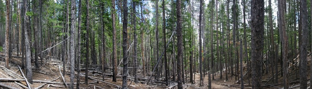
Here, there are no signs of fire in the last century. Hiking up the trail I didn’t notice it, but on the way down you can see that all the dead trees are lined up in the same direction. Why are all the dead trees lined up so nicely?

This area was greatly affected by beetle kill quite a while ago. It was one of the first places I recall seeing beetle-kill forest. The beetles burrow into mature trees, all with trunks at least ten inches in diameter. So all the big trees die, but beetle-kill trees take a while to fall over. They go from reddish-brown to gray and finally get knocked over randomly by wind or snow over the years. And they’d fall over in all sorts of directions.

I think this area was hit by a microburst. Two or three or four minutes of very high winds. Even live trees can’t stand up to the force; this dead forest never had a chance. Any creature unfortunate to be in the area was unlikely to survive. The dead trees are so densely packed, that getting through this area without a trail would be impossible. You just can’t bushwhack through it, you’d have to detour. Truly impassable without a trail.

Because the deadfall was so dense, I couldn’t see too many stumps. But I don’t think there were as many stumps as trees. Most of the trunks looked to be snapped off at the roots.

The next trail junction is the Willow Lake trail. Here the trail starts climbing steadily and relentlessly. It’s not terribly steep, but it goes on and on at a constant rate. On the way down, even knowing how long it went on, I was surprised at how long it went on. Above the top of this grade, though, the trail mellows considerably, climbing no more than two hundred feet a mile (with one exception).

After the big climb, the trail traverses a steep valley wall and reaches the final trail junction of the hike: the Salmon Lake trail. My plan is to visit both Salmon Lake and Upper Willow Lake (and lay eyes on the other various Willow Lakes). By my reckoning, it’s 5.8 miles to Upper Willow Lake with a one-mile round-trip side trip to Salmon for a total of 12.6 miles and maybe 2,800 vertical feet.

I would do Upper Willow Lake first, and if I didn’t feel like doing Salmon it would be a good excuse to come back. Alternatively, it would make a good single-night backpacking trip.

Continuing toward Upper Willow Lake after the Salmon junction, the forest thins again, revealing the dramatic faces of the mountains and ridges containing the valley: the flank of Red Peak to the south, Capricorn, Gemini Twins, and Sagittarius to the west, and East Thorn to the north. The trail meanders along a stream and among and along four or five lakes and ponds before reaching its final destination.

I stayed at the upper lake for forty-five minutes. I had my picnic lunch first. Instead, I should have taken a bunch of pictures first. By the time I was done eating, the few puffy clouds of earlier had grown big and gray. So it goes. After lunch, I explored for a few minutes before heading back down.

Back at the junction, still feeling fresh, I headed up to Salmon Lake. This is the exception to the generally mellow nature of the trail above the big climb. Here we are on a section reminiscent of the big climb. It is mercifully shorter, but at first seems almost malicious: we have climbed a hundred feet or more above Salmon Lake.

  • hiking trail with pyramids of beetle-kill
  • view of East Thorn mountain
  • two 14ers in the distance
  • one of the several Willow Lakes
  • one of the several Willow Lakes
  • Upper Willow Lake
  • Upper Willow Lake and Zodiac Ridge
  • Dillon Lake and dam in teh distance
  • first glimpse of Salmon Lake
  • Salmon Lake

Salmon Lake, I think, is not as scenic as Upper Willow Lake. True, that’s not a low bar. The trail skirts north of the lake, avoiding a giant boulder field, dumping the hiker at the willow-choked western end. Half, or more, of the shore is talus.

By counting the number of hikers I encountered all day, I doubt the parking lot ever filled up. There were only two cars there in addition to mine when I got back to the trailhead. I didn’t meet more than a dozen hikers and backpackers.

On the hike out, I got sprinkled on a bit, just enough for me to put the raincoat on. There was a thunderstorm across the valley to the east, the thunder distinct but not nearby. I got a big dose of the solitude I enjoy. Not a bad way to spend the day.

Due to the generally sparse forest for much of the hike, the views are above average. There’s only one section of trail I found difficult. It’s certainly worthy of a return visit.

Timetable

Not an out-and-back, this hike was a Y. The stem is the base of the Y.

Hike InHike Out
Stem
Trailhead7:32 am4:54 pm
North Willow Creek jct7:50 am4:36 pm
Three Peaks jct8:06 am4:18 pm
ENW Boundary8:09 am4:15 pm
Gore Range jct8:16 am4:06 pm
Maryland Creek jct9:08 am3:03 pm
Salmon Lake jct10:13 am2:02 pm
Upper Willow Lake
Salmon Lake jct10:13 am12:55 pm
Upper Willow Lake11:13 am11:59 am
Salmon Lake
Salmon Lake jct12:55 pm2:02 pm
Salmon Lake1:15 pm1:45 pm

A few more photos are available here and here.

Clayton Lake

Imagine your left hand, palm up. The hikes in the James Peak Wilderness correspond roughly to your fingers: Rogers Pass Lake and Heart Lake would be on your thumb and Lower and Upper Forest Lakes your pinky. Clayton Lake, then, as well as the two Iceberg Lakes, would correspond to your index finger.

Back before James Peak Wilderness became part of the National Wilderness Preservation System in 2002, there were trails serving the lakes on each of your fingers. The trail to Clayton Lake, though, was “abandoned” about thirty years ago. (The trail to Arapaho Lakes was similarly abandoned a bit more recently.) According to various online resources, though, the trail still gets quite a bit of use. All these sources say the same thing: just follow the creek straight up the hill. Descriptions of this former trail are all very similar: “The creek and trail funnel through a rock-bound gulch with little room to maneuver.” “That last part was pretty hard but really cool.” “There is a section that is a bit of a steep scramble. Used my hands quite a bit through that section.” And there’s this one: “I read all the comments and they said ‘Itโ€™s hard to see the trail as itโ€™s not maintained.’ No, the trail just completely doesnโ€™t exist at all. I attempted and got completely lost. It was quite scary and will never do it again.”

A couple of summers ago, I ran into a volunteer and quizzed him about reaching Clayton Lake. He suggested that it’s easier to get there by going up the Crater Lakes trail to about 9400′ or 9500′ elevation, then striking cross-country from there. On my hike to Crater Lakes a bit after that discussion had me thinking I knew where I should leave the trail. But it’s an inexact science. Satellite photos aren’t much help, as the area is fairly thick forest. But it does seem that this route avoids climbing straight up a steep slope. I was willing to give it a shot.

Ideally, I’d like to reach the two Iceberg Lakes as well, but I’m not confident I can do all three on a day hike. If I can’t collect the Icebergs in a day hike, I’ll need to backpack in and spend a night. I’m not confident that the “straight up the stream” route, including “steep scrambles” is something I want to try with a full pack. Perhaps the volunteer’s route is better suited. Well, there’s one way to find out.

Monday, July 10

I arrived at the trailhead parking lot at about 8 am. The road is in good shape right now and is set to improve as it is currently being graded. It’s about eleven miles of dirt road to reach the parking lot, but anything short of a low-slung sports car should have no trouble navigating it. I was a bit surprised to see only about a dozen cars in the lot, maybe half of which belong to backpackers not yet back from their destinations.

At the trailhead, there used to be a sign-in sheet where all hikers were expected to list the date, number in the group, their destination, and how long they’d be on the trail. This logbook is no longer there; at least it wasn’t there today.

It took me an hour and ten minutes to reach the trail to Crater Lakes. I hiked up this trail for about forty-five minutes, periodically checking the elevation with my phone. I was at more or less the correct elevation, I figured, so off the trail I went. Going was fairly easy at first, not too much deadfall and the terrain I was crossing was fairly level.

My plan was to avoid making any steep climbs, heading west or southwest and climbing as I went. Before long, I came across a small stream. I wasn’t expecting to reach water until I got to the stream that is the outlet from Clayton Lake, but it didn’t seem like this stream (actually three or four small streams braiding their way down the slope) carried enough water to be Clayton’s outlet. Nonetheless, I headed uphill following the stream.

The forest here was getting more difficult to traverse, getting steeper and having more fallen trees. I crossed the stream half a dozen times as I climbed, always searching for the easiest route. At one point, I climbed a bit where I knew I’d have difficulty going down. I try to avoid going up slopes I think will cause me difficulty when going down, but I figured (if I managed to retrace my steps) that I could make a small detour if need be.

After following the stream for a while, I found the source of my little stream. I was standing at the edge of a marshy meadow. Rather than slog my way across it, risking wet feet, I skirted the meadow. On the other side of the meadow, I found a grassy ramp, somewhat steep, that climbed alongside giant granite slabs. Above me looked to be the low spot of a saddle. Perhaps I was getting close to the lake.

Topping this slope I found myself back in the woods. With the ground much more level, the walking was easy again. I kept climbing, always looking to find the low spot on the saddle. Continuing west or southwest, I expected to come across the outlet stream eventually. Passing through a small band of trees, I found myself on another grassy slope, walking slightly downhill, and could now see the lake. I had arrived on the northern shore of Clayton Lake.

The lake is mostly surrounded by forest. I’m a big fan of finding a nice rock to sit on for my picnic. Ideally, said rock would be in the sun, out of the wind, and close to the water. In search of such a rock, I worked my way around to the outlet. There’s still quite a bit of snow here and I easily crossed a snowdrift that hid the outlet. I saw no sign of the old trail, but there was a social trail that edged the north shore. Finding mostly snow on the south shore, I abandoned my search in this direction and doubled back.

From the time I left the Crater Lakes trail until I returned to the trail about three hours later, the only sign I saw of any other person was a boot print in the mud on the little social trail that skirted the north shore.

I wandered the north shore for about fifteen minutes before I found my picnic rock, considerably farther from the water than I wanted to be, but so it goes. Just before I got off the Crater Lakes trail, I met a couple of backpackers on their way back to the trailhead. I asked if they’d seen any game. “Just mosquitoes!” Mosquitoes aren’t big game, but even on my picnic rock, out of the trees and in a light breeze, mosquitoes buzzed me constantly. I’d sprayed some mosquito repellent on me back at the car, so I was happy that it seemed to still be working. They buzzed, but they never landed.

After relaxing for a bit more than half an hour, I started to retrace my steps back down the mountain. I’ve found that route finding is easier on the way down than on the way up: the value of the high ground. I quickly found a game trail. A few yards down the trail, I felt that I should have been heading more to my left, but I stayed on this game trail for a bit longer. It seemed to be well-traveled, punctuated as it was with pellets. Before long, I decided to backtrack, forgoing the trail for the untracked ramp I climbed earlier.

Back at the marshy meadow that was the source of the small stream I followed uphill for a while this morning, I managed to find another game trail. At no time on my climb to Clayton Lake did I find a game trail, but from this trail I found just below my marshy meadow all the way back to the Crater Lakes trail, I managed to go from one game trail to another.

My experience with game trails is that they’re nice when they’re nice, but they often stop being nice in the most inconvenient places. Today, every time deadfall blocked the trail, I was able to find its continuance a few yards later. Game trails generally aren’t singular things: they’re all part of a network. From the marshy meadow back to the trail, whenever there was a choice of direction, I kept to the left and downhill. I figured I couldn’t go too far left – I’d eventually reach the Crater Lakes trail. My only concern was not finding myself at the top of some rock outcrop that I couldn’t get down.

These game trails kept me out of trouble: I’m pretty sure the deer and elk aren’t interested in getting stuck on some random outcrop and they don’t want to go up or down anything too steep. As I said, this game trail took me right to the Crater Lakes trail. I made a note of where it is. On the hike up the Crater Lakes trail, there’s a large coil of cable just off the trail. I have no idea why it’s there, but it’s been there for years. I figure my game trail is something like three hundred yards past the cable, very near a large sawn tree trunk. [Edit 07/20/2025: the coil of cable has been removed during recent trail maintenance.]

Given that my route back from Clayton Lake was so easy, I think I’ll return on a backpacking trip. Even having found this easy route, I think Iceberg Lakes are too far for me to reach on a day hike. Hiking cross-country with no trail is a lot more time-consuming and more strenuous. But I’m confident I can backpack up this route and by spending one night at Clayton Lake, I should be able to collect both Iceberg Lakes.

When I’m hiking on a trail, my mind often goes into auto-pilot mode. I just keep putting one foot in front of the other until I get to some navigation point. My feet stay on the trail, but my mind wanders. Bushwacking, though, is another story. My mind is intensely focused on the task at hand. Bushwacking is a bit like solving a maze that has more than one solution. At any given point, I’m looking for where I should go next. How do I get around this jumble of deadfall? I want to go there, but what’s the best way? Once I get there, where do I go next? My mind does not wander. I’m not thinking about some TV show, I don’t have some song earworming into my brain, I’m not bothered by what some idiot said on the internet, and I’m not worrying about rent, or debt, or thinking about what I might do tomorrow. I’m in the here and now, completely focused on the moment. It is glorious.

LocationUpDown
Trailhead8:10 am2:30 pm
Forest Lake jct8:46 am1:57 pm
Crater Lake jct9:20 am1:27 pm
Left trail/returned to trail9:54 am12:43 pm
Clayton Lake11:00 am11:57 am