Monday, August 31
For this week’s hike, I managed to overcome my compulsion to visit a lake I’ve never been to before and returned to Timber Lake.
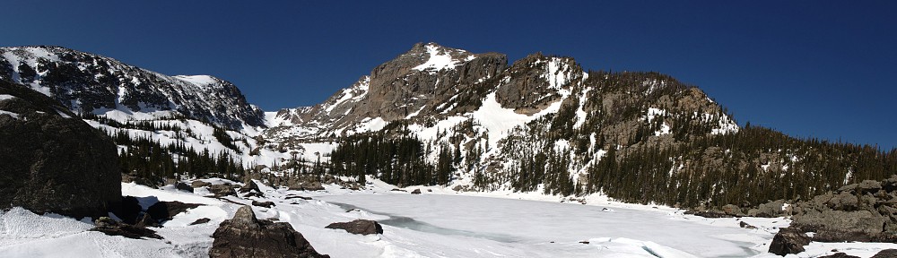
Timber Lake, with a surface area of about seven acres, sits in the morning’s shadow of Mt. Ida at a little over 11,000′ elevation. I was last here back in 2015. I gave a pretty good description of the trail then, so won’t repeat it.
The trail is your basic forest trail. Signs along the trail say the lake is 4.4 miles from the trailhead, but Caltopo maps reckons it at 5 miles. There aren’t any outstanding views on the way to the lake. My wife would probably describe it as “just another trail to just another lake.”
There is one outstanding feature of this trail, though. That’s the landslide area. The landslide happened during the 2013 floods. Locals will recall that just about every road into the mountains between I-70 and the Wyoming border was washed out. At the same time, there was a massive landslide on Twin Sisters.
When I hiked here in 2015, the landslide area was closed off – signs and orange tape directing hikers to detour above the slide. Now, there’s just a warning sign on each side of the slide area. The detour is still obvious on the west side of the slide, but I didn’t spot it on the east side. Judging from the state of the trail (not grown over at all, and with fresh boot prints), I’d guess very few people take the detour. The warning signs urge caution whether you cross the slide area or detour above it.
The slide area isn’t as big as I thought it was when I was here before. I counted 135 paces between the two signs, and only about two-thirds of that distance is the slide itself. The slide on Twin Sisters is an order of magnitude larger.
Erosion isn’t a topic I discuss very often with other folks. I suspect most people think of it as how rivers and streams wear away mountains. That’s true to a point, but it takes the normal flow of water (and wind) a very long time to effect change. That sort of erosion is ubiquitous, inexorable, and slow. Floods, like those in this area in 2013, or those like the failure of the Lawn Lake dam, or the slide in Chaos Canyon that turned the water of Lake Haiyaha turquoise, make the big changes. A flood can move a 50-ton boulder downstream a mile, or shift a mountainside. It is these catastrophic events that change the landscape.
My brother-in-law gave me a little emergency kit ages ago. I’ve carried it with me on day hikes and backpacking trips ever since. I’ve never used it until today. It fits in an Altoids tin. One might ask how much you can get in such a small package. My question is how Greg managed to fit everything into the tin. (It includes bandages, antibiotic ointment, matches, a razor blade, a compass, a length of cord, one of those Mylar thermal blankets, and a bunch more.)
I met a couple of hikers at the landslide area. One had slipped and bloodied a finger. He asked if I had a Band-Aid. As a matter of fact, I do! I dug to the bottom of my pack, retrieved the Altoids tin, and opened it. Naturally, the Band-Aids were at the bottom, so I had to take everything out to get to them. And, naturally, I was unable to repack the tin. It was like the tin was Dr. Who’s TARDIS – bigger inside than outside – until I tried to refill it. Evidently, Greg found the only way to pack this real-life 3-D Tetris game.
It took me a bit less than three hours to reach the lake. The weather was cool – I wore my jacket nearly all day – and the forecast was for rain starting mid-afternoon. In the end, it never did rain, and it warmed up enough in the afternoon for me to finally pack my jacket.
The two hikers I met in the landslide never did make it to the lake. I met another pair of hikers before I reached the lake. They asked if I’d seen any moose. They said they encountered a cow and calf on their hike in. I had seen the tracks, but not the animals that made them. I saw no big game all day.
One other hiker did arrive at the lake while I was there, and the only other hikers I ran into were on their way to check out the landslide area. I didn’t realize it was well enough known to be an attraction on its own.


A few yards Southwest of Timber Lake are two unnamed ponds, which I’m calling North Timber Pond and South Timber Pond. They’re scenic in their own right, and if you’ve made the effort to visit Timber Lake, they’re worth the extra few minutes. I suspect they don’t see very many visitors, as I didn’t spot any social trails leading to them.
On the hike out, I made a stop at one of the campsites on the trail. There are four. From closest to the trailhead to closest to the lake, they are Timber Creek, Jackstraw, Rockslide, and Snowbird. I checked out Rockslide. It’s a very nice camp. It’s only about a ten-minute hike to the lake, and ten or twelve minutes the other way there’s a privy (close to Jackstraw campsite). If I were ever to want to camp in the area, I’d stay here.
Timber Lake is worth a visit. It’s not a difficult hike, it affords some solitude, and the landslide area may be of interest.
| Location | Time |
|---|---|
| Trailhead | 8:54 am |
| Timber Creek campsite | 10:36 am |
| Jackstraw campsite | 11:15 am |
| Rockslide campsite | 11:30 am |
| Snowbird campsite | 11:35 am |
| Timber Lake | 11:41 am |