Portland Trip: Time Lapse and Timed Laps

It seems like it’s taken forever, but it’s been only (only?) four weeks. Perhaps I took the wrong path, but I wanted to post all the videos in one shot. And here it is.

Deschutes River

The skies were a clear blue for almost the entire float down the river, so if I wanted to do a time lapse I’d have to get creative. Mark suggested that it might be interesting to see the shadows move on the canyon wall, which I thought was worth a try. The challenge was in the timing. I didn’t know if the movement of the shadows of the rocks would be interesting, so I wanted to also get the shadow of the opposite wall climbing to the sky as the sun set. If I started too early, I’d run out of memory on the SD card. If I started too late, I’d only get part of the picture.

I’m pleased with the result. I did have a technical glitch, though. After a while I noticed that the camera was no longer shooting. The display showed Err: 999, whatever that is. I turned it off and back on and kept an eagle eye on it in case it happened again. It did, but the second time I caught it pretty quickly. So there’s only one significant discontinuity.

The Ridge

For some reason, I can’t get DashWare to use the location data for these sessions. It’s in the file but no joy with the software. That had the side effect of making it very difficult to sync with the video. Because I expect to run faster laps at the end of the day, I save my favorite angle for last – topless center mount.

Portland International Raceway

At PIR, when I launched RaceChrono it gave me a message that my demo copy had expired and telemetry would only last five minutes. But DashWare handled the position data this time, so the map is back and it was easy to sync but no RPM or throttle data. At PIR I had a carried a passenger for my final final session. I think I was driving better, finally putting two and three turns together each lap. Not my fastest time, though – the passenger is nearly a ten percent weight disadvantage.

Oregon Raceway Park

Clearly, I have a setup issue. The telemetry from the OBD-II is working but the position isn’t working. Perhaps it’s a metadata issue. I’d have liked to been able to make two videos for the ORP day, one for each direction. Good data and video from the morning. In the afternoon the lap counter wasn’t working for two sessions and I forgot to start the camera on the third. So it’s just the counter-clockwise lap.

I’m trying to figure out how to make DashWare work. I don’t like the green gauges, but I’m sure I’ll try a lot of things I may not like. I’d like to have the RPM gauge indicate the second cam.

Mt. Hood

Nice clouds on this one. Almost looked like the volcano was steaming at one point. Both cameras pretty much had no choice but to film the same thing, and placement problems for the GoPro to boot.
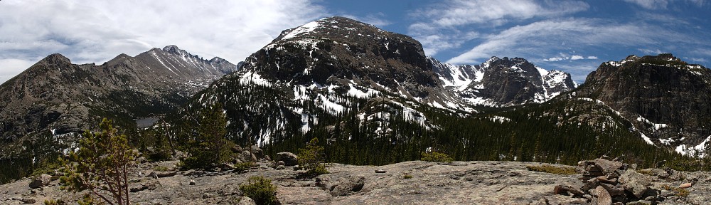
Grand Tetons

I like the way this one came out, in spite of the exposure issues.

Portland Trip: Day 15 – Grand Tetons

September 6, 2014

As has been standard operating procedure on this trip, I was up early, had breakfast at the motel, and got a sandwich to carry for lunch. I fueled up and was on the road, Idaho route 33, by seven. The first notable terrain feature is the sight of the Grand Tetons from the west side, near Driggs. The range as a whole looks like a giant set of teeth, and one of them looks like a giant shark’s fin. I probably should have stopped and tried to get a picture, but I was looking pretty much directly into the sun so I didn’t figure I’d get one to come out.

ID 33 continues south from Driggs before turning southeast to the foot of Teton pass. Now in Wyoming, the route is designated WY 22, but it’s the same road. This is easily the steepest pass of my trip, and one of the steepest passes I’ve ever crossed. It’s a 10% grade both sides, with many hairpin turns. At the foot of the pass on the eastern side, we cross the Snake River, circle East Gros Ventre Butte, rejoin our old friend US 26 and wind through Jackson, Wyoming.

IMG_7459s

Rolling north towards the park, Jackson Hole Airport is on the left. I missed the Fed’s Economic Policy Symposium at Jackson by a couple weeks, but there’s no shortage of expensive hardware operating here. A sleek Gulfstream was landing as I drove past.

IMG_7462_stitch_crop_resize

After entering the park (and crossing the Snake again), I stopped at the visitor center. I had been asking for hiking recommendations for some time. One suggestion was Phelps Lake, but I ended up deciding on starting at String Lake and going north past Leigh Lake and Bearpaw Lake to Trapper Lake. I found an idle ranger standing by a large map.

“Any reports of bear activity on the trail to Trapper Lake?”

“I’ve never seen a bear there.”

“Do you suppose I’ll be able to find somebody to hike with at the trailhead?”

“Who knows? Take your bear spray, make lots of noise, sing. If you’re a bad singer, all the better.”

That wasn’t very helpful. He’s never seen a bear there, but is that never on three hikes or never on thirty hikes? As it turns out, that’s a very heavily travelled trail. I don’t think I went 5 minutes without seeing other hikers, and that was before the trail got crowded. By the time I headed back to the car it was pretty much a conga-line hike.

The weather was gorgeous – a clear, cloudless day, calm and not too warm. The trail runs south to north along the shores of String Lake and Leigh Lake, so there’s no vertical component to speak of. I did take one of the trails that head up the valleys to the west hoping to get to an overlook but turned around before long without success. As I got toward the northern end of Leigh Lake I decided to go no further. The views were going from awesome to somewhat less awesome the farther north I went.

The sky was still cloudless but I set up the GoPro anyway. An occasional wisp would form over Mt. St. John and Grand Teton, but they disappeared very quickly. I hung out on the beach here for forty minutes or so, ate my lunch (the sandwich squashed, now resembling flatbread) and watched the boaters and kayakers on the lake.

My original plan was to hang out here most of the day, then head to a motel in Riverton for an easy day’s drive home tomorrow. Sitting on the beach I started pondering my options. If I left by two, I could probably be home by midnight. Or, I could drive through Yellowstone and see the sights. Having lounged by Leigh Lake for a sufficient time, I headed back toward the car.

Back near the parking lot, where there’s a nice view to the southwest, cloud action had improved over Grand Teton. I decided to sit there for another spell and got both cameras running. Here the trail was about fifteen feet from the shore of String Lake. The SLR clicking off a shot every two seconds caught the attention of most passersby, so I chatted with quite a few hikers. One was a wildlife photographer who had recently retired. We discussed 500mm lenses and I explained my process for shooting time lapse.

Several mentioned that the road to Old Faithful is closed and the traffic in Yellowstone is very bad. I mentally crossed off one of my options. I was wearing my Broncos cap, so another topic of conversation with folks was football. A Seahawks fan gave me grief, and a 49ers fan vowed that the Seahawks wouldn’t win their division. Even with letting the cameras run a good, long time I ended up back at the car a few minutes after two. Having eliminated Yellowstone as an option, I headed toward Riverton.