Portland Trip: Day 5 – Maupin to Shelton

August 27, 2014

Had lunch at the café with Mark before I hit the road.

Going north from Maupin on US 197, Mt. Hood dominates the view at first. Then the Oregon high desert transitions to straw colored rolling hills. Before long I reach the Dalles and the Columbia River.

I fuel up here. It’s still Oregon, so still full service. I get the atlas out and ask the attendant about the route I want to take. “Yes, that road is open. Very scenic. But it’s dirt, at least it was last week when I was on it.” So, to Plan B: through the Pinchot forest and the east side of Mt. St. Helens. I cross the river and head west on WA 14 – the Lewis and Clark Highway.

On the river I managed to fill up the SLR’s memory card. Completely full, can’t take another picture. I find a rest stop with the idea of firing up the laptop and transferring all the photos to my external hard drive. However, technology is my enemy today. Microsoft has all of a sudden decided my copy of Windows 7 is not authentic and won’t let me boot up. No photos for the rest of the day, and I’m left considering where to buy additional cards for both cameras.

My atlas shows the town of Carson at the junction where I want to turn. I note while writing this that Carson isn’t significant enough to merit appearing on Google maps. I head north here on a road with no identifying route number.

It’s an interesting route. Deep in dense forest, at times it’s like a tunnel – the branches arch over the road. It also smells quite like a lumber yard. I’ve been in many forests before, but never with such a powerful pine smell. The road twists and turns as it climbs, so it’s quite fun. After a while, though, there is a significant amount of road damage. In places, half or two thirds of the road has subsided six or eight inches for twenty or thirty yards. Nasty bumps in a low-slung car.

Being that the road is so poorly marked, I make an occasional navigational error but I’m never side tracked for long. After a while, I finally get to a gap in this dense forest and have momentary glimpses of Mt. St. Helens. The sun is starting to get lower in the late afternoon sky, making lighting conditions difficult – dark shade broken by bright sunlight right in my face. The road turns north again, toward Randall, and the difficult conditions are done. The last twenty or so miles to Randall the road is in rough shape again, so caution is warranted.

2014-08-27 17.28.42s

My only photo of Mt St Helens – taken with the phone

Arriving in Randall at dinner time, I hit the Mt. Adams Café. There I chat with the proprietor. He’s a muscle car guy and very interested in the car. While I’m showing him the car, somebody pulls up at the stop sign.

“Is it fast?”

“No,” I answer sarcastically.

“Like a Honda Accord?”

“More like a Toyota.”

After this interlude, I’m headed west on US 12, again with the low sun in my face. About fifty miles later I’m on I-5 headed north to a junction with US 101 and the final few miles to Shelton. I arrive at the motel parking lot a few minutes after sunset. This motel is only a few miles from the track, so I’m not surprised to see three Porsches there as well.

I manage to get the laptop booted up in safe mode. I didn’t think I’d be able to connect any devices in safe mode, but it lets me copy all the photos and videos onto the external hard drive.

Portland Trip: Days 3-5 – Deschutes River

August 25-27, 2014

I spent the night in one of the cabins at the Oasis and had breakfast in the café. We were packed up and ready to go by nine. Before long we were at the river. We put in at Warm Springs. I stood around watching as Mark did all the work. This was to be a recurring theme for the trip.

Mark has been a fishing guide and outfitter on the Deschutes for eighteen years. Everybody on the river knows him and he knows everybody. Although this was a “simple camping trip” where I could relax and enjoy the ride, I think I got a good glimpse into what Mark does for a living. He has all the gear required to provide his clients a fair amount of luxury while they flog the water. For this trip, he brought only a small amount – stove with fuel, three days food and water, chairs, cots, sleeping bags, dry bags with personal items, and a cooler full of beer.

IMG_3853_stitch_crop_resize

First picture on the river

I’m not sure what time we put into the river. I powered off my phone before stepping into the boat and didn’t turn it back on for three days. I slathered on the sunscreen, sat back and relaxed as we started our trip. There seemed to me to be quite a few folks fishing. Mark greeted them all: “We’re not fishing. Just floating, having fun.”

IMG_3893sThis was not a white water adventure. We would have only one rapids I’d call whitewater; only that one spot where we had to don our life jackets and put the camera into the dry bag. There were some ripples on the water every so often where we might get splashed a bit, but nothing big.

My attention was drawn first to the geology. The canyon walls are basalt, formed from myriad hexagonal cylinders that stand nearly vertical. The basalt was deposited in several layers. Different layers have different diameters of these “cylinders”. As the walls erode, the cylinders break into rocks that pile up and soil goes on top of the piles. They’re not quite vertical; lean somewhat to the west such that the eastern walls tended to be steeper while the western walls were more sloped. Sometimes the canyon was pretty narrow, other times quite wide.

IMG_3857s

Detail of hexagonal construction of the walls. The hexagons are different sizes in different layers.

The geology, once noted, generally didn’t focus much of my attention. The wildlife, however, did. Over the three days, we saw ducks and geese, kingfishers, ravens, and crows. Wild horses on the reservation side, deer on our side (and in camp in the morning). Lizards and snakes. The ubiquitous ground squirrels. And one morning I awoke to find what I thought were raccoon tracks. Mark had neglected to secure the cooler and the trash, but our visitor molested neither.

IMG_3869s

Osprey in stationary flight, hunting for fish below.

But it was the ospreys that I spent the most time watching. We didn’t float too long – we probably could have floated the entire distance in a single day – and by early afternoon had pulled into Hobo to make camp. While Mark took a nap, I found a spot in the somewhat limited shade of a dead tree. An osprey would station herself above the river, flying in place, hunting trout below. Then she’d fly to a high branch in an evergreen. I wondered if she was resting or still hunting. Before long I had my answer – she took flight and dove to the water. She aborted this dive, flew low above the river and returned to her perch.

IMG_3889sI must have watched this three hours or so. She did dive into the water once while I watched but came up empty handed (taloned?). It was about this time I regretted not bringing my longer lens. Throughout the trip I saw other ospreys hunt the same way. I saw them dive into the water several times and at least twice I saw birds carrying trout to their nests but never saw the kill itself.

Early on, there was a fair amount of company on the river. We passed several guys fishing and saw their gear being taken ahead of them to their campsite. A number of privateer groups floated by on rafts as well. There were more folks on the river the first day than the second. I enjoyed the solitude.

IMG_3864s

This guy is on camp duty. He goes ahead of the guides and sets up camp while the clients fish.

We slept in sleeping bags on cots outside under the stars. Mark had tarps with us should it rain, but with the exception of a couple hours that first afternoon we had beautiful blue cloudless skies. Being a city boy, I rarely get to see the Milky Way. We sat drinking beer watching the stars come out. Saw a few satellites and identified the flight path the airliners took, probably from Seattle to SF or LA.

IMG_3891s

Explosives Dangerous

IMG_3880s

Private Crossing

I started the second day a bit earlier than I anticipated. I awoke perhaps an hour before dawn and watched the reverse process of the night before – the stars fading one after another as the skies lightened and dawn broke. Once it was light enough to walk, I found my way to the railroad tracks and followed them upstream a bit. In camp, I found a pile of railroad spikes. Here at the tracks, I couldn’t help but notice how many spikes were missing from the ties. I was reassured the next day to find a section of track where the old wooden ties had been replace with new concrete ones.

After Mark cooked a hearty breakfast (and cleaned up and packed up and loaded the boat while I watched), we resumed our float. There’s no shade on the boat and the sun was quite warm. I was just about to ask if we could pull over for some lunch and some shade when we approached a railroad bridge over the river. Above here, the trains ran on the east bank; below us they would run on the west. Just after passing under the bridge, Mark pulled us onto a nice beach. We had arrived at Northern Junction.

IMG_3881_stitch_crop_resize

Early morning pano above Hobo camp.

Mark’s original idea was just to grab lunch and shade. We took only a few things out of the boat. If any outfitters arrived, we’d pack up and head to a camp a bit downstream. Today, though, there was very little traffic on the river. One group of privateers asked “Any room at the inn?” but by then inertia had set in and we weren’t about to move. Mark said the other two sites here were available but they continued downstream.

IMG_3933_stitch_crop_resize

The Beach at Northern Junction pano

Only three or four trains a day run on these tracks. This afternoon, maintenance teams were out. Two trucks passed north to south, a pickup truck and a larger truck. A short time later they headed back the way they came. I really have no idea what these guys do, but it was interesting seeing them pass by.

IMG_3927s

Service truck and raft

With no clouds, I had nearly resigned myself to not shooting a time lapse on this trip. Mark made the suggestion I try to get the shadows moving on the canyon walls. The rocks directly above us were quite rugged and had lots of shadows. I set the SLR up somewhat before sunset and let it run. I let it go until the shadows from the other side of the canyon walked up the east wall.

IMG_3946s

Southbound Train

At dusk, we were visited by some bats. They flew up and down the shoreline, sometimes passing just a foot or three from our heads. When I went river rafting in high school, we would throw pebbles in the air when bats were close. They’d chase the pebble for a couple of instants before deciding they weren’t food. But, as I said, inertia had set in and I wasn’t that interested in messing with the bats.

IMG_3892sOur campsite had quite a bit more shade than the previous night. This was great for daylight but the extra shade limited the star-gazing somewhat. Mark set up his cot near the water while I picked a fairly open place above. I stayed awake as long as I could, watching the sky. A train awoke me sometime in the middle of the night. Mark had “warned” me that the trains put on quite a light show when they come through, but even so I wasn’t fully prepared. I think of locomotives having one headlight. This train had about a dozen, all very bright. As it came around a corner it lit the entire canyon wall before the next bend had it cast a cone of light on our campsite. Very cool.

The next morning I managed to sleep until nearly dawn. I rolled over onto my right side and saw a deer. She looked at me then bounded into the brush. I got dressed and headed upstream on the access road to a ridge with a trail that leads to the rocks high above our camp. I had no intention of going all the way; just far enough to get a nice view.

IMG_5929_stitch_crop_resize

Northern Junction early morning pano

From our campsite, we could see a flag flying on these high rocks. Mark tells me the guy who put it there also has a logbook there. Every year he sends Christmas cards to whoever signs the log. Given a couple extra hours of time in camp (and a pair of hiking boots), I’d have considered going up that far.

The highlight of our third morning on the river was White Horse rapids. This was the only time we had to don our life jackets and the only time I had the camera in a dry bag. Mark has been through this on the order of 150 times but he’s not complacent about it. He knows other seasoned outfitters who’ve flipped their boats here. Although he doesn’t need to get out of the boat and scout the rapids from the shore, we did get out so I could see what we were going through. He casually pointed out a couple of rocks: “That one’s ‘Can Opener’ and over there is ‘Oh Shit’.”

IMG_3908s

White Horse Rapids

Yesterday we saw a number of maintenance trucks running up and down the tracks. This morning we saw a maintenance train. I’ve lived within a mile of railroad tracks for the last eighteen years or so and never saw one of these.

IMG_5954s

Maintenance train

We were off the river by noon or so and quickly back to the Oasis for lunch. After eating, I reloaded the car and hit the road for points north – Shelton, WA and The Ridge Motorsports Park.

I had a fantastic time. Can’t wait for the chance to do it again. Next time I’ll be sure to take the telephoto lens.

I’m still putting together the time lapse video and will post it soon. In the mean time, here are a few more pictures.

IMG_3866s

Wild Horses

IMG_3897s

Osprey platform with perch

IMG_3898s

Geese

IMG_5944s

More wild horses

IMG_5945_stitch_crop_resize

Canyon wall pano

IMG_5957s

Layers

IMG_5937s

Portland Trip: Day 2 Diversion – Blue Basin

August 24, 2014

From Wikipedia:

After road-building made the [John Day] valley more accessible, settlers established farms, ranches, and a few small towns along the river and its tributaries. Paleontologists have been unearthing and studying the fossils in the region since 1864, when Thomas Condon, a missionary and amateur geologist, recognized their importance and made them known globally. Parts of the basin became a National Monument in 1975.

IMG_3819s

Sheep Rock from the parking lot of the Thomas Condon Paleontology Center

IMG_3847_stitch_crop_resize

Day River valley, looking northwest

IMG_3832s

Exhibit and “Fossil”

IMG_3834_stitch_crop_resize

Not quite a 360 degree panorama at the end of the trail

IMG_3846s

Blue Basin, from Overlook trail

IMG_3831s

Dried mud

IMG_3826_stitch_crop_resize

I hiked up the Island in Time Trail, which runs 1.3 miles from the parking lot to a cul-de-sac in the center of the Blue Basin. The canyon walls are a pale blue-green and appear to be quite soft. Getting off the trail is a no-no. There are exhibits and fossil replicas along the way, as well as thirteen metal bridges. In about the only shady spot on the hike, there’s a sign low to the ground pointing to the Blue Basin Overlook Trail, the other end being quite at the trailhead. I went about a half mile up this trail to get a higher angle view of the place.

This blue layer of earth is exposed throughout the valley. It’s at the base of Sheep Rock, a few miles south of Blue Basin, and you can see it to the north on the other side of the river. But it’s most striking here.

Portland Trip: Day 2 – Boise to Maupin

August 24, 2014

Having gotten so far ahead of schedule I didn’t hurry to get on the road. I was expecting to be able to grab a bagel for breakfast at the motel but my choices were toast, cereal, or waffles. Not even a banana. So I packed up the car and hit I-84 expecting to be able to find food and fuel at a single stop somewhere along the interstate before I needed to exit. I managed to get the fuel.

My first navigation point was the exit for US 26, again conjoined with US 20. There’s a wide variety of agriculture here – corn, beets, alfalfa, onions, and potatoes too, I expect. The road has a rhythm, cruise at 70, slow down for a town. Speed back up for a while, come to the next town.

I soon noticed that there were fewer road signs. The only speed limit signs were entering and exiting towns. And the highest speed was now 55 rather than the 65 on US highways the rest of the trip. There were also far fewer route markings. At one point found myself going due north for a while and I began to wonder if I’d made a wrong turn.

Farming transitioned to ranching as the valley narrowed. There were few trees, either along streambeds or on the tops of the hills. Traffic thinned out and towns were smaller and farther apart. The road transitioned, too. No longer straight, it began to climb and writhe like a snake.

We come to a crest and another transition. I would have called the crest a pass, but here they are marked by signs saying “summit”. It’s hardly a summit when you can see higher ground on both sides of you. The western side of this particular summit takes us back to terrain reminiscent of deserts of northern Arizona or southern California.

I was going my standard five over the limit when a big pickup caught up to me. He stayed behind me for quite a while. I kept thinking he’d go around, but he stayed behind me so long I figured he’d never pass. He took his time going by, which is not unusual on the interstate. Usually it’s because the passenger is taking a picture. Not this time – the gal in the passenger seat just politely waved as they went by.

After some miles of this desert we finally enter terrain that looked like the Oregon I’ve always imagined. The road snaked through fragrant pine covered hills. This is the Malheur National Forest, where we join the Journey Through Time Oregon Scenic Byway. This pleasant stretch lasted only thirty miles or so before exiting the trees and descending into the John Day valley opposite Strawberry Mtn. I decided the weather was pleasant enough to take off the top, so I took a short break at a scenic overlook and slathered on some SPF 3000.

IMG_3818s

Strawberry Mtn

The John Day valley is broad at the eastern end. The valley floor is free of trees that cover the hills on both sides.

As it was getting on noon by my stomach’s clock (an hour off the time my cell phone displayed) I stopped for lunch in the town of John Day. Entering town, the church parking lots were packed. One had somebody directing cars to parking spots. The business district was quiet. I spotted the Grubsteak Restaurant and parallel parked behind a motorcycle a couple doors from the place. I happened to park in front of a brew pub, but it was closed. Oh well. I had a tuna melt and iced tea. The radio gave us a fishing report and the cowboy show. I’ve heard the farm report many times in the past, but never the fishing report.

John Day was also my first refueling stop since entering Oregon. Having been here many times, I knew about the no self-service law. This station had handwritten signs: “Don’t touch the nozzle! By state law we have to pump it.” As usual, the car drew a crowd. One guy looked at the tow ring (which is yellow) and asked if it was my dipstick. That’s probably the best one yet.

The next navigation point is at the junction with state route 19 and into the John Day fossil beds. While the scenery has been pleasant through the valley, the road has been a bit on the dull side. Here the river drains through a narrow canyon. US 26 leaves the John Day river and continues west. We follow the river north.

After diversions to the visitor center and a short hike to Blue Basin, I continue north on SR 19. This is clearly a secondary road. The shoulders are narrow or non-existent. The road is not new, but is nearly unblemished. Best of all, it clings to the banks of the river, bobbing and weaving as the river bends to the west. This is a lovely Lotus road. Finally the car is in its natural element. I drive as fast as I want (which is not to be confused with as fast as I can).

At the junction with 207 we depart the John Jay river and once again head north. Although I’ve seen a number of cars going the other direction, I’ve only encountered one going my way, and that was just a few miles past Blue Basin. The road is generally a series of long curves, arcing this way and that. Occasionally there are short stretches that are quite twisty and nicely cambered. It doesn’t get much better than this.

At least, that’s what I was thinking. Then I made my left turn onto Oregon 218. Driving this road is like riding a bucking bronco. Up and up, switchbacks and sweepers. Over a summit and down into the next valley, writhing manically. I finally started running into more traffic. At least four cars over the next thirty miles, a regular traffic jam. But they were easily dispatched, disappear from the rear view mirror after only a turn or two.

At Antelope, I’m on the east side of a diamond I need to get to the west side of. Shall I head north or south? North has been working well, so that’s where I go. Again the road rollicks up and up, tight turns right and left and right again. Eventually the road drops onto a plain, the fun is over. Just before Shaniko the road drops through a ravine for one last spasm of fun.

Shaniko marks the return to the US highway system, US 97 this time. Back to straighter, more heavily trafficked road, this one with lots of trucks. But the treasures of the terrain continue as we enter the Deschutes River valley and see a series of mountains strung along the western horizon. Mt Jefferson and Mt Hood standing proudly above the rest, separated by squalls, rays of sun like stage flood lights.

IMG_3851s

Mt Jefferson (10, 497’)


A few miles later US 97 meets US 197 where we turn right for the final few miles to Maupin where the road drops fifteen hundred feet or more to a bridge over the Deschutes River. The Oasis, my destination for the day, is just before the bridge.

Today’s drive was far superior to yesterday’s. Lovely roads and incredible scenery. With food and fuel stops and a nice little hike in the middle, I covered 362 miles in 9 hours and 20 minutes, never felt pressed for time, and arrived in time for dinner and a beer.

Portland Trip: Day 1 Diversion – EBR I

August 24, 2014

The pamphlet for the self-guided tour of the EBR-I says:

On Dec. 20, 1951, EBR-I became the first power plant in the world to produce usable electricity unsing atomic energy. After that day until decommissioning in 1964, EBR-I generated enough electricity to supply all the power for its own building whenever the reactor operated.

The blocky reddish tan building sits alone, miles from anywhere. I imagine in 1951 it was forty miles from electricity. Essentially, the first breeder reactor had the output of a good, modern, diesel generator.

IMG_3814s

The EBR-I facility.

Caution! Door Sticks.

I expected at a place so remote to be the only visitor, but there were a couple other cars. Just passers by who stopped for a diversion on their road trip? Or did they plan to come here?

I’ll admit to a bit of concern over the radiation warnings plastered all over the place. It’s not every day you visit a national historical landmark with these things all over the place. Upon closer inspection, they have to do with working in the building.

The place hasn’t been upgraded to include any modern landmark amenities like a gift shop. I was looking forward to the opportunity to get a shirt that says “I visited EBR-I and all I got was a few rays!”

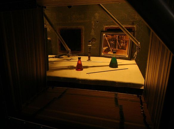
One of the interactive features of the place was the opportunity to try out the mechanical arms used to handle the fuel. The picture below is a view into the materials handling room. The arms visitors could try out were outside this, we wouldn’t want any amateurs knocking over the bottles of colored water. We’re looking through 34 layers of leaded glass.

IMG_3811s

I missed taking a picture of the fuel rods. They’re quite a bit smaller than I expected. Six pieces make up the rod assembly, each piece no thicker than a pencil. Around the corner from there is the rod farm where they stored the spent fuel rods.

IMG_3812sAnother exhibit I neglected to photograph was the recreation of the string of light bulbs that were illuminated when the thing was first turned on. They light four bulbs. The recreation has that early-50’s look to it, so I’m guessing it’s pretty accurate. The four bulbs combined were barely putting out enough light to read by. Nuclear power sure has come a long way.

Portland Trip: Day 1 – Denver to Boise

August 23, 2014

I packed the car last night. Everything went together just like in the dry run. But after I was in bed I thought of something I should bring that wasn’t on the list. Not just once but twice. Still, I managed not to think of taking a bagel out of the freezer for breakfast, but if that’s my biggest oversight I’ll be in good shape.

According to plan, I backed out of the garage promptly at 5:00am. Wanting to minimize my time on the Interstate, I got off I-25 at Ft. Collins and took US 287 to Laramie. The sun made its appearance about the same time I crossed the border into Wyoming. It was cloudy but not really overcast. The clouds were in layers, the lowest draping themselves over some of the hilltops.

I entered Laramie at about 7, looking for fuel and breakfast. I was pretty certain that if I went up the main drag I’d find somewhere to eat. There was nothing. I gassed up at the Safeway and ended up grabbing something at Wendy’s before getting on I-80. I sat at a window seat and watched people look at the car. She never fails to draw a crowd.

I’d have to say I’m pretty spoiled when it comes to scenic roads. So it should be understandable that I find the views along I-80 in Wyoming pretty boring. There’s really nothing interesting to look at until about Rock Springs where the geology changes a bit. To offset the boring scenery, or perhaps because of it, the speed limit is often 80. Typically, I’m happy going about 5 over the limit, so I ended up running most of the tank of gas at 85 or so. Instead of my expected 35mpg, I only got 28.

After fuel and restroom at mile 68, my route takes me off I-80 and onto US 30 at mile 66. Heading up US 30, there’s not a tree to be seen anywhere. The place is dense with oil production sites, all painted brown in an attempt to blend into the background. I’m amused that each has its own little solar panel. It’s a four lane highway much of the way through here. After a while, the oil production is gone, to be replaced by coal strip mines. They’re not really visible from the road, but a couple hillsides are nicely terraced, obviously reclaimed coal mines.

My next stop was in Cokeville for food. A couple miles out of town I saw a sign for a diner that looked promising. But when I came upon it, there were no cars in the parking lot. My first thought was “how good can they be if they don’t have any customers?” In retrospect that probably isn’t fair. Cokeville’s not a very big place. Instead, I grabbed a piece of pizza at the Pilot station. The pizza is from the convenience store – their restaurant is closed down. But it was actually a nice piece of pizza.

The weather had cleared up when I got on US 30, so I had some sun. But by here, the sky was filled with scattered clouds, some producing rain. I started going through these little squalls periodically. Never more than a few miles wide, they never caused me to turn the wipers on more than intermittent.

Before long, I was back on the super slab, northbound on I-15. The plan was to spend the night at Blackfoot for an early start with a quick stop at Craters of the Moon. This clearly would be suboptimal. I arrived in Blackfoot promptly at three. Way too early to bed down. So I fuelled up again, talked to three more guys about the car, and headed west on US 26.

In spite of the Snake River flowing through this valley, I find it very much like the San Luis valley. The native vegetation is much the same. It’s a bit denser here, and there is quite a bit more irrigated land than there.

I soon started seeing signs for the EBR-I Atomic Museum, a national heritage site. Miles from anywhere, I see a block shaped building a mile or so off the road. This is Experimental Breeder Reactor I. This was the first power plant in the world that produced usable electricity from atomic energy. This was Dec. 20, 1951. It was made a National Historic Landmark by LBJ in 1966.

The place was not at all what I expected, with the possible exception of the control room. Everything else was much smaller than I figured, although I can imagine the evolution from this early setup to something that would fit in a submarine. Very cool. And in spite of it being in the middle of nowhere, I was not the only visitor.

I spent about forty minutes there and when I returned to the car it was starting to rain again. By the time I got to Craters of the Moon, it was raining heavily. Perhaps I should have stopped at the visitor center anyway, but it was really coming down hard now and I had no idea how long it would last. So when a couple of bikers passed me, I let them get a bit ahead of me then matched their speed.

IMG_3815s

We had a nice little run, interrupted by some light traffic. They weren’t going that much faster than I’d have gone on my own but it was nice to pick up the pace a bit. Sometimes they went quite a bit faster than I expected, given the conditions. There was the occasional puddle of standing water. Again, the storm was fairly localized. Within twenty minutes we had gotten out from under it and the road was only damp.

This section of road around Craters of the Moon reminds me a lot of the area around Grants, New Mexico. The terrain, vegetation, and geology look quite similar to me. The lava here is blacker, perhaps, which makes me think it’s more recent.

US 20 and US 26 run the same route from Blackfoot past Craters of the Moon. Shortly after US 26 makes a right turn, the riders pulled over. I waved at them an continued. The weather had returned to the small, light squalls. I was back to my 5 mph over the limit. Traffic wasn’t heavy and slower cars were easy to pass.

Here I passed a red Honda. At least, I think it was a Honda. All identifying markings had been removed. It was red with black accents and darkly tinted windows. After I passed him, he matched my speed, following quite closely. Soon he downshifted and blazed by me at about 90, whereupon he slowed down again. I passed him a second time and he continued to follow me quite closely for quite a long time. He was being a bit of a butthead.

For the most part, both 20 and 26 were straight, flat roads. The valleys here are wide with flat bottoms. Sometimes the highway ran along the side thus twisting to and fro a bit. But long stretches were more centered in the valleys and the road has long straight stretches. Finally 26 started bending around the terrain, rising and falling. I ran into no traffic; my pleasure was uninterrupted. It was, however, short. I soon found myself at the junction with I-84.

Again the speed limit is 80, but here there is much more traffic than in Wyoming. The sky had cleared and I was feeling a bit warm for the first time today. I don’t think it was ever much over 60 all day, and often quite a bit cooler. But approaching Boise it was sunny and warm.

I pulled into the Kopper Kitchen at 7 for a Cobb salad and iced tea, found a cheap but clean motel and looking forward to a much easier day tomorrow than originally planned. I was happy to stop and see whatever sights I found along the way, which wasn’t much. With fuel and food breaks and a short museum visit, I was on the road 14 hours and covered 845 miles. Certainly more seat time than I planned, but it will allow for quite a bit of leisure tomorrow.

Much of today’s route was along segments of the Oregon Trail. I can only imagine the hardships involved in making this trek a century and a half ago. Pack up all your worldly belongings in a covered wagon, hitch up a team of oxen, and make your way through these inhospitable hundreds of miles taking a day to go as far as I go in ten or fifteen minutes.

Box Lake and Eagle Lake

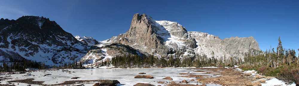
Saturday I hiked to Box Lake and Eagle Lake.

I was hoping to hit the trail by 7:30, but I got out of the house a few minutes late and had to stop for gas in Lyons. I was late enough I had to show my pass at the entrance and the rangers were directing traffic in the parking lot. Again I was parked in a small end spot right next to the trash cans and bathrooms.

“You were here last week, weren’t you?” No, it was three weeks ago. “Yeah, you were parked at the Finch Lake trailhead.” Turns out he used to own an Elise. A red one – he said everybody asked if it was a Ferrari.

He asked where I was headed and told me the bridge at Ouzel Falls is out. It didn’t matter to me; I take the campground shortcut anyway. He then told me a sow with two cubs has been hanging around Thunder Lake.

I wasn’t much behind schedule; hit the trail at 7:45. To get to Box Lake you must first get to Thunder Lake. The distance is 6.2 miles with a climb of only a tad over two thousand feet. The first stretch of trail follows the North St. Vrain. This part is heavily traveled in the afternoon with folks out to see Calypso Cascades. You arrive at the campground shortcut just before the trail crosses the river. The shortcut meets the Thunder Lake trail above the second river crossing and eliminates Calypso Cascades, Ouzel Falls, and six tenths of a mile.

With the exception of the campground shortcut, the trail is generally wide, seldom steep, and often free of rocks and roots, allowing for a faster pace. The next milestone is the junction with the Lion Lake trail. This is about halfway from the shortcut to Thunder Lake. Next are a couple of stream crossings and finally a short descent to the lake. Rather than the usual hitch rack there’s a corral.

Once at Thunder Lake, the idea is to cross the outlet, contour around the eastern buttress of Tanima Peak and ascend a gully to Box Lake. Foster warns “be careful not to get too high on the steep, cliff-ridden slopes.” From Box Lake, climb to the top of the next bench to reach Eagle Lake.

The streams are running quite high for mid-August, and Thunder Lake was spilling into the meadow on its eastern shore in several places. The water flows through the grass in a great swath. It’s possible to cross without going more than ankle deep, but only just.

Once across the outlet, there’s a faint trail. I didn’t spot it at first so I headed around the slope. I quickly found the trail. Long stretches of it aren’t so faint, but it does fade in and out in the grassier parts. I think that without a trail, I doubt I’d have gotten there. For the most part, the trail took the obvious route. But there were times when I’d have gone a different way if there was no trail.

Longs Peak and Mt. Meeker

The route alternates between forest and meadow. The meadows are vibrantly carpeted with blue, yellow, red, and white wildflowers. It was quite breezy at Thunder Lake, but here in the lee of Tanima Peak it is calm. The sun is shining brightly in a brilliant blue sky punctuated with the small, fast moving clouds so common here along the divide.

The trail dips a bit before reaching the gully. Here we climb through meadows bordered by granite. Water burbles down the slope, feeding the prolific flowers. There is a rich insect life here, as well. The mosquitoes were out in force. Every time I stopped I was swarmed by them.

Box Lake

Box Lake sits just over the top of the gulley. While it’s in a nice setting, the surrounding views are not dramatic. Eagle Lake is the true destination on this hike, and it’s just another quarter mile away. Climb another gully to the top of the next bench. Foster warns about “nasty krummholz” but the path I took it wasn’t a problem. There’s an unnamed pond here, bigger than I was expecting. It has a nice view of the valleys to the east. Continuing on over mostly bare rock, it was a simple matter of following cairns in a straight line to my destination.

Unnamed pond

Eagle Lake is fairly large. I sat on a rock above the lake with views of the Continental Divide over the lake to the west and Mt. Meeker and a sliver of Longs to the South. I set up the cameras then broke out my picnic lunch. It never ceases to amaze me how much better food tastes when I’m sitting by an alpine lake.

Eagle Lake

As is usual in these places, it was a bit breezy. I was looking forward to a breeze thinking it would minimize the mosquito situation. Unfortunately, the damn things managed to buzz around my head the whole time I was there. I don’t think I got bitten, but they sure were annoying.

After about forty minutes I started packing up. The weather was still quite nice. With all the moisture we’ve been having lately I was concerned a thunder shower would brew up, but there was never a threatening cloud.

There wasn’t much traffic on the trail in the morning. Near the trailhead I passed a group of six or eight guys loaded down with gear. Three runners passed me about a half hour apart and I chatted with a solo hiker on the shortcut section. On the way down I ran into people as soon as I returned to Thunder Lake.

Just after I passed the spur to the campsite, I encountered another group of heavily laden hikers. They were going to do Mt. Alice tomorrow, via Lake of Many Winds and Boulder-Grand Pass. It wasn’t until a few after we chatted that I realized this was the same group I passed first thing in the morning. Made me feel sort of good. I made it to Thunder Lake in two and a half hours and it took these guys half my age six. Of course, they had heavy packs, were only going as fast as their slowest guy, and for all I know they took a side trip to Lion Lake.

Pilot Mtn and Mount Alice from Thunder Lake

Shortly after talking to them I met another solo hiker refilling his water from a stream. He had hit the trail at five and spent most of the day above treeline. From Lion Lake he summited Mt Alice, Pilot Mtn, and Tanima Peak. Quite an ambitious hike. He probably beat me back to the parking lot by a half hour.

Timetable

 ThereBack
Trailhead07:45 AM04:25 PM
Shortcut (bottom)08:10 AM03:50 PM
Shortcut (top)08:50 AM03:05 PM
Lion Lake trail jct09:20 AM02:30 PM
Thunder Lake10:15 AM01:25 PM
Box Lake11:15 PM12:30 PM
Eagle Lake11:35 PM12:20 PM

Trip Preparation

My planned Portland trip is less than two weeks away. I first came up with this mad scheme back in January. Early on, I obsessed about it quite a bit. Now it’s getting close and I find myself back in obsession mode.

Here’s the quick rundown: spend two days driving to Maupin, OR. Take a three day trip down the Deschutes River. A track day at The Ridge Motorsports Park followed by a track day with Club Lotus Northwest at Portland International Raceway. Hike Mt. St. Helens. A third track day at Oregon Raceway Park. Hike Mt. Hood. Spend a few days in the office. One day on the road headed to either Yellowstone or the Grand Tetons. Hike there. Drive home.

That’s the plan.

Although there are some missing elements – I only know where I’m sleeping on eight of the fifteen nights – I’ve definitely moved from planning to preparation.

The car is nearly ready to go. I changed the oil today. I had the brakes flushed Friday, along with a couple minor repairs. I still need to clean the air filter.

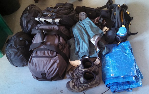
2014-08-10 18.22.54sI have a lot of kit to take. I feel a bit like Imelda Marcos, taking driving shoes, hiking boots, old shoes for the river trip, and a pair of sneakers. I have my fanny pack for hiking and my backpack full of work stuff and the laptop. I have helmets, driving suit and gloves, and tools for the track days. Cameras, tripods, connectors, chargers. Poncho, windbreaker, sunscreen. And, of course, clothes.

It’s a small car. I’ve been concerned it might not all fit. When I do track days, I have too much gear to take a passenger. But I’ll leave the five gallon gas can at home and won’t bring a lawn chair. Not as much gear when I hike, but still a non-trivial pile of stuff. Neither of those requires me to pack ten days of clothes and my work backpack. I wonder if I need a TARDIS to fit it all.

2014-08-10 18.32.30s

This evening Genae helped do a dry run.

2014-08-10 18.31.52sAmazingly, everything fit. Note that I had the top in the drivers seat. I’ll start with the top on and when it’s nice enough to go topless, it will have to ride in the passenger seat. And I’ll need to make sure some items are handy, but I’m pleasantly surprised with the results.

And I still have ten days or so to go over the lists. I wonder what necessity I’m forgetting…


Race Against Kids Cancer

Saturday was day one of Rocky Mountain Vintage Racers big weekend at High Plains Raceway. One of the objects of the event was to raise a bunch of money for the Morgan Adams Foundation “Race Against Kids Cancer” to buy a flow cytometer, whatever that is.

One of the many ways of generating cash was to sell rides in cars during the lunch hour. Rides were available at the $200, $100, and $40 level. For $200 you get to ride in a race car. Those were fairly limited as not many of the race cars have passenger seats. The forty dollar ride was in a “guest car”. I figured that would include me. Rides were an out lap, fast lap, and in lap.

I’ve done lunch laps a couple times before. There are two basic types – fast laps with corner workers or parade laps behind a pace car. This was more of a mix – helmets were required, but other passenger attire rules (long sleeves, long pants, no open toed shoes) were waived. Also, kids under 18 were allowed. Grid girls got a free ride in a $100 car, and corner workers also got free rides. I had six passengers – four who made contributions, a grid girl, and a corner worker.

I got there a bit before 11 thinking I’d need to get an inspection after checking in, and I wanted enough time to grab a bite to eat as well. I found the booth where they were selling the rides and they pointed me to one of the carports where I signed in and got my wrist band. Turns out I didn’t need an inspection. After I ate I stuck fairly close to the pavilion. Schomp BMW had several cars there, which turned out to be lunch lap cars too.

The races were running a bit late so we didn’t grid up until about 12:30. This was in the pit lane rather than where we grid up for club days. One of the grid workers said a few words to each driver. He told me I was a $100 car and was lined up in the proper place. That was a pleasant surprise. I was sure I was a $40 car – most of the cars gridded up were faster and much more expensive. Chalk another one up to the Elise’s drop-dead good looks!

Photo by William Taylor, Coterie Press

Photo by William Taylor, Coterie Press

I asked each rider if they wanted to go fast. They all said “yes”. Of course they did, that’s pretty much the object of the game. But I don’t know that they really have the same idea of fast as I do. I’m guessing most of them had never been on a track before. I’m going to enter corners twice as fast as many of them have ever experienced. Most of them obviously enjoyed it. But I wonder if I freaked out the kid a bit. He was too short to brace himself with his feet. I’m belted in with a CG lock, but I don’t have one for the passenger. He got tossed around a fair amount, and I’m not sure how well he could see.

On track days cars get released from the grid several seconds apart. Here you made your way out whenever you got somebody strapped in. With my first passenger we were in a line of cars fairly close together. A Porsche GT-2 and a BMW flew past us half way down the highway straight. I didn’t wave the second BMW through, but he passed me at the last moment. I admit I took more than a little pleasure knowing he shouldn’t have done it. His acceleration and top speed weren’t much better than mine, but he missed apexes and had to brake much earlier than me. He let me by less than a lap later, in turn 2.

Due to the lax attire rules, the grid girls all got rides. Luckily, I had the top off. They were leggy and wore high heels and form fitting outfits that barely covered their bottoms. My rider managed to ingress and egress without major loss of dignity. I chatted with her briefly afterwards. She made two observations. First, she couldn’t help but notice that while she was wearing what she was wearing, I was dressed head to toe in a fire resistant suit. And second, when we were going down the highway straight I pointed out a truck carrying a wind turbine blade. She felt I should have been keeping my eyes on the track. That’s about the only place on the track I can relax!

2014-08-02 14.13.16sWhen I was hanging around the pavilion before getting on the track, there was a giant pickup truck nearby. At one point there was another truck of the same model and year parked next to it. Quite a size difference. So on the way out I had to get next to it for a picture. It’s just a few inches too low for me to drive under.

This video is a bit longer than I usually post – just short of 11 minutes, and it only includes one lap. A good time was had by all. I got to run 17 laps (6 out, 6 in, 5 flying) for free and got a bit of a “warm fuzzy” for helping out a charity.

Epilog

Today I received an email reporting that RMVR raised $137,000. I think their goal was $87,000, so it’s great they exceeded it by a good margin.