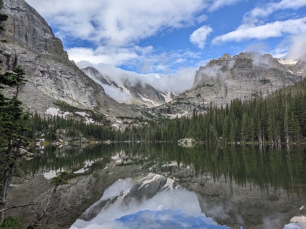
Share Album Published August 31, 2021 Forest Lakes (4 new items) Trailhead: Moffat Tunnel East Portal Distance: 7.8 mi Elevation Change: 1,641' Leaving the trailhead, the trail skirts the tunnel entrance then parallels South Boulder Creek. After about a mile take a right turn on the Forest Lakes trail. The trail climbs steadily to a bridge over Arapaho Creek. Lower Forest Lake lies about another mile and a quarter further on up the trail. Stay to the west of the lower lake to continue on the trail to upper Forest Lake.
Share Album Published August 25, 2021 Blue Lake Trailhead: Mitchell Lake Distance: 5.2 mi Elevation Change: 830' The trail passes Mitchell Lake and several unnamed ponds. Keep an eye out for moose.
Share Album Published August 25, 2021 Mitchell Lake Trailhead: Mitchell Lake Distance: 1.8 mi Elevation Change: 210' This is an easy one, both to navigate and to hike. There are no steep rises and the trail is well-maintained.
Share Album Published August 8, 2021 Rogers Pass Lake and Heart Lake Trailhead: Moffat Tunnel East Portal Distance: 8.8 mi Elevation Change: 2,061' Leaving the trailhead, the trail skirts the tunnel entrance then parallels South Boulder Creek. Continue along the creek, past the trail junctions to Forest Lakes and Crater Lakes, through the forest, to Rogers Pass Lake. Skirt the northern shore of the lake then climb a short ridge. Descend the other side to arrive at the south shore of Heart Lake.
Share Album Published July 25, 2021 Arapaho Lakes Trailhead: Moffat Tunnel East Portal Distance: 7.1 mi Elevation Change: 1,961' Leaving the trailhead, the trail skirts the tunnel entrance then parallels South Boulder Creek. After about a mile take a right turn on the Forest Lakes trail. The trail climbs steadily to a bridge over Arapaho Creek. About five minutes after crossing the bridge, look for branches blocking a trail to the left. Follow this trail (some routefinding skills required) until it returns to Arapaho Creek. Cross the stream and regain the trail, which soon climbs steeply beside the falls and cascades. A short while after exiting the forest, the trail bends to the south before reaching the outlet of the lower Arapaho Lake. Skirt the south side of the lake, turning west, to reach the upper lake.
Share Album Published June 14, 2021 Forest Lakes Trailhead: Moffat Tunnel East Portal Distance: 7.8 mi Elevation Change: 1,641' Leaving the trailhead, the trail skirts the tunnel entrance then parallels South Boulder Creek. After about a mile take a right turn on the Forest Lakes trail. The trail climbs steadily to a bridge over Arapaho Creek. Lower Forest Lake lies about another mile and a quarter further on up the trail. Stay to the west of the lower lake to continue on the trail to upper Forest Lake.
Share Album Published June 12, 2021 Denver (1 new item) Early days yet on this page - I need to dig through the archives.
Share Album Published October 7, 2020 Mount Bierstadt Elevation: 14,060' Difficulty: Class 2 Route: West Slopes Trailhead: Guanella Pass Start: 11,669' Total Gain: 2,850' RT Length: 7 miles
Share Album Published October 3, 2020 Quandary Peak Elevation: 14,265' Difficulty: Class 1 Route: East Ridge Trailhead: Quandary Start: 10,850' Total Gain: 3,415' RT Length: 6.75 miles
Share Album Published October 3, 2020 14ers Colorado has 58 mountain peaks exceeding 14,000 feet (known as "14ers" locally) — the most of any state. I lack the skills and desire to stand on top of all of them, but I think most Colorado hikers try to "bag" a few of them.