LoCo Spring Drive – Day 2

June 3

We wanted to get an early start today. Our first stop is the Dinosaur Quarry Visitor Center. It’s a short drive from there to the Quarry Exhibit Hall, and by 9:00 we’d have to take the shuttle bus. So we had breakfast and checked out of the hotel by 7:30.

Fossils in the quarry wall

They built a building over a “wall” of fossils; hundreds in a very small place. There are the bones of Allosaurus, Diplodocus, Stegosaurus, and several other behemoths plainly visible, free to be touched (as long as you don’t climb on the wall). The exhibit hall also includes murals and castings and signs detailing the fossils and the history of the quarry.

Quarry Exhibit Hall

The layers of the Earth are nearly vertical here. One of the layers had a faintly blue tint, which reminded me of the John Day fossil bed that I visited on my Oregon trip a few years ago. I asked about the similarity back at the visitors center but the ranger I talked to had only recently started work there and didn’t have an answer.

Swelter Shelter

We took a quick side trip about a half mile up the road to Swelter Shelter. This is a small site with enough parking for maybe half a dozen cars. Just a couple hundred feet from the road you get to see both petroglyphs and pictographs. A petroglyph is an image chipped or carved into the rock while a pictograph is something that is painted on the rock. The pictographs are somewhat more rare, as they’re more easily weathered. Unfortunately, many modern visitors have left their own marks here as well.


Extinct and large

After Dinosaur, back to Vernal then north on US 191. After a few miles the road rises steeply, navigating ten switchbacks taking us from high desert to more mountainous terrain – aspen and pine. The Simplot phosphate mine is visible in places on both sides of the highway. There are a couple of scenic overlooks but we dallied longer than expected at Dinosaur and didn’t stop to take in the views.


Extant and small

For several miles along this route we pass through a number of geological layers; we’re traveling through time. I didn’t have any idea which way we were going, from older to younger or vice-versa. For each layer we traversed there was an accompanying sign by the side of the road: “Morrison formation – where Stegosaurus roamed”. Some referenced “bizarre sharks” or fossilized sand dunes.

Passing through geologic history, we climbed and the terrain changed from high desert to mountain forests of pine and aspen. Flaming Gorge dam was next on our itinerary. US 191 makes a right turn at the junction with UT 44. We continued on 191 to the dam. Here we made notes of what we might see when we come back with the luxury of more time. They give a walking tour of the dam, where you can go deep inside and see the inner workings.

Flaming Gorge dam

On the east side of the dam there’s a road down to a boat ramp on the river. Near the top of this road is a small pullout with a nice view of the face of the dam. We asked some other members of our group if they wanted to go with us but had no takers. By the time we returned to the parking lot half a dozen others changed their minds. That’s okay, though, as there was very little parking.

We headed back down US 191 toward UT 44. Genae was keeping an eye out for a place to pull over so we could get a picture of an interesting bridge we crossed to get to the dam. It’s very much like the bridge at Roosevelt dam near Phoenix. Mike was way ahead of us, though, and had already picked out a spot for a group photo.

Which of these is not like the others?

Next we made another side trip, to Red Canyon overlook this time. There were a number of warning signs: “Steep cliffs. Guard your children!” The view was spectacular. Although we couldn’t hear the boats below us, we could see them clearly. We watched a water skier wipe out. By now it was noon and lunch wasn’t scheduled until we got to Green River. So it was decided we’d change plans and have lunch here. But no food was available; we had ours with us in a cooler (advantage of having cargo space) and a few others had stopped at a Subway in Vernal, but some didn’t have food. So a few cars went ahead of us.

After lunch we took a side trip down the Sheep Rock Geologic Loop for another group photo. We understood the loop was closed and turned around but found out later that some who didn’t have lunch went this way and the loop was open and “spectacular”. While we were stopped for this photo, I saw Ken messing around at the front of our car. He had a magnetic roundel, and temporarily made our car an honorary Lotus.

The terrain changes dramatically as we cross from Utah to Wyoming, from pine and aspen forest to high desert. Along the way we encountered some of the same signs as we saw in the morning, describing each of the geologic layers we traversed.

We stopped for fuel in Green River, WY. This was our originally scheduled lunch stop. It’s a good thing we adjusted our plan, as it was late afternoon by now.

About this time, I exchanged text messages with Victor. He confirmed that the car was ready. But shortly thereafter he called. He was sorry, but the car wouldn’t be ready until Monday at the earliest. He test drove it, but the fan never came on. Evidently the engine head coolant temperature sensor was bad and the fan wasn’t coming on. They can’t get a replacement part until Monday. I was disappointed, to say the least.

The final leg of the day was a blast eastbound on I-80 to Rawlins. We were gassed up and ready to go, so we hit the road first. It didn’t take long for the modern cars to pass us by, but we had a big enough head start that the older cars were still behind us.

After getting checked in at the hotel we had time for a brief rest before heading to dinner at Aspen House. We can be a bit picky when it comes to dining out. We wanted to go over the menu first, thinking we may head off on our own. They don’t have a menu on their website but the Yelp reviews were pretty good so we said “what the heck” and went anyway. This was a good decision. The restaurant operates in an interesting old Victorian house and the food and service were both good.

LoCo Spring Drive – Day 1

It’s time for another edition of Lotus Colorado’s “Colorado Good.” This time we’re making a loop that covers three states, with stays in Vernal, UT and Rawlings, WY and visits to Dinosaur National Monument and Flaming Gorge Reservoir.

This year the entry list included thirty people in fifteen cars, including nine Lotus. Ours, unfortunately, was not one of them as the Elise is still in the shop. We always have a variety of cars; it’s not really about the cars. But I have to admit that it felt a little off driving the Hyundai. In some subtle ways we were outsiders. Not among the group, of course. But when we drove through towns we were invisible in the Hyundai.

Friday, June 2

Mike’s directions had us rendezvousing at the rest stop in Edwards. The Denver contingent made plans to meet just outside Morrison but we headed off on our own. We’d be in a group for the better part of three days so we took advantage of having a little time on our own.

We left the house at 8:30. We weren’t rushed getting out of the house and it was plenty early. I figured we might have the better part of a half hour to loiter at the rest stop. The weather was quite pleasant – sunny and mostly clear, and calm. Another beautiful day in Colorado.

When I travel I always ask myself, “What did I forget?” I’ve been pretty good lately. I managed to not forget anything on my last several business trips. We were nearly to the assembly point when I realized I’d forgotten the SLR. So it would be cell phone pictures instead. Luckily, cell phones these days do a decent enough job to tell the story. (True, I didn’t take any pictures today, so you’ll have to judge that tomorrow and Sunday.)

As I expected, we were the first to arrive. It’s a nice little rest stop, services both eastbound and westbound traffic and sits a bit off the highway, so it’s fairly quiet. I couldn’t help but notice a “No Loitering” sign on the building. I don’t think I’ve ever seen a rest stop where loitering was specifically prohibited.

By the appointed time we had assembled most of the gang. From here until a few miles outside of Vernal it would be new roads for us. Although we were headed north, we started to the south. We skipped a few miles of interstate this way on our trip to Wolcott where we picked up CO 131 and the drive started in earnest.

I won’t bother with a navigational blow-by-blow. I will say that the highlight of the day was the twenty or so miles we spent on County Road 27 from Oak Creek to the junction with US 40. It’s quite a nice Lotus road, with a smooth surface featuring lots of twists and elevation changes. I’ll admit that it’s not as much fun in the Hyundai; low power and high center of gravity is not as good as high power and a low center of gravity. I look forward to making another pass on it someday in the fun car.

Somewhere around here Victor phoned to tell me my car would be ready tomorrow. I normally don’t care much if we have cell coverage, but I was happy we did at that moment. I’ve been a bit stressed out that I might not get the car back in time for my Austin trip next weekend. So this was a phone call I was happy to get. I reminded Victor that we were on the LoCo drive and we’d be in Ft. Collins on Sunday afternoon. We agreed I’d pick it up then. Excellent news!

We stopped for fuel in Craig, followed by a picnic in the local park. Usually we have to check the route carefully and have a plan for getting food. Will it be Subway again, or do we have multiple choice? The one advantage of not being in the Lotus is having plenty of cargo space. We had not one but two coolers with us, provisioned with ample supplies of cold cuts, cheese, condiments, beverages, and fruit. This gave us a few extra minutes of relaxation.

US 40 goes directly from Craig to Vernal. I drove that section ages ago, on my first trip to California. There’s nothing, really, to see on that road. Mike routed us through Meeker utilizing a couple of state highways. A few more miles, but less traffic and more appealing scenery. We connected back up with US 40 at the village of Dinosaur. Rather than go directly to Vernal and the hotel, we made a quick side trip to the visitor center for Dinosaur National Monument. We arrived there about 4:15.

This entrance to the park gives access to a 31 mile drive to a scenic overlook near the confluence of the Green and Yampa Rivers. It’s about forty-five minutes each way, so taking it this time was out of the question. Someday we’ll spend more time in the neighborhood; we’ll get to it sooner or later.

Our short break over, we resumed US 40 westbound to Vernal. Just after passing through the village of Dinosaur there is a large area adjacent to the road that recently burned. The highway makes a straight southern bound to this area, which was six or seven miles long and perhaps a couple hundred yards to the north. It looked to be quite recent, still smelled freshly charred. Writing this now, I looked it up and discovered that it just happened a few days ago. A 25 mile stretch of US 40 was briefly closed to fight the fire that burned 920 acres of cheat grass and brush on May 30th.

After we got settled in to the hotel we all made our way to the Vernal Brewing Company for dinner. I’m sure it’s hard to seat a table for thirty, so I try to be forgiving. We were offered a limited menu, with the choice of rib eye, salmon, or chicken. I didn’t see anybody with the chicken but did see ribs. Both Genae and I selected the rib eye. Service was good, given the circumstances, but my steak was on the cold side. In addition, it was about the thinnest rib eye I’ve seen. It seemed a bit on the tough side, but that sensation may have been enhanced by the dull cutlery. Not exactly satisfying for $75.

We were back to the hotel a bit after 9pm. It was a long day of driving. We covered more than the usual number of miles. We turned in, looking forward to more sightseeing tomorrow.

Laguna Seca Trip: Day 14 – Bayfield to Denver

Friday, July 22

Today was a day of waiting for pilot cars at road construction sites. I had eight, and the one on US 50 east of Gunnison had me behind at least a hundred cars.

I’ve driven Durango to Denver (or vice-versa) dozens of times. Somehow, I’ve never taken CO 149. LoCo did the road a couple of years ago, but we didn’t participate in that drive. Today I rectify that oversight. I’m driving it south to north, which is start to finish according to the mile markers.

The upper Rio Grande flows through a U-shaped valley, open and grassy, forested only on the slopes. There is a railroad as well as the highway; each runs along one side of the valley or the other. They often switch sides, crossing each other and crossing the river. At Creede, the road makes an excursion up a gully, makes a U-turn, and returns to the main valley. The forests on the southern ridge are almost completely beetle-killed. The road leaves the Rio Grande and starts climbing Spring Creek Pass. I’d been running topless all morning. When it started sprinkling here I stopped and mounted the top. For once I got the timing right – it rained heavily moments later.

With the mounting of Spring Creek Pass, the road goes into its second phase, a pair of two lane mountain passes. Many of the epic pass roads of yore have been widened and lost much of their character, including two today, Wolf Creek and Monarch. Although this route gets more traffic than I expected, it’s not likely to be widened anywhere along its length for some time. Climbing the pass, they’ve removed about sixty yards of beetle-kill on each side of the road, leaving only an occasional survivor standing sentinel.

Spring Creek Pass was in use by the old Taos trappers in the 1820’s as the shortest summer route from Taos to Gunnison country. It appears as Pass of the Rio del Norte on the R. H. Kern army map of 1851. It was also occasionally referred to as Summer Pass. It tops out at 10,858’ and crosses the Continental Divide. (This is the second of three CD crossings of the day. The aforementioned Wolf Creek and Monarch are the first and third.)

A few miles later the road crosses Slumgullion Pass, five hundred feet higher than Spring Creek Pass. It was named by pioneers from New England. Slumgullion is the multicolored refuse produced by butchering a whale. These New Englanders thought a large rock slide on the west side looked like slumgullion and thus the name. I don’t know if that slide is visible from the road; I didn’t know to look for it. Instead, I was too impressed with the result of beetle-kill removal at the summit. The entire saddle of the pass has been cleared giving an impressive view of the mountains beyond. The extensive beetle-kill is not a happy sight, but this view is a positive side-effect.

After the passes you descend to Lake City. We arrive here in a string of traffic, the result of a long wait for a pilot car where they’re repaving the road a few miles up the hill. The town clearly makes it’s living catering to those who fish and hunt. It’s very rustic. For about three blocks, I saw no cars. There must have been fifty Jeeps in a row. ATV rentals everywhere.

The third phase of CO 149 begins now: the descent through a narrow canyon carved by the quickly flowing waters of Lake Fork, a tributary of the Gunnison.

It’s a very scenic and fun drive. I was able to have long stretches where I could maintain a bubble around me – nobody in front to deal with, nobody coming up from behind. There’s no need to go particularly fast to enjoy the road. There are a number of long sweeping turns, like the carousel at Road America, easily enjoyed at sixty.

Going this way, using CO 149 and US 50 to replace the San Luis Valley, requires an additional investment in time. It doubles the time it takes to get to Salida to four hours. I will look to take this route again on a future drive to Durango, as long as I have the time to spare. You haven’t really driven a road unless you’ve gone both directions, have you?

I grabbed a quick sandwich in Gunnison and promptly got stuck in the longest line of traffic of the day. Although I had a good view of the road ahead, I couldn’t see far enough to see the flagger. I was easily behind a hundred vehicles. I probably passed thirty ascending Monarch. From here on home there was always somebody in front of me. At least I wasn’t leaving Denver – 285 coming out of town was stopped for miles.

Home again, home again, jiggety jig.

Laguna Seca Trip: Day 13 – Henderson to Bayfield, CO

Wednesday, July 20

Today is a “zero day” in Henderson with Chris. A corollary to “What happens in Vegas stays in Vegas” is “Nothing happens in Henderson.”

Thursday, July 21

In a feeble attempt to exit Vegas before it gets hot, I was out the door by 7:30.

Google wants to take me west to go east; it will suggest I make four turns or have me on a dirt road in Death Valley to save a quarter mile but will take me miles out of my way to put me on the interstate. Chris gave me a different recommendation: Boulder Highway to Nellis to Las Vegas Blvd to I-15. I take Chris’s route and for fun leave Navigator running to see how long before it reroutes me to my current path. It gave up about half way up Nellis after recommending about thirty left turns. This, perhaps, is a ploy by the Las Vegas chamber of commerce to keep me on the Interstate rather than driving through their town. Either that, or Google is still messing with me.

I’m not a particular fan of Vegas. I’ve only visited the place a few times, but it strikes me as a crummy little town. Every place I’ve seen off the Strip is run down, somewhat dilapidated, desiccated. I don’t like the weather there, and even when it’s not baking hot I find nothing appealing about it. If it weren’t for the gambling, this place wouldn’t exist, it would be just another Great Basin valley, an isolated Air Force Base.

My Vegas escape route takes me by the speedway and the location of the proposed Tesla giga-factory before depositing me on I-15. I take the interstate a few miles past St. George, Utah. In order to get Navigator to take me on my desired path, I had to give an intermediate destination. That’s St. George. So it got me off the highway and sent me left and right and left again until I was in front of the local college’s football stadium. “You’ve arrived at your destination!” Maybe I should have looked for that Starbucks instead. Actually, if I wouldn’t have wanted to top off the gas tank, I’d never have gotten off the interstate here. I get back on I-15 for a few more miles before heading east, ending the trip’s last Rule #1 violation.

This is the road to Page, Glen Canyon Dam, and Lake Powell. I’ve never seen so many boats on the road before. Boats outnumber RVs. Big boats, pulled by dueller diesel pickup trucks. Big, shiny, black pick up trucks.

I often say of Wyoming that all the interesting bits are around the edges. I’ve decided that Nevada has it worse. It has no interesting bits. Pretty much as soon as you leave Nevada the terrain gets much more interesting. Nevada, in my experience, is like a wrinkled table cloth – just one valley after another. Sameness followed by sameness, with minor variations in vegetation. Back in Utah, the wrinkles are replaced by layers. At St. George you enter red rock canyon country. We’re at the western end of the Grand Escalante Staircase (even if we’re not in that particular park). We can see different kinds and colors of rock, interesting formations. I’m happy to be leaving the Great Basin in my rear view mirror.

Not long after St. George the road takes me through Colorado City. There’s a Colorado City in Colorado but this one is bigger. It’s one of those places I’d heard of in the news over the years but never bothered to figure out where it was. It was in the news because it’s where a splinter sect of fundamentalist Mormons live. These Mormons are polygamous; believing that their god wants their leaders to marry as many fourteen year old girls as possible. In all the small towns through here, I see women in the old style garb. These dresses strike me as not far removed from the bee keeper suits women are made to wear in parts of the Middle East.

Not only are there a lot of boats on the highway, approaching Lake Powell there are lots of places to store your boat, so you don’t have to tow it up and down the highway. Lake Powell appears, side roads lead to marinas. When I see a sign for Wahweap Overlook, I stopped to look it over.

IMG_2293_stitch_crop_resize

Lake Powell from Wahweap Overlook

The next obvious stop was the Glen Canyon Dam’s visitor center, followed by a walk part way across the bridge.

Glen Canyon dam and bridge

Glen Canyon dam and bridge

Navigator’s penchant for short cuts kicks in again in Page, with the result that I drive by the lumber yard instead of any restaurants. I need to eat in Page as there’s nothing available until Kayenta, still quite a way down the road. The Maverick station has a store with a grill offering burgers and Navajo tacos. I grabbed a burger and ate it at a picnic table outside. I share the table with a young French couple. Seating was limited to two picnic tables. The other was occupied by a family. Guns were not welcome here, they were encouraged. Show your gun and a permit, get a 10% discount (not good on fuel). You can also get the discount by showing ID that says you served in the military. I wonder if that includes the military of other countries? I wonder what the French couple thought of the gun discount.

Just after Page the road passes parking lots for Antelope Canyon tours. This will have to go on the list of places to visit. We’ll certainly have to come back here and explore the place in more detail.

I’m taking AZ 98 from Page to a junction with US 160. This junction is about 30 miles from Kayenta. This is my least busy road for the day, a relaxing drive. From then on, it’s familiar roads for me – Four Corners and the oddly named Teec Nos Pos, through Cortez, past Mesa Verde, and skirting Durango. When I got to about Mancos the place looked and smelled right: I’m back in Colorado.

To top off the day, I had dinner at the Seven Rivers Restaurant at the Sky Ute Casino in Ignacio. I had the petit filet mignon, jalapeño mashed potatoes and the corn dish. Yum.

Grace and Greg kindly put me up for the night. Grace was a good sport, suffering through the modern equivalent of getting out the slide projector: going through the photos on the laptop.

Laguna Seca Trip: Day 11 – Monterey to Henderson

Tuesday, July 19

Now we enter the phase of the trip where things are a bit more free-form. So far, everything has been pretty well planned – the route is known (even if not perfectly followed), activities defined, lodging reservations made. Now, though, things are more like ideas than plans. The idea is to visit Yosemite, but it’s not well enough defined to call it a plan: drive through the park, stop at the visitors center, chat with a ranger to determine a hike for tomorrow, perhaps take in a short hike, then off to the Inyo National Forest to search for camping.

With that in mind, I want to do a little trip preparation. The internet in the motel room is nearly worthless and isn’t connecting so I figure I can go to a Starbuck’s, grab a bagel and some internet. I use the Google Navigator app on my phone: find Starbucks. It thinks about it for a few seconds and presents me with a choice: which Starbucks would I like to visit? There’s one in St. George, UT, and a couple near home in Arvada. I know I passed one within a few blocks of the motel and might guess there’d be about thirty in a five mile radius of my position. Why does Google want to send me to St. George?

No matter, I find the Starbucks. It’s in a Safeway. I grab the laptop and head inside. Get the laptop booted up and search for wi-fi. None of them seem to be Starbucks, but Safeway has an open network. Get connected to that only to find it doesn’t have internet. So no further planning for me at this point. I’ll rely on the phone app for navigation.

This goes well enough. The drive from Monterey to the approaches of Yosemite is pleasant; scenic but not particularly noteworthy. Well, except one bit: Google has me make a turn onto Road 9. This is a farm road, paved sometime in the last century and barely maintained. I’m taken through the farms of the central valley – some sort of nut orchards, corn eleven feet tall, olive orchards, various other crops. Next is a right turn on Sandy Mush Road. It’s in only slightly better shape. Why is Google sending me on these odd roads?

I arrive at Yosemite around 11. If our national parks were named for their most prominent feature, RMNP would still be RMNP. Bryce would be Hoodoo. Yosemite would be Granite Slabs. As soon as you see the first giant slab of granite that forms a cliff wall you see the entrance station.

At the gate I ask for the visitors center and am directed to Yosemite Valley, the most crowded part of the park. Here, people have parked cars at every available turn out or wide spot. I find a place to pull over and consult the park map. I see that I passed the turn off for the tunnel view, so I decide to check that out before hitting the visitor center.

I get lucky here. I imagined the parking lot to be bigger. It’s not very big, and it’s crowded. The three cars in front of me are waiting for spots and blocking ingress and egress. But they didn’t notice that a car behind them wants out, so I snag a spot before those folks. I take the opportunity to snack here; I’m starting to get hungry what with having skipped breakfast.

IMG_2260_stitch_crop_scaled

Part of the Yosemite crowd

The view here is pretty magnificent. The car normally draws a lot of attention. But here I’m mobbed by comments and questions. Nearly as many people take pictures of the car as they do of the view. I’m used to the car getting such attention. Even when there’s another Elise people like the green and yellow. But I’ve never seen anything like this. I have my snack, snap a few pictures, and am back on my way back downhill into the valley.

Yosemite Valley tunnel view

There’s a trailhead! I should stop here and take a short hike. I pull into the lot. Sort of: I can’t actually get into the lot because not only are all the spots full but there’s a long line of cars hoping to get a spot. I make about a 9 point turn to get out and note that cars are parked along the road below the parking lot, too. Clearly, I’m too optimistic. I’m going to have trouble parking anywhere in this place.

I decided to skip the visitors center and head to Tioga Pass. There are pullouts up and down all the roads in the park. I find one here with a view of the valley and park the car. I did a quick u-turn and park so that I can try to get a picture with the car in the foreground and climb a few feet up the hillside across from where I’m parked. I missed the opportunity for a quick shot. Other cars and people are arriving and they all seem to want to get a shot of the valley while standing by my car. I wait patiently and eventually get the shot.

IMG_2268sNow a tour bus pulls up. Because I’m parked where I am, he can’t get in. The ass end of his bus is blocking traffic. The driver sees me; I point to my car and to me, run across the road and hop into the car to move it down far enough for him to get parked. No key in my pocket. Where the heck is it? It’s not in the ignition, not in the seat. How the hell could I lose my car key? I need to move it downhill, so I just take it out of gear and let it roll. The bus gets parked and the driver gives me a thumbs up. I’m in a bit of panic, though. I finally find the key in the wrong pocket (I never put keys in that pocket). I make a pantomime of “cant’ find my keys” for the bus driver, then show that I found them. He laughs.

I continue up Tioga Pass, stopping at most of the pullouts. Early on, we get a view to the east and see damage from a recent forest fire. The road continues to climb and turns back to the west. Overlook after overlook is crowded. All the trailheads have full parking lots plus lines of cars on both sides of the road in both directions. Doesn’t look like I’ll be hiking today.

But, frankly, for the last few hours I’ve been considering just heading directly to Vegas. The congestion here is just an additional factor. Perhaps the deciding factor, but just one factor. I continue to take my time through the park, seeing what sights I can (and answering questions about the car at every stop). When I was looking at the map earlier, I saw there’s another visitor center at Tuolomne Meadows, so when I get there I make a quick stop. This is not the visitors center I’m looking for; it doesn’t have much to offer. And it offers me no reason not to head to Vegas. I decide to table my decision until I reach Lee Vining for a late lunch/early dinner.

Over my meal I call Chris to make sure it won’t be a problem arriving at his door two days early. This done, I call home and let Genae know the change in plans. I let Google Navigator select the quickest route to Vegas and hit the road. Now, up until now the idea was that I’d drive a somewhat longer route and see what Death Valley looks like. Yes, I’m probably insane for wanting to go through Death Valley in July in a convertible with English air conditioning (probably works great in London, cooling from 80 to 75, but it’s certainly not good for desert southwest climes). With the updated itinerary I’ll be skipping Death Valley.

The first bit of the next part of the trip is CA 120. What a fabulous road. I’ve seen a road built like this before, near Joshua Tree. The road was built using no cut-and-fill. It looks like they drove a road grader to clear the weeds, then just poured asphalt right on the ground. I didn’t see a single culvert and the only shaping of the roadbed they did was to bank the road enough to prevent any cases of negative camber. The road lies directly on the terrain, unlike most roads. If the ground falls two feet, so does the road.

This is actually quite fun. You can’t go terribly fast, but you don’t need to. It has more curves per mile than you’d expect, and it rolls up and down so much you generally can’t see more than a few hundred yards. One section descends through a gully not much wider than the road. It’s a series of S-curves a few miles long. Tightening, loosening, getting steeper then not so steep. Next comes a sign: “Dips Next 5 Miles”. This section is a straight line but the road goes through depression after depression. Again, you can’t see very far, so it’s strictly no passing. But the road goes up and down like mad. The dips come in combinations: one, then three quick ones, then a big one, then a double. Sometimes the dips are so steep you feel like you’re going straight down. None are more than perhaps thirty or forty or fifty feet deep, but they’re big enough to give you that “light stomach roller coaster” feeling, followed by some serious compression at the bottom. I was having so much fun, I laughed out loud several times. What a great Lotus road.

After this fun section, I was directed through a couple of navigation points. By now I notice that the map doesn’t show my route in a blue line. In fact, the map is empty save for the pointer that indicates my location. But it’s still telling me where to turn. Okay, I must be out of cell range. I’m sure it loaded the required info when I started and I’ll be okay. Remember, I lack an atlas.

I also use the phone as a speedometer. I notice that as I speed up or slow down, the reading doesn’t change, and the compass heading is stuck. I arrive at a T-intersection but Navigator is silent. The phone has locked up. I cycle the power and relaunch Navigator. The phone actually says “No Sim” before it says “No Service”. In any event, Navigator will be no help here.

Last gas, of course, was Lee Vining. I’d seen one sign indicating how far I’d have to drive to get gas. The signs here told me that town was to the right. I need to go southeast, and it’s south to the right, north to the left. I go south. It isn’t long before I see this is the wrong way to go. The road makes a right turn and heads directly into the sun. Yes – directly: we’re climbing a steep pass, the road still poured directly onto the terrain. I know I can get gas in about 25 miles this way, I have no idea how far I need to go the other way. The safest course is to proceed to the known gas station.

Mono Lake

Mono Lake

This is all a big adventure. The road I’m on is not quite as fun as CA 120, but it’s still a gas. It climbs steeply, twisting and turning all the time. Like the other road, the surface is good. Near the top of the pass the little canyon we’re going through is so narrow as to support only a single lane. “Yield to Oncoming Traffic.” Like the other road, it’s not heavily traveled: occasional cars but not a single truck. I’m having fun, it’s all good. Another fun Lotus road.

In the next town I gas up, get connected with Navigator, and answer more questions about the car. Navigator wants me to retrace my steps, but I see that the route through Death Valley is only 20 minutes longer from here. I’m not a big fan of repeating routes when I have so many to choose from, and as it’s only 20 minutes, what the heck? Perhaps I’m fated to go through Death Valley.

A few miles down the road, Navigator gives me a new message: Shorter route available. Do you want to take it? It can’t be the one I’ve already been on, can it? I’ve been going 20 minutes already, and turning around here would be longer, wouldn’t it? I accept the change. Of course, it wants me to make a u-turn. I cancel and reselect the Death Valley route.

Passing through the next town I can’t help but notice a bunch of runners. They’re scattered along the road side in pairs or pairs of pairs. I think the guys at the edge of town are stragglers, but after making a turn to the east I see they’re running along here, too. They’re coming my way, running on the foot-wide shoulder. There’s not much traffic, so I can almost always give them the full lane. Along the other side of the road, spaced irregularly, are vehicles deployed to assist the runners, always in pairs. I’m guessing one of the pair is the competitor, the other is providing support or assistance.

By the time I’ve gone sixty or seventy miles I’m really curious. The sun went below the mountains to the west some time ago; dusk is turning to dark. How long will I need to keep an eye out for runners in my lane? There’s a pullout ahead, so I pull off and ask the crew there. “How far are we running?” “One hundred and thirty five miles.”  This isn’t just a 135 mile run, it’s the Badwater Ultramarathon. It’s a 135 mile run out of Death Valley to the Mt. Whitney portal, which means it includes over 8,500 feet of climbing. The things people do.

The road here starts a serious descent: tight turns and steep grades. Drop offs on one side. And still there are runners. I pretty much have to crawl down the mountain to be sure I don’t run into somebody around a blind corner. By the time it’s fully dark I haven’t seen a runner in fifteen minutes, but there’s one final straggler.

The road is now clear of runners, but with the dusk and dark other critters are appearing. A coyote is ambling down the road toward me, following the center stripe. Rabbits occasionally make a dash across the road, or sit and watch me go by. It would not be fun to clobber one of these guys. Are there really as many rabbits as I’m seeing, or is my imagination getting the best of me? Now, instead of a 9:30 arrival in Vegas it’s more like 11:30. I have a couple more hours of night driving.

Shortly after Stovepipe Wells, Navigator directs me to take a left on Scotty’s Castle Road, followed by a right on Daylight Pass Road. I’m not happy that it’s taking me onto named roads. I much prefer numbered routes. After a few miles of Daylight Pass Road I enter Nevada and Navigator tells me I’m back on a numbered route, a Nevada state highway. All is well again! Except that it’s not. Now Google says to make a right turn on Airport Road. This is a dirt road. Does Google want to kill me, have me dispose of my own body in the desert? Why is it taking me this way? Should I rebel? In the dark, with no map, I follow directions. It turns out that the road is dirt only two miles, which doesn’t take long, even at 15 mph. Shortly after regaining pavement I arrive at an intersection with US 95 which will take me right to downtown Vegas.

I have survived the various tests Google as presented me: I found a Starbucks in Monterey, I overcame resetting the phone in the middle of nowhere with no service, I was not left for dead in Death Valley. And one final minor annoyance: Navigator left me at the end of Chris’s street rather than in front of his house.
Laguna Seca Trip: Day 9 – Danville to Monterey

Sunday, July 17

I wanted to find a place to hand wash the car this morning, so Rod came with me as navigator. Just exiting their neighborhood I spotted a red M100 ahead of us. Rod said, “Catch him!” He made his green light, we got stopped by a red. He was out of sight, but Rod suggested he might be going to the auto parts store. Sure enough, when we were gassing up Rod spotted him. Naturally, I had to go introduce myself. I met Mel, who would be taking his other Lotus to Laguna Seca tomorrow. What are the chances?

We found the car wash, but they weren’t washing cars because of a compressor problem. Not sure what they need a compressor for to do a hand wash, but so it goes. Back at the house, Rod helped me wash it in their driveway. I didn’t put a lot of effort into it, but managed to get about eight pounds of bugs off of it. She’s presentable now.

After lunch I packed up the car and was on the road by 2:20. Went over the San Mateo bridge and then to Half Moon Bay. Traffic crawled along slowly most of the way. South on PCH, steady stream of traffic headed northbound, nearly as much as going my way. Just south of Half Moon Bay I saw Bo’s car parked by the road. He wasn’t in it. I should have stopped. My plan was to stop a little farther along, but soon all the parking areas were filled. I ended up not stopping until I got to the hotel. Google navigation had me take an alternate route due to long delays.

At Thunderhill Bo said he might try to make it to Laguna Seca. So when I saw his car, I thought he was going to be there.

Checked in at the hotel and unpacked the car. Spent some time on the phone, then set off in search of dinner. Found the Alvorado Street Brewery and Grill. Had a pilsner and a patty melt. Started up the car to head back to the motel and got a check engine light. I checked the codes when I got back: 1302 and 0128. A 0128 indicates a bad thermostat. The phone app didn’t know what a 1302 was so, naturally, it directed me to the internet. I cleared the codes and will drive it to the track and seek professional advice.

It turns out that the next night the internet in the motel didn’t work properly. It would have saved me a lot of stress had it been this night instead. I made the mistake of reading a few pages of a Lotus Talk thread. Evidently there was a common problem, codes 1302 and 0303 (or 0302 or 0301 or 0304) that was terminal for a number of people. Limp mode, five thousand dollar repairs. Cam problems.

I shut off the laptop. If I have a terminal problem, what do I do? How do I get the car to a shop? If the repair will be expensive, I may want to have it shipped home and park it until I can afford that large of a repair. I have more stuff than I can take on an airplane. How do I get it all home? How do I get me home?

It’s going to be a long night.

Planes fly really low over my motel.

Laguna Seca Trip: Day 6 – Lassen to Willows, CA

Thursday, July 14

Today will be an easy day. It’s only about three hours to the motel in Willows. So I took my time getting packed up. Chatted with a fellow from Huntington Beach who used to own a Porsche Speedster. The car gets a lot of attention on the road, but very few people approached me to talk about it in the campground.

With some time to kill in the park, I decided to hike to Terrace Lake. There are actually two lakes here, almost adjacent, the other being Shadow Lake. On the map, Shadow Lake looks pretty big and the trail goes right along the shore. Should be tough to miss. I head down the trail, encountering quite a bit of snow. At times it’s a little tough finding the route. A few minutes later I arrive at a trail sign: Terrace Lake is .3 miles down the trail to the right.

I head down the trail to the right. I hike quite a long way without seeing any lakes at all. Before long I figured I’d gone a mile but I decided to carry on. I soon reach another trail junction. This one says Terrace Lake is 1.7 miles up the trail I’ve just come down. Clearly, somebody moved these lakes. You’d think somebody capable of finding more than eighty lakes in RMNP should be able to follow a trail to a couple of lakes here. How can both signs be wrong?

Shortly after turning around my mind wandered back to the question of “what if it erupts now?” This time it would take me an hour to get back to the car, but everything is in the car, so that’s good. I’m amused that I went down this line of thought once, let alone twice. The chances of this thing going off are orders of magnitude less than of me getting hit by lightning or getting in an auto accident. I never ponder those things.

There’s a large down tree that crosses the path; a section has been sawn out. The diameter of this tree trunk is four and a half or five feet. I was curious how old it was but the cut was old and rough so I couldn’t tell. Gave it a good look both times I passed it; it may have been the most interesting sight on the hike.

I arrived back at the trailhead just as a guy is starting down. He had spent the night at the same campground, but Loop A instead of Loop B. He hiked as far as Cliff Lake yesterday, said it was the best hike he’d been on. He asked me what I thought of Terrace Lake. I told him I couldn’t find it. He aborted his hike. I’m sure he’ll find it eventually, as he lives in Red Bluff, only about an hour away.

I stopped at the visitor center on my way out and bought a shirt. Still no cell service here, but another text message arrives. I’ve heard quite a few odd accents and foreign languages so far on this trip. A German family was in line in front of me. I’ve heard Spanish, French, Dutch, German, Polish, Korean, Japanese and probably a couple more.

On the road again, I turn right on CA 36. Very quickly, two motorcycles and a giant truck catch me. I’m only doing 5 over. The bikes pass me on double yellow. They pull off at a country store a few miles later so the road in front of me is clear. The big truck is getting big in the mirrors. I pull over and let him pass. It’s a big timber truck, with no cargo. He’s carrying his rear wheels rather than pulling them. Before long he’s out of sight. We hit a series of increasingly tight turns: 35mph, 30mph, 25 mph. I finally catch him but when the road straightens out, he’s pulling away again. At an intersection he pulls off to the right and waves at me as I pass, then he makes a left turn (where a fully loaded timber truck is arriving).

By now the road has fallen about a mile. The high point, at the summit parking lot, is about 8,500’. Now we’re around 3,000. No longer in subalpine forest we’re in widely dispersed scrub oak and yellow grasses. Still falling, we drop through vineyards. In the end, we fall to almond orchards and olive orchards fifty feet above sea level. We may as well have fallen all the way to hell: the sun is harsh here, and hot. And the air is hot. I’ve been cold quite a bit so far on this trip; I haven’t complained because I knew I’d remember it fondly.

I have lunch at the Applebee’s in Red Bluff. I sat at the bar. Everybody knows the bartender and waitress; they’re all locals.

It’s hotter than hell here. My phone says it’s 87, but it’s gotta be more like 100. I have 45 miles of Interstate to deal with next. I-5 is heavily traveled and carries lots of trucks. Most of the cars are left-laniacs, never getting out of the left lane. Before long we arrive at a construction zone. Right lane closed, I think it said, but there was only one sign. I’m in the right lane. I figure I’ll do a zipper merge when the lane is actually closed. Only a few of us attempt this; we pass about a half mile of cars.

Check in at the Motel 6. No carpet, no shampoo in the bathroom but no worries, I brought my own. First on the agenda is a cool shower. Need to wash off several layers of bug spray, sunscreen, and sweat. Next is laundry. Somehow I manage to forget to wash any of my shorts, but the shirts, socks, and underwear clean. Except one pair of hiking socks cleverly hiding in my hiking shoes. Dang.

This is the closest motel to the track. There are two or three more within a quarter-mile, but this is the cheapest one. I took a short walk, not much to see. There’s a State Trooper office and two restaurants that appear to be closed in addition to the other motels. When I got back I took a look at the cars in the parking lot. A couple of nice Audis, a Corvette, an old Mitsubishi with some stickers on it. I would likely see all these cars tomorrow.

I’m disappointed that I didn’t get to see Bumpass Hell. That was number one on my list. I understand they’ve been working on it quite a while, and still have a way to go before they’re finished. Comparing Lassen to Bryce or RMNP, it’s more like Bryce. It’s all about the volcano. It encompasses the volcano and a few surrounding features. The road probably couldn’t have been better sited to allow access to all the interesting features of the park. This has the effect of making many of the hikes “upside down”. Many of the trails descend from the road – you hike down when you’re fresh and it’s cool, you do all the work after you’ve walked quite a way and it’s hotter. All the Bryce hikes were upside down, too.

There are 150 miles of trail in the park, 17 of which Pacific Crest Trail. Based on the amount of hiking I log in RMNP, I’d be able to hike every mile of the Lassen trail system in two summers. I really enjoyed my short stay, and I’d still like to see Bumpass Hell.

Laguna Seca Trip: Day 4 – Ruby to Lassen Volcanic Nat’l Park

Tuesday, July 12

When I awoke, I noticed that the neighboring SUV never got anything set up. All they had accomplished was to lay out a large tarp. They spent the night in the car. That made it easy for them to leave – they were gone before I even started packing up.

I was on the road by 7:45. The town of Lemoille butts up against the wilderness area. Before seeing it, I imagined more high desert. Instead, it’s more or less a bedroom community for Elko, houses on one acre lots. A much nicer place than I imagined.

After yesterday’s events, we can add a new rule to cross country drives: Rule #3: Never pass a gas station in Nevada without topping off. I don’t care if I just filled the tank two blocks back on the other side of town – stop again anyway. So I gassed up at the last gas station in Elko before getting on I-80. There was a group of motorcyclists at this station. One said his son-in-law in Denver just sold his silver Lotus. I asked what his name was but didn’t recognize it. I’m guessing he wasn’t a LoCo member.

Today is another massive drive day – 537 miles if I don’t make any more navigational errors. First is an eighteen mile blast west on I-80, to the junction with NV 278. I take this south to junction with US 50, which I’ll take more or less to Reno. After that, US 395 to Susanville, then a couple of CA state routes to Lassen.

This first section, I-80 and the first miles of NV 278, is fairly mountainous. I-80 navigates a bridge/tunnel complex here. These miles of I-80 are out of character for rest of the road, an interminable drive that makes I-80 through Nebraska look short in comparison. It’s apt that it happens here, so close to the Ruby Mountains, which is also out of character for Nevada.

There are a number of ranches along the northern miles of NV 278, but not much traffic. Eventually the road straightens and levels, quickly leaving the ranches behind. We’re headed south through one of the many north/south valleys. About ninety miles south of I-80 we get to US 50, America’s Loneliest Road. Ironically, it gets more traffic than the road I used to get here.

The junction with US 50 is a few miles west of Eureka. There’s a mine there called the Fad Shaft. This is the site of the second richest mine, behind the Comstock Lode. The Fad Shaft was started later, went down 2,465′ where it flooded. The Fad Shaft never produced any ore. Today the site is an operating heap mine. Gold bearing rock is crushed into pebbles and piled onto a thick plastic liner. Cyanide dissolves the microscopic gold which leaches into collection tanks.

It’s already clear that Rule #3 is a good policy. The last gas station I saw was the one I filled up at. That was a hundred miles ago. There have been no signs indicating how far to the next services, and no signs directing me to any services which might exist. I’m a few miles west of Eureka. I assume there’s a gas station there, but that assumption isn’t backed up by any signage.

US 50 cuts across these many north/south valleys one after another. This is the Basin and Range province of the Great Basin. The floor of each valley is a few feet lower than the previous. Eventually, we come to a pass between these valleys that is more like a true mountain pass. The economy of signs is evident here: at the foot of the pass, there’s a sign: Curves ahead, 30mph next three miles. This is repeated at the summit. In those three miles there might be three curves that slow, but you never know when they’ll appear.

At the summit I pass two bicyclists headed the other way. These guys are nuts. There’s nothing but nothing until Eureka. I assume they’re doing this for fun. I’m not sure how fun it sounds. They didn’t seem to be carrying much gear and no support vehicle was evident. I wouldn’t even want to cover this ground on a motorcycle.

Half way down the other side is the small town of Austin. A billboard fifty miles or so back says “What happens in Austin gets bragged about.” I apply Rule #3 here, but it’s too early to eat. At the gas station, I ask how far to the west before I get to a town with a restaurant. 112 miles. That town is Fallon.

Between Austin and Fallon, we continue to traverse the valleys. The plant life varies from valley to valley – generally the pale green sage dominates. Sometimes it’s dry yellow grass. In some places, the ridges look like a sort of biological Neapolitan ice cream: yellow layer on the bottom, green pine forest in the middle, pale grass on the tops.

Later on, the vegetation on the valley floors disappears entirely to be replaced with alkali flats or salt flats, not sure which. Nothing grows there, and there are some sort of mining operations in places, working the surface.

There are occasional rest stops, but in keeping with the signless theme of the state, they are unmarked. At 75 mph they’re hard to see, blink and you’re past. They’d be invisible in the dark. They’re just rest stops, no latrines, no water. A place to sleep if you can’t make it the 100 miles to the next motel.

This route is the old Pony Express route. How far can a horse run? That’s how close together the stations need to be – about ten miles apart. There’s no evidence of water anywhere, with the exception of one spring I saw several miles from the road (a clump of trees at a gash in the ridge.) One of the old Pony Express stations is called Sand Springs. My mental image was a spring that seeps sand rather than water. Turns out there’s a large dune there.

Just like Utah, Nevada is largely federal land. In Utah, it’s largely parks and wilderness. In Nevada, big chunks of it are military. A few miles before reaching Fallon I pass a sign: US Navy Centroid Facility. A two track dirt road on the right leads a short distance to a small structure surrounded by a chain link fence. A few minutes later I see signs on the left for B-17 Range, another US Navy property. Finally, a sign that ties it all together: US Naval Air Station Fallon. This is the TOPGUN school.

Fallon marks the return to civilization. There are cultivated fields here: corn, alfalfa, hay. You go through several miles of this before actually getting to town. I stopped here for lunch at Julio’s Mexican and Italian Restaurant. I found it a little odd to have chips and salsa placed at your table in an Italian restaurant.

From Fallon to Fernley much of US 50 is four lane divided highway, heavily traveled. I get back on I-80 for 33 miles, then take US 395 north out of Reno, again a four lane divided highway for quite a way. Eventually we arrive in California. All traffic is stopped for “inspection”. Most vehicles were just getting waved through, including me. Would they have confiscated my apples?

I gassed up in Susanville. I didn’t realize at the time, but this was the last time I’d have cell service for a couple days. This town is on the cusp between desert and mountain. Leaving town, the road rises immediately into fragrant pine forest. I pulled over here to finally take the top off the car.

IMG_2168s

First sight of Lassen Peak, 10,457′

Remembering the mosquitoes, I stopped at a small gas station/general store just outside the park to get some bug spray. There were a couple of guys there with backpacks. Perhaps hiking the PCT, I decide in retrospect. I should have asked them. This is another case of not doing my homework – I didn’t realize at the time that the PCT went through here, although it should have been obvious.

The park entrance was unmanned, and the visitor center was closed. A sign at the entrance announced that one of the trails I want to take, Bumpass Hell, is closed. Stopped for a wander through the Devastated Area. This is the path the eruption took back in 1915. This is what the area around Mt St Helens may look like in another 70 years or so. Lassen and Mt St Helens are the only two volcanoes in the 48 states to erupt in the 20th century.

I arrived at the campground, navigated to my spot, and got set up fairly quickly. The campground has bear boxes for every campsite. My site is right next to the bathrooms. Probably not the best choice, but so it goes. The place is pretty crowded – tents and RVs large and small. Being next to the bathrooms, lots of traffic passes by. Surprisingly, very few people approach me about the car.

I walked a lap of the campground to check it out. One site had two small tents and some hiking shirts laid out on the hood of an SUV. Two young guys were there. I asked them if they were local, or knew the area. We chatted for a few minutes. They’re disappointed that Bumpass Hell is closed and believe the boardwalk is being rebuilt. They recommended a substitute hike, King’s Creek Falls. The also said not to bother with Cold Boiling Lake.

For dinner tonight I tried the four cheese rice with the lemon pepper salmon. Not bad, but reinforces my thought that it’s not sufficient after a long day of hiking. I mixed up some trail mix for tomorrow. I don’t know exactly where I’ll go, but I should be able to hit a number of short hikes.

Didn’t listen to music tonight. Lots more activity in this campground than either of the other two. Ruby was very quiet. Here, many people sat around their little campfires talking. Many of the RV people retired indoors but there was still quite a bit of noise. Plus there’s the bathroom traffic.

The campground is in a forest of tall pine trees so the stargazing is not good. I found a place where I could see the moon, Jupiter, and Saturn all at the same time. That one spot was near the right rear tire of the car. By the time I retired, it had moved to a few feet left of the driver’s door. The other direction, I found a place where I could hang the big dipper from the top of a tall tree. I’m sure I looked odd, in gray sweats, gray hoodie, standing in the dark next to my car.

Laguna Seca Trip: Day 3 – Bryce to Ruby Mountains Wilderness

Monday, July 11

Another good night’s sleep: I woke up a bit before 6 but managed to stay in the sack until 6:15. Got everything packed up and was on the road by 8:15 or so.

Red Canyon is the first stretch of road; half a dozen miles or so from the summit (where the campground was) to the floor of the Sevier River valley. Made my way to UT 21. Left a small town with about 3 or 3.5 gallons left in the tank, saw a sign that said “No services next 83 miles”. I can easily make 100 miles, so onward!

The road goes generally east-west. The valleys it goes through generally north south. The Sevier River valley has a river (obviously). The next several had no rivers, not even sign of flowing water – no gullies, the road has no culverts. The valleys are shallow and wide – the road goes straight across. At the top, a couple of curves then straight road nearly to the top of the other side, then a few curves again. Repeat several times.

It’s tempting to put the hammer down and go like mad. But the road isn’t exactly billiard table smooth, and there are cattle guards periodically. I didn’t want to hit any of them at more than 30 or so. Not much traffic on this road, and most of it passed me.

These are valleys of theoretical cattle. Plenty of cattle infrastructure: there are cattle guards and signs warning of free range cattle, even a holding pen and well. But no sign of any actual cattle, valley after valley. No deer or antelope warning signs, either, so one would think there’d be fewer of them than cattle. If that’s possible.

Not much plant life here. In many places it doesn’t reach more than a few inches off the ground. But the terrain does seem to support a healthy rodent and rabbit population, judging by the roadkill. Based on how little traffic seems to use this road, it must mean a fair probability of hitting an animal.

It has been a while since I passed that sign, “No services next 83 miles.” In fact, it’s been about a hundred miles and still no sign of an an open gas station. Needless to say, I was feeling quite anxious. I passed through two towns, both looked like ghost towns. Either I missed the gas station or the sign was wrong. When the fuel warning light had been on for 30 miles or so, I went from anxiety to resignation. I no longer had any doubt I’d run out of gas.

This would not be a happy experience, but I was thinking it wouldn’t be much more serious than a delay of a couple hours. Although not heavily traveled, there were cars passing in both directions so I shouldn’t have to wait long. Also, I was confident that the car gets so much attention nobody would fail to stop if I was out there waving my arms.

Topping the next ridge, the road was quite steep on the down side: 8% grade next 5 miles. I shut off the ignition and coasted at speeds sometimes over 80mph. Probably coasted 4 miles. Going up the other side of the valley I see a billboard in the distance. Perhaps there’s a gas station there? By now I was thinking I wouldn’t even make it that far. I did manage to get there, to find a country store. Only it wasn’t a store, it was a bar. A sign next to the door said “Plan your next party here!” This place is 50 miles from nowhere. I stopped and went inside. It’s dark as night; a bar with a pool table. A gal comes out of the back room, dour and smile-free.

“How far is the nearest gas station?”

“25 miles.”

“I’m not going to make it.”

“He can sell you some gas, 5 gallons for $40.”

“Take a credit card?”

“He prefers cash.”

I have no idea who “he” is, but it doesn’t matter. Eight bucks a gallon is a bit much but I’m not really in a position to bargain. Not the most expensive gas I’ve ever bought, but close to it. She tells me to pull up to the pump and exits the back. The pump is on one of two white tanks on stilts, without labels. Hopefully, one is gas and the other is diesel. “Can I buy two and a half gallons for twenty bucks?” “No.”

Her dog, penned nearby, is excited and barking. “Oh, shut up! You’ll get the goats excited!” Sure enough, a drove of goats arrives to see what the dog is all excited about. She’s pumping gas, but the meter isn’t running. She’s clearly done this enough to know how long it takes to pump five gallons and when I start the car, the gas gauge reads as close to half a tank as you can imagine. I’m soon back on the road, anxiety in the rear-view mirror.

I find Ely the described twenty five miles up the road and stop for fuel and food. Here I leave US 50 until tomorrow and head up US 93. When I arrive at the junction of US 93 and ALT 93 confusion sets in. I seem to remember needing to take an ALT route. Memory tells me I want to keep going straight, which ALT 93 does here, but it’s not in my notes. I stop here and fire up Navigator, but of course there’s no cell coverage. I throw the dice and take ALT 93. This turns out to be wrong – I end up in Wendover. I get a nice view of the salt flats, but I’m farther from my destination.

No big deal, hop on I-80 and head to Elko. This eliminates the need to use the offline maps I downloaded last night as I easily get service in Elko and have navigation right to my camp site.

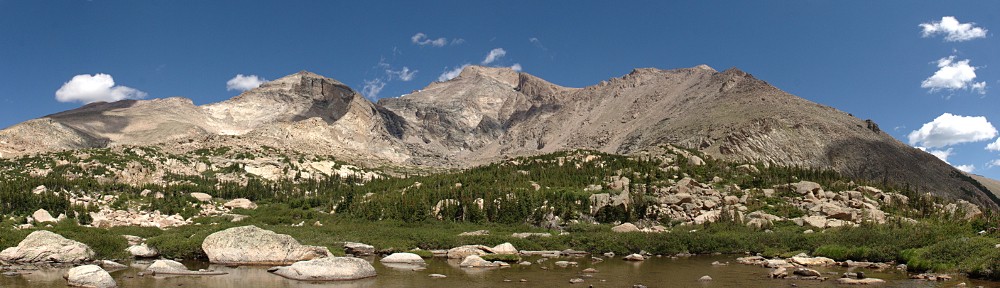
Snow Lake Peak, 11,142'

Snow Lake Peak, 11,142′

Ruby Mountain Wilderness is a neat little hidden gem, shall we say. When I was researching camp sites I found this oasis of green on an otherwise drab and barren map of Nevada. Alpine, snow capped, and glacial, it’s out of character for the area.

I get camp set up. It seems I’m not in a tent site but one for an RV. There’s room for a small camper and a short, steep path to a concrete pad where a picnic table and fire ring stand. I have no suitable place to pitch the tent. I make do, but I’m on a bit of a slope. We’ll see in the morning how it worked out.

I hiked up to a little lake. Pond, really, or perhaps Puddle. It’s two miles each way. I’m almost always starting my hikes in early morning so it feels a bit odd to be starting a hike at about 5pm. I’m usually done hiking by then. This little glacial valley is oriented north-south, so it’s already partly in shadow. By the time I get to the lake (surrounded by vegetation, no suitable place to sit and take a break) it’s fully in shadow and starting to get a bit cool. I turn right around and head back.

I was back in camp by 7:15. Now I finally get to try my camp cooking. I grab a package of Basmati rice and Spicy and Sweet tuna. This dang stove heats up so quickly, I burn a layer of rice to the bottom. It’s not a bad meal, though. Even though it’s two servings of rice, it might be on the light side after a strenuous day of hiking.

It’s 8:20 and the sun has basically set. Still too light for stars, but a bit different than the last two nights. Here, we’re on the eastern side of the Pacific time zone while in Bryce we were on the western edge of the Mountain zone. Should be getting dark soon. Time to select some tunes and get ready for the show.

Settled on Ronin for sunset. But it was getting too cold for me to sit in my chair, so I retreated to the tent. Through the flap I had a view of the sunset. An SUV pulled into the next spot and four people piled out – mom, dad, two teen-aged daughters. I thought they were getting set up; they made a fair amount of noise. One of the girls walked up the slope behind their site, not realizing she ended up right next to my fire ring and picnic table. Once she saw me she sheepishly said “hello” before retreating.

Not being a camper, mosquitoes were not much on my mind when planning this trip. It wasn’t until tonight that I gave them any thought at all. They were a minor nuisance here, but I guessed I might want to stop somewhere before pitching the tent tomorrow for some bug repellent.

I turned in, expecting an uncomfortable night.

Laguna Seca Trip: Day 1 – Denver to Bryce Canyon

Back in December I was working in San Francisco. I reached out to a few Golden Gate Lotus Club members in an attempt to get together for dinner or adult beverages. For one reason or another I was never able to visit with anybody. In the course of these emails and phone calls I learned GGLC would be having a track day at Laguna Seca in July.

I started planning almost immediately. The plans changed many times, but the central idea of the trip was lapping at Laguna Seca. In its final form, the trip would include several National Parks, three race tracks, visits to six states, and driving something like 3,500 miles.

Saturday, July 9

It’s here, it’s finally time to hit the road. I will be covering a lot of ground, literally, in the next two weeks. We start off with a big mileage day, and we start by violating Rule #1: No Interstate Highways. I’m on I-70 westbound until some miles after Green River, UT.

If you’re going to drive on the interstate, I-70 west of Denver is as good a place as any to do it. It’s quite scenic, as interstates go, what with the climb to the Eisenhower Tunnel, Vail Pass, and Glenwood Canyon. I left the house at 5:40, so it was still quite cool at high elevations. I wanted to run Glenwood Canyon topless but I waited until Avon to pull over and take the top off. It only took a few minutes for me to turn the heat on full blast. I kept thinking, as I was shivering, that this chill would be a fond memory in the heat I expected later in the trip. I didn’t complain about the cold.

The short canyon between Debeque and Palisade is a preview of what the Colorado River does a few hundred miles down stream.  Here the canyon is not deep but it has a bit of the character of the Grand Canyon and what I might see when I cross it again in a couple of weeks near Page, Arizona. This canyon section is only a few miles long and dumps us in Palisade where the almost otherworldly cliffs on the north side of the road contrast with the precise grid of the peach orchards on the south.

I gassed up in Fruita, last gas in Colorado. Most of the exits between the state line and Green River offered no services. At Green River there’s a sign that said “No services on I-70 next 106 miles.” I only had to go a short distance longer before exiting, but even on UT 24 there was nothing until Hanksville where I stopped for lunch. Utah has long stretches of desolation. Between I-70 and Hanksville I saw one small red outcropping of hoodoos, a foreshadowing of things to come.

It was now the heat of the day in the high desert – I put the top back on at my lunch break.

At Hanksville the character of the road changes from high desert to mesa and canyon. The road goes along the Fremont River; the bottom of the canyon is green and the canyon walls vary from nearly white to dun to red. There’s even a layer of green that almost matches the color of the sage brush. This is iconic old-Western landscape, the stuff John Ford movies are made of.

2016-07-09 13.52.53s

Petroglyphs

When planning the route, I was so focused on Bryce Canyon I didn’t notice that I’d be passing through Capitol Reef National Park and Grand Staircase-Escalante National Monument. There are no entrance stations for these parks, just drive right through. I didn’t even know I was in Grand Staircase-Escalante until I met a ranger who gave me a map after I answered questions about my car.

Capital Reef is red sandstone, carved by water. It supported the Fremont people as much as two thousand years ago. They lived in pit houses (dug into the ground, with thatch roofs) and natural rock shelters. Several petroglyphs can be viewed just a few yards from the road. The park is much bigger north-to-south than east-to-west; the road passes through only a few miles of the park and certainly gives only a brief glimpse of what’s to offer.

2016-07-09 14.04.12_stitch_crop_resize

Chimney Rock (extreme right)

A few miles after leaving Capital Reef we arrive at the junction with UT 12. Here we turn south and enter Grand Staircase-Escalante National Monument. When I was eating lunch back in Hanksville, I overheard a couple at the next table talking about this road – they didn’t like the drop offs. A bad road for an RV might be a good road for a Lotus. The road starts off quite pleasant, running through a section of the Dixie National Forest, with scenic overlooks every few miles.

2016-07-09 14.56.10_stitch_crop_resize

Grand Staircase-Escalante

After a while I get to the stretch of road the couple was talking about. The road goes along the spine of a narrow ridge, just a bit wider than the road itself, with steep drops off both sides. I stop here to take the top back off; it has cooled down a bit. We’ve climbed to over 9,000’ above sea level.

IMG_2045_stitch_crop_resize

Lotus road!

Utah is a bit of a geological marvel. Pretty much the whole place is interesting. I always joke that Wyoming is only interesting around the edges, and that about half of Colorado is interesting. In the last few miles I’ve passed through two National Parks and a National Monument. What isn’t park or monument is Indian Nation or Bureau of Land Management land. Just about all of southern Utah is federal land in one form or another, and it contains many wonderful views.

I get to Bryce Canyon Pines by 5:30, get checked in, assemble the tent, empty the car by 6:00. Then I head into the park to scout it for tomorrow. It’s a short drive from the campground. In the visitor center, I chat with a ranger about which trails he recommends from my list.

2016-07-09 19.27.15s

Hiking in the hoodoos

He says I have plenty of time to do Queen’s Garden and directs me to Sunset Point (not to be confused with Sunrise Point). I have a couple of hours of sunlight left so I head down the Queen’s Garden trail. It’s a fun little trail. Queen’s Garden, it turns out, has a hoodoo that looks, in silhouette, like a famous statue of Queen Victoria. Near here the trail connects with a trail to the Navajo Loop. This was recommended by the ranger, so rather than return the way I came, I follow the Navajo Loop trail. I could have gone left or right at the junction; my choice to go left turns out to be the correct choice.

It’s 1.4 miles back to Sunset Point. The trail is very narrow in places, squeezing through the hoodoos. Before long I find myself standing at the foot of dozens of switchbacks heading up, up, up. I was back to the top and in the car by 8:15.

There are some high clouds; not sure what sort of sky we’ll have tonight. In any event, I won’t try any astrophotography.

Plan tomorrow is to hike the Fairyland Loop – 8 miles, 2300’ elevation change. That shouldn’t take more than 5 hours, I’m guessing. I’ll need to ask at the visitor center for another short hike now that I’ve already done the one that was suggested.

Back at the tent, it was quite late and I didn’t want to bother with trying to figure out the camp stove in the dark, so my first camp meal will have to wait. I did mix a batch of trail mix for the morning and had a small sample of it as a late snack. The sun doesn’t fully set until after 9:30, and with the waxing crescent moon the Milky Way was not visible. I hit the hay a bit after 10:30. One problem – I neglected to scout the bathroom situation before it got dark. They’re porta-potties, not actual bathrooms. I made a half-hearted search for one in the dark. It wasn’t until morning that I found out the map has the one nearest to me on the wrong side of the road.

IMG_2055s

The camp site