Wednesday, July 20
Today is a “zero day” in Henderson with Chris. A corollary to “What happens in Vegas stays in Vegas” is “Nothing happens in Henderson.”
Thursday, July 21
In a feeble attempt to exit Vegas before it gets hot, I was out the door by 7:30.
Google wants to take me west to go east; it will suggest I make four turns or have me on a dirt road in Death Valley to save a quarter mile but will take me miles out of my way to put me on the interstate. Chris gave me a different recommendation: Boulder Highway to Nellis to Las Vegas Blvd to I-15. I take Chris’s route and for fun leave Navigator running to see how long before it reroutes me to my current path. It gave up about half way up Nellis after recommending about thirty left turns. This, perhaps, is a ploy by the Las Vegas chamber of commerce to keep me on the Interstate rather than driving through their town. Either that, or Google is still messing with me.
I’m not a particular fan of Vegas. I’ve only visited the place a few times, but it strikes me as a crummy little town. Every place I’ve seen off the Strip is run down, somewhat dilapidated, desiccated. I don’t like the weather there, and even when it’s not baking hot I find nothing appealing about it. If it weren’t for the gambling, this place wouldn’t exist, it would be just another Great Basin valley, an isolated Air Force Base.
My Vegas escape route takes me by the speedway and the location of the proposed Tesla giga-factory before depositing me on I-15. I take the interstate a few miles past St. George, Utah. In order to get Navigator to take me on my desired path, I had to give an intermediate destination. That’s St. George. So it got me off the highway and sent me left and right and left again until I was in front of the local college’s football stadium. “You’ve arrived at your destination!” Maybe I should have looked for that Starbucks instead. Actually, if I wouldn’t have wanted to top off the gas tank, I’d never have gotten off the interstate here. I get back on I-15 for a few more miles before heading east, ending the trip’s last Rule #1 violation.
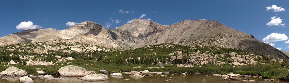
This is the road to Page, Glen Canyon Dam, and Lake Powell. I’ve never seen so many boats on the road before. Boats outnumber RVs. Big boats, pulled by dueller diesel pickup trucks. Big, shiny, black pick up trucks.
I often say of Wyoming that all the interesting bits are around the edges. I’ve decided that Nevada has it worse. It has no interesting bits. Pretty much as soon as you leave Nevada the terrain gets much more interesting. Nevada, in my experience, is like a wrinkled table cloth – just one valley after another. Sameness followed by sameness, with minor variations in vegetation. Back in Utah, the wrinkles are replaced by layers. At St. George you enter red rock canyon country. We’re at the western end of the Grand Escalante Staircase (even if we’re not in that particular park). We can see different kinds and colors of rock, interesting formations. I’m happy to be leaving the Great Basin in my rear view mirror.
Not long after St. George the road takes me through Colorado City. There’s a Colorado City in Colorado but this one is bigger. It’s one of those places I’d heard of in the news over the years but never bothered to figure out where it was. It was in the news because it’s where a splinter sect of fundamentalist Mormons live. These Mormons are polygamous; believing that their god wants their leaders to marry as many fourteen year old girls as possible. In all the small towns through here, I see women in the old style garb. These dresses strike me as not far removed from the bee keeper suits women are made to wear in parts of the Middle East.
Not only are there a lot of boats on the highway, approaching Lake Powell there are lots of places to store your boat, so you don’t have to tow it up and down the highway. Lake Powell appears, side roads lead to marinas. When I see a sign for Wahweap Overlook, I stopped to look it over.

Lake Powell from Wahweap Overlook
The next obvious stop was the Glen Canyon Dam’s visitor center, followed by a walk part way across the bridge.

Glen Canyon dam and bridge
Navigator’s penchant for short cuts kicks in again in Page, with the result that I drive by the lumber yard instead of any restaurants. I need to eat in Page as there’s nothing available until Kayenta, still quite a way down the road. The Maverick station has a store with a grill offering burgers and Navajo tacos. I grabbed a burger and ate it at a picnic table outside. I share the table with a young French couple. Seating was limited to two picnic tables. The other was occupied by a family. Guns were not welcome here, they were encouraged. Show your gun and a permit, get a 10% discount (not good on fuel). You can also get the discount by showing ID that says you served in the military. I wonder if that includes the military of other countries? I wonder what the French couple thought of the gun discount.
Just after Page the road passes parking lots for Antelope Canyon tours. This will have to go on the list of places to visit. We’ll certainly have to come back here and explore the place in more detail.
I’m taking AZ 98 from Page to a junction with US 160. This junction is about 30 miles from Kayenta. This is my least busy road for the day, a relaxing drive. From then on, it’s familiar roads for me – Four Corners and the oddly named Teec Nos Pos, through Cortez, past Mesa Verde, and skirting Durango. When I got to about Mancos the place looked and smelled right: I’m back in Colorado.
To top off the day, I had dinner at the Seven Rivers Restaurant at the Sky Ute Casino in Ignacio. I had the petit filet mignon, jalapeño mashed potatoes and the corn dish. Yum.
Grace and Greg kindly put me up for the night. Grace was a good sport, suffering through the modern equivalent of getting out the slide projector: going through the photos on the laptop.